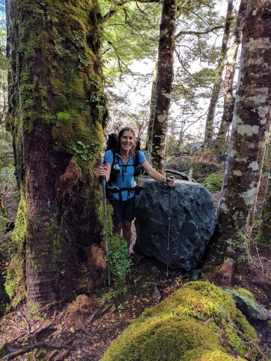
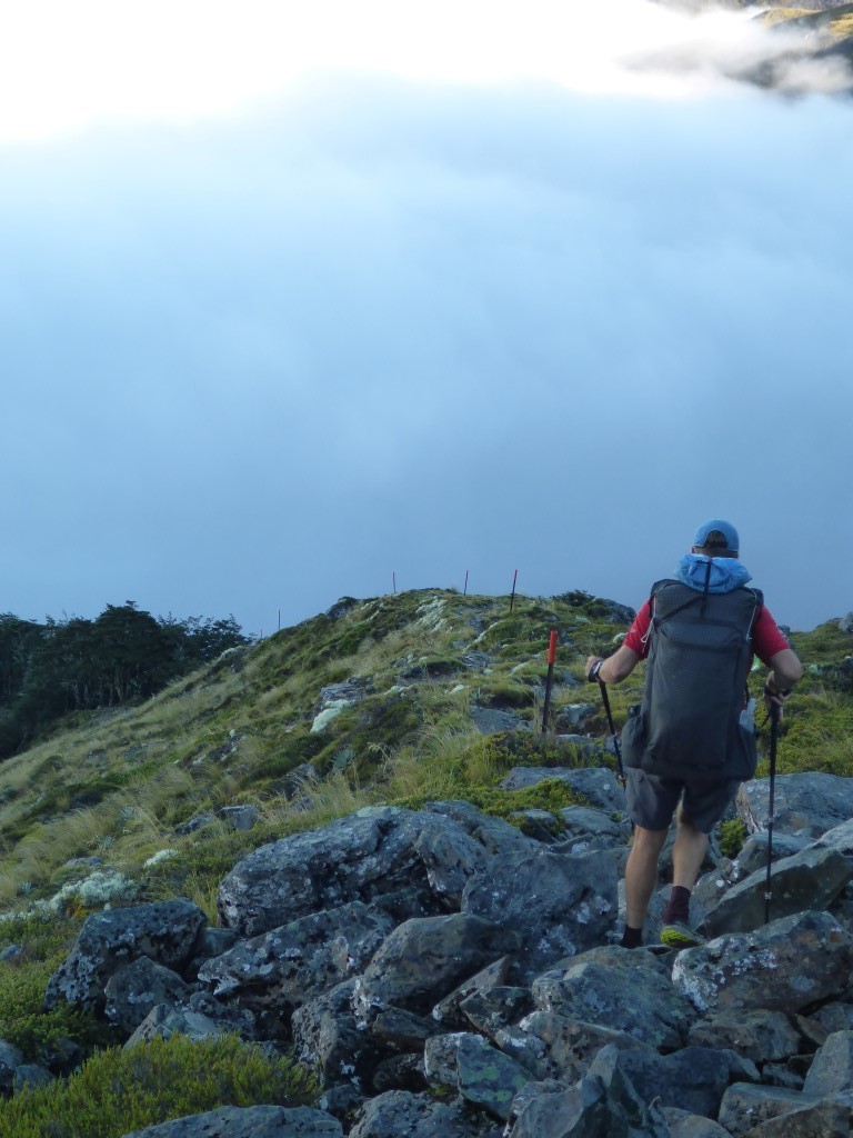
|
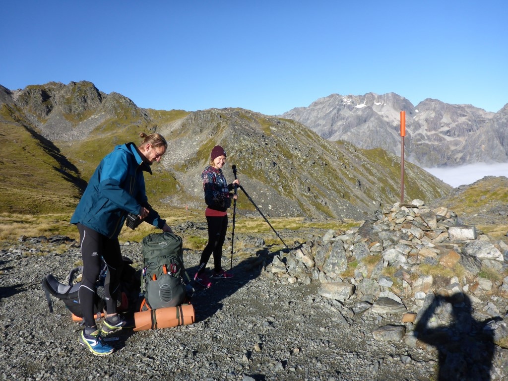
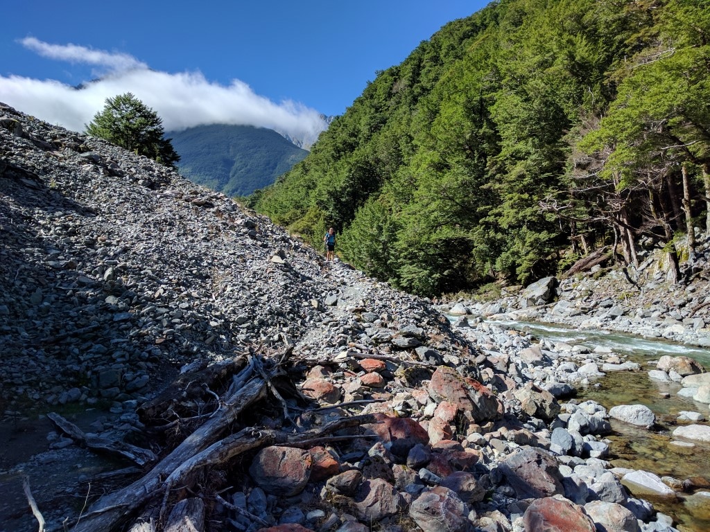
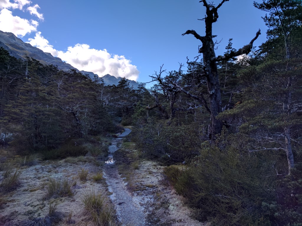
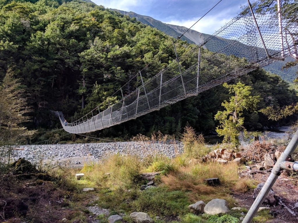
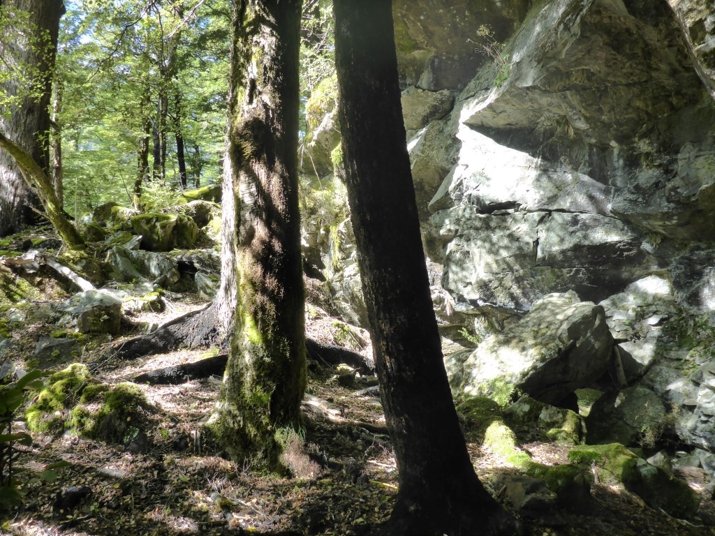
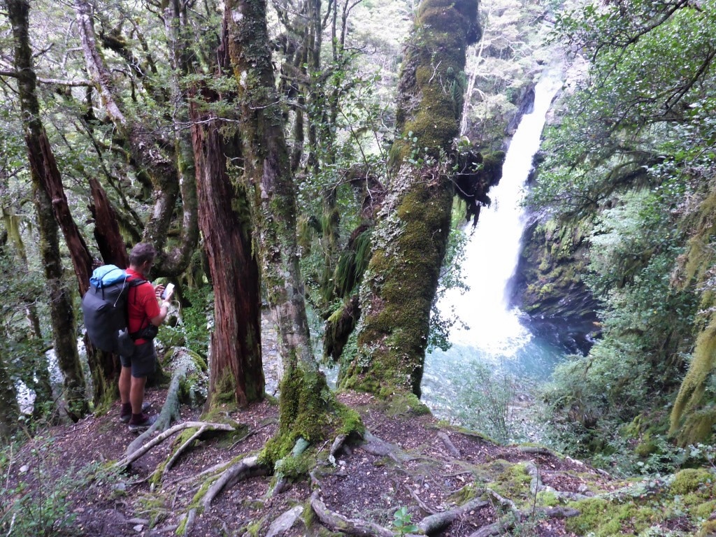
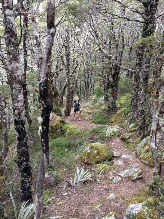
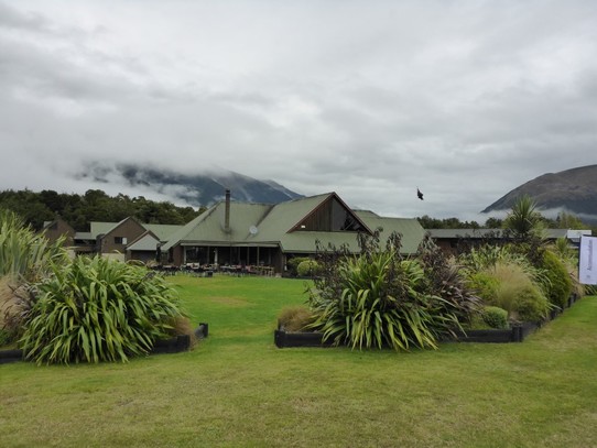
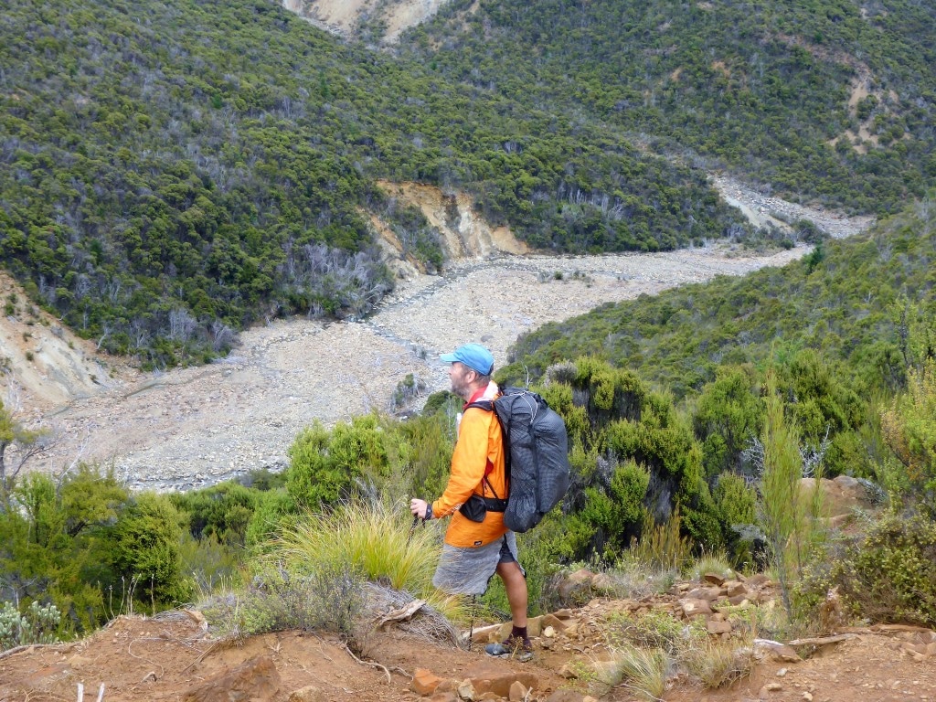
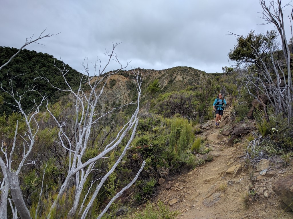
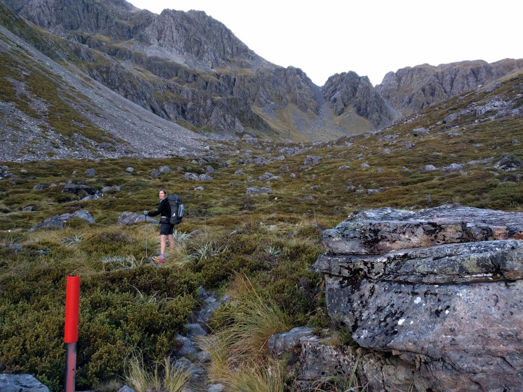
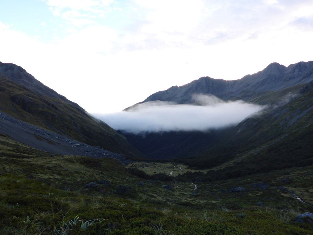
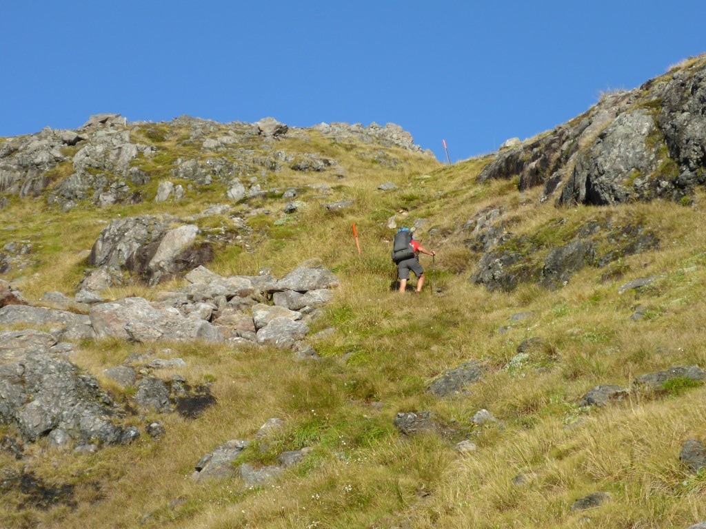
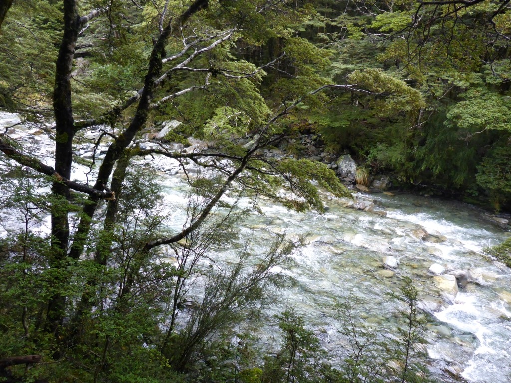
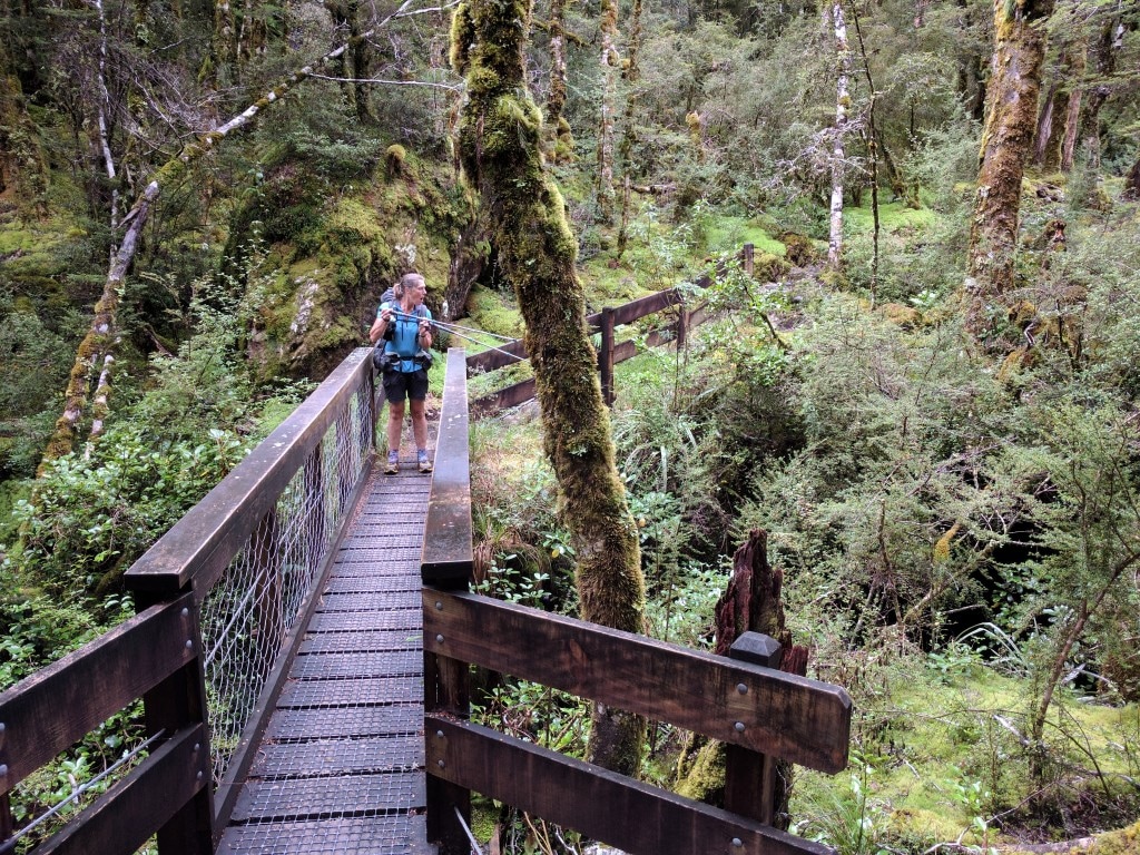
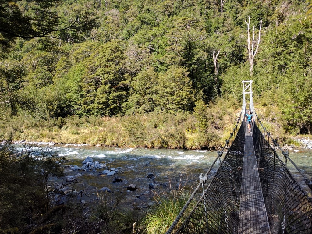
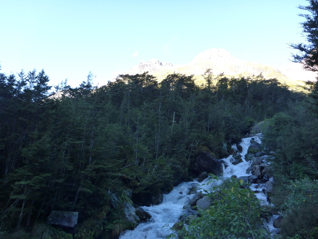
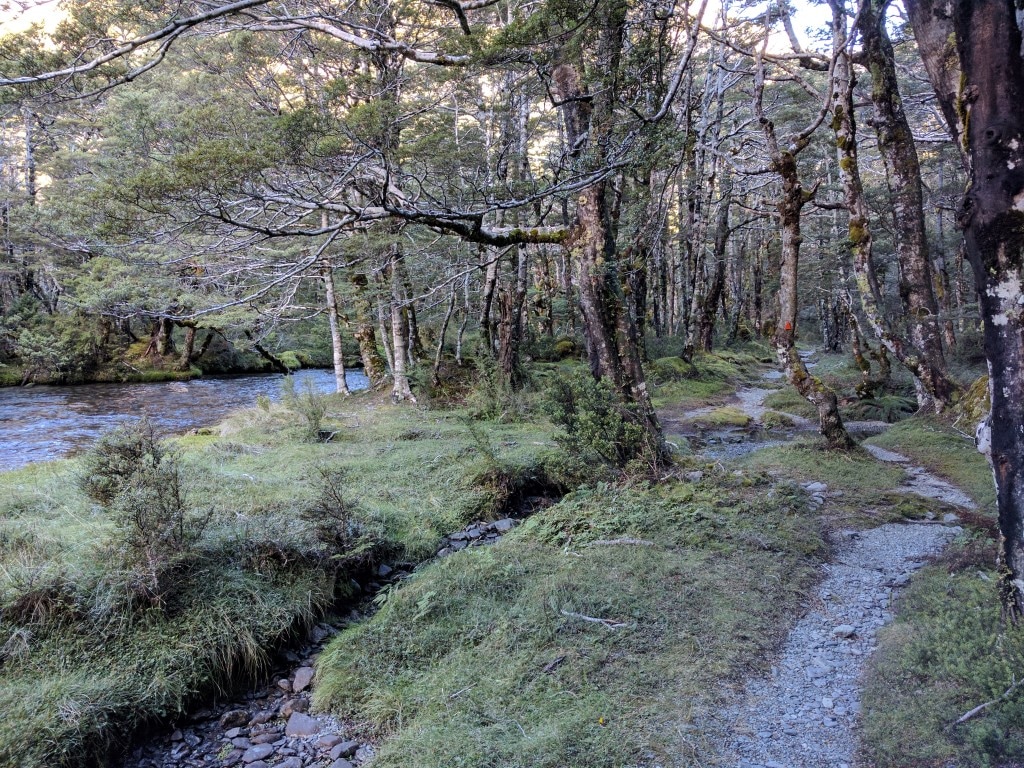
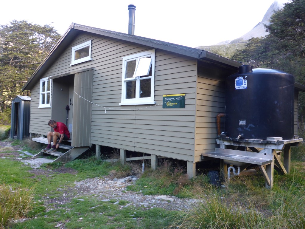
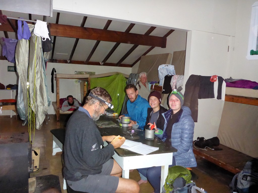
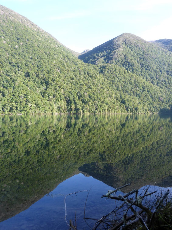
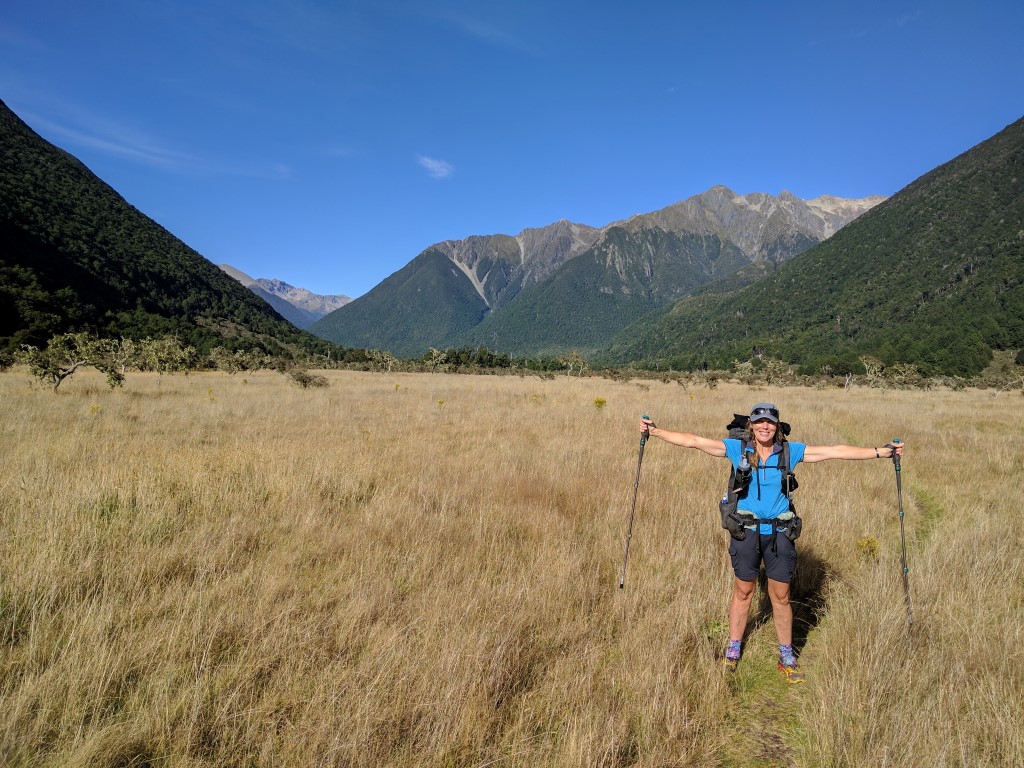
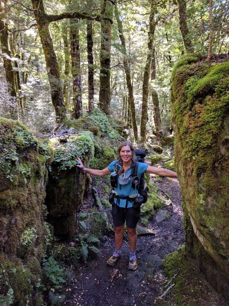
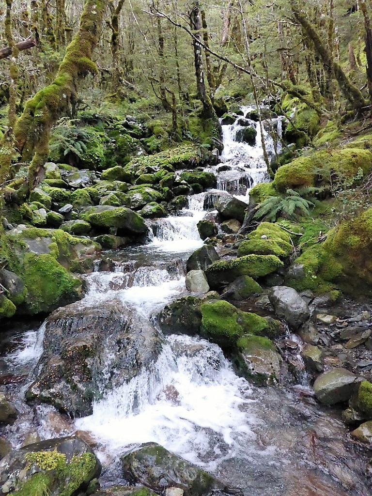
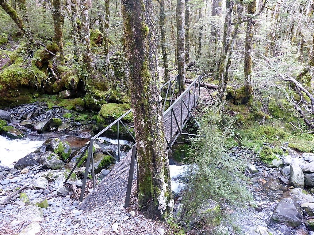
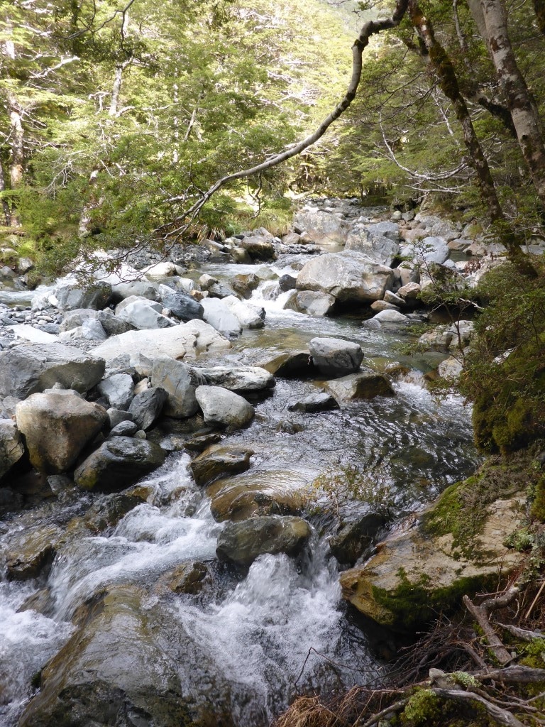
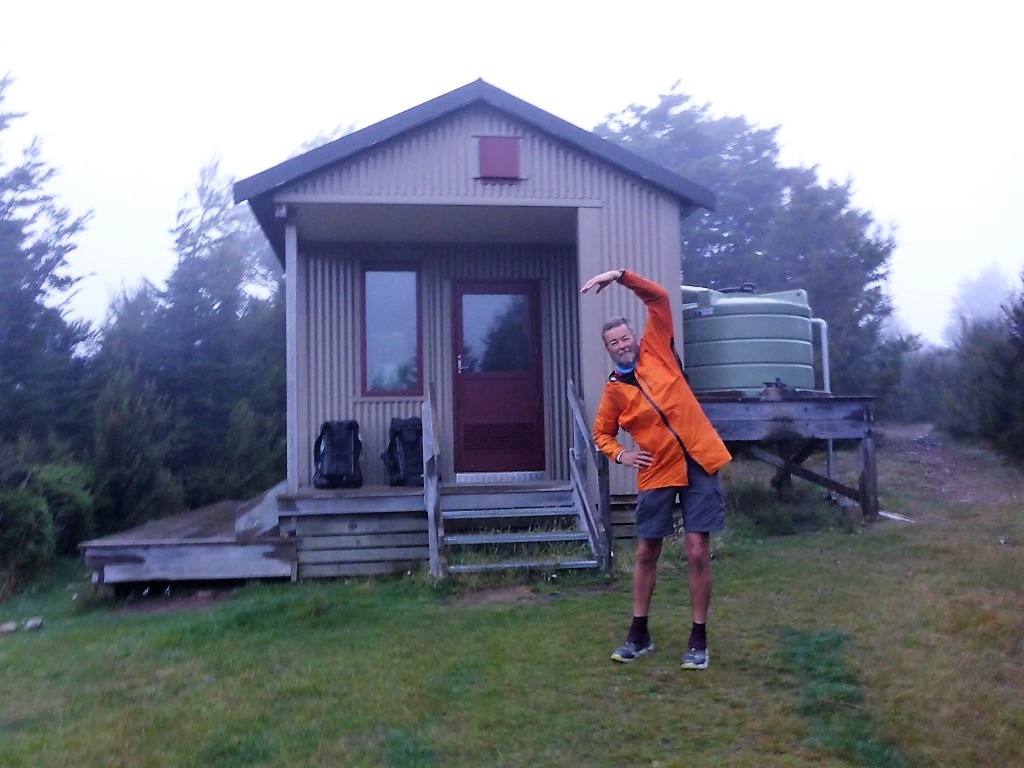
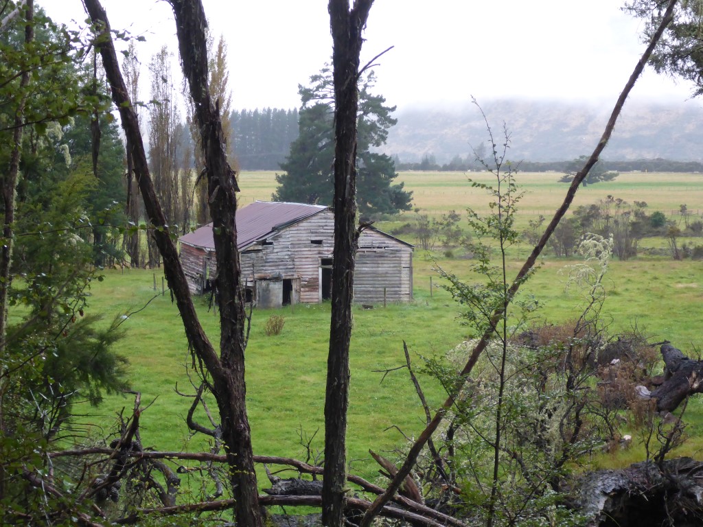
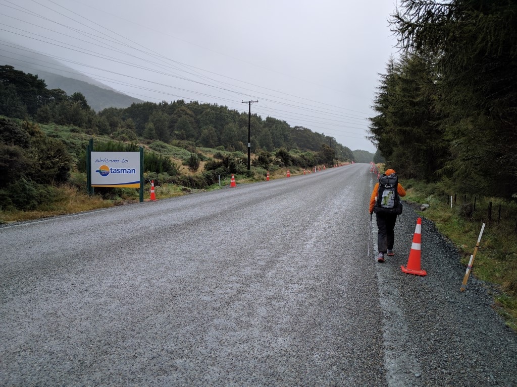
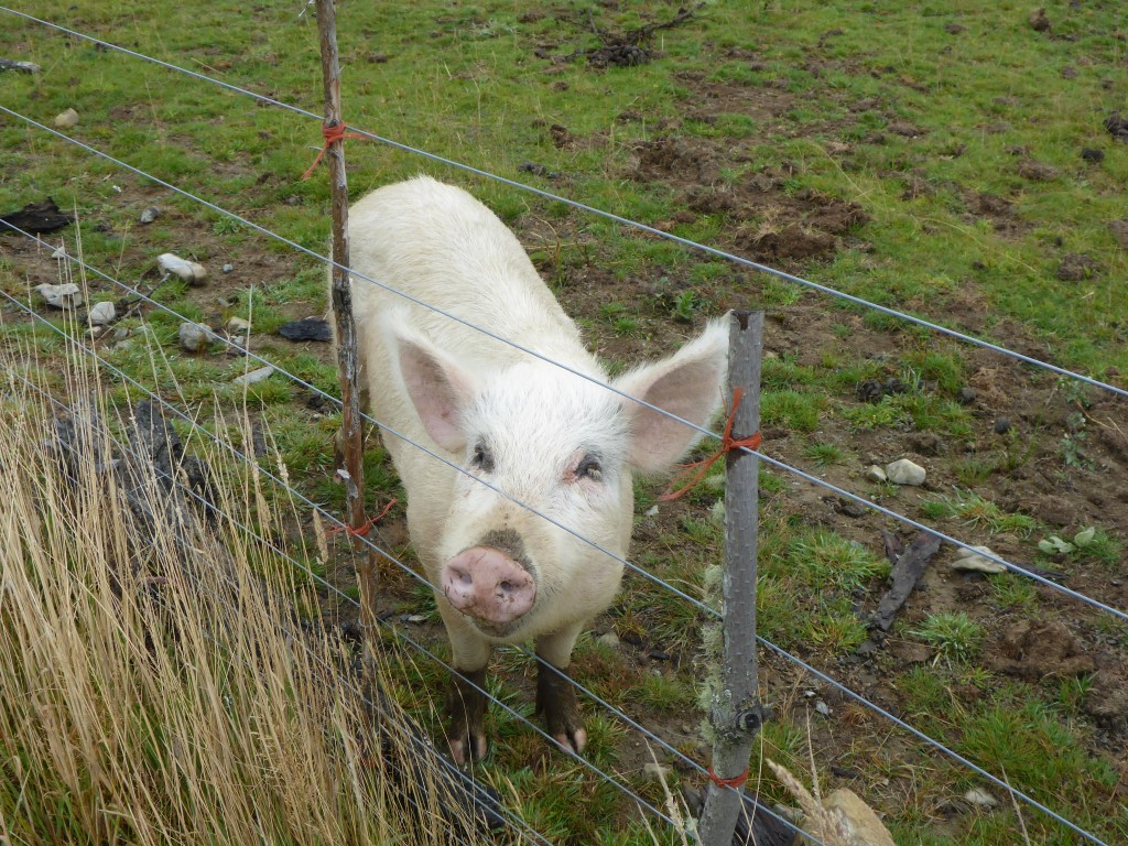
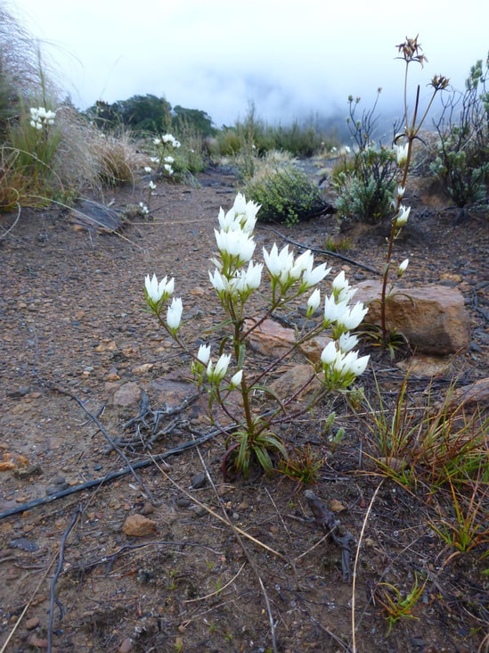
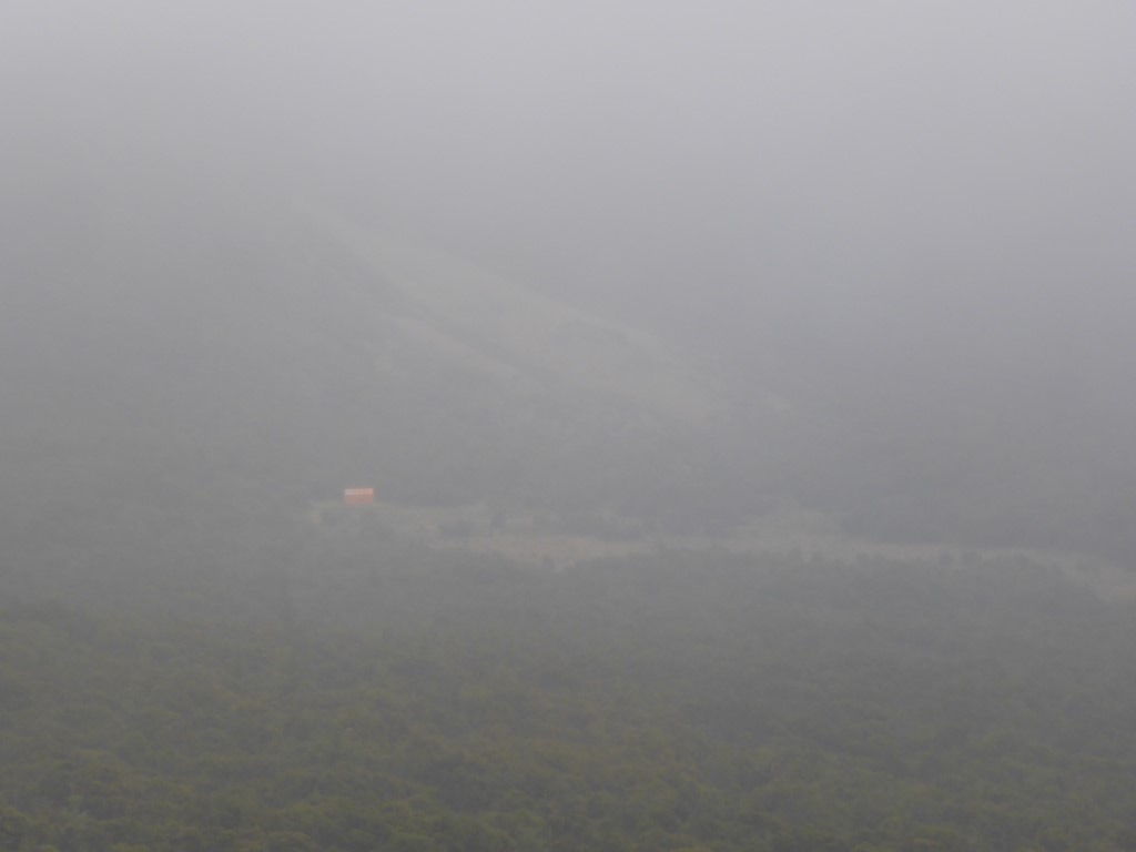
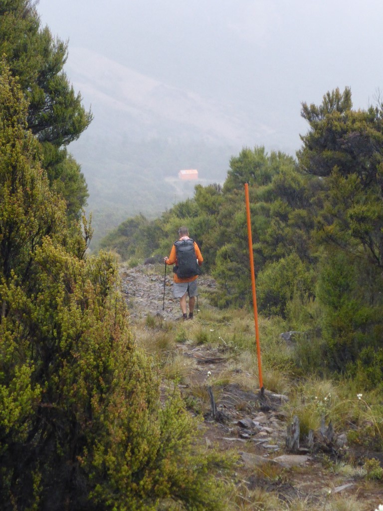
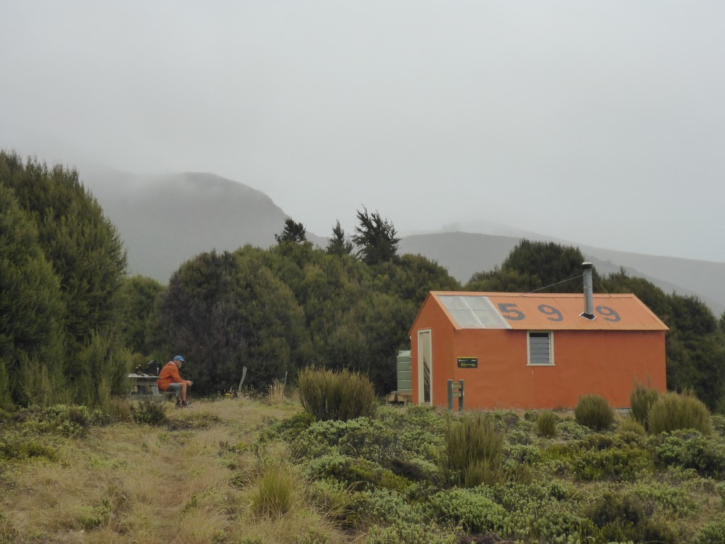
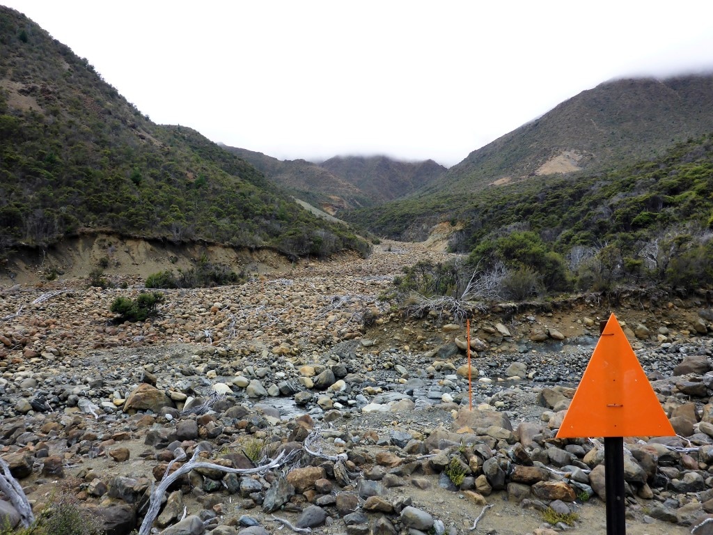
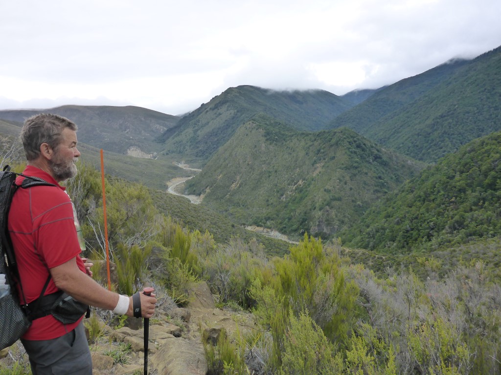
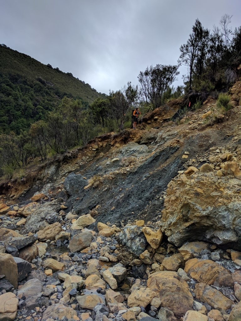
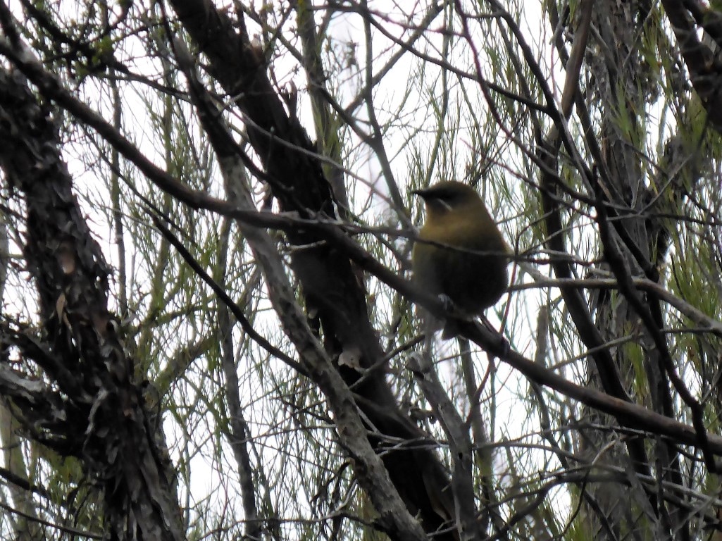
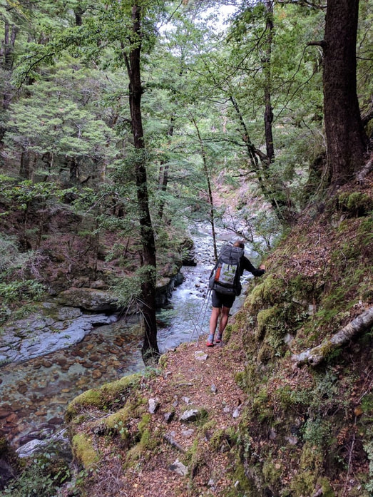
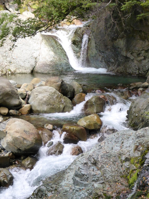
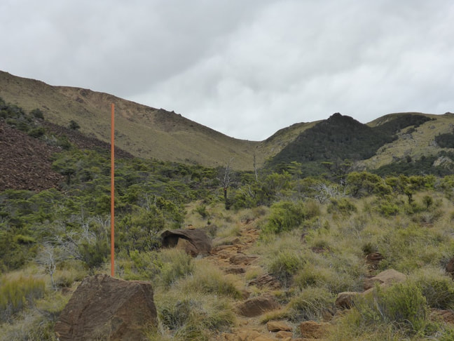
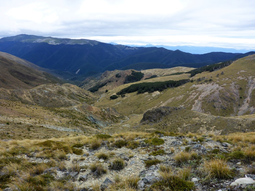
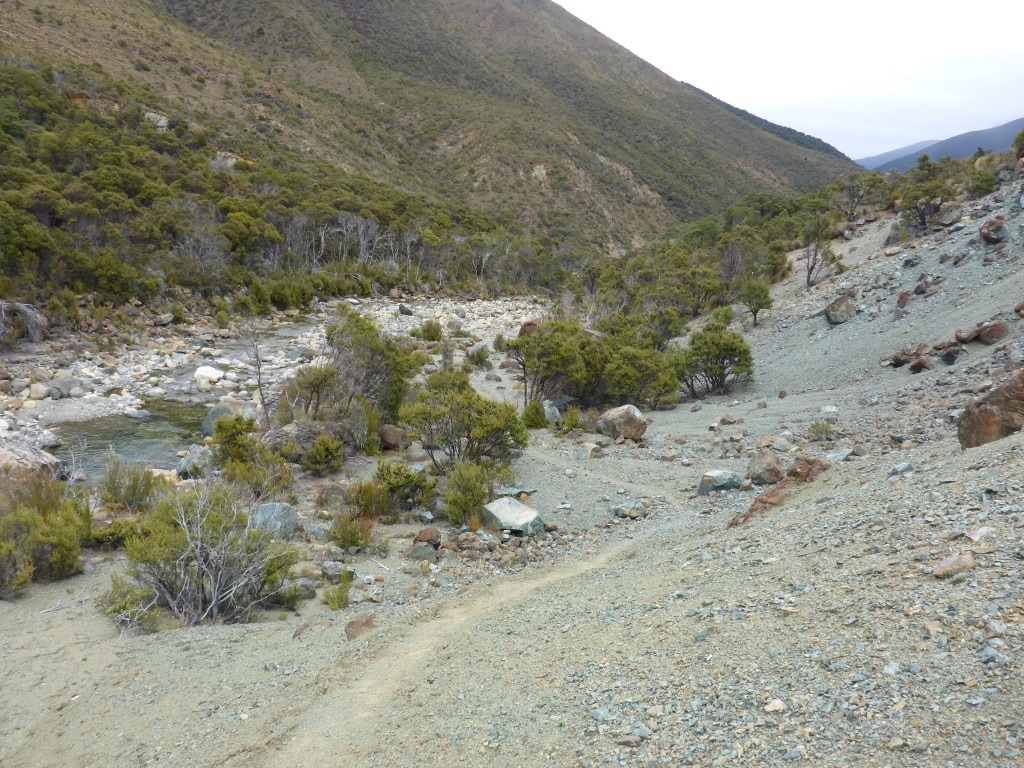
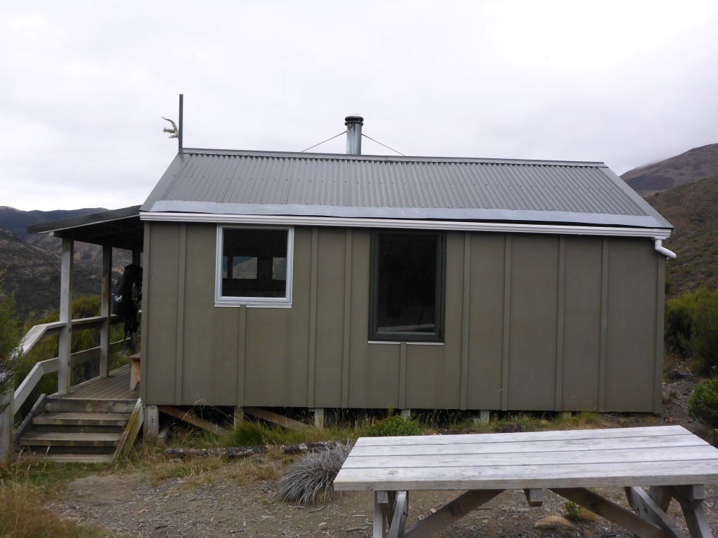
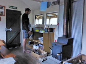
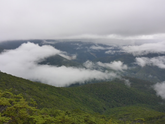
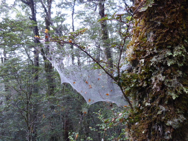
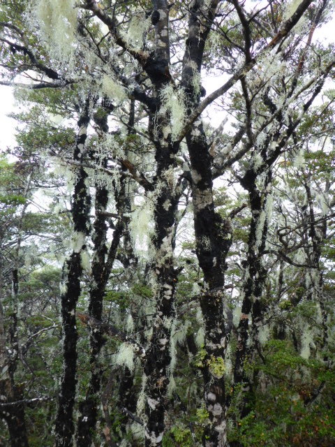
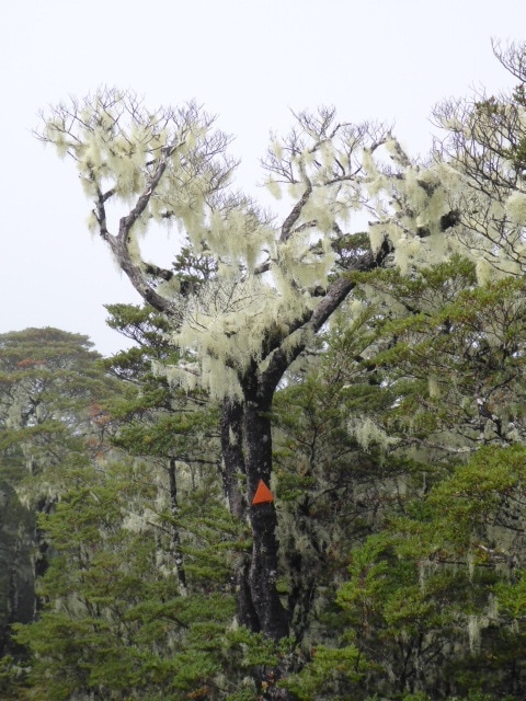
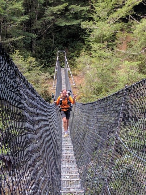
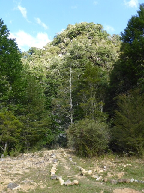
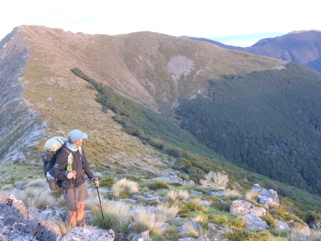
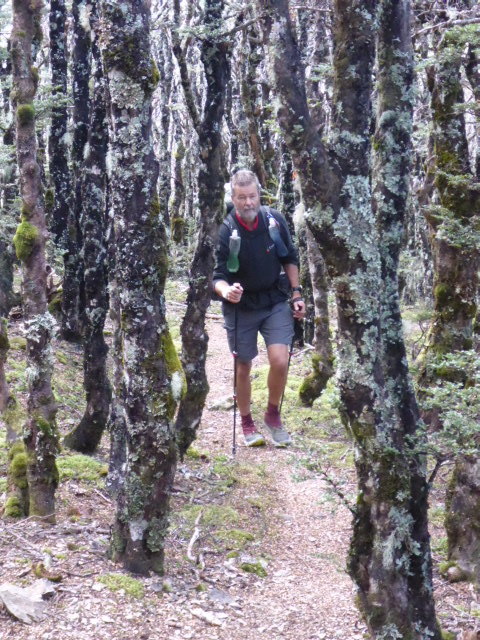
We got away early at 0730, with no breakfast, to try and beat the sandflies! Arrived at the lovely Anne Hut at 1600 after 29km - a 8.5hr day that involved 7h10 of actual walking (although forgot to stop the watch straight away at Anne Hut). We were pleased enough as the suggested walking time is 9 hours. GPS info for the day is here. We followed the Waiau River valley for much of the day. Initially there was a bit of crossing of water and a bit of walking in scrubby bush alongside the river, as well as patches of river valley grassland (the area is part of St James Station). After about 2hr and 8 km we stopped and had a cuppa - unusual for us but we had left early and only had muesli bars for brekkie so a hot drink sounded great! Of course the sandflies found us in no time so, much as we dislike using it, it was on with the repellent. Once the tea was made we walked around a bit as we drank in order to minimise the sandfly impact - doesn't encourage stopping for a rest :-) The half hour break was great, however, and the hot drink was a nice booster! 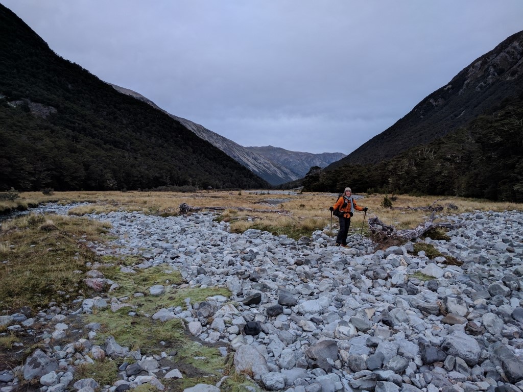 Down the valley early in the day (0750) - bit cloudy today. 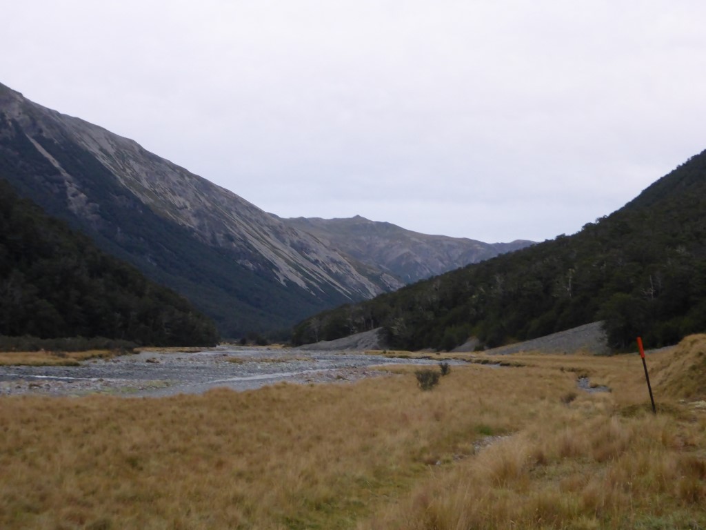 The valley does narrow up on occasions, although generally plenty of flatter country to walk on.  Ragwort - the evidence of farming.  As are the old waratahs and rusty wire fences. 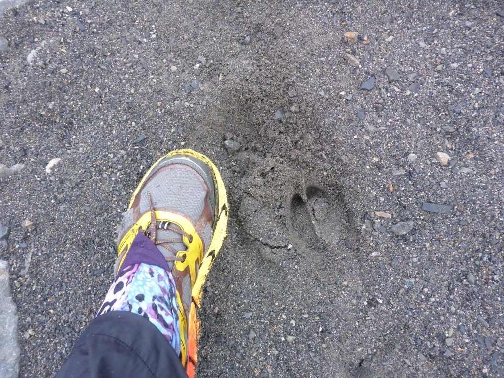 A cloven hoofed animal!! Pig? 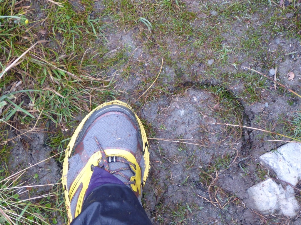 Even I can tell that's a horse!  A very occasional diversion through the bush margin for a change. 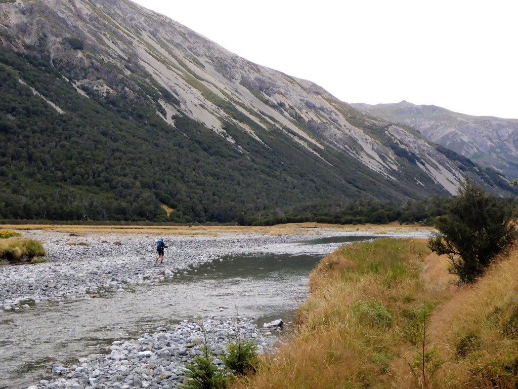 But otherwise, a lot of this underfoot. 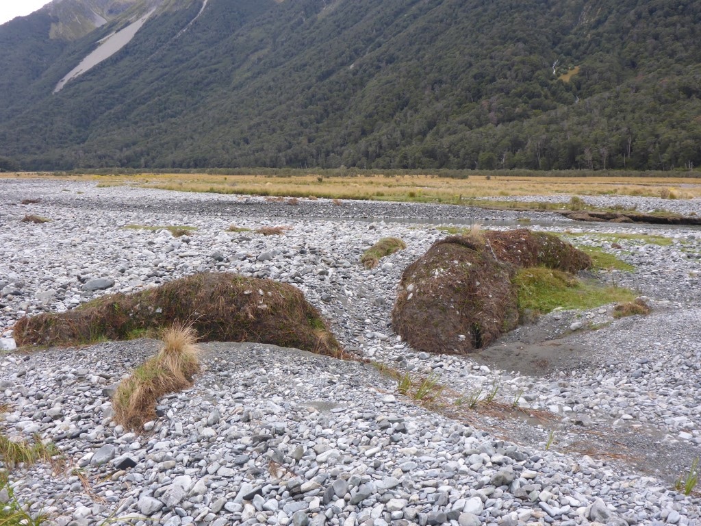 Rolled up bits of soil/vegetation moved by floods at some stage ....  .... most likely to have come from riverside erosion like this? Lots of places where the previous track disappears into a washout and the new track is rerouted slightly to cope. 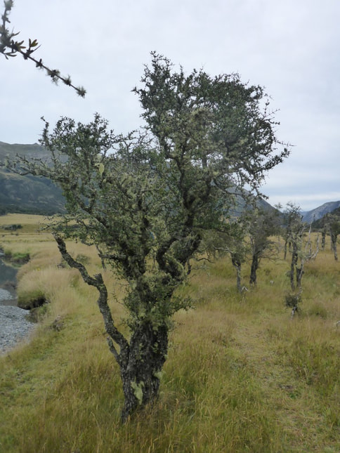 Matagouri abounds, although luckily not so thick that you can't generally get through it OK. 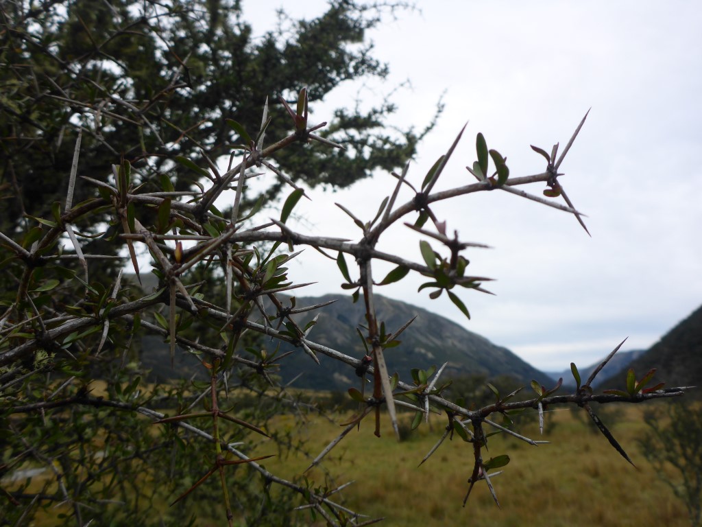 For those that don't know matagouri, here is a close up of the spiky bits!! 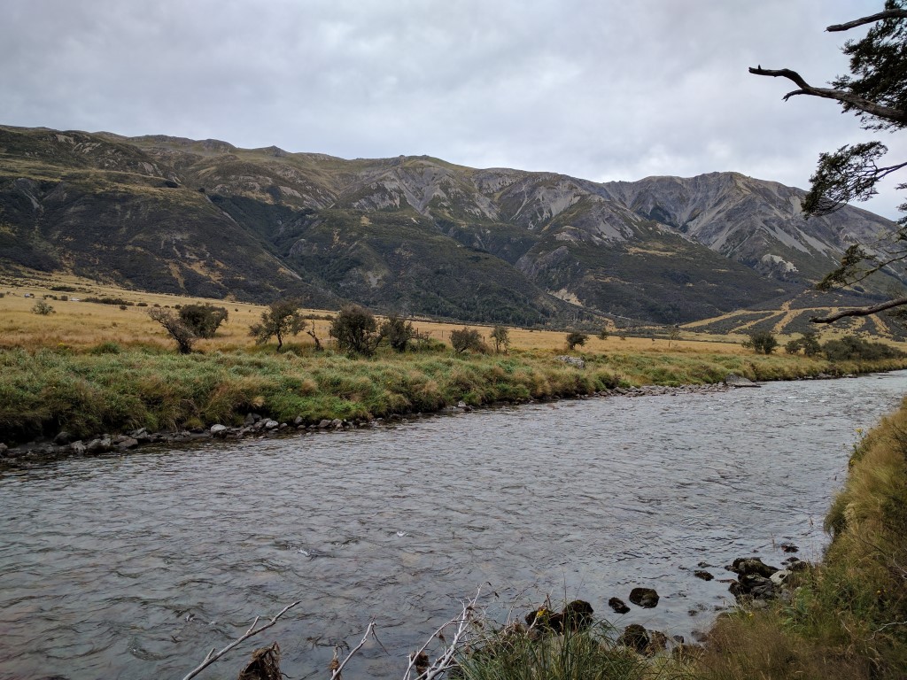 Looking across the Waiau. Two vehicles at centre left which we assumed were hunters. Obviously 4wd access up the other side from somewhere. 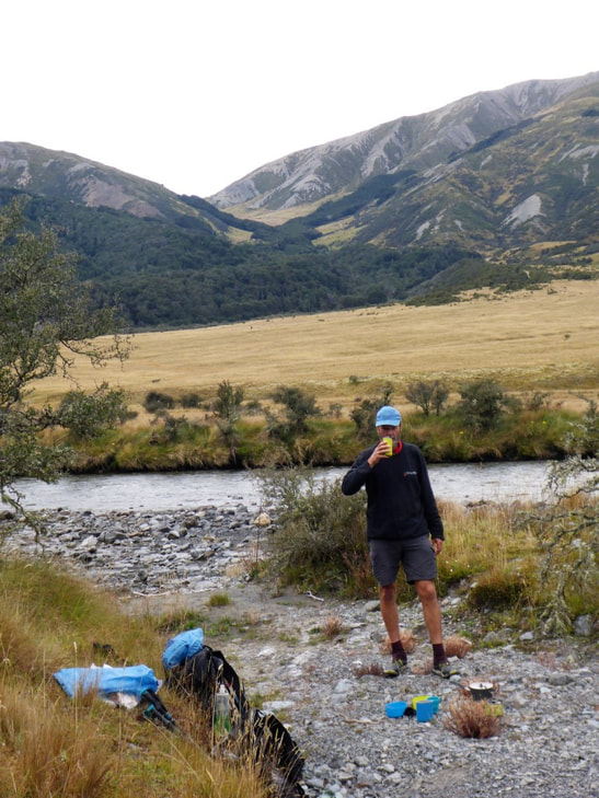 Tea break beside the river. Surprised you can't see the sandflies in the photo :-) It was more of the same, mostly grassland, for another couple of km at which stage we hit a 4wd track that we followed for around 19km - including a crossing of the smallish Ada River. Just before that we went past the Ada homestead which is still in private hands. There were lots of horses grazing on the property - we can only assume that they are probably St James stock. Not sure if they use them for trekking or not but there was some evidence of horses on our track as we came down the valley 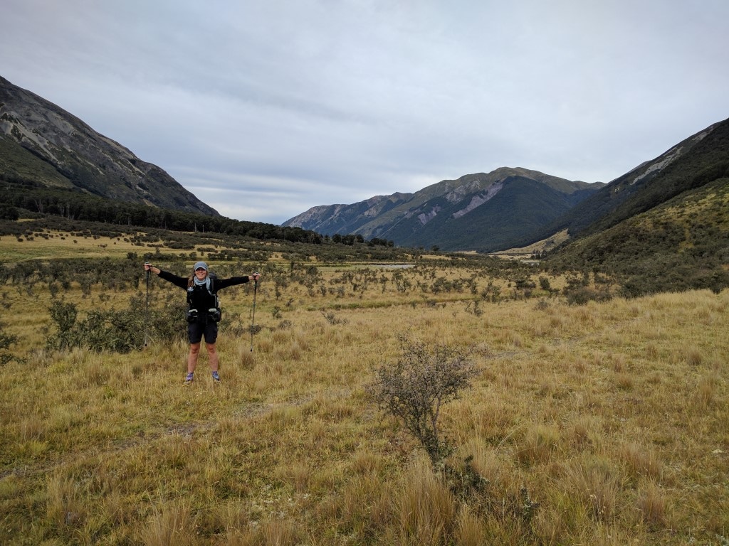 Still heading down the same old valley. 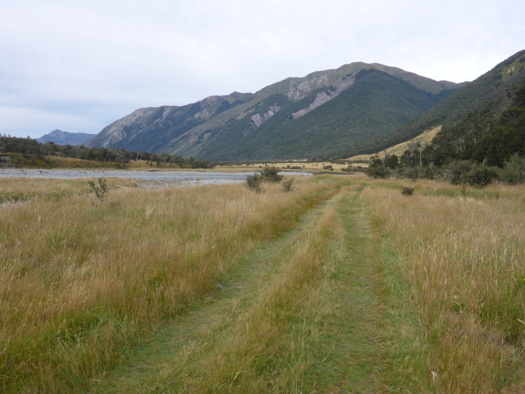 The good thing about a 4wd track is that the grass is flattened - easy to see what is underfoot. 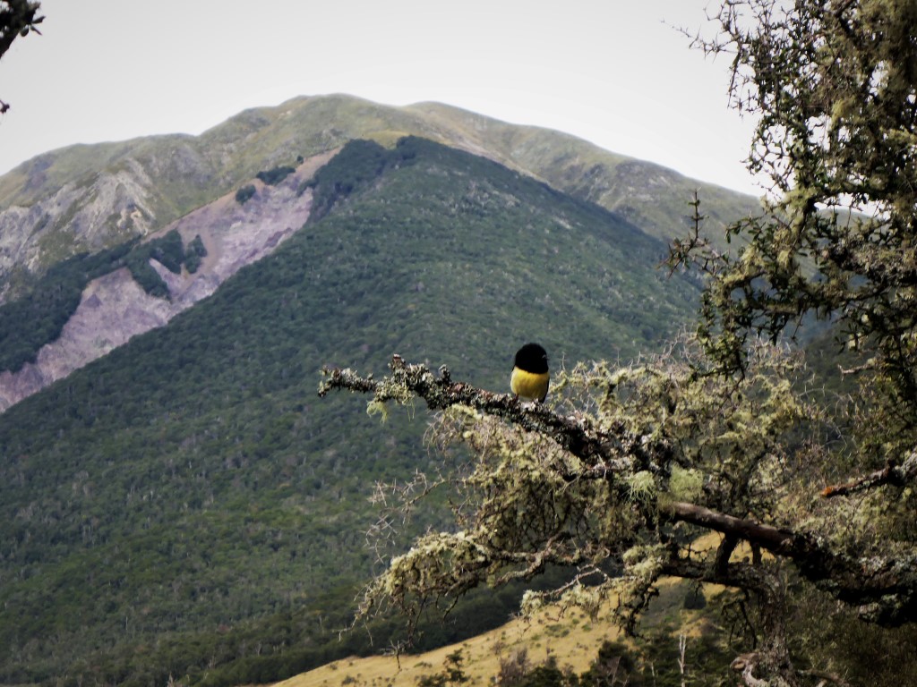 South Island tomtit - had to google to find out why it was so yellow when the North Island ones tend to be a bit whiter. 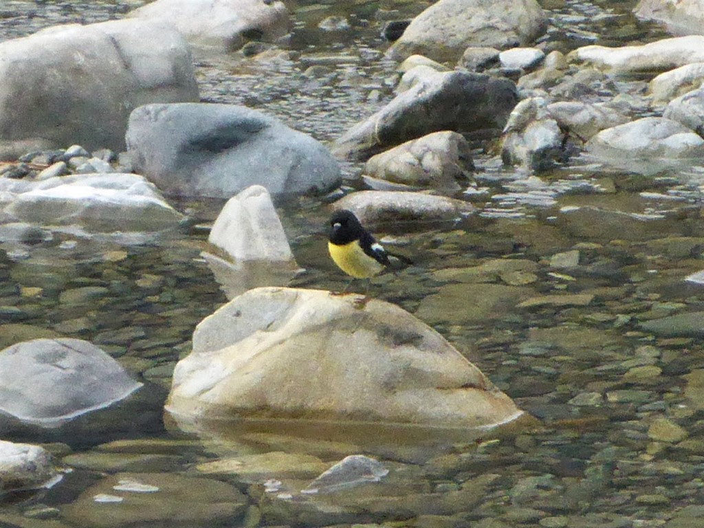 It was equally at home sitting on the rock! 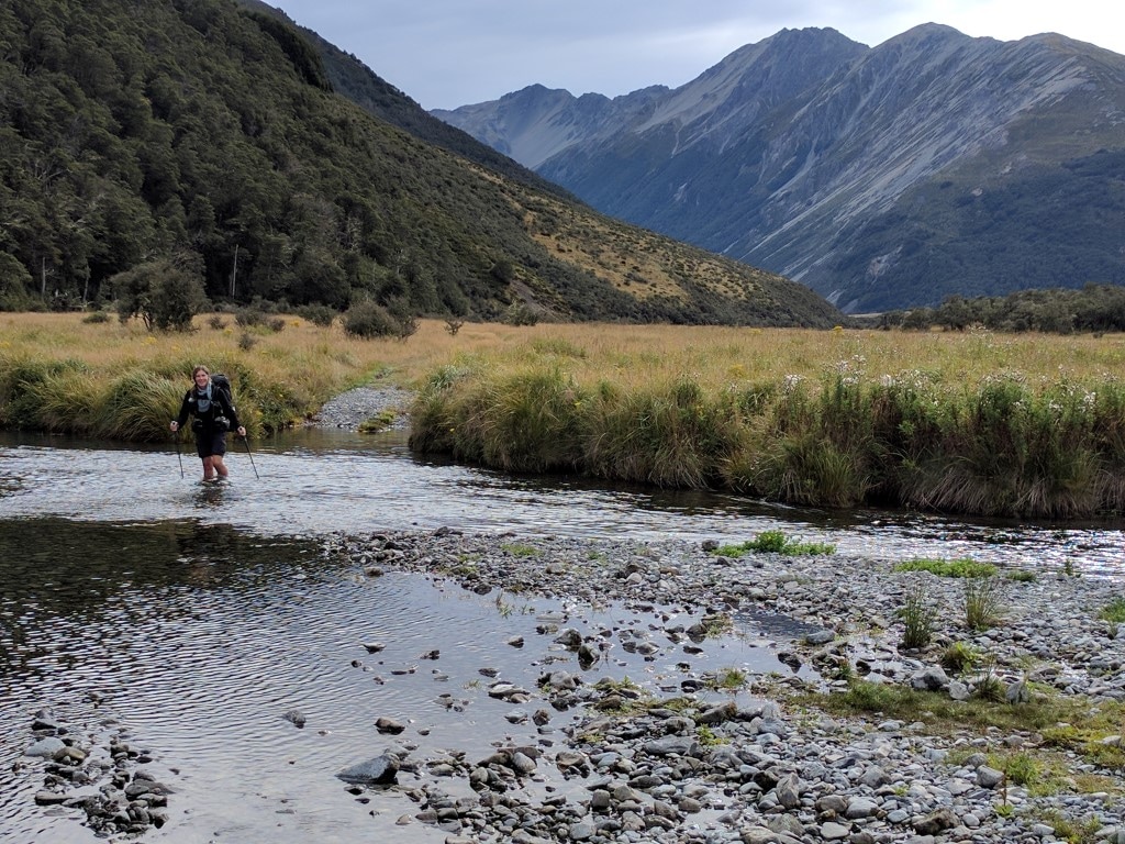 No serious river crossings today - this is about as deep as it got. 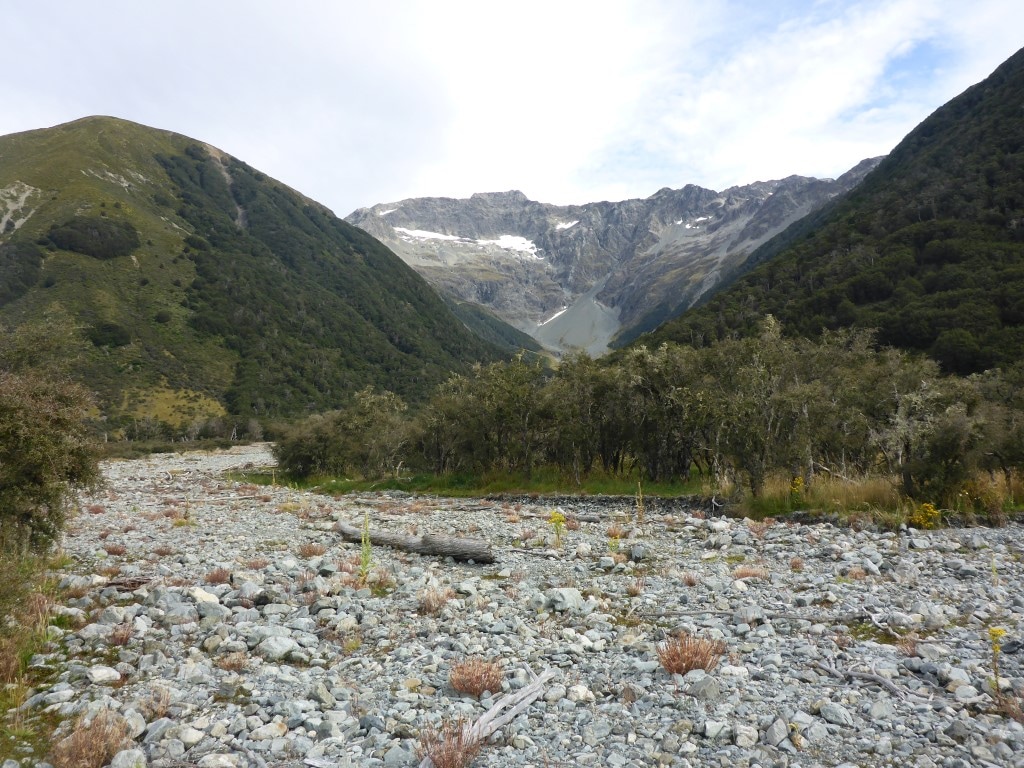 You have to remember to keep looking sideways as different valleys come in to join the Waiau. 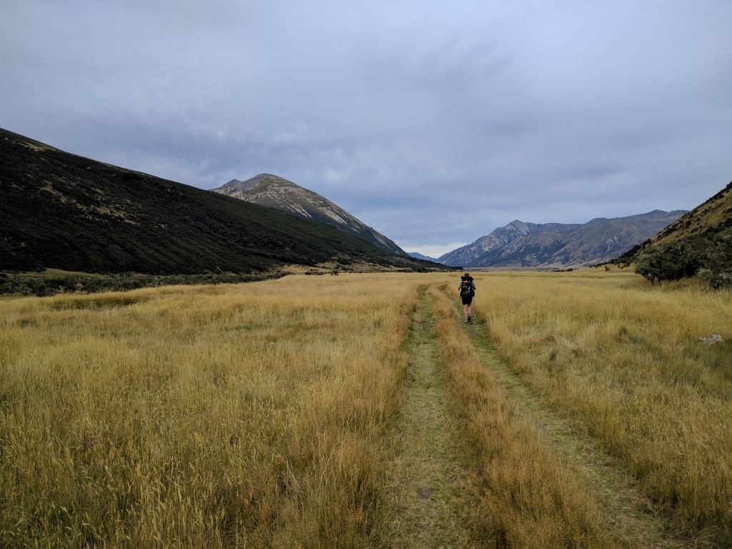 And the 4wd track and easy going continues.  We thought we could hear voices at one stage - looked across to find two cyclists on the St James cycleway, on the other side of the Waiau!! 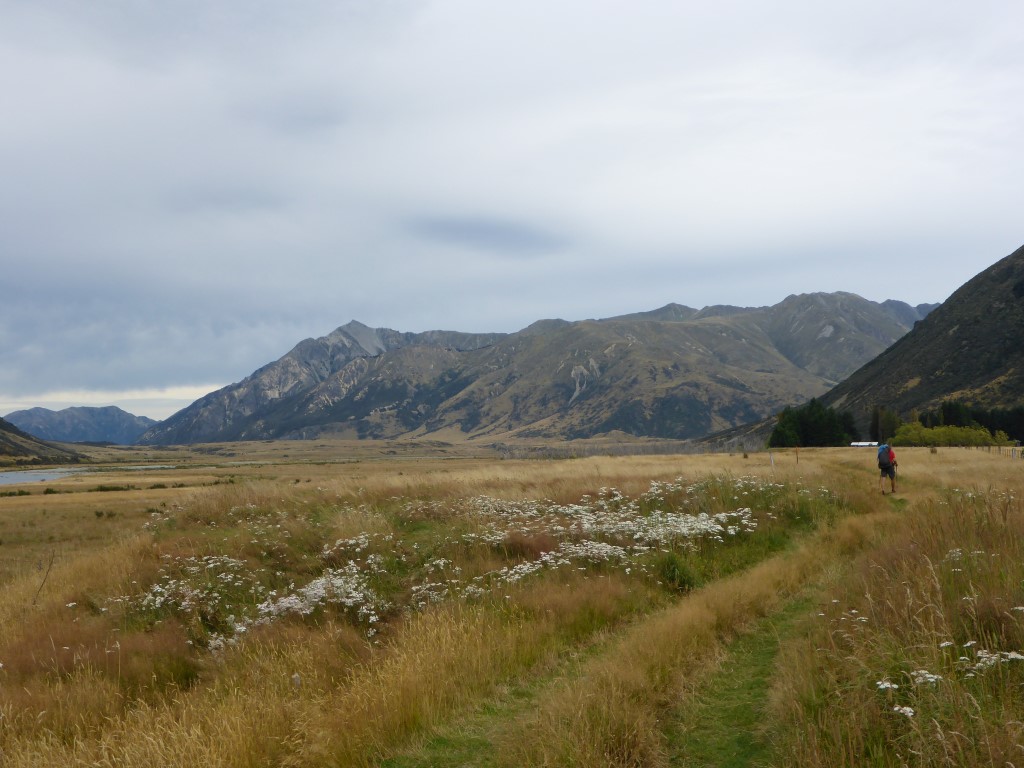 Approaching Ada Homestead. 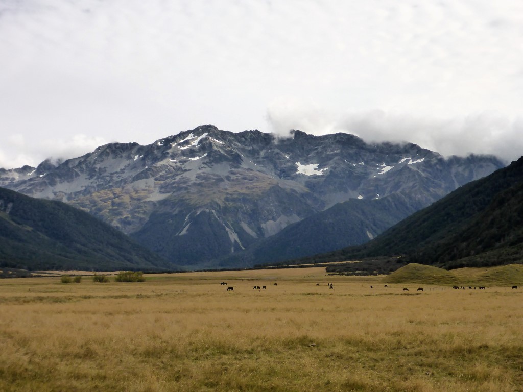 Horses at Ada Homestead - looking up the Ada valley. The scenery is still stunning but didn't change a lot as you walk along. This 4wd track actually goes all the way past Anne Hut but near to the hut we took a diversion from it, crossing a swingbridge across the Henry River before following that river, more or less, for a few kms until reaching the hut. The swingbridge was interesting - not different from any of the others we have crossed but there was a strong nor'wester blowing down the valley and the bridge was living up to its name (i.e. it was swinging!!). Neither of us are natural at using these things (although we are much more used to them now!!) so the crossing was a bit slower than usual! By this time we had joined up with the St James Walkway which took us to the hut. This is a lovely new 20 bunk serviced hut that opened in Feb 2012 after the previous one, I believe located closer to the Anne River, burnt down in 2010. Arriving at the hut nice and early on a sunny but windy day (the sun had broken through by now) meant we had a good opportunity to dry everything out, which was great. Should note that we have never seen so many bumblebees in one place - fantastic - they were flying around the hut in some numbers, trying to land on us and everything we had out drying, especially if it was blue!! A young French couple, Florence and Madeleine, were there when we arrived. They are nearing the end of a 12 month working holiday and are doing the St James Walkway after earlier doing the Travers-Sabine circuit as well. Around 1930 two other couples arrived close together. Markus & Nana and a kiwi couple, Tawera and Rachel (TA sobo). Both couples had camped at Waiau Forks soon after the Waiau Pass, so had done an extra 5km or so over and above our distance for the day. We discussed the fact that we would be up an hour earlier than usual because of the daylight saving change tonight - meaning daylight start for us becomes about 0630 instead of 0730! 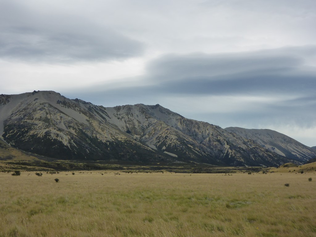 As always, it's easy to see where all the rocks/gravel that you are walking on come from. 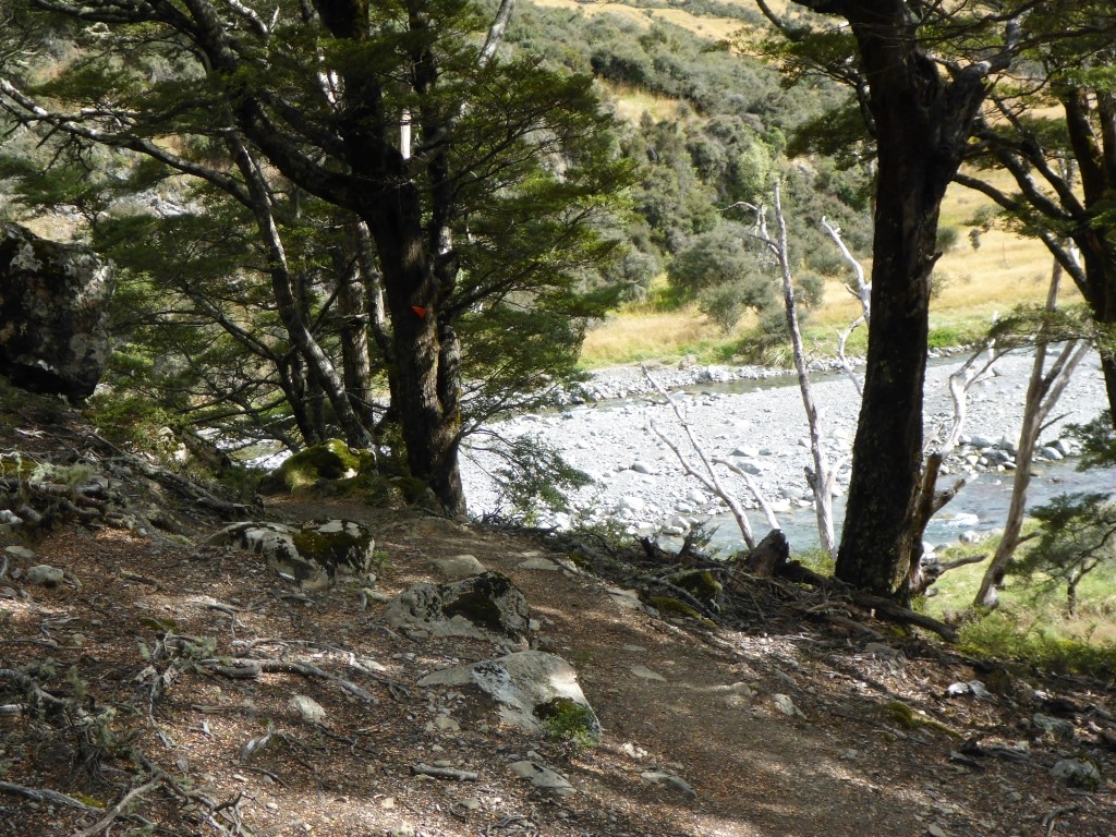 A diversion from the 4wd track - although with river levels low we could probably have just continued on it! 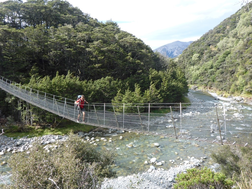 The "swingy" swingbridge - not easy to capture the wind in a still photo! 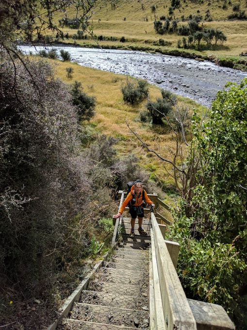 At the end of the bridge was this nice set of steps to take us back down to the river edge!! 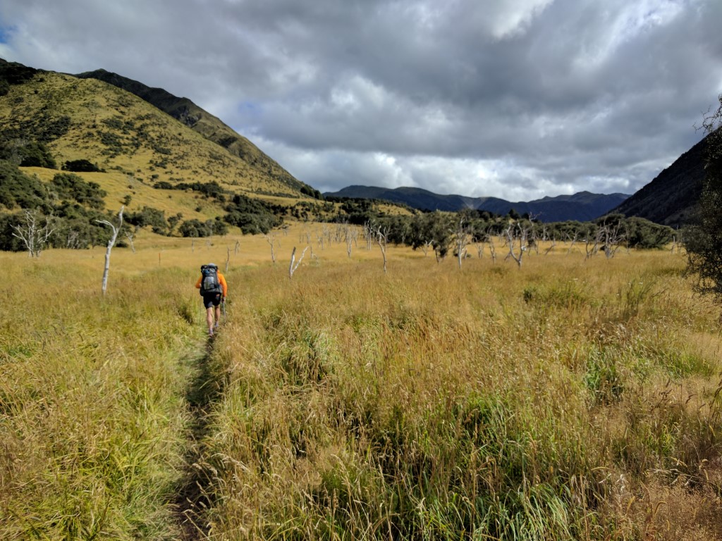 Then off up through the long grass - a little swampy in one or two places. Only 2 km to the hut from here. 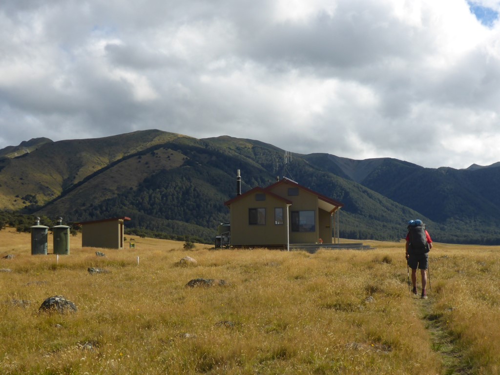 Nice new hut stuck in the middle of the Henry River Valley. DoC wardens quarters at this end of the hut. 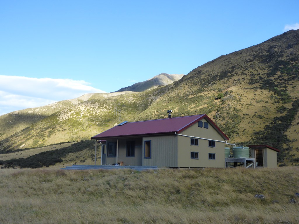 Anne Hut from the front. 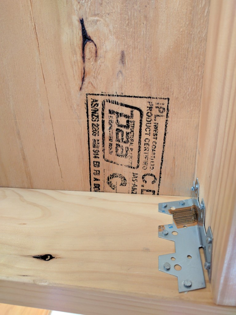 Family will recognise this - good to see IPL ply being used in the hut!! 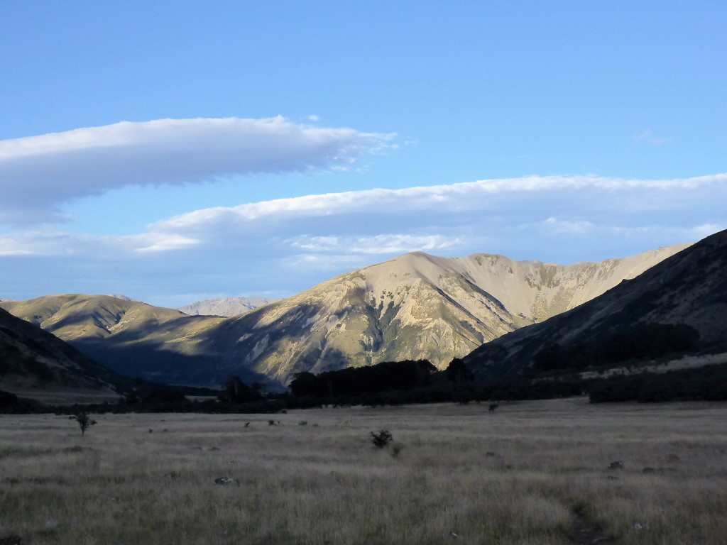 Not the best photo - but captures the view from the hut back down the Henry, towards the Waiau valley.
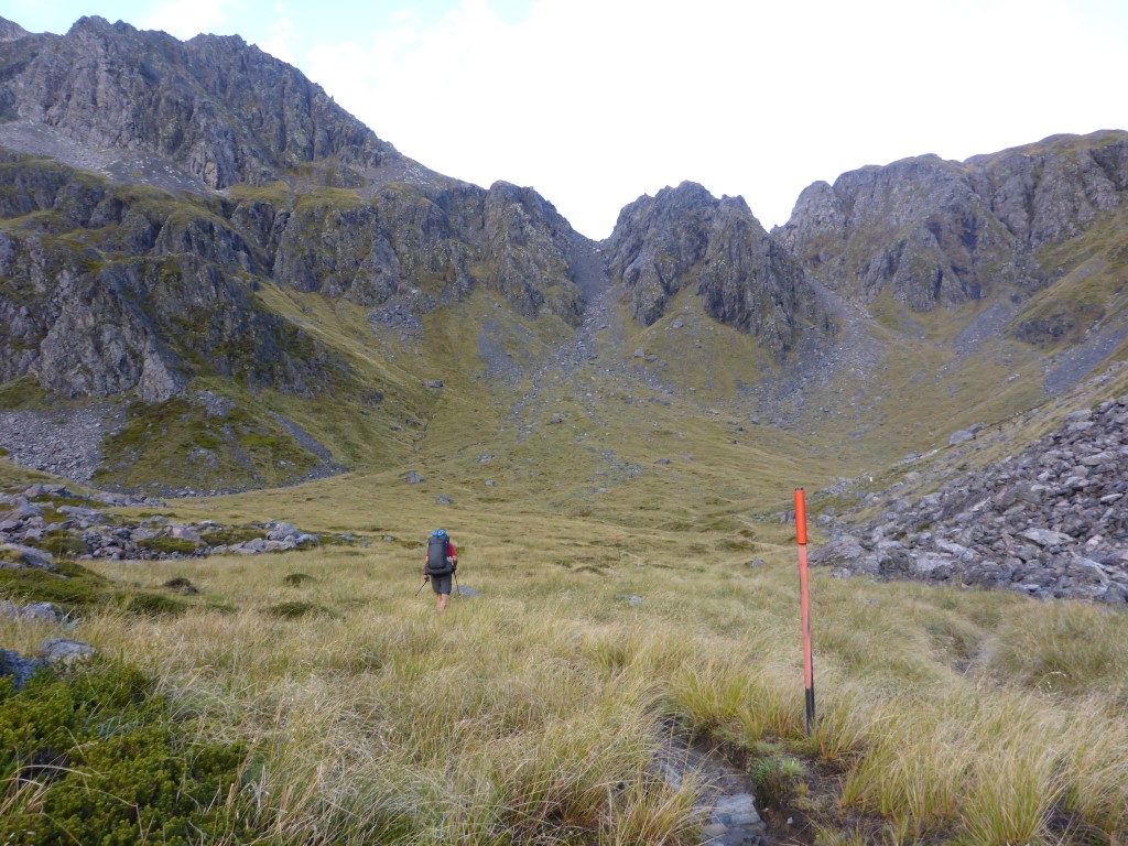
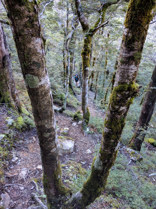
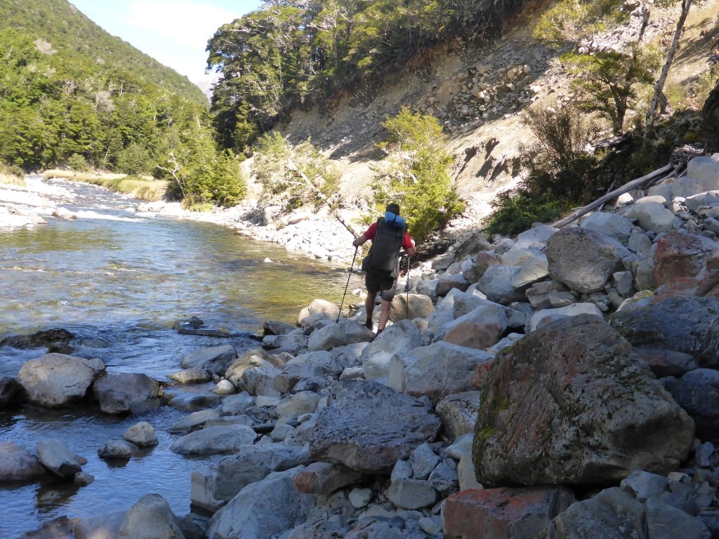
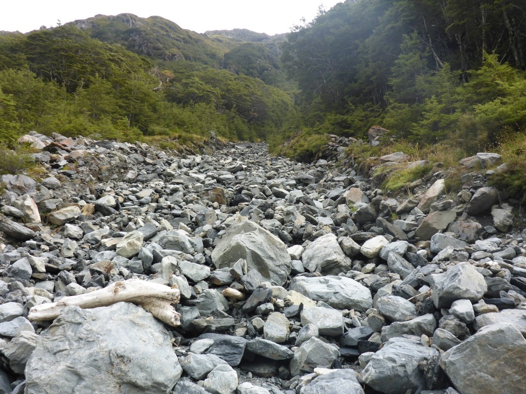
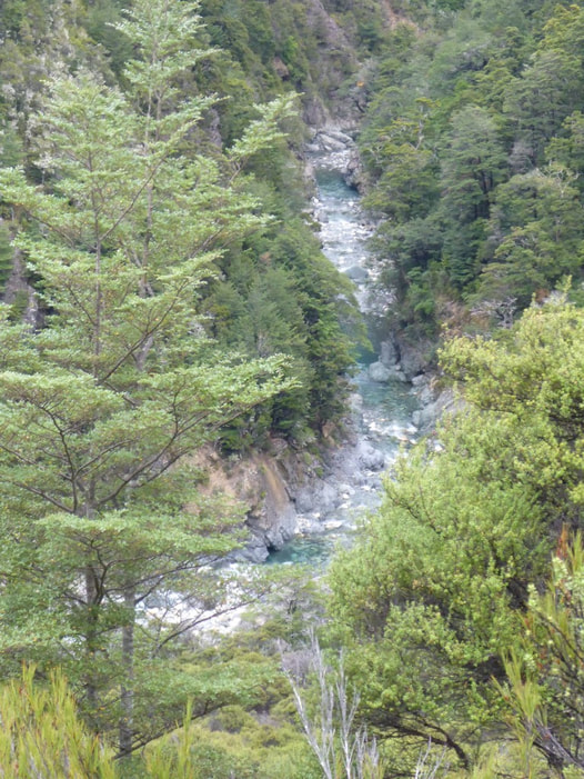
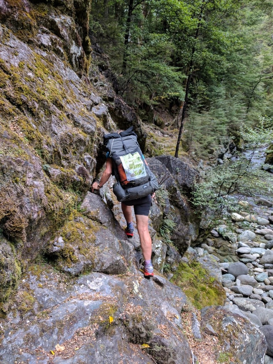
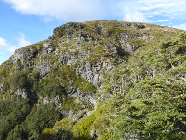
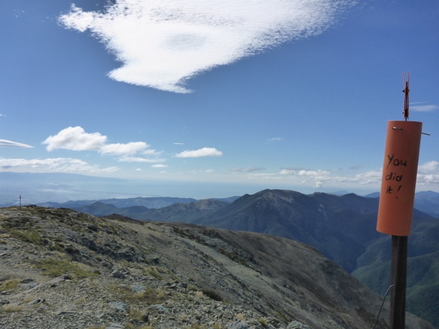
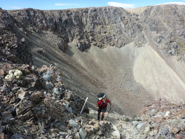
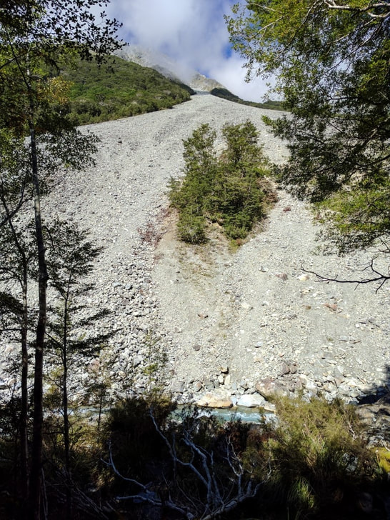
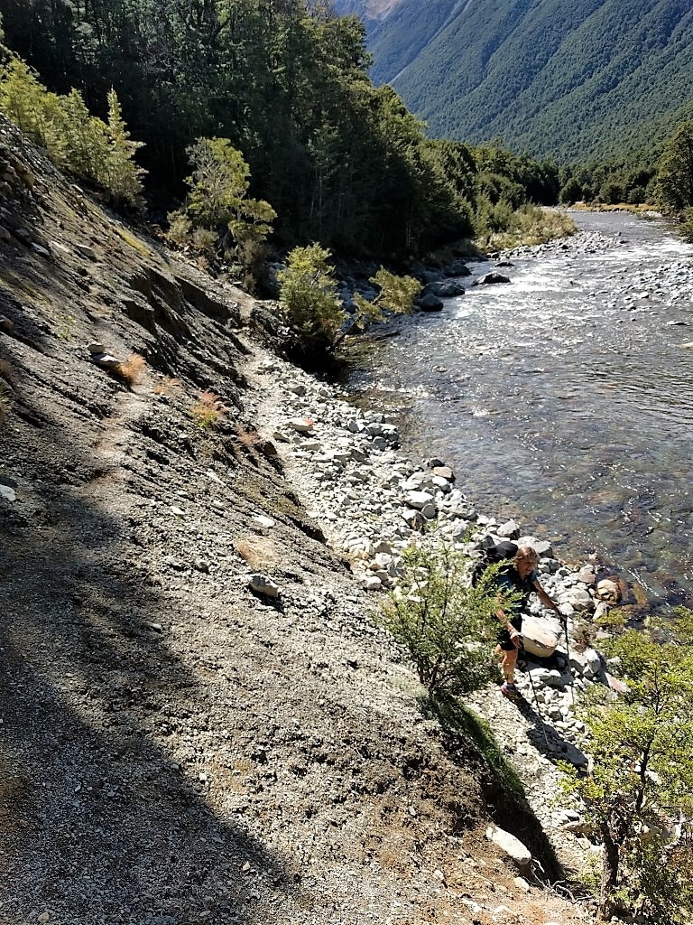
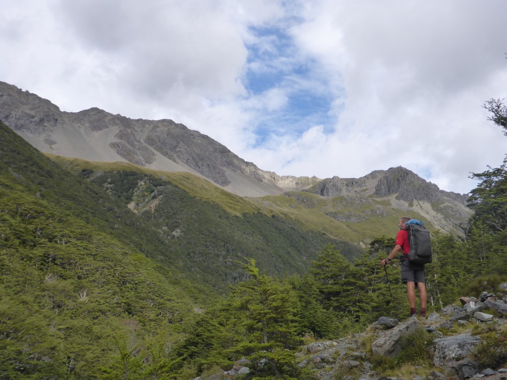
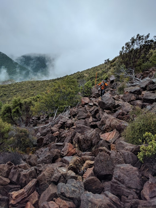
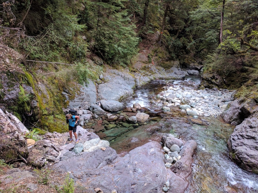
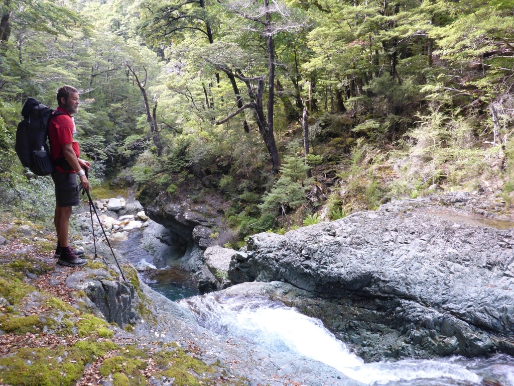
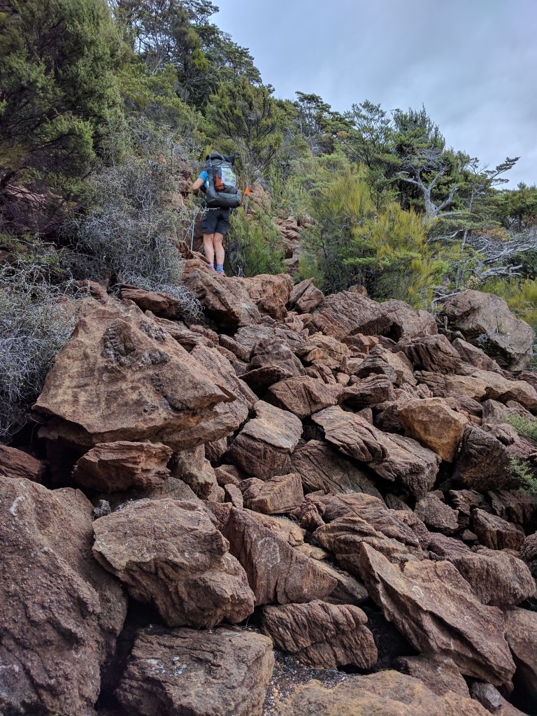
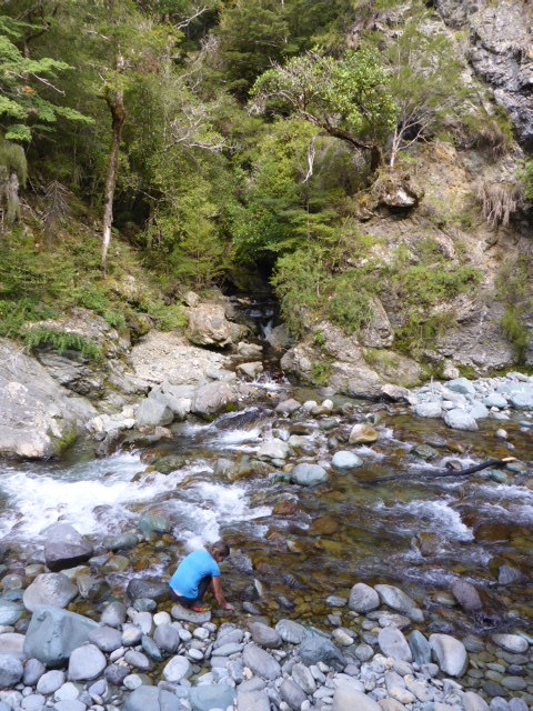
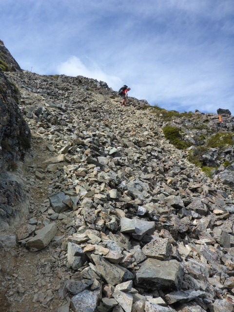
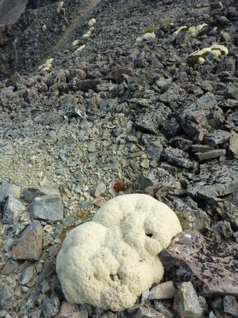
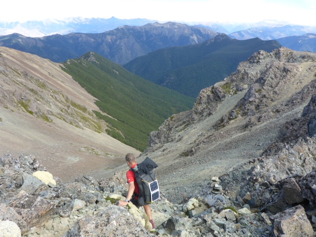
0 Comments
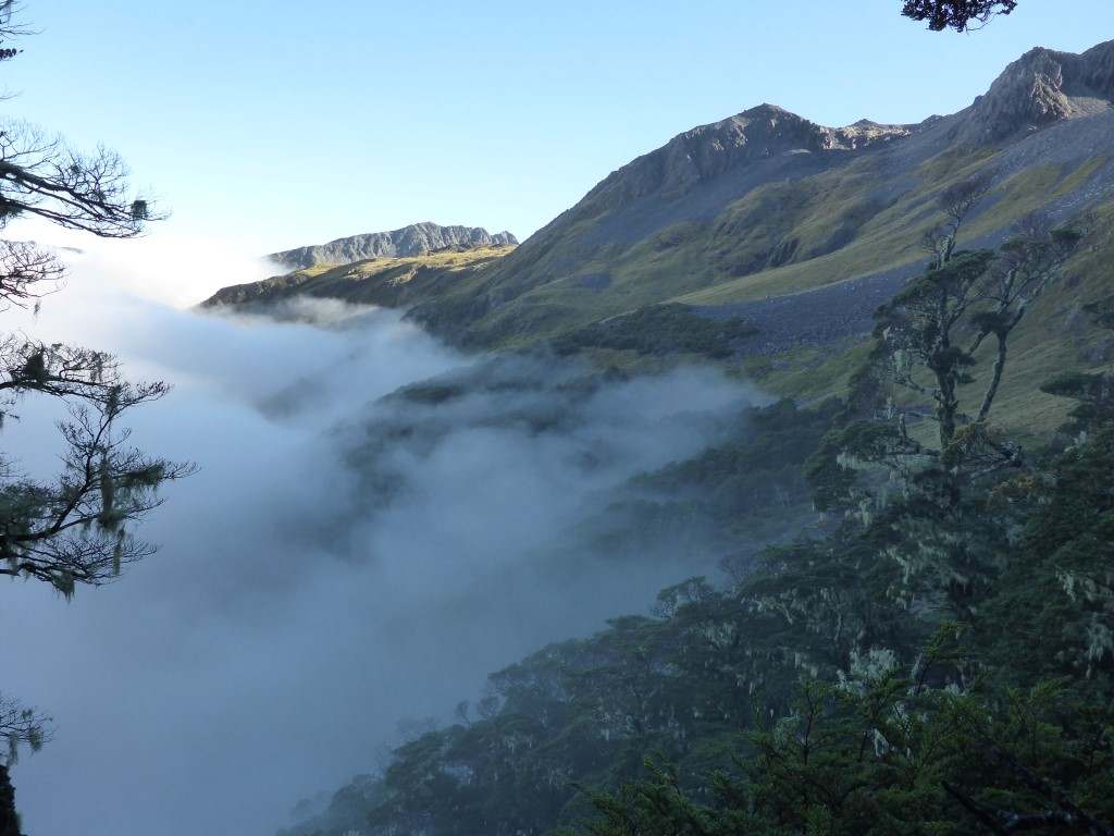
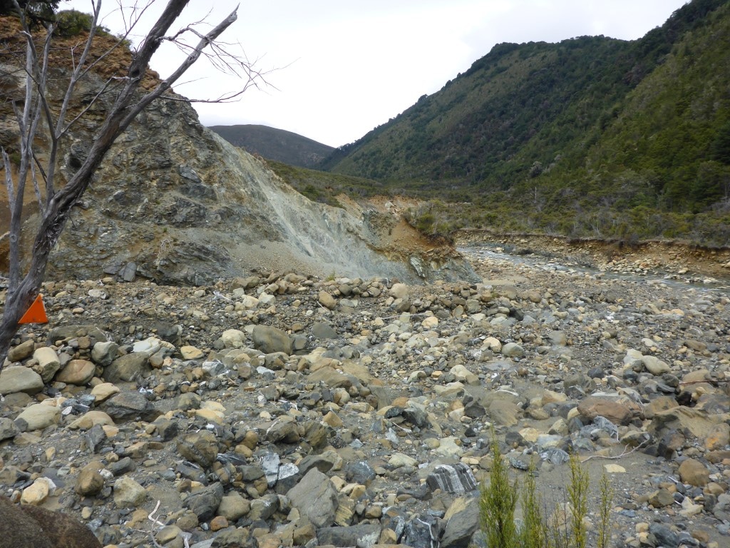
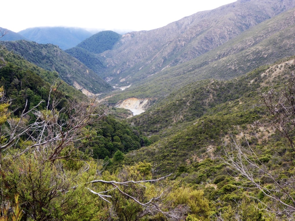
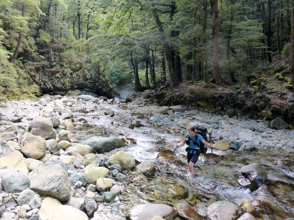
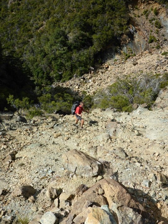
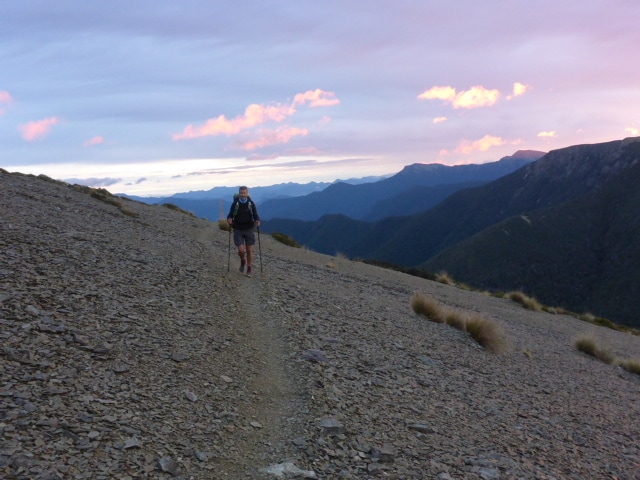
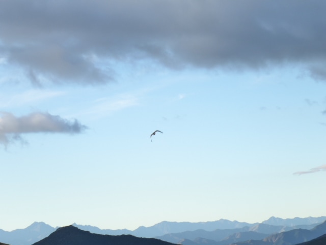
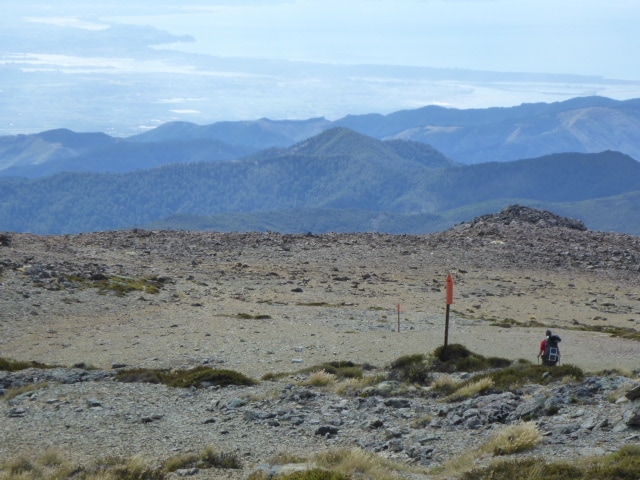
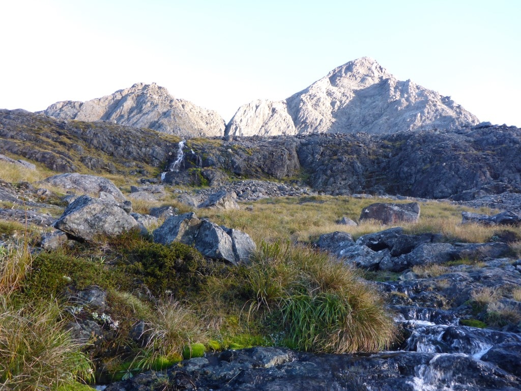
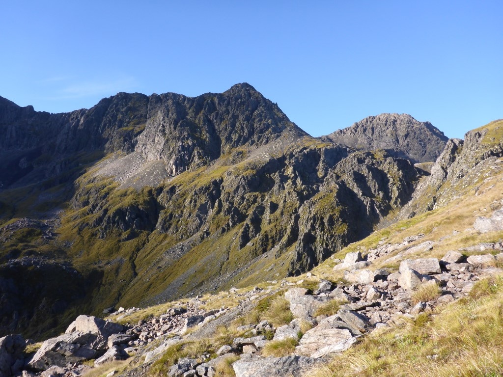
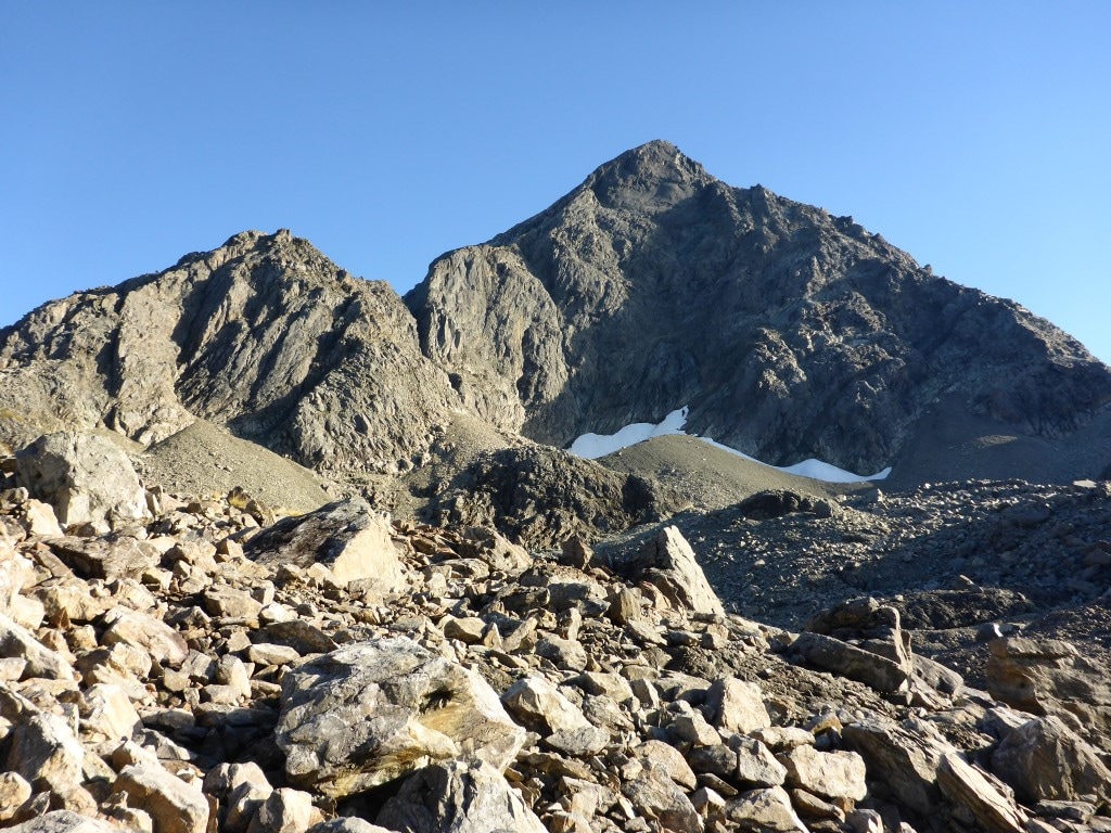
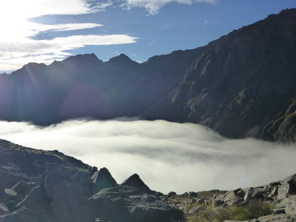
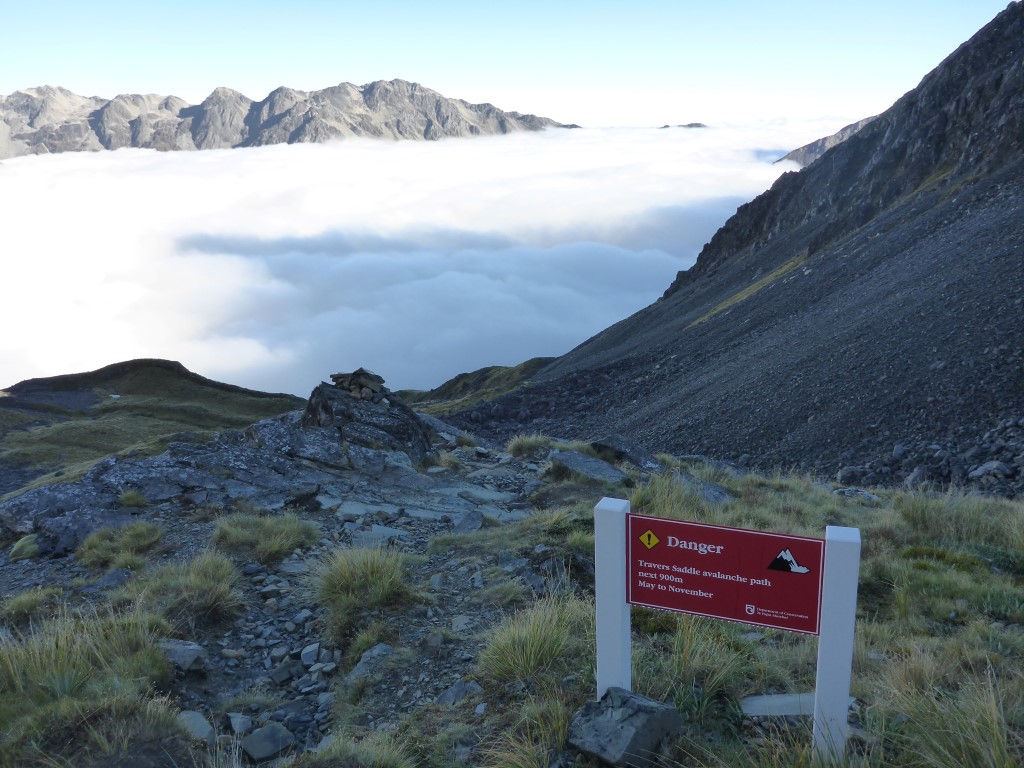
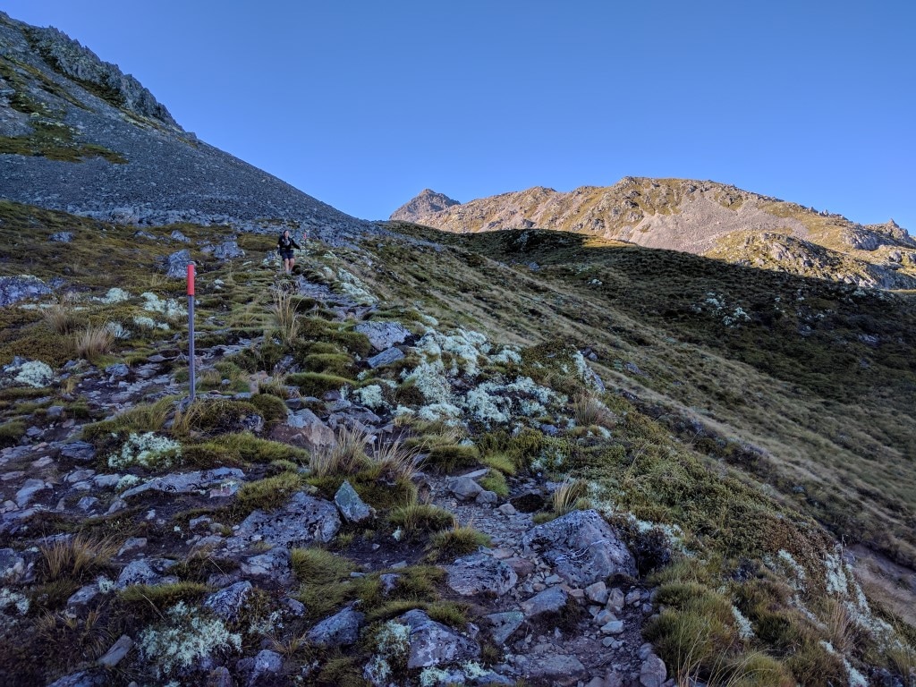
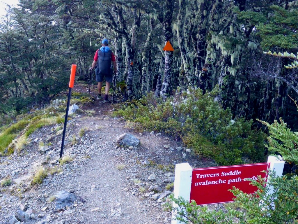
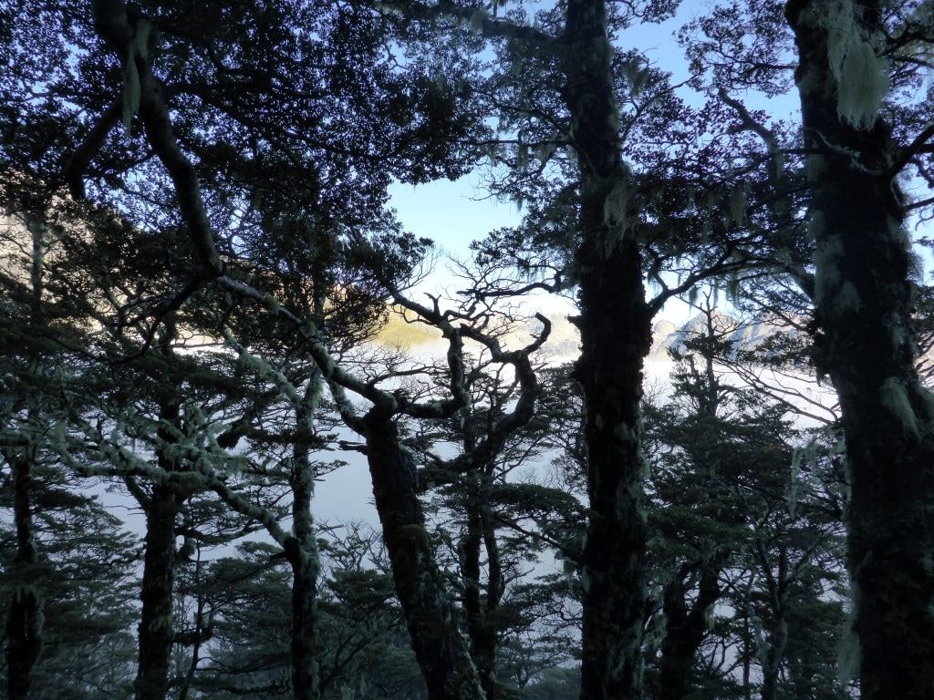
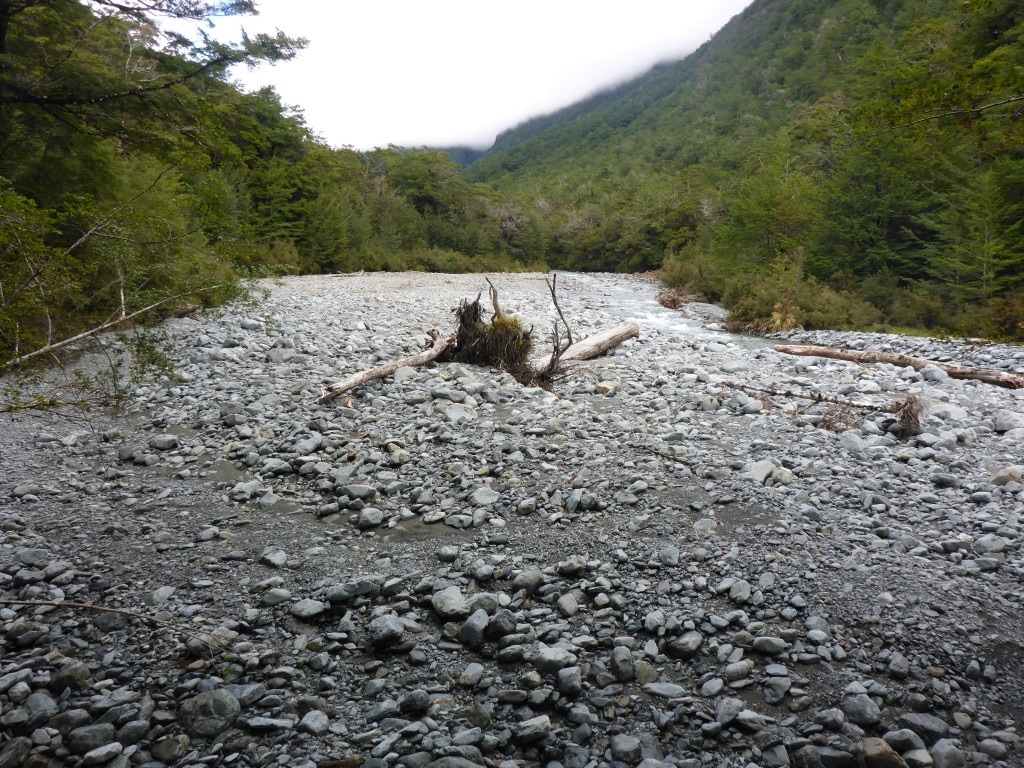
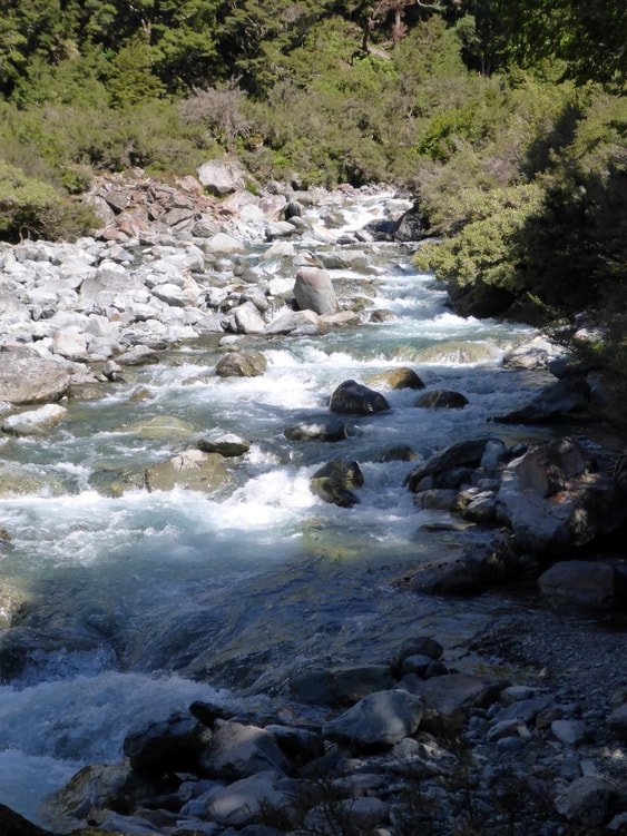
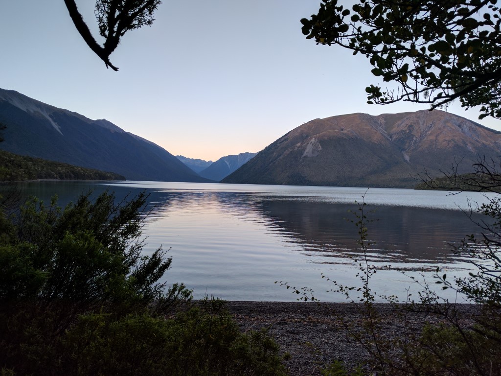
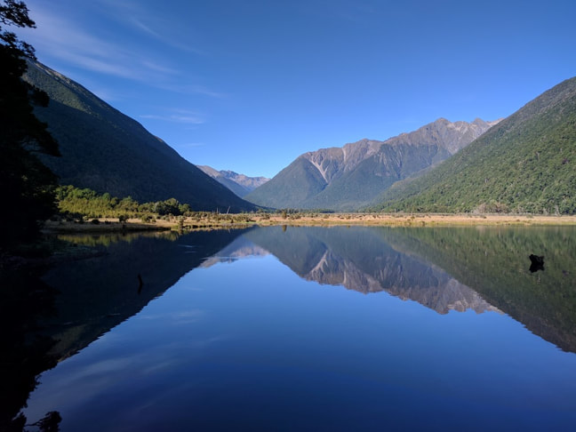
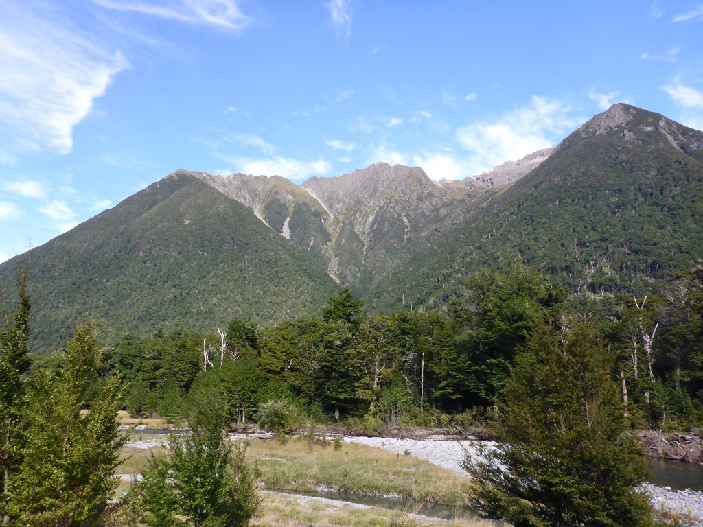
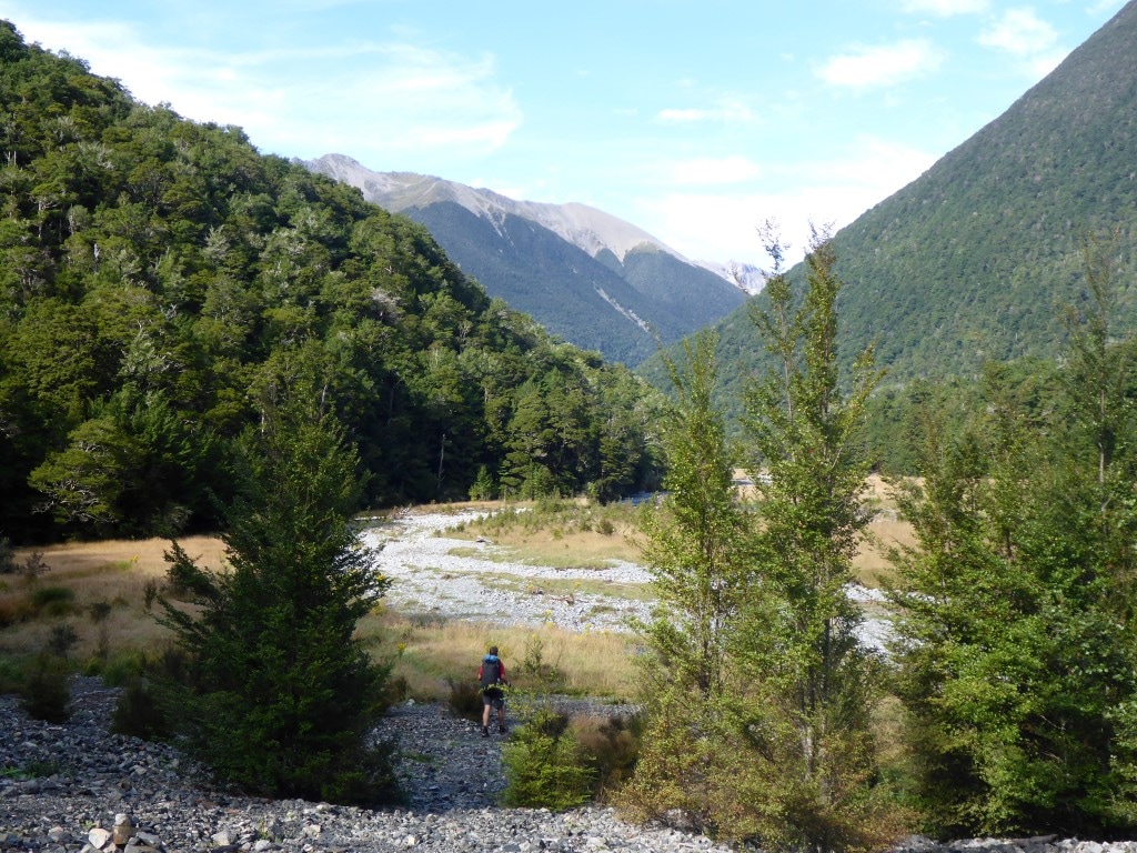
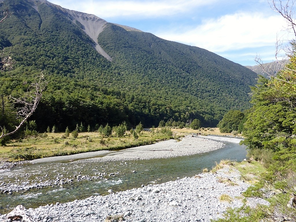
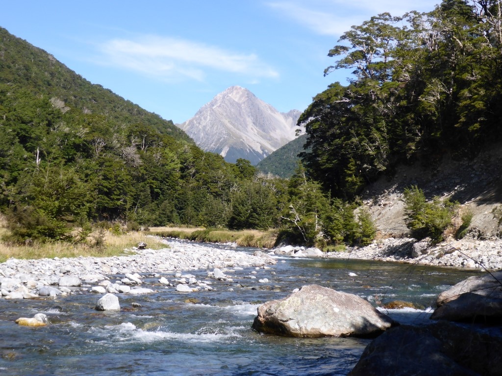
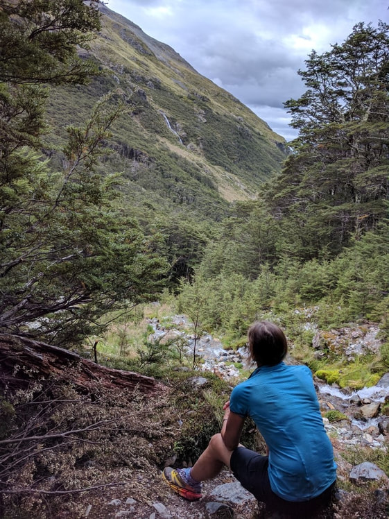
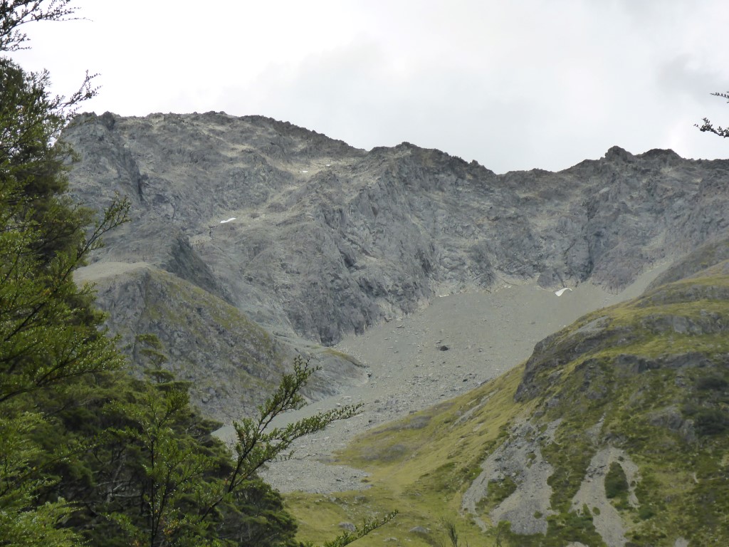
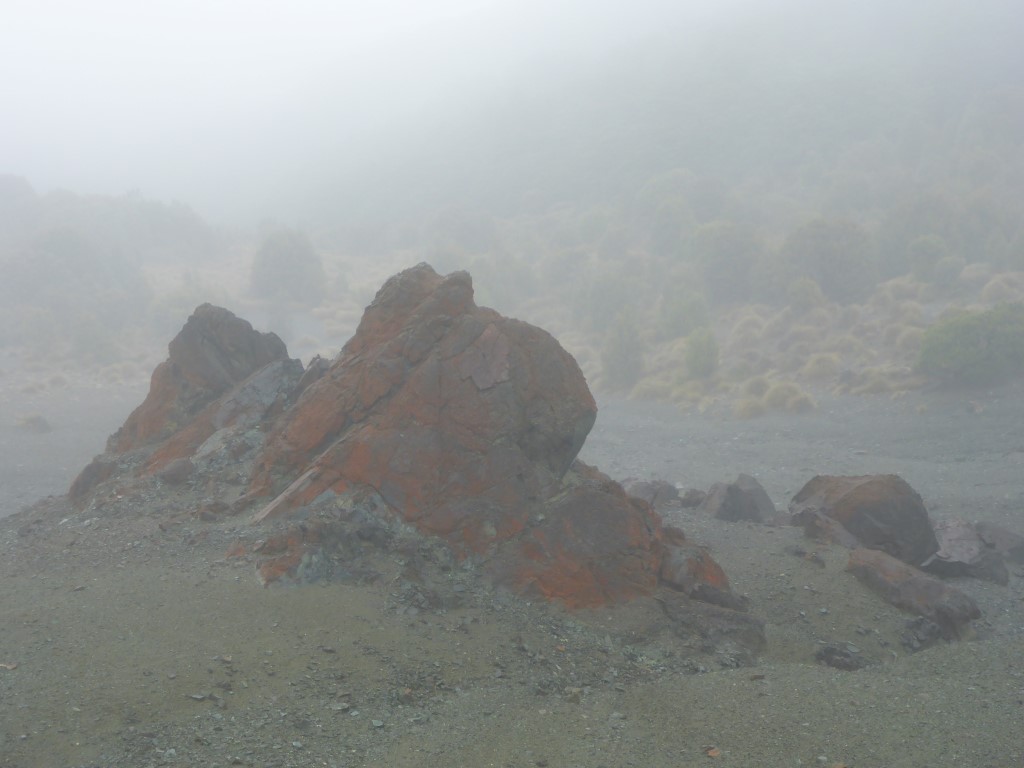
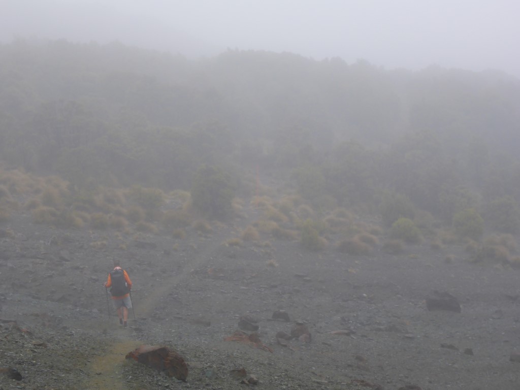
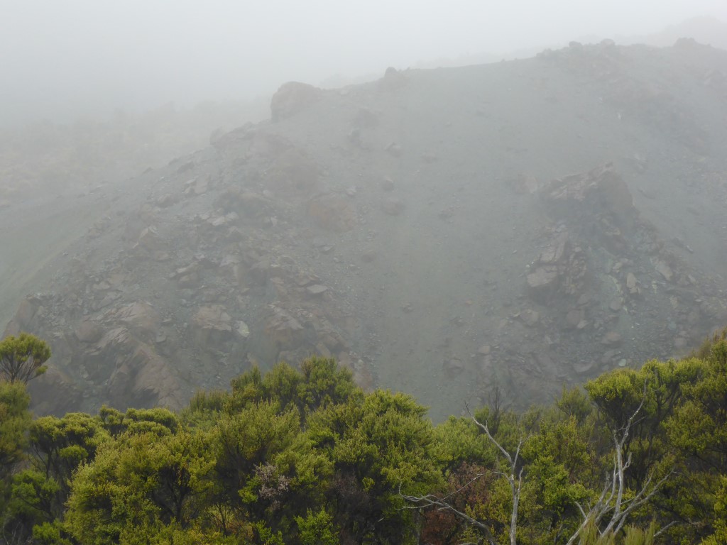
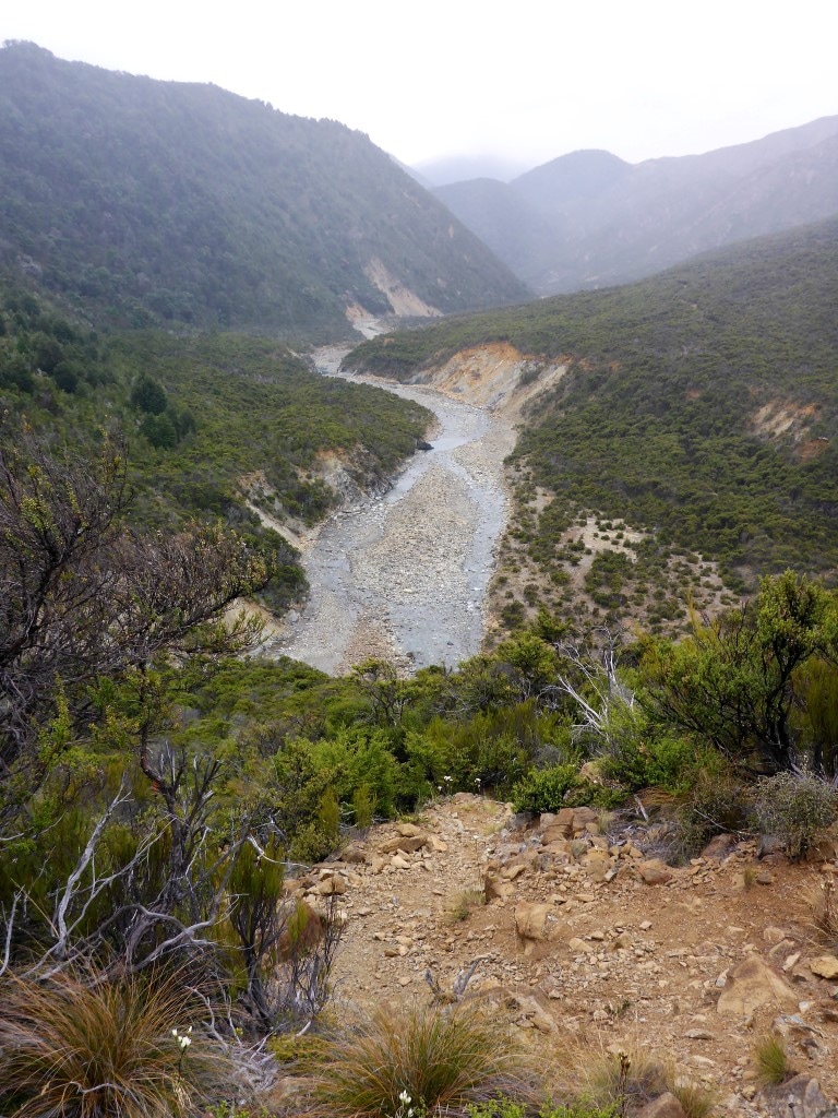
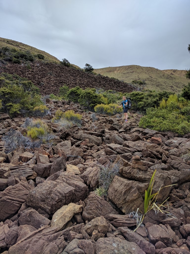
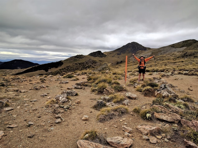
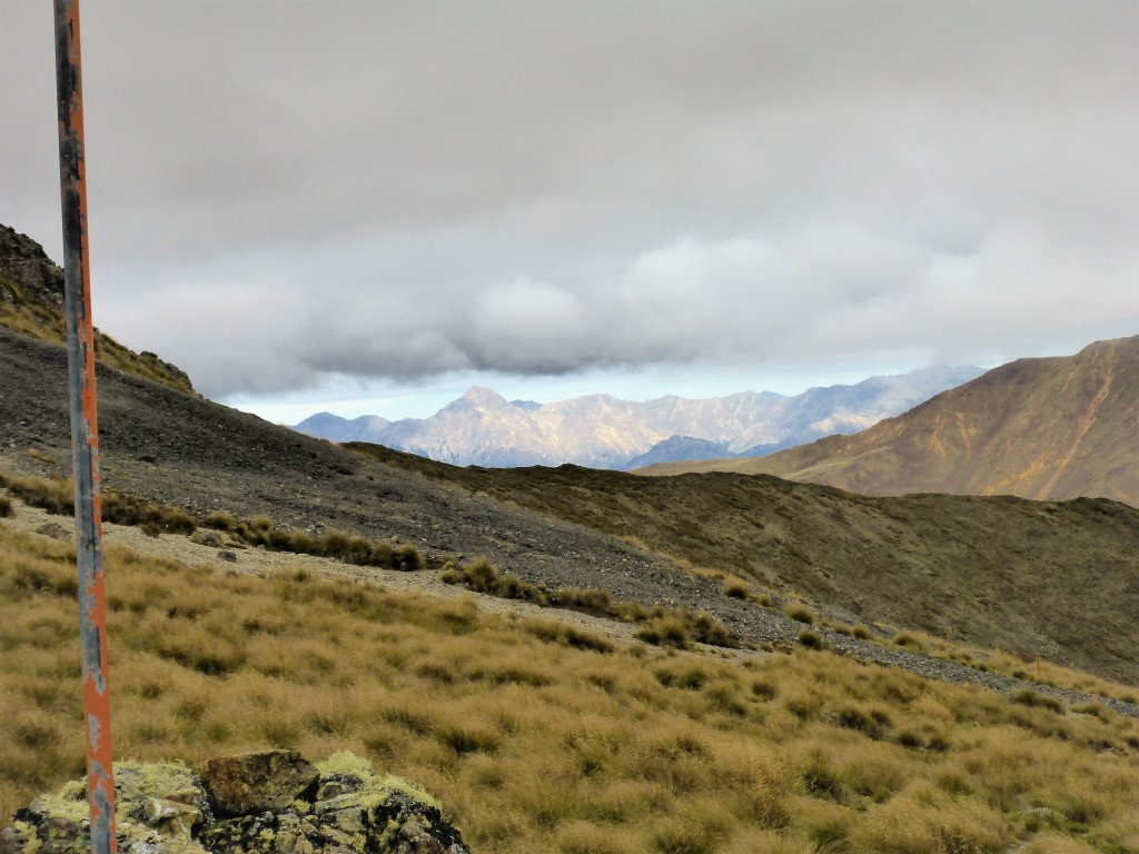
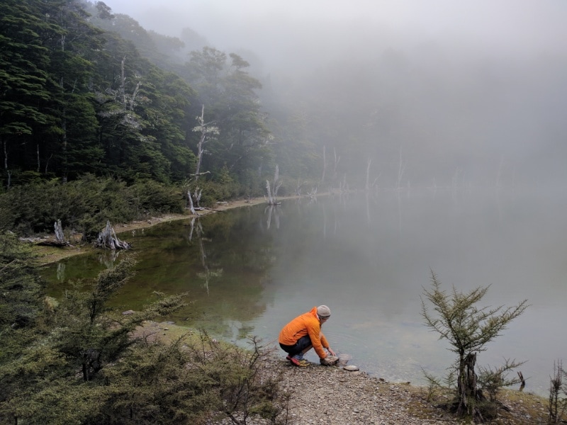
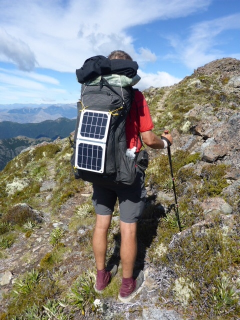
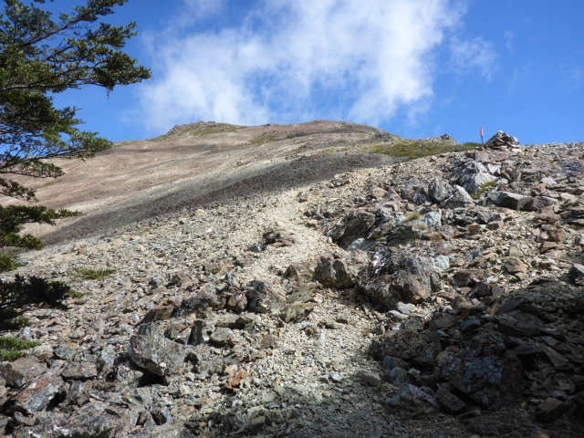
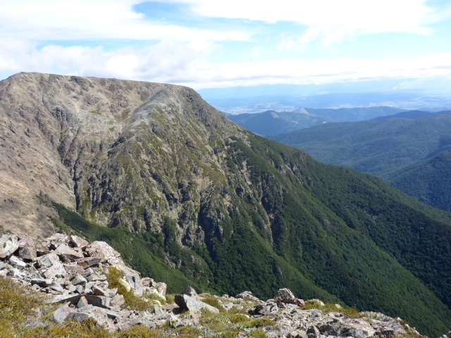
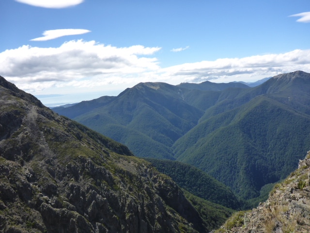
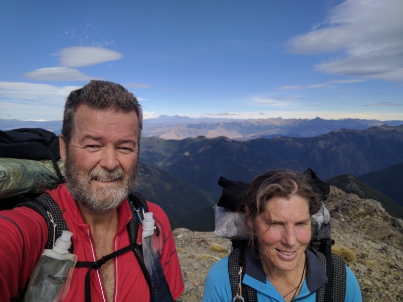
Left Blue Lake Hut 0750 and stopped at Caroline Creek around 1645 after covering just over 13km. Just under 9 hours in total, with around 8 hours of walking - gives you some idea of the terrain!!! The GPS track for today is here. As well as the stops shown on the graph, we had two more 10 minute breaks (forgot to stop the watch for those!) - one near the head of Lake Constance and another at the top of Waiau Pass. After leaving Blue Lake, we initially climbed about 300m above Lake Constance which was clearly visible below. We of course then dropped right down about 150m to the lake shore! We walked around the lake to the head and stopped shortly after for a break as the sun had just appeared in this part of the valley (about 0930), and it's much nicer stopping in the sun :-)! Markus and Nana were a little ahead of us but on the way, prior to our stop, we could also see a bright yellow fluoro top of someone part way up the first ascent, with another person as well - approaching the steep shale section - so we were wondering who that might be, as they were not at the hut last night! 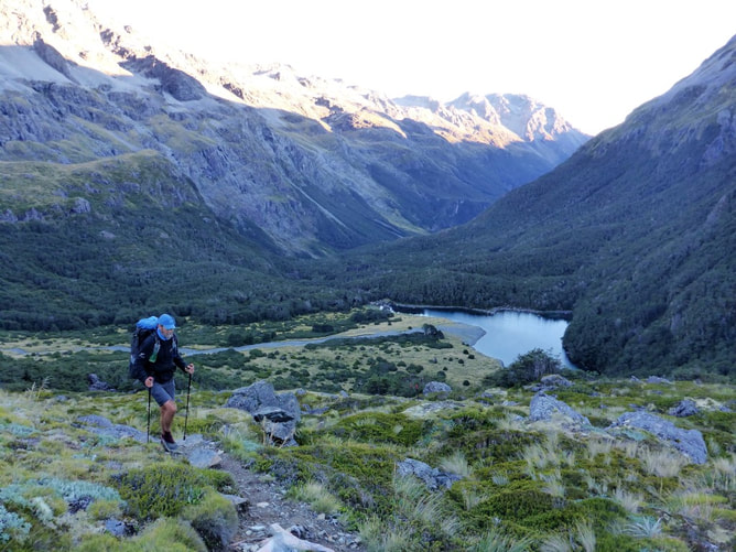 Climbing away from Blue Lake. 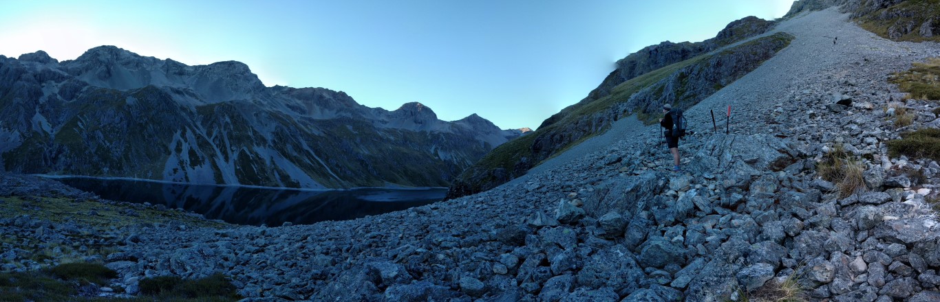 Pano from the bottom of Lake Constance. Markus and Nana heading up the scree slope behind B. 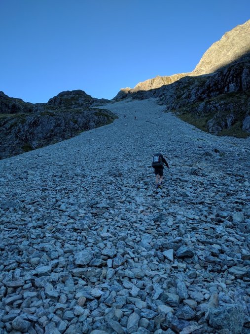 B setting off up the scree. 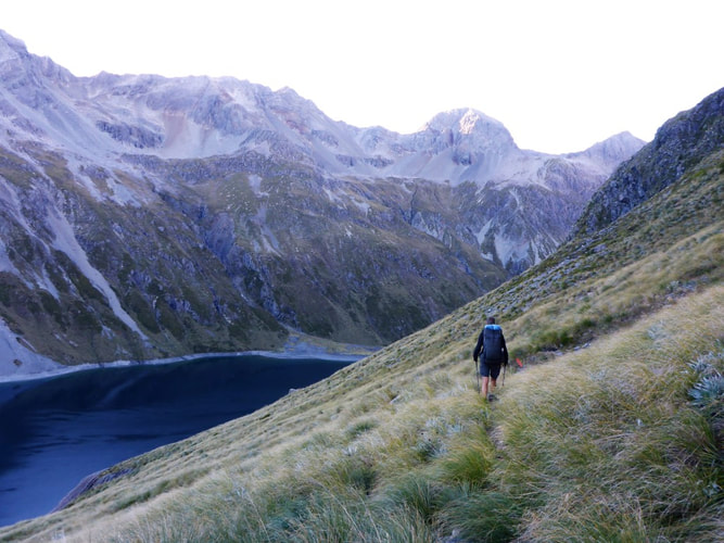 Walking around almost 150m above Lake Constance. 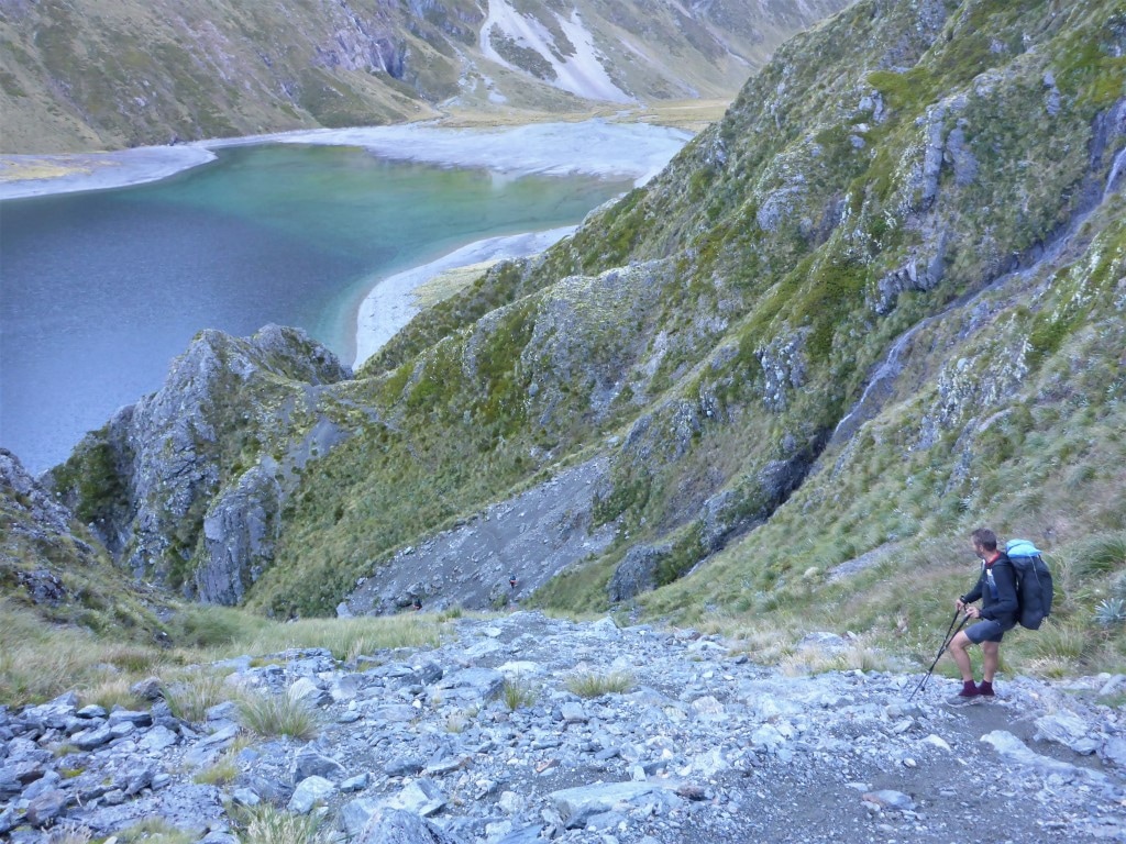 This part of it went down very quickly!! 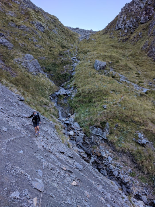 Sidling a little after the steep bit shown in the previous photo. 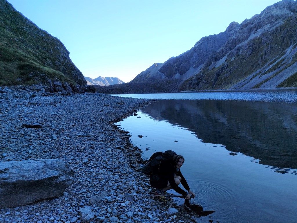 B dipping into Lake Constance.  We think this is our first encounter with the notorious "spaniard" - not in flower but leaves are still vicious!! 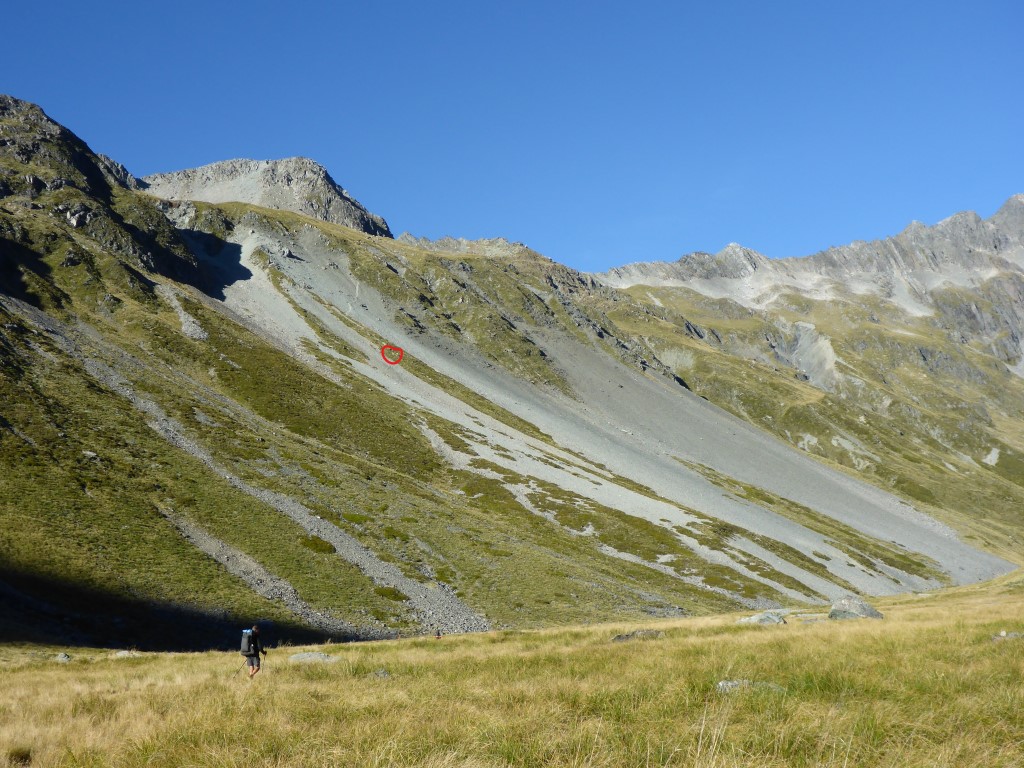 Just before our stop we spotted a couple heading up the pass - circled in red! 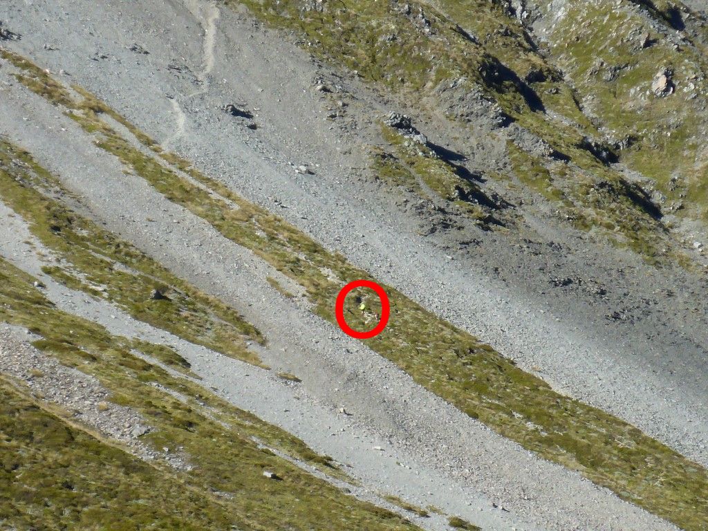 You should just be able to see Peter's yellow vest right in the centre, on the vegetated section. Above them you can see the path up/across the steep scree slope. 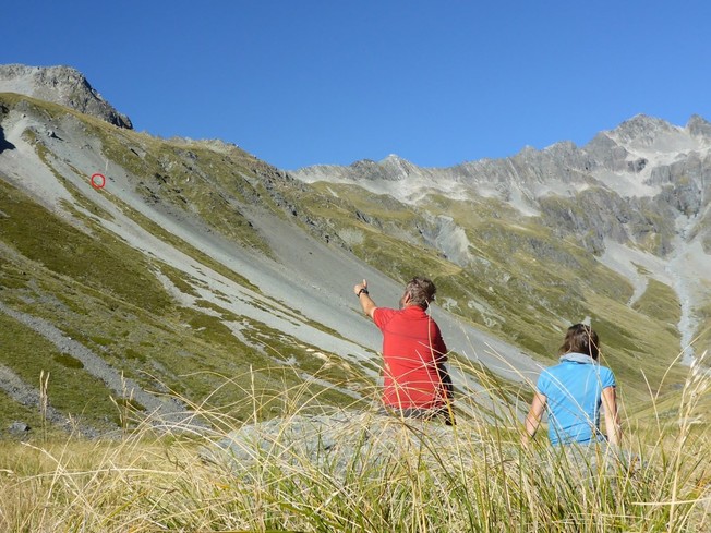 Stopped for a rest - spotting progress as P & J reach the start of the scree sidle/climb (circled in red again). Another 10 min walk up the flat saw us at the base of the very imposing steep climb up towards Waiau Pass. Long and slow! It's a bit of a two-stage climb - it flattened out a little (relatively speaking!!) for a short while after the first substantial climb and then there is a shorter final steep ascent to the pass itself. We arrived at the top at midday, stopping for a break to rest, eat and take in the spectacular views. Markus and Nana were there and the mystery of the other couple was also solved. Judy and Peter, an older couple from Hawkes Bay (I think in their late 60’s) were the ones ahead of us - having camped last night on the flats at the head of Lake Constance. They are doing chunks of the TA, although not sticking to it religiously, being prepared to depart the track (e.g. they ended up crossing the Waiau further down and connecting with the St James cycleway to take them directly into Hanmer) when it suits. Keeps reinforcing that age is no barrier per se!!  As the late John Clarke would have said - "straight up the guts Trev"!! 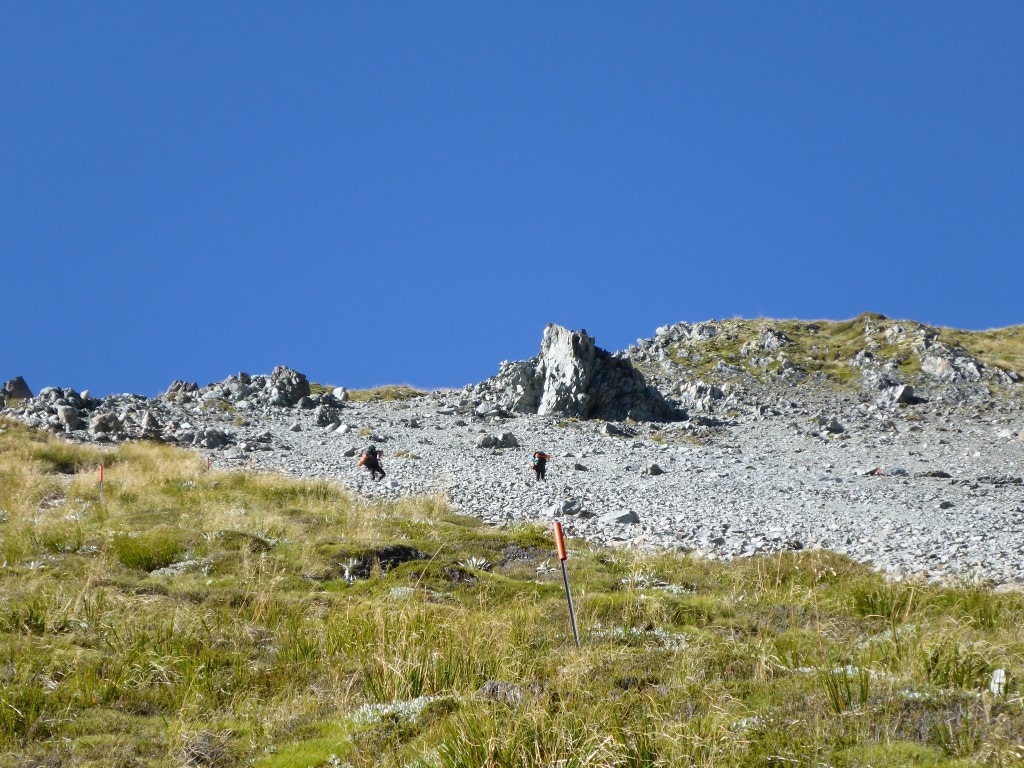 We are part way up the vegetated section - Markus and Nana up ahead are on the scree section. 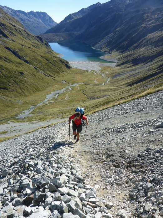 I didn't feel all that secure on this bit. It headed up on an angle across the steep slope and the footing was loose - concentration!! 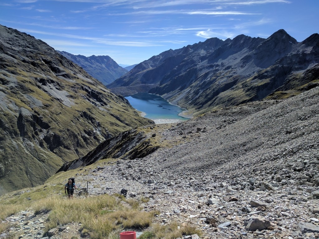 B heading up the "slightly flatter" section part way up! 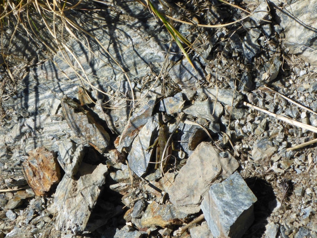 There was quite a bit of local wildlife in the form of insects. 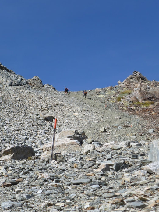 The second steeper section heading up to the pass. 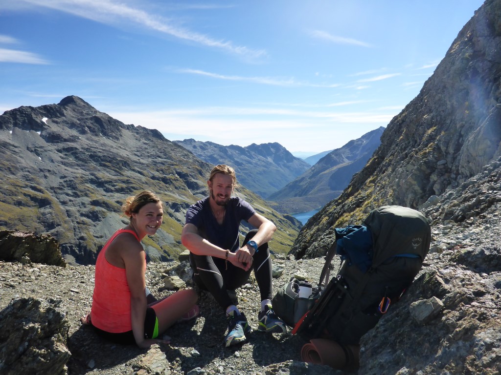 Markus and Nana at the top, looking back towards Lake Constance. 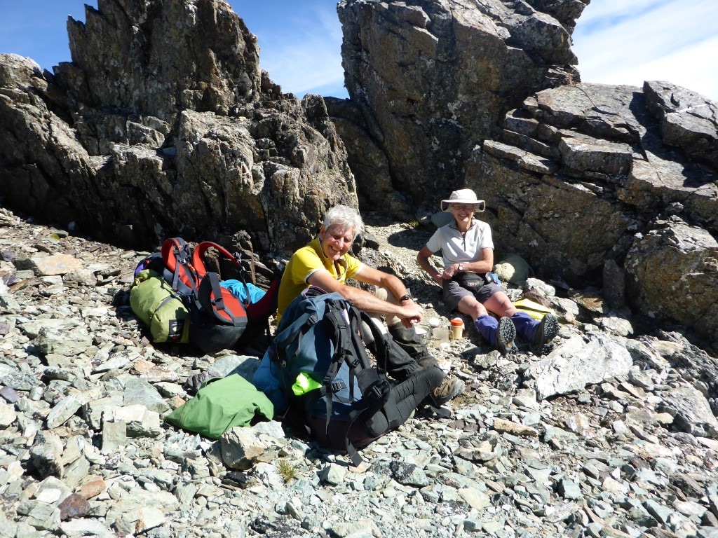 Peter and Judy enjoying a well deserved snack!! 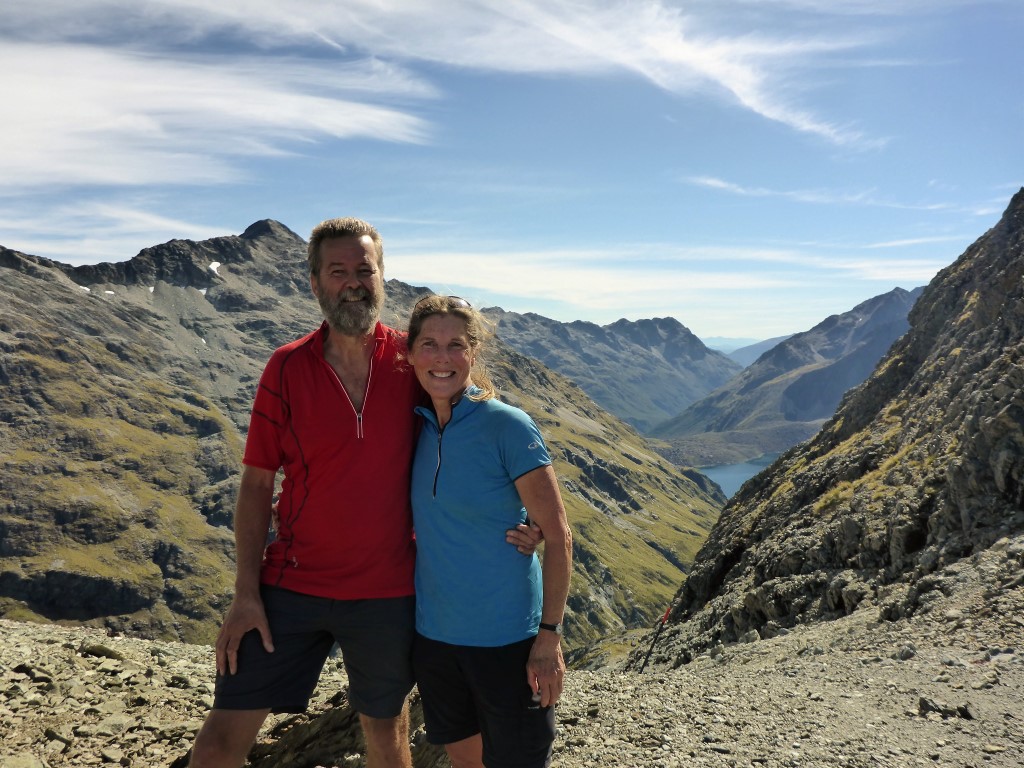 Markus kindly took a snap so B didn't have to find a rock for the camera like usual :-) 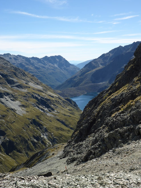 Another view of where we had come from. What followed was an equally steep descent down to the Waiaua River West Branch (although I have also see it referred to as the Thompson River), including one gnarly pinch down a rock chute that required rock climbing skills, and took a while to negotiate!! But, overall, not as challenging as a couple of spots in the Richmond Ranges, from our perspective. We all stopped for lunch once we had got down to the river. Peter and Judy headed off first, followed by us and then Markus and Nana - it turns out that Markus and Nana camped at Waiau Forks so we didn’t see them again until Anne Hut. 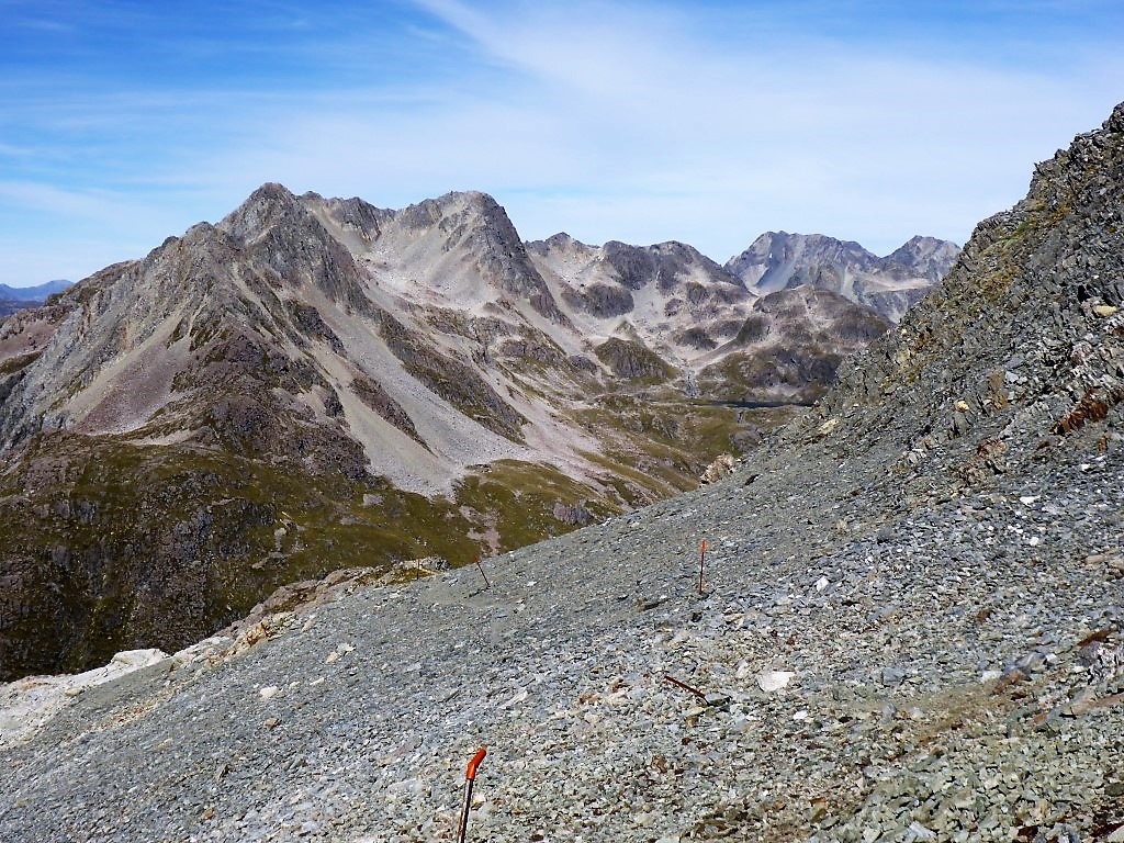 Looking slightly west of south across the valley we are dropping into. Hard to spot, but Lake Thompson is a sliver just above centre right. 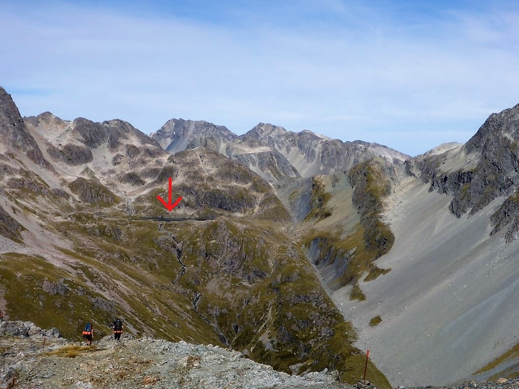 Taken from slightly lower down. Lake Thompson under the red arrow. The Lake feeds straight down the steep face - pretty much the start of the Waiau West Branch. 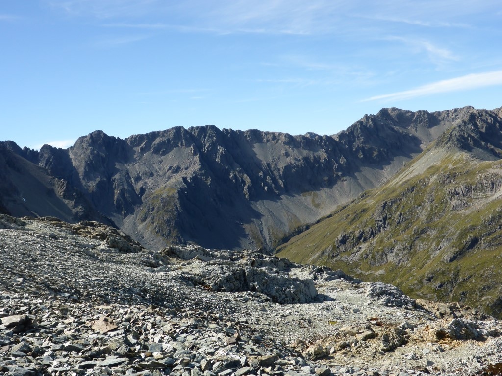 Looking further east - seems like that might be part of the St James Range?? 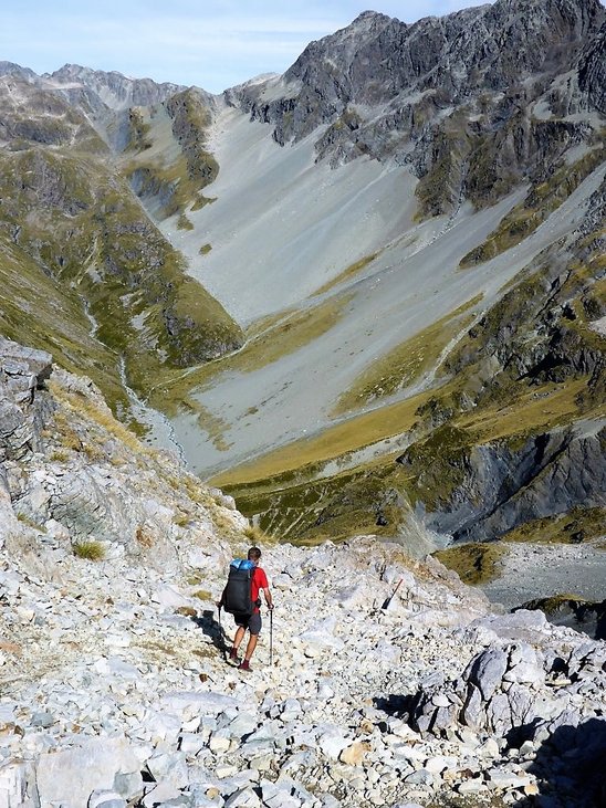 Starting off down the other side. 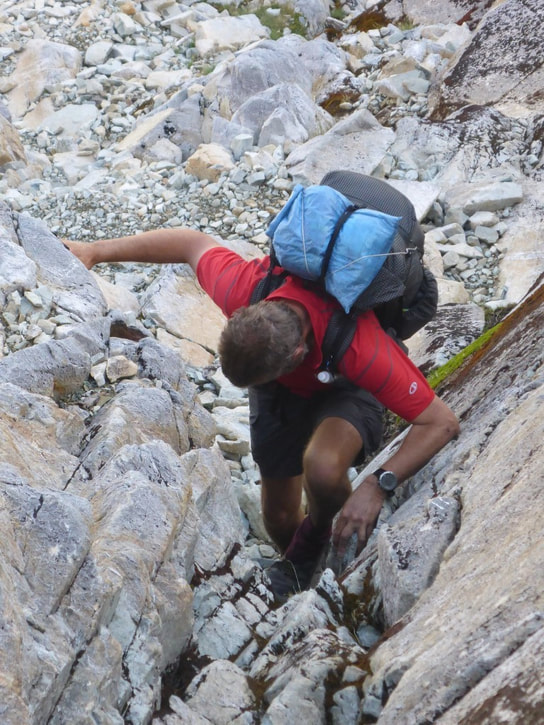 This little bit required some mountaineering / rock climbing skills! 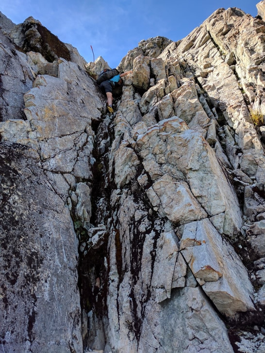 From the bottom. Footholds were minimal and it's one place where longer legs are an advantage!! 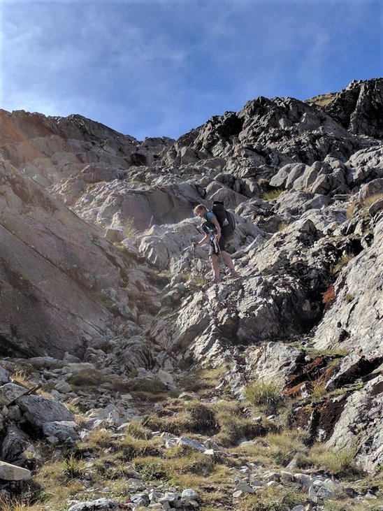 Still pretty rocky here as well! 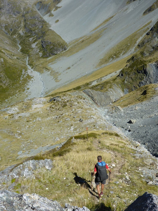 This steep ridge down was a bit of a knee-banger.  B found time to capture a clear rock pool :-) 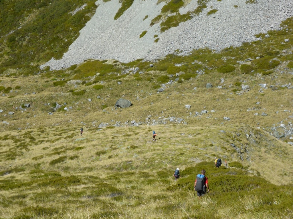 The "ant trail" nearing the bottom of the ridge - getting closer to the river at the bottom. 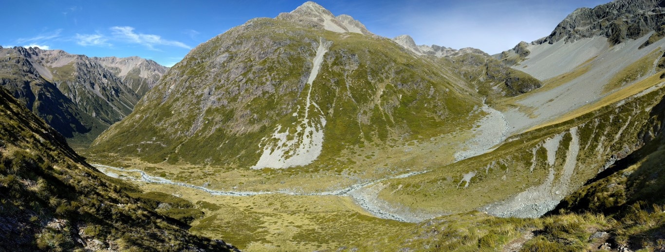 Pano of the river looking south. Coming down from Lake Thompson upper right, the river heads to Waiau Forks just out of sight at the far left. 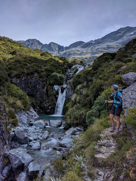 Still places where you get lovely little waterfalls like this 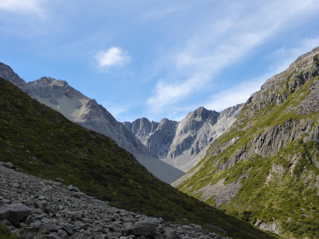 Looking about NW up to where the Waiau East Branch comes from. 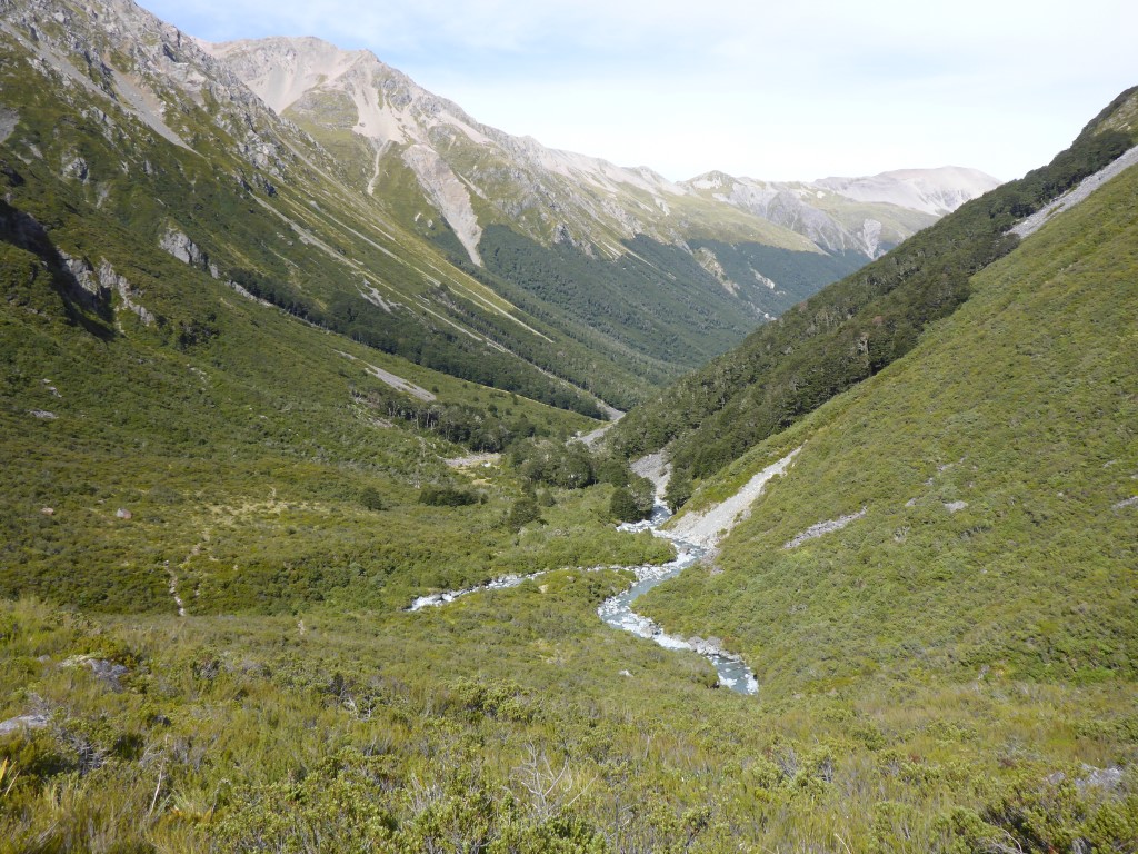 Waiau Forks - West Branch coming in from the right, East Branch from the left. Then we follow down the Waiau valley directly ahead! Then it was on down the Waiau River valley. We met a couple of hunters heading up just before Waiau Forks - they were planning to head up to Lake Thompson, opposite Waiau Pass and camp up there in search of deer. It was still quite “lumpy” terrain but eventually we reached the flatter valley - although this was still not easy going, with a number of rock slides to traverse alongside the river. Sometimes we were in the bush margins and sometimes right along the river edge. A couple of km from Caroline Creek bivvy it widened out and flattened even more, with some faster progress made. We had decided to tent near the bivvy so stopped there about 1645. Should have probably gone further in hindsight! Sandflies are pretty bad here and there is no real reason to camp close to the bivvy (no toilet)! A lesson for us to tuck away. We found out later that DoC are apparently looking at upgrading the facilities here - mention of a full hut going in to replace what is essentially a two-bunk emergency shelter. A very cheeky little robin was entertaining Belinda and, as is often the case in the bush, would come right up to us. Sitting in the tent, he came right up to perch on my pack, presumably interested in all the sandflies as well. Such cute little birds :-) 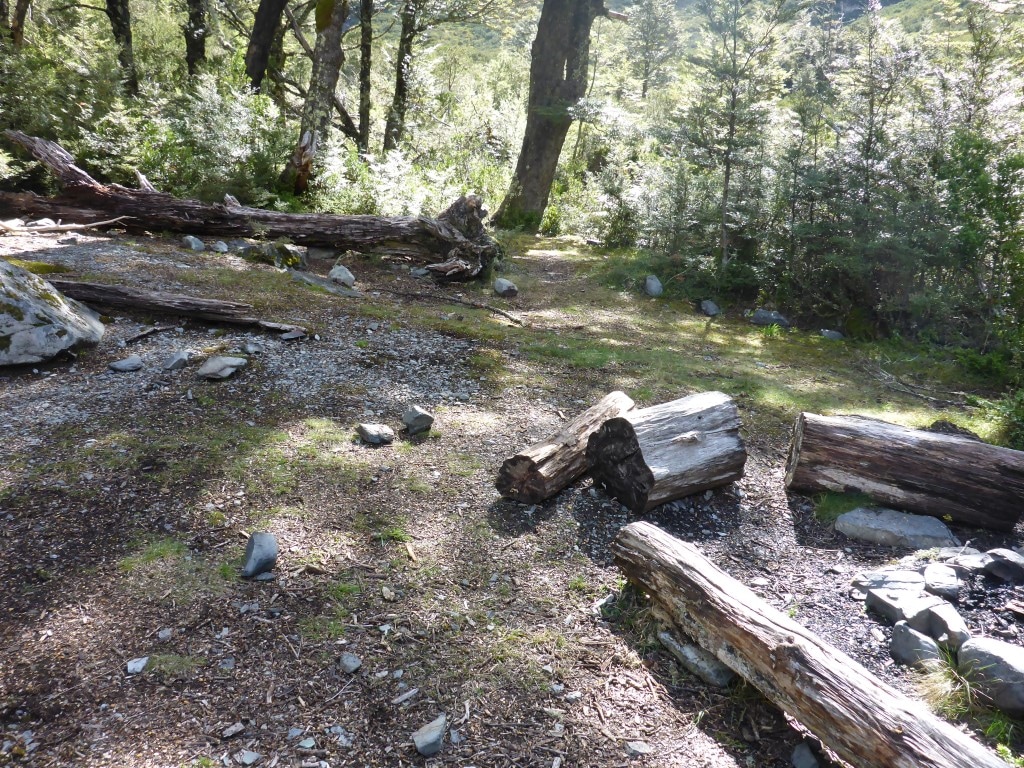 There is a little informal campsite at Waiau Forks, but we had plenty of time to push on down the valley. 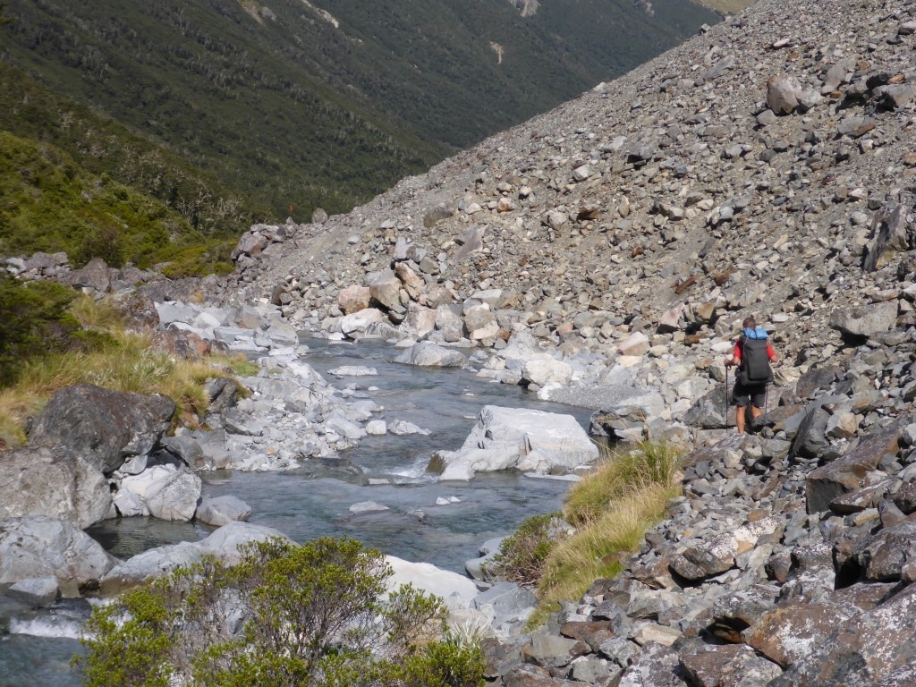 As noted, crossing these rock slides is just par for the course around here. 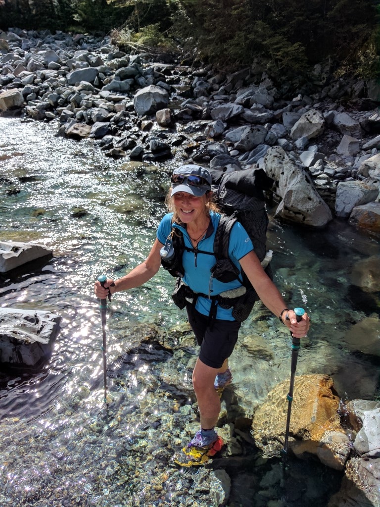 The occasional wet foot crossing was required. 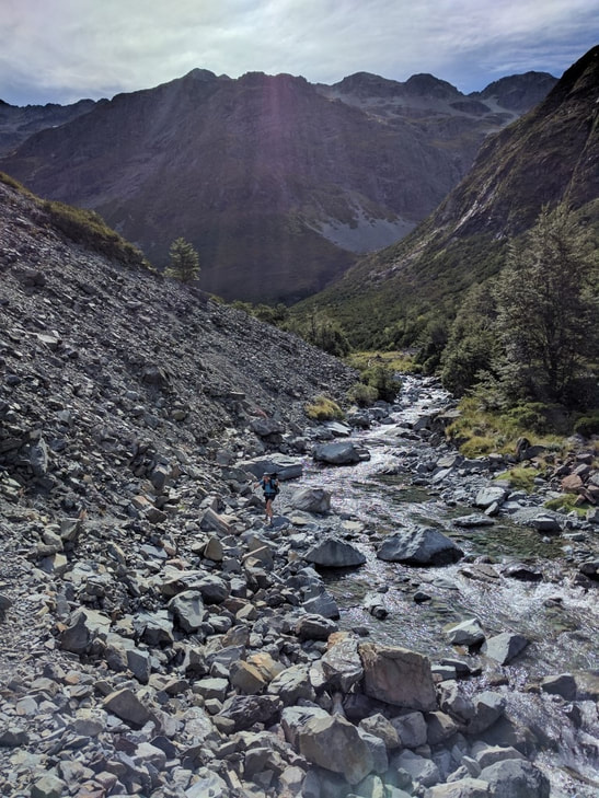 B coming up through another rock slide. 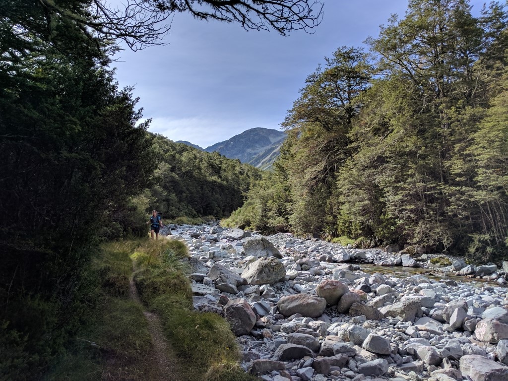 Got to walk alongside the river on a grassy area as the valley started to widen out a bit. 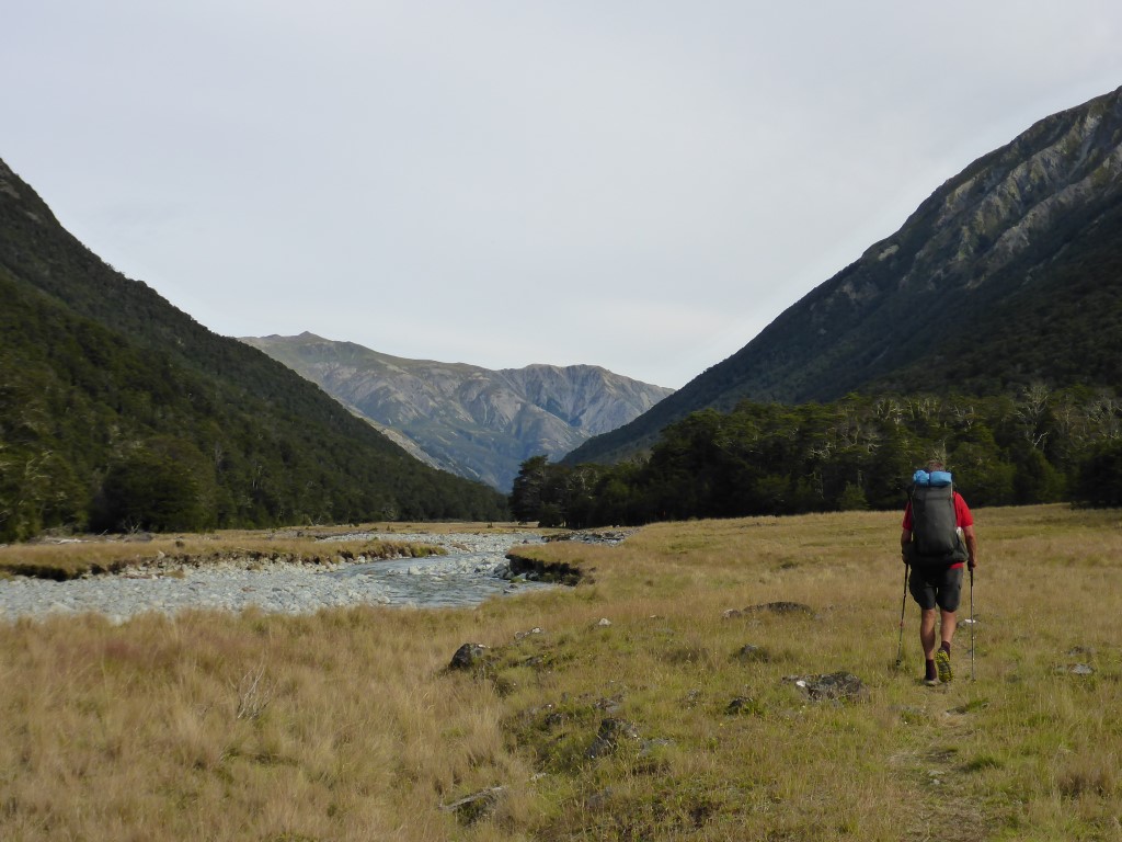 And as it got wider still!!  Sign at Caroline Creek bivvy. 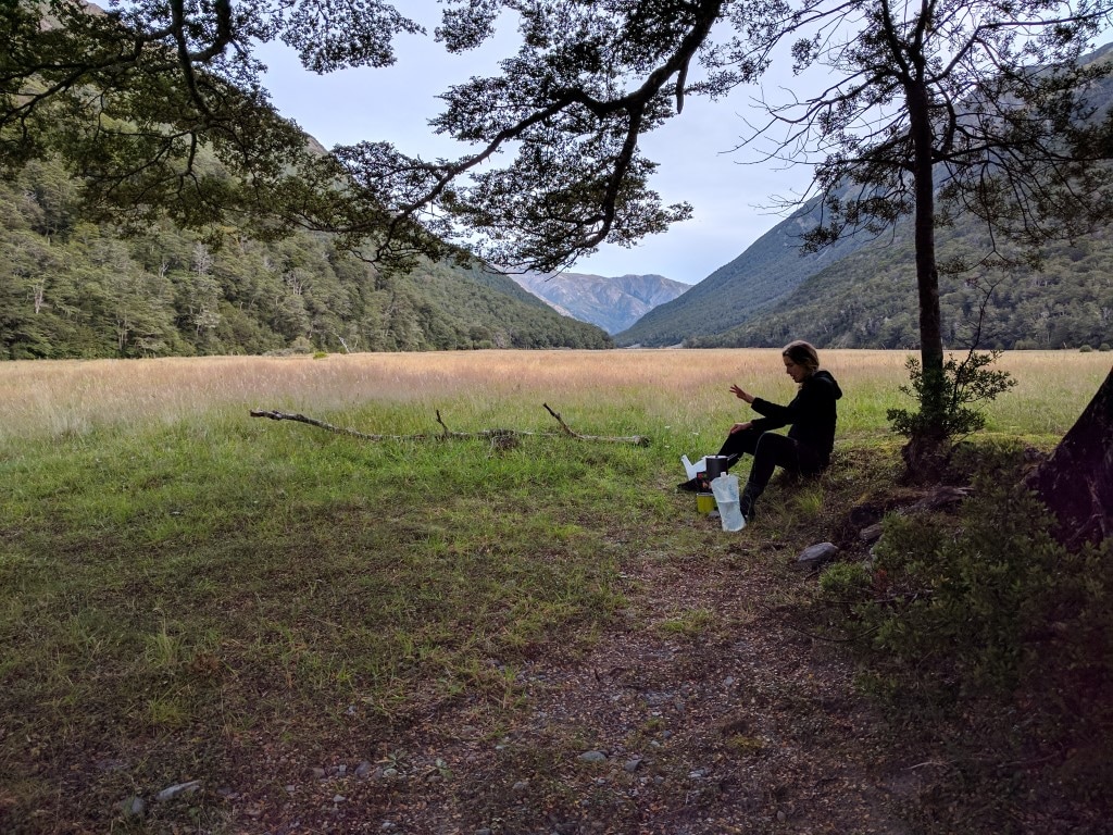 Cooking a little way away from the tent - didn't really reduce the sandflies!! 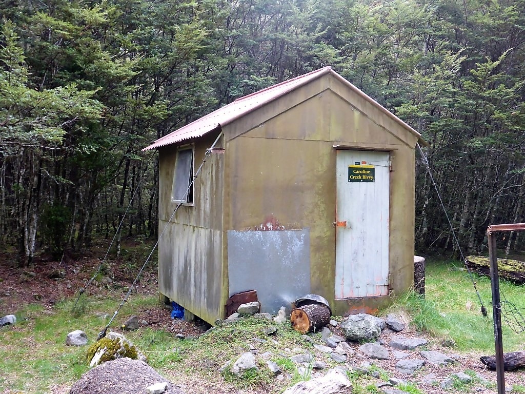 The actual bivvy building. 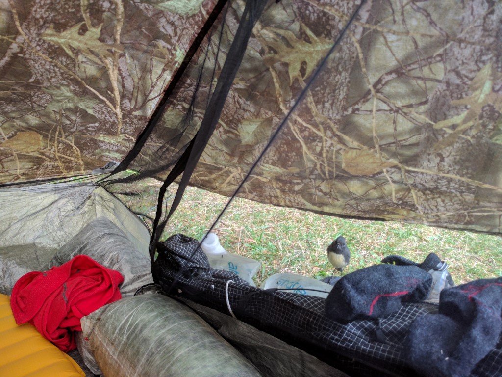 Our friendly little robin - able to withstand the smell of my socks somehow :-) We left the hut about 0755 this morning - always a bit later than we plan, but still not long after the light is good enough for us (generally around 0730)! We got to Blue Lake Hut at 1700 covering 14.5km, so a 9 hour day in total, involving around 7h50 walking. The GPS data for the day is here. Lots of photos again today as the day was very varied with lots of great scenery from our viewpoint! The day started with a climb up to Travers Saddle which, at 1787m, is almost 400m higher than the hut. Markus and Nana had left a little before us. You are pretty soon above the bushline, into mainly tussock and rock :-), with some lovely views back down towards the hut and the Travers River. We did notice that the mist was rolling into the valley behind us, so a good time to be heading up! We passed Markus on the way up - he is an avid photographer and was setting up a shot back down the valley. We arrived at the Travers Saddle after 1hr20 and 2km, enjoying a 15 minute break with Markus and Nana there as well, before heading off down the other side on a long descent.  A clean and tidy Upper Travers Hut upon departure :-)
 Slightly flatter at this point, but more climbing to come!
 Markus and Nana at the saddle - Markus has a tripod and remote control so selfies are not a problem for them!! 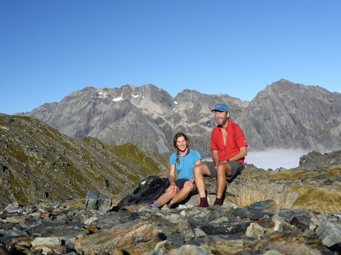 B, on the other hand, is adept at getting rocks to act as "tripod"! 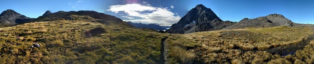 Pano from the saddle - the centre looks directly back where we have come from (note well worn path!). From here, we knew we had a >1000m descent before climbing back up again to Blue Lake Hut!! We headed off first, initially down a fairly steep rocky descent. Not long after, the descent continued down a steep ridge through beech - this part was pretty treacherous because of the mud generated by the overnight rain. Suffice to say we took it rather slowly!! The initial ~900m descent was over about 2.5 km. This took us down to the Sabine River East Branch which we more or less followed (but with some ups and downs) - this was a bit muddy in places, with some small steep pinches thrown in for good measure. This took us over to the Sabine River West Branch (~160m lower than where we hit the East Branch), which we followed up for a short distance to West Sabine Hut, reaching there at 1310. This was about 5.25 hours in total (about 5hr walking) - we were pretty happy with that especially given the slow nature of parts of the descent from Travers Saddle.
 Heading down from the saddle initially through tussock and rock. 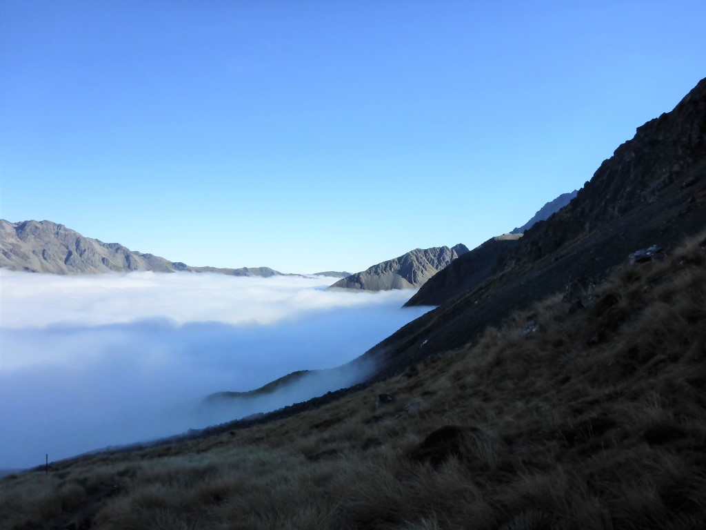 Another shot of the misty valley :-)
 As we were on a fairly distinct ridge, we got some good views out from the bush as we descended.
 Another rocky section as we neared the West Sabine River East Branch.
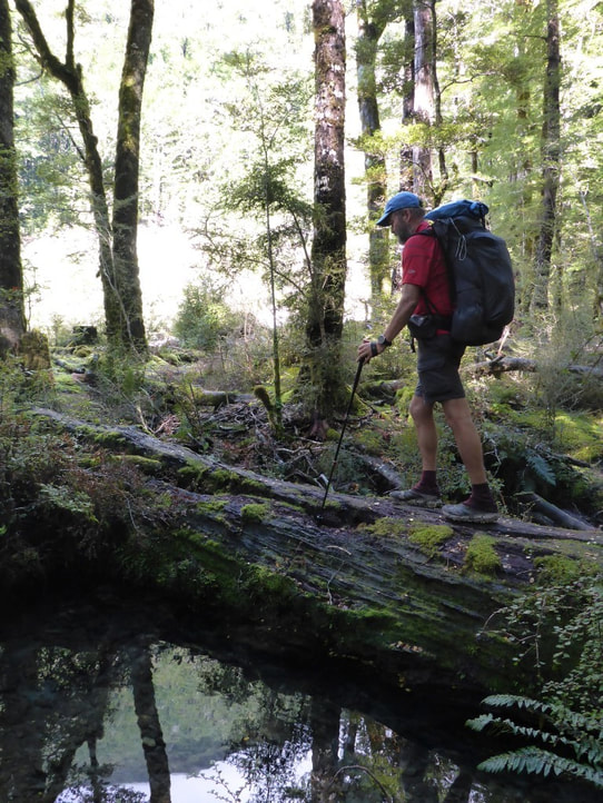
 Going was variable - this was logs dropped into a bog (we started referring to them as a "bushman's boardwalk"!!).
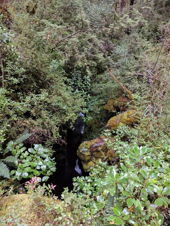 ..... and the chasm below that necessitated it - I estimate the water was a good 20m below in this very narrow, deep channel!
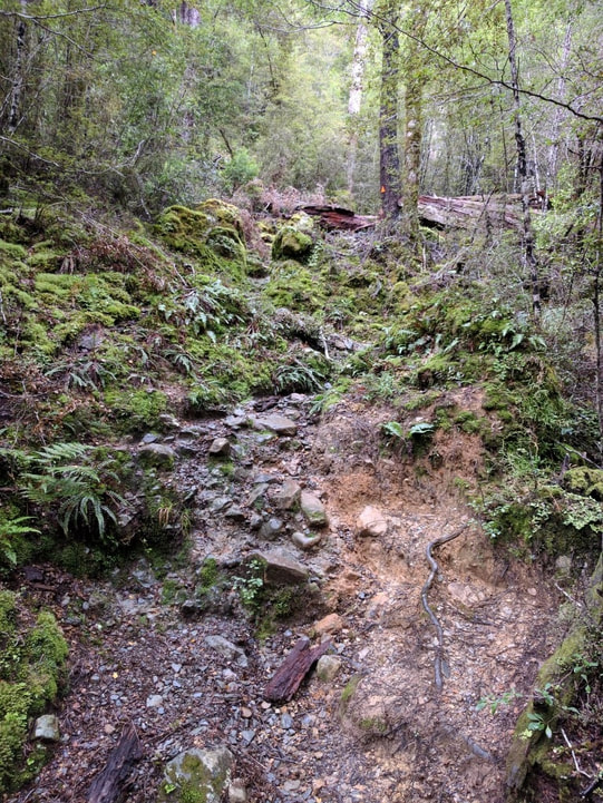 Not many smooth bits to be had here (pretty normal)!
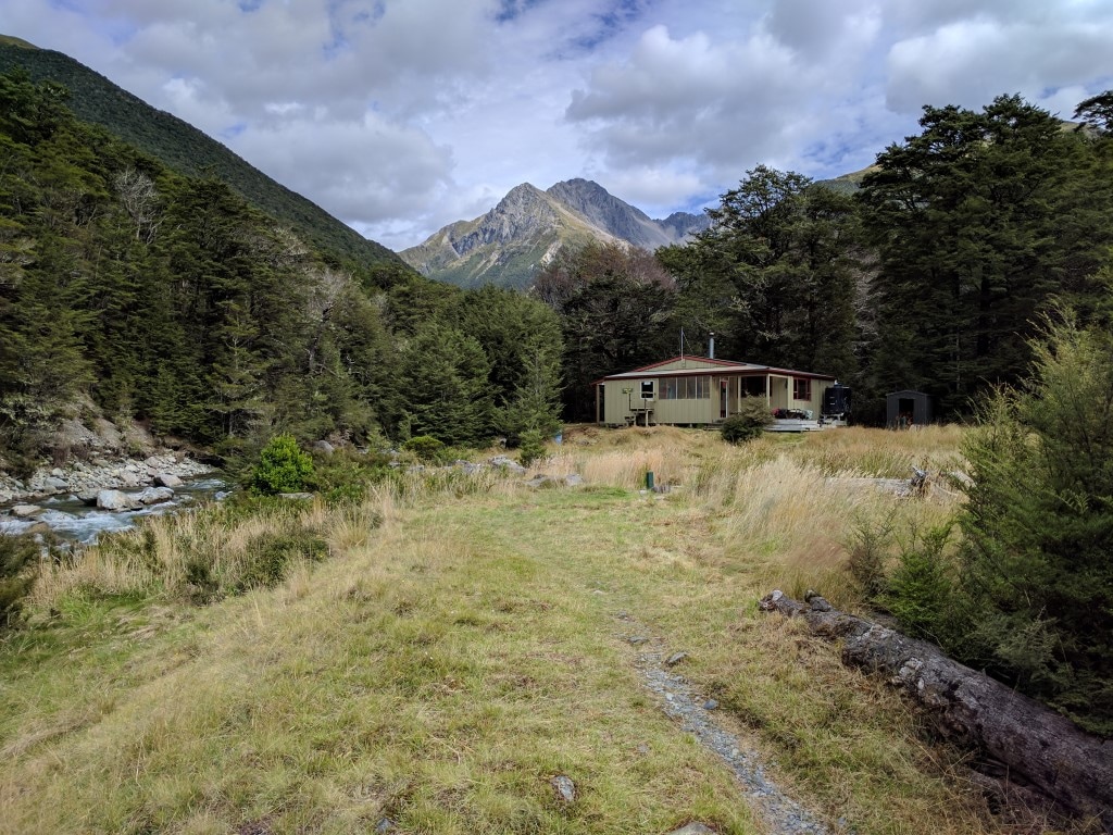
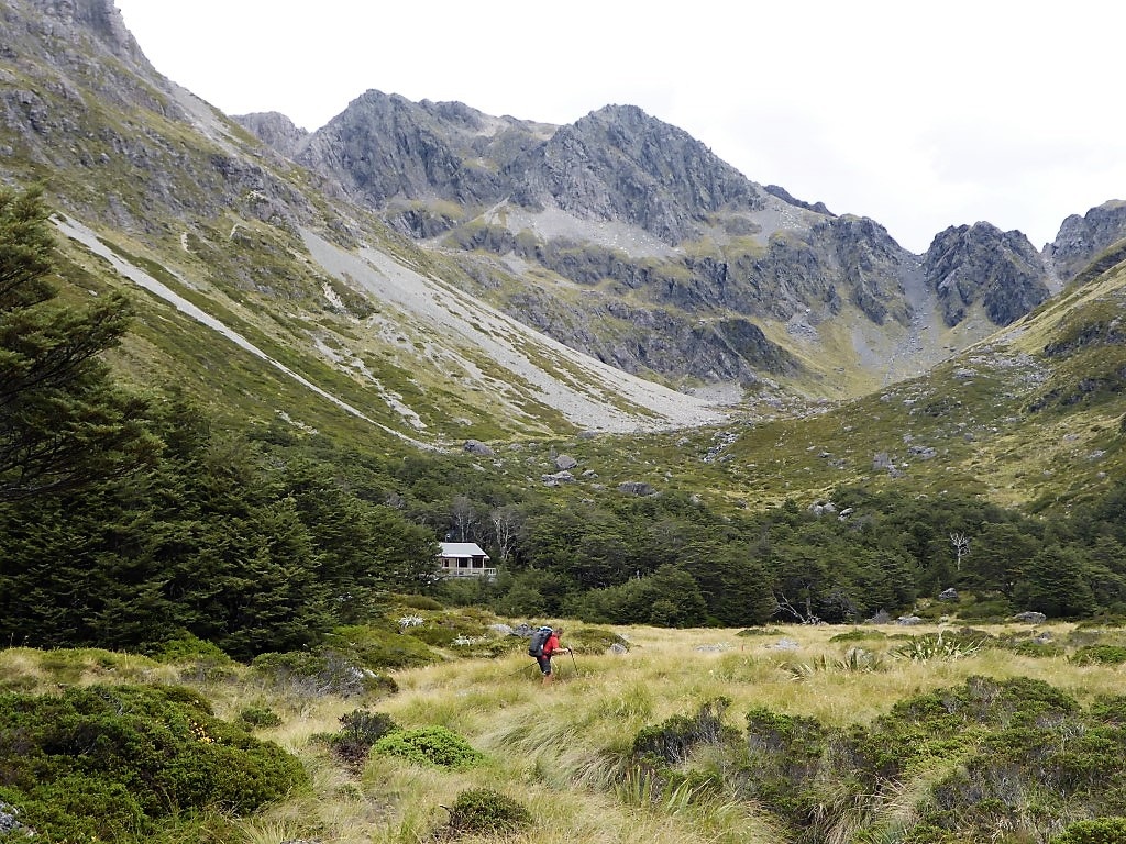
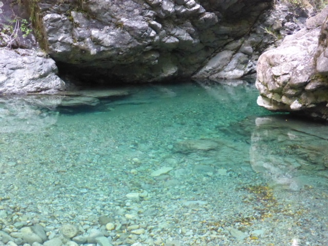
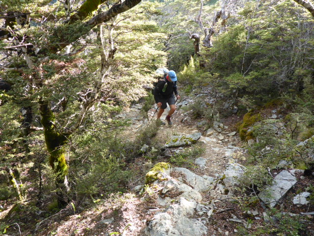
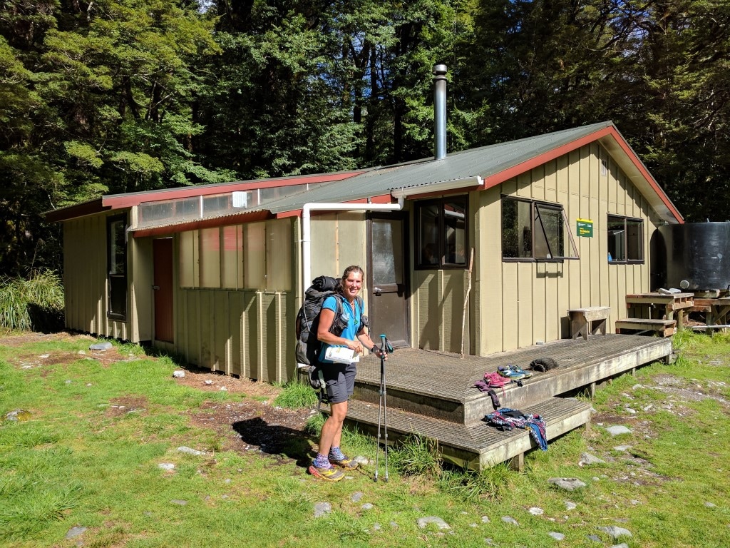 And finally at West Sabine Hut for a lunch break. Left this hut at 1400 and it took us the full 3hrs to get to Blue Lake Hut, including a couple of brief rests along the way. This was a climb of about 520m over 7km. There were more stunning mountains to view, but this part of the track was mostly in bush. There were some steeper bits along the way, including the last bit to Blue Lake Hut. Some parts were a little muddy, but not too bad overall. We arrived feeling a little tired about 1700 and, after dropping off our packs, shot straight down to Blue Lake for a look at the beautiful clear water. Belinda could hear and see some activity up the slope from the lake, so we assumed we were due some nobo company! Not long after we got back to the hut, three nobos turned up - Josephine from Germany, Nic (Wanaka) and Hayden (US). Markus and Nana followed half an hour later. This is a nice serviced 16 bunk hut but we were a little more restricted than usual due to the fact that the nobo hikers had got a little wet and spread tents etc around the hut to dry! As usual, everybody retired pretty soon after dark!
 And a "not so" swingbridge with an alternative type of wooden base!!
 Negotiating yet another rockslide that has come down into the river.
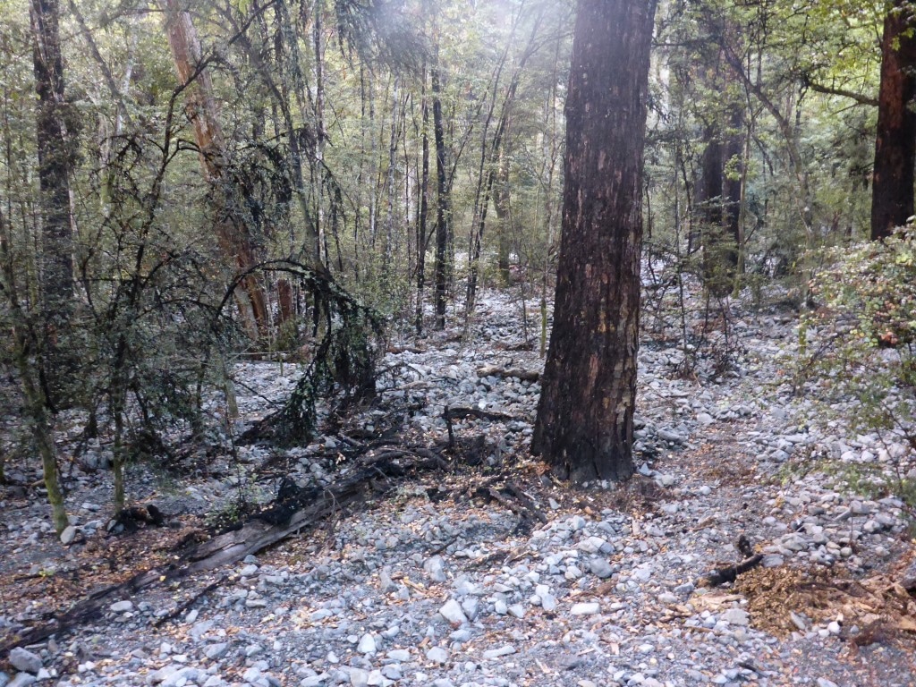
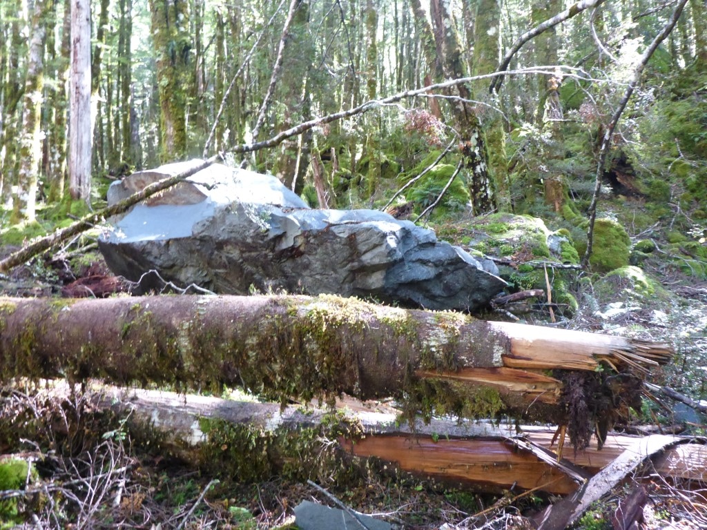 We were on the true left bank and started coming across all these relatively fresh boulders and tree damage.
 B shooting the gap! Same spot as last photo, from the other side.
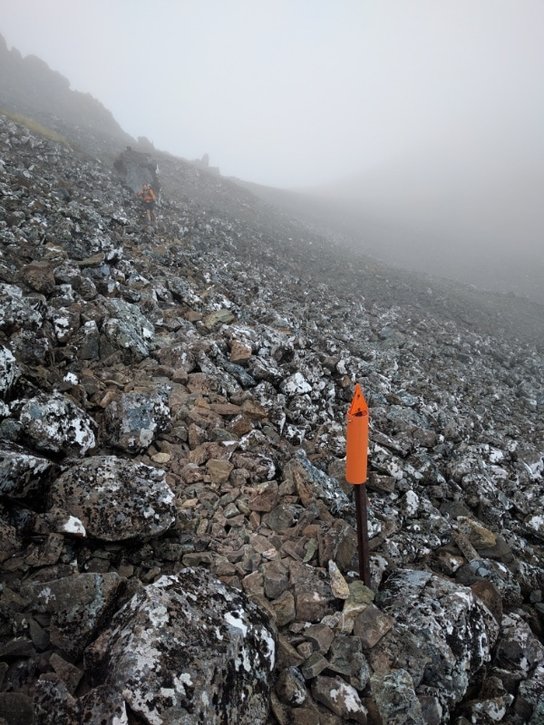
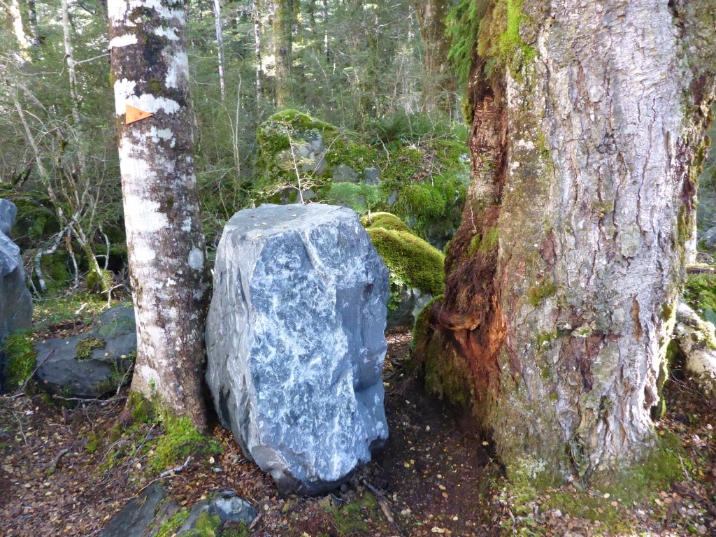
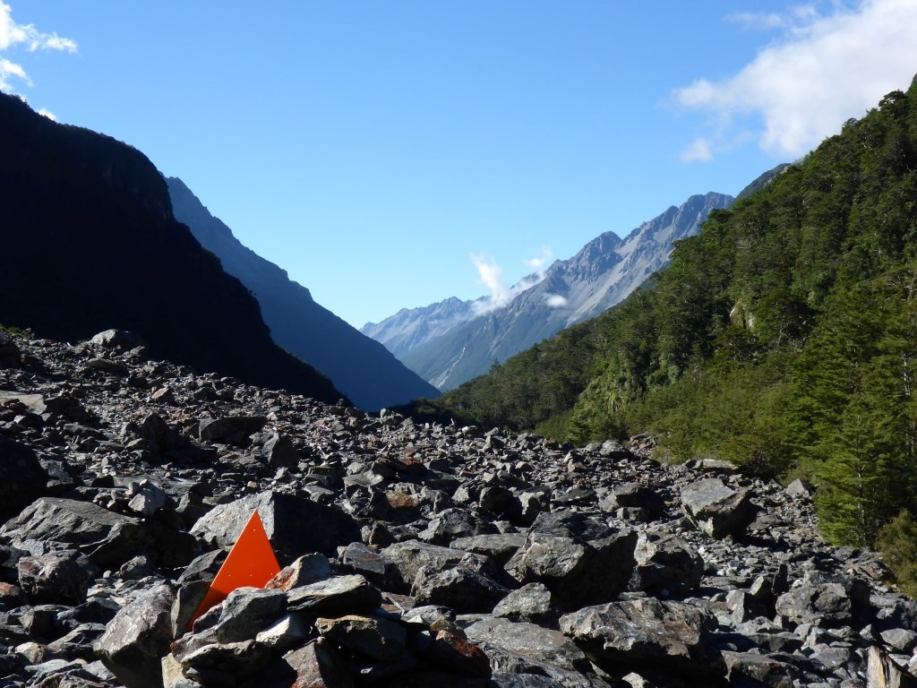 Nothing much to attach this orange triangle to here!
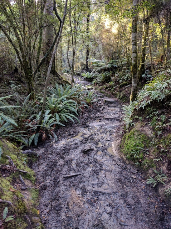
 Flatter section, including short boardwalk, about 20 minutes from the hut.
 But the last 10-15 minutes was a bit steeper. 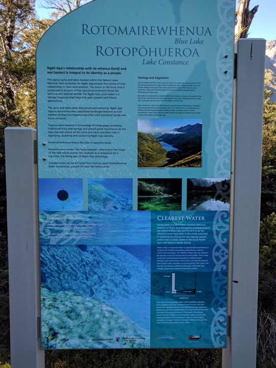 Very informative sign at the lake itself. 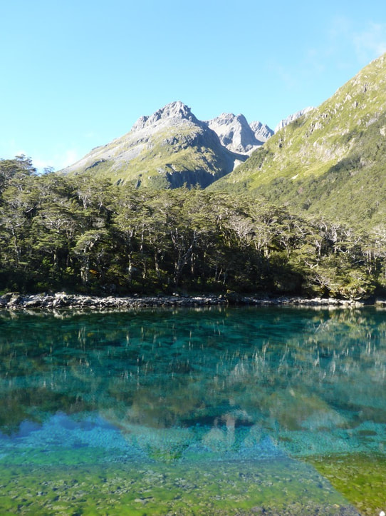 Gorgeous! 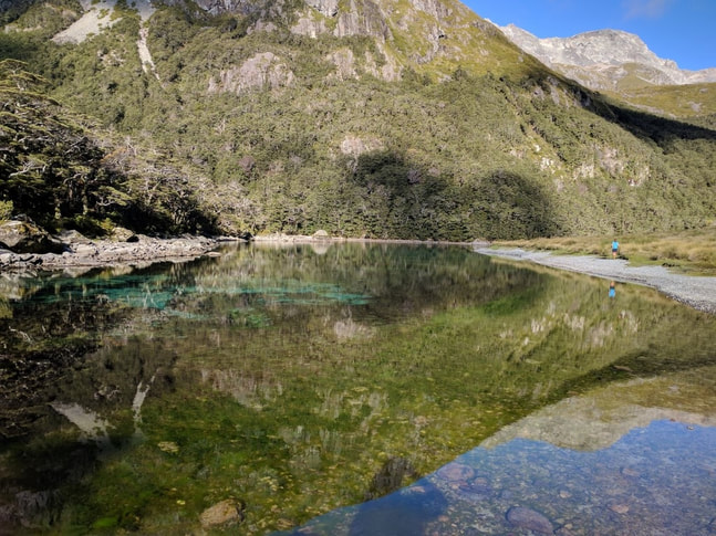 B and her reflection both heading off around the lake for a look. 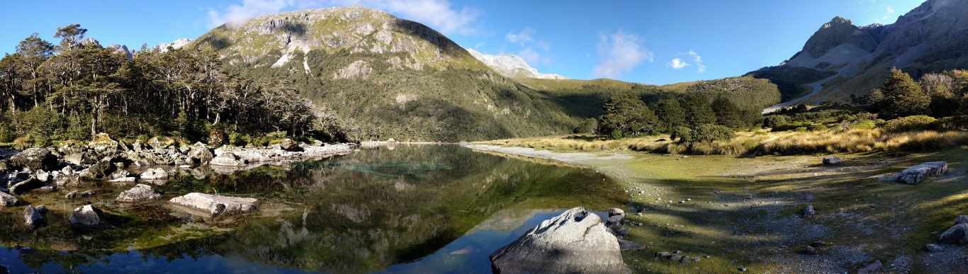 Pano - the lake outlet is through the rocks to the left and we will be heading out to the right of the photo tomorrow!
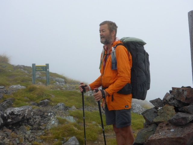
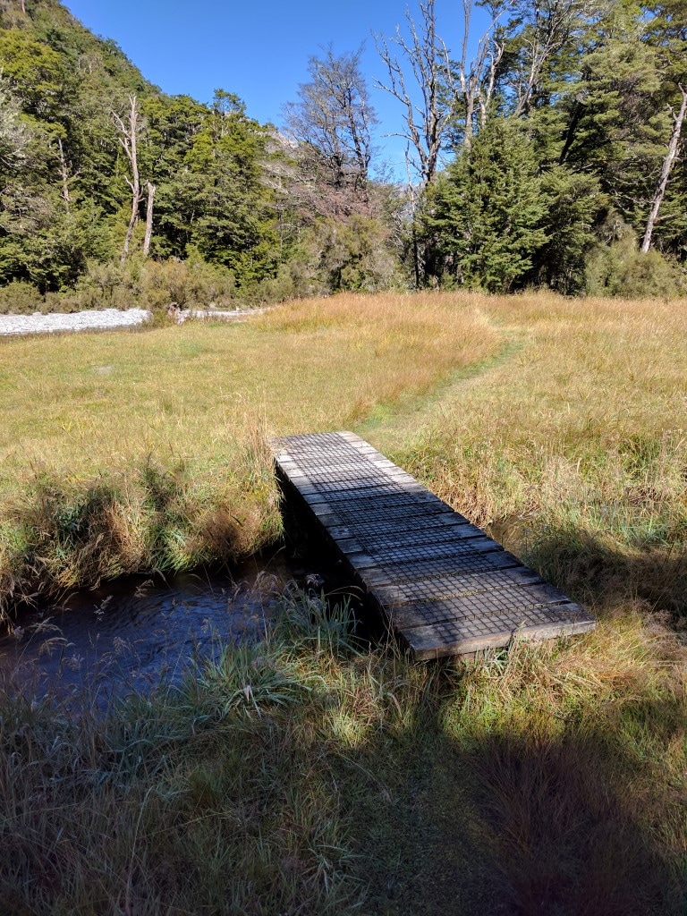
We set off from the Alpine Lodge at 0725. We eventually arrived at Upper Travers Hut at about 1800, having covered 29km in the 10.5 hours (about 9h30 walking time). Upper Travers Hut is 700m higher than St Arnaud so it was mostly flat and relatively gentle uphill walking today as you can see from the GPS elevation profile - here. Re GPS - for those interested, I decided at St Arnaud to change the Suunto GPS accuracy to "good" (down a notch) in order to try and get more battery life. On the most accurate setting (and 10 second sampling) I can get two long days only. Anyway, I wasn't so chuffed with the results of the track on this setting so changed back once we got to Hanmer Springs. So be aware that the track for this coming section to Boyle Village is less accurate / more generalised than previous! There are quite a lot of photos today - I had to prune them down from around 140 taken between Belinda and me. I should perhaps note here that the blog is obviously primarily a record for us (and family and friends who may have an interest in what the "crazies" are up to!) - we both enjoy going back and re-reading what we got up to. As many will know, when you are walking so much, it can easily blur into one great jumble of experiences, with one day hard to distinguish from another once a few days have gone by!! If the blog is also useful to those looking to tackle parts or all of TA in the future - that's great also :-) We headed down the road from the Lodge to the lake (Rotoiti) and basically headed south round the eastern side of the lake, through beech forest mainly, for about 9.5km to Lakehead Hut. It's a very pretty walk, with lots of views of the lake and the hills on the western side. A reasonable amount of bird life was in evidence, especially as the day warmed up a little! Going was OK underfoot, initially smooth but soon into more usual rocks and roots as you headed further away from town - and pretty muddy in places with the recent rain. We arrived at Lakehead Hut at 1005 and stopped there for a short break and to fill in the hut book (as usual!).
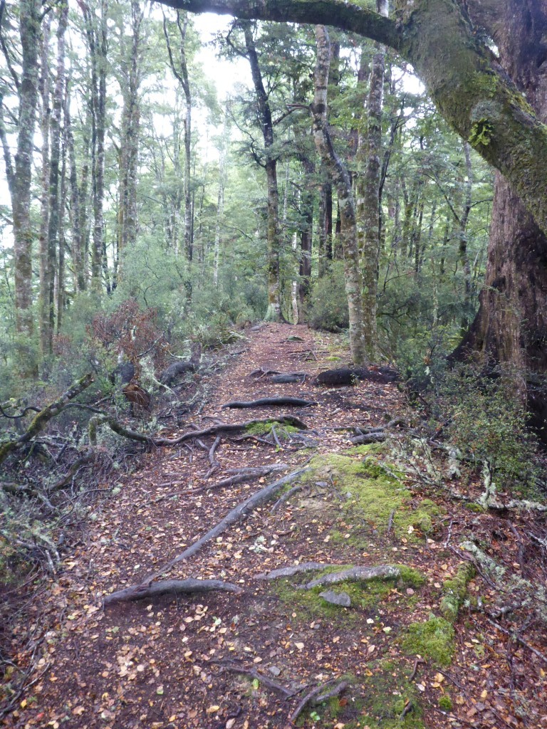
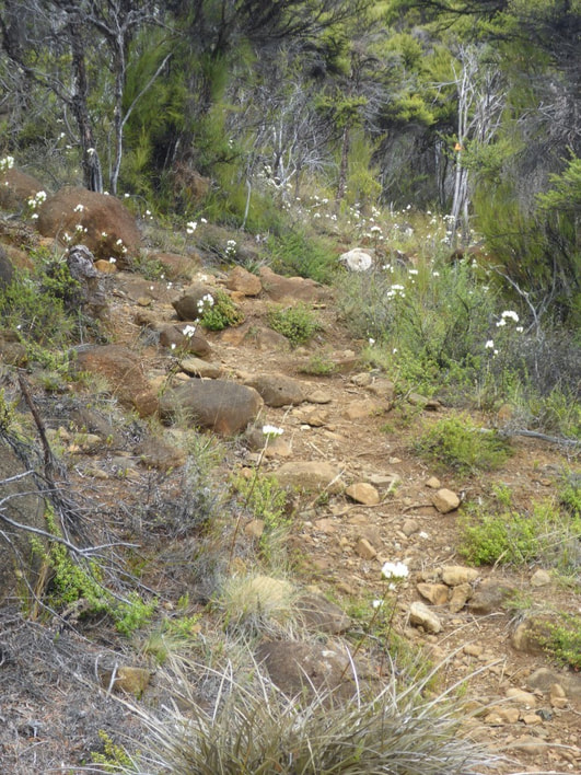
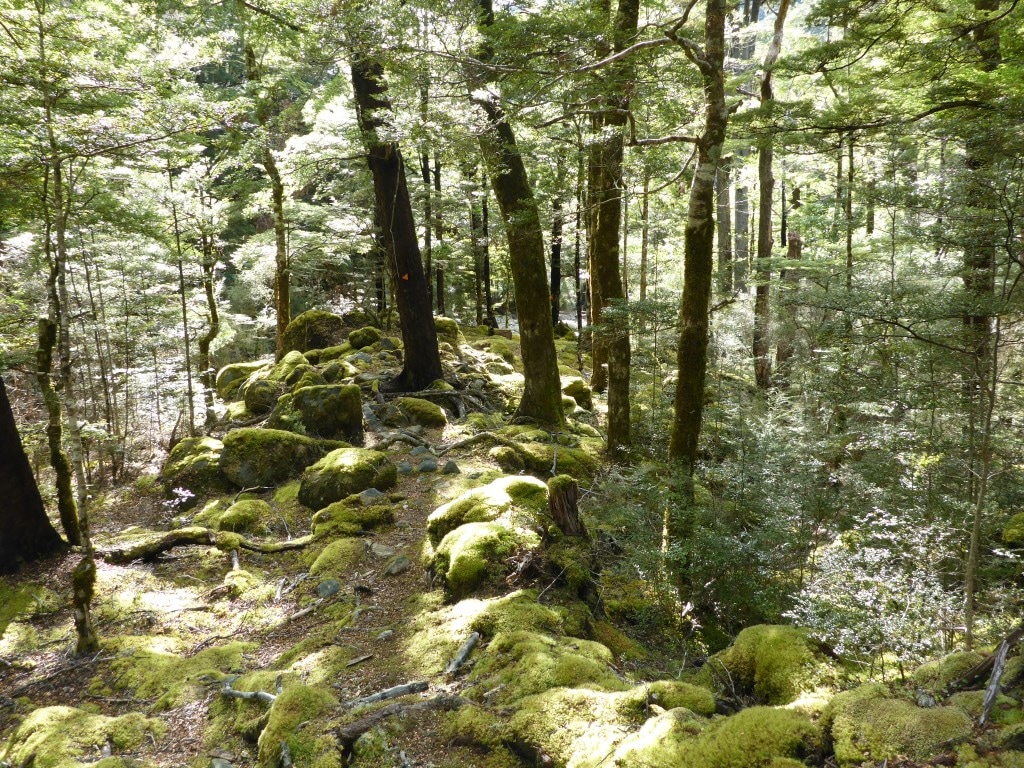
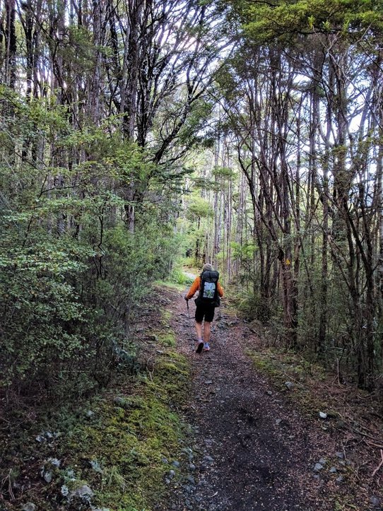 Young beech trees and a reasonable path.
 About an hour after we started - looking back towards the St Arnaud end of the lake.
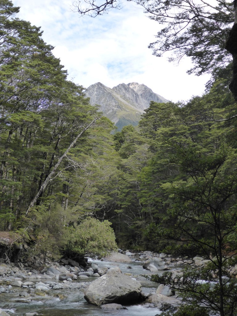
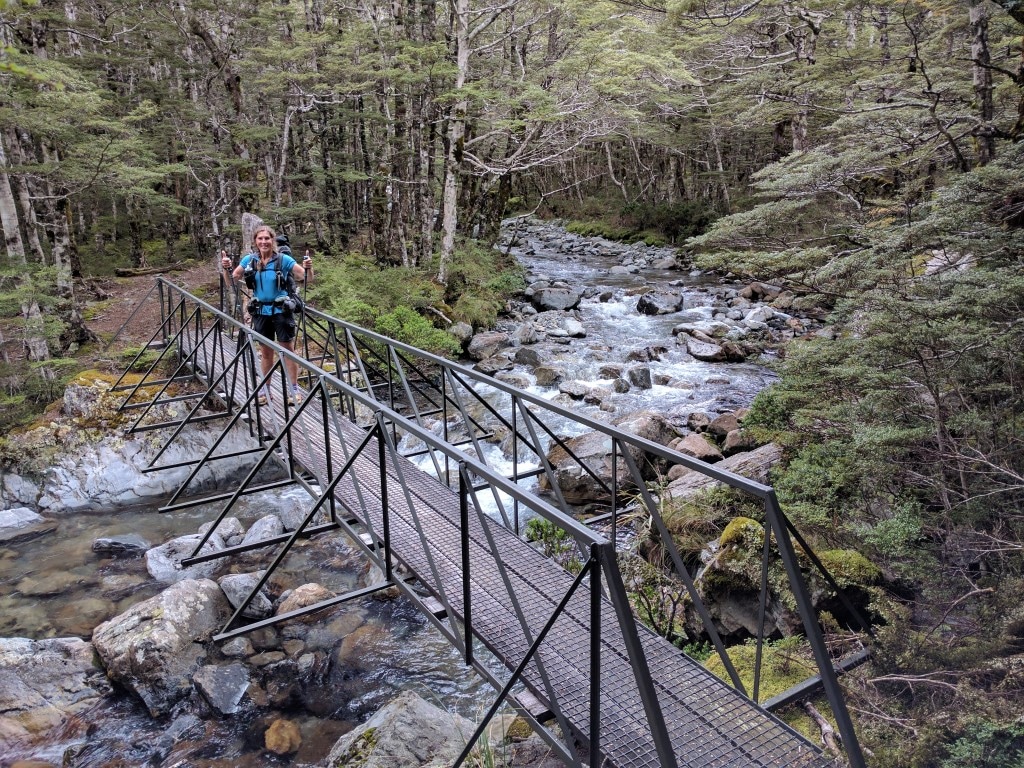
Then it was on up the Travers River valley which included some open river flat walking as well as a good length swingbridge over the Travers River at one point. But as the valley narrowed it was back into more familiar mix of beech forest through large rocky patches and the occasional scramble across rockslides along the edge of the river! Nothing out of the ordinary for TAers :-) John Tait Hut appeared at about 1430 after 23km. We only had a 15 min break here as we had stopped for lunch an hour earlier.
 Swingbridge across the Travers - the river was quite low, but it wouldn't take much rain to make the bridge a necessity!
 There are some big rocks right through this terrain.
 Another boulder/rock slide to negotiate.
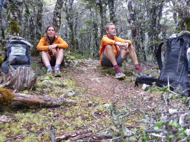
 John Tait Hut comes into view. The final stretch was a 6.4km hike mainly following the river up to Upper Travers Hut (1340m asl). B’s sore feet and my rumbling guts slowed us a little on this stretch and, as noted above, we made it to the hut at about 1800. A young German couple, Markus and Nana, were at the hut also. The rain came in just after we got to the hut - Belinda had again done a great job of warding off the weather until we were under cover!! We had a pleasant evening chatting with Markus and Nana, who were good company.
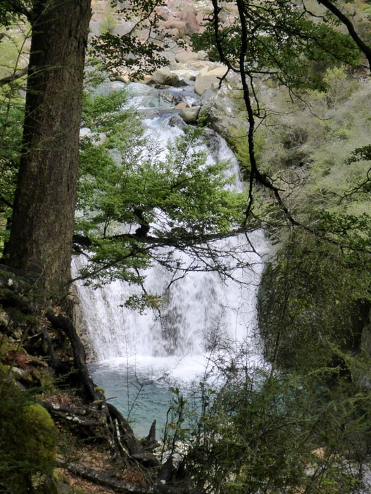
 Travers Falls a couple of minutes off trail.
 Another rocky stream bed.
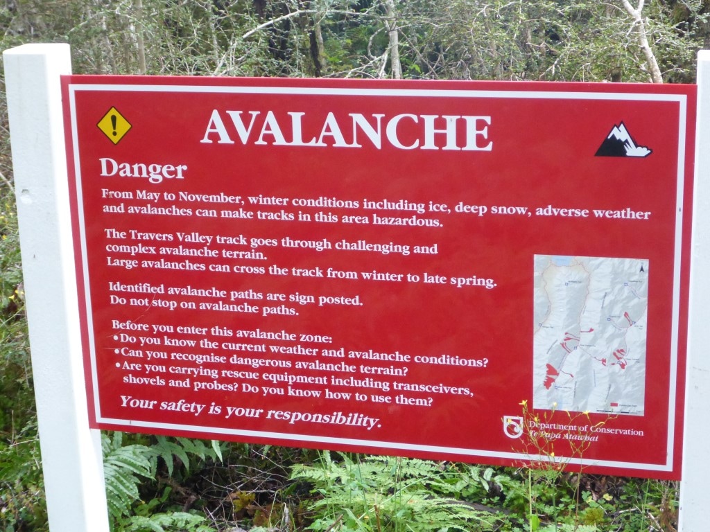
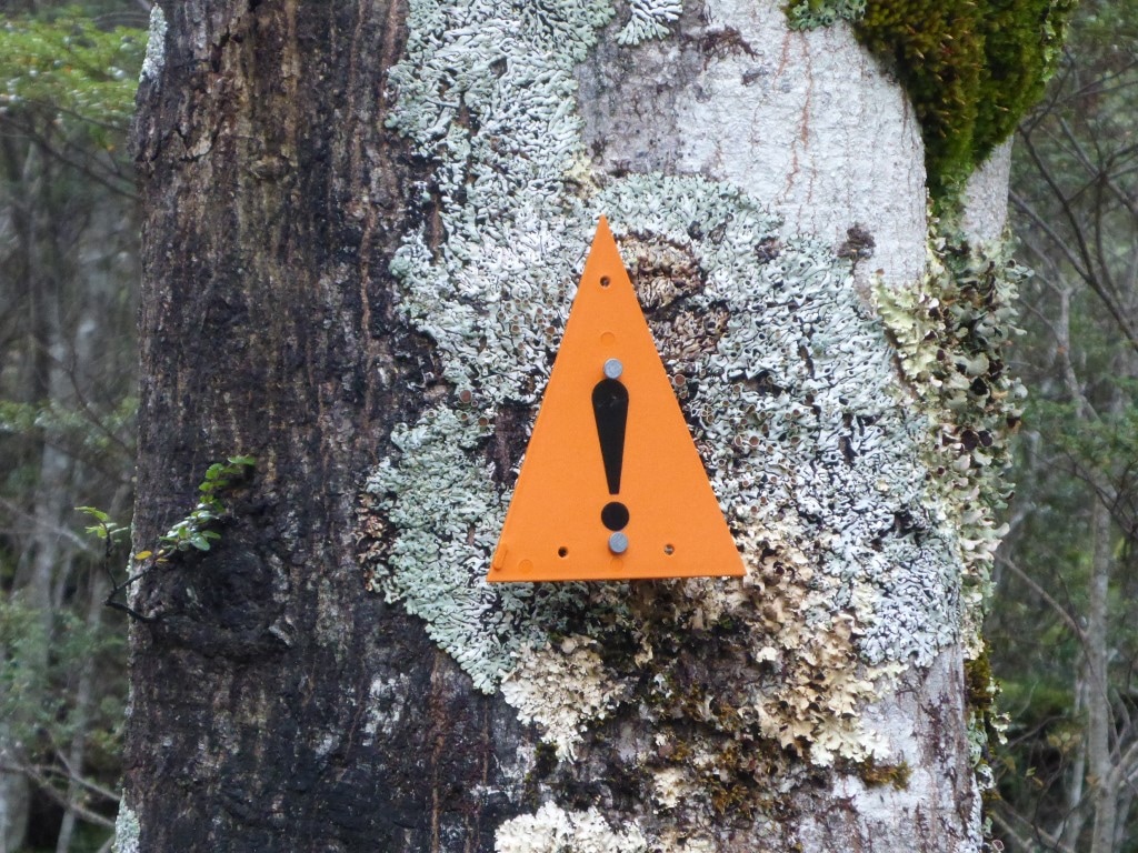 The ubiquitous orange triangles get an exclamation mark added when in an avalanche zone.
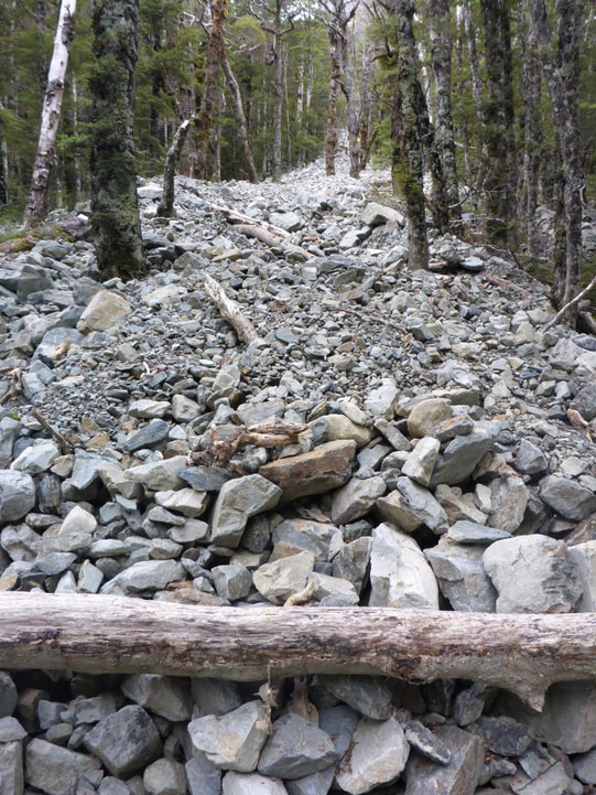 Rockslides, both big and smaller, were evident in gullies all over the place.
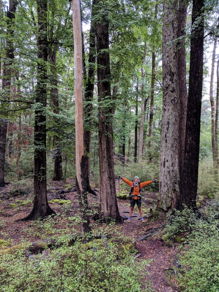
 A pleasant bit of track through beeches for a change.
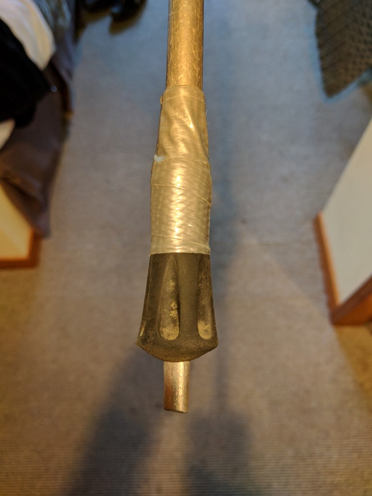
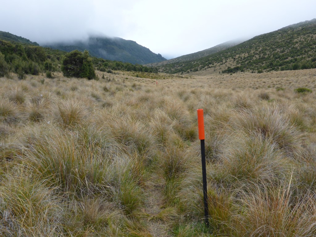
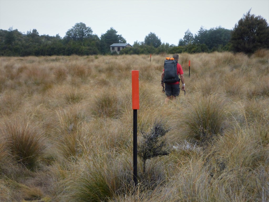
 Upper Travers Hut appearing across an area of tussock. 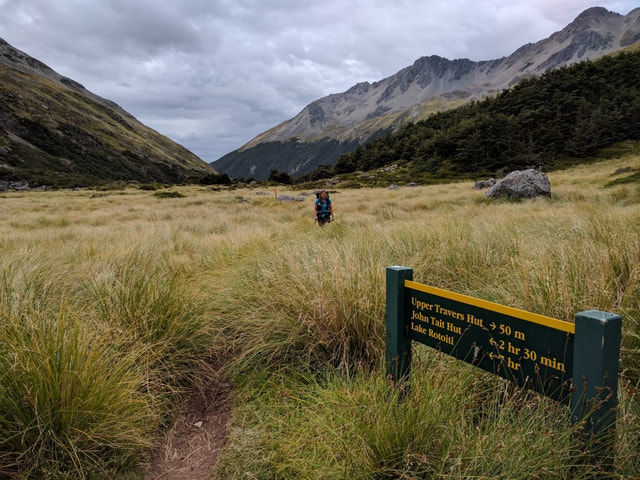 Almost at the hut, looking back down the Travers River Valley. We decided that B's poles could potentially be modified with a #8 wire approach and that a time-consuming trip to Nelson could be bypassed. It also meant B would try and make do with her alternate insoles for the next while. Monday we had a wander around town (very small!) and spent some time at the fantastic DoC Nelson Lakes visitor centre. Lovely staff and a mine of information in the displays. Sorted out our resupply box and realised that we could be more brutal in our culling and would send some stuff back home. The lodge will luckily arrange for that to happen as there is no post office here. We caught up on what was happening with family and the world as well - as well as limited reception over the last 9 days or so, the power situation meant we were also in battery conservation mode! Lots to catch up on! Had a lovely dinner at the Lodge - we are both filling up before the next 6-7 day stretch over the Waiau Pass towards Hanmer Springs. Actually we cross the road about 50km from Hanmer, at Boyle Village, but will hitch in for rest day and food resupply. Tues was still catch-up. I was busy writing blog notes and B was writing some stories as well. Also got to pay the taxman today - lucky for mobile banking apps! It's a fine day today so would be a good day for walking, but they're the breaks! I am certainly appreciating the weight off the feet for a couple of days, especially as the next three days or so will be relatively long and hard again! I did a fix on Belinda’s poles using duct tape and a couple of rubber stoppers that we each have for our poles, hoping that this would get us through as far as we needed to go. Preferable to spending a whole lot of time and angst trying to hitch into Nelson for some sort of replacement!!
We really appreciated the two days off as, for us, walking 12 days in a row, especially over some challenging terrain, was quite a stretch. Yet again, I can confirm that our older bodies cannot quite manage what they used to at 20 or 30 - albeit they still go remarkably well most of the time!! We had seen, however, the predictions of the tail end of cyclone Debbie heading down this way so were also cognisant of not dawdling too much and maybe getting dodgy weather, especially for the Waiau Pass. But we figured if we put in some longish days we could make Blue Lake Hut on the second night and go over Waiau on the third day. If not, there was still wriggle room to allow another night in one of the huts before Waiau!
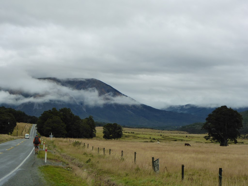
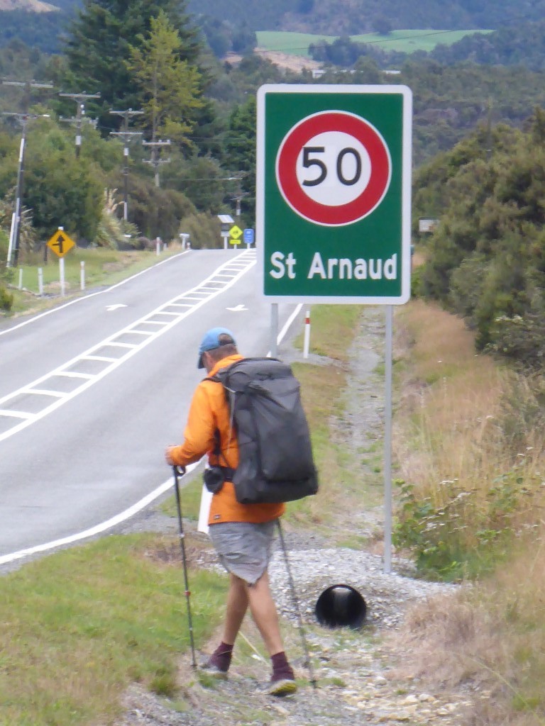
Today was a relatively simple walk into St Arnaud. We got away just before 0800 - it wasn't a long day but we thought we might minimise traffic problems if we could walk the road earlier on a Sunday morning. It was about 18km in total to get to Alpine Lodge and we arrived at about 1230 with only a brief stop on the way for a rest and snack. The GPS data for the day is here. It was chilly and misty this morning so we both had an extra layer on. We made a rookie mistake by initially heading off in the wrong direction for 200m or so - didn’t feel right when we were heading uphill!!! A quick correction saw us onto an obvious 4wd track as per the notes :-( The first 5 km were down this easy, wide 4wd track before the next 2km through a bit of native and exotic forest brought us to SH63.
 On the margins of the bush section - you may be able to see a yellow grader in the centre of the picture - that is SH63.
Of course, since the earthquake, SH63 has become part of the new main route between Picton and Christchurch so is somewhat busier than might otherwise be expected. All in all though it wasn't too bad, albeit it did involve climbing as we had dropped height considerably in the previous 7km!! Rocked into the luxury of a room at the Alpine Lodge and eventually decided we would take a full 2 days to rest up and sort out resupply (our box had arrived here no problem), washing (clothes and bodies after 8 days!) and equipment issues (possibly a trip to Nelson). Being Sunday it was the famous BBQ buffet night here at Alpine Lodge, so B and I both tucked into that before retiring for the night!
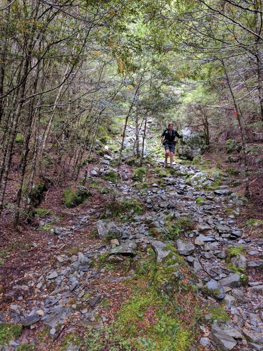
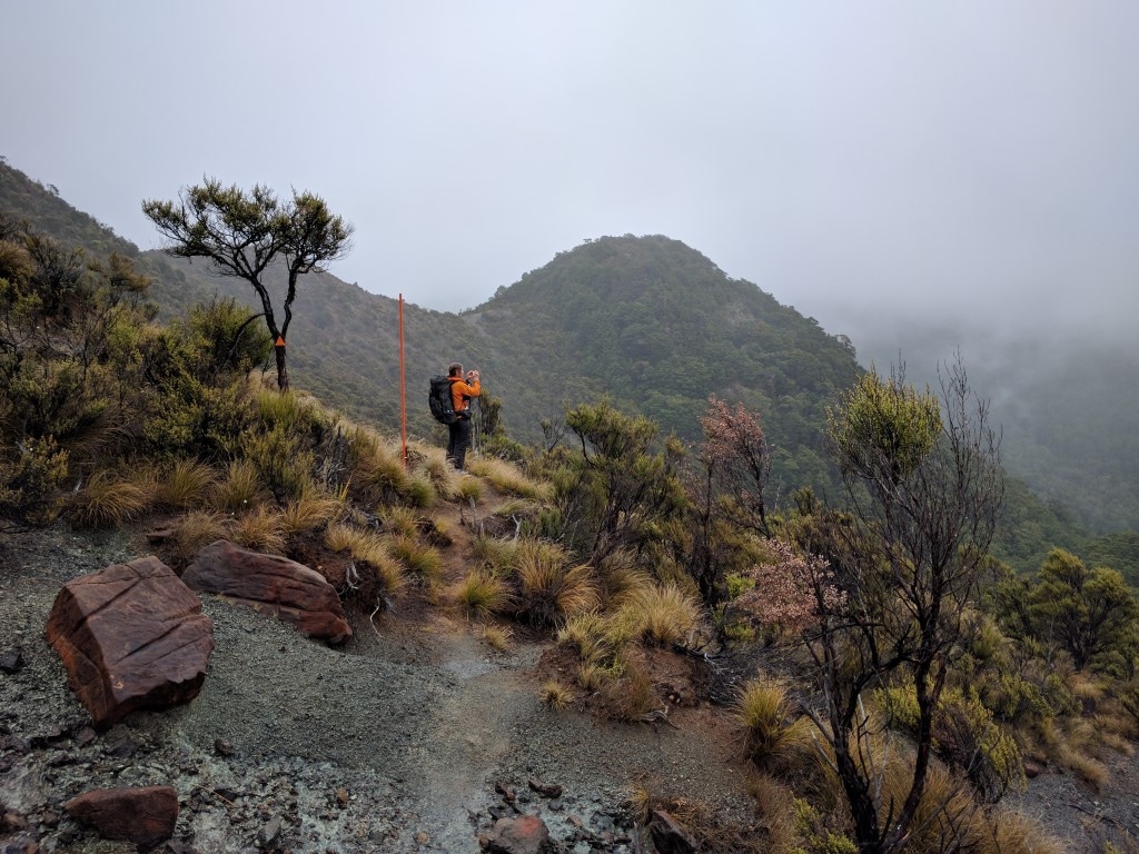
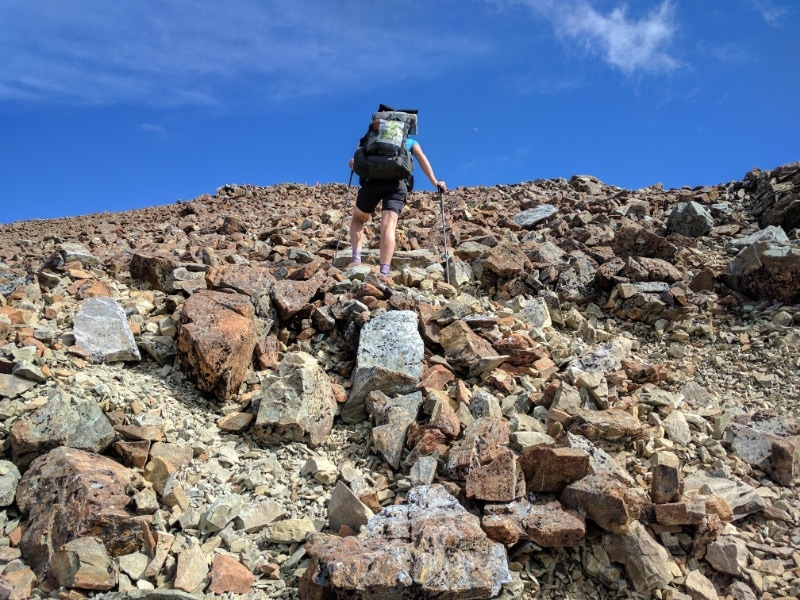
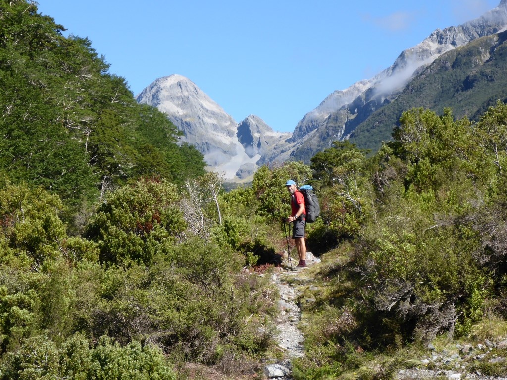
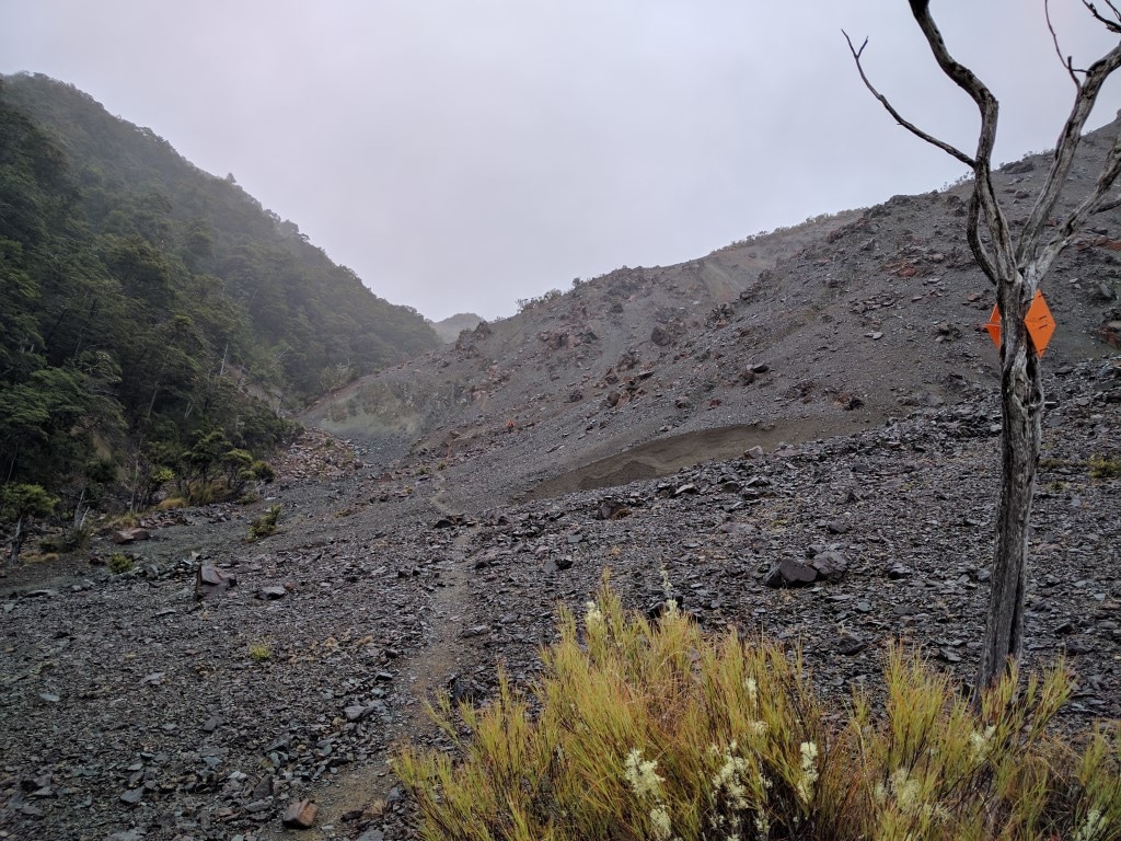
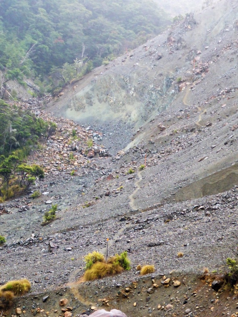
 St Arnaud Lodge is in a lovely setting right by the road. We got away at 0750 today and covered the 18.9km to Red Hills Hut in around 8h20 of walking plus stops, arriving before 1730. Today was more ups and downs - although we never got above 1070m or below about 600m we nevertheless ascended and descended approx 1200m vertical - all the little bits add up!! The day finished with about 4km of steady, sometimes steep, climbing - from the last Motueka River crossing at 600m to the hut at 900m asl. Easy to see from the GPS data here. We set off for Porters Hut initially. Despite the TA maps/notes saying it is about 9km, it turned out to be 7km and we made it in 3h15. The terrain is interesting and involved traversing a lots of rocky sections and boulder fields. It is apparently an odd mineral belt that stretches up toward D'Urville Island. There was an explanation on a poster in Porters Hut so I have included a photo of it below for those interested, rather than try and repeat it all here!!  Ready and raring to go :-)
 Looking back down on the hut as we head away into the mist.  Wet weather gear in evidence.
 Photographing the photographer.
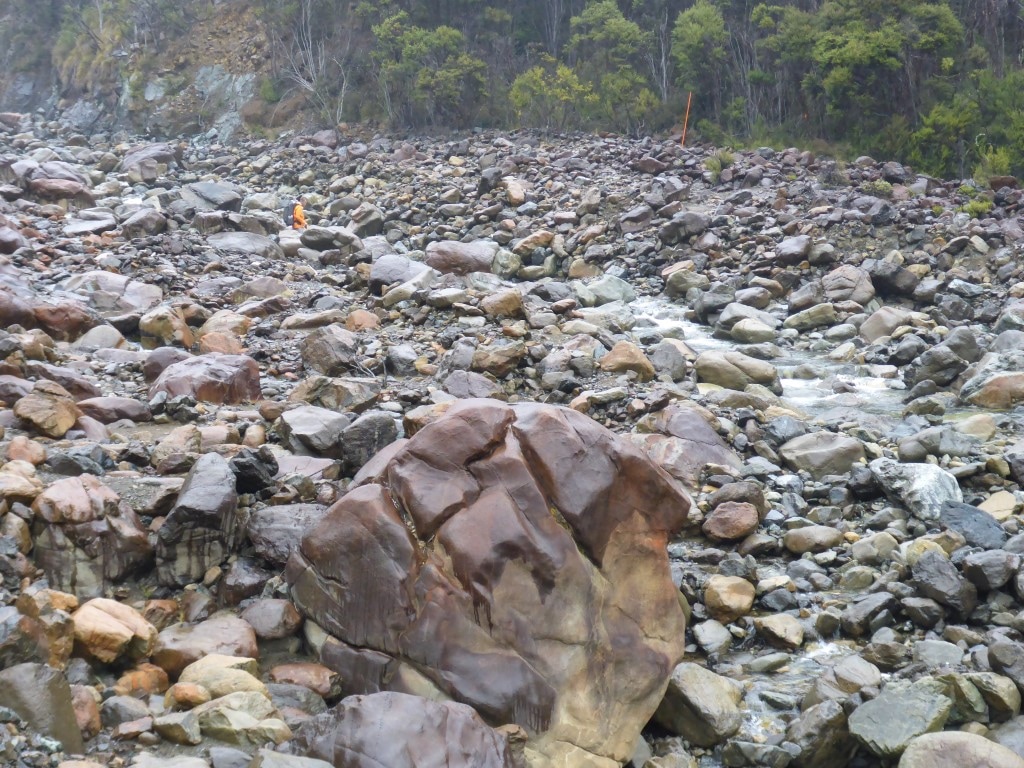 Me disappearing into a bit of a river boulder field.
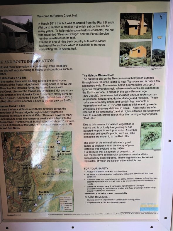 Here's the explanation of the geology of the area! The last km to Porters was pretty much a straight line through low scrub on an open path - very unusual for us! As part of DoCs upgrading of these facilities (partly because of TA numbers) there is now a water tank installed here, despite the notes saying otherwise. We stopped for a brief break as it was not yet lunch time for us. It had started off a bit misty and drizzly today so we had wet weather gear on - finally managing to get it off by about 1300 as the day cleared up a little. Carried on up and over to eventually curve down through more of the same rocky terrain, with numerous stream crossings and the odd bit of boulder hopping on larger river beds, to the Motueka River Right Branch. It is obvious that there are massive sudden water flows down some of these side streams in heavy rain - luckily not an issue for us. We headed along, mostly a little above, the Motueka River before crossing it a last time near the confluence with the Maitland Stream.
 As before - not sure which creek this is - there's soooo many!!!
 B enjoying not being on so many boulders.
 Nearing the Motueka - an example of one of the many creeks flowing into the Motueka Right Branch from the Red Hills area above us.
 The odd stream bed to cross as we wandered alongside the Motueka.
After that it was the final steady climb for 4km or so (although a very steep scramble to get out from the Motueka initially, after that final crossing!), sidling above Maitland Creek towards Red Hills Hut. We started to get into some more swampy/muddy areas here and the last km or less as you approached the hut was across a swampy tussock area. As noted, we arrived at the hut by about 1730. It is a nice new hut (2009) with double glazing but no fire. We found a couple of nobo walkers who had hitched out from St Arnaud - kiwi guy Frank with his Czech girlfriend Zusa. Had a good chat with these guys. The mist had settled in for the evening and the temp dropped somewhat so it was into the sleeping bags about 2030.
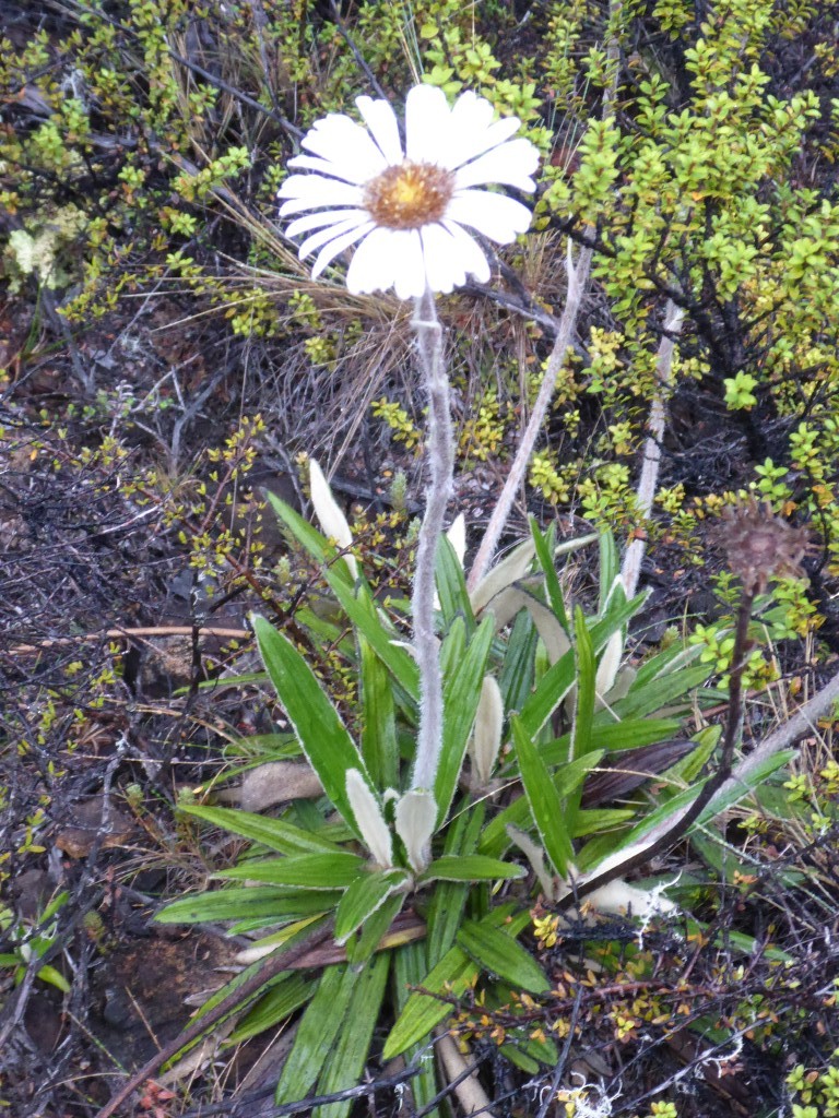
 Having made the final crossing of the Motueka, this is looking back down the valley as we climbed up alongside Maitland Stream. 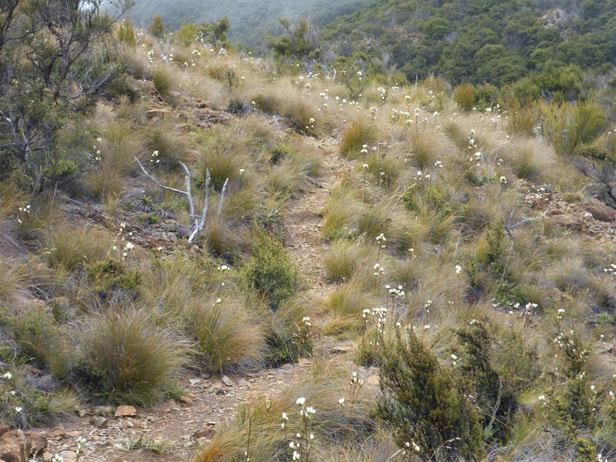 Things got less steep as we approached Red Hills Hut. More flowers to brighten the day!
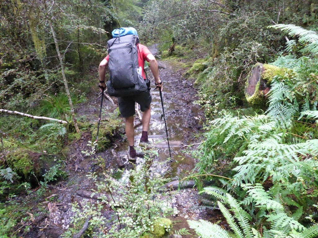
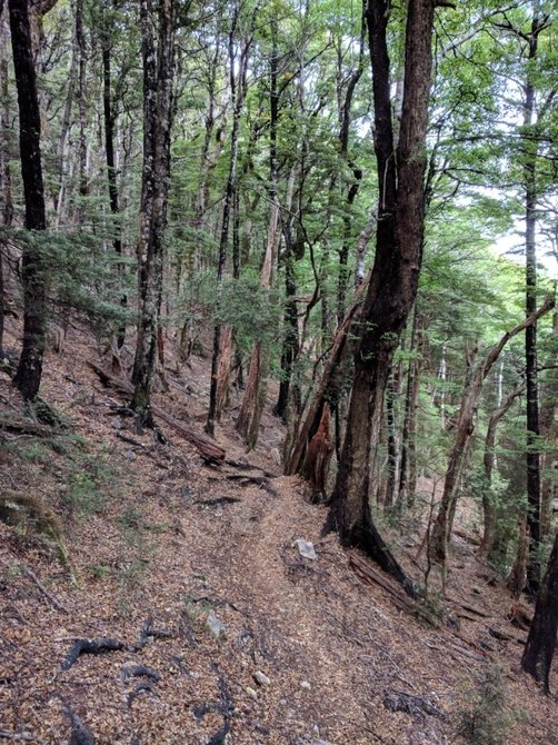
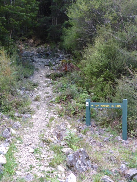
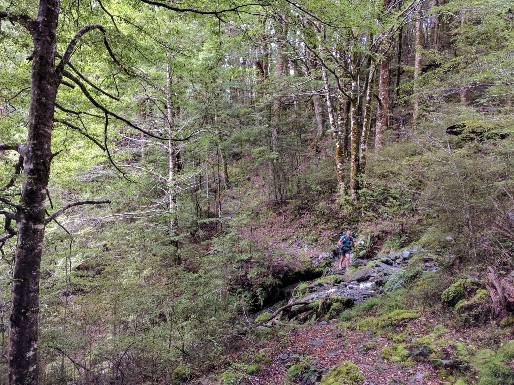
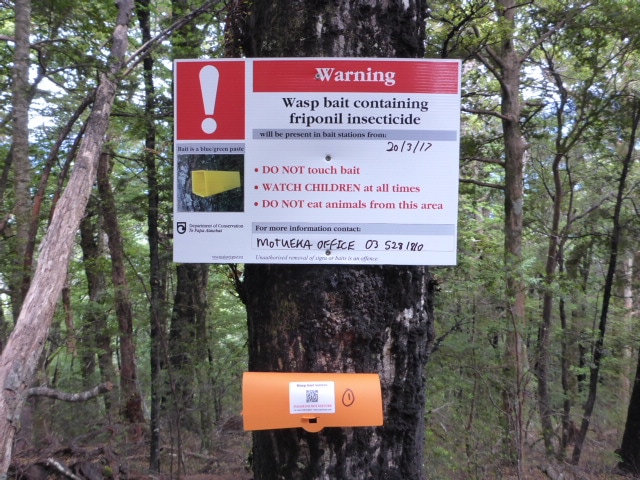
Got away at 0740 today for the trek to Hunters Hut, 19.6km away. We walked for just over 9 hours today plus an hour or so of breaks, so arrived at Hunters Hut at 1800. The days GPS track is here. The first section to Top Wairoa Hut carries a TA warning about sidles on steep terrain that may be a challenge. The reality for us was that it was no worse than walking around a steep hill on an animal track on the farm - so it was not a problem, especially compared with Mt Rintoul! It was also through bush so was far less open and therefore, for me, not at all intimidating. This section also involved 8 river crossings (Wairoa River Left Branch), mostly wet feet crossings, but river levels were very moderate so that wasn't an issue either - not even getting to knee level. We noted that the wasp baiting continued on this section to Top Wairoa :-) While we were following a river, it was steadily uphill - about 500m vertical over the 4 hours.
 As well as the odd rocky sidle!
 Quite a few shallow river crossings today - pretty normal.
 Lots of little waterfalls, including on side streams.
 Still plenty of patches with no vegetation - often caused by rockslides.
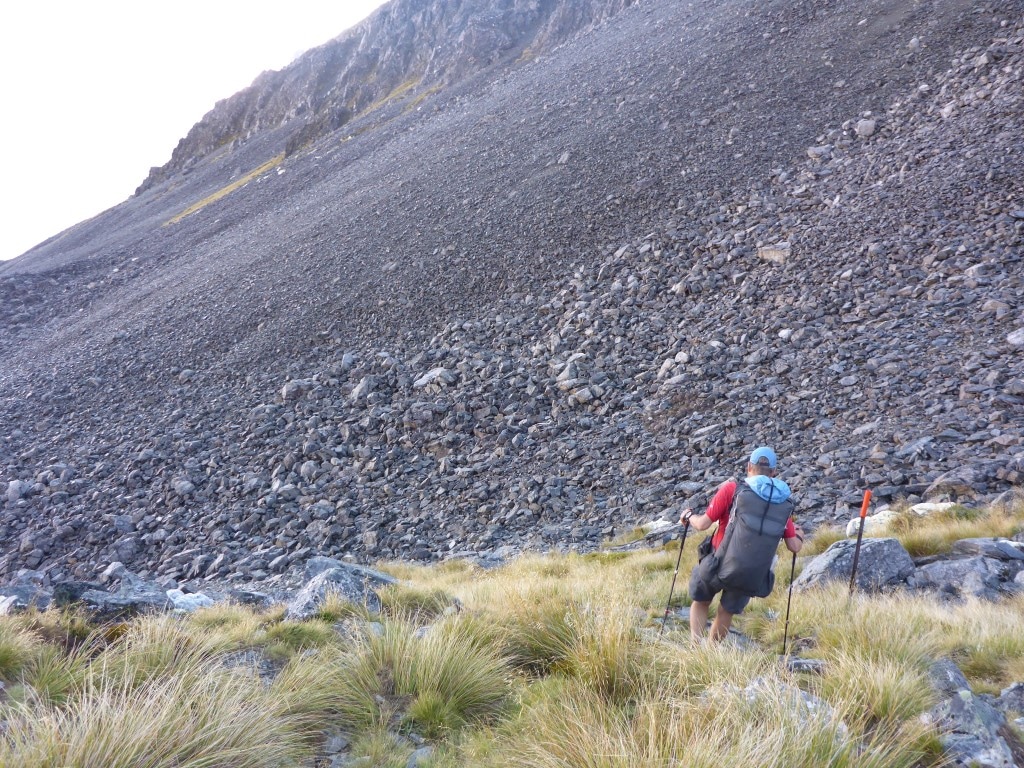
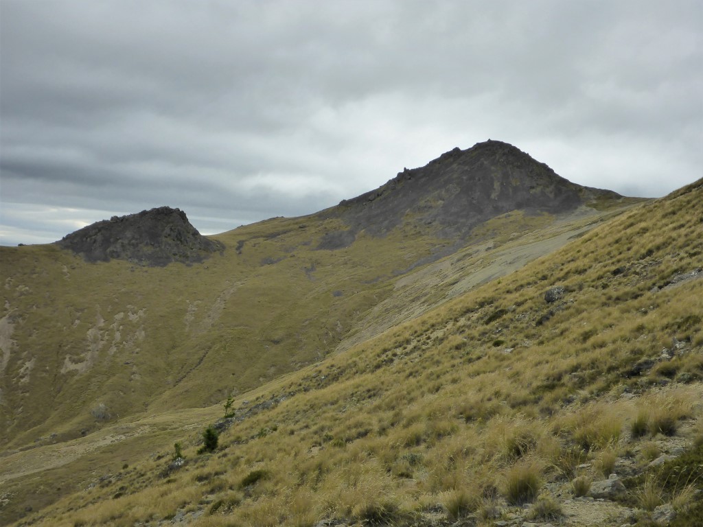
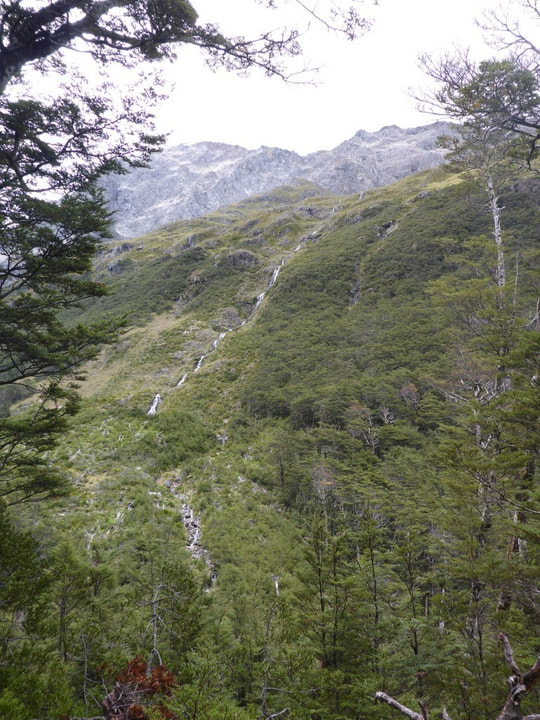
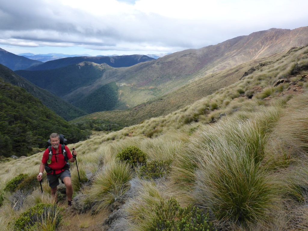
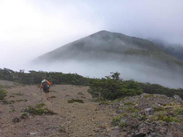
From here, as the TA notes say, the landscape changed as we hit "Red Hills" conservation area. The landscape became more open and barren as we climbed up some exposed ridges (a bit disconcerting for me as it was quite cool and windy, although the rational me knows it was not at all dangerous!) towards Mt Ellis (1615m asl). The GPS track has us going over but the notes said we pass below. We were relieved to see it was the latter as we only got to about 1515m!! It was just one of those days where weather conditions and our own state of mind meant neither of us was looking forward to a climb over Mt Ellis - so, a good result! 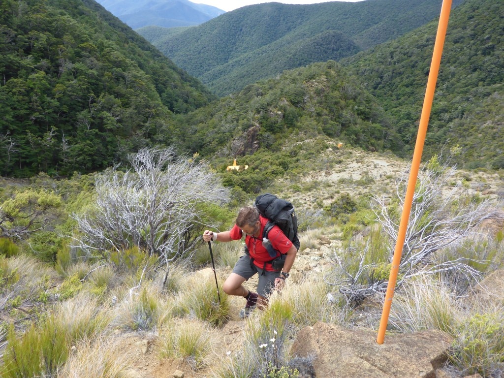 Bit of a climb away from Top Wairoa (in background).
 Mt Ellis appearing.
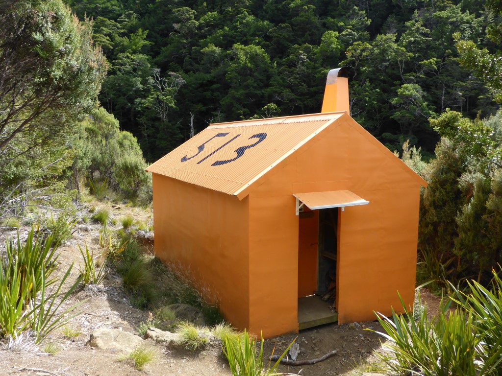
 And looking back across the shale after crossing it. Pretty gentle slope in this case - easy walking. It was a bit chilly up here so it was good to head down a little (although the knees didn't always agree)! This was down through a mixture of scrubby bush and more open rocky/gravel areas also involving several river crossings. Eventually we crossed the Motueka River Left Branch again at about 750m asl and headed up the final stretch to Hunters Hut - it so often seems that we have an uphill to finish the day - in this case only about 100m vertical!! The little sign at the bottom said 15 minutes but it was 15 minutes that seemed to us more like 50 - again, just one of those days!! As with Rintoull and Mid Wairoa, we had this nice little hut to ourselves :-) Belinda went out to the toilet after dark and had the misfortune to sit on a wasp - a painful experience (and a fatal one for the wasp)!! A bit of cortisone cream helped alleviate some of the pain and swelling, but a reminder to be careful out there!! :-) This is a very comfortable hut built in 1997 (renovated 2011) to replace the Bush Edge Hut which was tragically washed away with the loss of two DOC goat shooters, Russell Griebel and Bob Waldie, in a flash flood in February 1995.
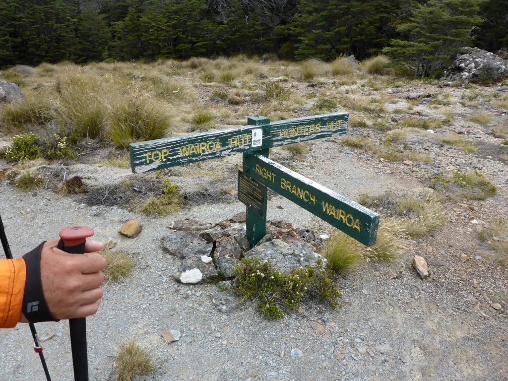 Signs are always interesting to us - and also provide a good "anchor point" when trying to figure out the photo sequence!! 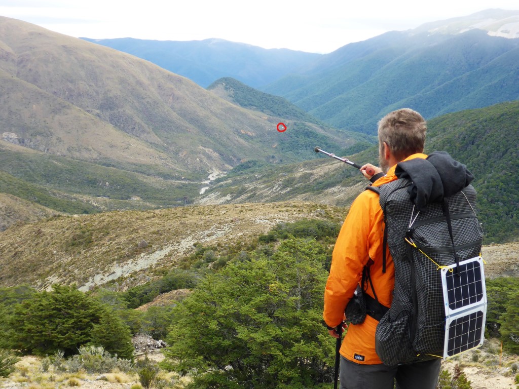 I've circled Hunters Hut on the far ridge. But, of course, we have to go down to the river then up to get to it!
 And up at the hut looking back.
Away 0730 for what was a TA projected 8.5 hour day. Ended up getting to Mid Wairoa Hut around 1530 for an early finish after 16.2km - 7 hours walking and an hour of rest stops. The days GPS track is here. Apart from a trip around Purple Top, at about 1500m, the rest of the walk to Tarn Hut (1030m) was mainly down through beech forest. The day was misty and drizzly on and off and as we approached we could see the lake edge appear through the mist and trees. We walked around the lake to the hut at the southern end. It was 1130, so too early for lunch, but we stopped for 15 mins for a look around and to fill in the hut book. 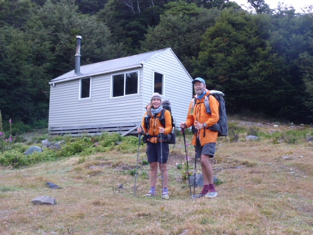 About to set off from Mt Rintoul Hut, minus one insole!
 Orange poles and cairns both help with direction finding!
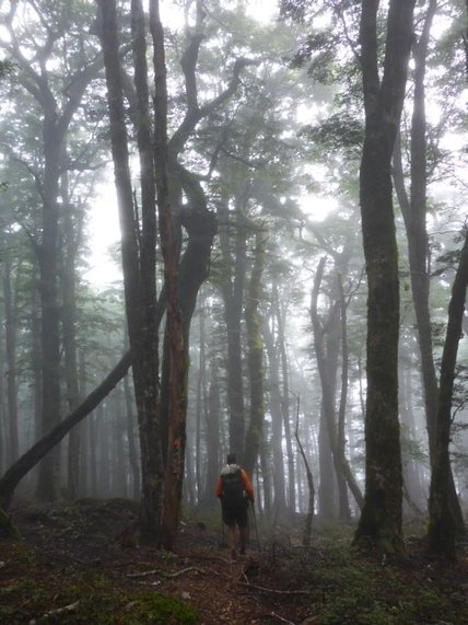
 Junction in the mist.
 The terrain was still a bit rugged in places around Purple Top.
 The misty drizzle hadn't let up yet. 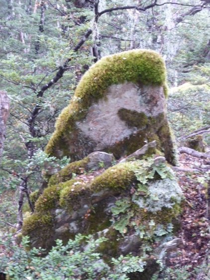 A very artistic mossy rock!
 Close to the tarn.
 Short break at Tarn Hut. Then it was away towards Mid Wairoa Hut where we planned to stop for the night. This hut is down at around 360m asl so there was a fair bit of downhill through the beech covered hills! The last little bit down to the river was particularly steep and hard on the knees! Came across a German guy nobo near the bottom but didn't really stop to chat. From the Bushy Top junction, about 7km from the hut, we came across the first of a series of wasp bait stations that had been put in only a few days before. They were every 50m or so all the way to the hut. We certainly saw evidence of some sick looking wasps around and when we got to the hut the was a distinct absence of wasps. This was remarkable as a number of hut book entries over the last couple of weeks had alluded to lots of wasps being a problem at both Mid and Top Wairoa Huts. It was hard to imagine such an impact in a short space of time but the empirical evidence suggested it was working - fantastic to see DoC getting into the problem :-)
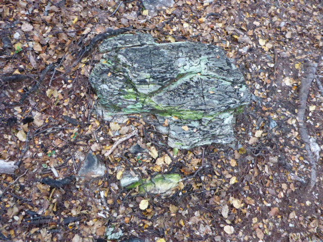
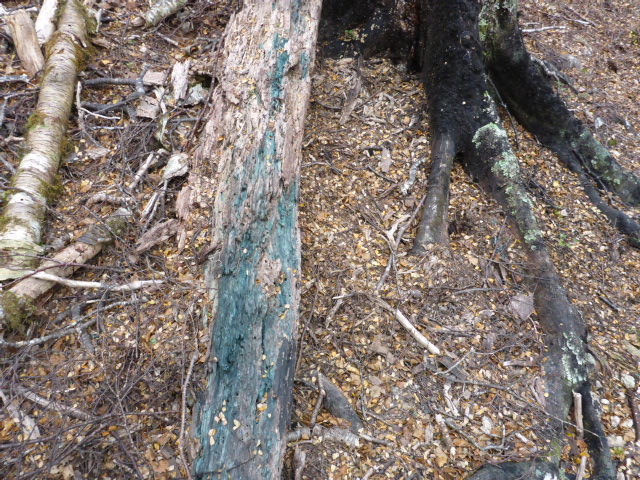 Quote a few dead logs take on this green colour - have not yet found out what it is.
 Downhill - especially steep on the last bit down to the swingbridge over the river. Just before the hut we crossed the river on another swingbridge - this one had a tricky little dismount at the end! It was only 100m or so to the hut from here. This hut had a little open fireplace (most are woodburners) so we lit a small fire for a couple of hours just to provide a little cheer! Managed to find some kindling and some wood to replace the little we burnt.
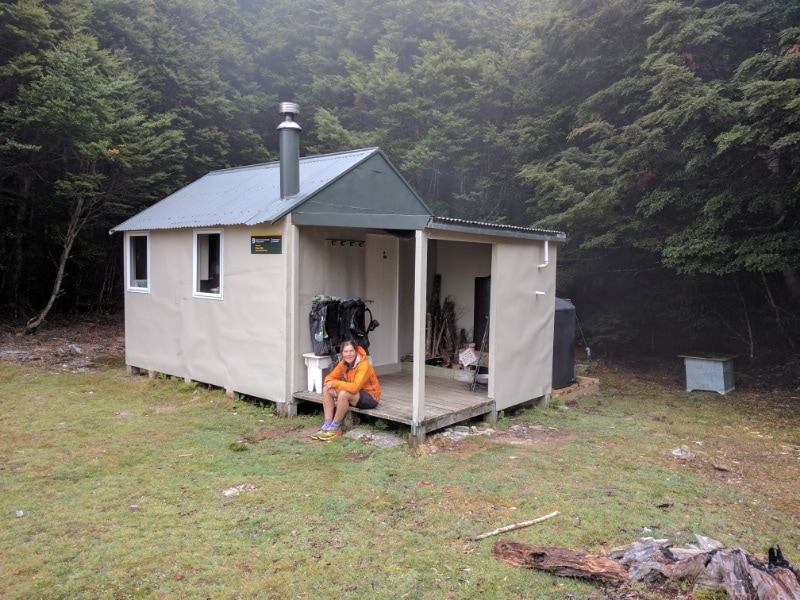
 Only 100m or so of this to get to the hut from the swingbridge. 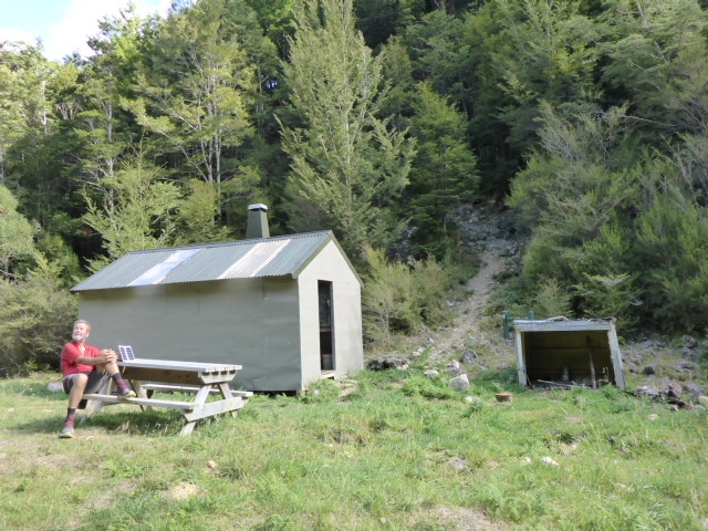 Mid Wairoa Hut - very pleasant.
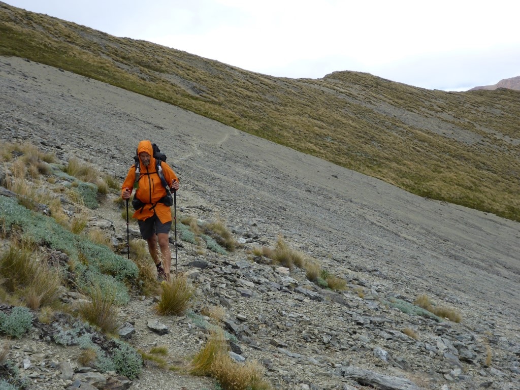
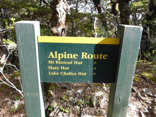
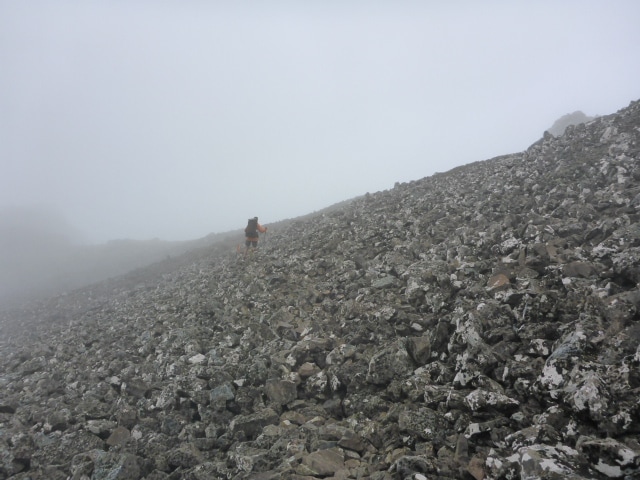
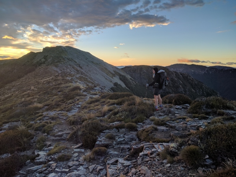
 We'll be off up there tomorrow morning! 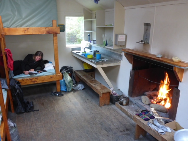 B relaxing with our little open fire burning. On our own again! Up early and away by 0730 again as we knew we had a big day of mountain climbing ahead of us. Little did we realise how challenging!! 8 hours of actual walking to do 13.6km, with only an hour of stops in total. Got to Mt Rintoul Hut around 1630. The day's GPS is here. From Slaty Hut to the second Old Man Hut junction took us only 4 hours, as against TA suggested 5 hours, so we were pretty pleased with that. This was mostly above the treeline, so underfoot was starting to get into rocks, rubble etc that was going to become familiar over the next few days! We were also starting to glimpse what the views were all about! We were back into bush at this second junction so stopped for lunch before setting off up Little Rintoul. Old Man Hut is over 200 vertical metres below the track so you would only go down if you need to stay there! 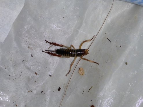 B's friendly visitor (weta) as she was getting up this morning :-) 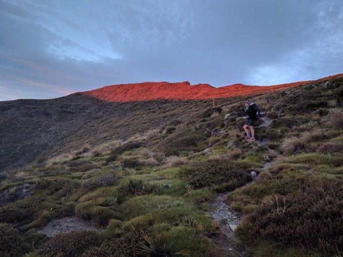 B heading into the red rising sun just as we were starting out from Slaty.
 Lots of TA walkers means the path is often obvious on shale slope.
 B's lone goose way up in the mountains!!
 The "bad" thing is you can generally see where you have to go! :-)
 View back towards Nelson.
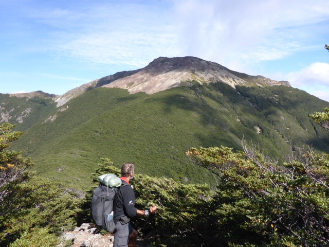
 Luckily we already knew it was an alpine route :-) We then started the climb up Little Rintoul (1643m), coming out of the bush reasonably quickly. Now we were getting into some more serious rocks, rubble and scree slopes underfoot. I won't try and describe it - rather the pictures can do it! Met a German guy coming down Little Rintoul but only stopped for a very brief chat. It was quite a slog uphill in places - a case of one foot in front of the other, whilst always having to be very careful where you placed that foot! The weather was quite kind to us - quite clear but not too hot, and the views we were getting were well earned!
 B climbing up boulders - there was a lot of this during today.
 There is the local flora to brighten the day :-)  More rocky tops and scree slopes to negotiate.
 More boulder fields. After this little summit we had to drop down 250m below a saddle before ascending another 350m to Mt R itself. This descent was pretty tough in places, a lot of it down a fairly steep scree slope. The toughest part for both of us is primarily our knee joints as they take a real pounding on all the downhill! Anyway, we negotiated it fine and another uphill slog saw us with some great views from the 1731m peak.  Leaving Little Rintoul with Mt R in background. Saddle visible in centre of shot but we dropped right down to the bush centre left and headed up the scree slope onto the ridge! 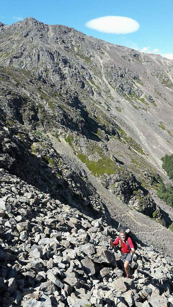 And from the other direction! Little R in background, with us dropping 250m to the bush seen lower right, then up scree and rocks to the ridge. I'm almost there!
 View from to of Mt R - someone is a bit free with the use of black marker pen - not really necessary to add graffiti no matter how well intentioned.
 From the top, it was initially a gentle descent on flattish ground. We traversed a ridge for a km or so before dropping down over the next km, eventually down through bush to the Mt Rintoul Hut, which is at about 1250m asl. 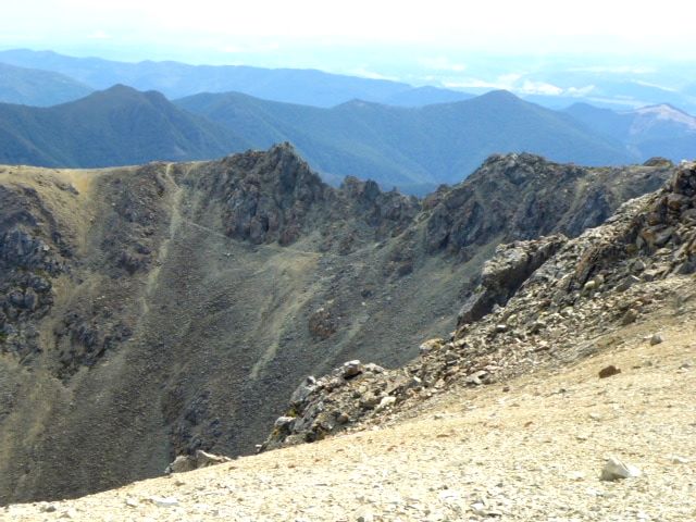 But the flatter bit didn't last long! If you look at the pointy rock outcrop centre-left you can see our track just below the rocks, at the top of a scree slope.
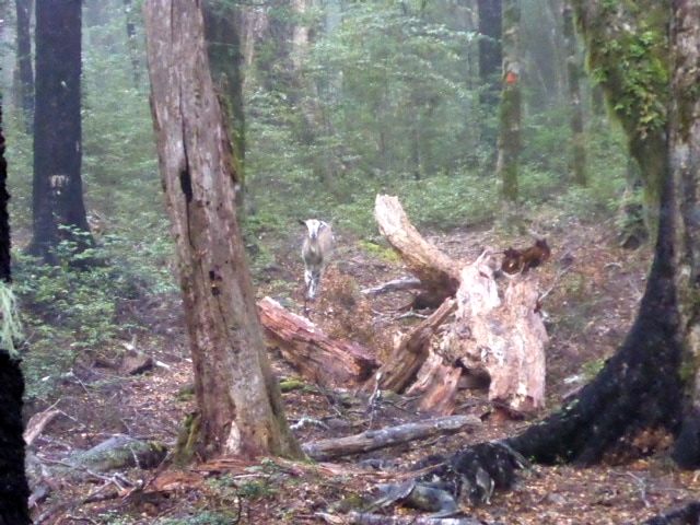
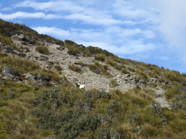
 Always remembering there is still room on TA for uphills amongst the downhills!! 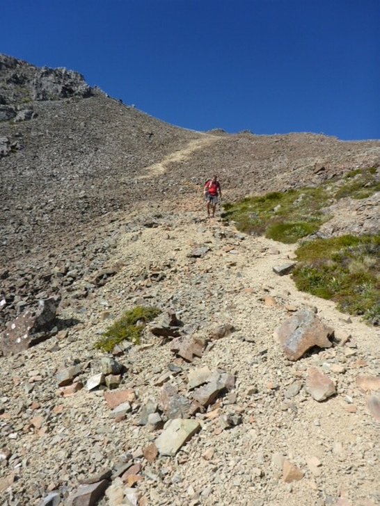 Slightly more gentle terrain! We put our shoes and gaiters outside to air, and Belinda took her insoles out as well. A little later, Belinda went out to gather her stuff up and discovered one of her gel insoles had disappeared! There were a couple of goats hanging around and we are not sure whether it was one of them or a weka that stole off with it (we hadn't seen any weka here though - at least not until the next morning). Nett result is that B has to revert to her standard Hoka insoles that came with the shoes. Lucky we each carry a spare pair! Lesson learnt!! We were pleasantly surprised to have the hut to ourselves tonight (hut snobs!).  Looking out from Rintoul Hut. The goats in the background may well be the thieves that stole B's insole! They were not perturbed by our presence! |

AuthorBelinda and Anthony (aka Tony) Hadfield made a decision, in their late 50's, to do something a "bit different" and walk New Zealand's 3000km Te Araroa Trail over summer 2015/16 - although updates will now tell you that this plan will take longer now!!. As the old saying goes - "don't leave home 'til you've seen the country"!! Archives
January 2018
Categories |

 RSS Feed