|
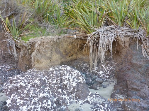
The knee gave me a few issues overnight and was fairly sore so we made the call that we needed to get it checked out. We were very fortunate to be able to give Maria a call and she very kindly said she would come and pick us up - about a 2 hour drive for her from Opua out to Diggers Valley Rd!! A "trail angel" indeed :-) We were in no mad rush so we decamped and headed off around 0900 for the downhill (some very steep!) run to Diggers Valley Rd. The day's gps track is here. It was definitely all downhill, as noted - and as you can see from the photo below, some of it simply wasn't negotiable on your feet - particularly with the mud around! So it wasn't just our shoes/feet that were muddy by the end of the descent - I had also slipped over a couple of times earlier on the descent, so was well used to it by then!! 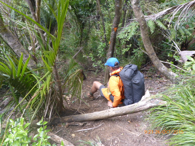 Me demonstrating the alternative descent method - again photos don't truly show the steepness!! After about 2.5km or so, we emerged onto an old farm track that is actually an official road - Veza Rd (you can even find it on Google Maps!!) - although I don't think even a 4wd has been up it for some time! This was on the forest margin so we had views of some real farmland. 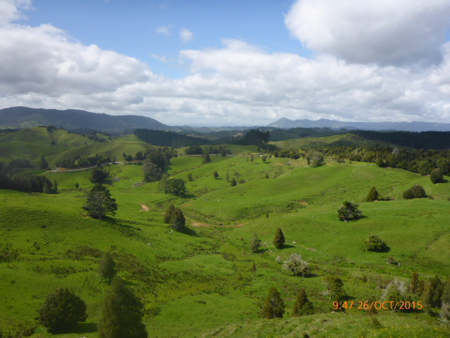 Looking more or less east onto farmland from the Herekino forest exit onto Veza Rd We followed this grassy "road" for about half a km or so until it exited onto Diggers Valley Road (a very rural gravel road). As we had a bit of time before Maria was due to pick us up, we decided to walk the next 1.2km to where the next part of the TA turned off Diggers Valley Rd into forestry land again - that's where we will have to start when we get back to it again!! 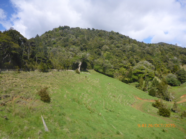 Looking back up to Herekino from Veza Rd - which runs just on the top side of the fence line Having walked the 1.2km, as above, we decided that we were unsure as to which direction Maria might be coming from, so walked back the 1.2km (!!) to the intersection. We sat down and got the food bag out for a bit of lunch - but about 5 minutes later Maria rocked up to pick us up. On the 2hr trip back we saw some lovely bits of Northland we would otherwise not have seen.
Andrew cooked us another roast for dinner - which was hugely appreciated - as were the couple of beers I felt I could safely consume (not having had one for the best part of a couple of weeks! So safely back in Opua - and very lucky to have such a support base to lean on here in the form of Maria and Andrew!
0 Comments
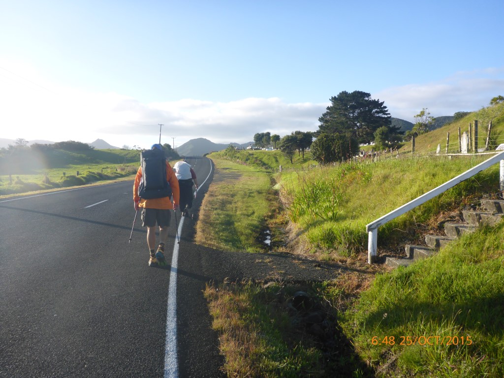
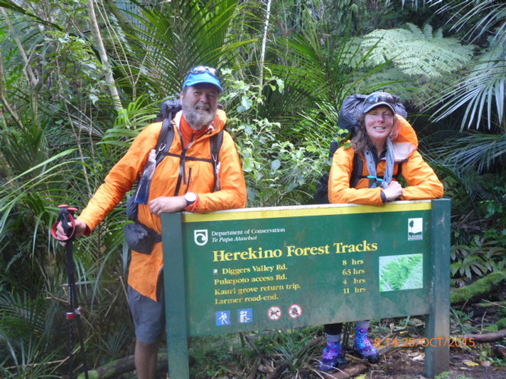
Today we managed around 21km in just over 9 hours. First road walk section to Herekino Saddle. Start of Herekino Forest Track to Taumatamahoe trig. We set off from the campsite around 0700 after watching the last 5mins of the NZ vs SA match - so at least it was a positive start to the day! First 8km was asphalt road hike to Herekino Saddle. First thing of interest was coming across the National Weavers hui at Roma Marae! 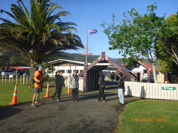 Lovely ladies at weavers hui Had a chat for a few minutes with the lovely ladies there, with some mutual photos - I think they thought we might be a bit mad when we mentioned Bluff!! Then it was back on the road up to the Herekino Saddle and the start of the Herekino Forest Tracks. We had started off the day again in Bob's company and caught up with him for a rest at the saddle - as we had been going 2hr by then. I had noticed a niggle in my right knee on the road section but figured it could be walked through - as with other niggles we had had on previous days. Anyway, after a break, it was into the forest.
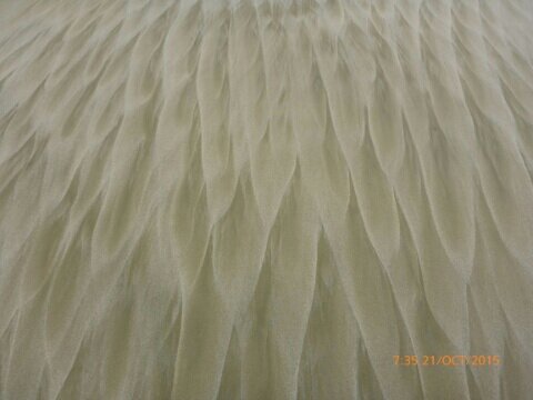
We settled into a fairly steep climb initially and were soon into some nice NZ bush - with lots of rimu, totara, kauri and many other species in all shapes and sizes. Included in this was a couple of nice stands of fairly sizeable kauri. 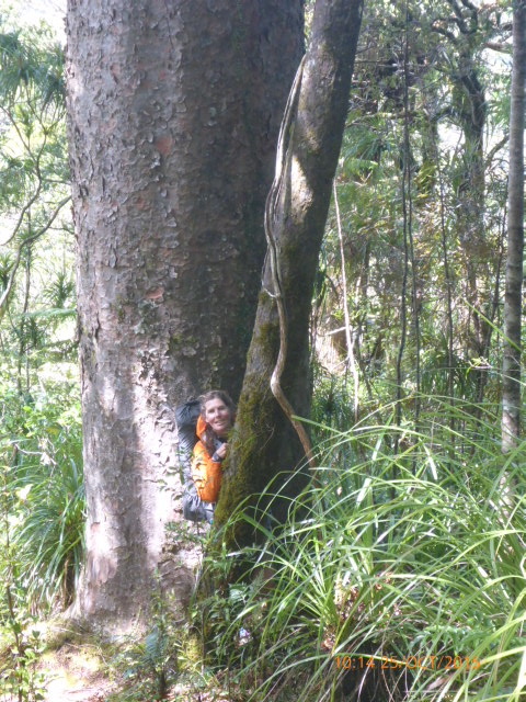 B and her "average" kauri tree! 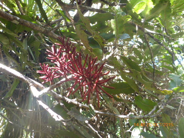 Rewarewa flowering There was a fair bit of up and down today, as well as some flatter sections along ridge tops. It was, as expected after yesterdays downpour, pretty muddy - but you just accept that you are going to get wet, dirty feet and get on with it :-) The tracks were, of course, variable. Its nice walking on kauri leaves I discovered - but a fair amount of the bush section was normal root-infested NZ bush track! We did have a stretch of old narrow 4wd forestry road in between the two sections of bush track, which was a bit of a relief for my knee. 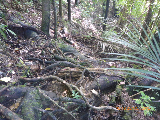 Lots of roots! Pictures can never do justice to how steep parts are. 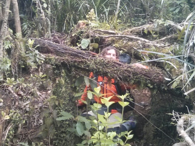 Or how much of a contortionist you have to be at times - B is better than me!! Anyway - after about 12.5km of forest we reached Tamatamahoe trig. My painful knee had definitely slowed us down, as we were behind the DoC estimates of time. For a number of reasons, we decided to camp in a small spot at the trig. My knee was not great, we had been going over 9 hours and, importantly, this was the only spot within cooey that had cellphone reception if we needed to call for a ride out. We thought we could see how my knee was overnight before making decisions - so set up camp. A couple of young guys - Sean from Canada and Arno from Germany, who had also been at the Ahipara campsite - stopped for a quick chat before heading off on the 3km downhill to Veza Rd to camp for the night. It was a fairly breezy southerly and a little chilly overnight - what you get for being on a high spot (~560m) but we were very comfortable with our gear to keep us warm and toasty. 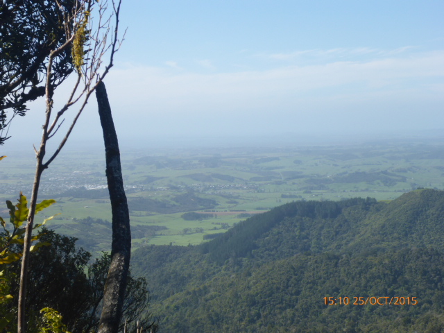 View looking north from gap in bush atop Taumatamahoe 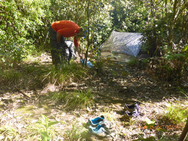 Tucked in the bush alongside the track for the night Belinda here:) I thought I would contribute to the blog every now and then. Anthony is doing a great job at recording our adventure but as we are having another zero day (due to extreme weather), it's a good opportunity for me to add a bit. Cape Reinga to Ahipara was just stunning. We lucked in with tides and weather so it all went pretty smoothly. The expansiveness of the beaches, the dunes, the crashing waves - it left me in wonder. We established a nice routine that helped pass the kms. There was a bit of talking, a bit of resting (always on the lookout for a good log), a bit of eating and of course a whole lot of striding out. Discussions and decisions about water is a biggy because of availability and carrying the precious liquid. The biggest surprise for me over the first four days was my lack of appetite. I believe it will kick in but I found it interesting how the body responds under certain circumstances. Amongst the wonder of this wilderness there was a sadness for me. As some of you may know, I have a thing about rubbish and regularly collect rubbish when walking. Anthony made me promise I was not going to cart a rubbish bag along TA before we started! You guessed it, even in this amazing, raw wilderness, man's waste is apparent - usually captured in the gullies, streams and sand dunes from high tides and winds. So sad. Moving on - by day three I had a little toe blister which was manageable but when the thigh muscles starting objecting I dived into an audio book to help take my mind off the discomfort (pain actually). The perfect companion for this situation was Catniss Everdeen of The Hunger Games as she was in a heck of a lot worse place than I was. It was fitting that I finished the book just before reaching Ahipara - we both made it! Thank you Suzanne Collins. One other thing I wanted to share was an occasional chat about my hiking gear. Anthony covered our gear list pretty comprehensively but I am talking about the relationship you develop with your gear. For this last section, the item that won MVG (most valuable gear) award went to my beautiful quality, loose woven, pure cotton scarf. Anthony thought of it as s fashion statement ( I agree it's pretty styly) but oh my goodness it was so much more. It is so versatile and made the world of difference. The photo pretty well tells the story. I have fondly named the scarf 'Joan', after an incredible woman I met in England in August. That's it from me..... the rain is easing, roll on tomorrow. :) B 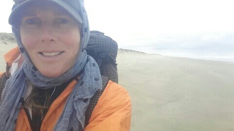 This rest day was always planned - and boy did we need it. Just looking at a couple of guys coming into camp now (2 hours later than us) and they are obviously TA walkers. That distinctive hobble was how we looked last night!
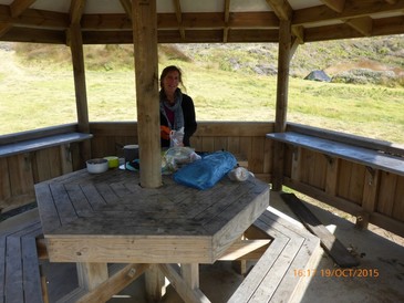
Lounging around today: catching up on blogs and emails; short 3km round trip walk into town for burgers and chips and food items; washing; sorting through our food parcel we sent here; planning for next stage etc! Also decided to spend another day here - mainly because tomorrow's weather (Sat) looks like crap (rain) so no point in walking while day in rain if it's unnecessary, and it will also help muscles, blisters etc heal!! so Sunday a.m. start into Northland Forests section. Only bummer is we have to shift from cabin into our tent for Sat night because cabin is booked out over Labour Weekend. They have big lounge area etc so no problem. Just have to find and fix leak in B's air mattress tomorrow! So, another zero day tomorrow. Today took us to from TA km69.5 to TA km101 but the Suunto says we did around 32.5 actual in just over 9 hours. (today's gps track) After achy bodies last night we started of more or less OK. B was having quad issues though and I was just generally sore, so we had a slower first half day. As you can see below, it's funny what/who you can run into in the middle of nowhere. A while lot of "lumps" in the far distance resolve into a woman, a bicycle and five dogs! And very big dogs - four Anatolian herding dogs and one a type of European shepherd apparently! 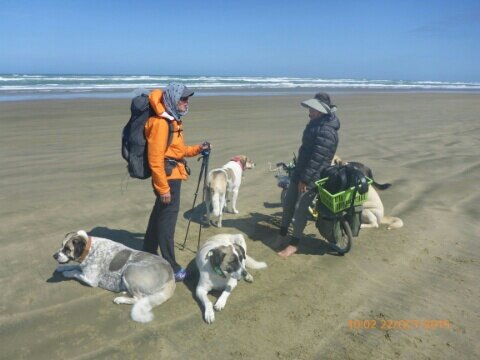 B with lady and her five dogs After lunch the pace picked up for a little while but in all honesty we were both pretty shattered for the last few kms! No more photos of the beach today but as we reached the boat ramp at Ahipara we found someone to take a photo to signal our surviving 90 Mile Beach!! :-) 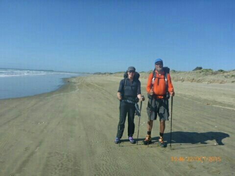 Made it! In summary we were even a bit proud of ourselves for making it relatively unscathed, although the last km to the campground was pretty slow! Again, pretty weary might (politely) describe us after such a long beach walk!
Overall, a great experience. Sure some might say it's a bit repetitive towards the end, but it is a magnificent walk all the same. We were lucky having only a slight sprinkle or two of rain and tides were pretty good which limited the soft sand walking, and we only had to dive up a sand dune a couple of times to avoid getting wet at high tide! Now for at least one rest day before the Northland forests! This day took us from TA km40 to TA km69.5. We actually did just over 30 km in 8.75 hours with stops. In short, today was a lot of beach - surprise! The wind was starting to head round to the NW and onto our back quarter rather than the SW we had on out front quarter the first two days. Every little bit of propulsion helps I can tell you! (link to gps track for day) Yet again I had a glitch with technology and bumped the pause button on the Suunto as I was putting my pack on after lunch, so the track details are missing approx 1 hour and 5 km! I'll get better at checking after every stop now! 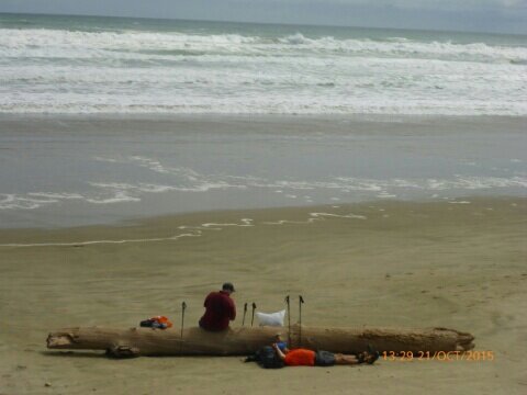 Caught up with Bob again for another break Arrived at Hukatere and set up at Utea Park for the night. Decided on a simple cabin because (a) why wouldn't you! and (b) we have a slow leak already in B's sleeping mat which we will try and sort at Ahipara. Very convivial night with hosts Paul and Tania and there lovely Japanese woofer Atsuko - as well as German and French visitors.
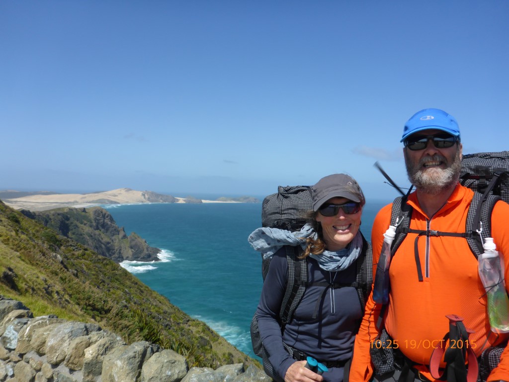
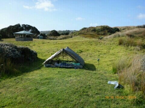
 Our cabin at Utea Park - Hukatere. Approx 28km today according to TA, but we did around 29km actual leaving at 0800 and finding campsite amongst pines just south of the Bluff at about 1630. And no - this is not the "Bluff" that we get to finish the hike at! The first 4km was a hike across/over Scott Point before we hit the famous 90 Mile Breach at around TA km16. (link to gps track for day) 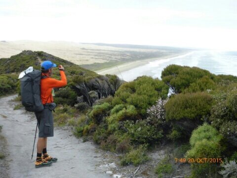 Looking at 90 Mile Bch from Scott Point Then onto the start of the big beach walk - all 84.5km of it to Ahipara! 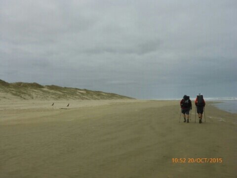 We meet up with a fellow TA hiker at Twilight Camp named Bob (aka "Atlas") - an American who is a very experienced long distance hiker. He had been very helpful with tips etc. We leap-frogged each other during the day, occasionally walking or eating together. I'm sure we'll meet many other interesting people along the way - a great part of this adventure! 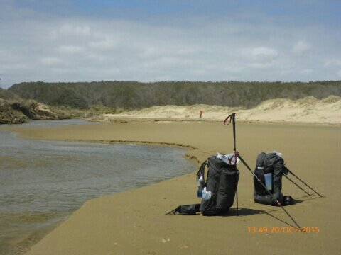 Rest spot beside one of the (few) creeks Eventually found a camp amongst pines just south of the Bluff - thanks to Kirstine Collins' notes from last year. Bob joined us there about 20 mins later. Next morning as we were getting up B saw some of the Northland wild horses right by the camp and managed a quick photo before they took off. 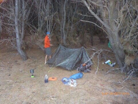 Tent amongst pines 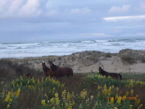 B's wild horses! It was great to set off on a fine day - may there be many more to come! We had to get the obligatory "start" photos of course - at the lighthouse and at start of steps leading down towards TeWerahi beach. Day's GPS track is here - note I accidentally turned it of after lunch so the straight line across Cape Maria van Diemen is not true - and distance is wrong by about 1km or so!
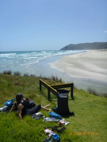
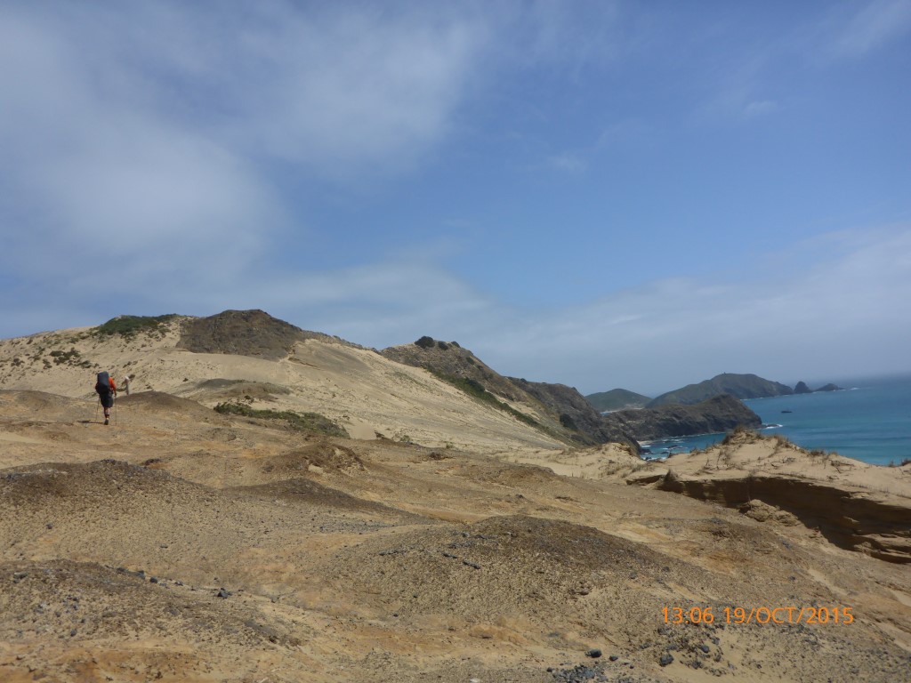
We were unable to get the tides in our favour so we did a short scrub bash above the rocks at the start. Rest of the day was mixture of beach and climbing over headland of Cape Maria van Diemen - lovely scenery to our eyes.
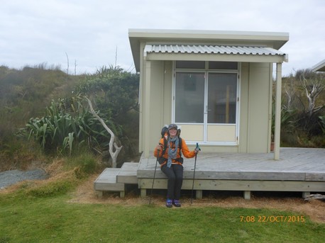
Our lunch spot was just at the start of our first headland - with picture of B as we hiked over it. This basically cuts across Cape Maria van Diemen. It was a leisurely 12km hike today, having started at the Cape at about 11.30. So reaches Twilight Camp around 4 if I remember correctly. The Suunto doesn't appear to have stored multiple days walking so I am going to have to improve my technology skills as I appear to have no record of first three days walking! Nice little campsite which now has a water tank installed.
 A very hectic last few days tidying up stuff for home and farm saw a last minute flurry of activity this morning, as we had a 2.50 flight through Auckland to Kerikeri! made the flight safely enough thankfully. Now at Maria and Andrew's place above Opua. Lovely view up the Waikare Inlet - thought I would post a photo since we should be heading up the inlet in maybe 12 days or so - to head into the Russell forest! 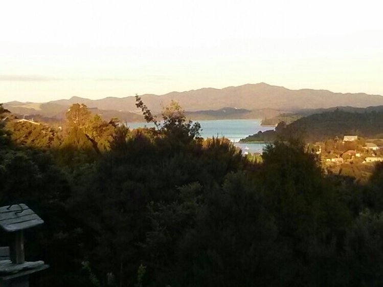 Hope it looks that good when we are back here walking! Day of rest tomorrow, then due to start at the Cape on Monday a.m.
|

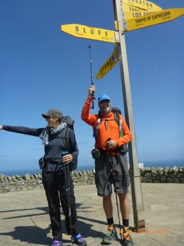
AuthorBelinda and Anthony (aka Tony) Hadfield made a decision, in their late 50's, to do something a "bit different" and walk New Zealand's 3000km Te Araroa Trail over summer 2015/16 - although updates will now tell you that this plan will take longer now!!. As the old saying goes - "don't leave home 'til you've seen the country"!! Archives
January 2018
Categories |
 RSS Feed