|
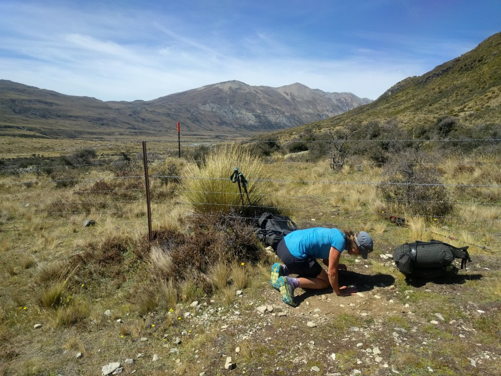
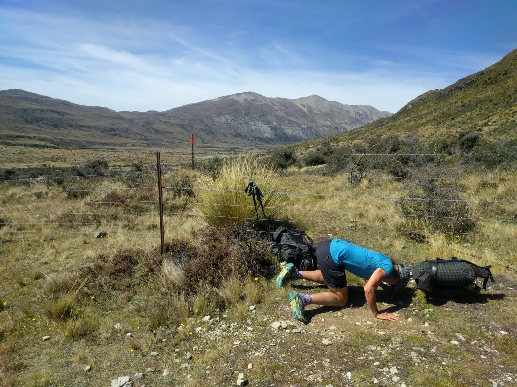
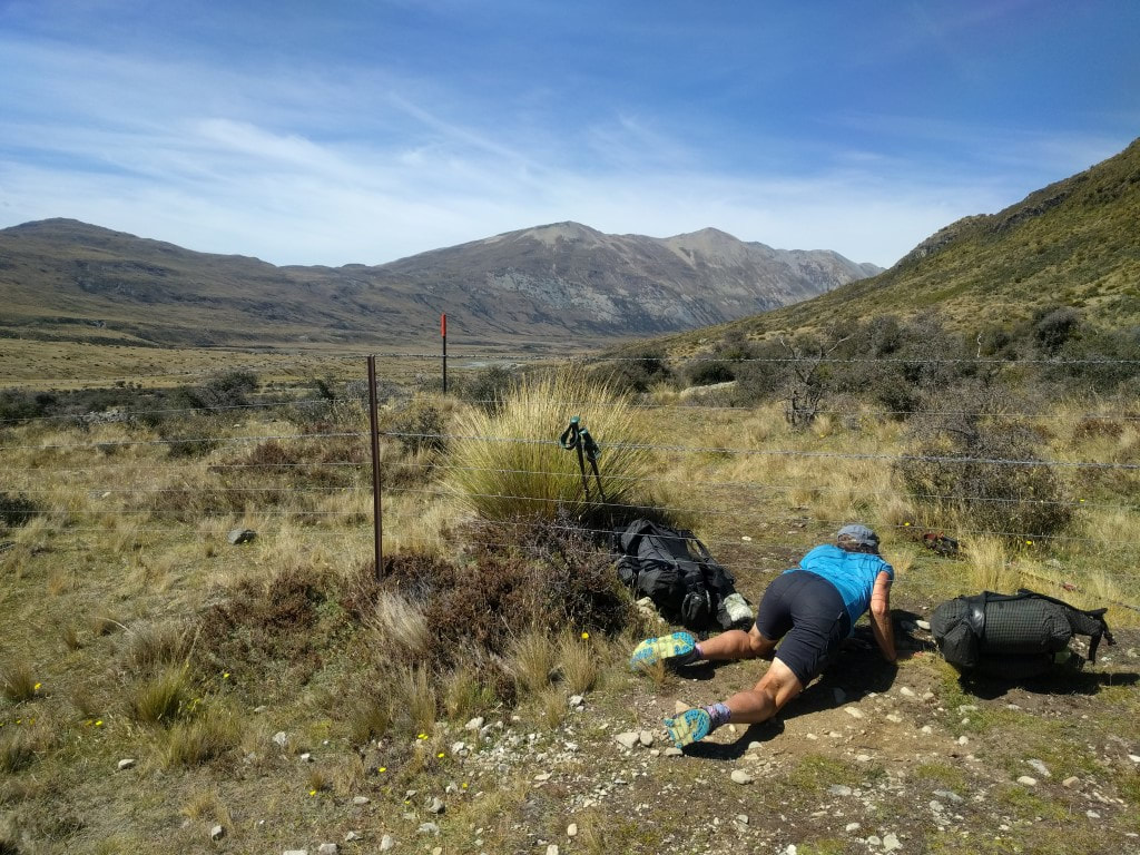
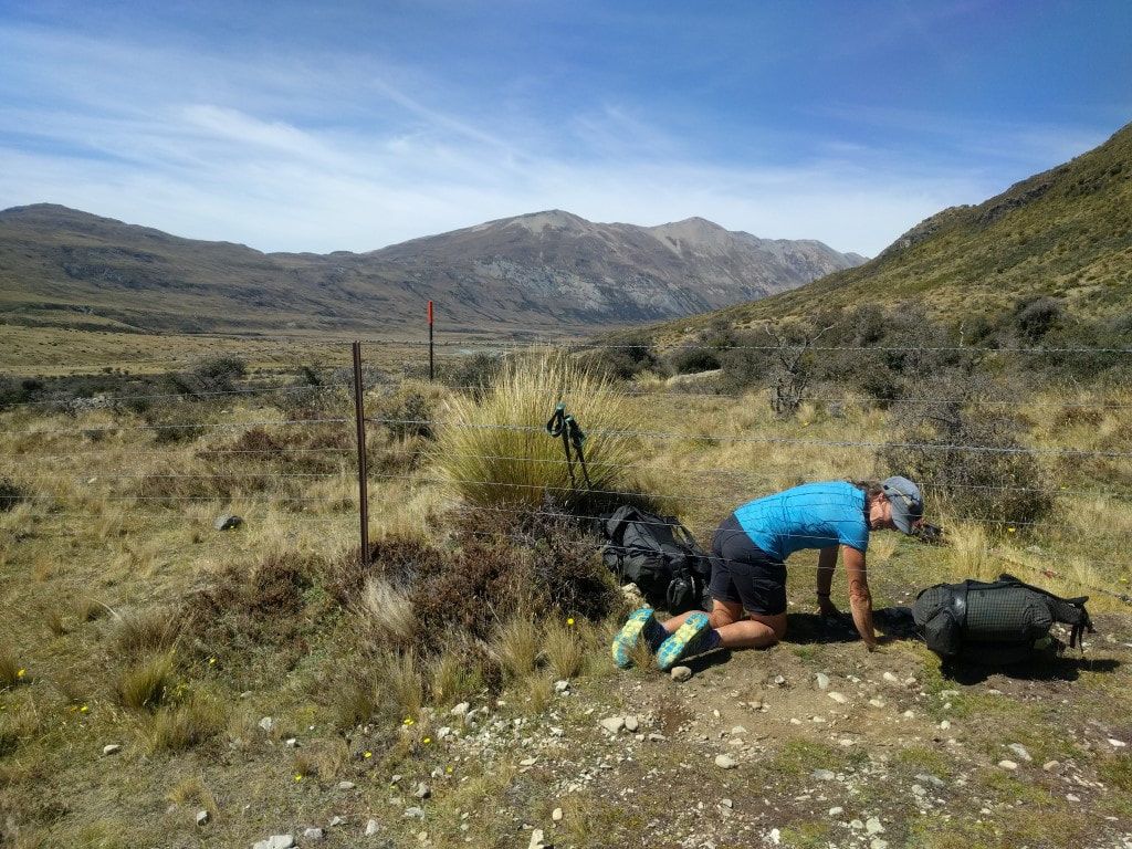
David, Caesar, B and I had left our packs out in the common area last night to minimise noise in the morning as we wanted to be up at 0600. We got underway around 0720. It was a bit misty around the hut at 0600 but it cleared relatively soon so didn’t affect our start. The day ended up being 29km in around 7h45 - I forgot to turn the watch back on after our stop for lunch around 1220 - so missed about 15 minutes and 1km of tracking (its easy to see the straight line on the Suunto GPS map, so I can work out how long it was off!). The GPS info is here. We set off through beech forest knowing there were not a lot of ups and downs today, which should make for relatively easy going. Some of the beech track was “rocks and roots” which made me a little slower as I was still being very careful about where I placed my feet. In other places the underfoot was better, with a few roots and no rocks - which increased speed a little. We had our first stop after 1h40 having averaged 3.5kph to that point, so we knew we were making reasonably good time. As we got higher, we entered areas of scrub and also of tussock - with some bog areas thrown in for good measure. 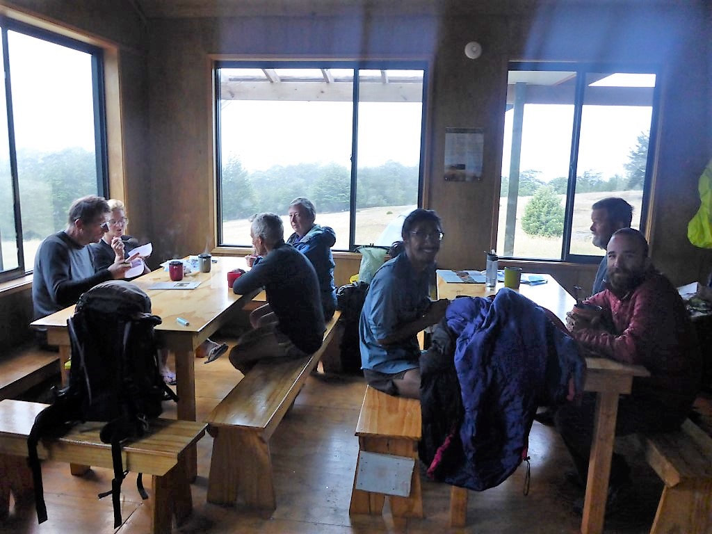 Breakfast - almost ready to go. 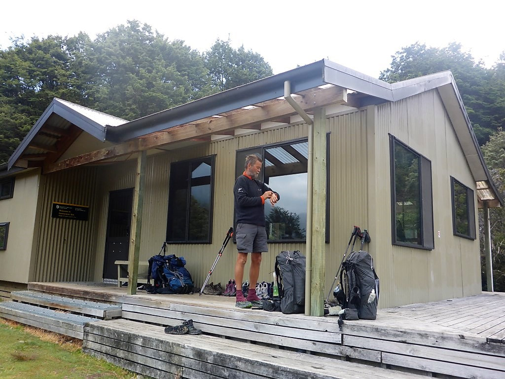 Surely it must be time to go now??! 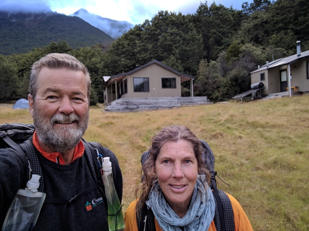 The occasional selfie is deemed acceptable :-) 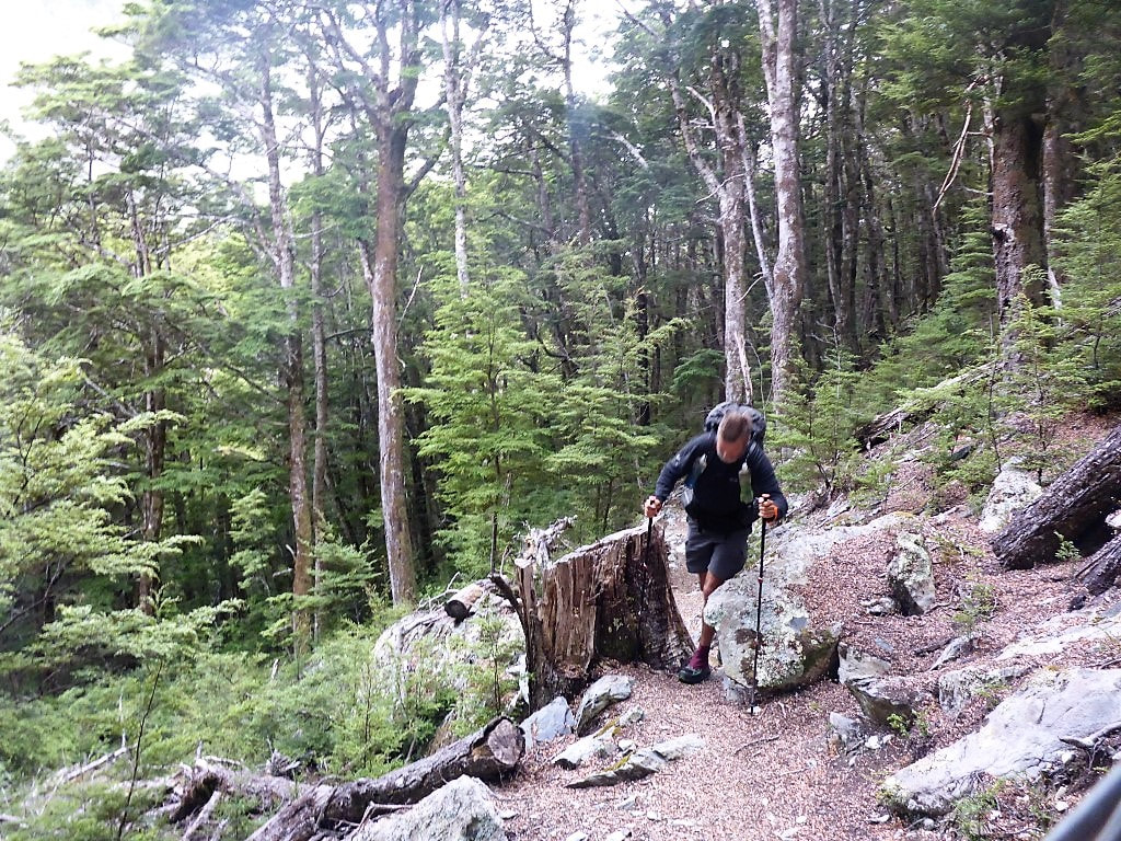 Between a rock and a tree stump! 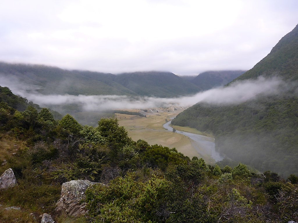 Looking up the Greenstone valley - which we are no longer following. 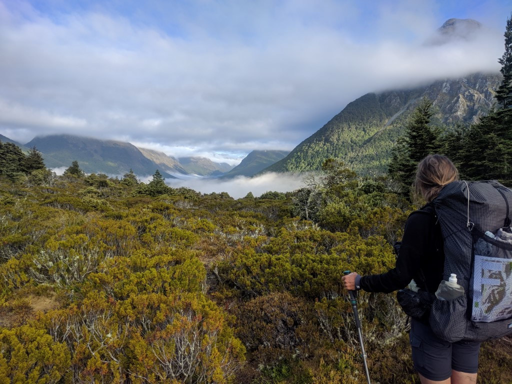 That's our direction. 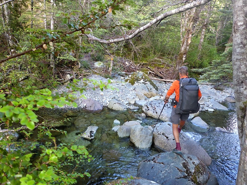 Dry foot crossing :-) 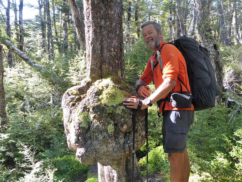 A rather large burl (looks like a "carbunkle"!!). 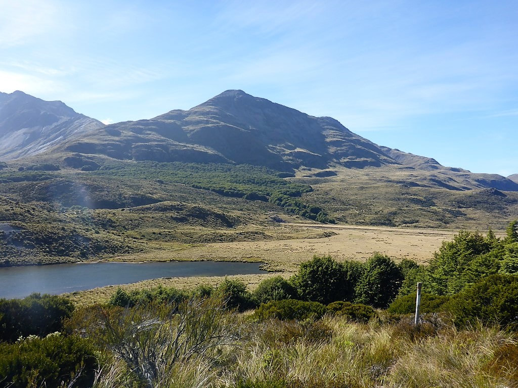 Random little pond amongst the tussock. There were a few of these during the day. 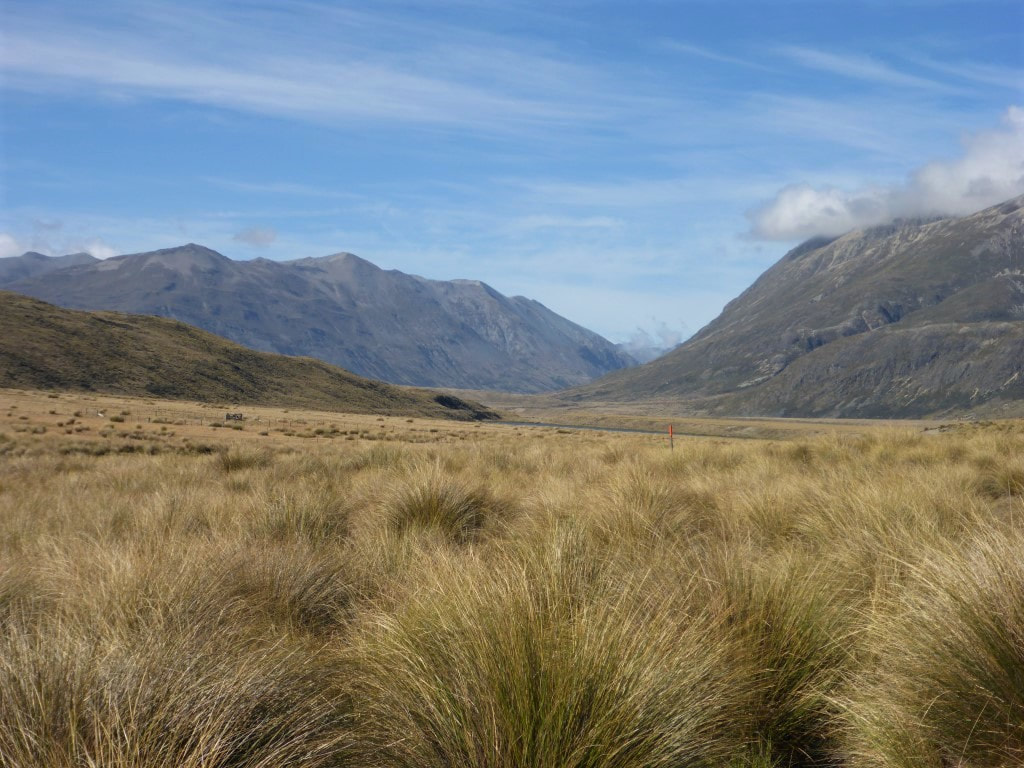 More tussock to wade through as we head down the valley.  What does one make of this helpful sign? :-) We eventually dropped into the river valley, although we were walking on a sort of terrace above the river often, rather than right down by the river. We arrived at Taipo Hut just before 1030 - 2h45 walking time - so had made pretty good progress seeing as DoC times say 4-5hr! I can imagine, if it is wetter, that some of the boggy areas would be much slower going, but we managed to go over or round all the bogs pretty easily. It was a nice fine day with a gentle breeze, which helps. We had a break at the hut and were underway again after an almost 15min break - straight across a swingbridge over the upper reaches of the Mararoa River (that we would now follow, more or less for the next day and a half). 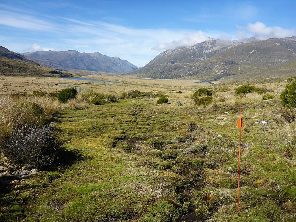 Less than 30 minutes from Taipo Hut. A typical boggy area where it is hard to keep your feet dry. 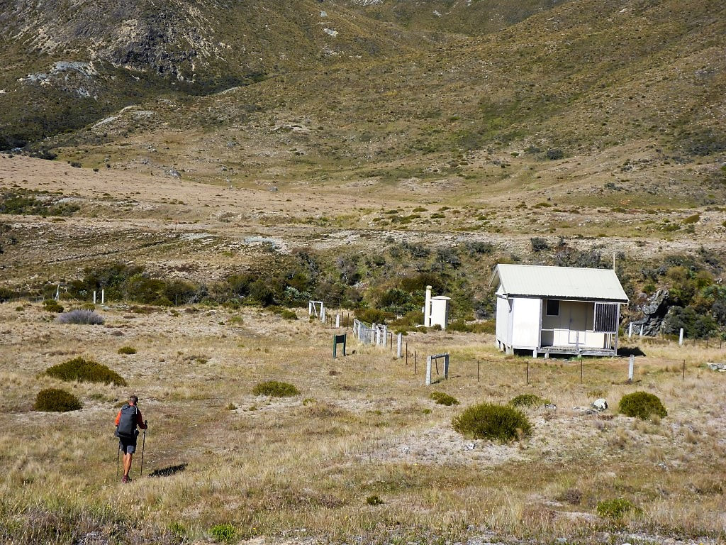 A fenced-off Taipo Hut. Swingbridge is at left of shot. 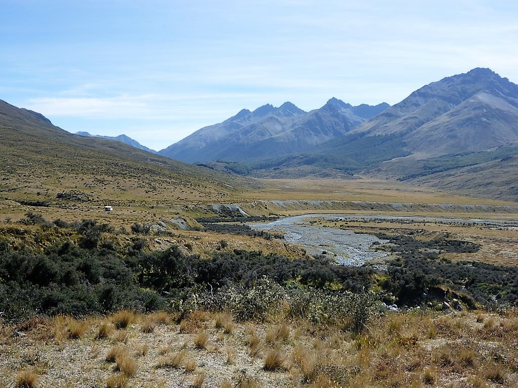 Looking back at Taipo Hut not long after leaving. From here the first couple of kms was very easy going on a flat track before the track headed to the edge of the valley, running just at the bottom of the hills to the west of the river. This made for little ups and downs through more open scrubby/ rocky, tussocky, and occasionally boggy, terrain - so the going was slower. This was mostly the case until we hit the swingbridge across the Mararoa to Boundary Hut - this 12km or so from Taipo Hut took us about 3h15 walking time (with a long stop for lunch thrown in). After the swingbridge, the hut is actually 200m or so back upstream (easy to see on the day’s GPS track) but, as it was hot and time for a break, we headed back to it - also topping up our water while we were there. 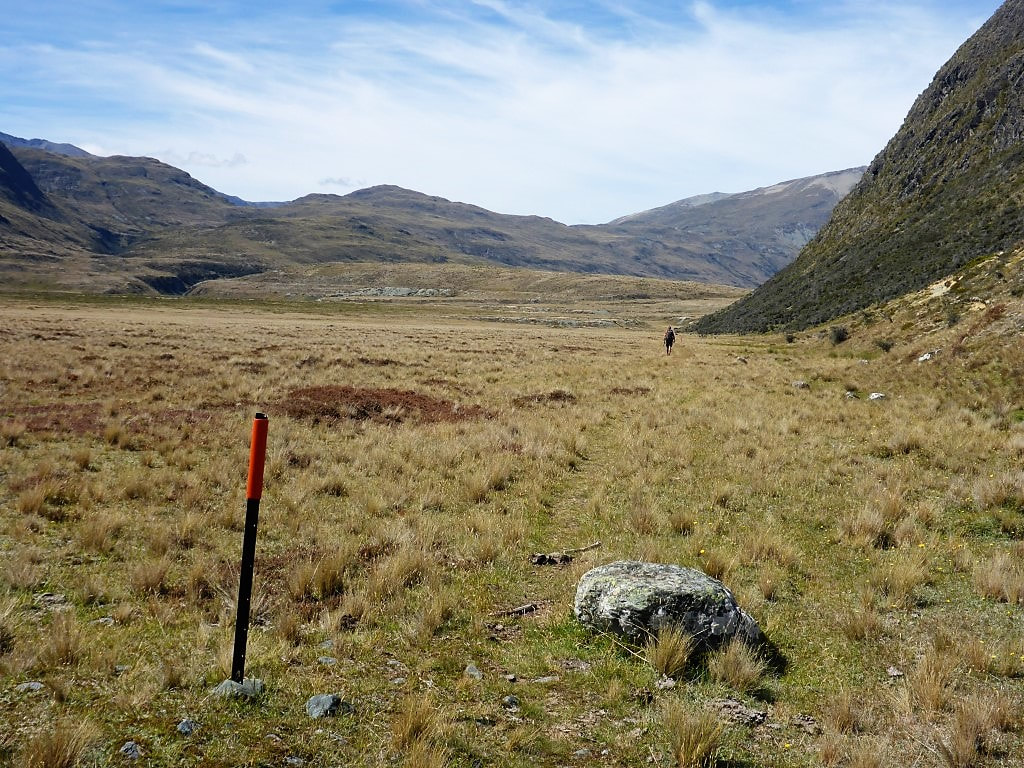 This bit was easy going - maybe it would be like this for most of the way? Yeah .... Nah!! 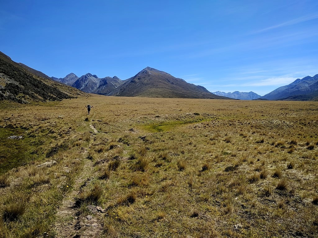 B celebrating the nice walking conditions here :-) 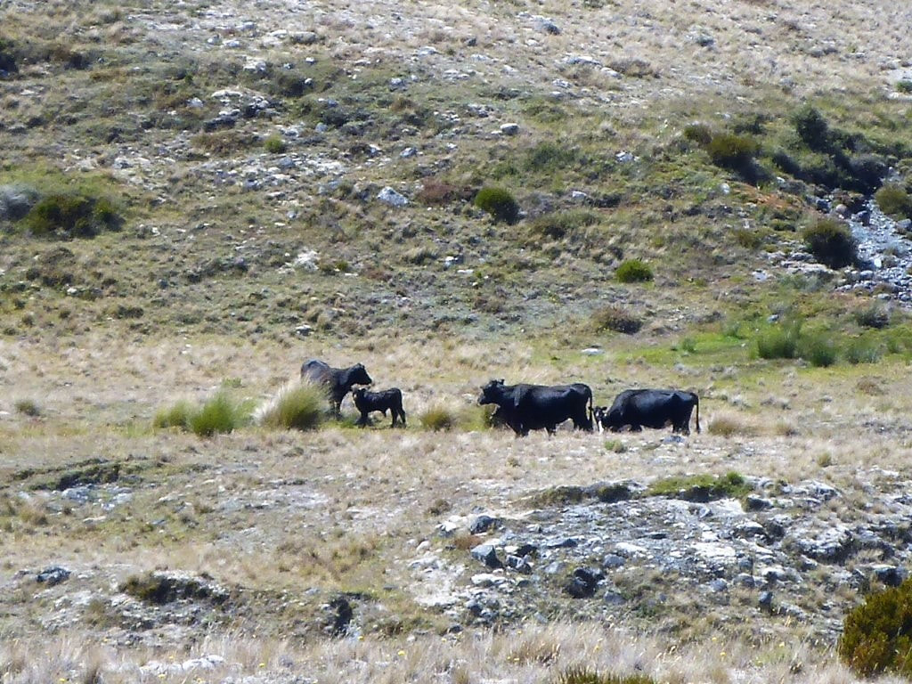 Back into farmed country. 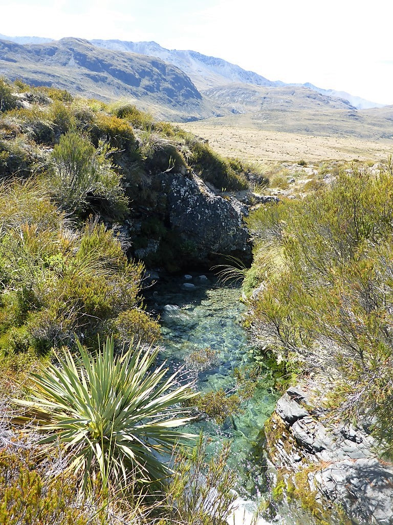 Nice clear stream along the way. Seriously?? The only time we have come to a fence without a stile or gate. Barbed wirw on top, so only sensible way was under without packs attached :-) B is more nimble than me so was chosen as the model for this particular photoshoot. 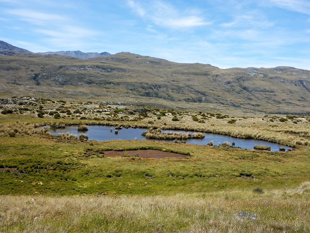 Another boggy pond to detour around. 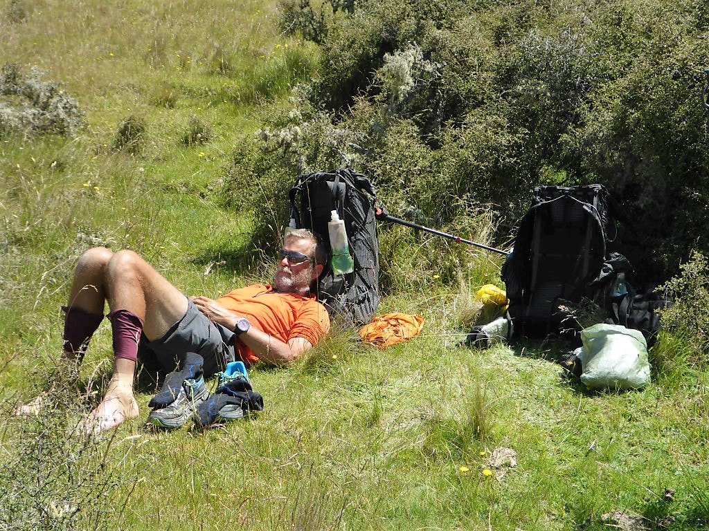 Lunch stop. With strapping tape on the left ankle and compeed/tape for blister on the right foot, a good time to give them some fresh air! 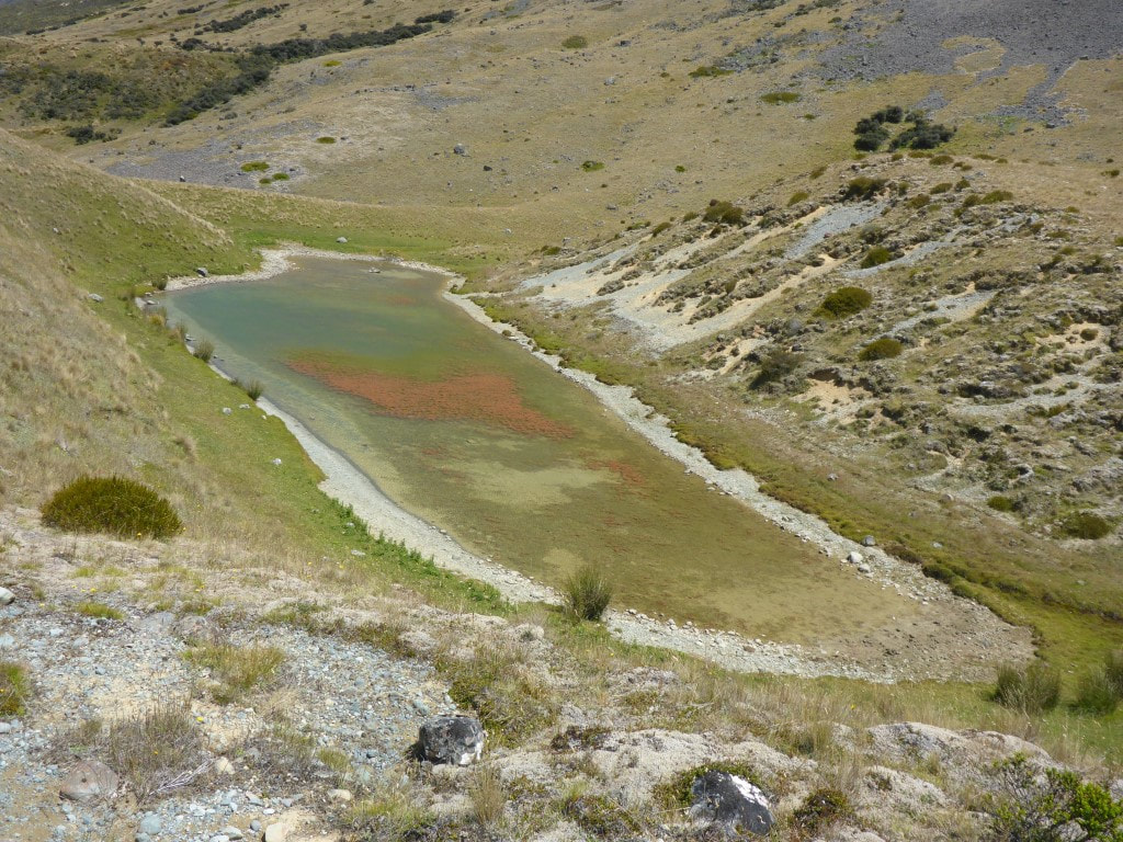 Shallow, and showing some algal growth. 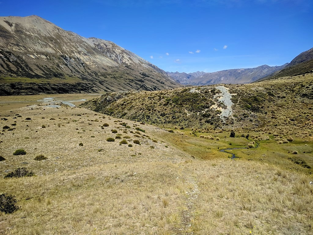 Then we randomly had to drop down, through the wet bit at the bottom, and up that gravel face on the other side :-( 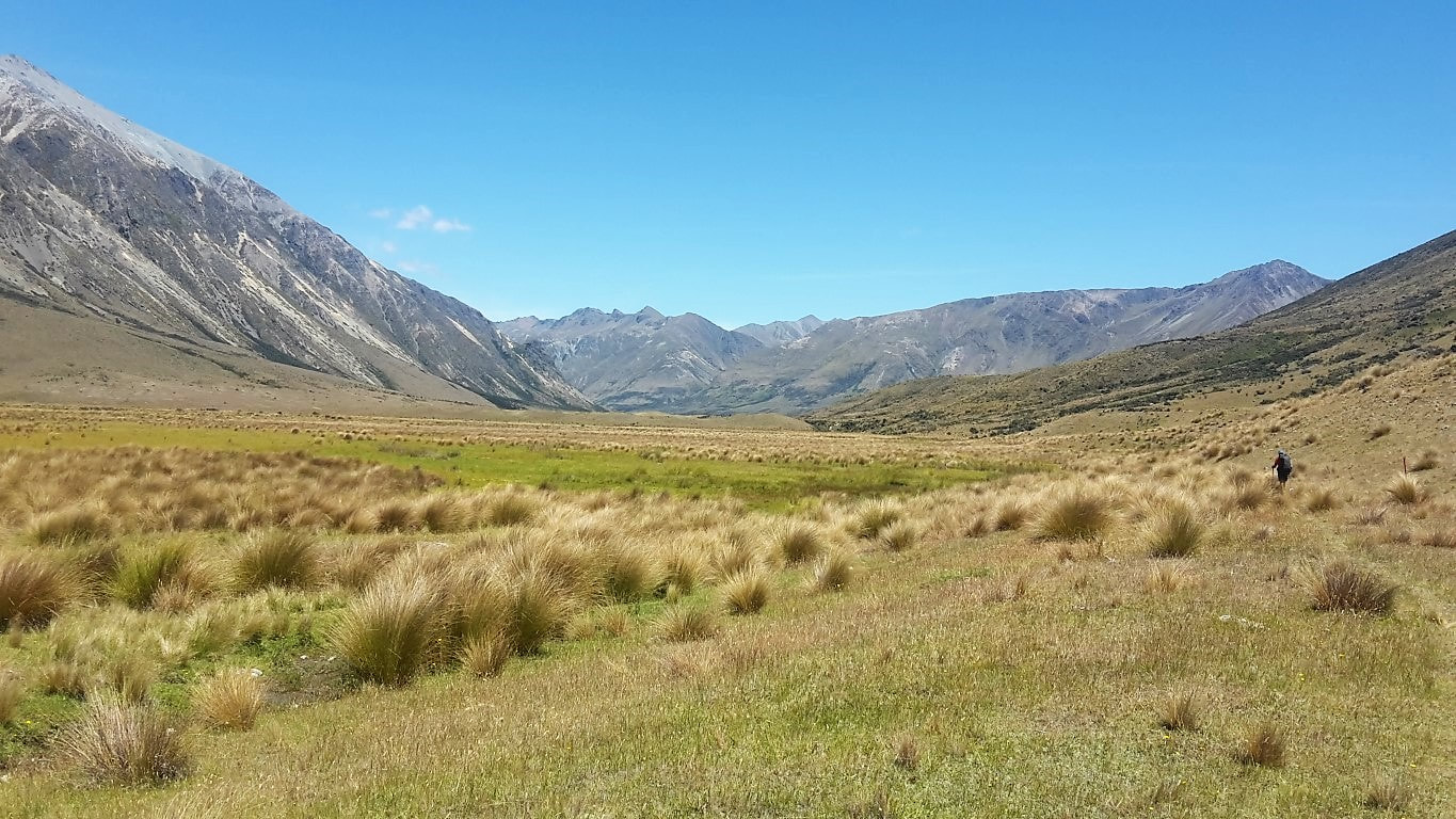 A little section of easier walking on the valley floor. 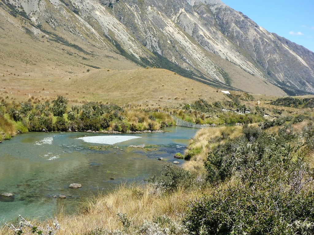 First glimpse of Boundary Hut. Also a substantial stockproof floodgate in the river. 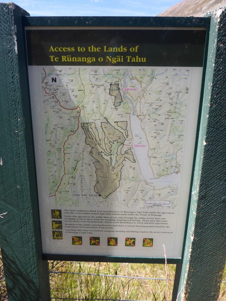 A fair bit of yesterday and today had been through Ngai Tahu lands. This was where we exited those, just before Boundary Hut. 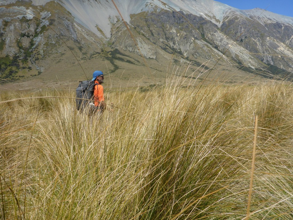 There was some pretty tall tussock to battle through as we neared the swingbridge.  B's different take on crossing a swingbridge :-) 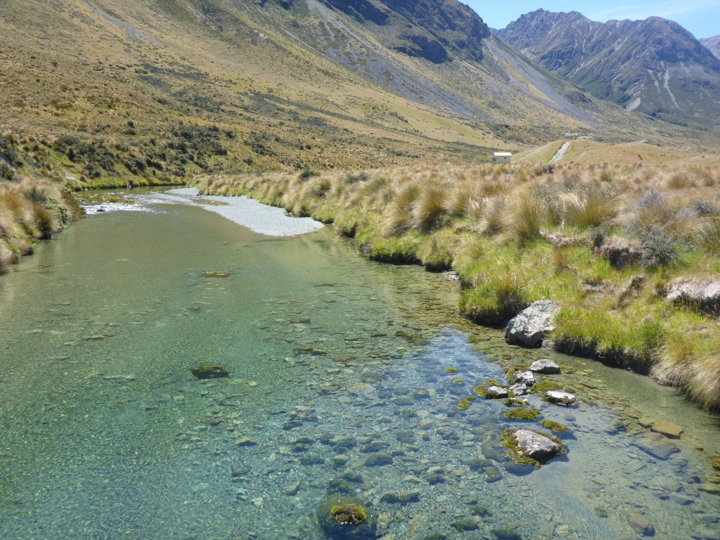 After the bridge we headed back 200m off trail to the hut. We rejoined the trail heading off towards Carey's Hut on a 4wd track and immediately ran into three guys on trail bikes - the only problem with getting so close to “civilisation”! The 4wd track comes as far as Boundary hut, with no vehicular access beyond that. It was only 6.5km to Carey’s Hut, but by now it was really hot so, with no shade, we started to feel the effects! At one stage I had even thought we could do another 10km to Mavora Lakes campsite but by the time we arrived at Carey's I was convinced it was a good place to stop for the day! The last 2.5km or so the track climbed above the Mararoa River on the hillside (up to 60m or so above the river at times), with a fairly sharp descent to the hut over the last little bit. David and Caesar had arrived a couple of hours before us as they are faster and don't stop much. They were lounging in the sun in a couple of deck chairs left at the hut! The hut is right beside the lake so the guys had already been down there for a “refresh”. B and I also took off down there once our packs were off. We both had a bit of a dip in the lake and rinsed out our clothes as well - walking in this weather is very sweat-inducing :-) We had a couple of visits from small groups of bikes - most of them are camped down at Mavora Lakes campsite. About 1800 we also had a couple of American nobos, John and Katie, drop in for a chat. They decided to push on the 1.5 hours to Boundary Hut and maybe try and get out to the Greenstone carpark the next day. So it was the four of us for the night in what is quite a pleasant 6-bunk hut. 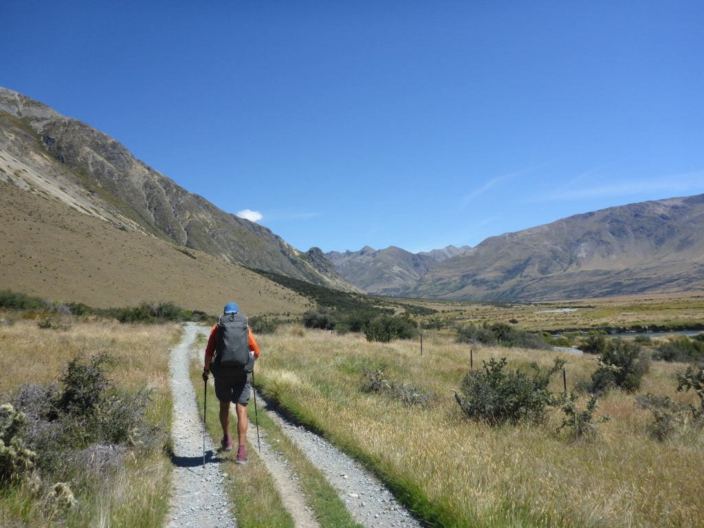 Not atypical of our initial track after the hut - although there were quite a few big puddles (made by 4wd traffic) on the track to get around in places. 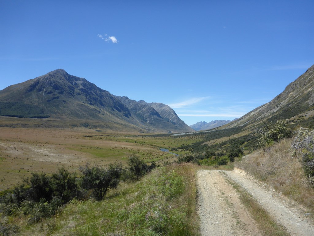 Climbing up above the river for the last 2.5km or so to Carey's Hut. 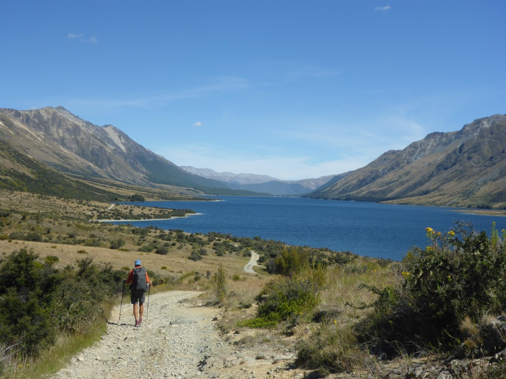 Looking down North Mavora Lake. Not far to go, as the hut is near the head of the lake. 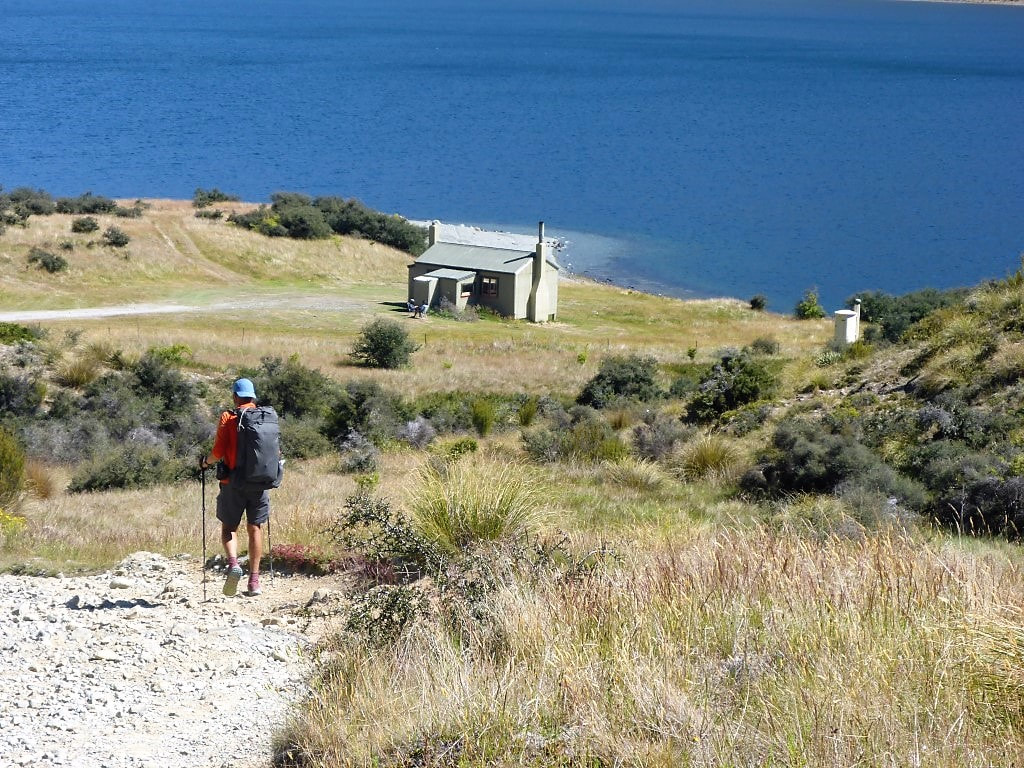 Dropping down to the hut. Could see the guys sitting in the sun! 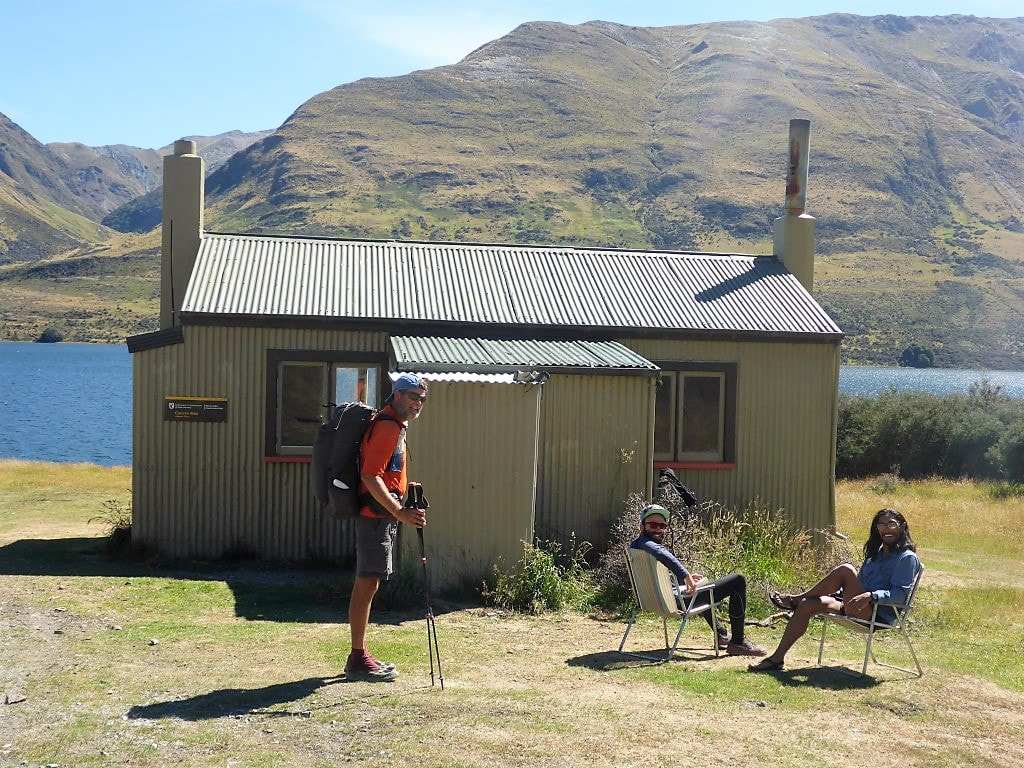 Sheer luxury :-) 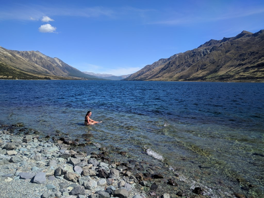 B taking a nice dip in the cool lake - very refreshing after a pretty hot day's walking.
1 Comment
We only ended up doing 14km of the trail today, from the lake edge (2km from the Greenstone carpark) up to Greenstone Hut. This took us 3h20 of walking time. The GPS track for the day is here. As noted in yesterday’s blog, the plan had been for Chris to drive us round to the Greenstone trailhead (about 1.5hr drive), so we were up about 0700. Unfortunately a family emergency during the night meant that Chris and Jane were not available, so the plan changed to us taking Chris's car around for Graham/Jane W or David/Liz to pick up later, as they were still planning to take the jet boat up to Glenorchy to do some runs up the Dart River. By the time we had loaded Chris's car (about 0920) Jane W had come across to say they were about to go so we might as well go in the car with them - so another change of plan!! With six of us in the vehicle and the jet boat in tow we set off for Glenorchy about 0930. Driving up, Graham noted that the lake was pretty calm so it was highly likely he could take us across to the Greenstone trailhead by boat rather than car - a great bit of variety for us compared to the usual walking or vehicles (and much quicker)! Having arrived in Glenorchy, the boat was duly launched and Graham and Jane took us across, dropping us off on the shore by Greenstone station at about 1130. The generosity was much appreciated :-) 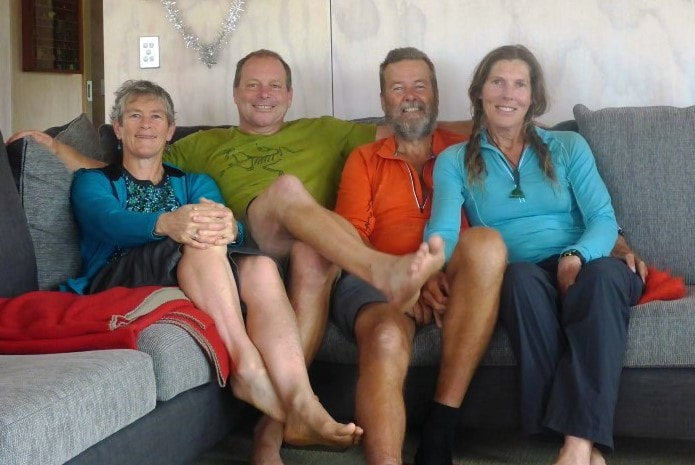 Just about ready to go, but not without a photo op with Jane and Chris :-) 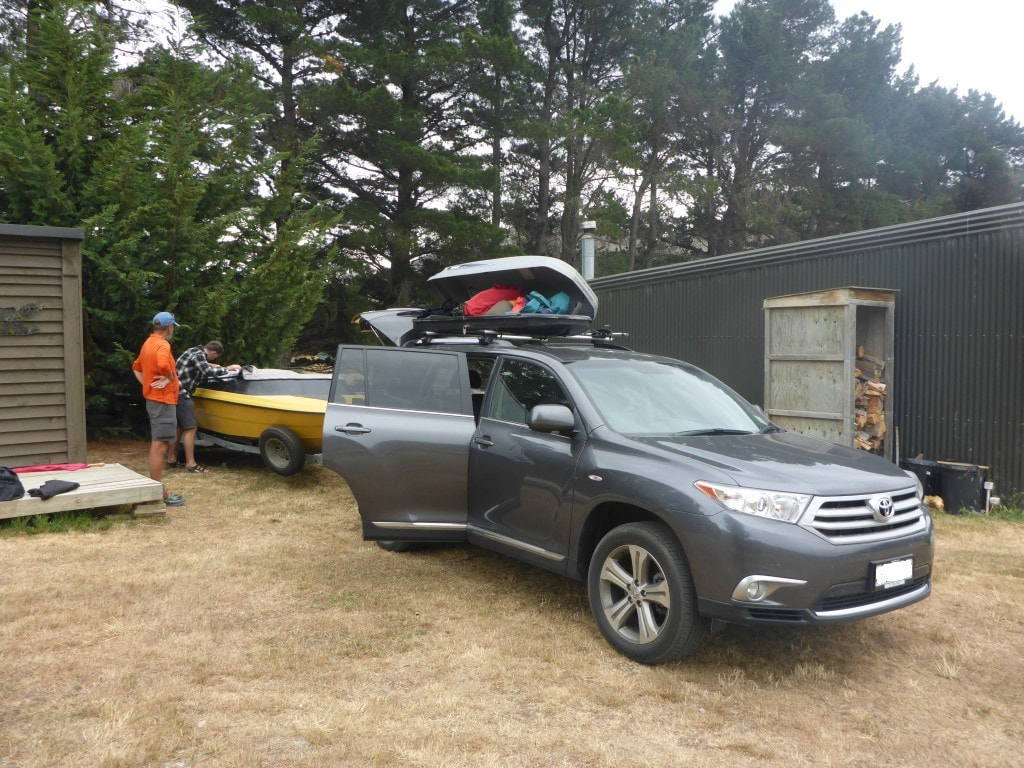 Almost ready to depart - Graham putting our packs into the boat for the trip. 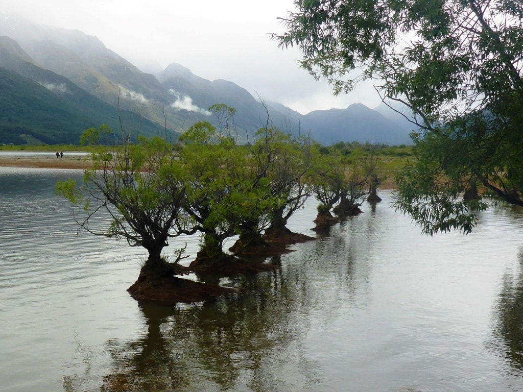 Trees growing in the lake at Glenorchy. 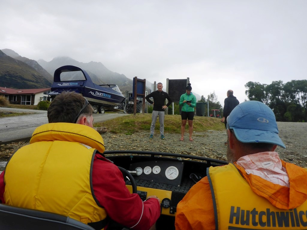 No room for Liz and David on this trip :-) 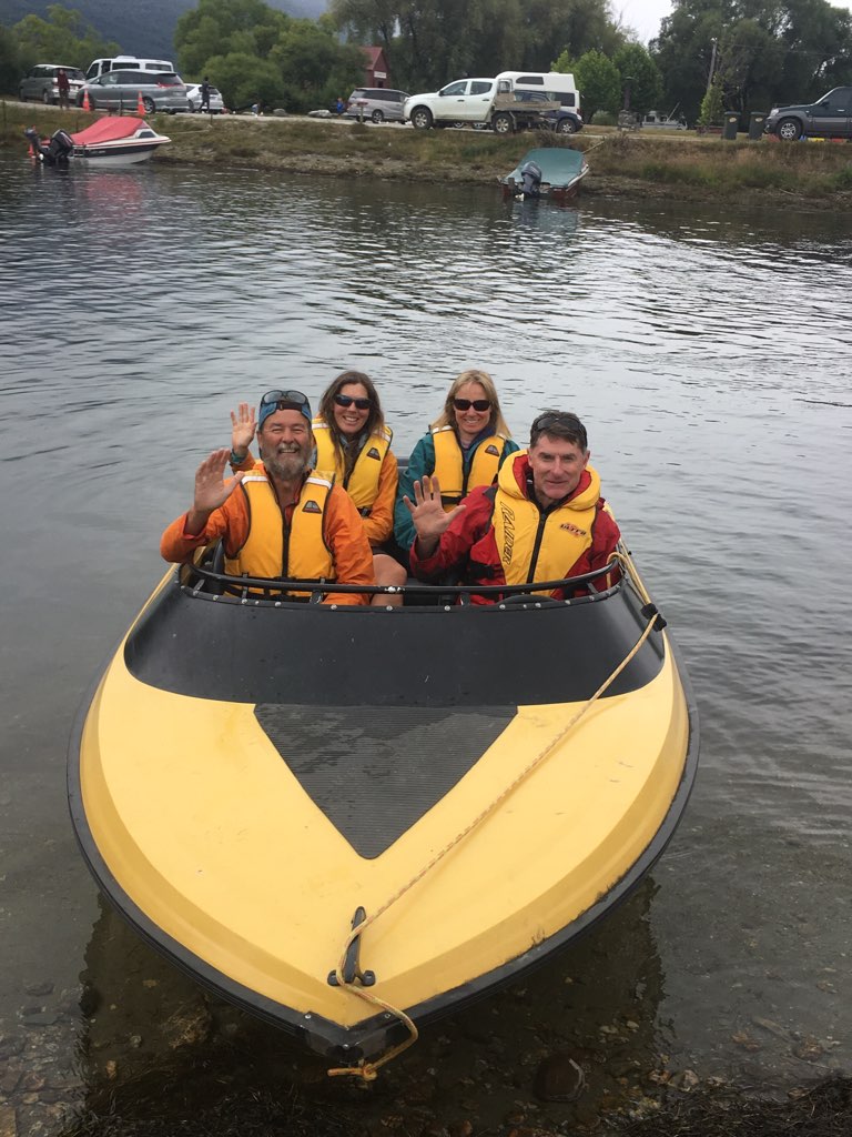 But Liz very kindly sent us this photo of the departure from the ramp. 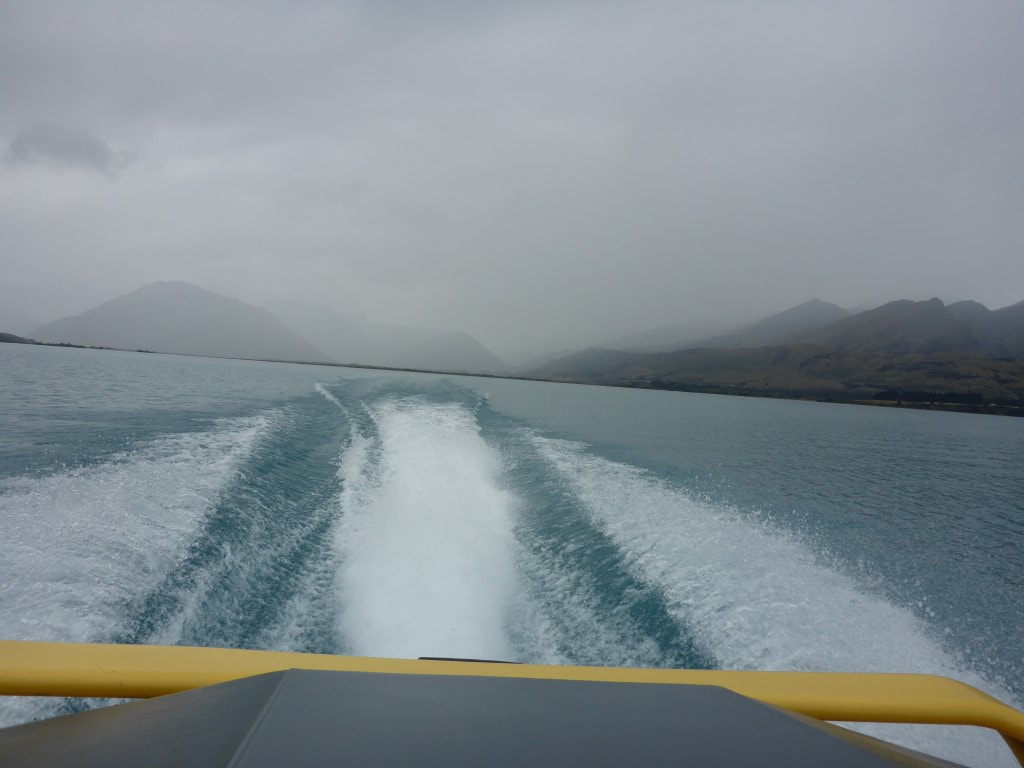 Speeding along. Looking murky back up the Dart and Rees River valleys.  Jane W and Graham about to depart after dropping us off. Thanks again for a real blast! :-) The trail notes say that the section starts at the carpark (2km up the road) but the GPS track has it starting at the lake edge where we were dropped of, so who knows?! Anyway, after a quick reorganisation we set off just before 1140 for the 2km walk up a nice, quite flat, gravel road to the carpark. It was a bit murky with occasional drizzle so we started with raincoats on. A brief stop at the carpark and we were on the track up towards Greenstone Hut. As part of the well used Greenstone-Caples Track (and as access to others) this was a pretty good track, well benched and surfaced most of the way to the hut. A lot of it was through beech forest, with the odd bit of more open pasture, all the time pretty much following the Greenstone River. There was a small amount of descent occasionally but essentially it was a nice gradual climb for most of the way. One highlight along the way was spotting another karearea (NZ falcon) sitting in a tree not far off the track. This was just before we reached the swingbridge across the Caples River just above its confluence with the Greenstone River.  Start of the 2km to the carpark - nice easy road to walk on.  Shelter / info at the carpark.  Very gentle, well-formed track :-) 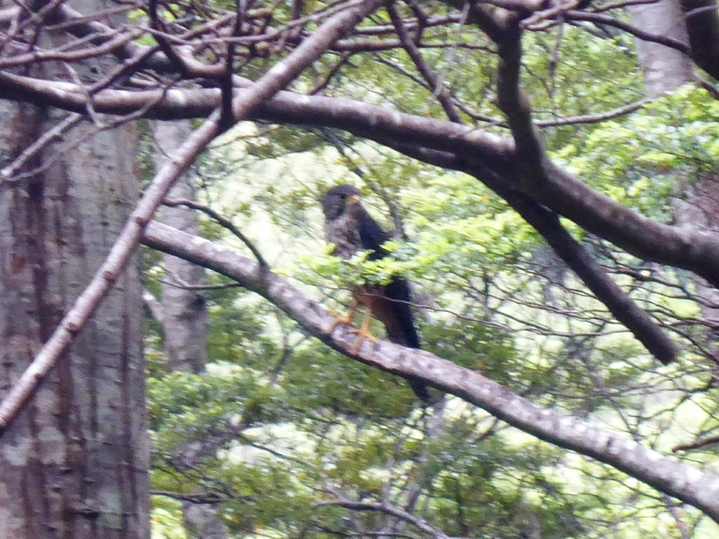 This was a surprise to spot in the trees!! 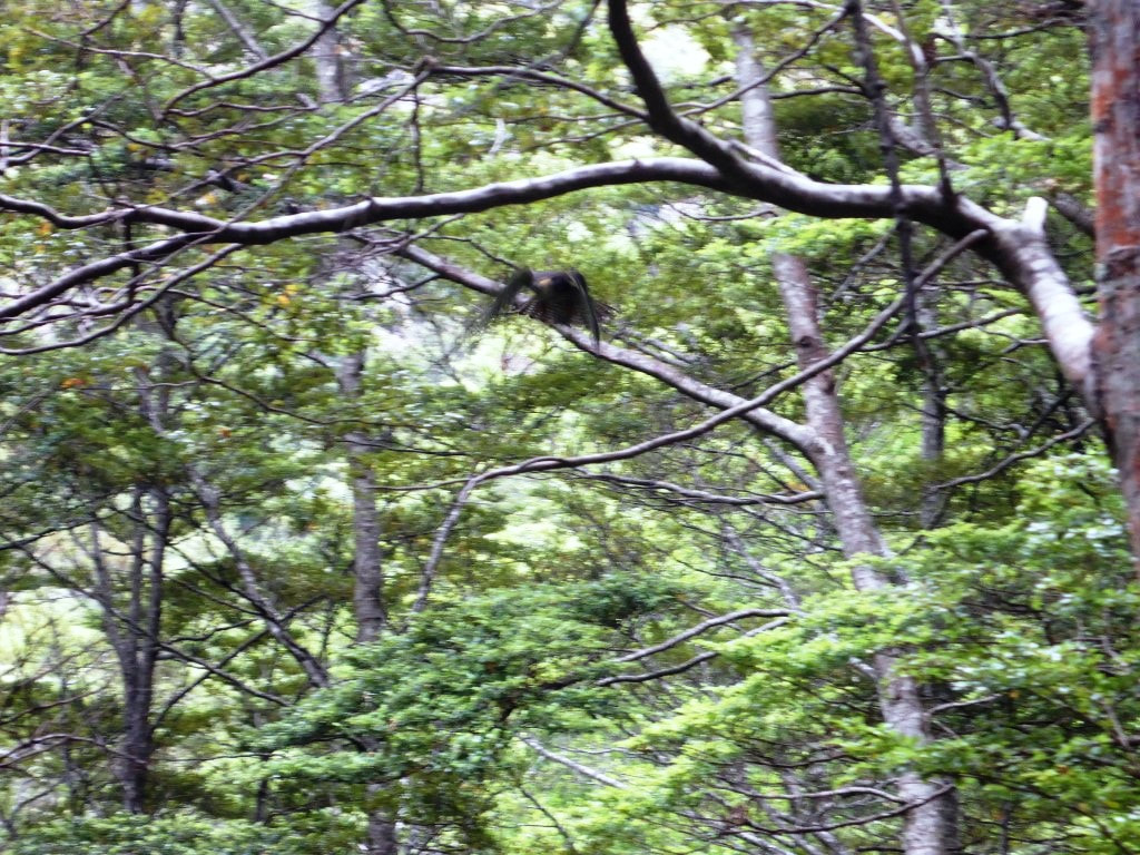 Taking off - camera not quite fast enough to capture a clear image in the low light unfortunately. 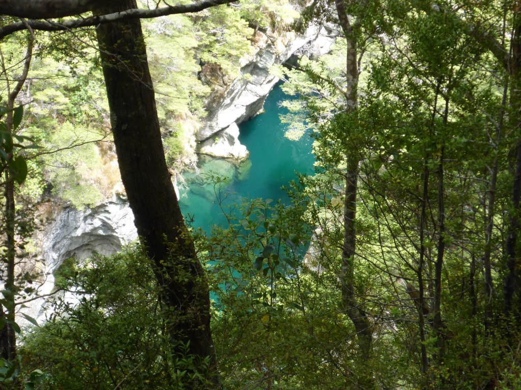 Beautiful clear pool below us. 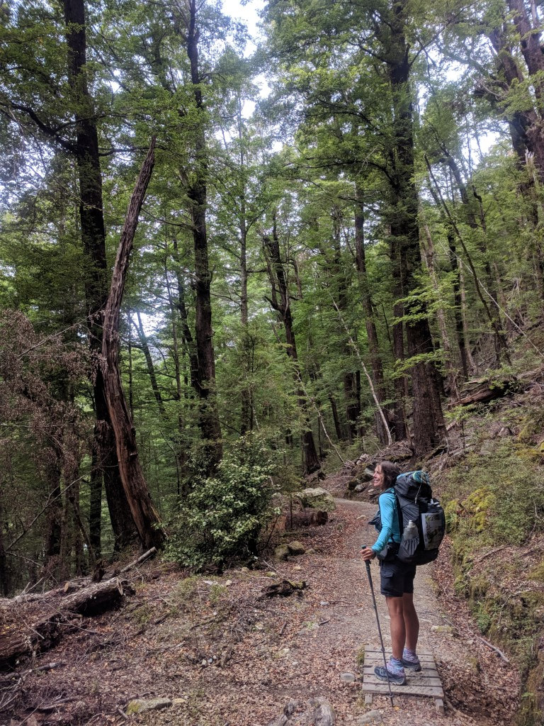 You know its luxury tramping when there is a small ramp over a tiny waterway :-) 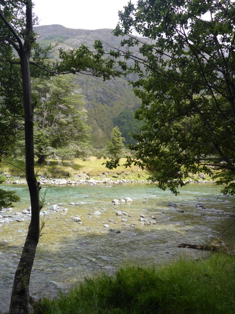 We dropped back down to the Greenstone near the swingbridge at the Caples/Greenstone confluence. 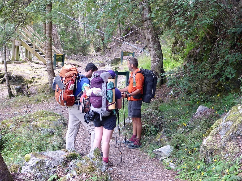 At the swingbridge - met a couple of young kiwis who were ontheir way out from the Caples/Greenstone Tracks loop. Then it was about 500m of more open walking before getting back into forest closer to the true left of the Greenstone again and continuing up the river. Most of the rest of the walk was in beech forest apart from a km of more open flats starting about 5km from the hut. It is a pretty walk, and the quality of the track underfoot makes it very easy to enjoy. My foot was going surprisingly well considering how sore it had been the last week or so - so that was a plus. B was feeling a bit off her game today after a rest so we decided we would stop at Greenstone Hut (a relatively new 20-bunk hut) rather than try and push on an additional 10km to Taipo Hut. That took the pressure off and allowed us a pleasant unrushed stop for the later afternoon and evening. David had also decided to stop here as he had found that a previous tramping companion, Caesar from California, was also here, so we caught up with him again. The hut was pretty full, as expected, with several tents set up outside as well but we found a bed each in one of the bunk rooms. Had some lovely chats with a number of the people in the hut, including Jim and his wife Sue. Jim had done heaps of mountaineering in his life and had lots of local knowledge (despite being from Auckland!) and regaled us with some fascinating stories of climbing and tramping in the south!! Despite it being New Year's Eve, we were in bed by about 2115! Hut etiquette and tiredness rule over New Years Eve celebrations out here :-) 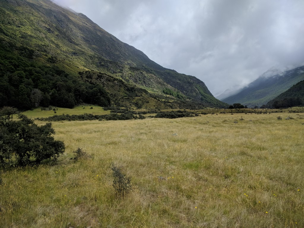 A little bit of open walking for a change.  Someone had taken the time to build a little "shelter" :-) Although it wouldn't keep any weather out! 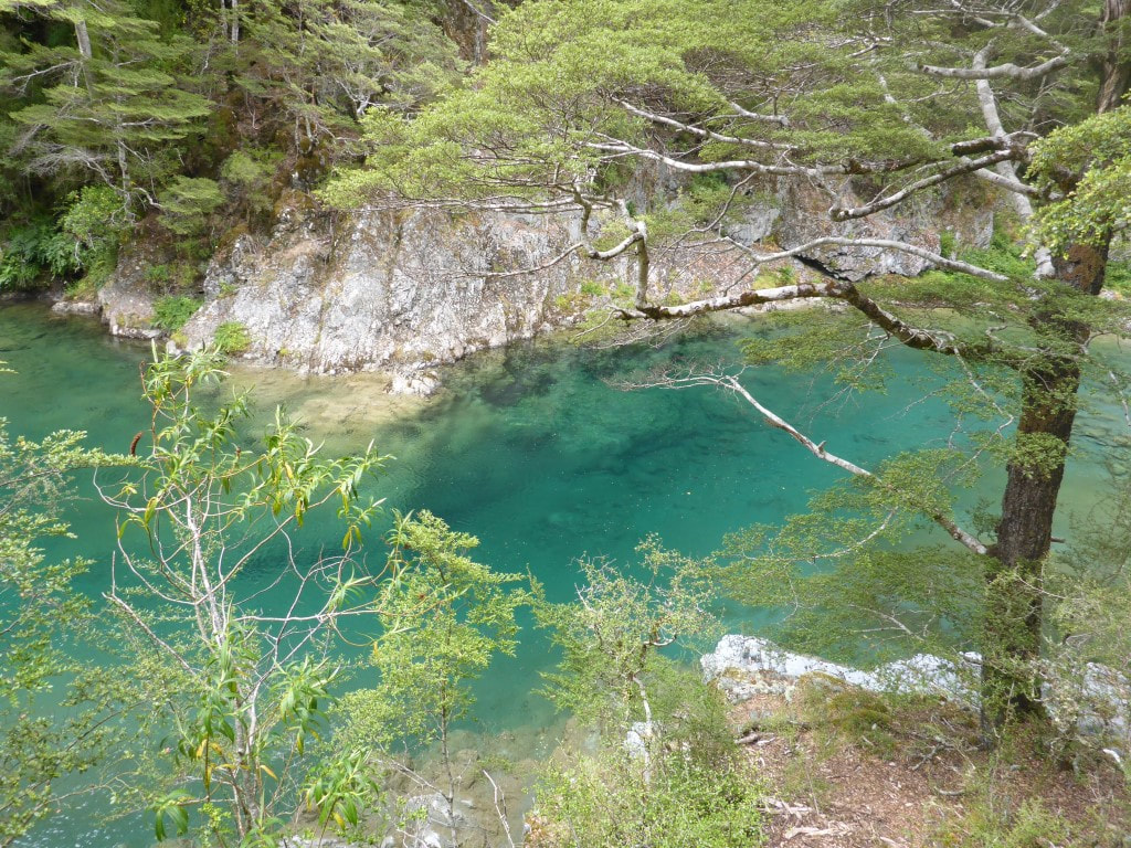 Another lovely deep pool below us along the way. 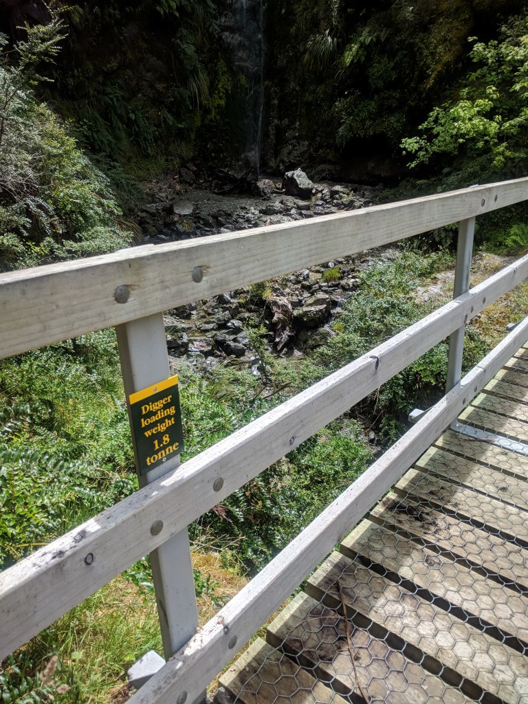 I couldn't resist! Anywhere you can take a 1.8T digger, guarantees a very nice wide track!! 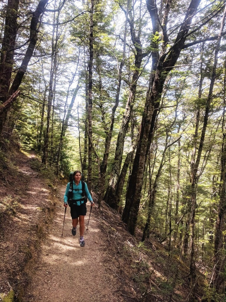 You could almost walk this with your eyes closed :-) 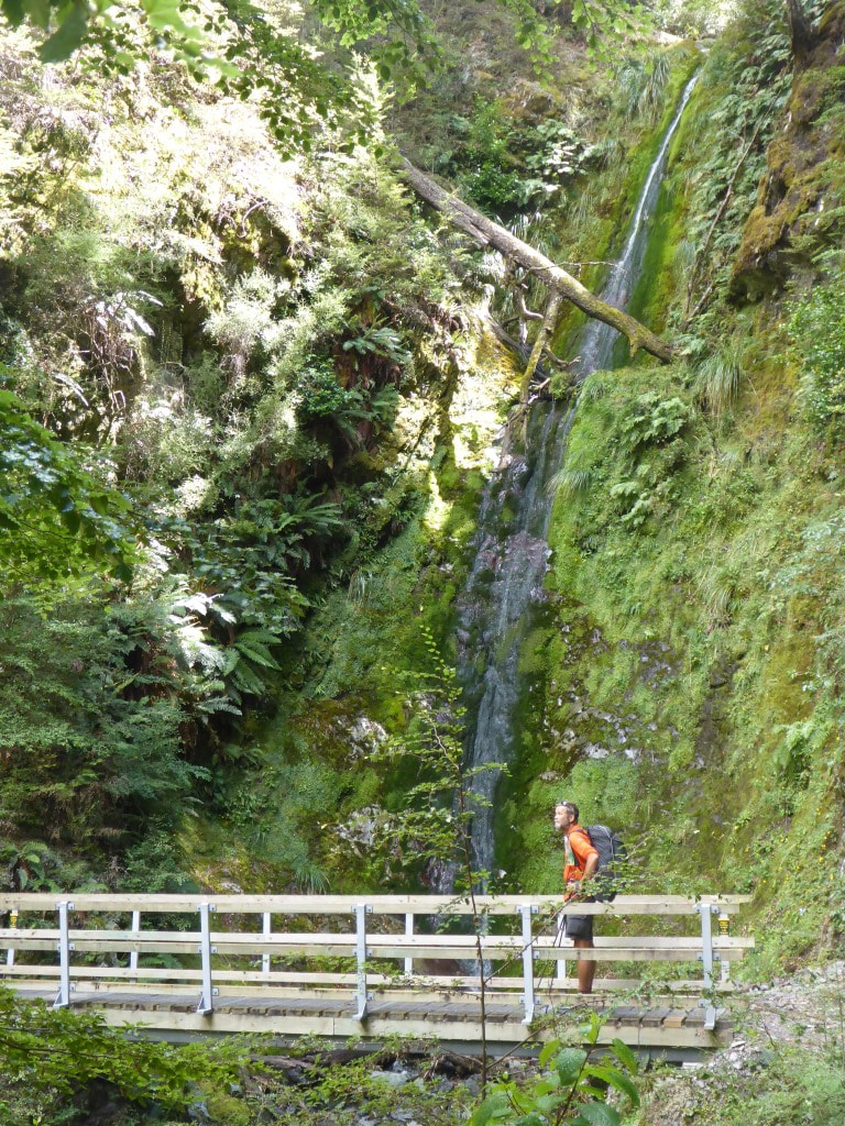 Nice waterfall - and another 1.8T bridge. 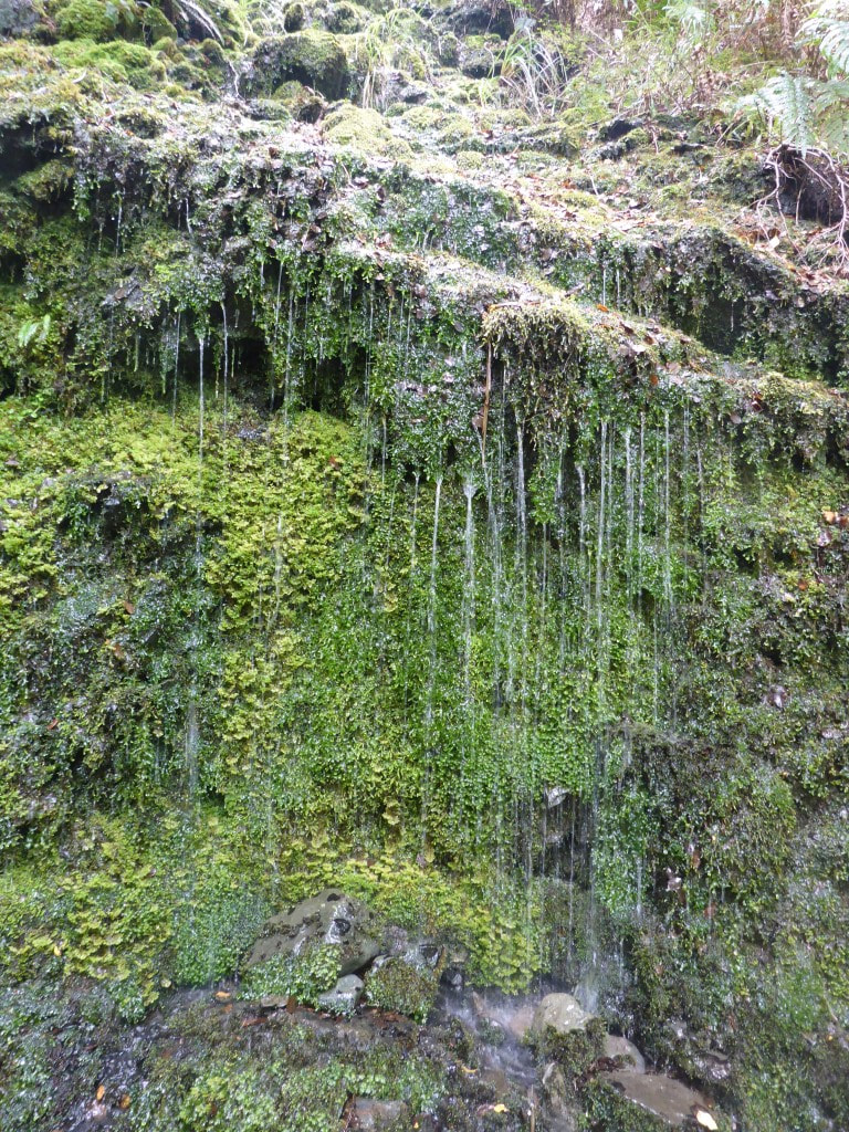 Water everywhere. 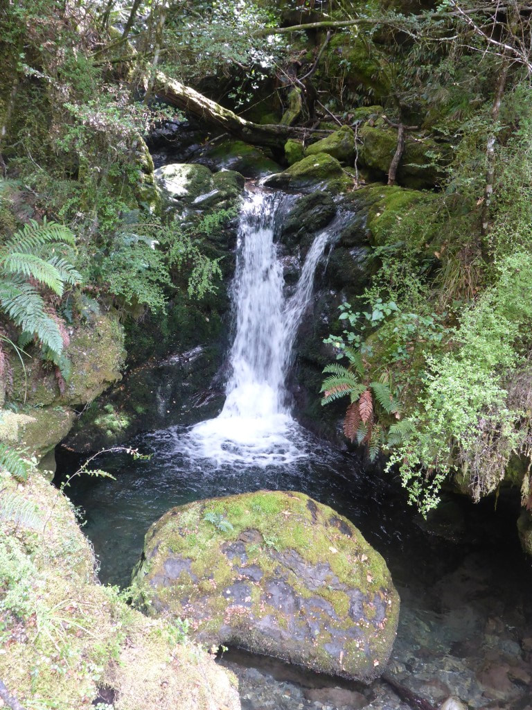 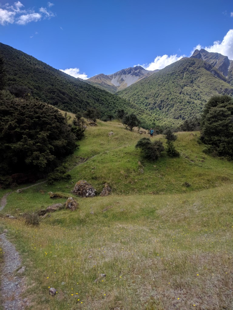 More open - path not as wide but still good going. 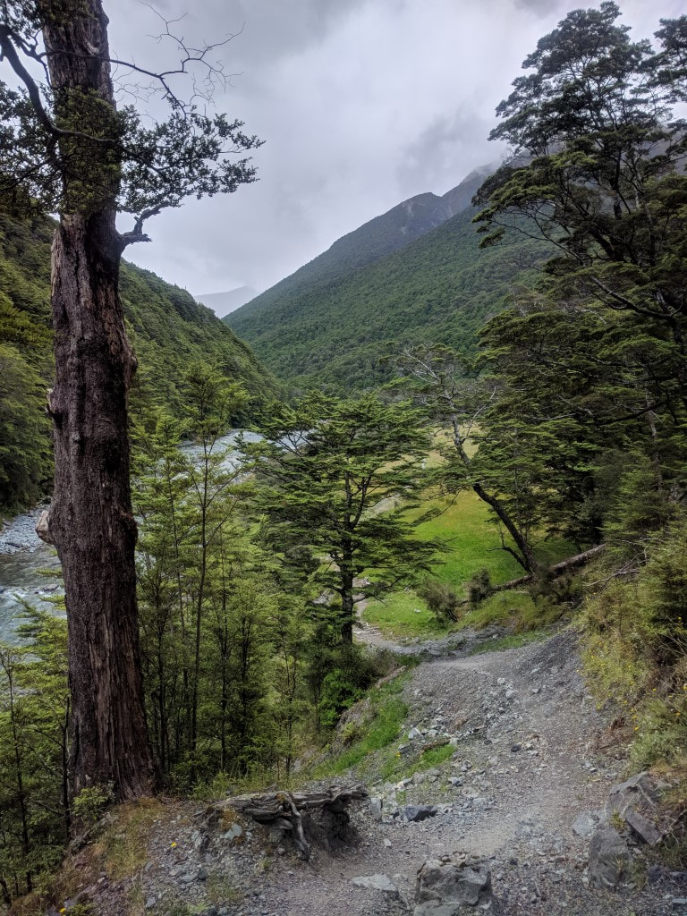 Continuing up the Greenstone. 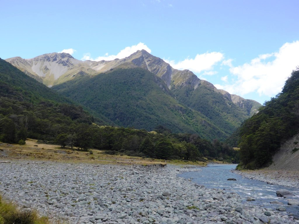 We did have to walk across one bit of riverbed! 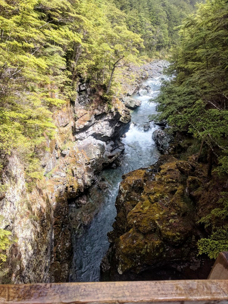 A deep gorge, but bridged. 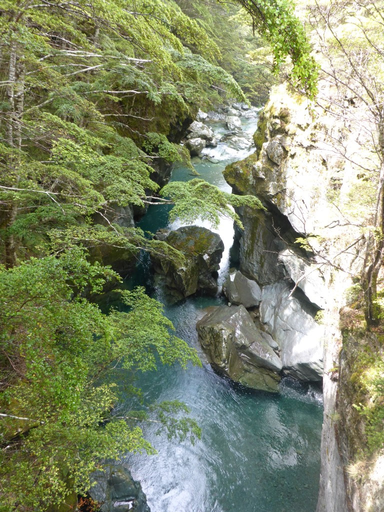 Another impressive gorge, nearing the hut. 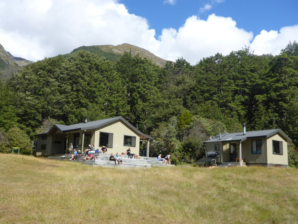 Greenstone Hut (with hut warden's quarters to the right). 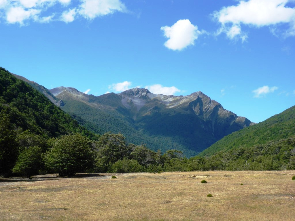 Looking back down the Greenstone River valley from the hut verandah. The hut is about 50m higher than, and a little away from, the river. 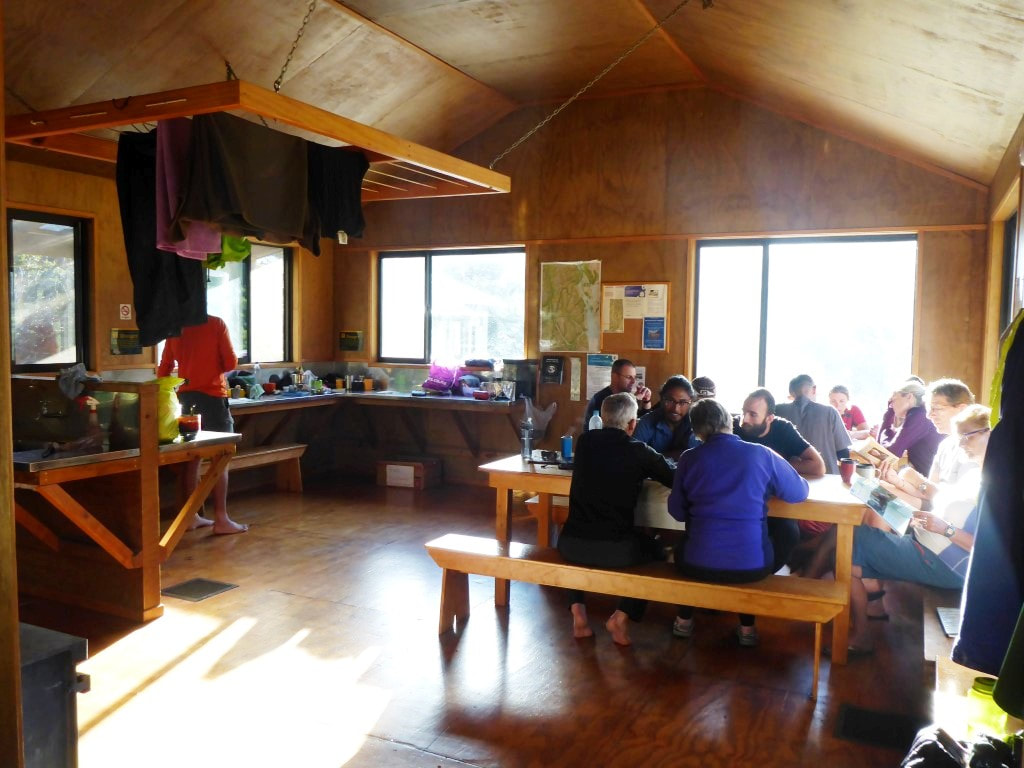 Some of the people for tonight - most will be going a different direction to us tomorrow! Jim and Sue closest with backs to camera, talking with Caesar and David. Today was a great chance for a rest in idyllic surroundings! My foot was really sore and I was hobbling pretty badly!! That was my excuse to put my feet up for most of the day :-) I did, however, finally managed to get some blogs done - I still couldn’t get WiFi Direct to connect the phone and camera but could connect both to J & C’s WiFi network and transfer photos that way. Nothing is ever as simple as it should be. The others headed off for a day’s cycling up the Arrow River track - Jane S apparently persuaded Graham to head over Big Hill with her while the remainder, I believe, went up the 4wd road we had come down the day before yesterday!! No rest for the wicked. Along with a bit of rest, Belinda had a great time harvesting produce - including apricots, cherries, raspberries, blackcurrants and redcurrants. It's amazing to have all these things growing on the property - Jane and Chris are amazing the way they have such a broad range of produce growing, especially with the busy lives they lead! After everyone was back, Jane was convinced my deep blood blister should be lanced!! I finally decided to consult our son Gray who assured me that, in theory at least, it should disperse - and that opening it up might be OK if I could keep it clean (that wasn't going to happen!) - so I decided not to accept Jane’s kind offer of surgery!! We had a lovely dinner with the whole group - it is always great to meet interesting new people and share stories :-) The plan for tomorrow was that Chris could drive us (a long way!) around to the trailhead at the Greenstone carpark. The others were thinking about taking the jetboat up to Glenorchy to spend some time doing trips up the Dart River, but were likely to be going later in the morning. With that plan set we headed off for another night’s bed sleep before it was back to tents and huts for a few days!!  Assistant blog editor. The most chilled out cat you will ever meet :-) 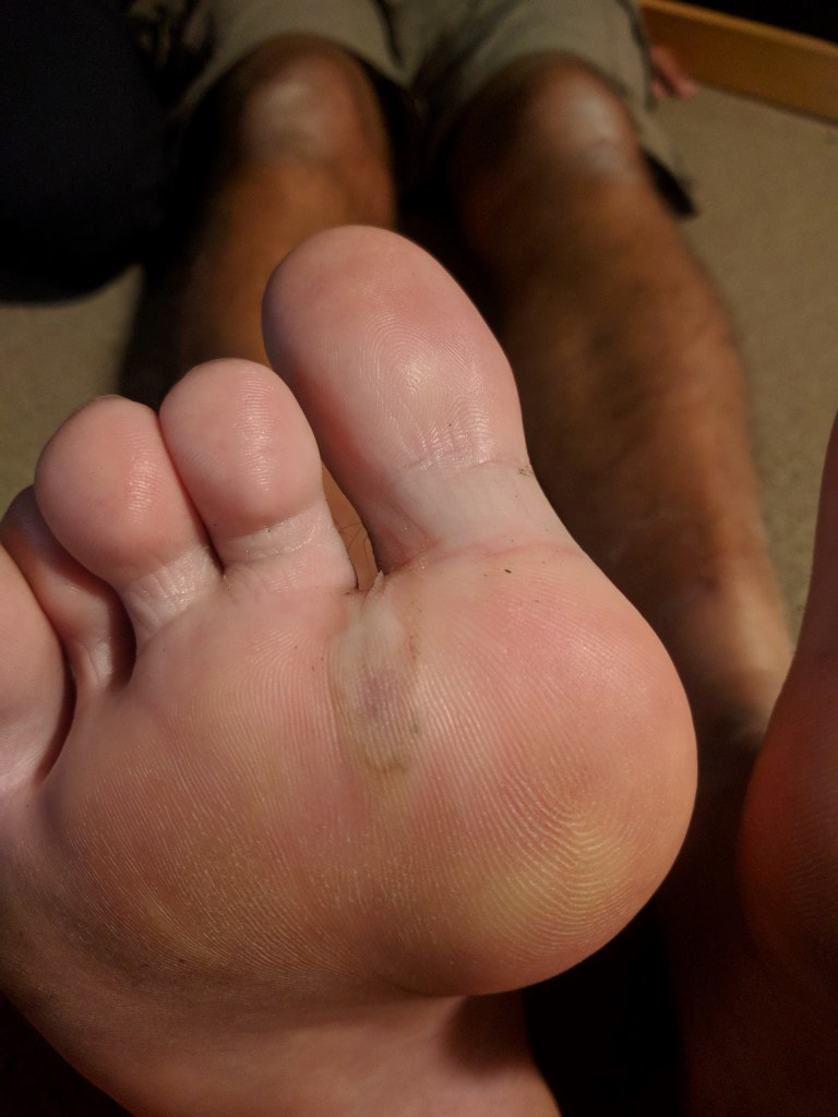 Scary, I know - but that is the offending spot on the foot that is causing issues! Today was our “slack pack” day where we were leaving most of our gear at the camp for later pickup. The office didn’t open until 0800 so we planned a departure after that, as the day is basically flat and not too strenuous!! The day turned out to be just over 24km in a leisurely 5h30 of walking, leaving just after 0800 and arriving at the official finish on the Queenstown waterfront at 1440. The GPS for the day is here. There isn’t really a lot to say about today - hopefully the pictures will tell the story. In summary, today was a mixture of some road/footpath walking and some cycle/walking trail walking. We headed out from Arrowtown and walked through parts of Millbrook before heading toward Lake Hayes. After that we followed the Queenstown cycle trail to the historic bridge across the Shotover and from there around the river for a short while before heading up into the Frankton industrial area. 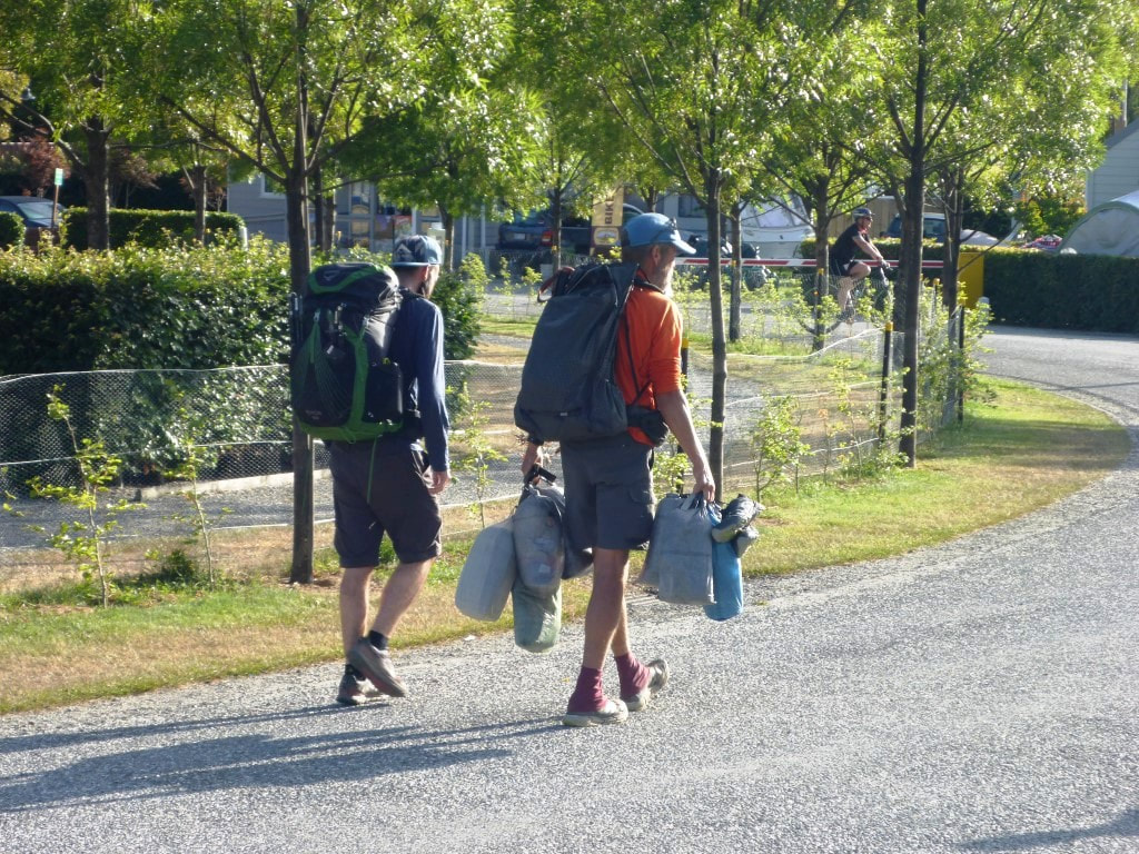 Walking to the campground office with the surplus gear :-) 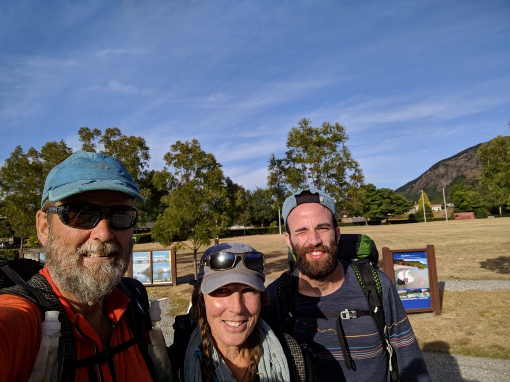 The team for the day leaving the campground. 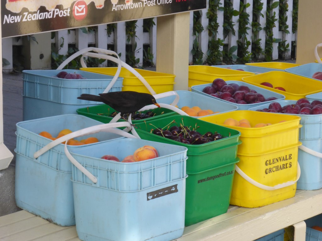 Its not just humans that appreciate fresh cherries and apricots! 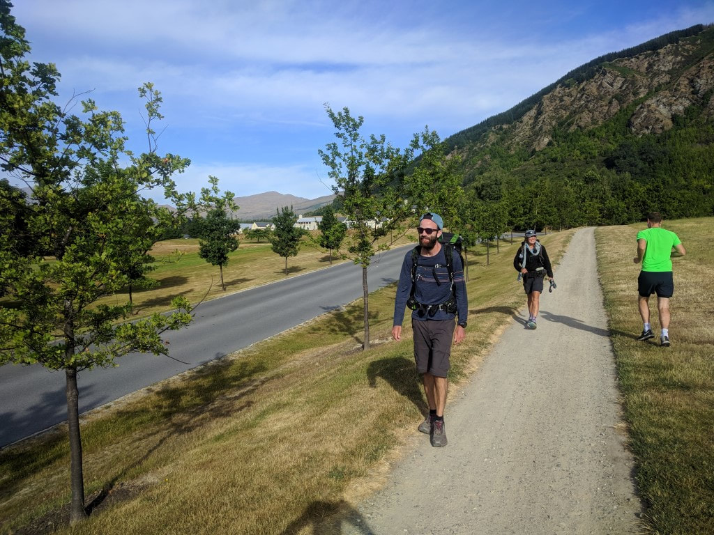 Entering Millbrook Resort. 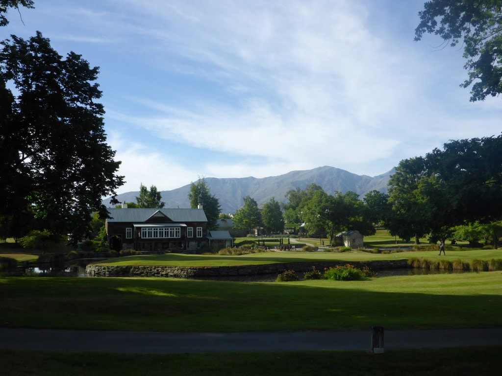 Immaculately maintained - part of Millbrook.  B absolutely loves all the local stonework - this is just one of many photos :-)  Heading down toward Lake Hayes.  Bits are still farmed, but for how long? The land is probably worth a small fortune. 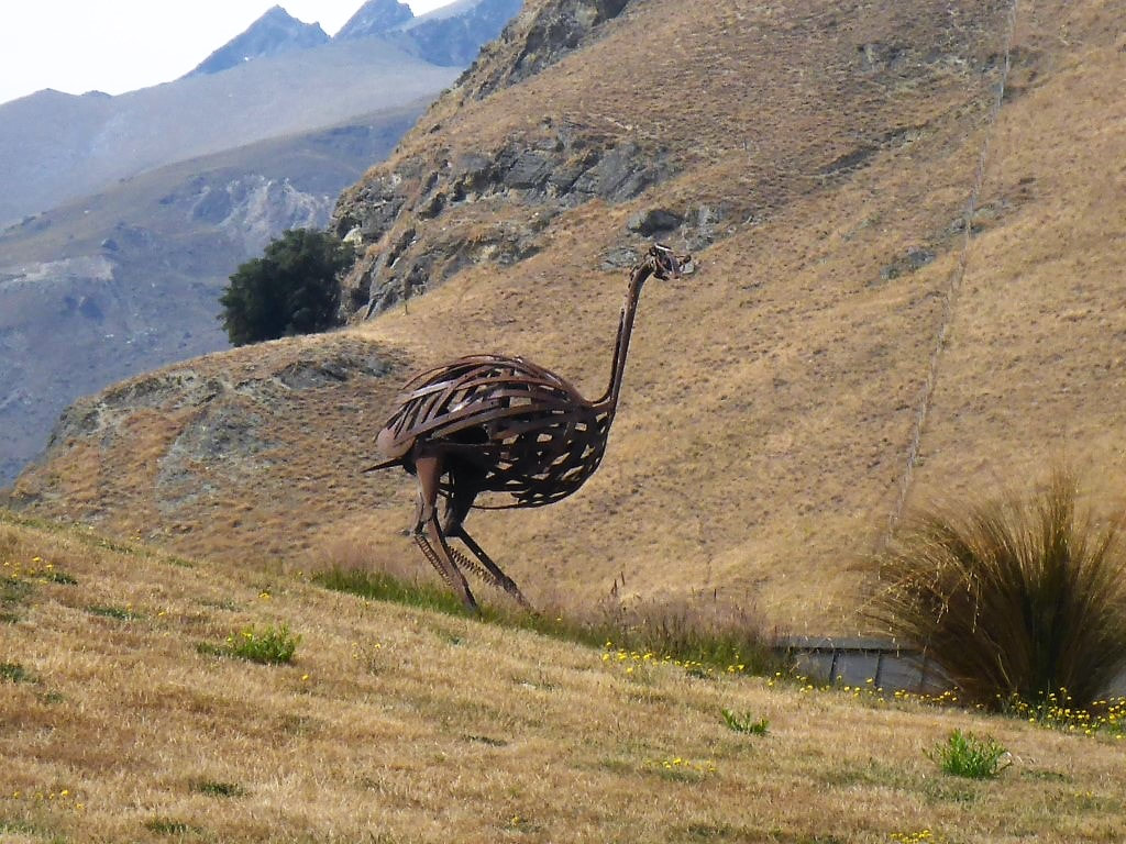 The metal moa. 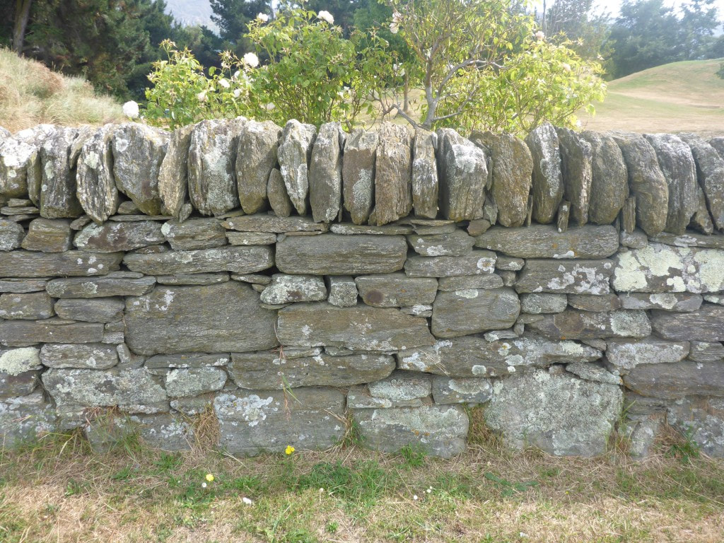 B likes the stones for fencing as well. 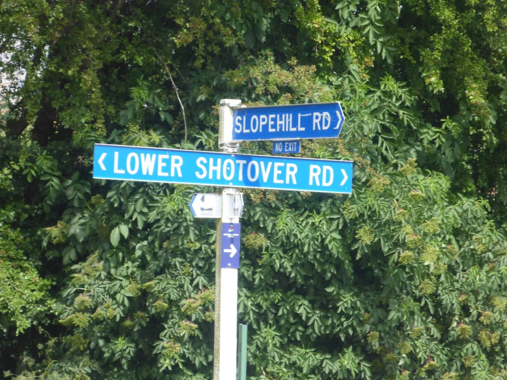 Haven't seen one of these white TA signs for ages. But there wasn't always agreement between the signs, the notes and the GPS track!!  Some entertainment in the letterbox department. 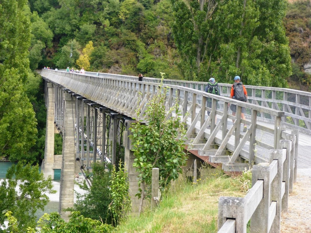 The restored historic bridge over the Shotover River - foot traffic only now. 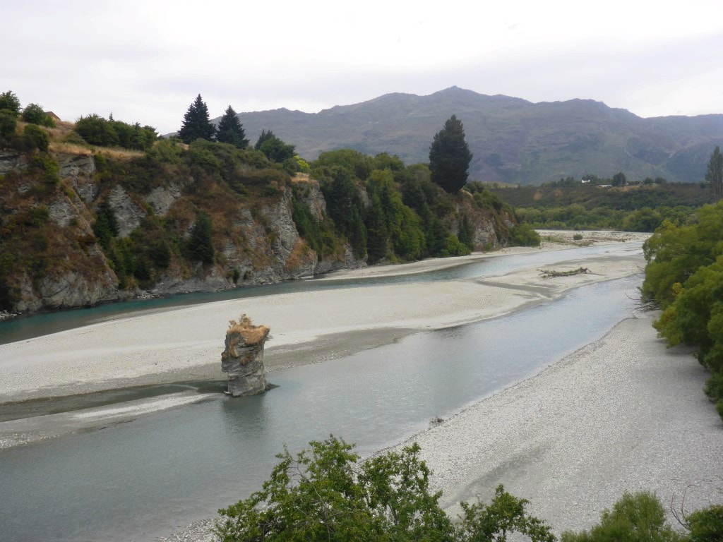 Odd rock outcrop in the middle of the Shotover. A little time was spent through the Frankton commercial area and near the main Frankton Rd before we crossed the Domain and ended up on the Frankton walkway/cycleway that took us around the lake edge (actually around the edge of Frankton Arm). 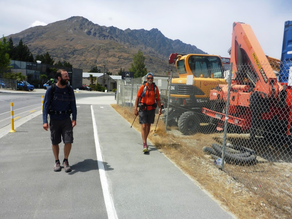 A bit of walking through the industrial area. 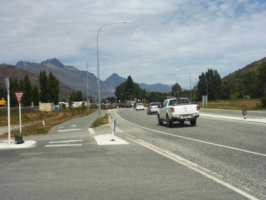 A short section alongside the road ........... 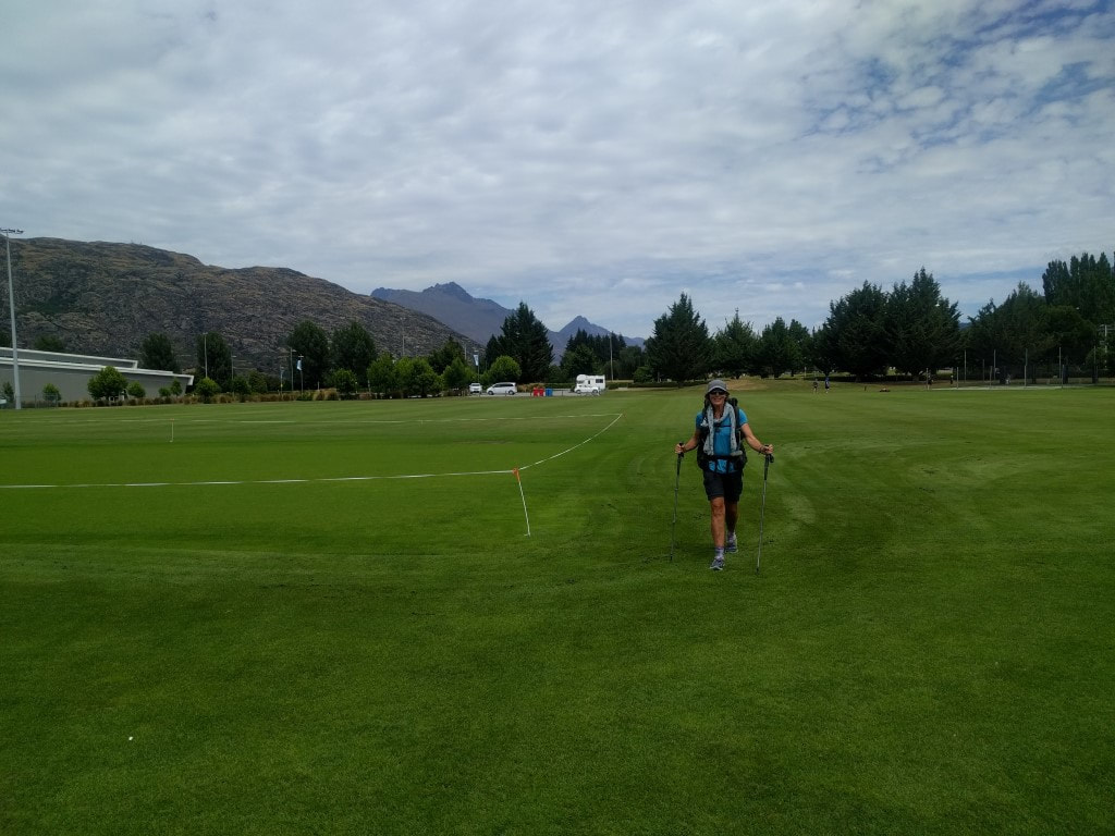 ...... then some on lovely grass through the domain ........ 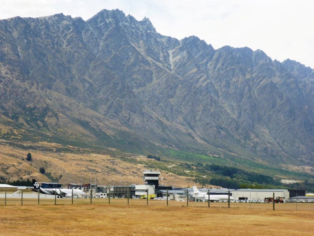 ..... past Queenstown airport ........... 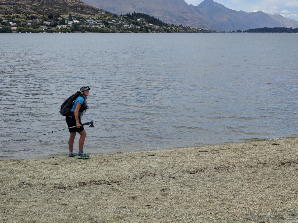 ...... and finally to the lake edge on Frankton Arm. 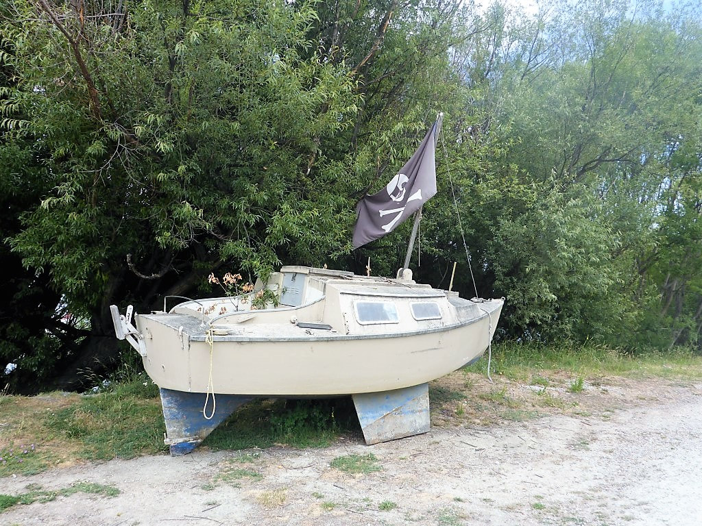 This pirate ship is somewhat land-bound!! 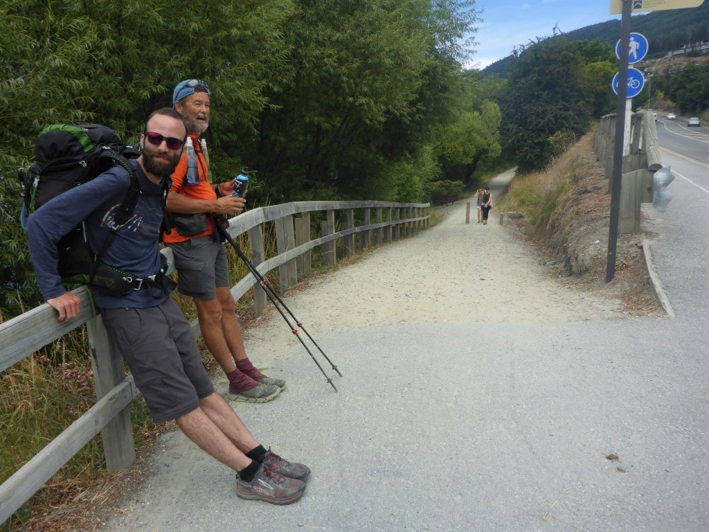 The cycle/walk trail keeps you off Frankton Rd (SH6A) which is great. 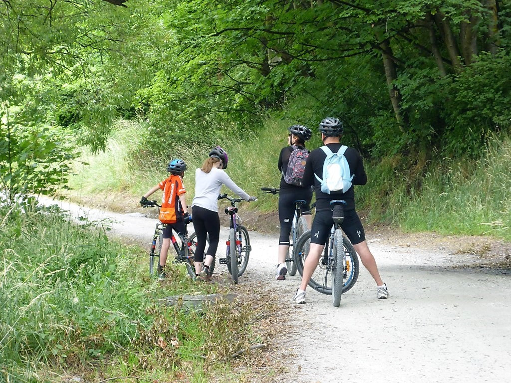 Family outing. The path is well-used by cyclists - a really quick way to get into town from Frankton. 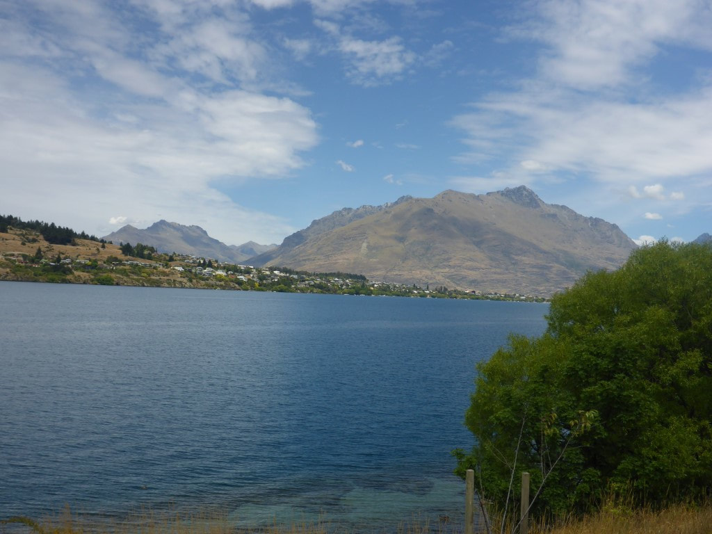 Looking down Frankton Arm. 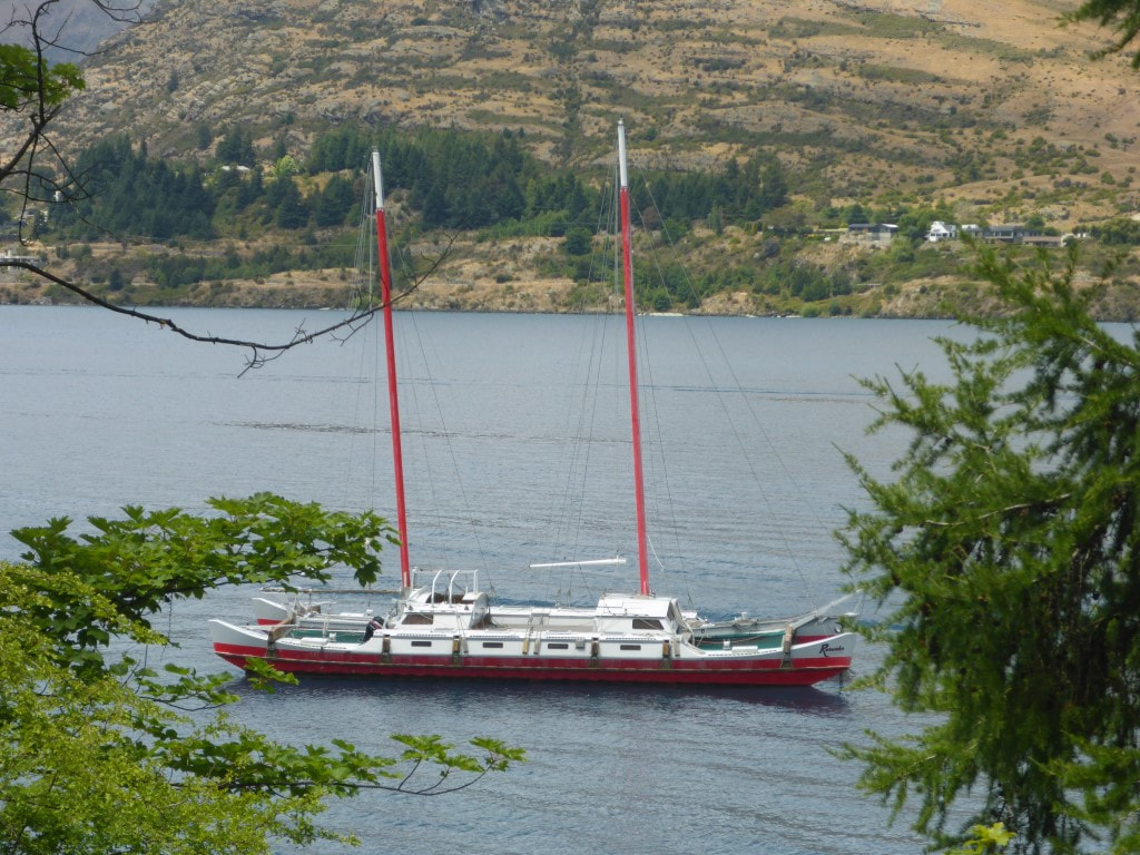 That's a large catamaran to have been trucked in by road at some stage! 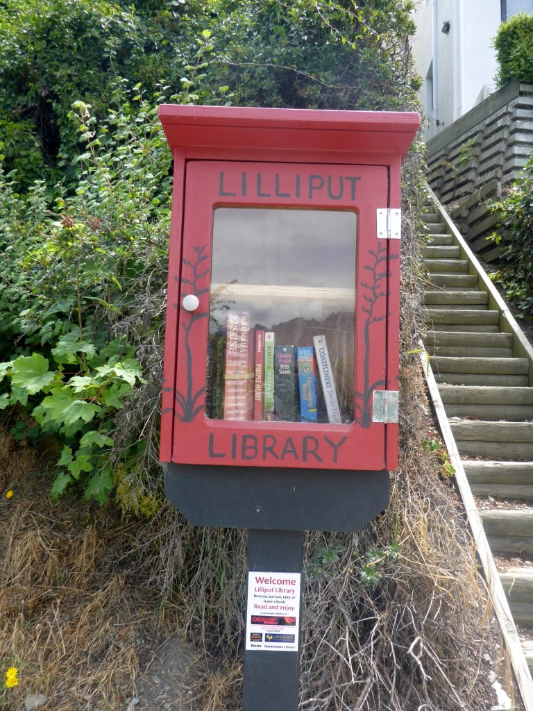 B found this quirky little book lending spot :-) 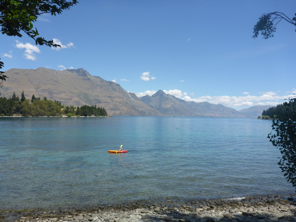 Looking at where Frankton Arm joins the main body of Lake Wakatipu. Great day/spot for a paddle. Finally we arrived into Queenstown central, including a short section down through the Botanic Gardens before walking down the waterfront to the "finish line"!! David headed off to his hostel and B and I headed into the centre of town for a feed! It didn't take long before we had had enough of town and were ready to head out :-) One of Jane and Chris’ friends, (another!) David (down from Auckland with partner Liz and staying at Jane S and Chris’ with another couple, Jane W and Graham from Chch), was out and about in Chris’ vehicle and had been assigned the task of picking us up (!!) so we were in contact with him. He was nearby so kindly offered to pick us up in Queenstown (our original plan had been to taxi out to Frankton, resupply, and get picked up from there). The pickup was successful :-) and David took us out, through the manic traffic, to the Frankton shopping centre so we could restock at the supermarket and, from there, back to Arrowtown to pick up our gear before heading out of town to Jane and Chris’ place at Gibbston. We had also stayed with these guys just before Xmas last year when we were on an injury-enforced break from our nobo attempt and, as always, really appreciate the hospitality provided in this gorgeous spot!!  Into town on the lakefront.  The view from there.  David assured me this was the end of this section - I'm a trusting soul :-)  Couldn't resist a picture of the late lunch in central Queenstown! 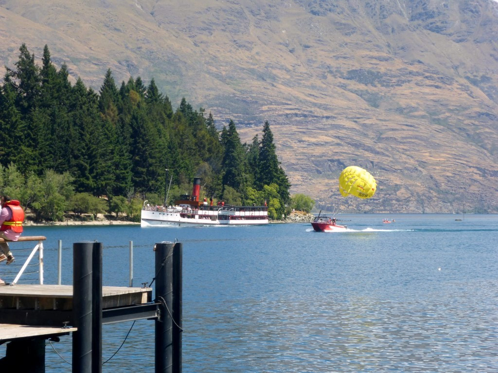 The TSS Earnslaw coming back to its berth. Lots of tourist activity on the water! Got up at 0600 with a bunch of others, including Bruce and Chris, and got away about 0715. Today turned out to be almost 25km in 7h45 walking time. The GPS track is here. Bruce and Chris headed off northbound to Highland Creek and beyond. We really enjoyed meeting them, and hope to catch up with them again sometime in the future. Our sobo journey took us pretty much straight into a 540m ascent to Roses Saddle - initially a bit of a zigzag partly on an old farm track, then into some direct ridgeline climbing. Even with our usual regular micro breaks we were at the saddle after 1h15 - pretty much all downhill (I'm generalising!) from here. It was a fine sunny day, although cool to start, and we stopped after 15 minutes to strip off as we struck the sun! Across the top the wind was quite cool so we just kept pushing on to warm up. After 2 hours we stopped for our regular snack break in a nice little sheltered basin. 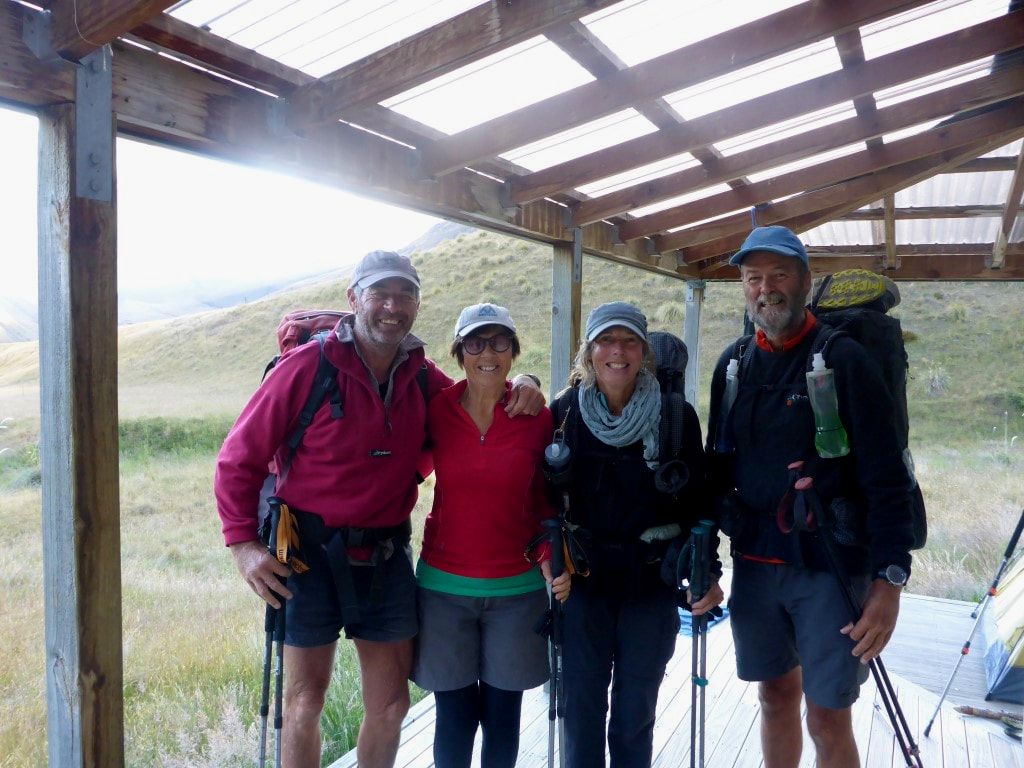 With Bruce and Chris, about to depart. 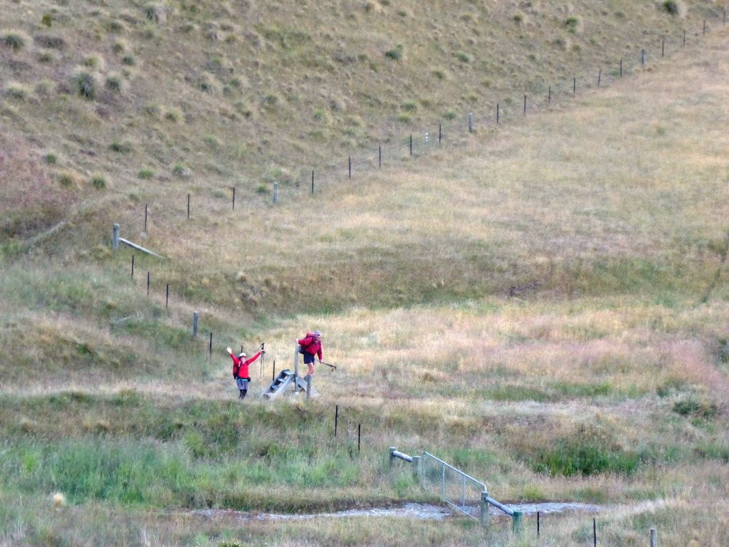 Off northbound! 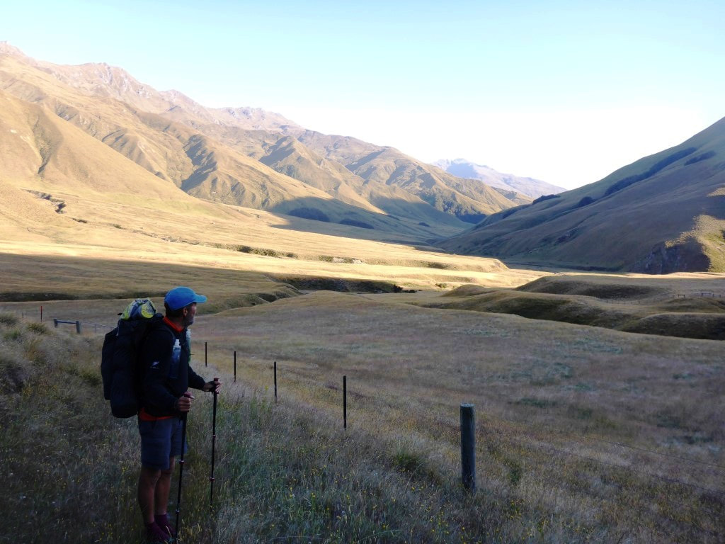 The way we came yesterday. Bruce and Chris by the river about to start up the ridge. 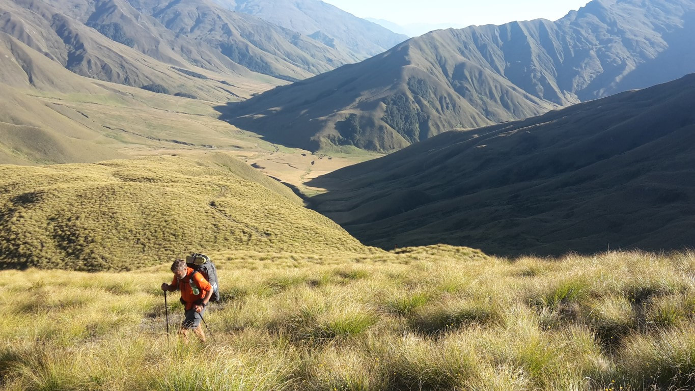 Heading up our ridge with the hut and Motatapu valley behind us. 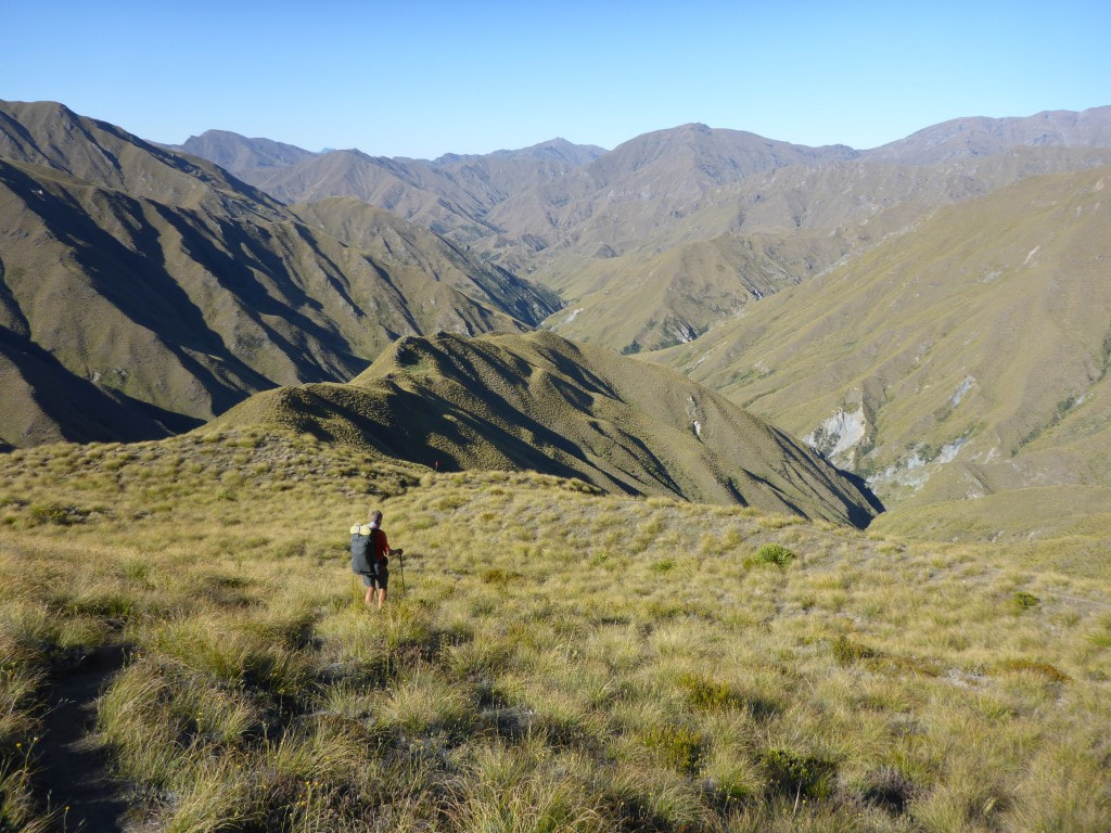 Already over Roses Saddle and heading down. 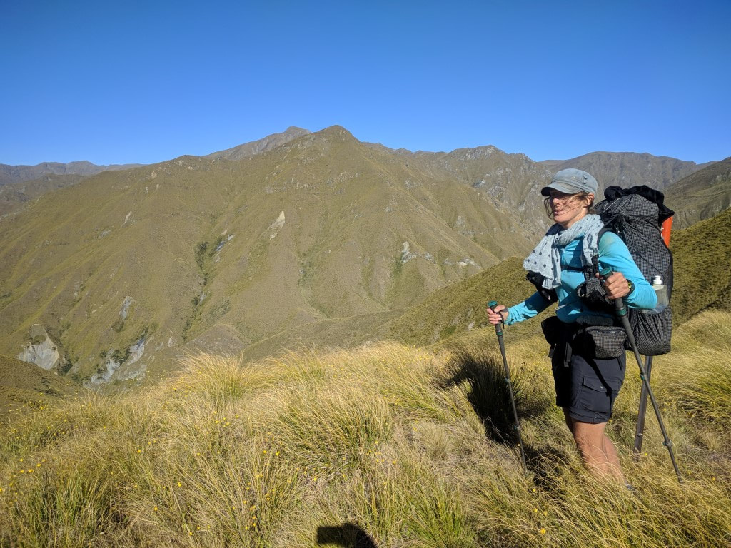 Absolutely looking the part :-)  Not unlike bits of yesterday and the day before! From here we carried on down, eventually dropping down a steep little face into the Arrow River valley. As we were walking down this face, another Karearea rose up out of the scrub in front of us and flew over to the next ridge. At the bottom we could see an excavator and an old hut (Bruce had mentioned this last night). It was here that we made a bit of an error. We hadn’t read the notes before starting out (rookie mistake) - they said that if the river is OK then it was better to just follow the river bed. Belinda was keen (even without having read the notes!) but I thought my sore foot (the deep blood blister underneath the ball of my foot) wouldn’t handle the constant walking over stones in the riverbed. Anyway, we decided to take the high water track on the true left of the river. Not a good idea! It was the shittiest (really the best word to describe it) bit of track that we had experienced to date (perhaps a much less challenging version of the Flood Track up the Otira that we avoided). It went up and down, often bashing through scrub and bush, with sometimes limited ground trail to try and follow. Eventually it broke out into easier tussock, but we were not happy by the time we reached the river crossing at Macetown!! It also dawned on us that this was the section that Bruce mentioned last night where it was better to use the river - we simply hadn’t connected the dots. We would advise anyone coming through (nobo or sobo) to definitely take the river option between here and Macetown if water levels allow. We eventually reached the crossing over the river by the campsite at Macetown and joined the 4wd track on the other side. 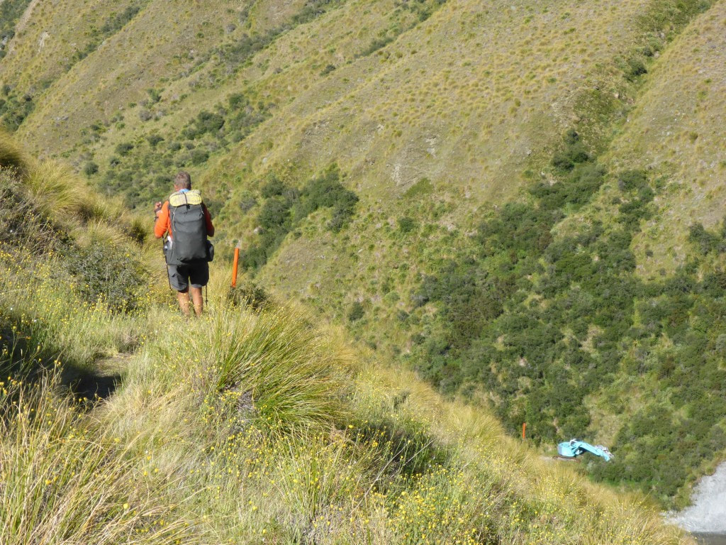 About to drop down steeply to the Arrow River. Excavator below (walked up the riverbed!). 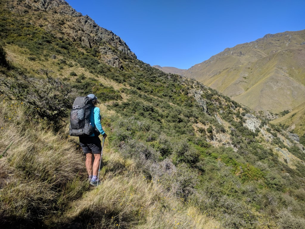 One of the better bits of the horrid high water track. 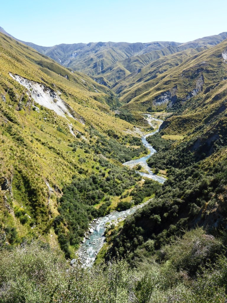 Didn't take many photos of this bit!! Spent a lot of time going up and down over those little ridges through scrub. 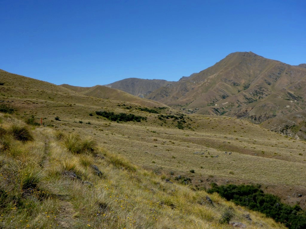 Then at least the high water track broke out into some more manageable tussock - with a track partly alongside an old water race. 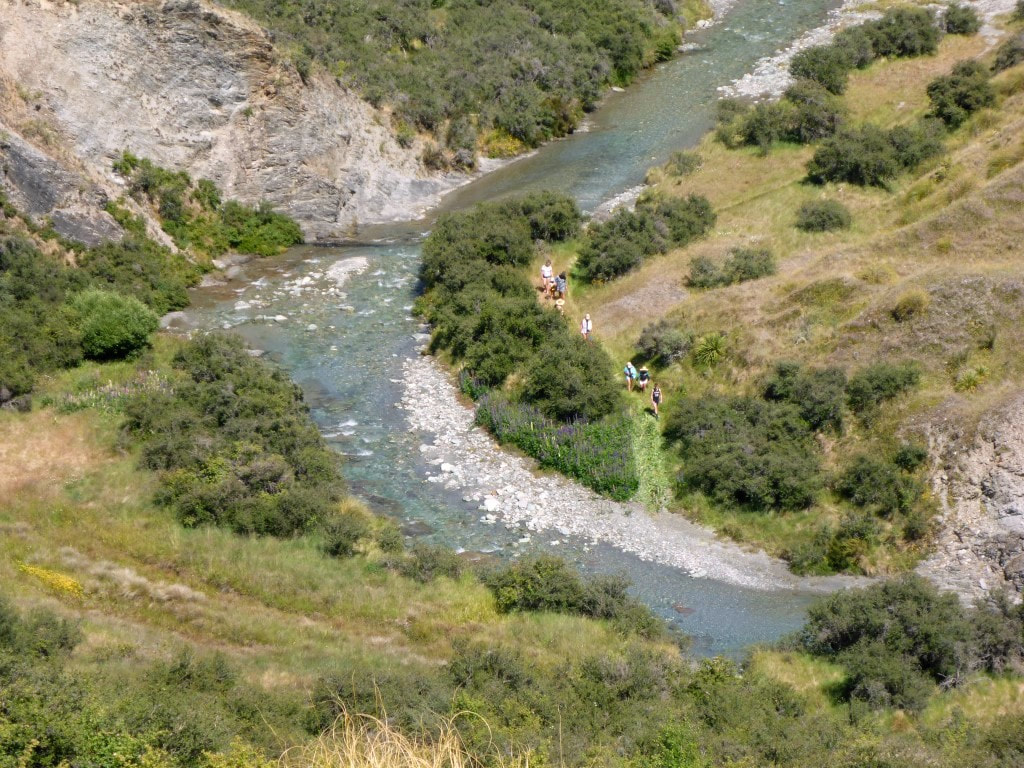 A family outing below us along the way. 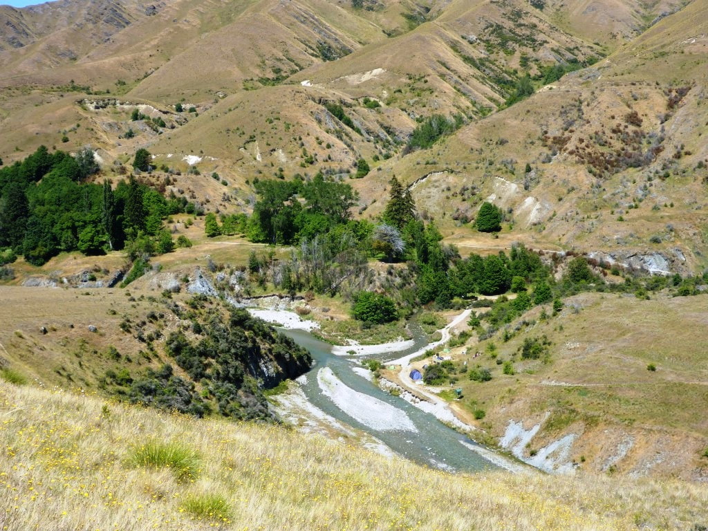 Where we cross the river. People ensconced in the Macetown camping area across the river. We had a little look at the historic remains as we walked through Macetown. This can be reasonably busy as it is accessible by 4wd, so we had to watch out for vehicles for much of the rest of the day. So we then effectively followed the Arrow River into Arrowtown - we had decided that we would take the alternative river route rather than going over Big Hill, as the bodies needed a bit of a rest from climbing!! We were in and out of the river as the 4wd track often crossed the river and sometimes went down it for short periods - so the feet were cool!! We did take a couple of detours off the road when offered - these often took us over or around river crossings (for walkers and cyclists). 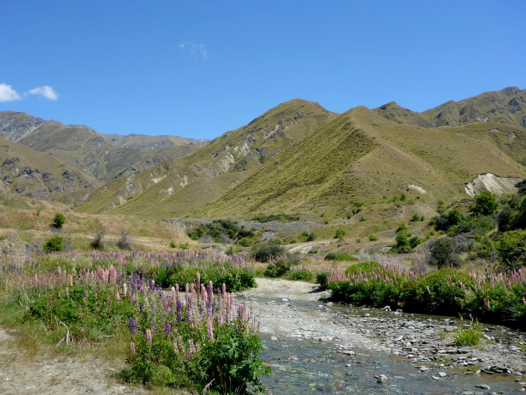 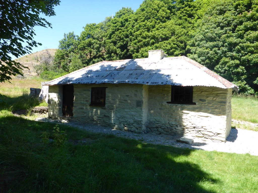 One of the few restored buildings at Macetown. 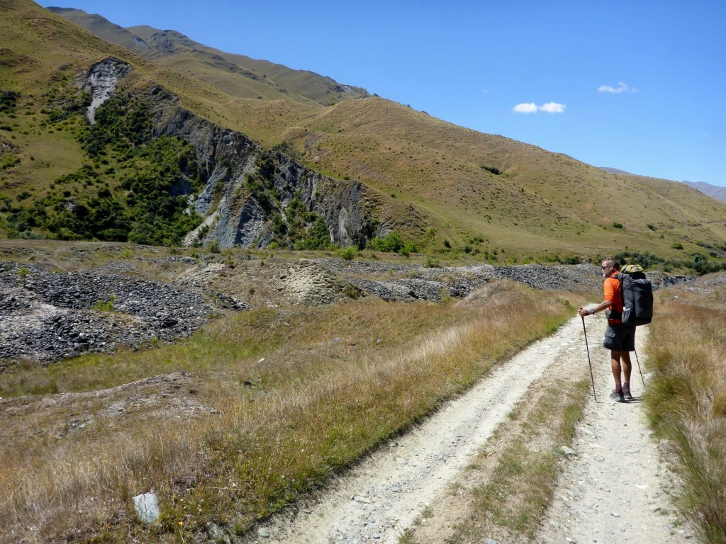 Evidence of mining activity abounds. 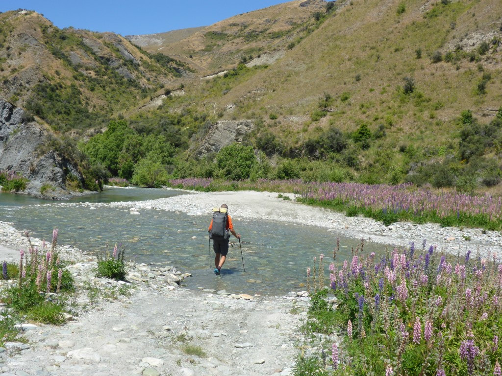 Another of many river crossings today. 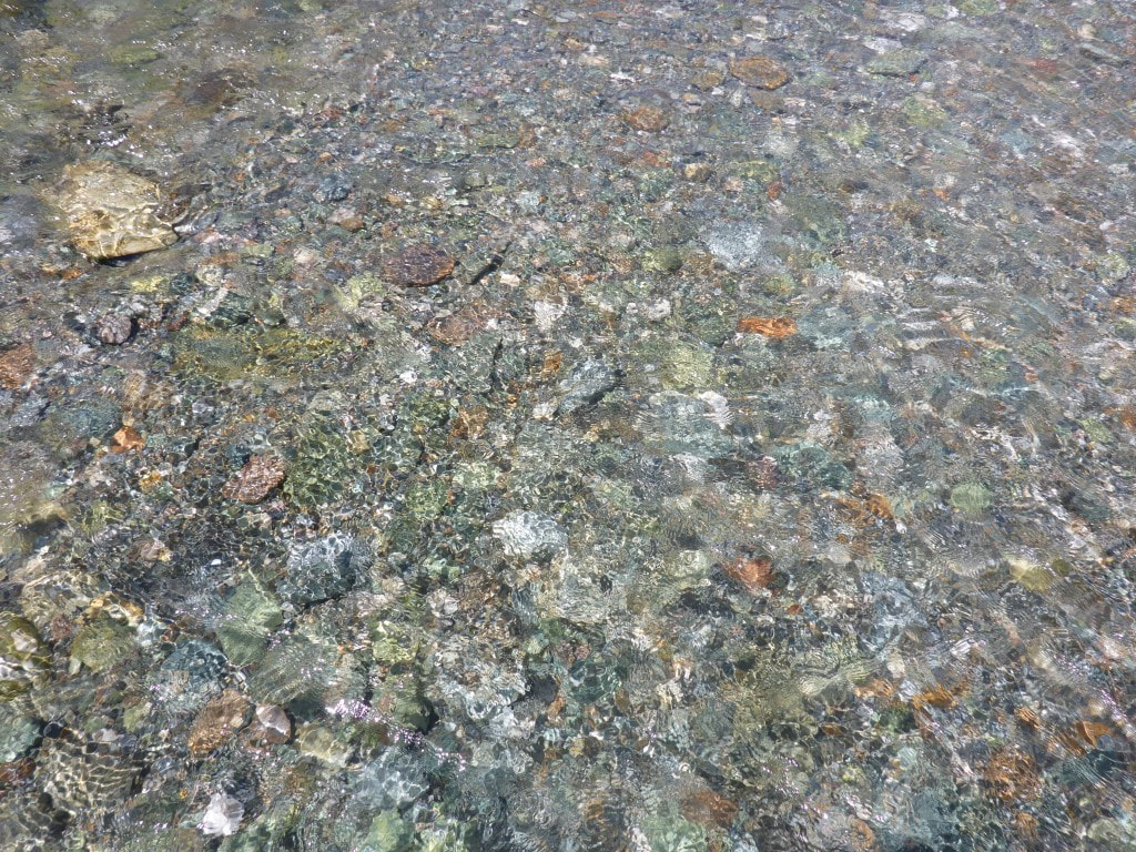 Quite clear water! 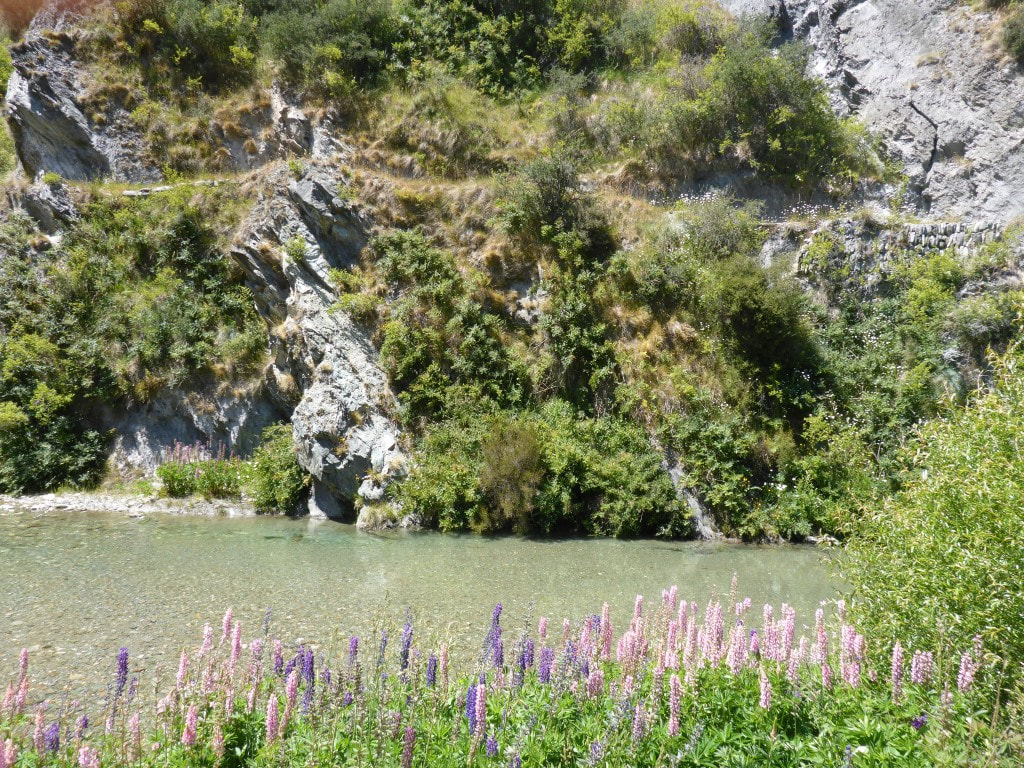 Track cut into rocky face on the other side of the river. 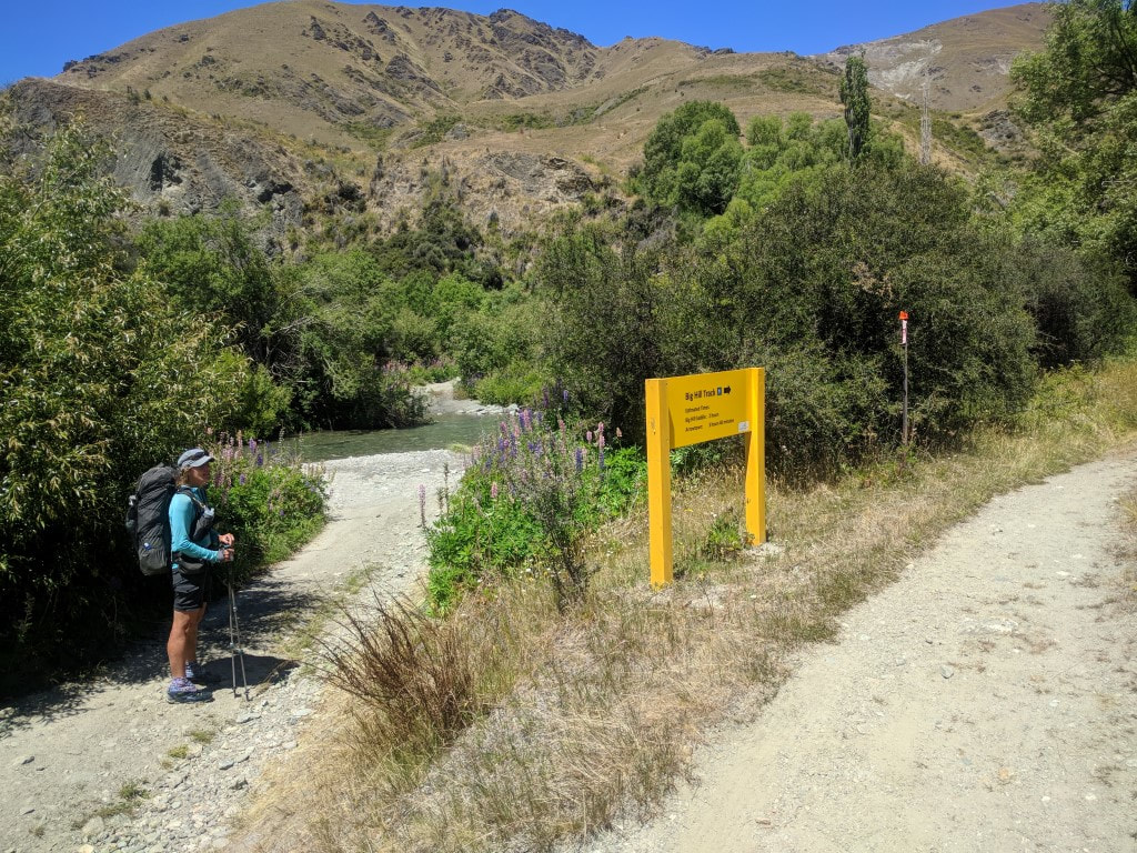 The Big Hill turnoff. As noted, we elected for the Arrow River alternative :-) 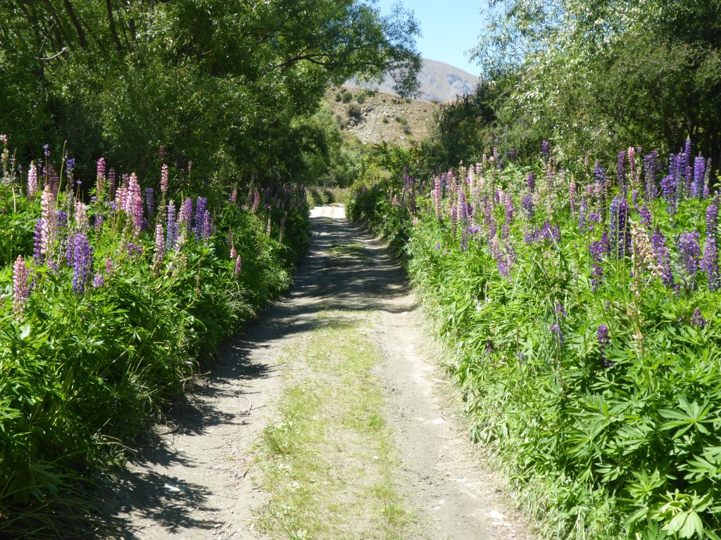 Found a little spot amongst the trees and lupins for a shady lunch. 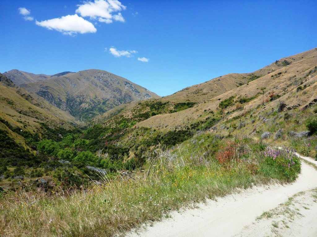 Going that way. The Arrow turns right at the base of the big hill in the background. 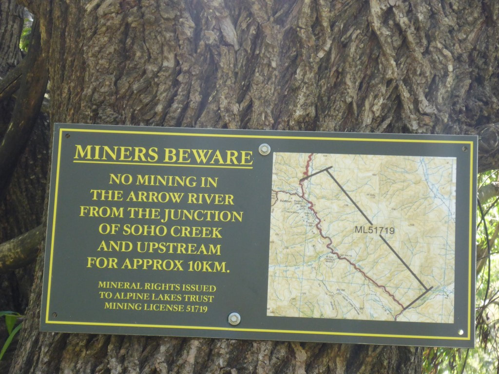 Obviously mining activity is ongoing! 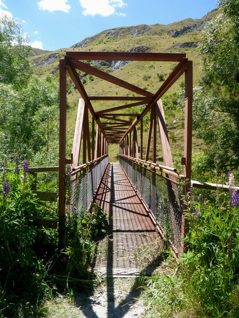 Saw this bridge and thought we would cross it. Took us on a little detour avoiding a couple of river crossings - nice for a change. 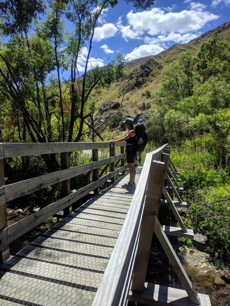 And at the end of this detour, another bridge to take us over a stream joining the Arrow. 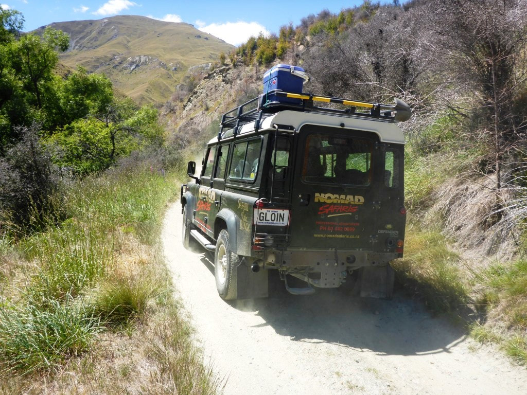 Not just private vehicles heading up here. "Safari of the Rings"! *GLOIN* 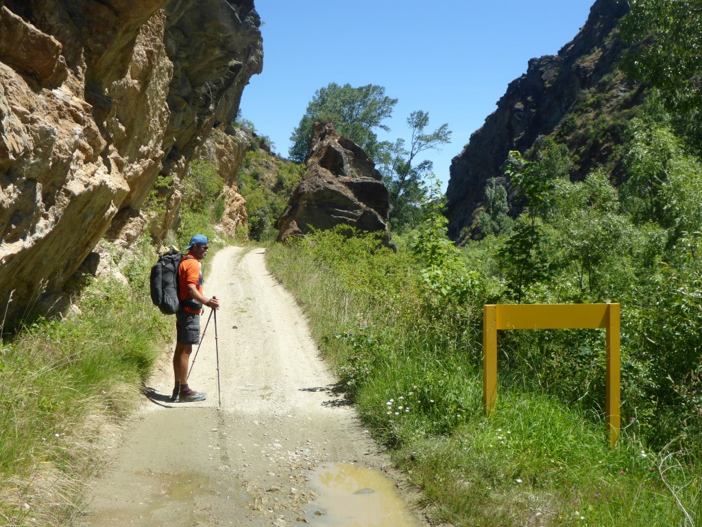 Not a lot of passing opportunities for vehicles on the narrow road. We passed an old water storage/collection system that we thought might be defunct but we followed a large pipeline down the road and river, hearing water in it at times, before eventually finding a sign near the end of the track saying it was an irrigation scheme - so definitely still in use! We got back onto a local walkway (off the road) for the last bit into Arrowtown and found our way to the campground, which was a little off trail. We had only been able to book a tentsite a couple of days ago but, as we arrived, David met us as he was heading uptown. He had hoped to see us as he had a four bunk room all to himself and wanted to ask if we wanted to share it. So we jumped at the chance (thanks again, David :-))!! We sorted out the bookings at the office and then the three of us went uptown for a lovely meal (and a couple of beers in my case!). We had spoken with our friends at Gibbston, Jane and Chris, who we were staying with after Queenstown (for a rest day!) and they suggested leaving much of our gear at the campground to be picked up by them or one of their friends. So we thought that was a great idea to have a “slack pack” day to Queenstown tomorrow!! As he is in no hurry, David is planning to walk with us tomorrow as well. 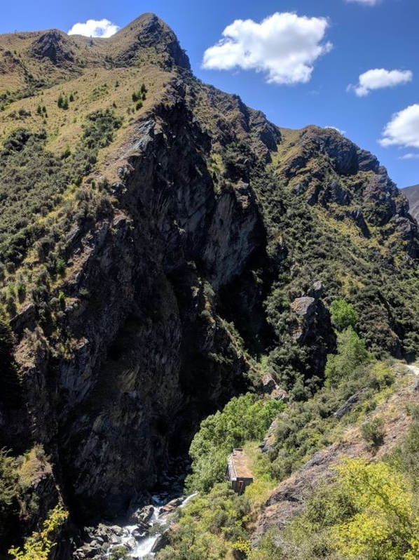 The concrete structure below was some sort of water collection system. Water was flowing out it back into the river but also into a pipeline. 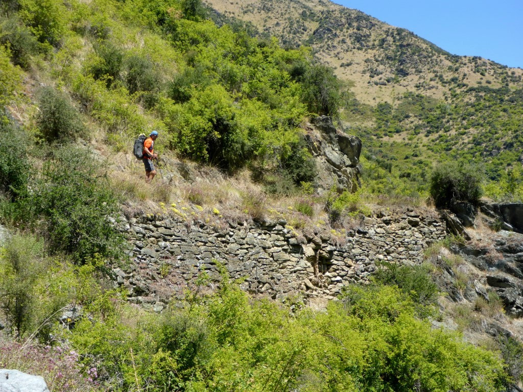 The old stacked rock wall to support the road! That's where I took the previous photo from. 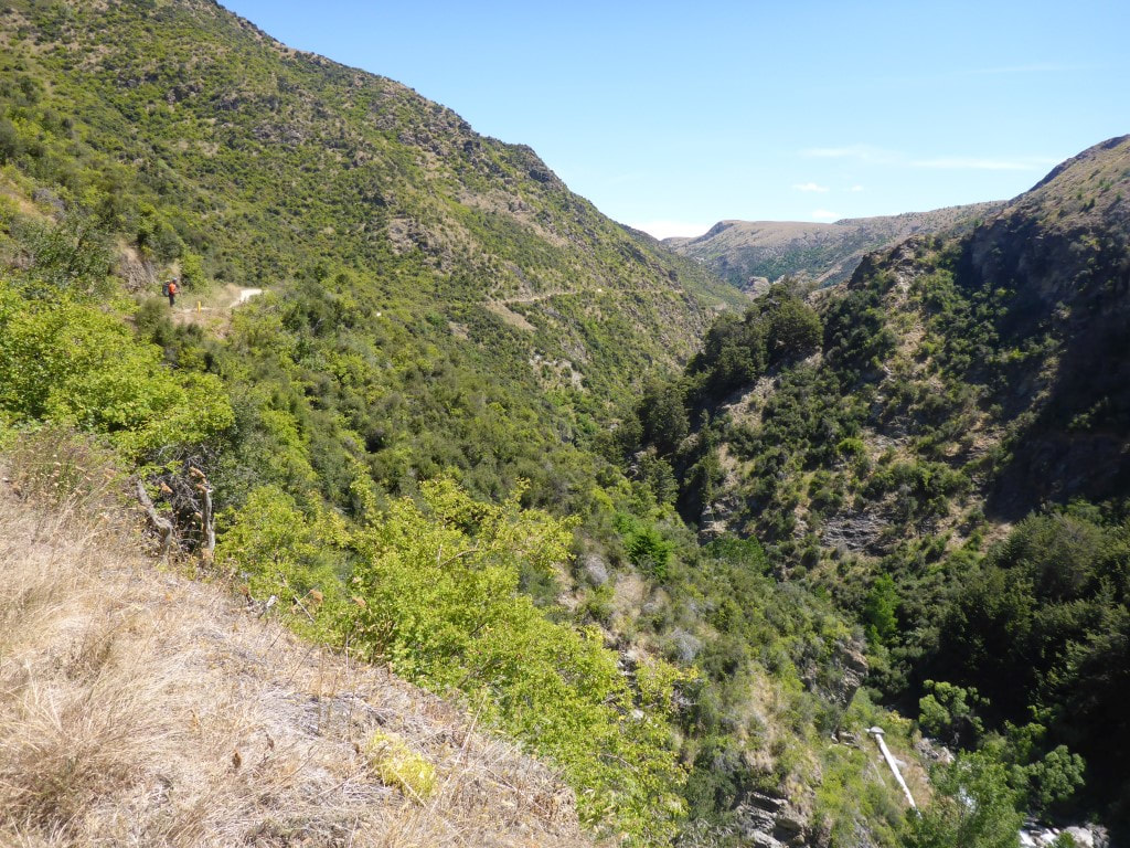 Looking down the river gorge - you can just see the pipeline in bottom right of shot. 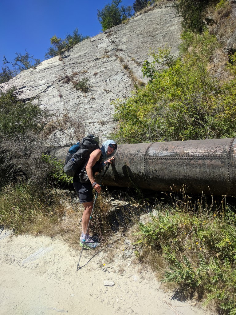 Could hear the water flowing in the pipe - looks pretty old and has a number of repairs that we could see! 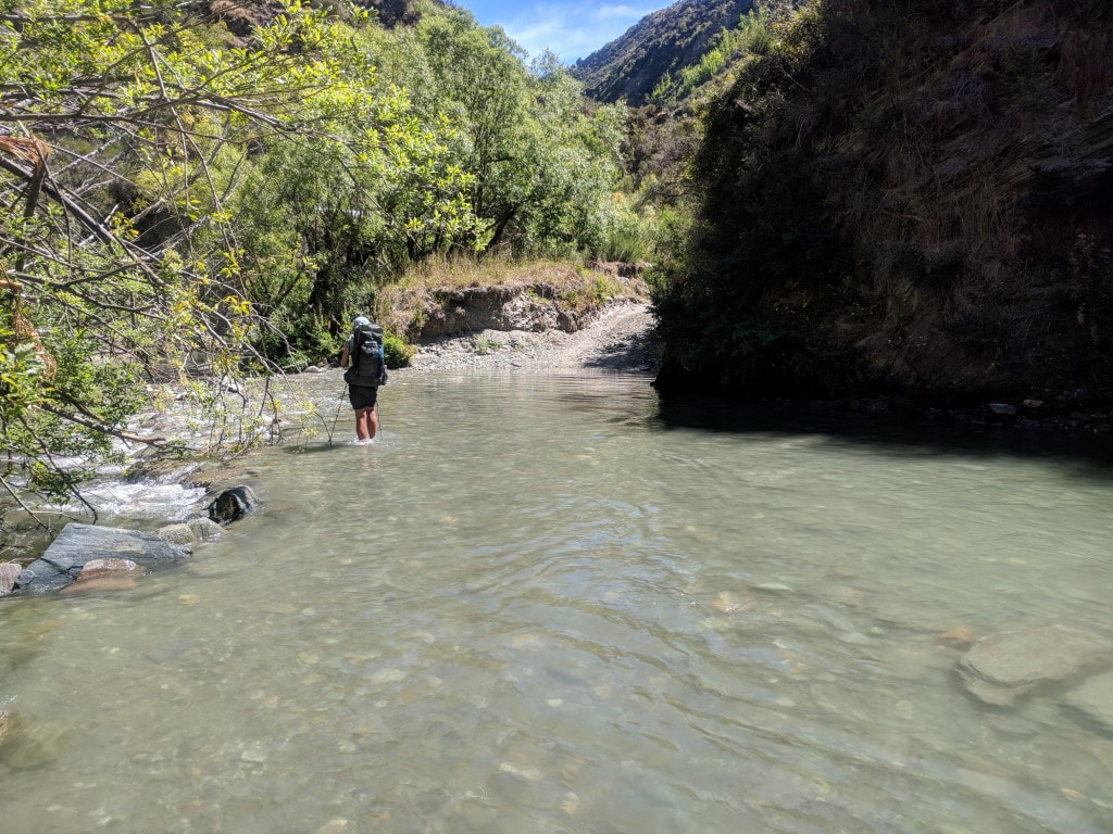 Still following the 4wd track :-) 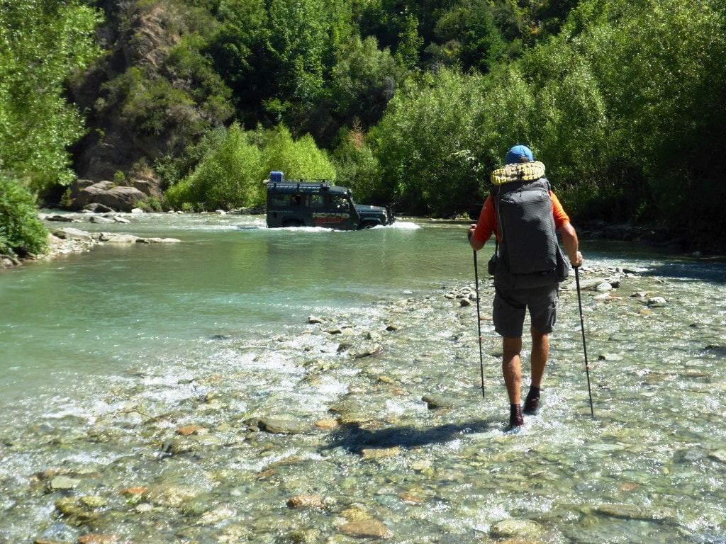 Sometimes a bit hard to figure out where the road goes until you get there. Having a vehicle in the river helps!! 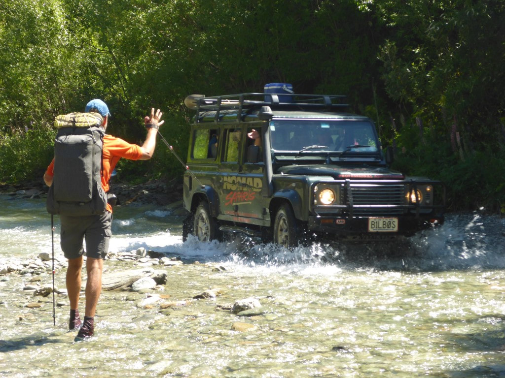 And a friendly wave from the tour operator. "Safari of the Rings" *B1LB0S* 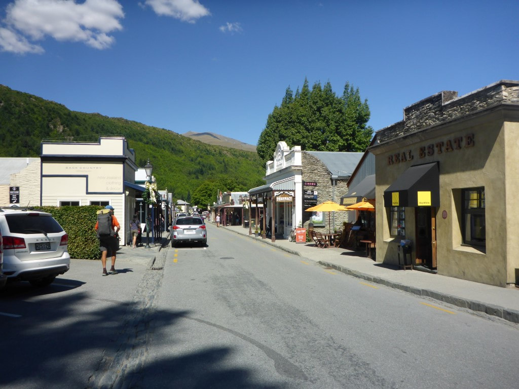 Eventually reached town - chance for a nice cold drink at last. 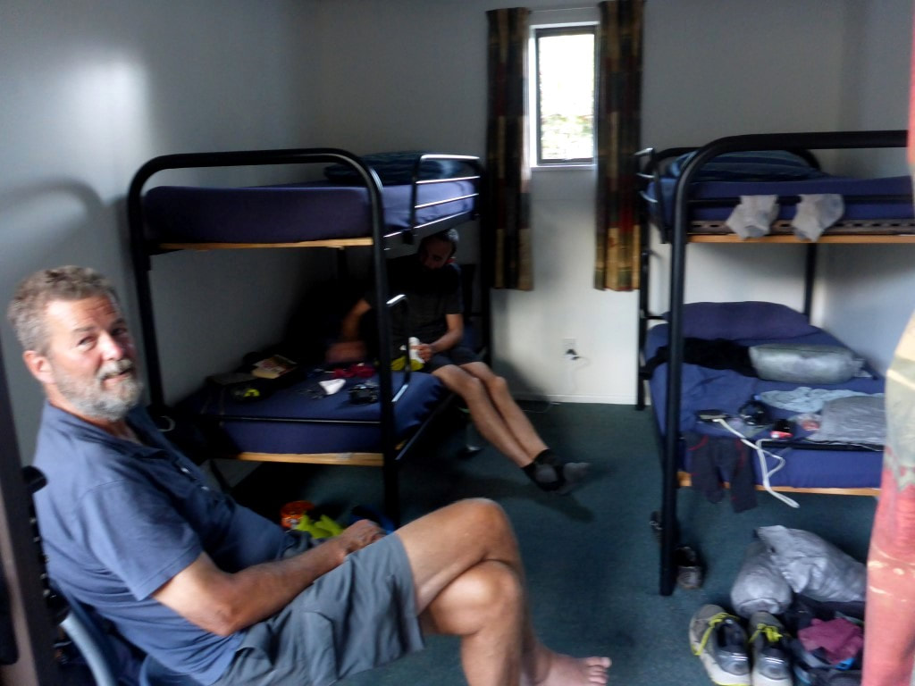 Relaxing in our bunkroom for the evening - thanks again David :-) Got away about 0740 on a chilly morning. We did almost 11km in about 5h15 of walking arriving at 1430 having had a few good stops along the way. However, in that 11km we went up over 1060m and down over 1200m in total - so not a simple walk in the park! The GPS data for the day is here. Last night another young woman, Holly, joined us in the hut. She works at Outward Bound and was attending a friend's wedding in Queenstown. So, as you do, she had decided to come early and walk the Motatapu Track to Queenstown!! We got away at about 0730, just behind David. It was cold enough that as we dropped down into the gully in front of the hut there was a definite frost! Our hands were pretty cold to start but we headed uphill to warm up and to seek out some early morning sun! Today was basically all uphill and downhill - with a little bit of sidling - not really any flat stuff until we got to within a km or so of Roses Hut. 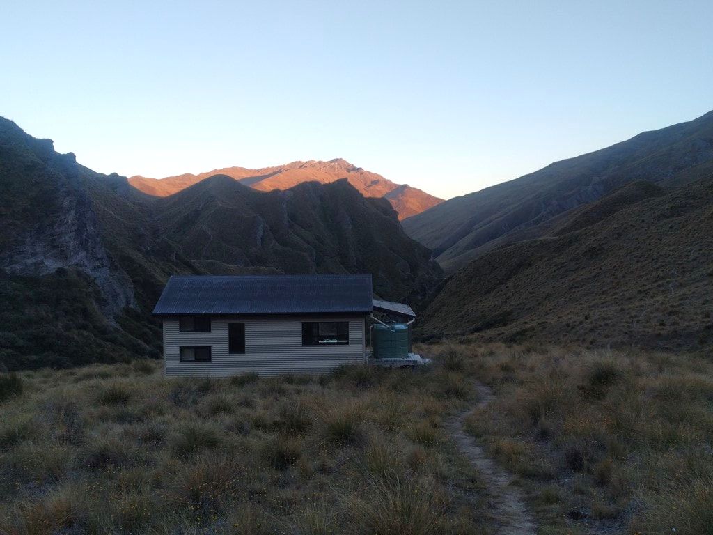 0620, and a chilly start to the day! We are initially heading for that first set of hills directly above the hut roof.  Wee bit of frost as we dropped down from the hut. 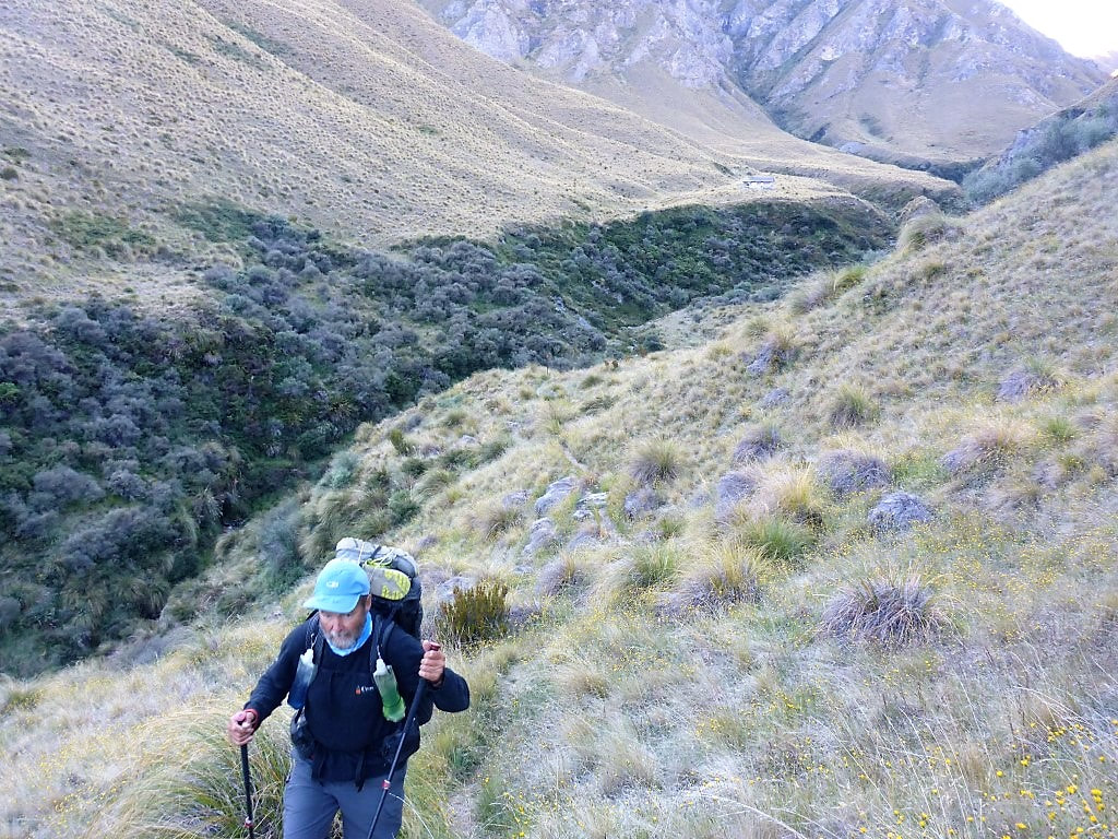 Looking back at the hut not long after leaving. We basically had two sets of 400m+ up and downs today so we knew what to expect, more or less. If you follow the link above to the GPS info for the day and turn on the satellite imagery on the map, it gives you a clear picture of what we did. The DoC warnings for this section suggest it is pretty tough with steep ridgeline climbs and descents and steep sidles. With my lack of a head for heights in wide open spaces I wasn't sure how I would go. However, the reality was that is was no problem at all - not much worse than a walk on steeper bits on the farm at home (that was a relief for me)! We started off up through rocky tussock land (again!) and made steady progress toward the first of our 1220m high points. 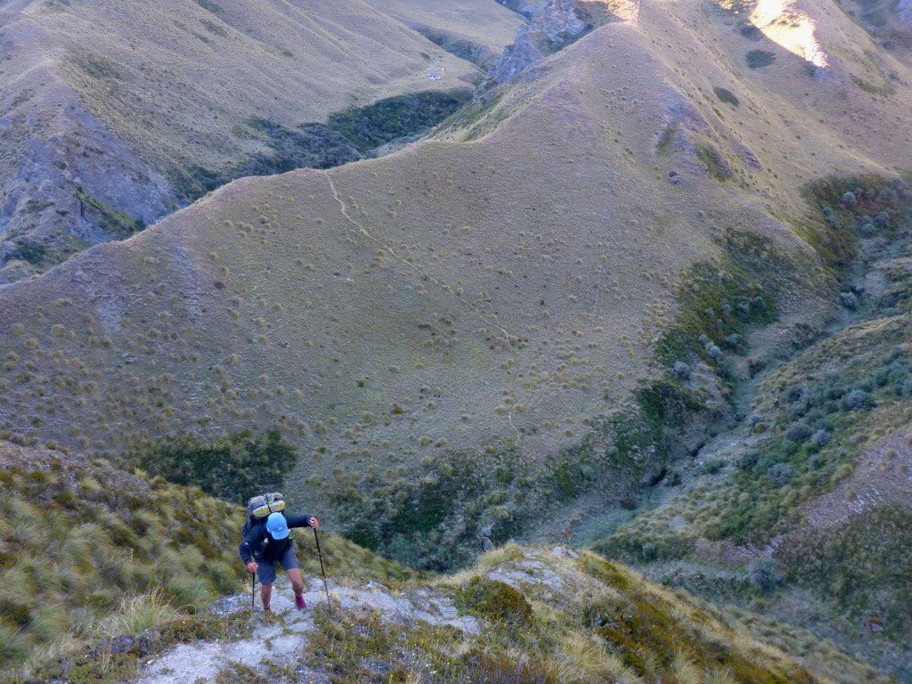 A bit of uphill warms you up! Although it's still cold - has to be for me to be going uphill with a jersey on over my walking shirt still! 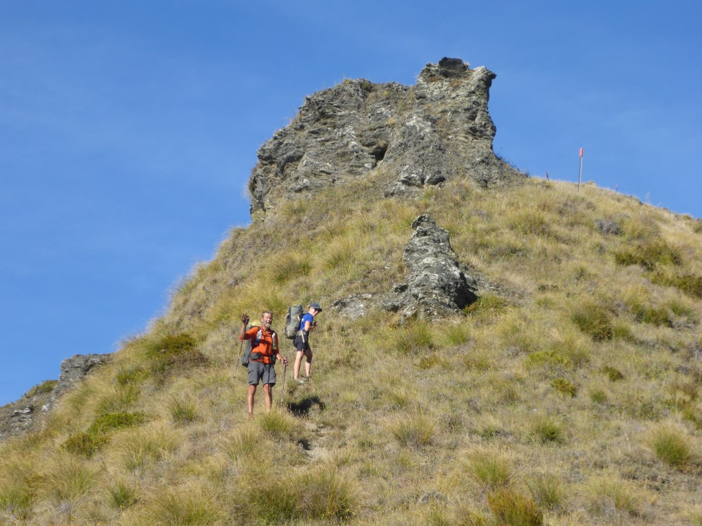 Holly overtook us after about 40 minutes. Now higher up and in sunshine - jersey definitely packed away :-) 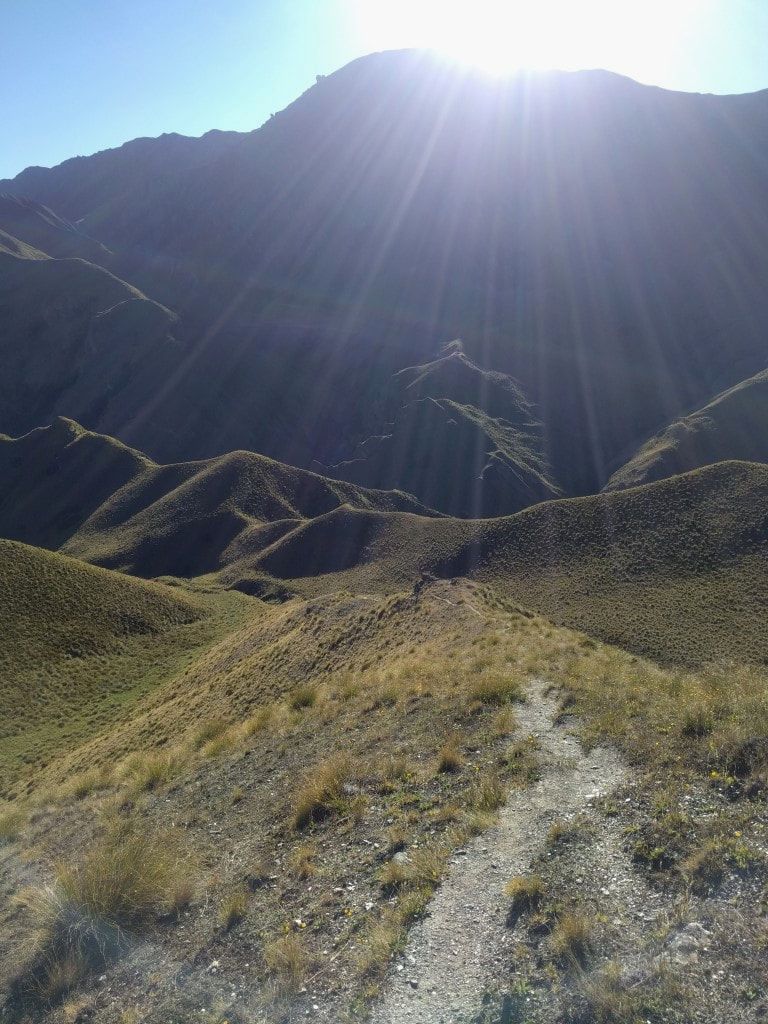 Looking back into the rising sun - the track shows where we have come from. 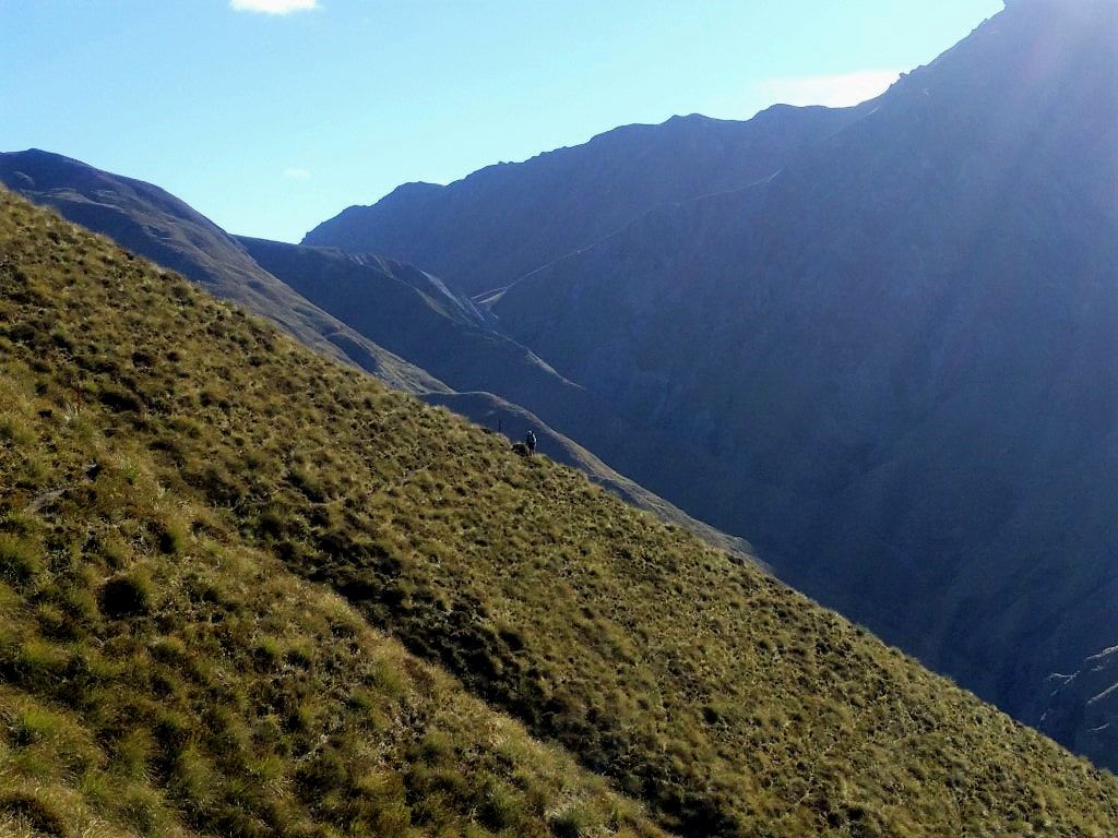 B coming along behind on one of our sidle sections. 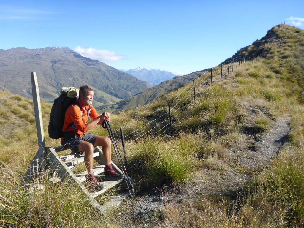 As I have mentioned before, these are good for more than just climbing over fences! 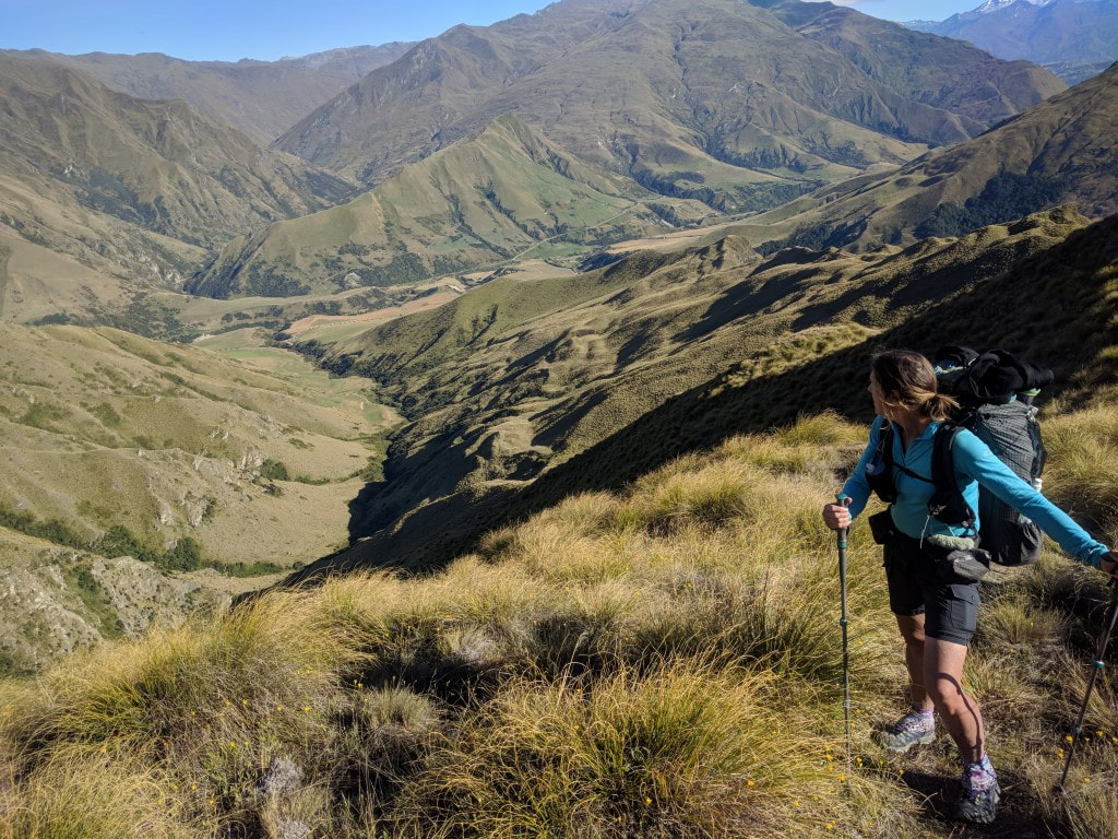 Looking down to the Motatapu valley (Motatapu Station). Lake Wanaka is at the end of the valley if you follow it off to the right.  Tree-lined track in the middle of nowhere! One bit of excitement for the day was a close encounter with a karearea (NZ falcon). We were near a stile on the first high point of the day and Belinda's attention was caught by an old pair of hobnail boots tied to a waratah (which was somewhat attention-grabbing!) - I noticed a couple of meters away a bird flapping around close to the ground. I couldn't immediately see what it was until it started to take off, when it became obvious. We think it was probably feeding on something but neglected to actually look! Fantastic to see one so close - B did manage a quick snap as it took off. 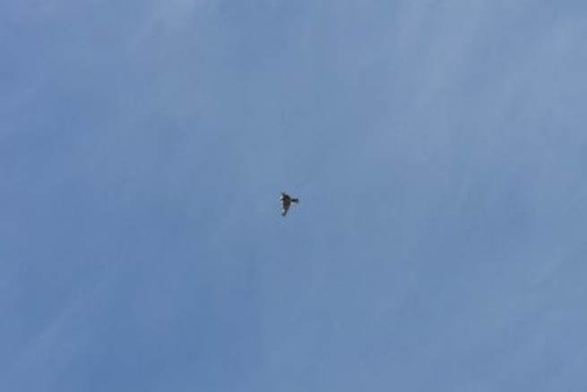 Karearea.  Boots hanging by the stile! 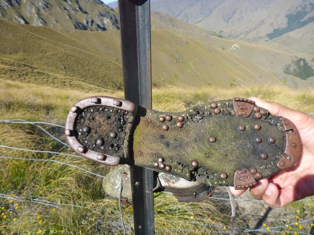 Old style. I remember Dad wearing hobnail boots on the farm when I was a youngster. 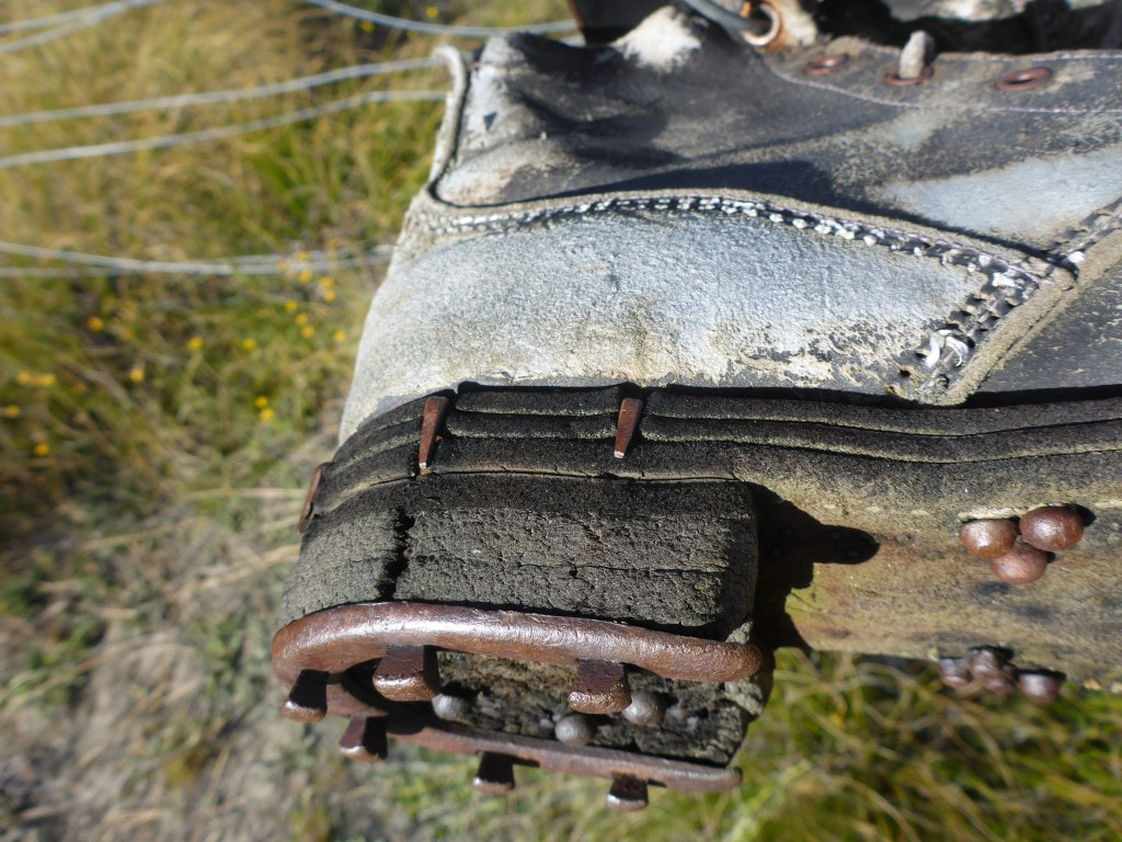 Horseshoe nails to attach the heel plate :-) 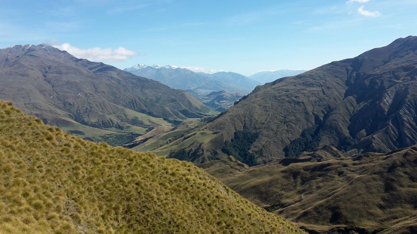 Looking back at the Motatapu valley again. 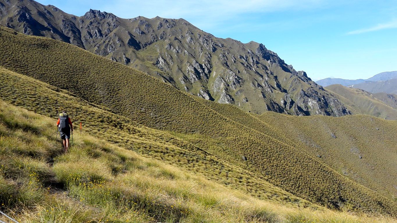 On our way down from the first peak. Then it was back down to around 750m before heading up again to the second high point of the day. We stopped at this second 1200m peak for 45 minutes or so for lunch and a quick internet catch-up, as we had some reception. Then it was, yet again, a steep descent back below 700m with a final very gentle uphill to the hut. We stopped at the river a couple of hundred metres before the hut (right beside the main access road for Motatapu / Mt Soho Stations) to fill up, although it turned out there was a little stream quite close to the hut which also provided for water (see dead bird story below!). 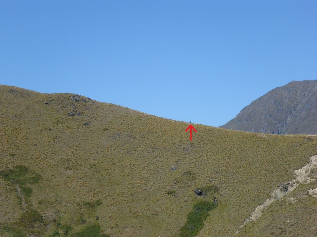 On our way down we spotted David on the skyline heading up toward the second peak. 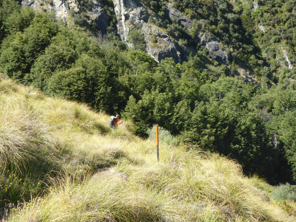 Back down below 800m and a little more beech - at least temporarily. 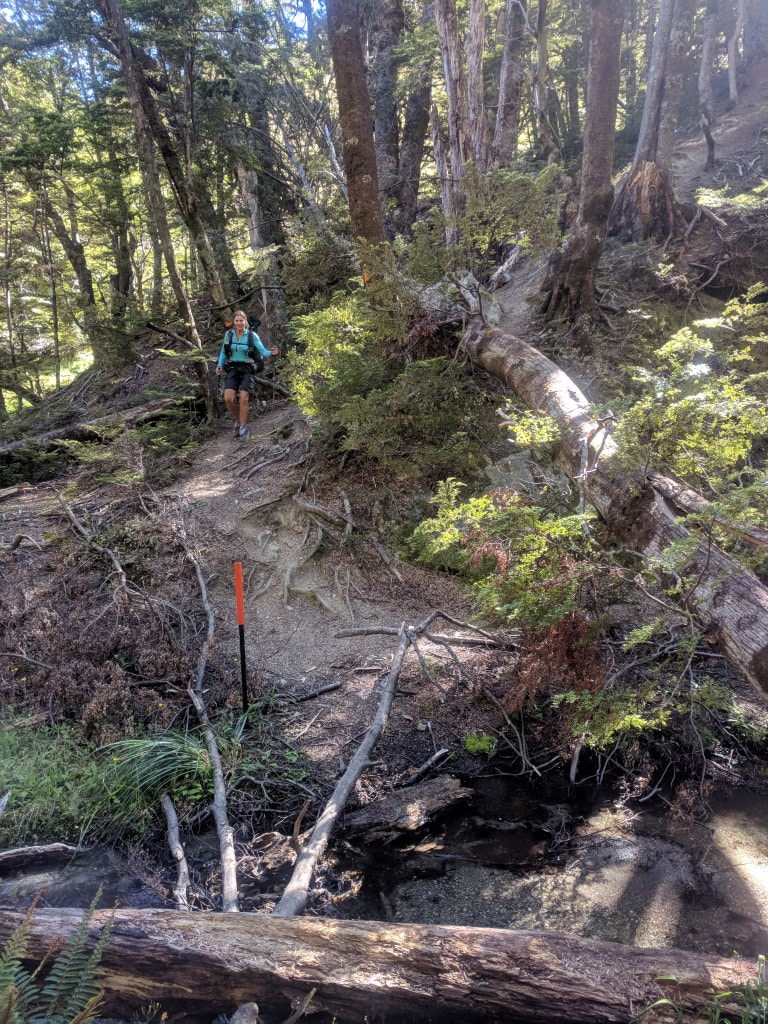 B joining me at the creek in the bottom of the gully. 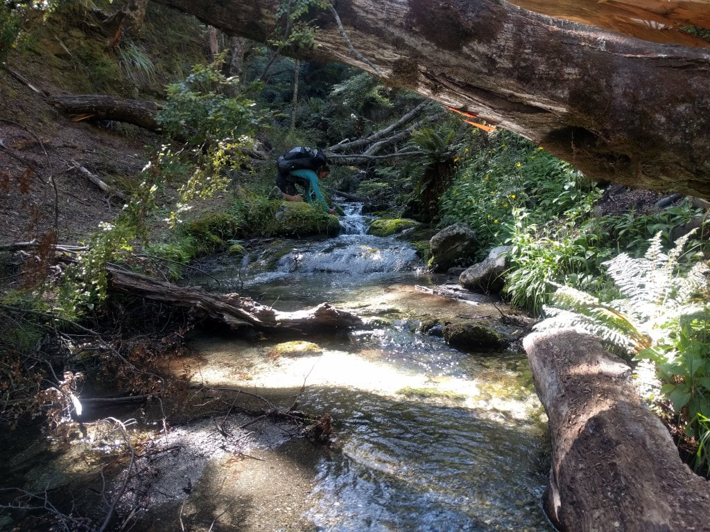 Topping up with liquid refreshment :-)  The track did a zigzag out to where I took this photo before turning back up the ridge. B decided to do the kiwi thing and go straight up to the ridge :-) 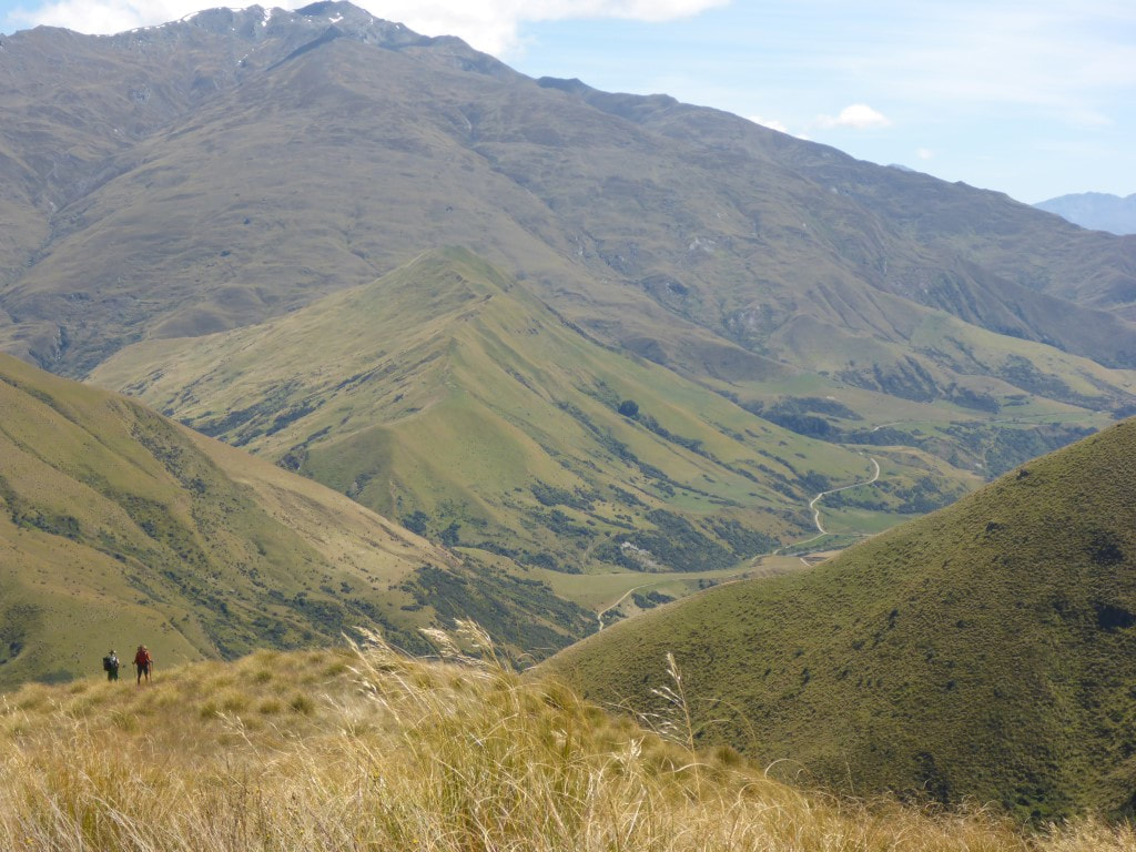 On the way up I chatted with a nobo walker who B bypassed because of her direct route! 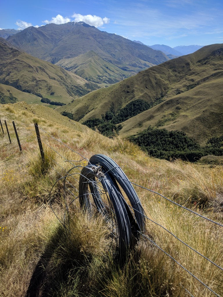 For repairs. Must have been here a while as they don't run stock up here anymore. 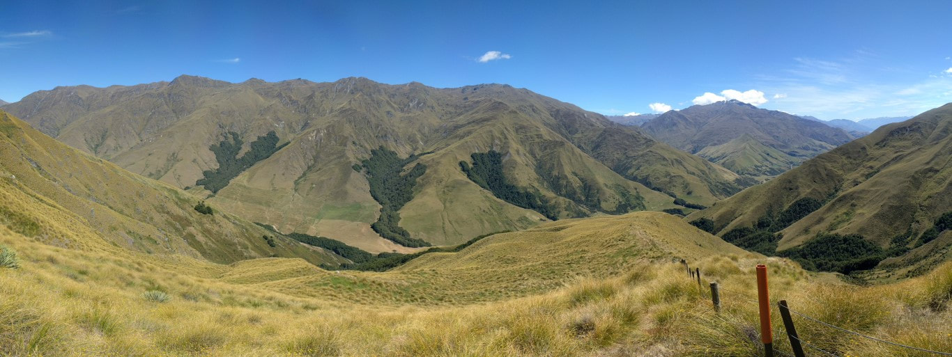 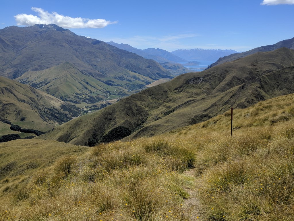 Looking back (NW) with Lake Wanaka in the distance, from near the second peak. Only a day and a half to get here from there :-) 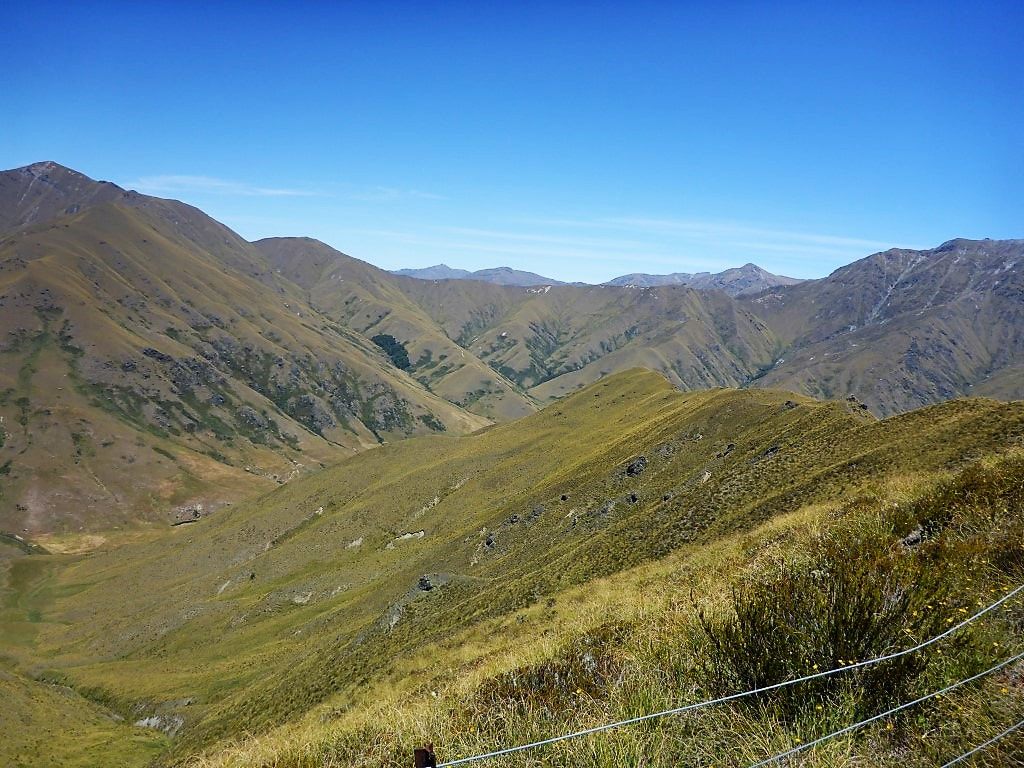 Looking more or less SW - that's the ridge we follow down to Roses Hut in the valley. 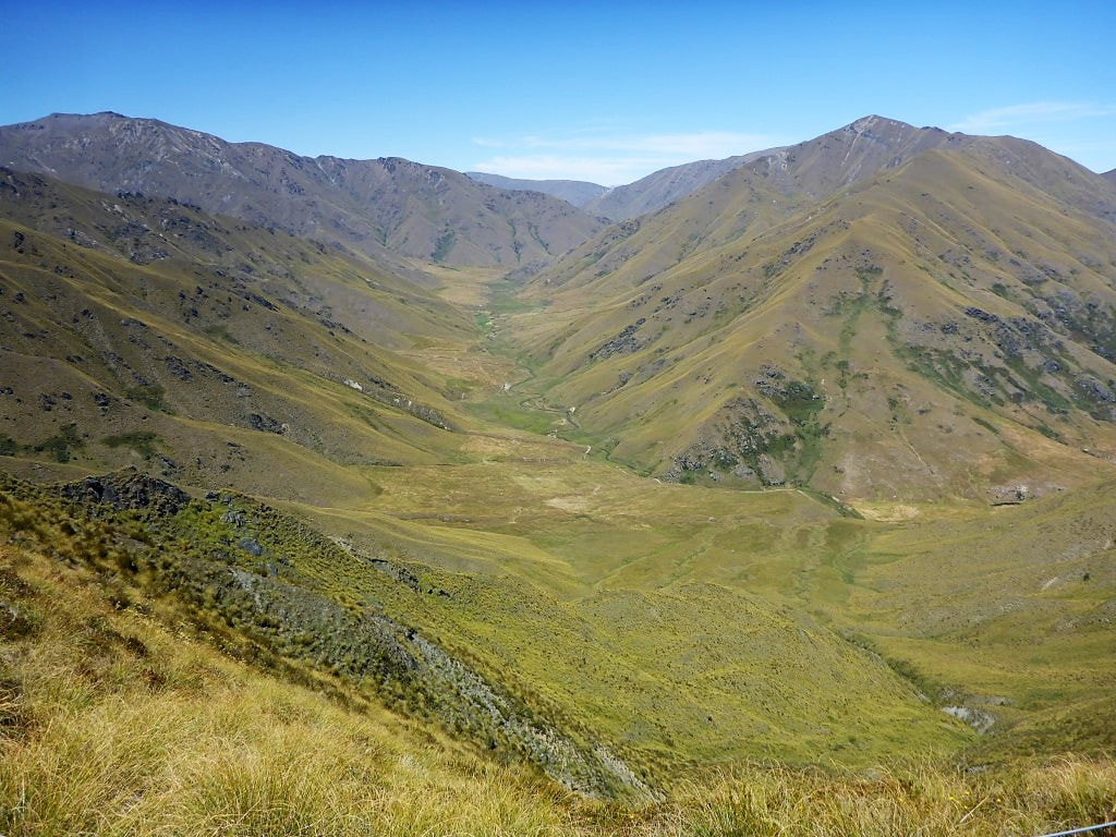 From a similar spot looking south, the valley swings more southerly near Roses Hut. Following that valley will get you into the Arrow River valley and to Arrowtown. 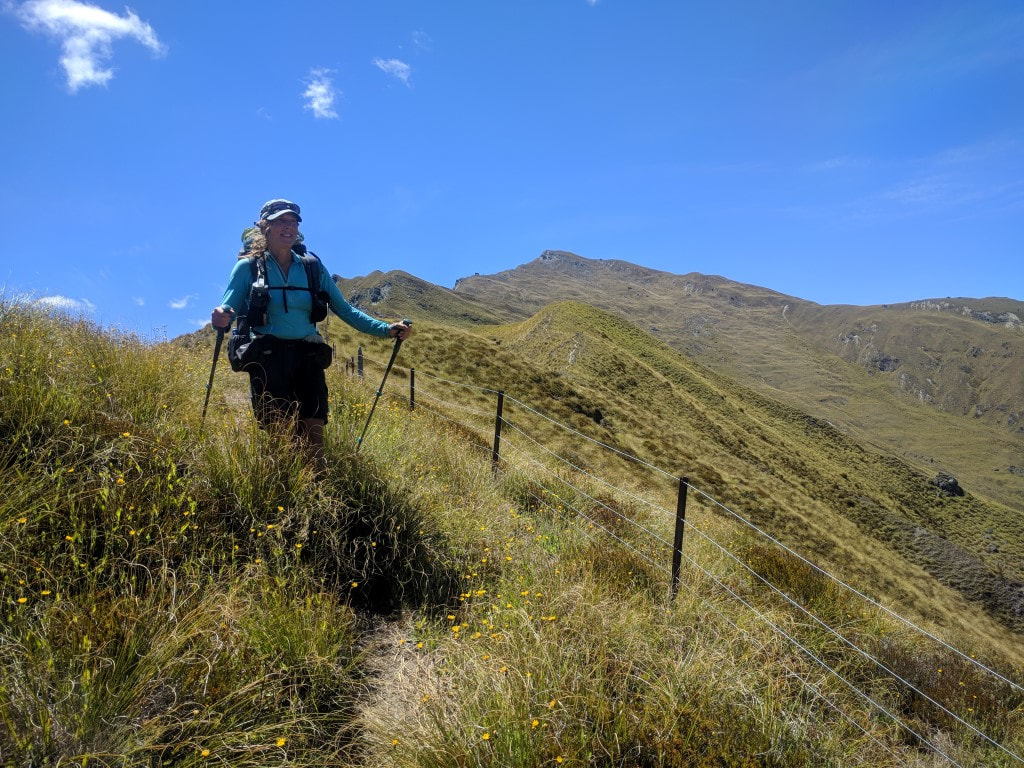 Off down the ridge she goes. 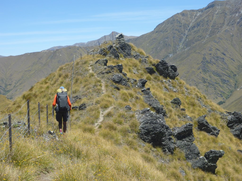 Not quite all downhill. 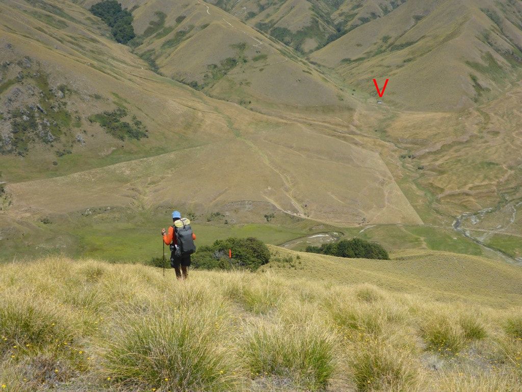 Down to the valley floor, with the hut in sight (under the red V). The ridge we head up tomorrow is just to the left of the hut.  Another "stile to nowhere". This fence has been dismantled, but not the stile :-) David and Jack were both there ahead of us and we also found a couple of farmers from the Hakataramea - Bruce and his wife Chris - with whom we had some great chats. On another matter entirely, we had been hearing stories from a number of days back about a dead bird in the water tank at Roses Hut and had thought we would do something about it as no-one else seemed to have! Turns out that Bruce had the same thought and had immediately got on to draining the tank and cleaning it out - apparently he enlisted the aid of Jack (a bit younger and agile!) and sent him into the tank to scoop out sludge!! Anyway - a good job done Bruce; just have to wait for the next rain to fill up the tank again. Then Tom from Scotland came in (he was just walking from Arrowtown to Wanaka as conditioning for more tramping). With the four from Israel, Belgium and Canada (Daniel Jordan Darcy plus one other who liked to walk on his own at the back) arriving later, that made 11 in a 12 bunk hut. We were all sitting around at 1945 when Jack saw another 2 people half way down the last ridge. So looks like it will be 13! The late arrivers were sobo (fast) hikers who settled for putting up their tent. 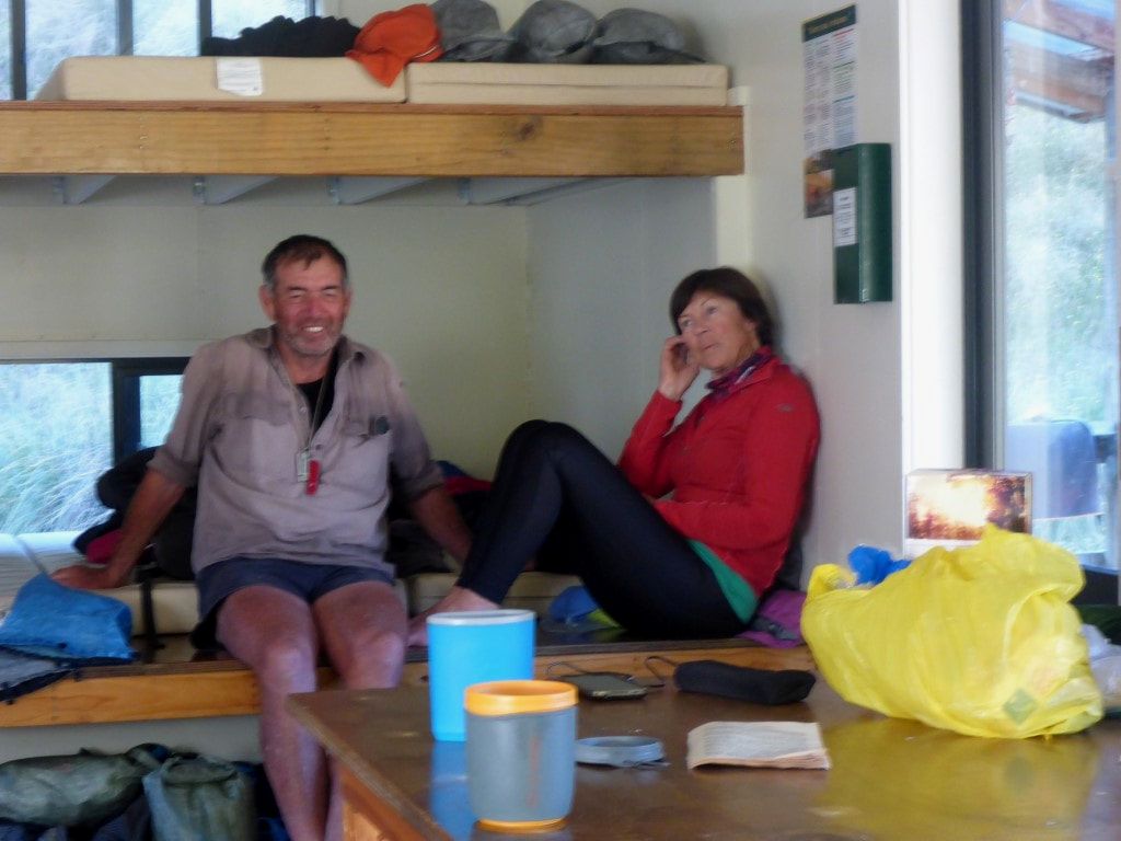 Bruce and Chris. 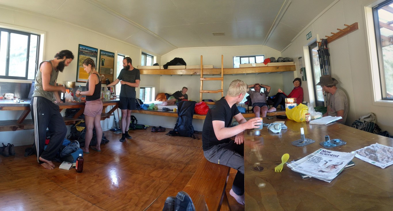 Part of the team. (L to R) Daniel, Jordan, David, Tom, Jack, Bruce, Chris and Darcy. We left the campsite at 0730 and did 16.5km in 6.25 hours of walking, arriving at Highland Hut at 1515. The days GPS track is here. It was a short walk (about 700m) up from the campground entrance to where the Motatapu Rd turnoff took us up toward the Fern Burn carpark. We arrived at the carpark after a 45min stroll. The track started on flattish farmland and passed through some ewes and lambs and, in the next scrubby paddock, some deer. Then we started to climb a bit alongside Fern Burn. The going was varied with a little bit through small trees but also more open grass/bracken/fern country, with a few wet patches to negotiate. Most of the Motatapu track passes through land controlled by Mutt Lange (originally bought with his then wife Shania Twain and later added to). In total the four stations make up over 55,000 ha, and cover most of the land between Wanaka and Arrowtown, but around 53,000 ha was put into a QE2 Trust covenant, I believe, so the vast majority is protected and only relatively small areas of valley floors support mainly sheep farming. The track and huts were paid for by the owners as part of Overseas Investment Office requirements when approving the purchase. It took us only 2.5hr climbing from the carpark up to Fern Burn Hut where we stopped for an early lunch at about 1120. Passed a guy from Auckland who was just down doing a bit of tramping here while his wife was back in the UK. At the hut an English chap arrived on an “up and back” walk - he spends quite a bit of time walking in NZ. David from Germany also came in while we were there. He is doing TA and heading for highland Creek Hut like us. 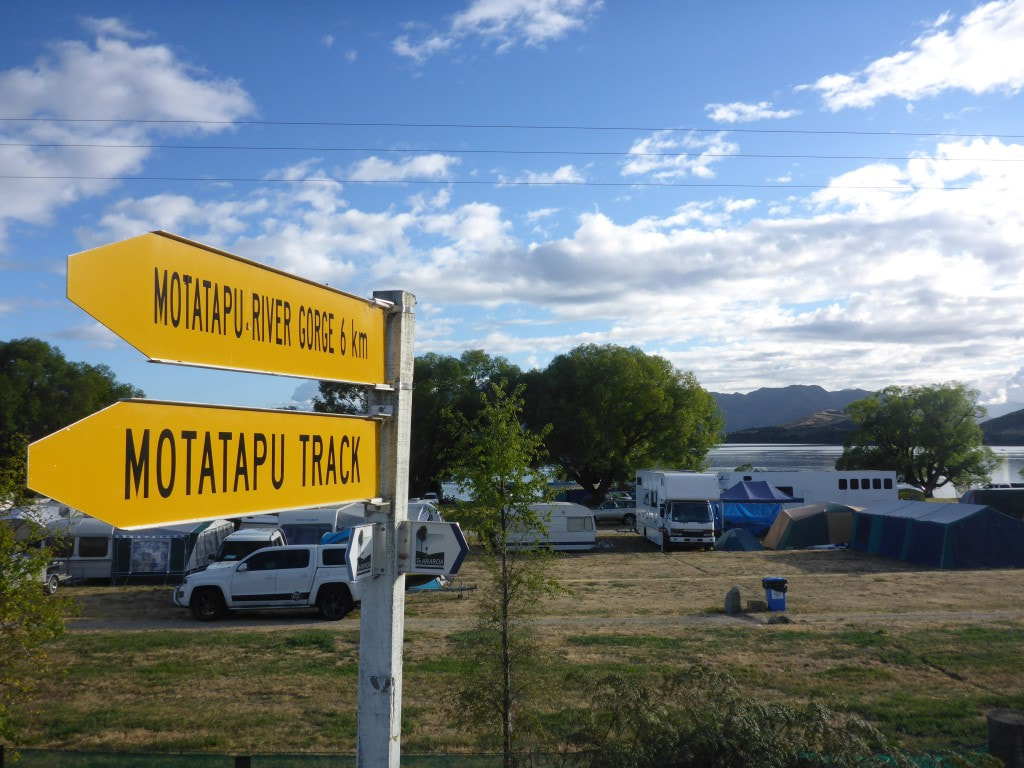 Still alongside the campsite when we turned up Motatapu Rd. 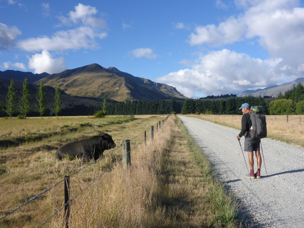 Greeting the angus bull. 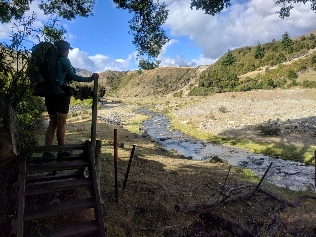 Heading into farmland from the carpark on Motatapu Rd. 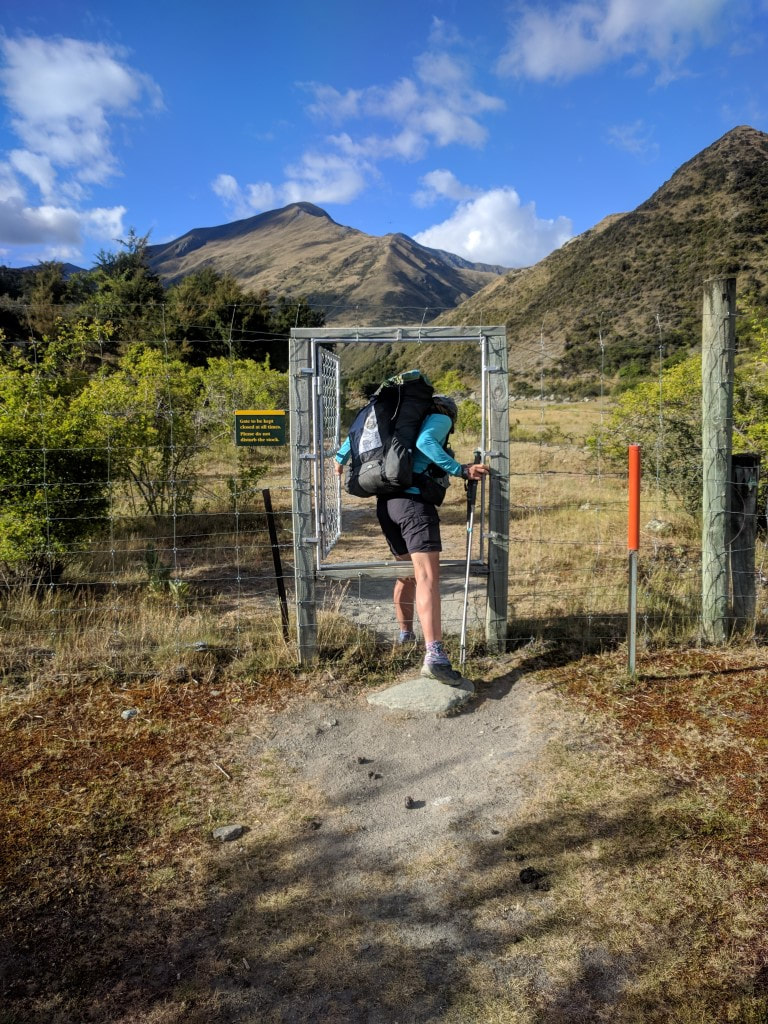 Very flash way of managing access through a deer fence - we have come across a couple of these in our travels previously. 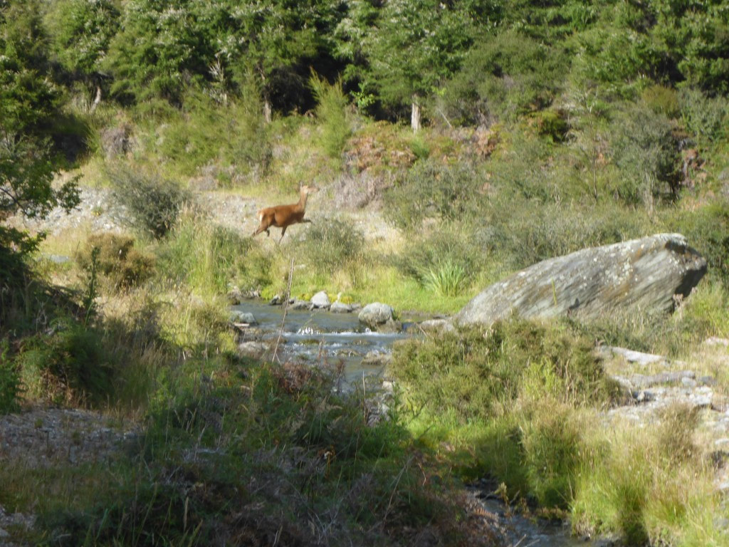 The reason for the deer fence :-) 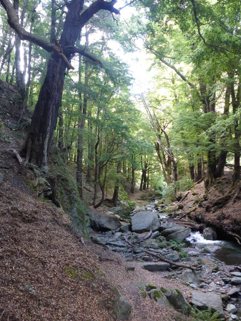 And back into a bit of open beech forest. 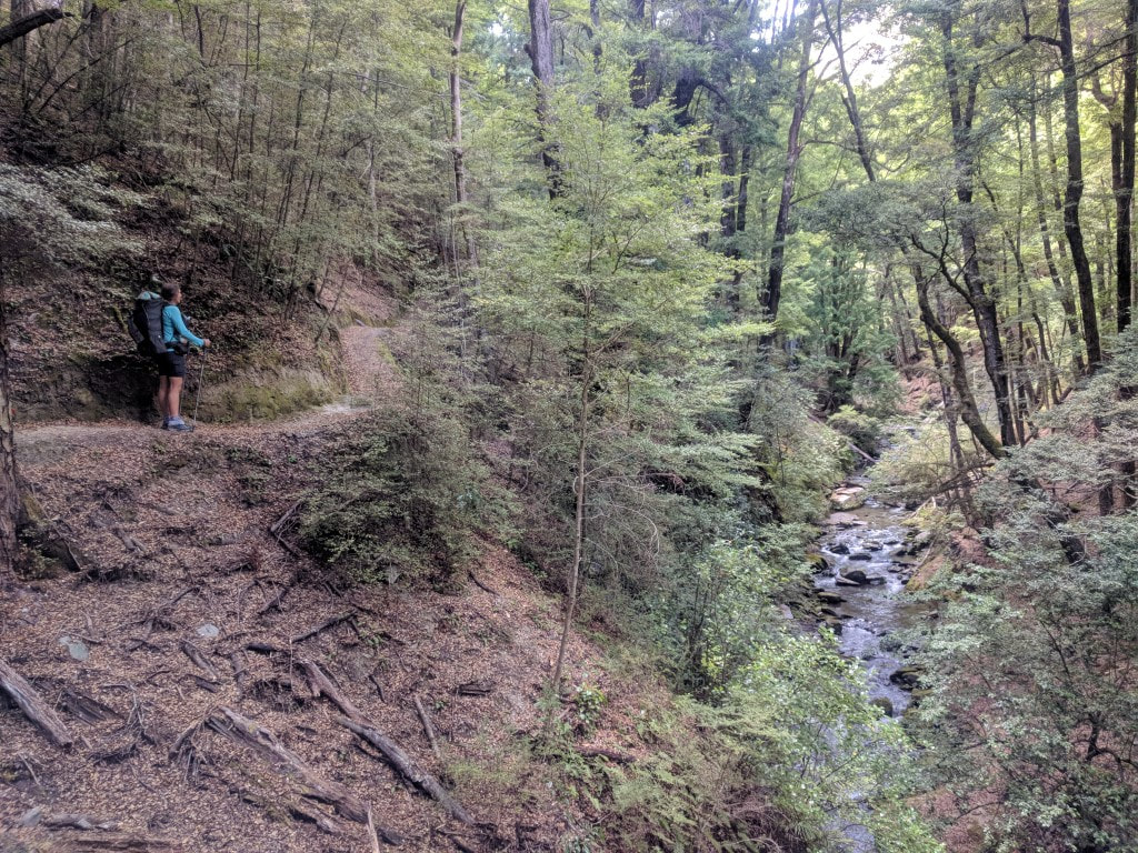 The track was reasonably well formed in this case. 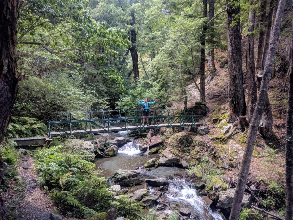 Flash bridge across a smallish stream. 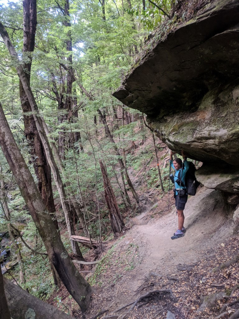 Hercules (or the female equivalent in this case)!  Known as the Stack Conservation Area - not a particularly exciting name?? 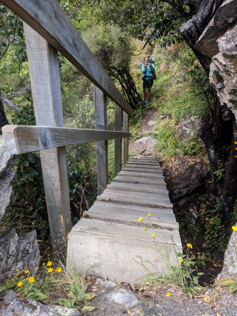 This little structure took us over a deep little rocky "ravine" that would have been a challenge without it! 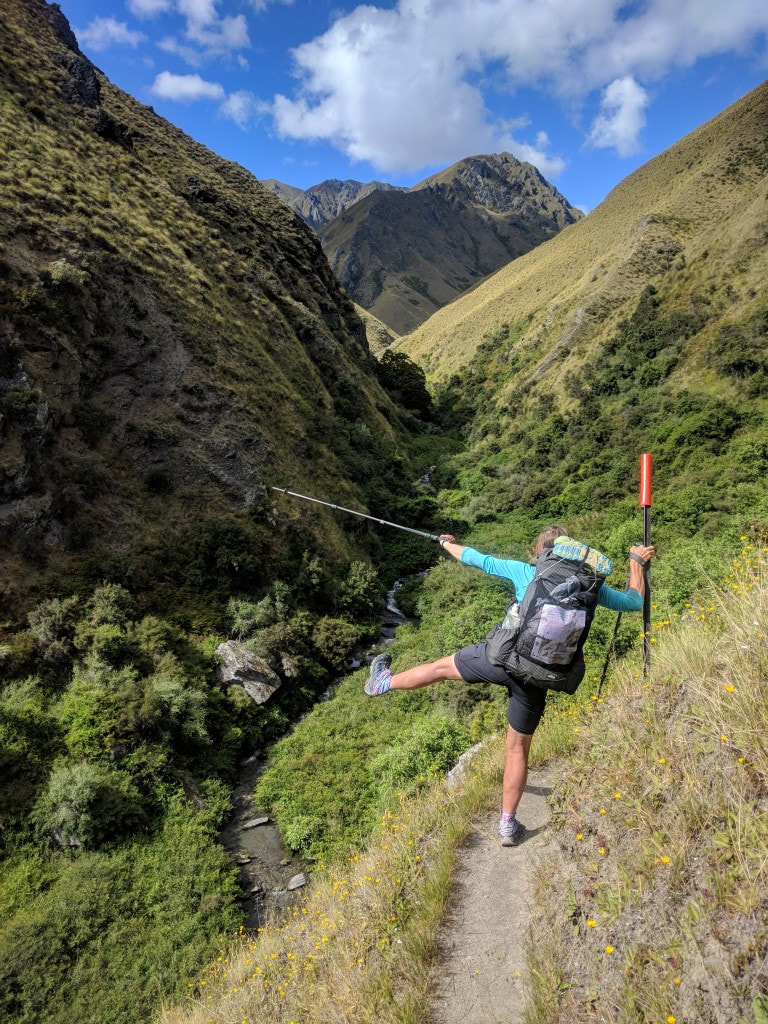 Tramping is always a balancing act :-) 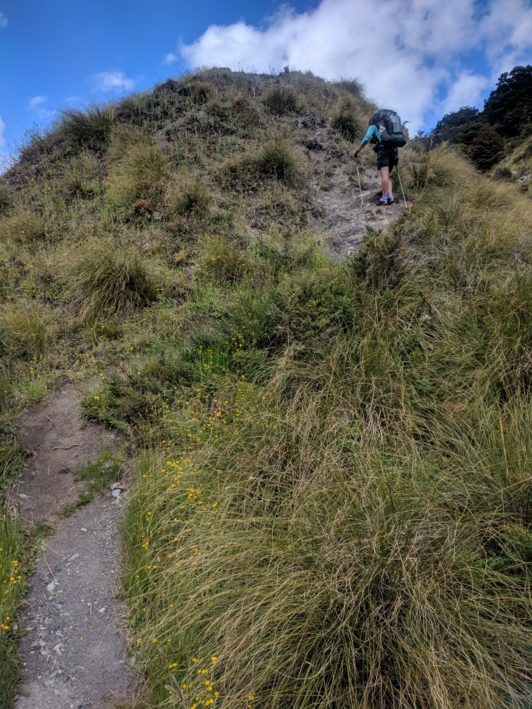 A little bit of our uphill for the day. 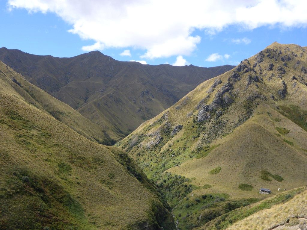 Fern Burn Hut appearing below us. We set off just before 1200, letting David go ahead as he would be faster. The photos probably do more justice to the terrain than words but we climbed up through mainly tussock country to Jack Hall’s Pass (1275m), about 500m above Fern Burn Hut, where we got some good views back towards Wanaka. 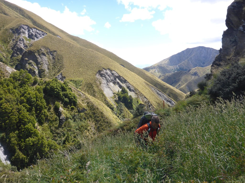 Heading up away from the hut - unusual bit of longer grass that is not common in this mainly tussock country. 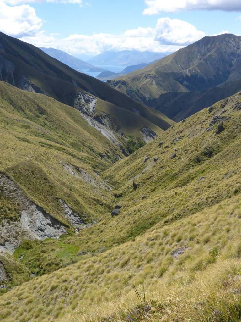 Good views back to Lake Wanaka as we neared Jack Hall's Saddle. 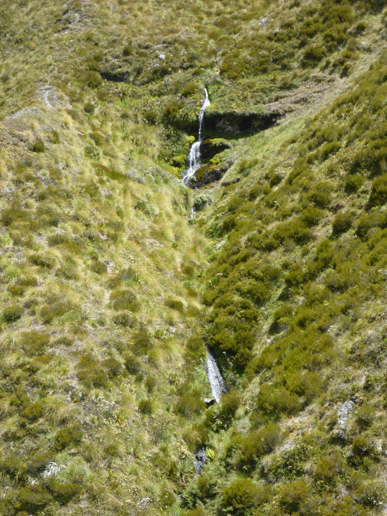 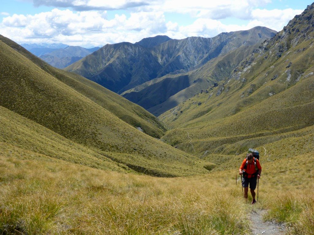 Chugging up the hill - the saddle almost in sight!!  And DoC are generally very good at letting you know when you have arrived! From there we did some up, but mostly down, including some sharp spur descents taking us towards the next hut. Took exactly 3hr walking from Fern Burn to Highland Creek Hut, arriving at 1515, so an early stop for the day - which suited my sore foot! Perhaps surprisingly, we actually did 1300m of ascent and 750m descent - didn’t really feel like it today :-). David was already there and then we were joined by Jack from Aussie. Another local came walking/running through from Arrowtown, but he was heading all the way over to the carpark - so he took off soon after. We four had dinner, then about 1915 another walker came in. This was Daniel from Israel who told us he had three friends maybe half an hour behind. They arrived in about 2000 so we were up to 8 in a lovely (c2008) 12 bunk hut! Looks like everyone is heading for Roses Hut tomorrow! 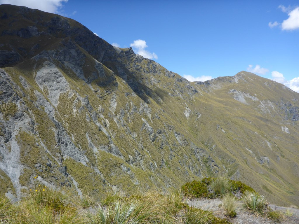 Luckily we aren't climbing up there. 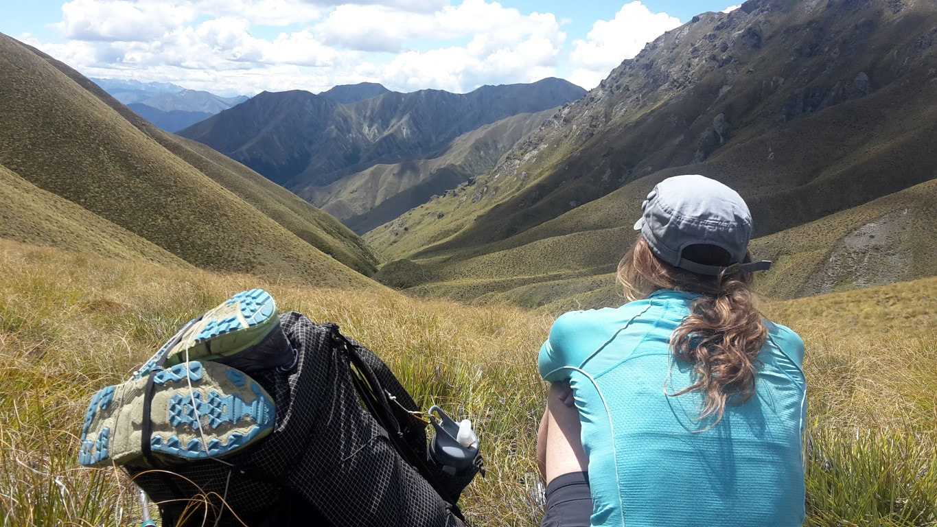 Time to stop and smell the roses - or, in this case, admire the views. 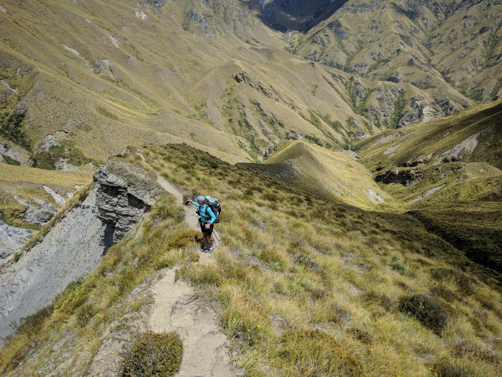 Another ridge to head down - luckily the drop-offs weren't too big! 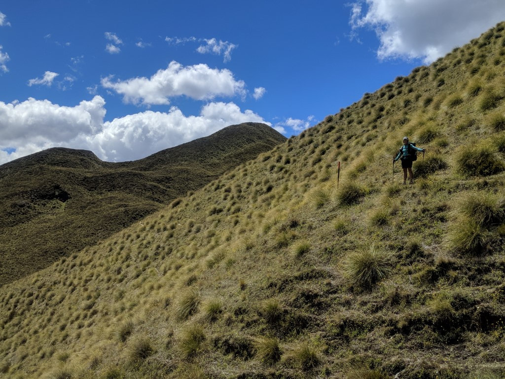 A wee bit of a sidle for a change. 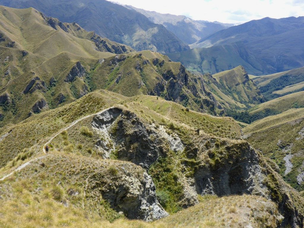 It's quite a dissected landscape - but the track is easy to see at least! 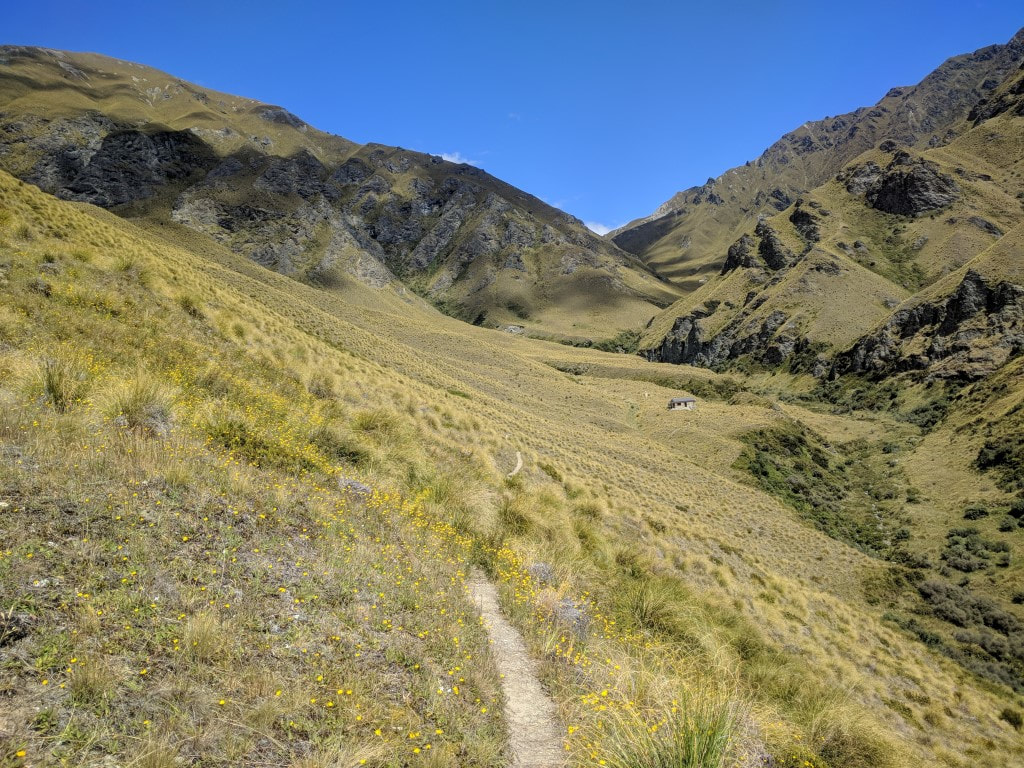 Highland Creek Hut is parked in a lovely little high country basin.  B and I arriving at the hut - photo courtesy of David Hadamik (thanks David). 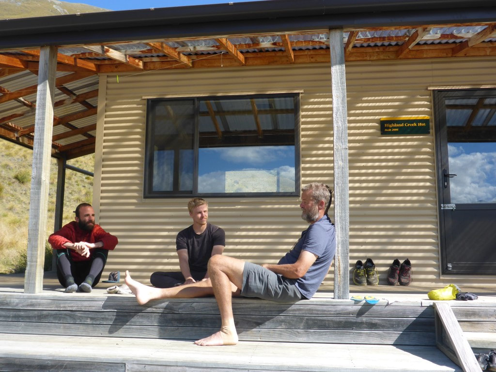 David (Germany), Jack (Aussie) and me enjoying a little fresh air and sunshine on the hut verandah. 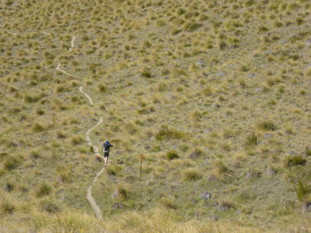 The young chap from Arrowtown who was doing the whole track in one day - heading for the carpark. Really didn’t do much today - a very uneventful Xmas day. Belinda went for a walk - I rested my sore right foot and gave my strapped left ankle a bit of fresh air!! I had hoped to have a pie for lunch but there were none to be had in the camp store so we bought ourselves some stuff for lunch. Not exciting - baked beans for B and a pasta packet for me - but it was at least a change from our usual :-) Got ourselves sorted for a reasonable start time tomorrow and hit the sack! 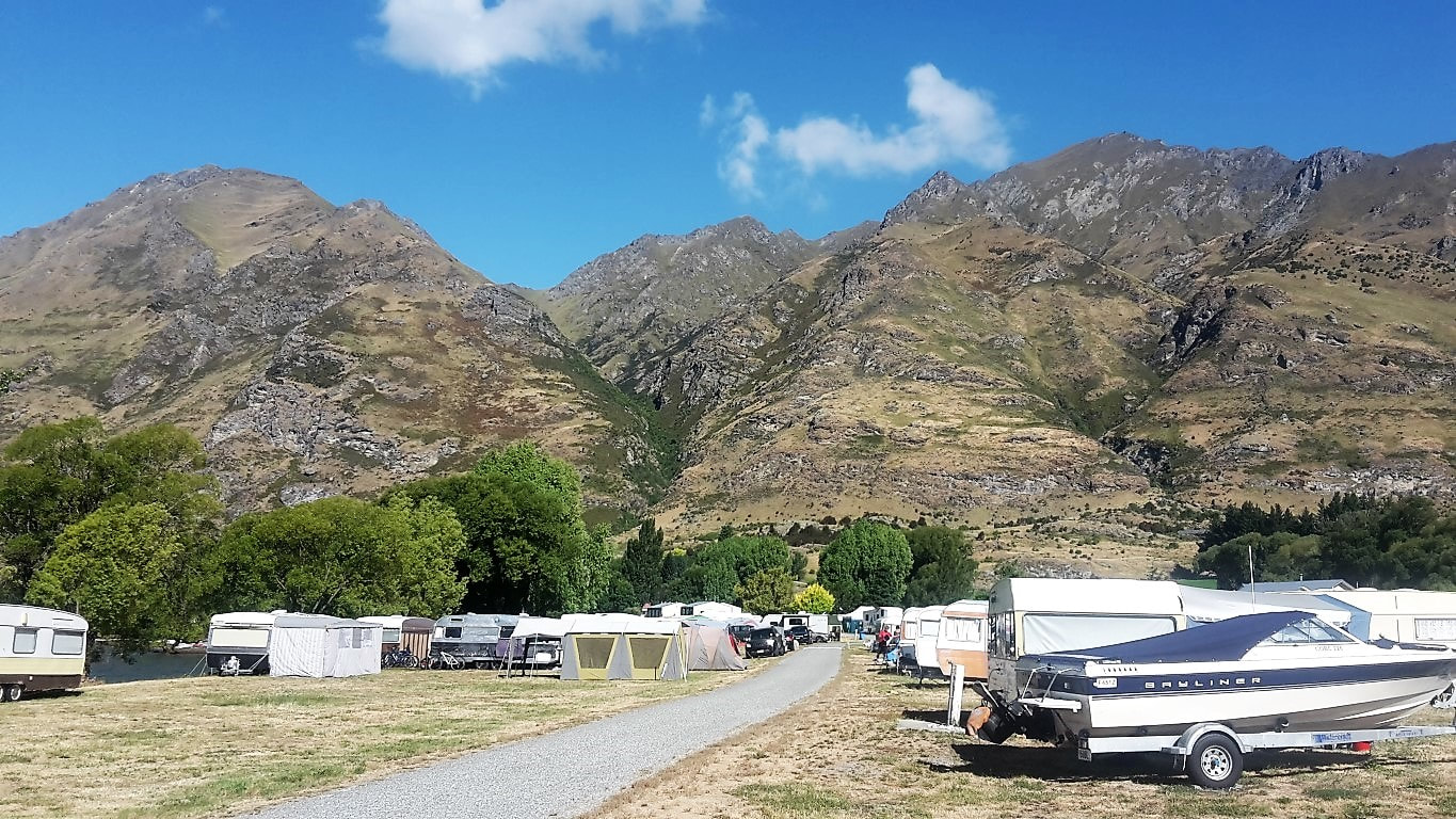 Camp filling up - apparently it is after Xmas that the busiest time happens. 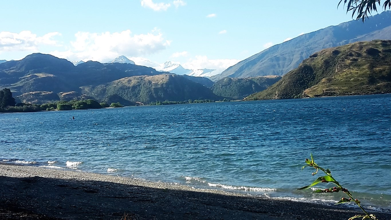 Lovely lakeside views - not quite a millpond today, with a little wind. 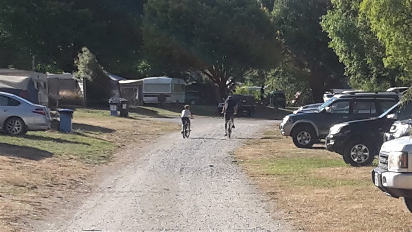 The best way to get around a long campsite! 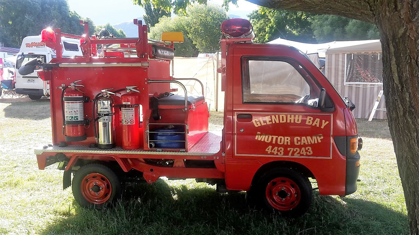 Big enough to have its own little fire truck :-)  And rubbish truck.  View from in front of our cabin back towards the main entrance. That's the famous Roys Peak in the background just out of sight to the right of shot.  Looking from the camp across Wanaka-Mt Aspiring Rd to the hills. Our plan for today was a leisurely rise to do our resupply shopping at about 0800. But first we dropped in to Outside Sports to get a replacement pair of Icebreaker socks. I always felt weird about using Icebreaker’s lifetime warranty but the guy in the shop was great and said "no problem" - grabbed an identical pair of the shelf and took my old holey pair in exchange! He said they never had any issues with Icebreaker replacing them - a good PR ploy :-) So now I have a nice new pair of socks to finish off with. Then it was over the road to New World for our restock, which we took back to the hostel to organise for our next stretch. Having only a short 15km to Glendhu Bay today, we exited the hostel at 1000 and found a nice cafe for a hearty brunch to set us up for the day! Then it was a brief look at a local market before hitting the lakeside trail. Again it was a weekend warrior type cycle trail initially - flat, well packed and well used. We wandered past the famous ”Wanaka tree” and had to take a photo even though millions will have taken better ones!! The track for the day is here. About half way, I'm guessing just past Damper Bay, the track started to get a bit more hilly with lots of little ups and downs. As a consequence, mainly because of water effects on slopes, the track got a little rougher, but still fine for walking. This part of the track was noticeably less populated with traffic (foot and bike) - obviously people like the flat bits better!!  Trampers brunch! 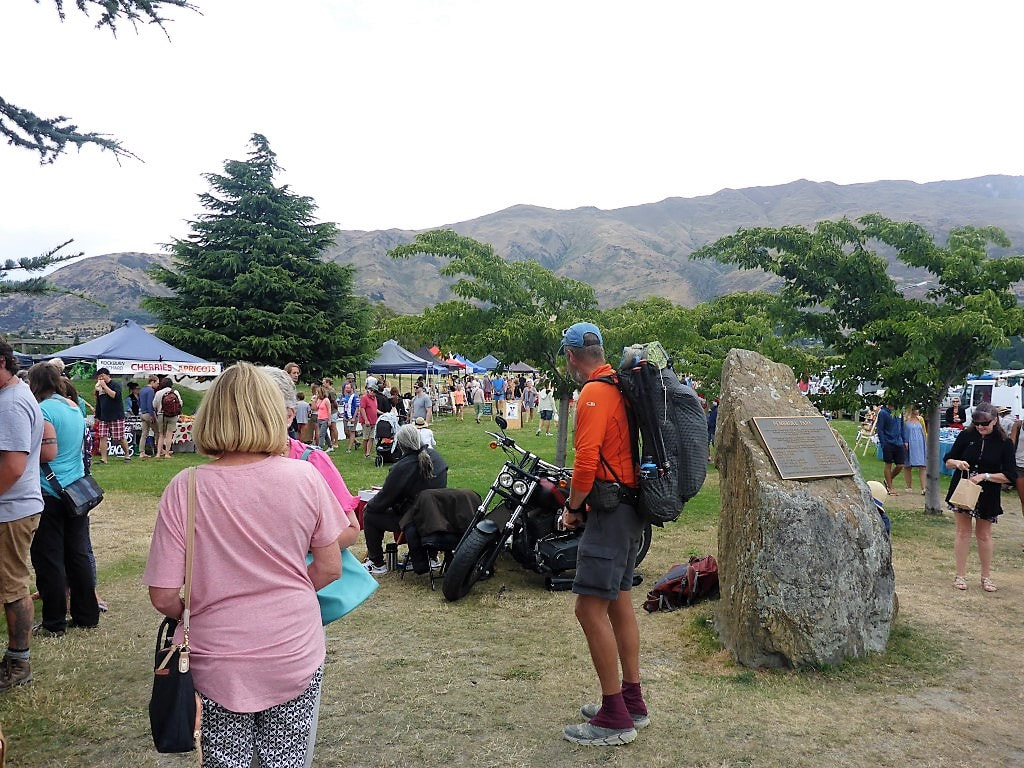 Market day. 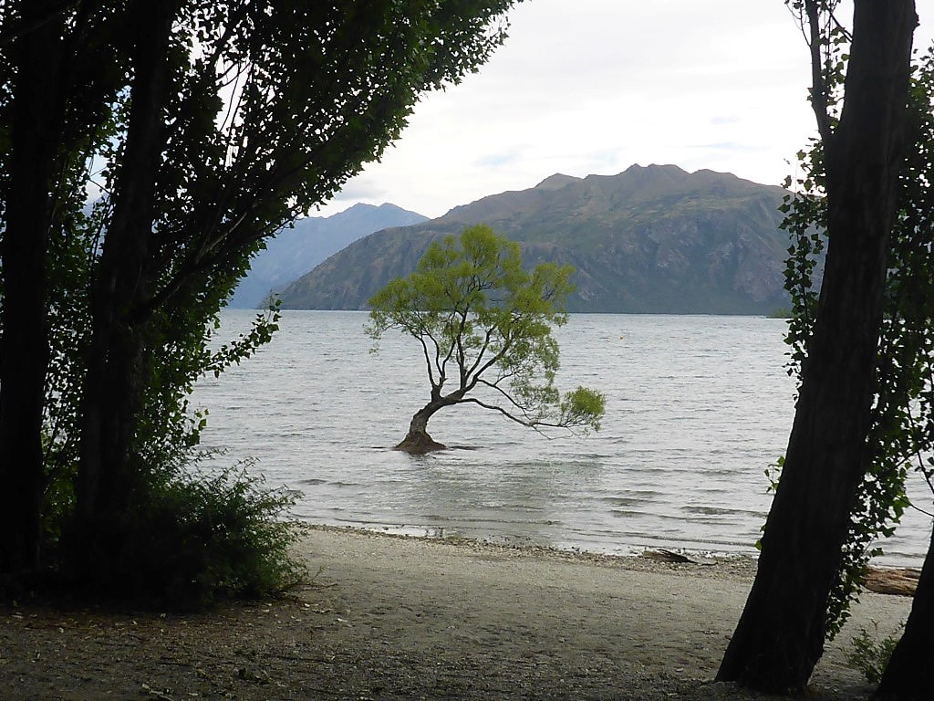 Off around the lakeside - and the obligatory shot of the Wanaka tree :-) 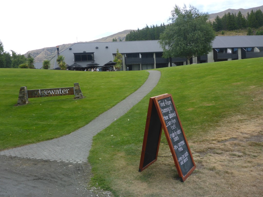 We could have stopped for a hobbit-like "second breakfast" but decided not to. 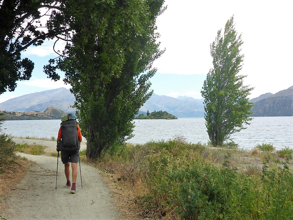 Meandering around the lake on a nice flat track. 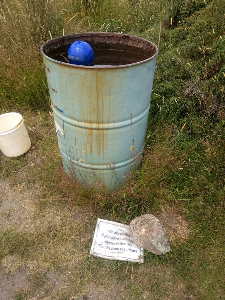 A nice way to help support the replanting programme by keeping plants moist. 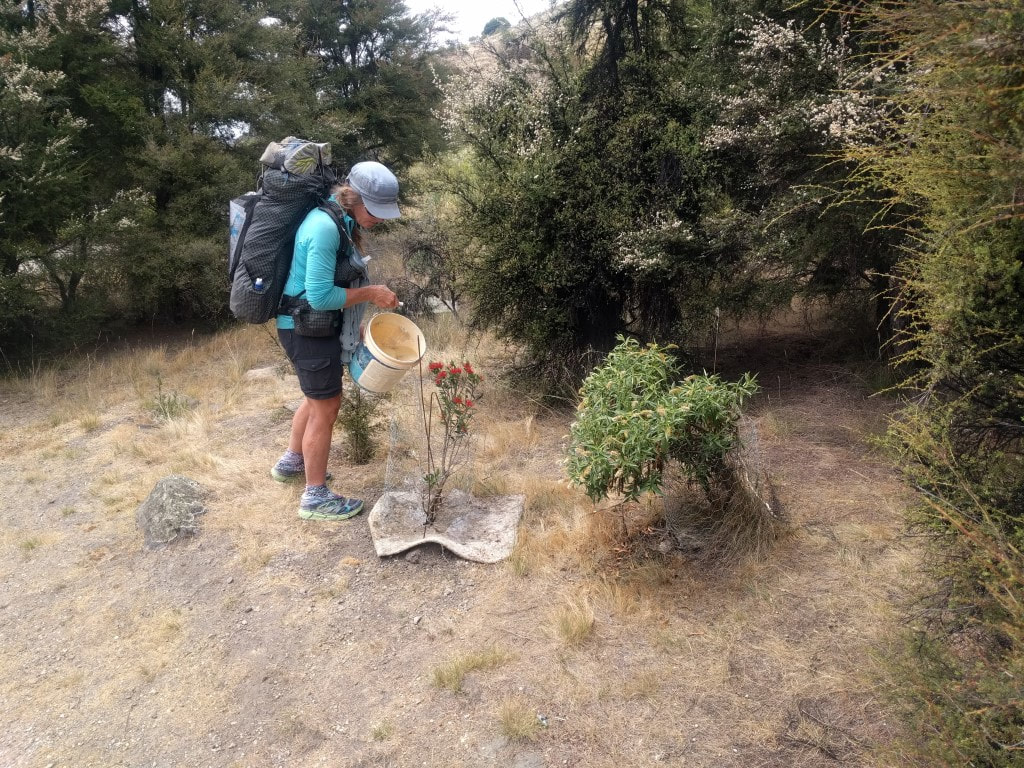 So B kindly obliged :-) 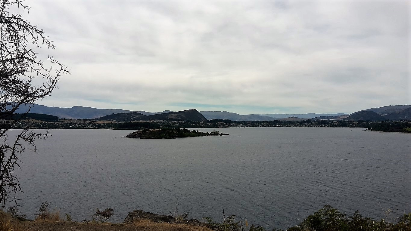 Looking back towards Wanaka. 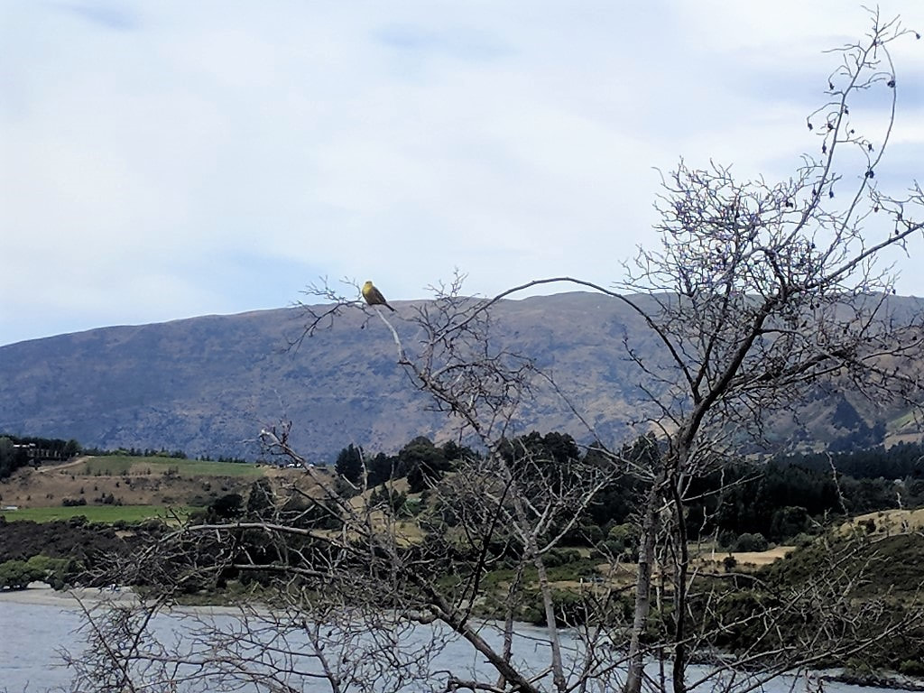 A bird along with the scenery for some variety! 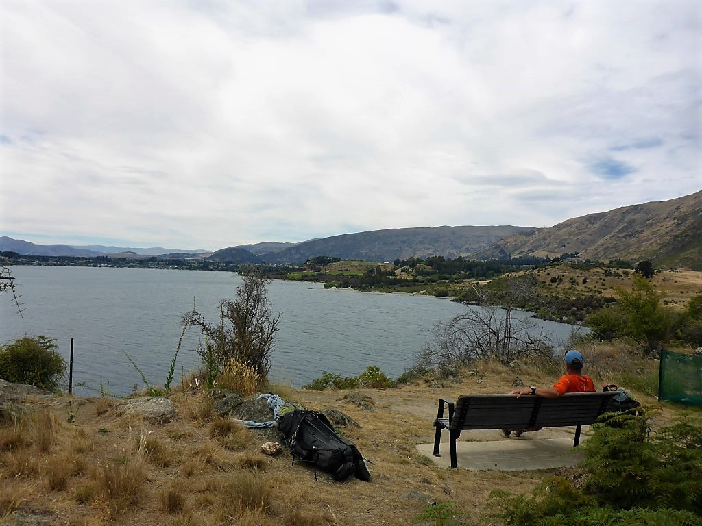 Nice rest spot for a stop - a bit overcast so not as hot for us today. We plodded on with our sore feet and eventually reached the campground. We settled into our quaint little cabin and stocked up on some cold drinks from the store - then first priority was a wash and a little lie down!! After our big brunch we had brought some fresh soup with us for a lighter dinner and were ready for bed around 2200, knowing there was no rush to get up on Xmas day. A lie-in - a luxury not often afforded us :-) 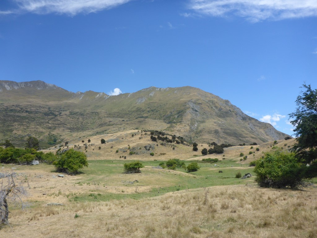 Farming country looking a little dry - although a tinge of green in the dips. 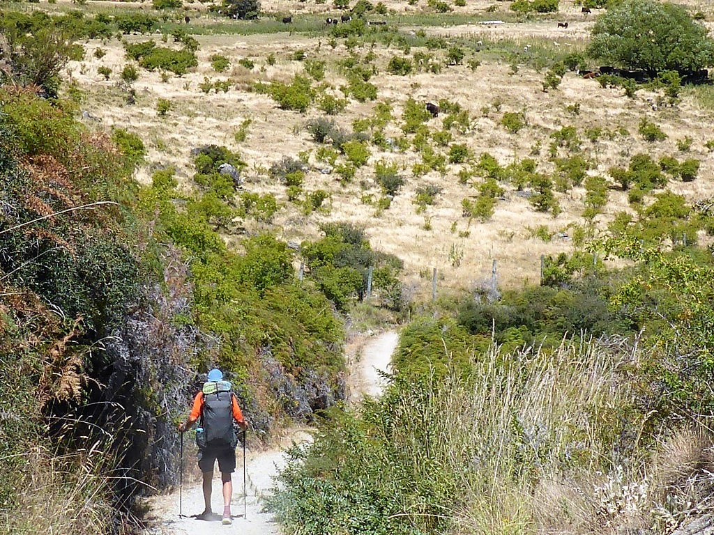 Heading down - cattle on the other side of the fence.  Pleasant views to the head of the lake. 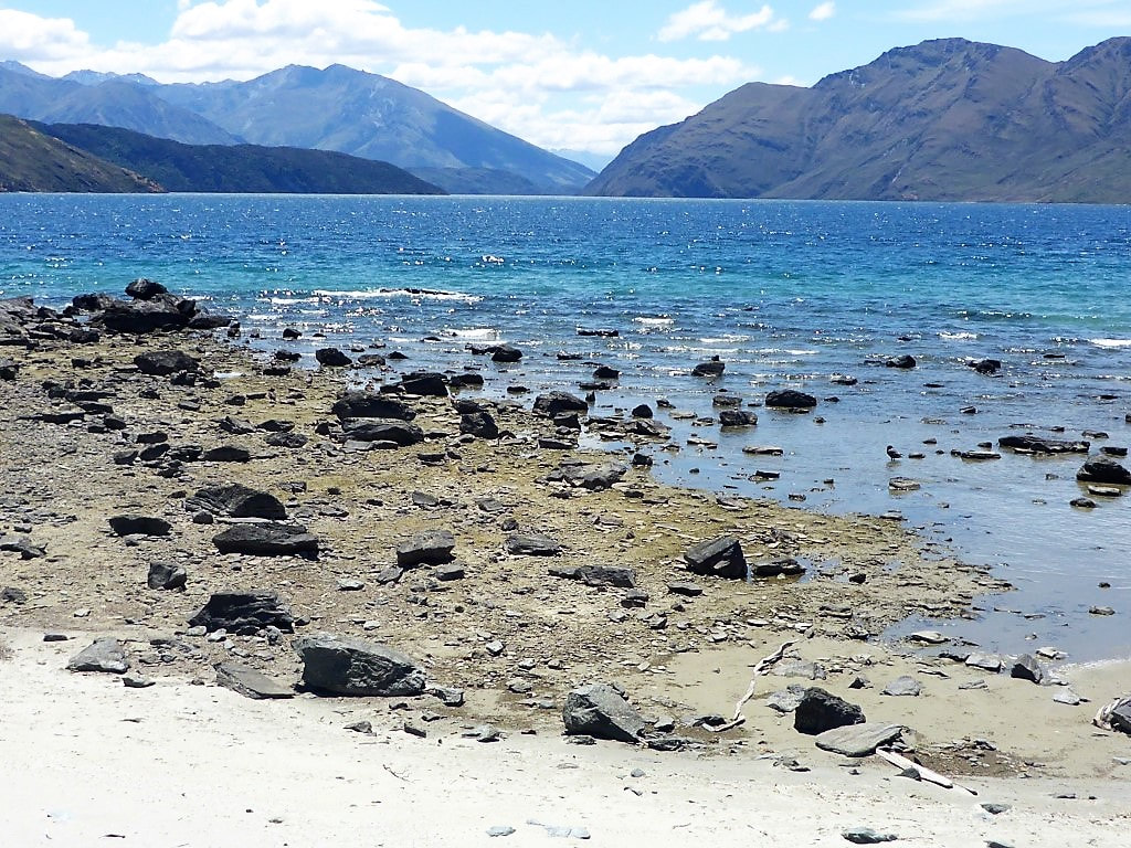 Getting close to the shore at times. 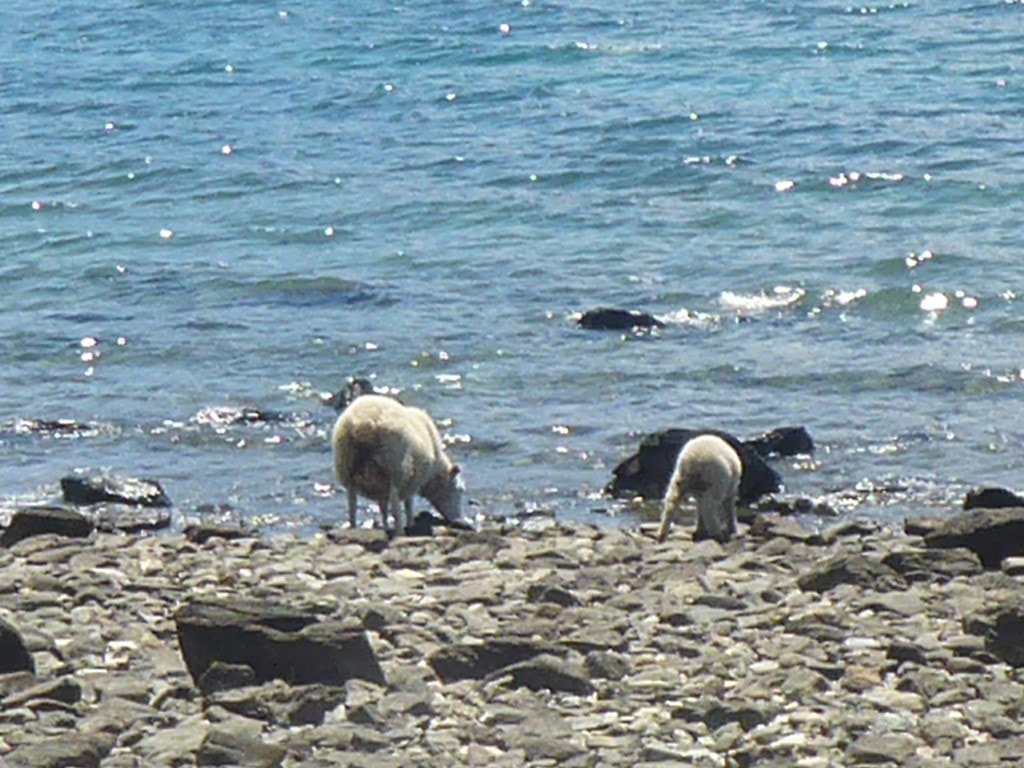 It is also a very big water trough for the stock in places :-) 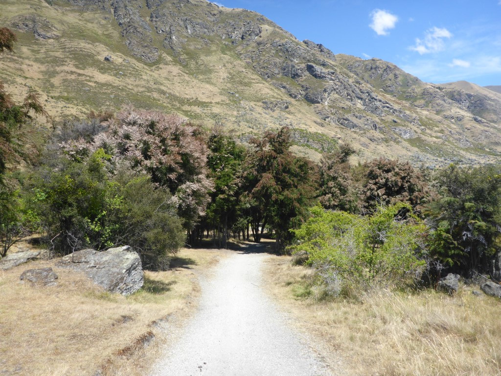 Getting a little warmer now so the approaching shade was welcome. 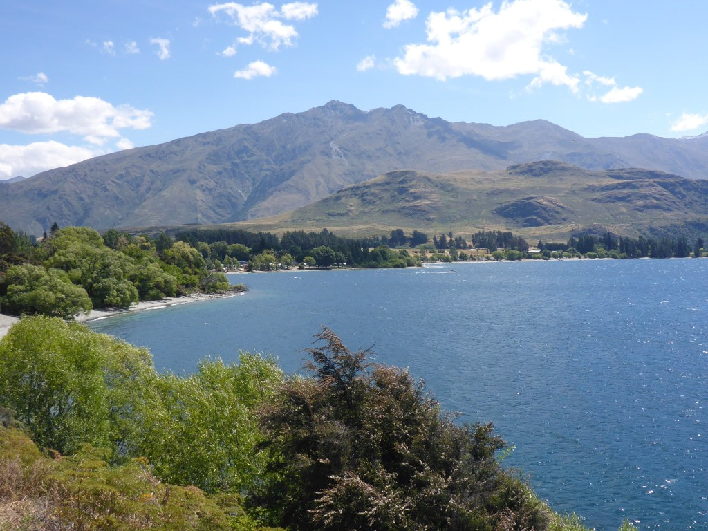 Getting closer - can actually see the campsite now! 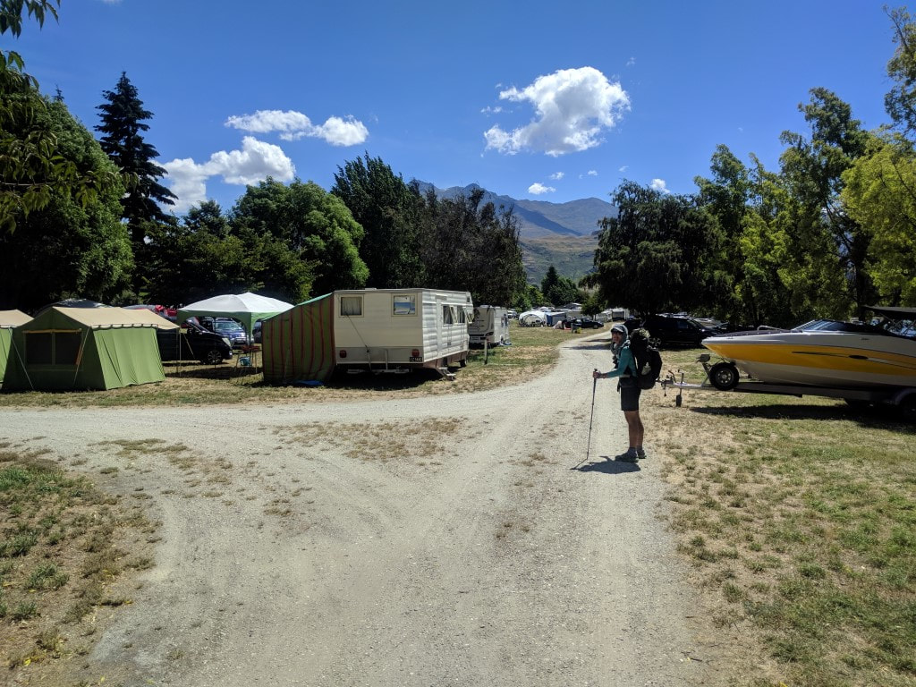 The start of the campsite. Looks like it covers almost 10 hectares (about 1.4km end to end) - apparently over 2000 people when it is full!! 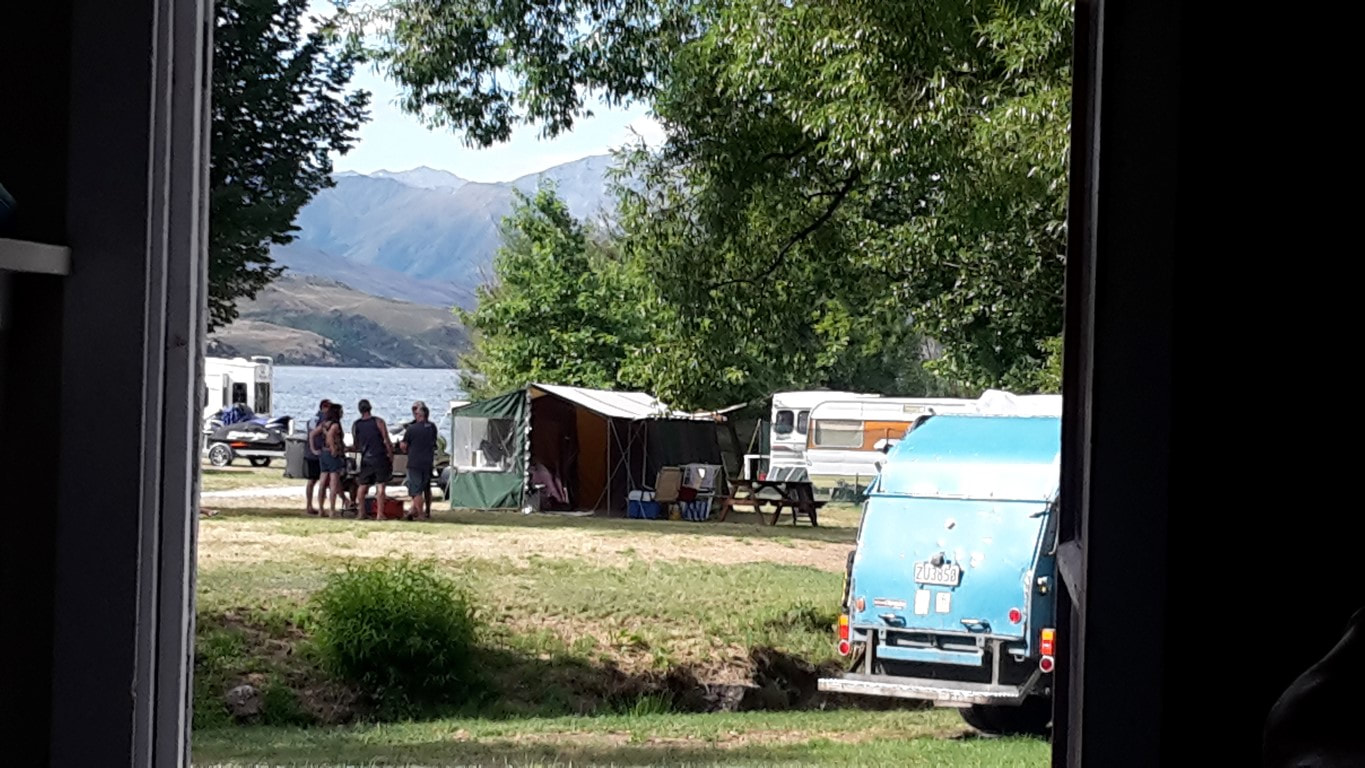 View out our cabin door toward the lake. We were up early and packed up ready to go about 0620. Today ended up being over 37km in just over 9.5 hours of walking. It was a day of two sections: a very steep descent initially, followed by a long relatively flat run from Hawea to Wanaka. GPS data for the day is here. It was a short climb up to rejoin the trail before starting a 950m descent over 4km down to Timaru River Road on the shore of lake Hawea (we had already dropped around 300m from Breast Hill to the hut last night)! I have to say I found this the most nerve-wracking section so far. With no head for heights, the steep rocky decent on a fairly sharp ridge (at times), with big drop-offs in places, did nothing for my head! Still - it's only mind over matter! I thought I was being very slow and cautious, with B keeping a respectful distance behind! Eventually, after about 650m of descent and 1h40, it switched to a zigzag track on a steep face which I found a relative doddle! Surprisingly we hit the road in a whisker over 2 hours, which is faster than DoC suggest! Marie had left after us and not long before we hit the steep zigzag she caught up with us. Lucky she was behind us as B had stopped to rearrange her mesh pocket on the way down and my Icebreaker cap had fallen out! Marie had spotted it and kindly picked it up :-). We said goodbye to Marie at the road as she was heading down to the road to hitchhike straight to Chch for her flight out on Xmas day, rather than turn off onto the lakeside track that we would follow - it obviously went OK as we saw later on her Facebook page she made it back safely. 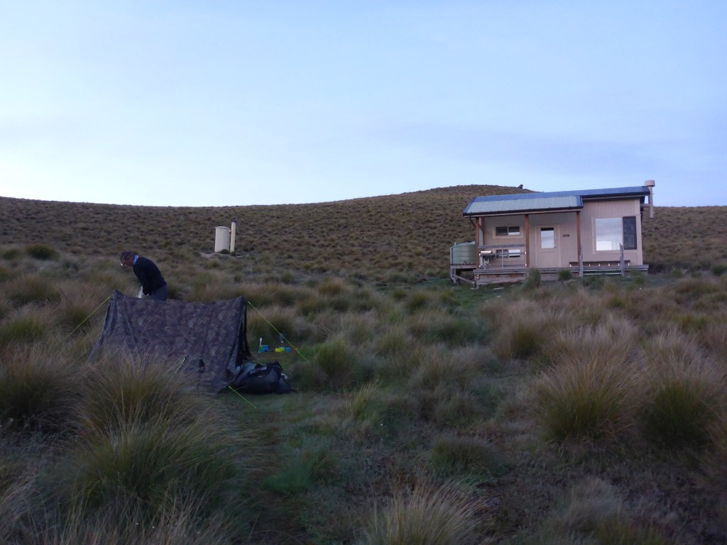 Tent and hut at 0530 - plenty of light around although I still had my headlamp on as we were up in the dark. 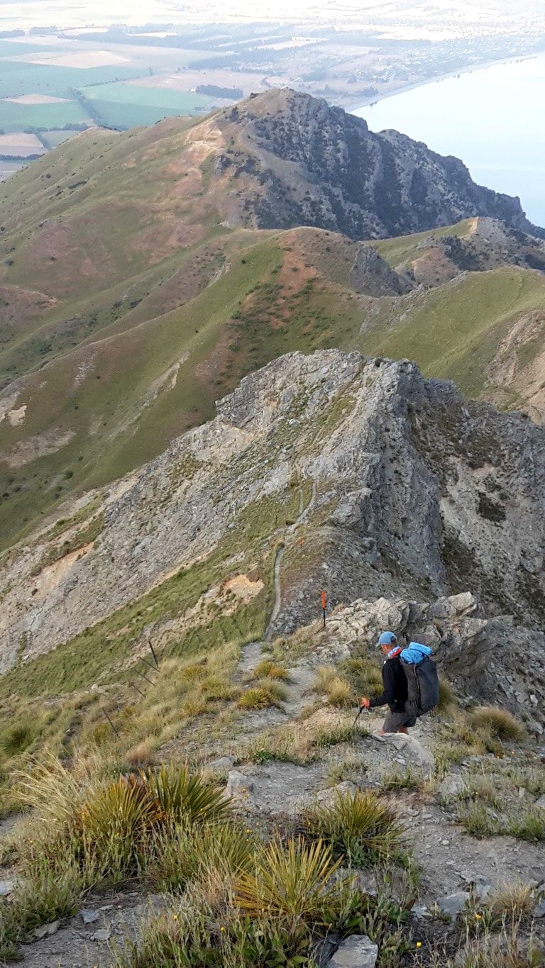 Starting down - around 900m still to go!  Little bits of "up" as well.  Sheep on the other side of the fence below - has no trouble with heights.  B a respectable distance behind, giving me some space :-)  Slightly "flatter" bit on top of a ridge = sheep poo city.  B taking in the still-stunning views on the way. 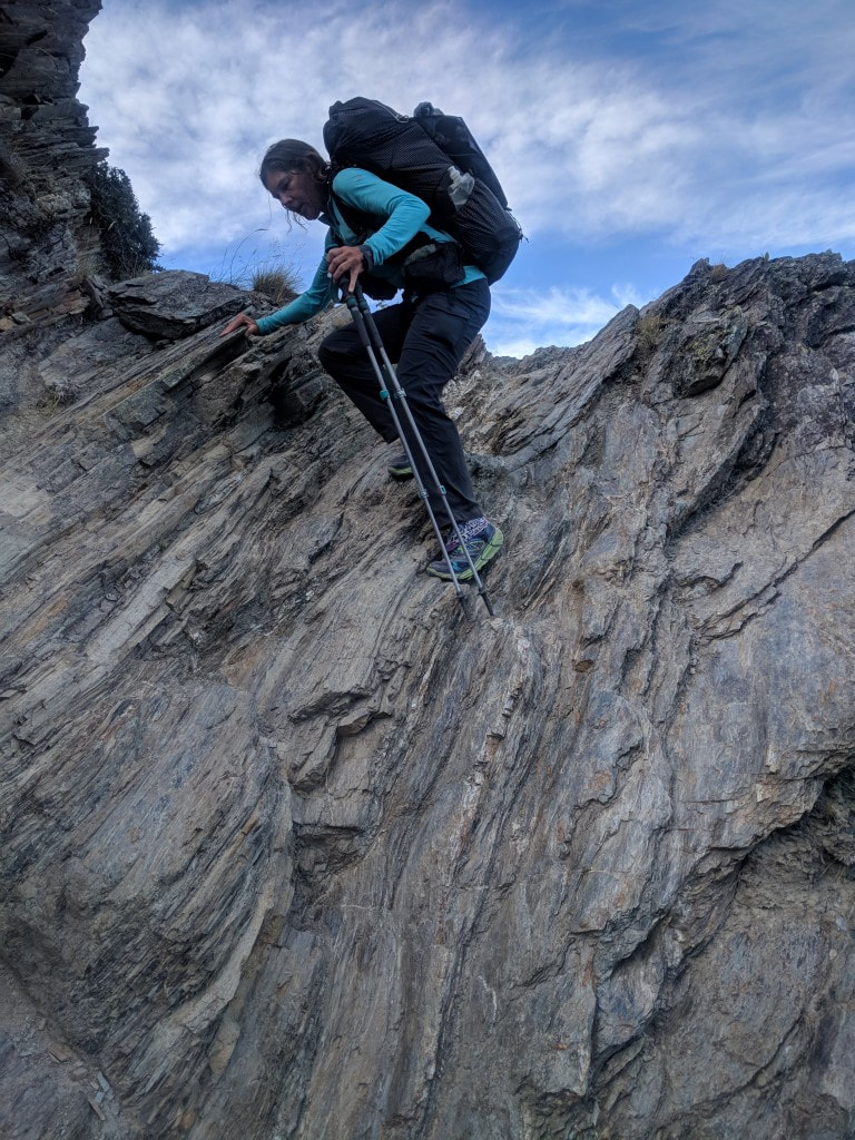 This bit was more climbing than walking - poles not much use! 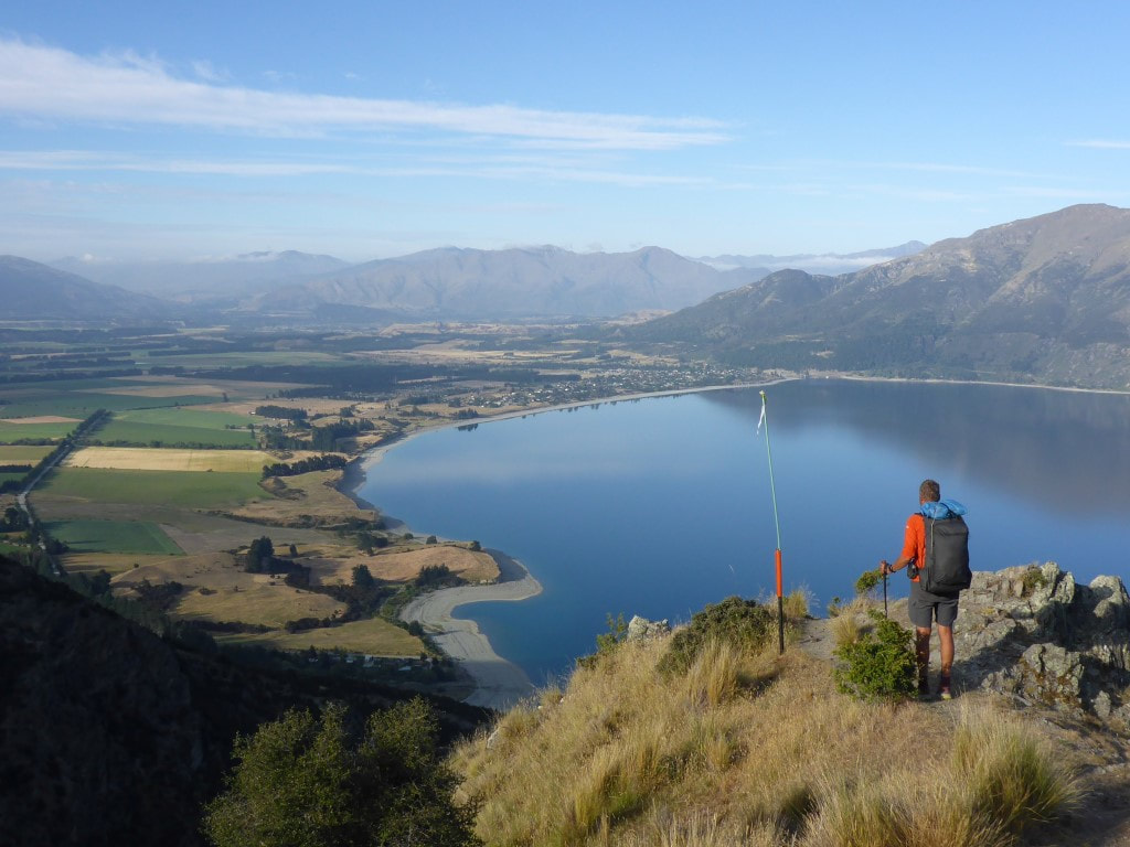 View of Hawea village at 0800 - almost at the zigzag track with 350m still to descend. 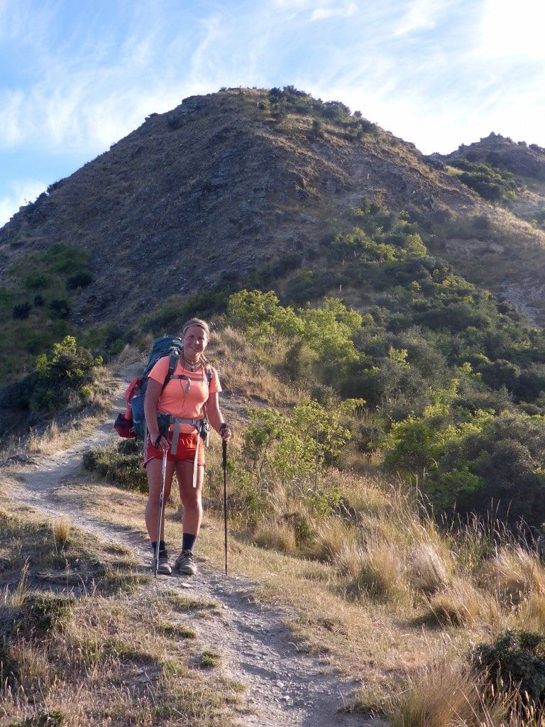 Marie catching us up - and kindly delivering my cap in the process :-) 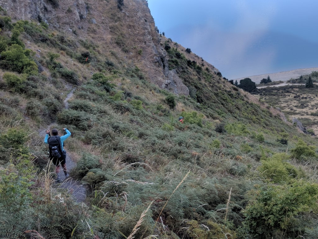 Marie (centre of shot), followed by Belinda on the zigzag track - me being "tail end charlie" now. 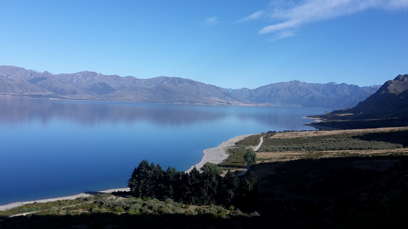 Another view toward the head of the lake from lower down. 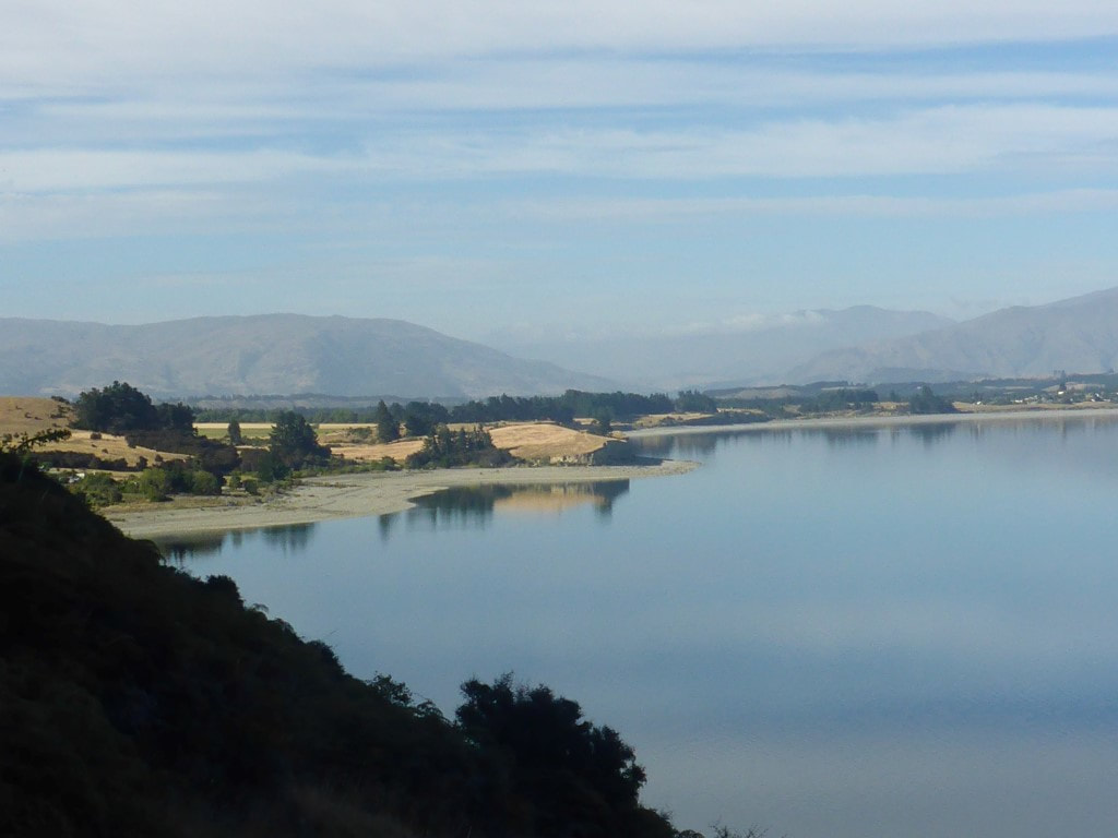 Getting closer to the lake. 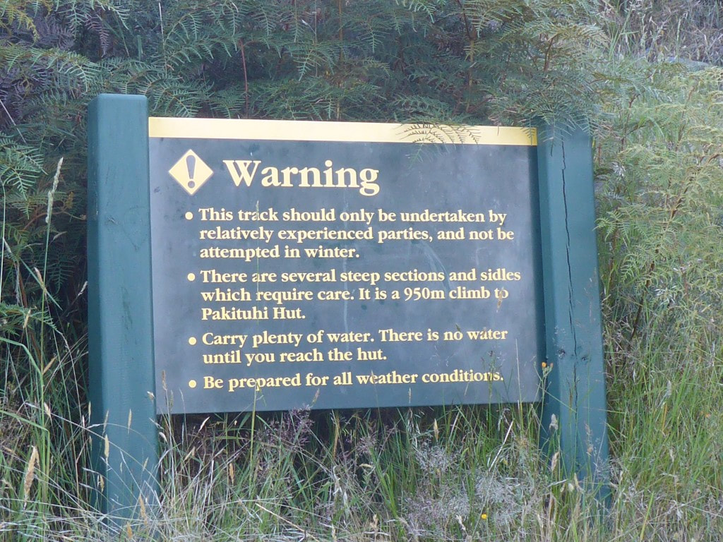 One of the signs at the road end of the track for those heading up!! Pretty much the rest of the day was spent on various cycle/walking tracks so was pretty easy going after what we had done over the last few days! Every now and then it's nice to be on flat terrain :-). From the Gladstone Reserve we walked around the lake edge to the village - getting near to the control gates we took a small detour from the trail and found a cafe/store on Capell Ave near the intersection with Parry Cres (its worth the small deviation off trail for this!!). We decided to stop here for half and hour for a coffee and some hot food (pie in my case and vegetables stack for B) which was very much appreciated :-) 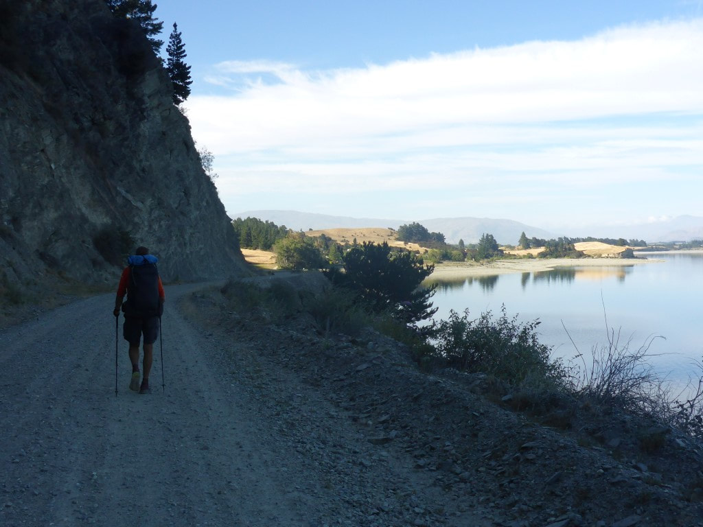 Finally onto Timaru Creek Road at the bottom of the big hill - 0845. 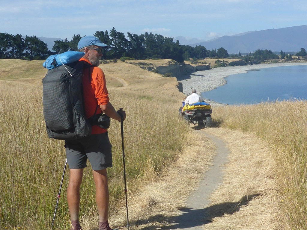 Nice track from Gladstone Reserve around lake edge. One of the local volunteers checking the track on quad bike.  B's artistic shot from the lake edge. 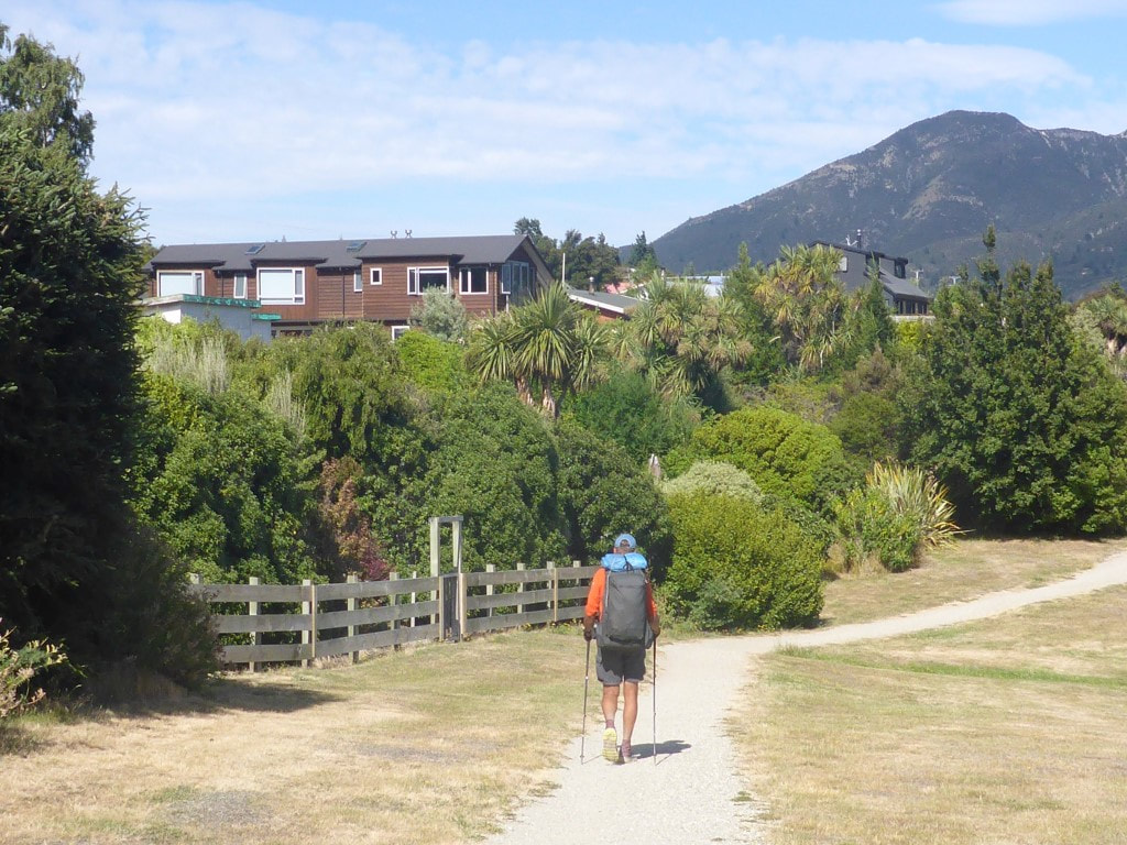 Entering Lake Hawea Village - cute little place, not quite yet got the growing touristy feel of Wanaka or Queenstown (or even Arrowtown).  "Cabbage tree 1 with lake". 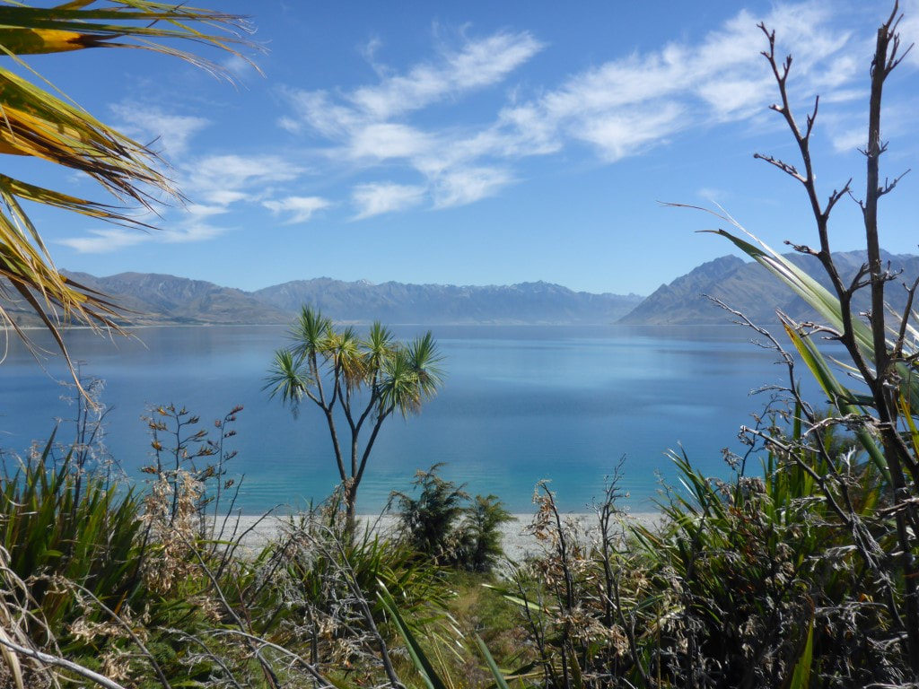 "Cabbage tree 2 with lake" :-) 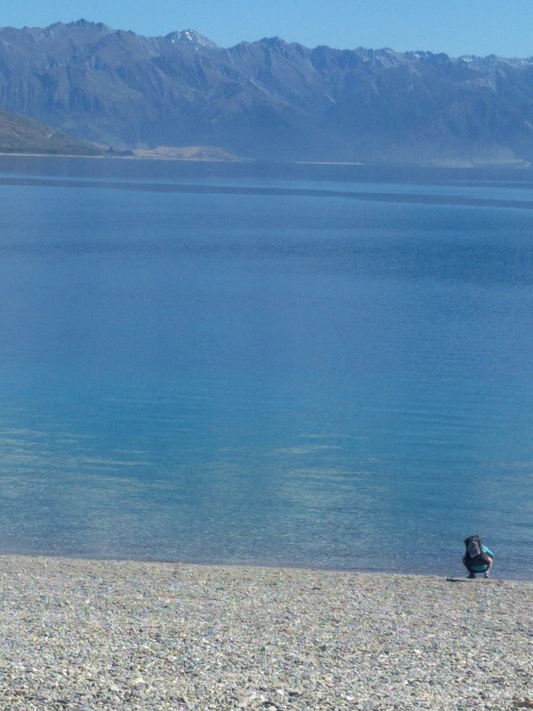 B dipping her fingers into Lake Hawea. 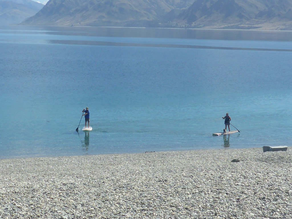 Paddle-boarders - note the dog catching a ride on the right hand board. Then it was another 12km mostly following the Hawea River towards Albert Town. We stopped here under a tree in a campground for half an hour or so as the day was hot and the track fairly exposed. We had stopped a few times to wet our headgear to help with cooling. A quick diversion into Albert Town to try and find the “store” for a cold drink proved a dismal failure so it was back onto the river track (this time now following the mighty Clutha River) towards Wanaka. 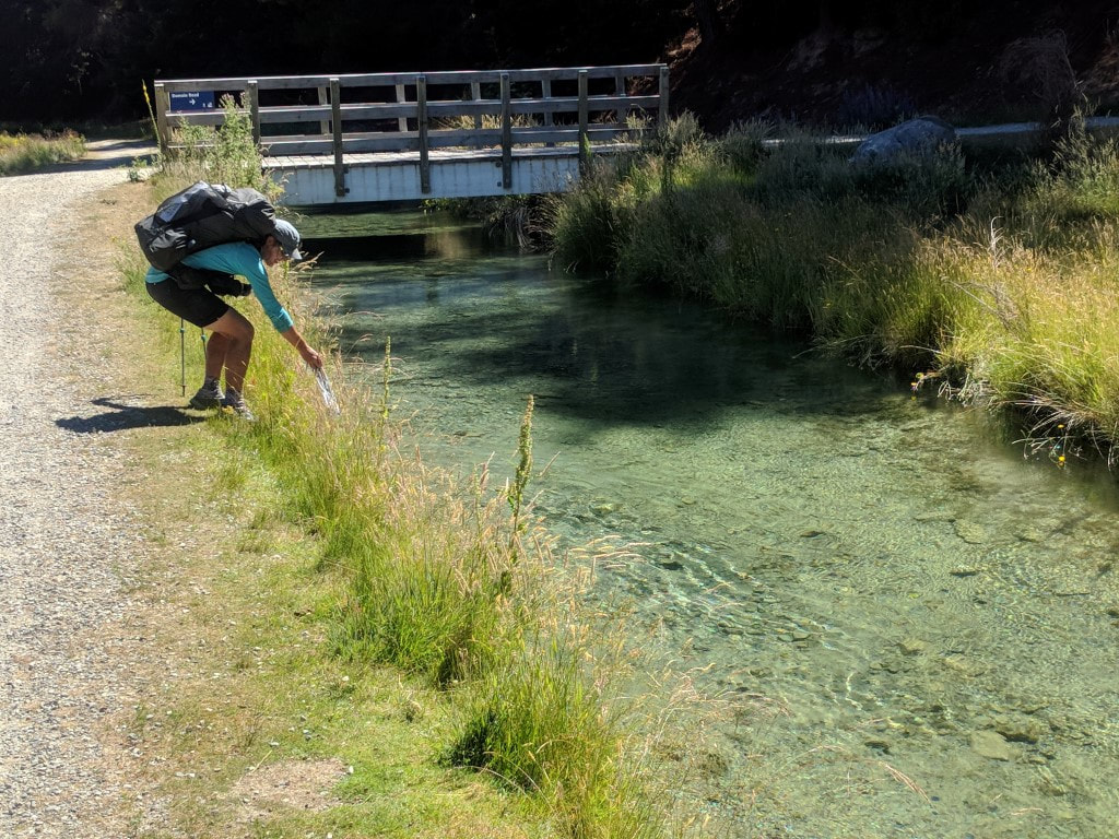 B wetting Joan (her scarf) in the water race. The water race was on our left and the river on our right for this part of the walk - easy access to coolant! 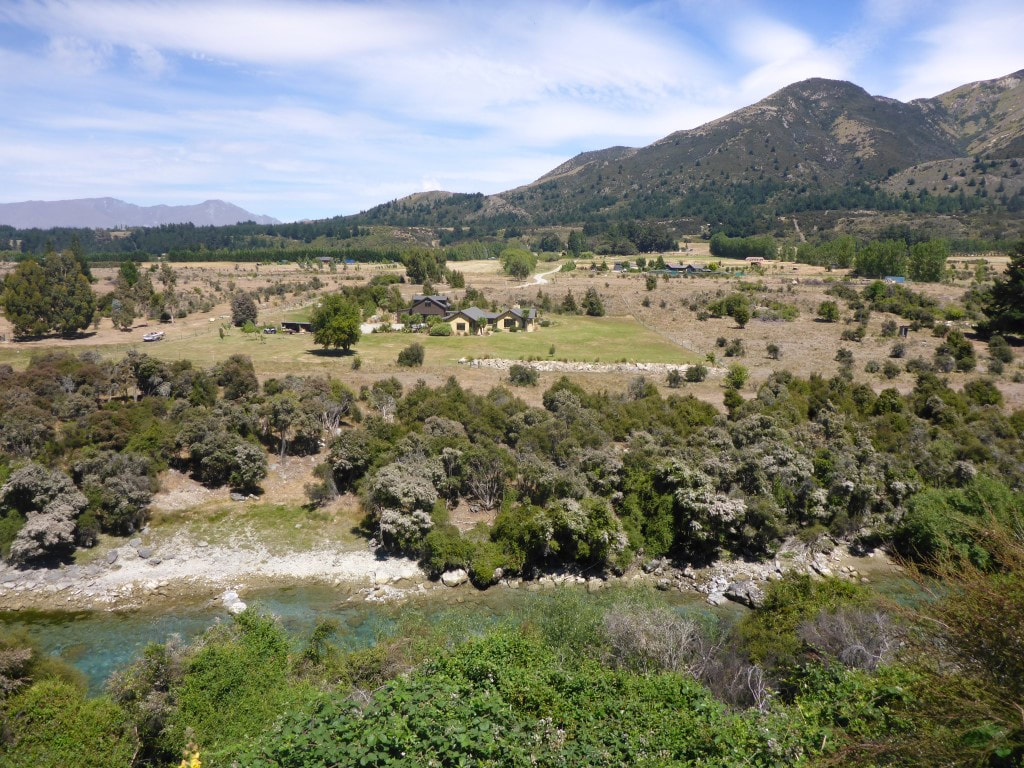 New area of development across the Hawea River. 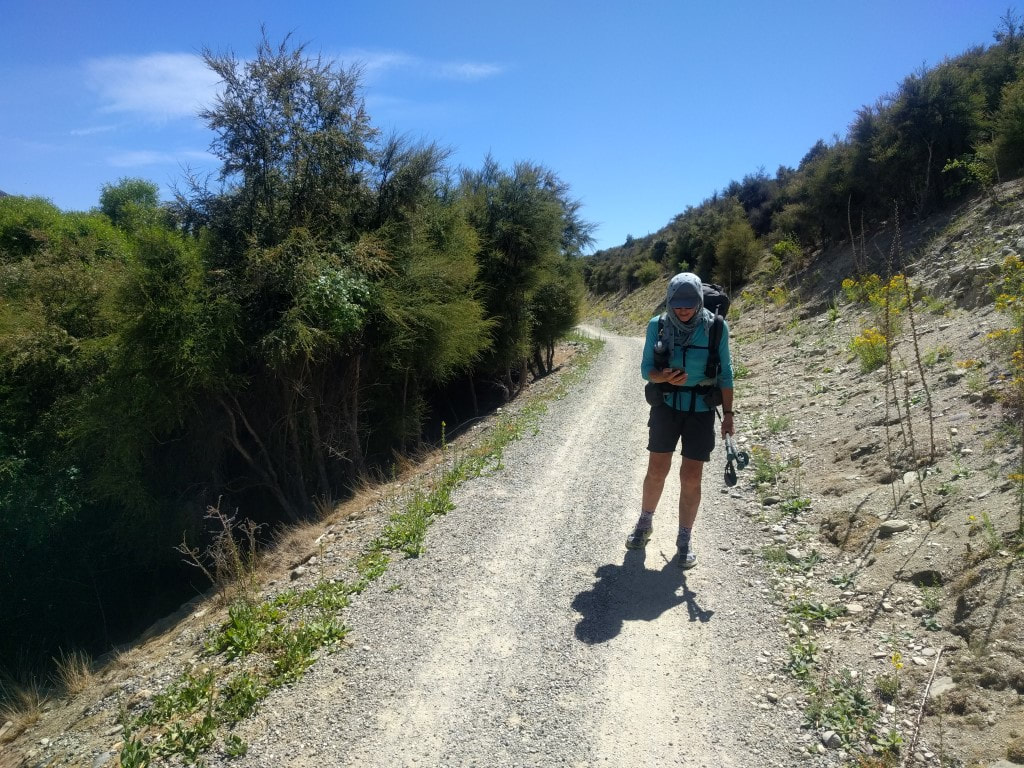 The technology fiend (not really)! :-) 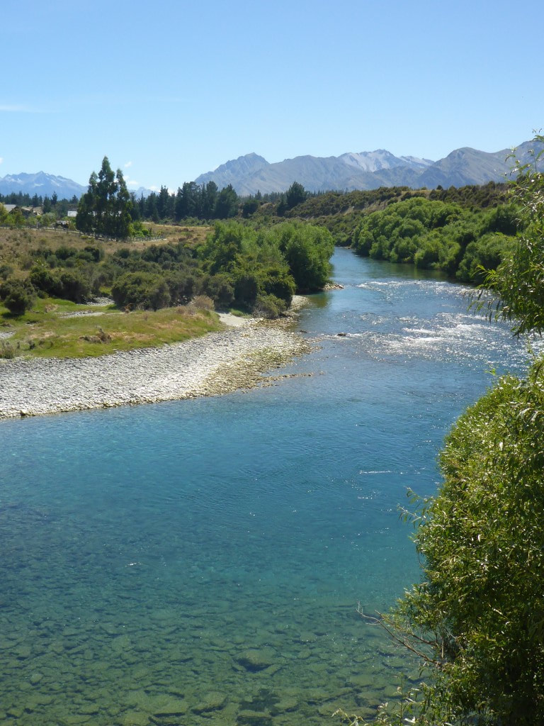 Nice clear river.  One of a couple of standing waves for use by surfers/body-boarders along the river. 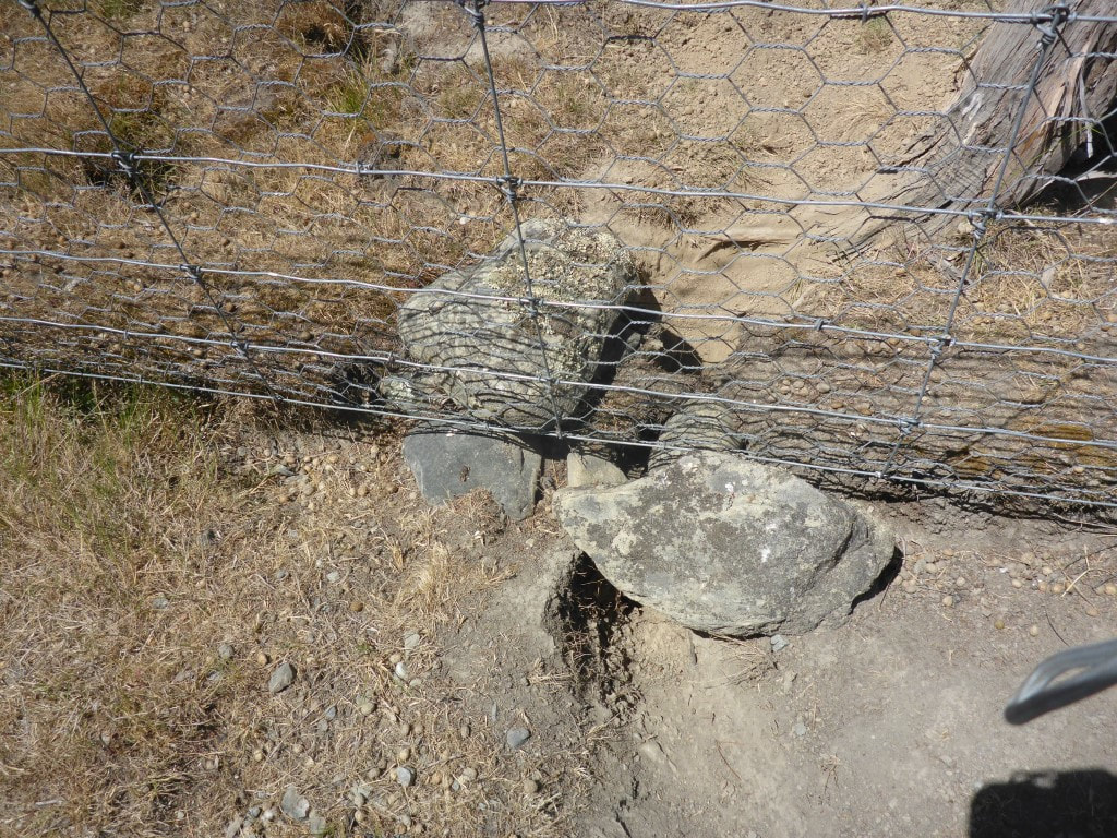 Battle between rabbits and landowners continues! 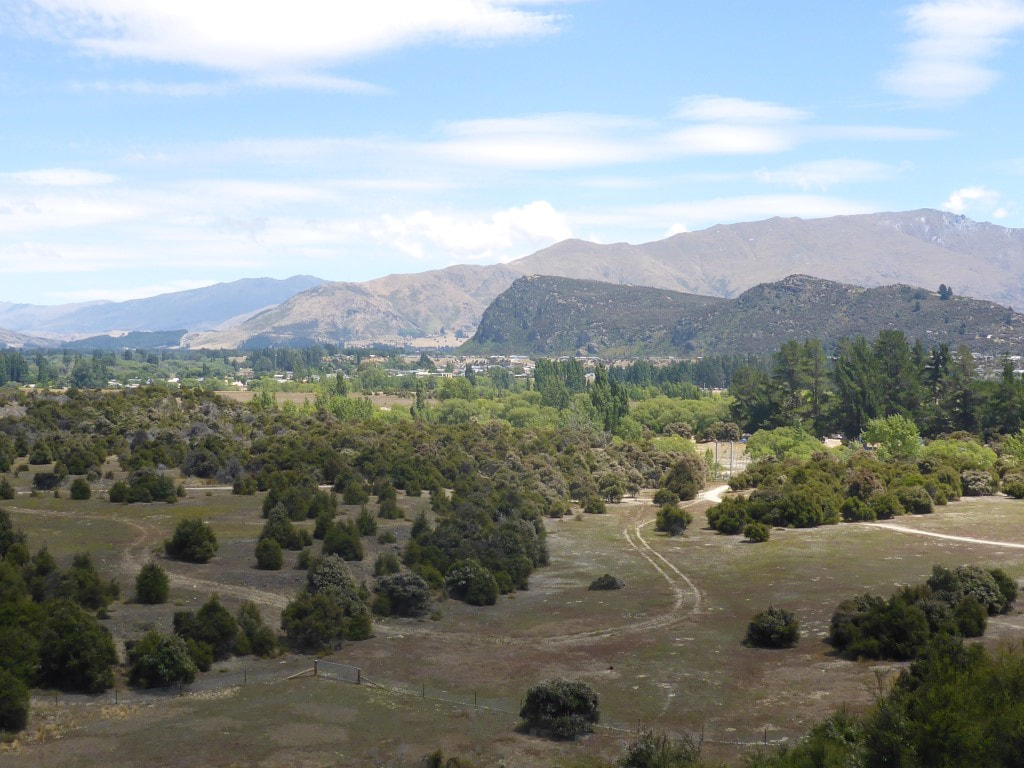 About to drop down toward a bridge across the Hawea before heading for Albert Town. 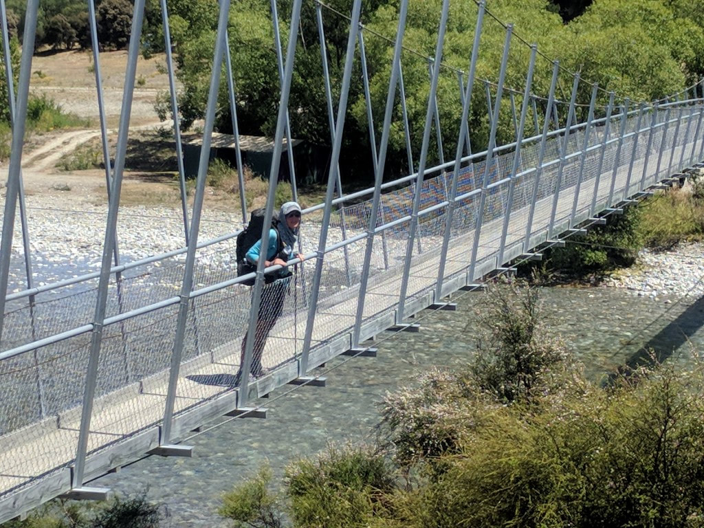 Across the footbridge - campsite on the other side. 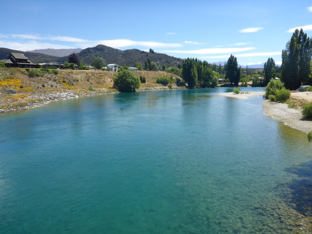 Photo looking up the Clutha from the single lane bridge on SH8 - Albert Town on the left of photo. Heading up the cycle trail alongside the Clutha, there were quite a few people on rafts and kayaks enjoying the trip down from the lake Wanaka outlet, which we arrived at after about 4km. These tracks are well used by locals and we passed numerous cyclists and walkers (it's all pretty easy going). From the outlet it was another 8km around the lake edge into Wanaka and to the YHA where we had a lovely ensuite room, arriving about 1800 from memory. On the way through town we couldn’t resist buying a bag of lovely fresh Central Otago cherries - a real treat! Julia had sent us a parcel with another pair of shoes each, so we picked that up as well. Then it was into town to check if we could find some gel insoles for the shoes (B needed some new ones and I was having trouble with pressure points under the ball of my right foot for the first time ever!). We also sat down to a lovely meal at a local eatery and I enjoyed several beers as we had a bit of a wait for the food (that's my excuse anyway). Given the state of our bodies we decided another rest day would be helpful and luckily managed to extend our cabin at Glendhu Bay campground for another night, so we would spend Xmas day there as well. Might also minimise the effects of a couple of days of possible showers! 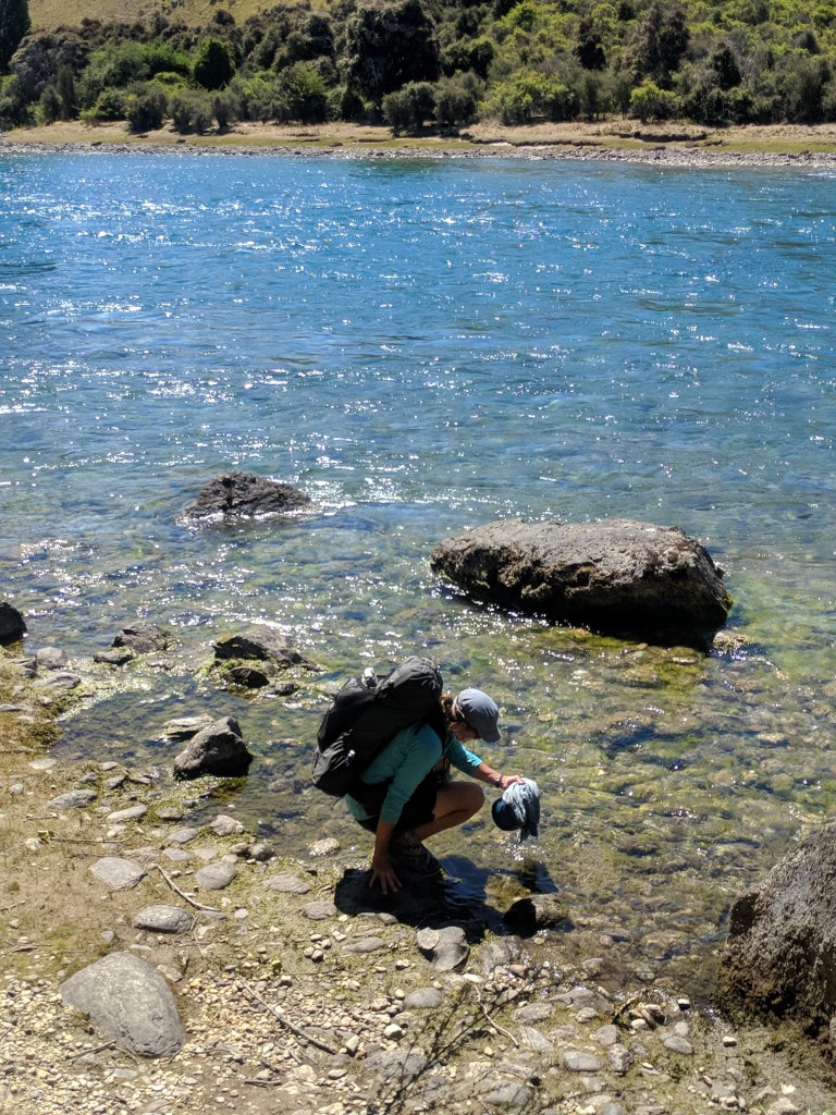 B wetting Joan in the Clutha, as well as my cap. 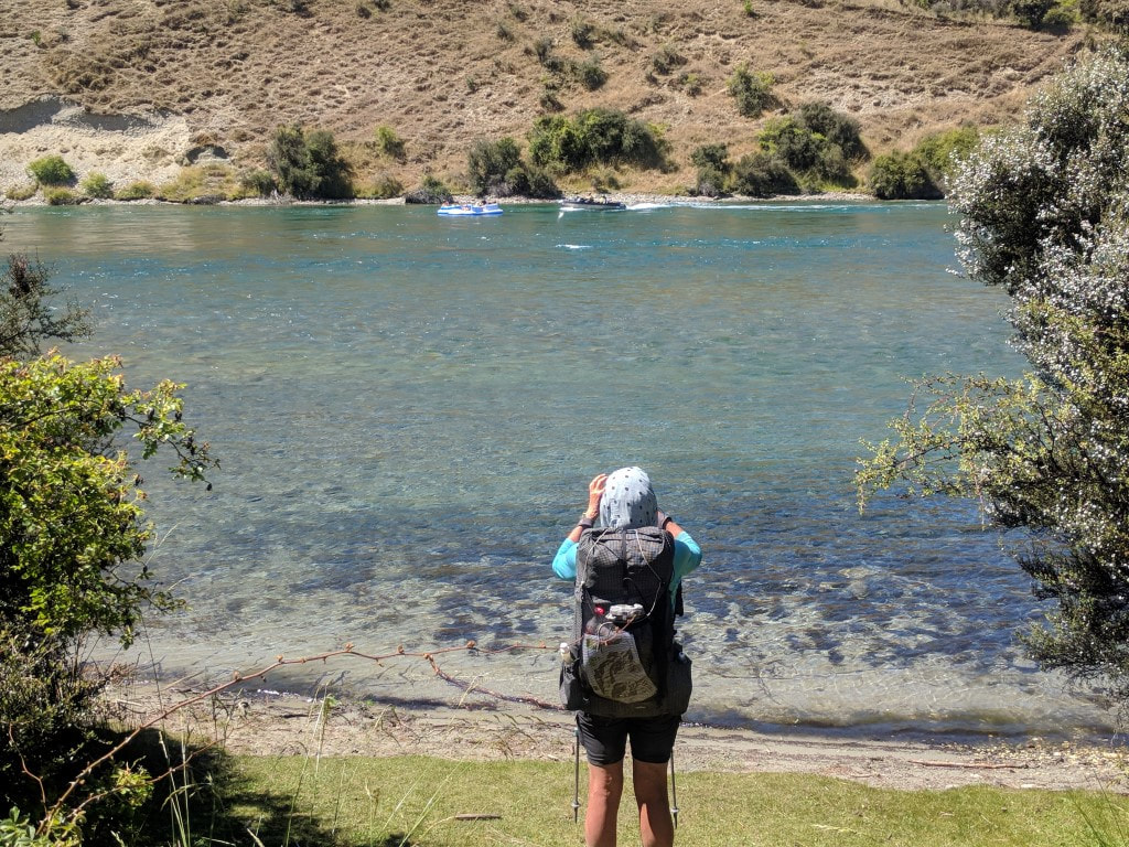 Jet boat occupants chatting with some kids on inflatable rafts. 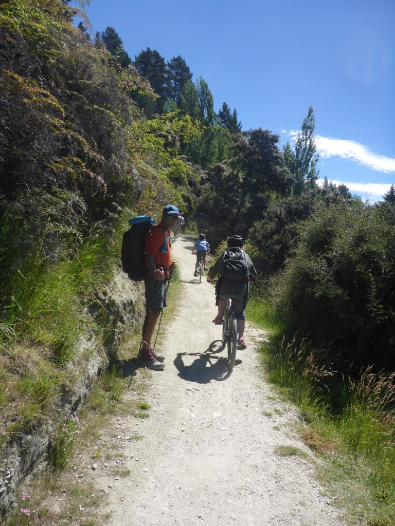 It is a cycle trail as well, after all. 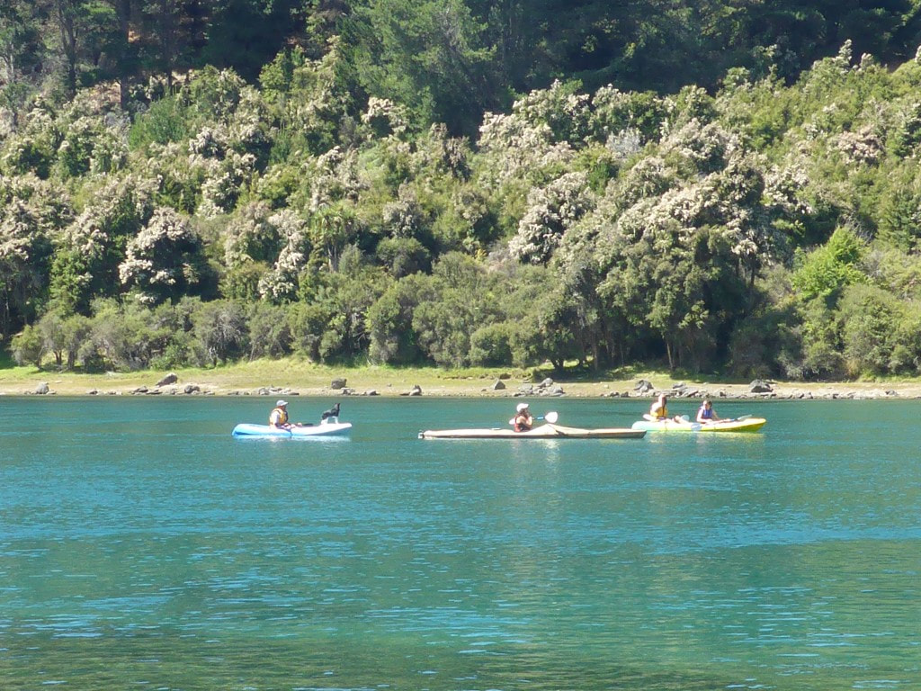 Kayaks - one with a dog onboard. 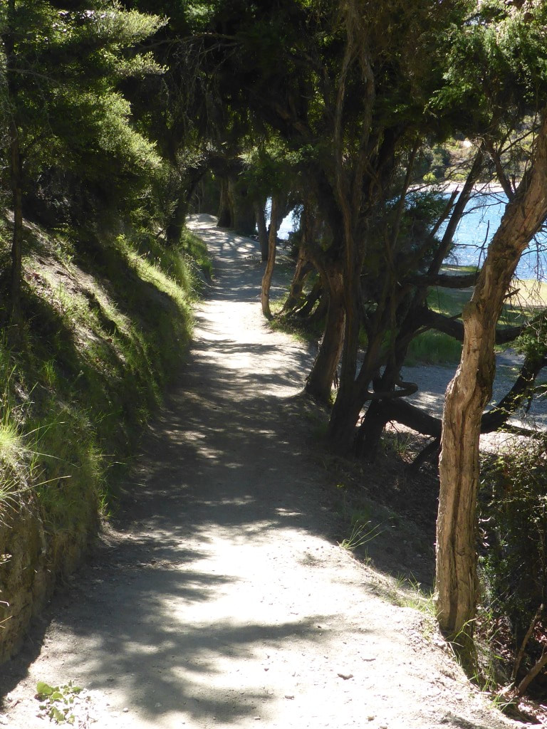 Nice track for walking - and even a bit of shade here. 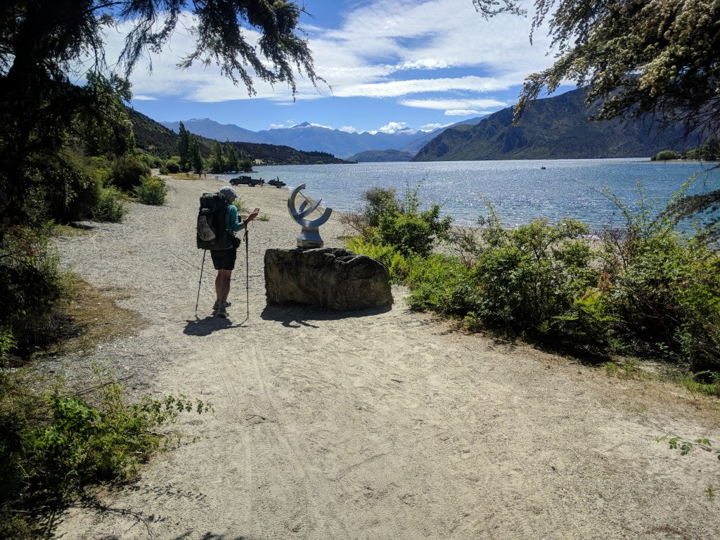 Sculpture at the lake outlet - this seems to be where most people launch for a trip down the Clutha. 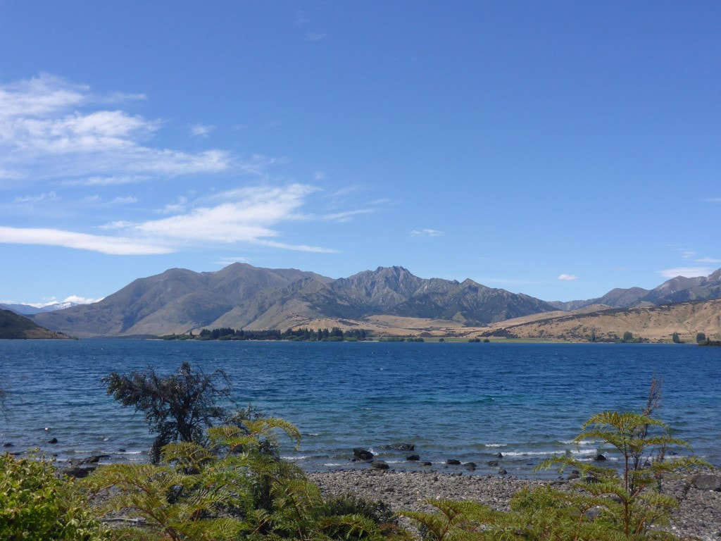 Looking across the lake to Dublin Bay. 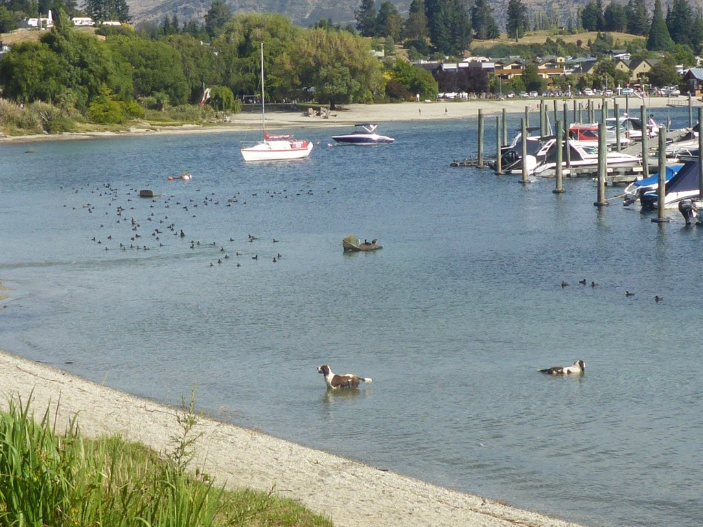 Water dogs obviously! Wanaka town centre in the background. 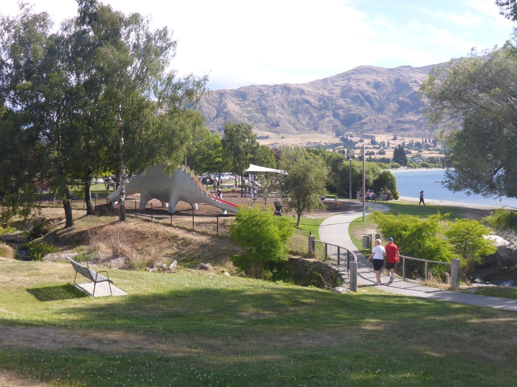 Waterfront walk into town centre. 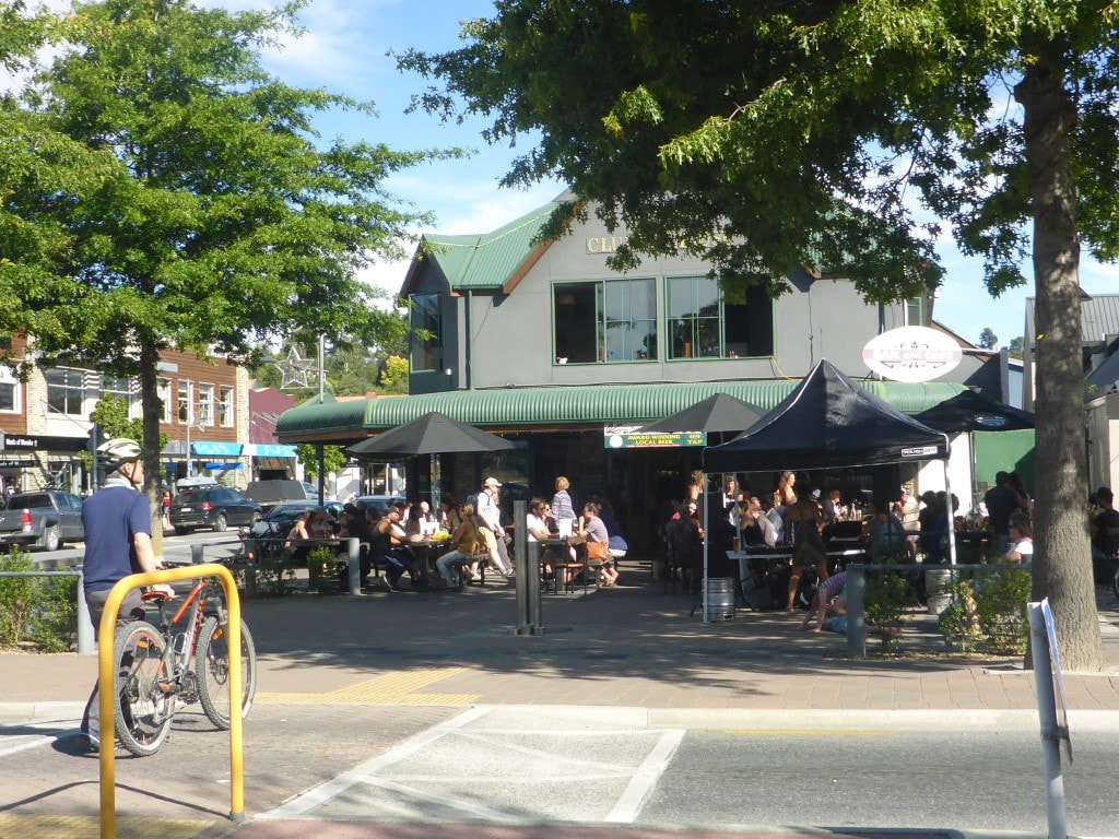 It was pretty busy in town - as one might expect a couple of days before Xmas! |

AuthorBelinda and Anthony (aka Tony) Hadfield made a decision, in their late 50's, to do something a "bit different" and walk New Zealand's 3000km Te Araroa Trail over summer 2015/16 - although updates will now tell you that this plan will take longer now!!. As the old saying goes - "don't leave home 'til you've seen the country"!! Archives
January 2018
Categories |
 RSS Feed