|
Made an 0630 start from the hut this morning as it looked like a fairly tough day ahead to get all the way to Pakituhi Hut, beyond Breast Hill. Ended up covering about 25.2km (left watch on pause for short while so did a little more than GPS data suggests) in just over 10 hours of walking - arriving at the hut at 1930. The 10 hours walking included literally dozens of micro-breaks because of the terrain! As the data shows, we did around 1700m of ascent and 1400m of descent during the day. It was an absolute gut-buster of a day for us! GPS track is here. It was a big photography day today - over 140 photos between us!! So apologies in advance for the trouble I had culling them for the blog page - it was an epic day in many ways! The TA notes actually explained the first bit very well! A short 20 minute continuation on an old farm track made up the start of the day, before dropping down on a sharp ridge into forest closer to the Timaru River. The TA notes state that the track then “climbs, descends and sidles through this steep sided river valley”! And this is what we did for almost 5 hours. We probably did more sidling on steep slopes than we have done in one TA section before, with lots of climbs up and down alongside the river included. There were also plenty of times we crossed the river, with occasional stretches walking downstream in or near the riverbed. We had about had enough of it by the time we arrived at the junction with the Timaru River track - after 4h50 of walking time covering 12km! Despite that, it was through nice beech forest and did include the odd little stretch of nice flatter walking at times - but not much of it unfortunately! 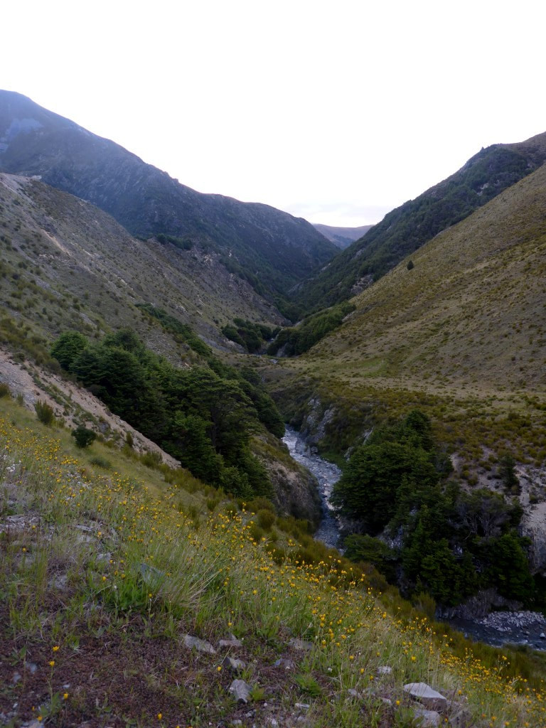 The start of the day - we soon dropped down into that narrow little river valley! 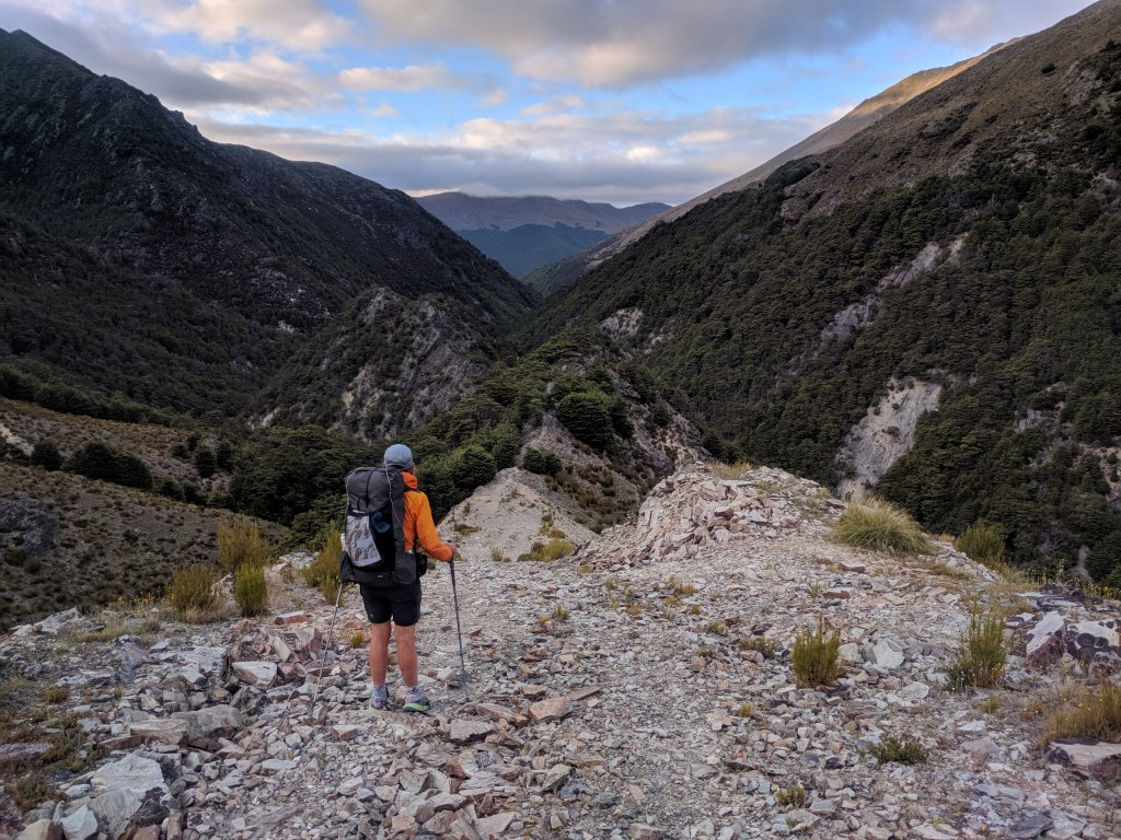 The farm track turns a sharp left here and you can see the track that we follow straight ahead on that narrow ridge, before dropping down toward the river. 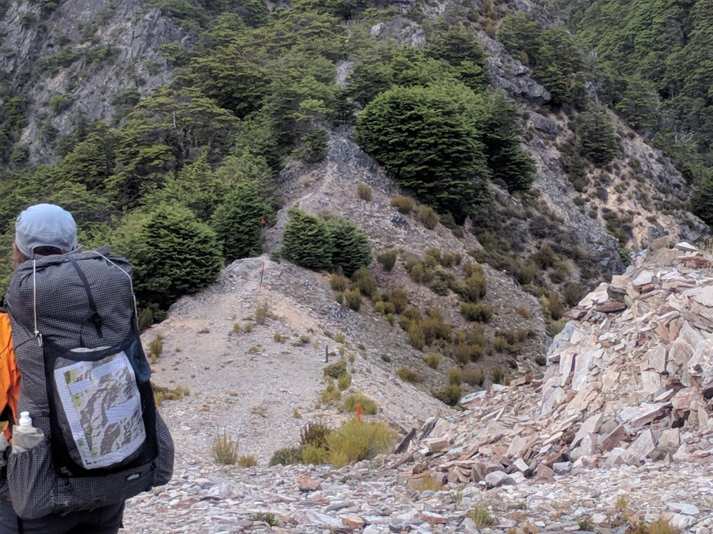 A closer shot of the same ridge track. 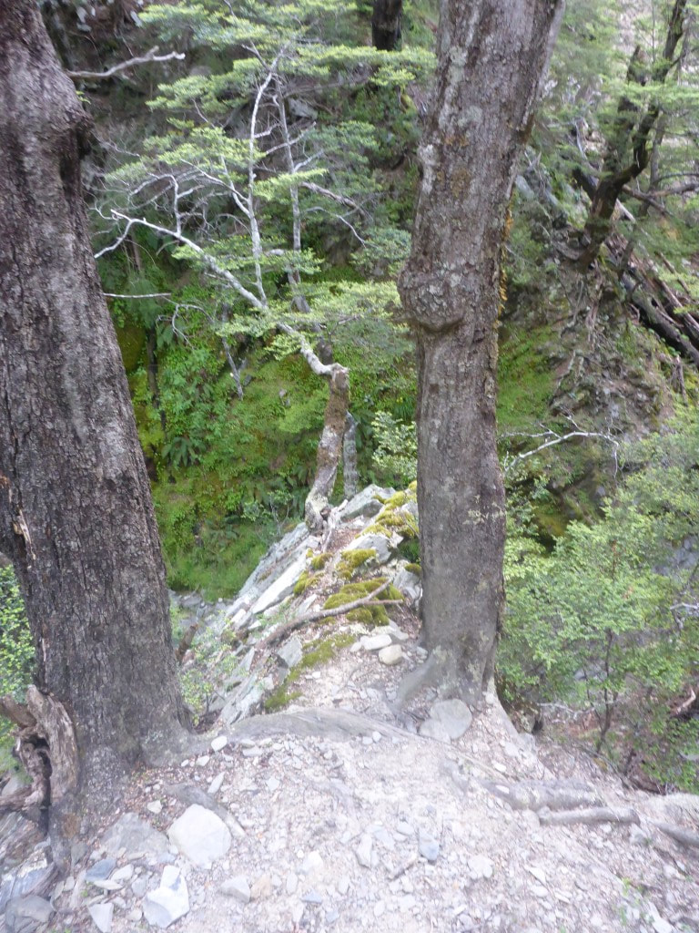 A squeeze between the two trees. 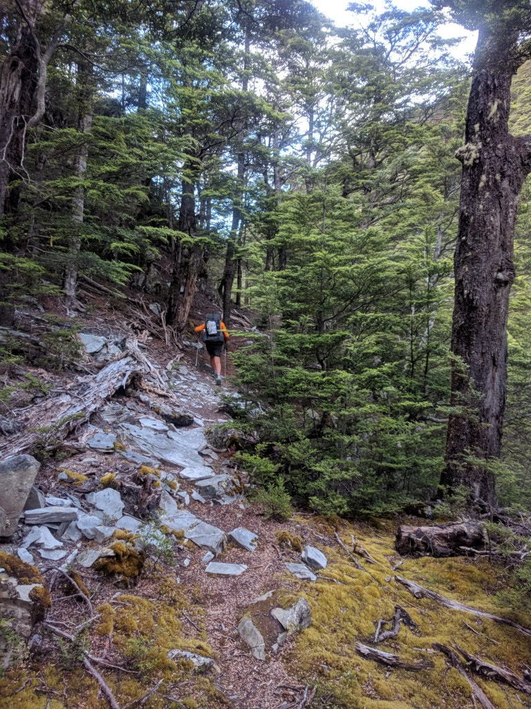 A typical rocky/rooty sidle - although not too steep in this case. 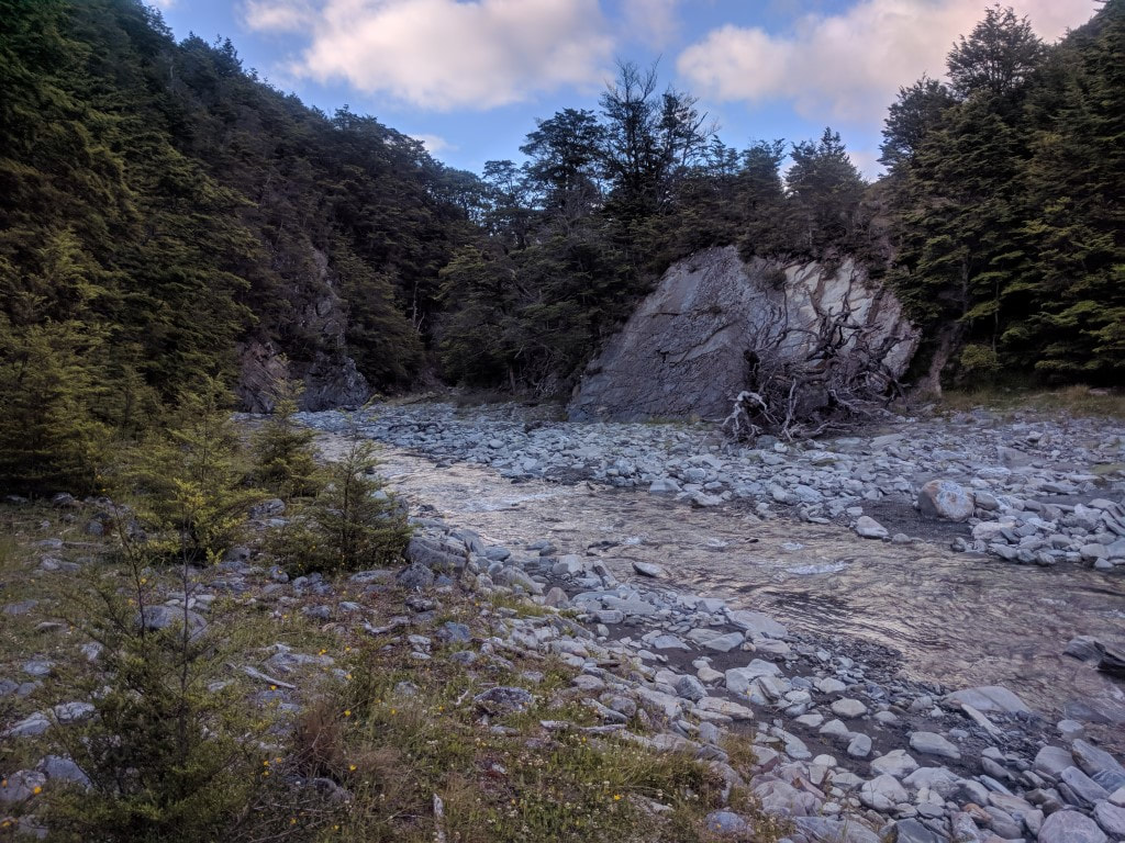 This was one of the wider parts! 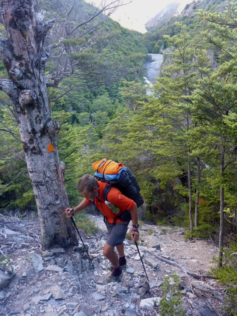 As I noted above, plenty of little uphill bits. 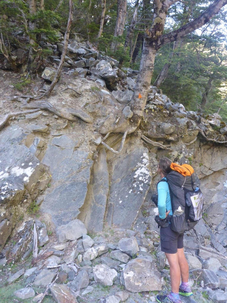 Climbing out of the riverbed - we pondered the best way to negotiate this bit!! 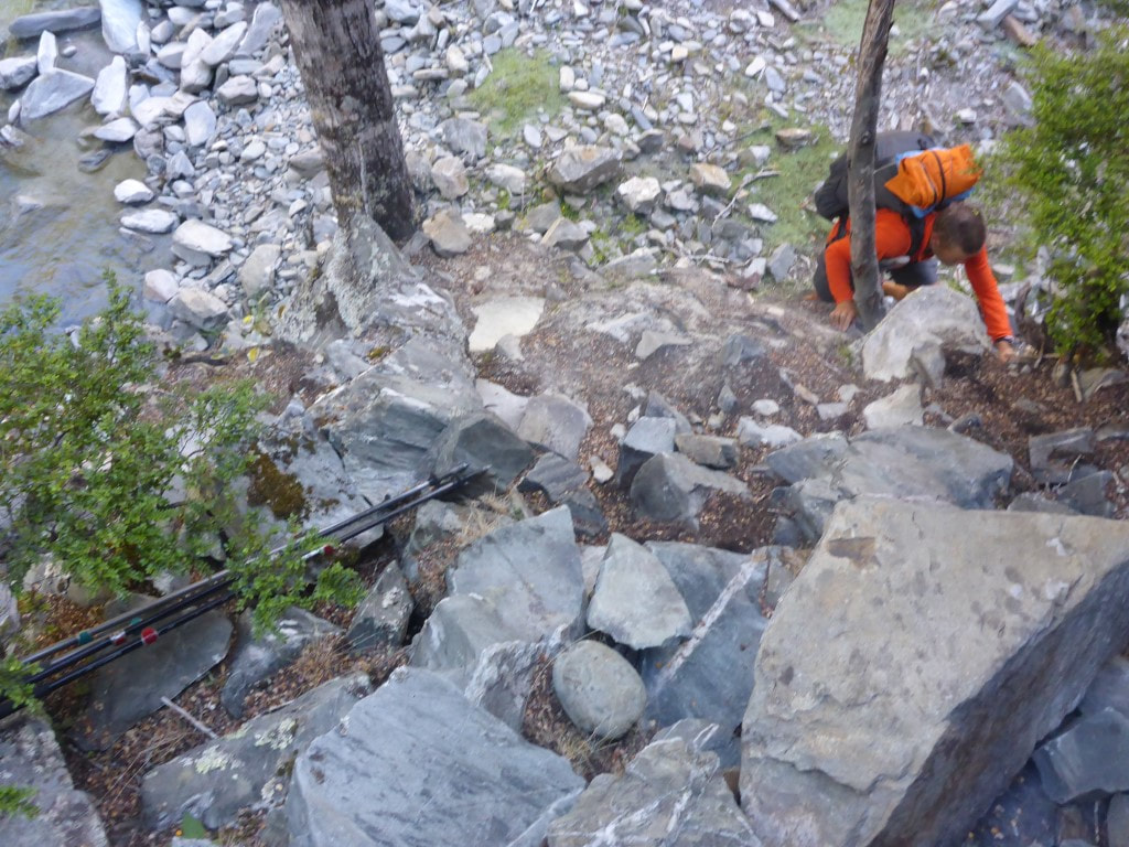 B climbed up without poles, I threw the poles up, and then clambered up myself (in ungainly fashion) :-) 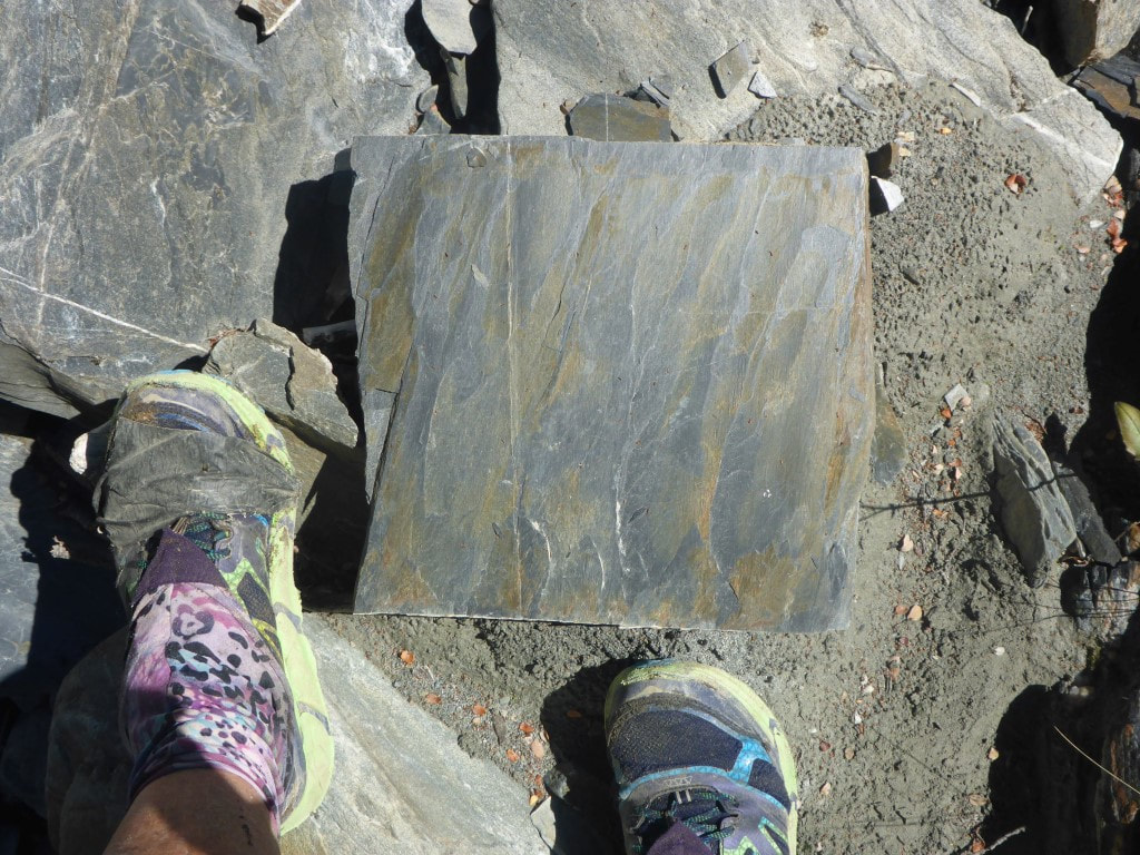 A bunch of these would make a fantastic patio - no cutting required! 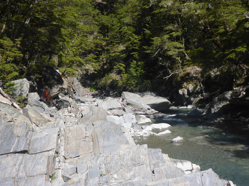 A rockier part of the riverbed to negotiate. 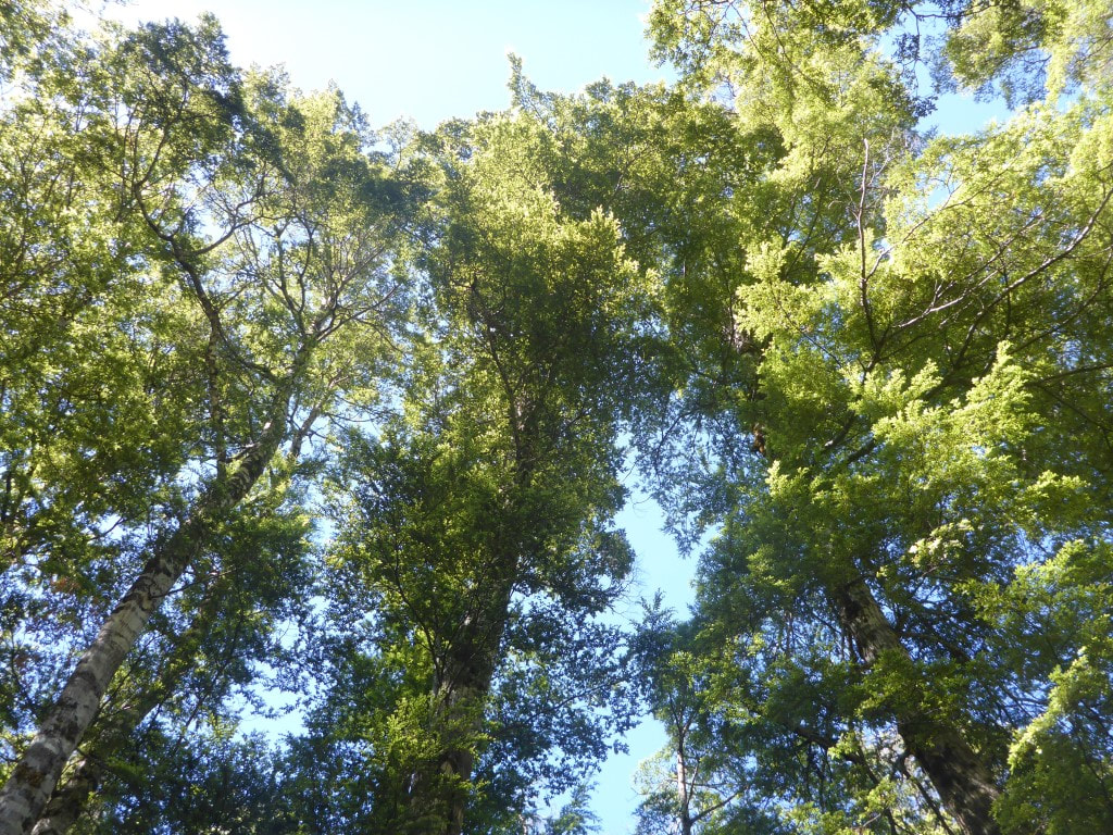 But there were some nice beech trees along the way :-) 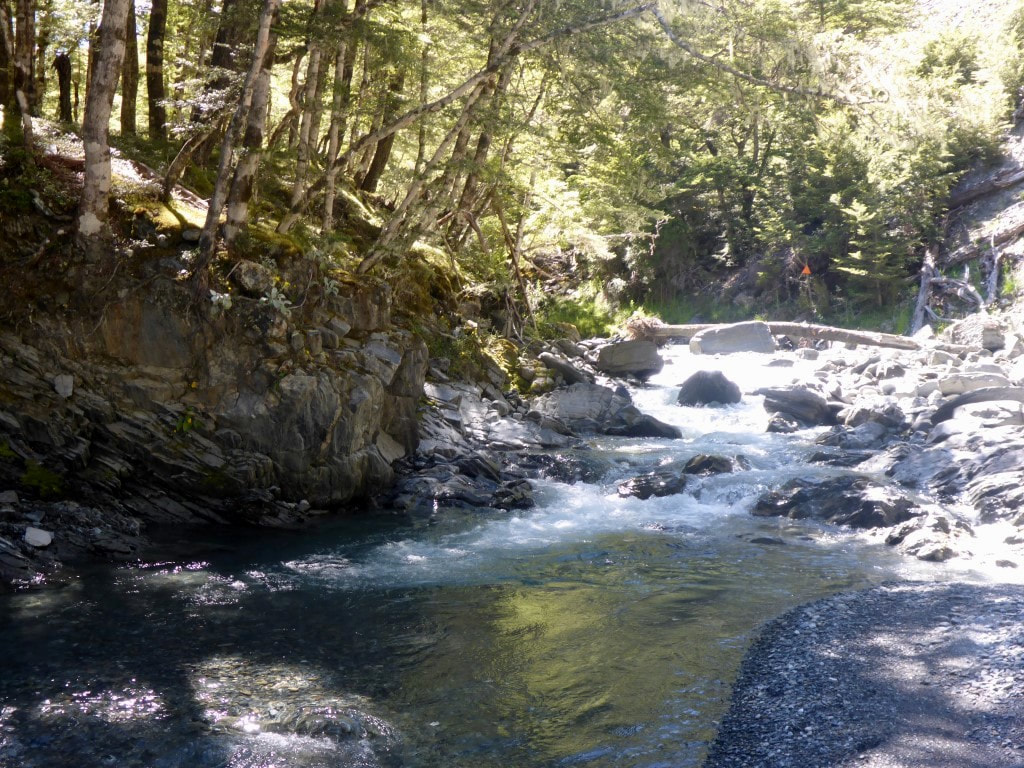 Orange marker straight ahead - find the best route! 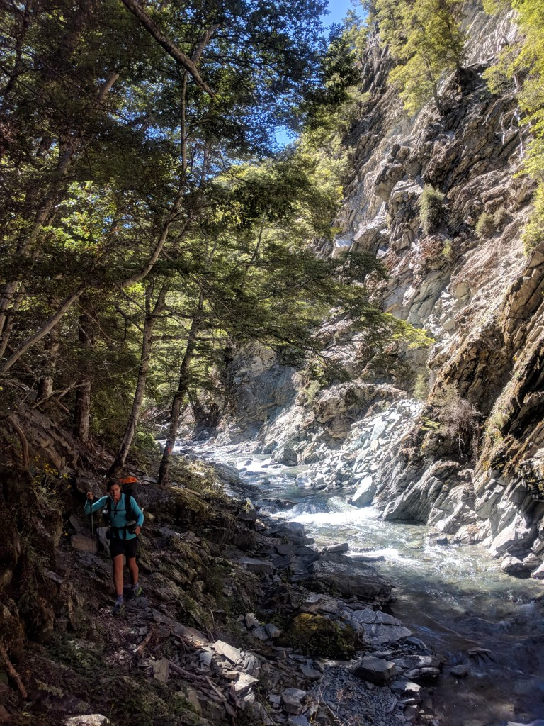 Another riverside stroll. 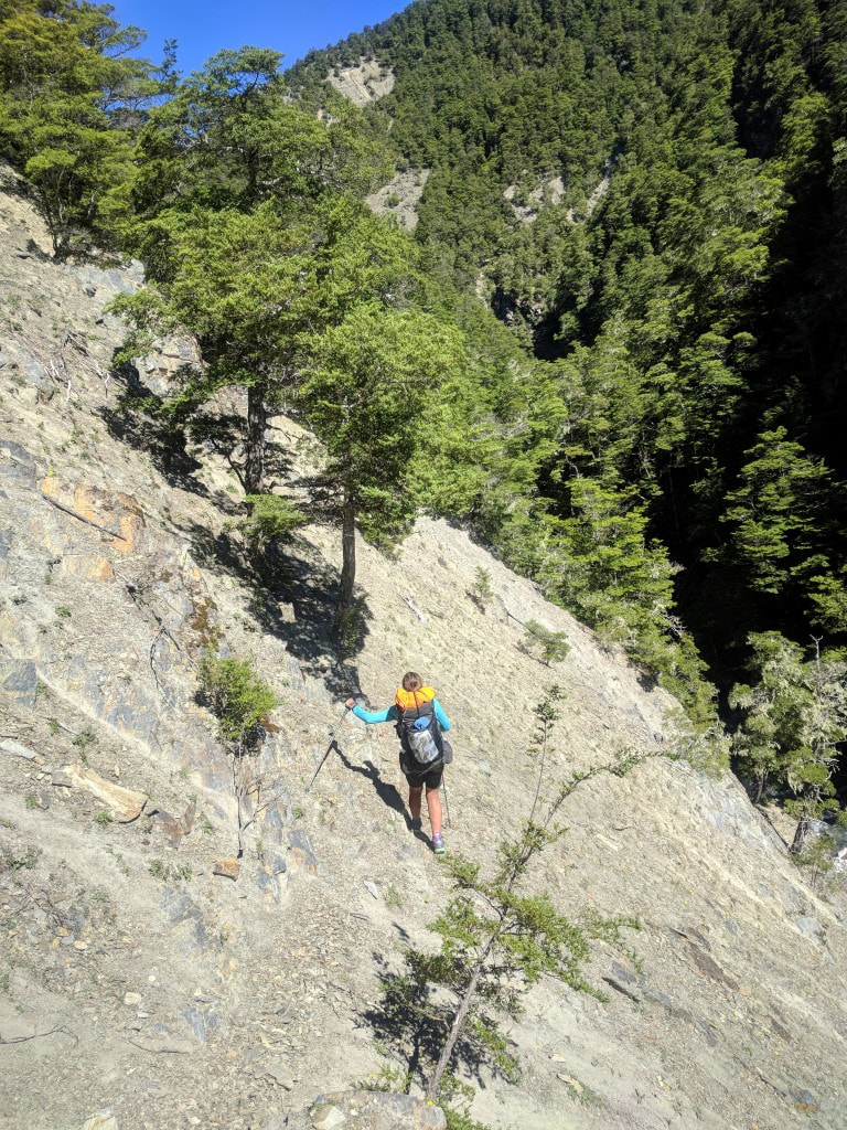 And another steep sidle - care required with foot placement. 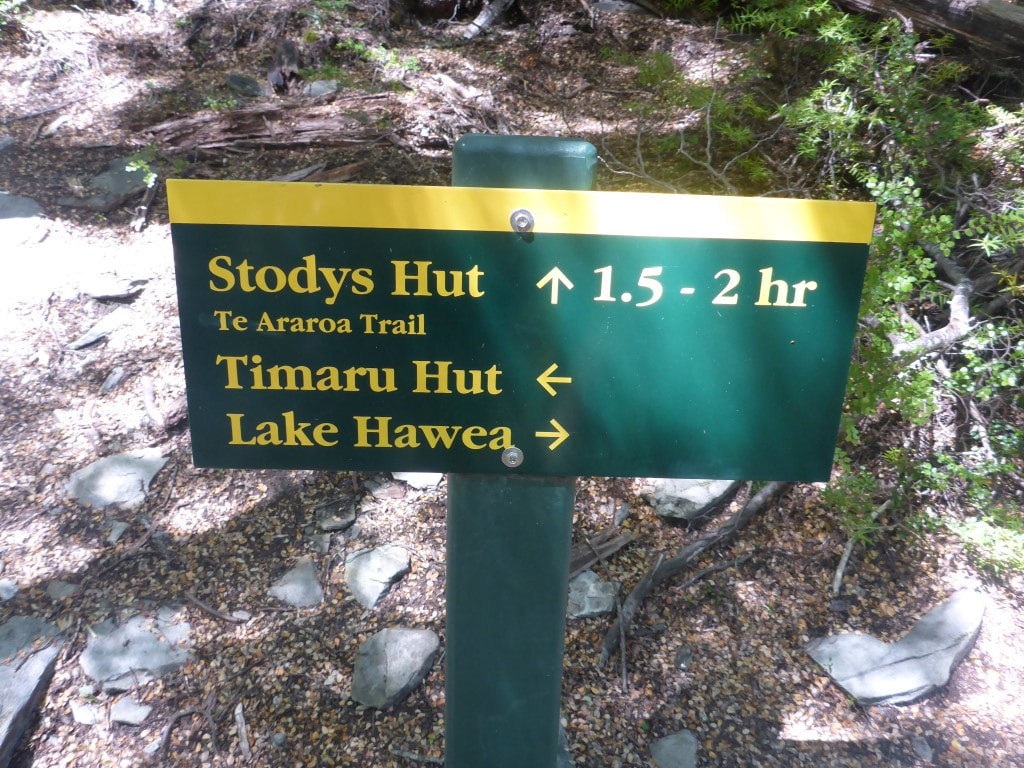 The Timaru River Track junction. A steep climb awaits - took us 1h50. Just to rub in the pain to our achy joints and muscles we were then faced with a 500m climb over 2km or so! This was up through scrubby forest for the most part but was very steep and lose underfoot, making it pretty slow going for us. At least we were in shade a lot as it was pretty warm and sunny. Then it was a steep sidle across an open face and a short section of gentle descent through bush before reaching Stody’s Hut, an old musterers hut with a dirt floor. It had taken us 1h50 to do 2.4km from the Timaru River Track junction - a hard slog indeed! At Stody’s Hut we met Marie, a young German - she had earlier completed the TA (except a few sections of the North island) and was just doing a 2 night trip up from Hawea, on one of her favourite TA bits, to fill in time before flying back to Germany on Xmas day! She had stayed at Pakituhi Hut and had just done a day walk over to Stodys and was about to head back to Pakituhi. This was late lunch time for us and we needed a good break so spent some time relaxing and filling water from a nearby stream. Marie headed off and we followed about 20 minutes later. 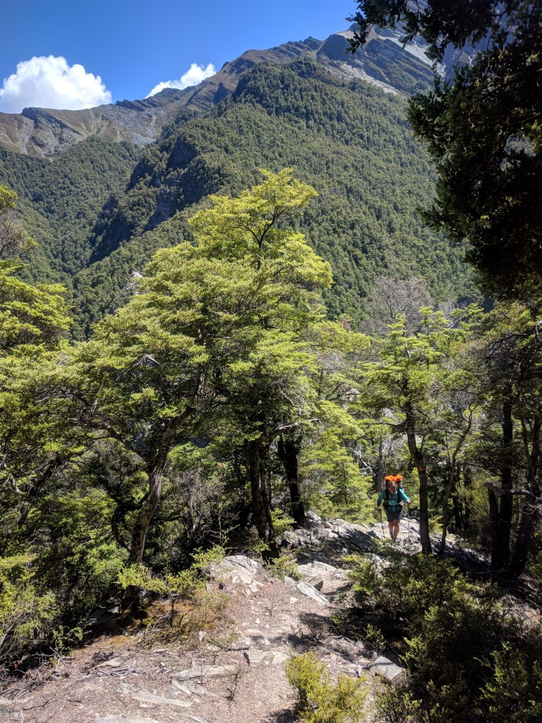 Part of our initial climb - as always, you never take photos on the hardest bits! 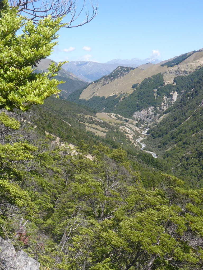 Part way up and looking at the Timaru River heading west toward Lake Hawea. 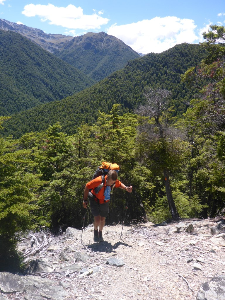 Just to confirm that this bit was all uphill!! 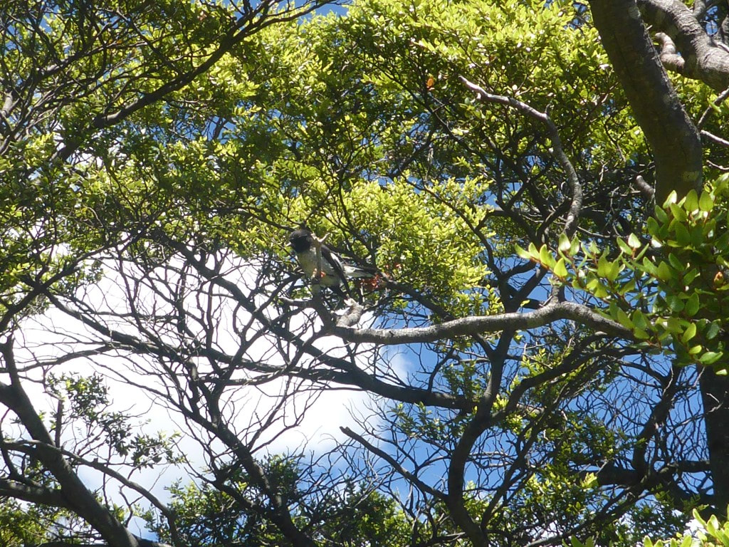 We did see a few robins during the day. B captured this one - always nice to see as they are pretty friendly usually. 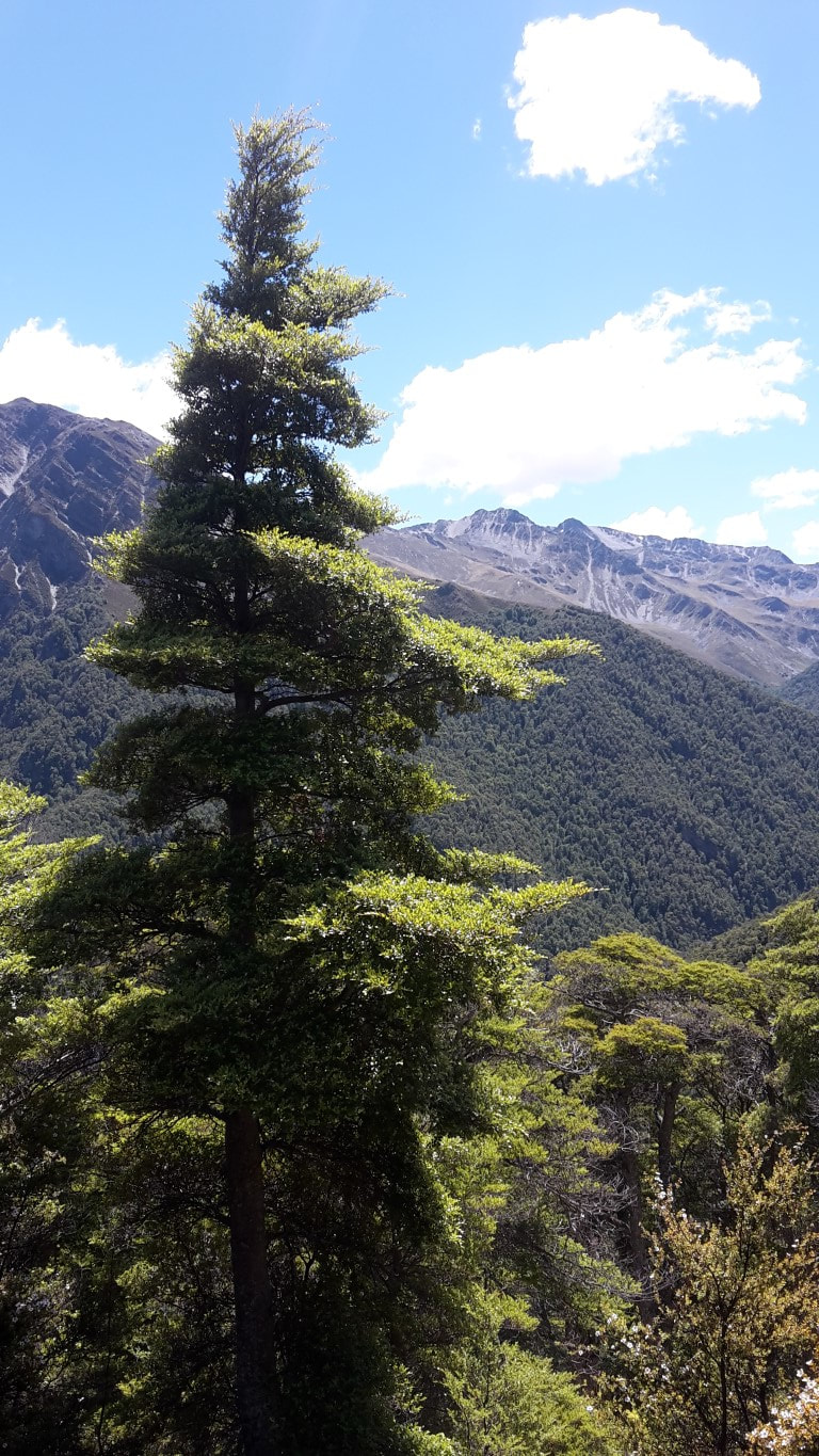 A fine specimen of beech! 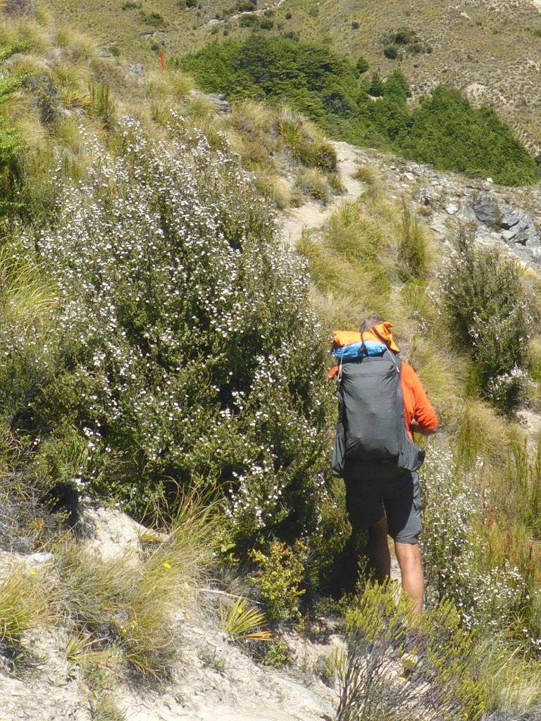 The last little bit to Stody's Hut was a steep sidle involving a slight drop in altitude. 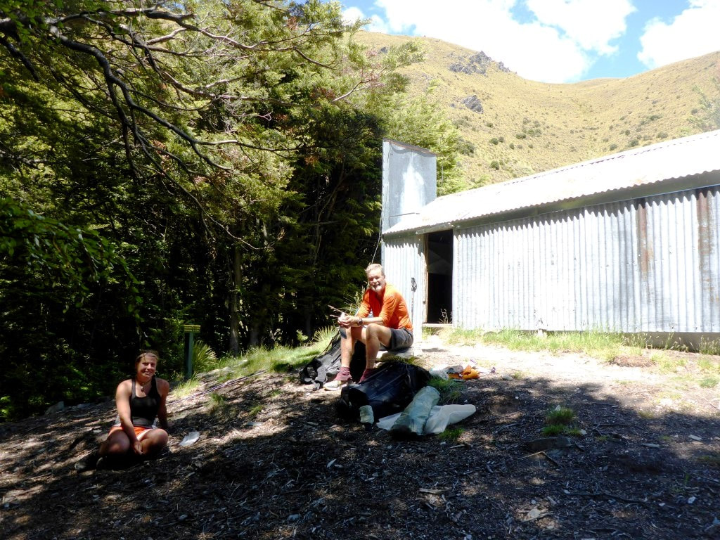 Marie and me outside the hut. 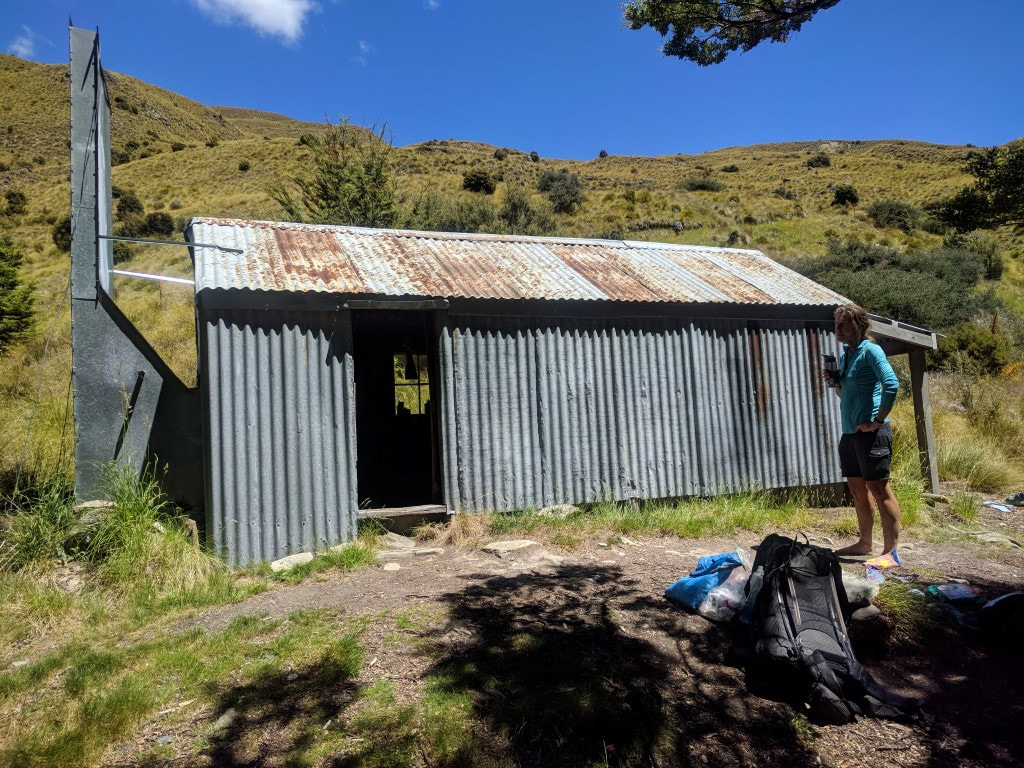 A quaint old hut. We were now back into open tussock country and on an old farm track so, while we still had to climb from 1080m asl (Stodys) to around 1578m (Breast Hill), at least the underfoot conditions were pretty reliable! It was a hot, sweaty climb given the exposed nature of the terrain. We stopped part way up where we had cellphone reception and organised some accommodation at Glendhu Bay, a 15km walk from Wanaka. This was after altering our plans slightly for how we would tackle the Motatapu Alpine Track - we had chatted with Marie about it and she had given us some good advice on time/distance/terrain that made us rethink. 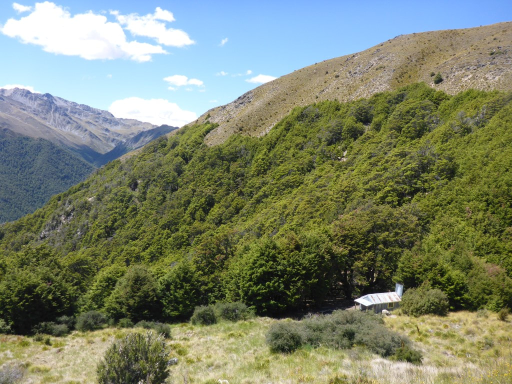 Heading up from Stody's Hut. 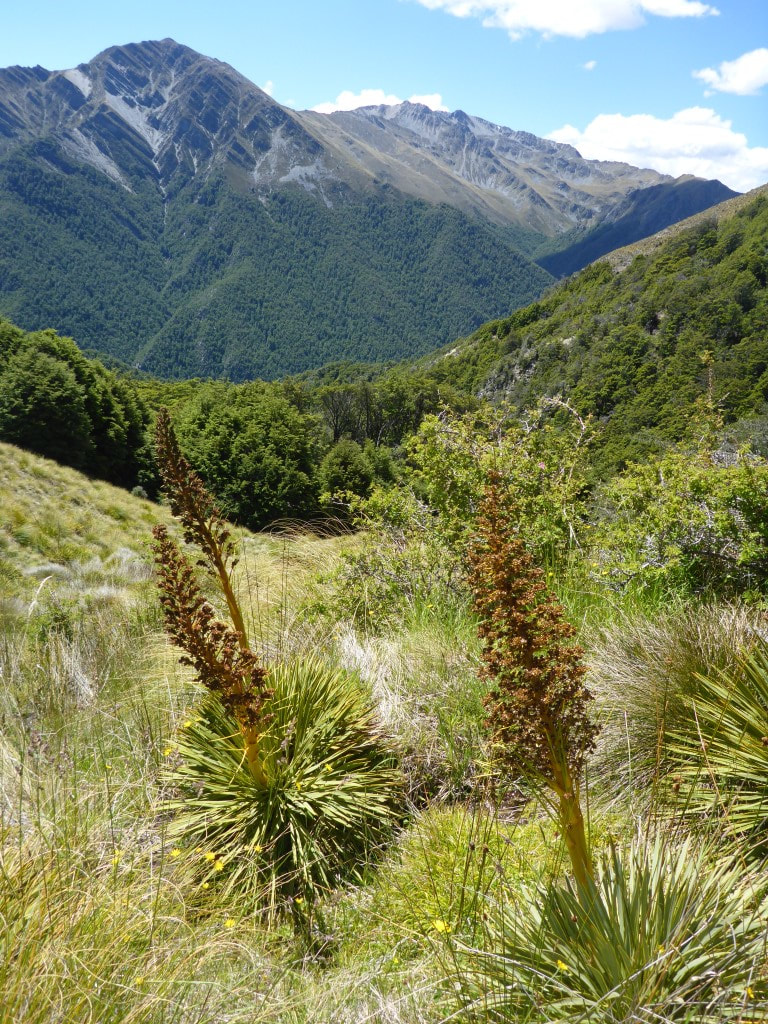 A reminder, if needed, that spaniard is still around in this environment! 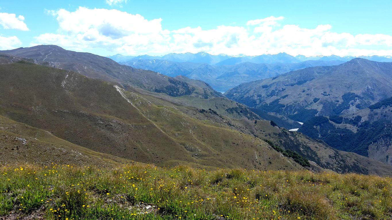 Looking at the Timaru River heading into Lake Hawea (the lake is just visible in the "V" at the end of the river valley). 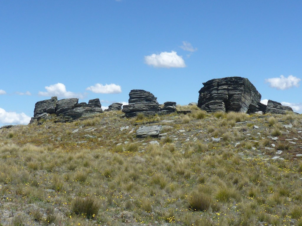 Rocks seem to grow out of the ground everywhere. 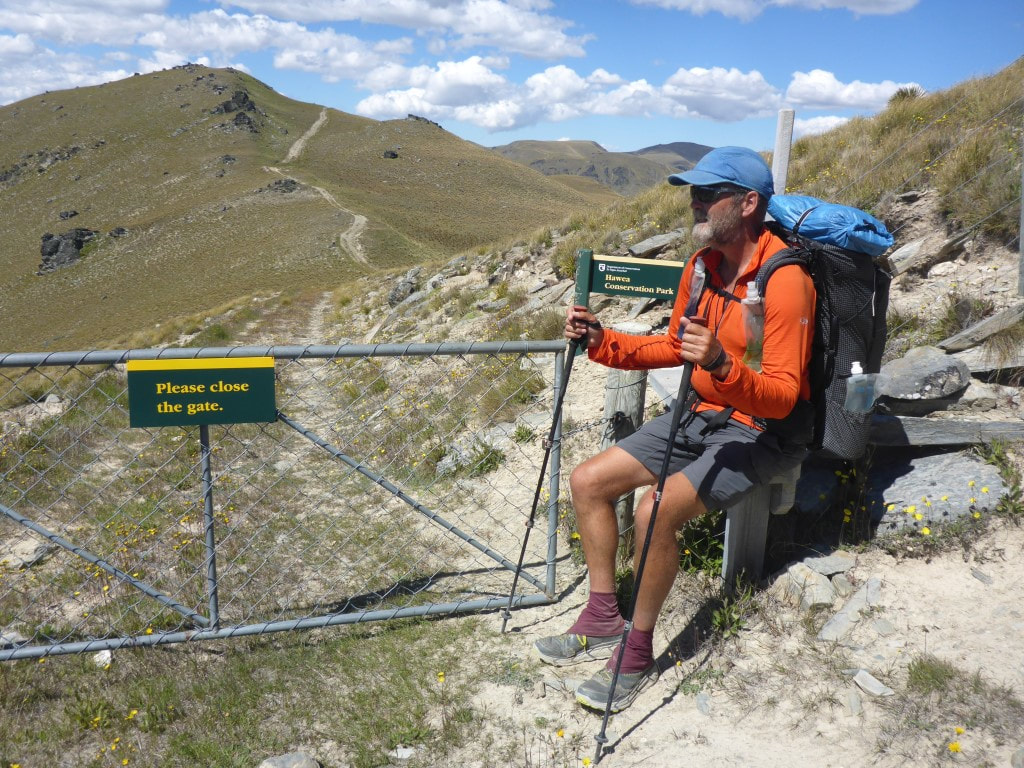 Stiles are not just for climbing over fences! 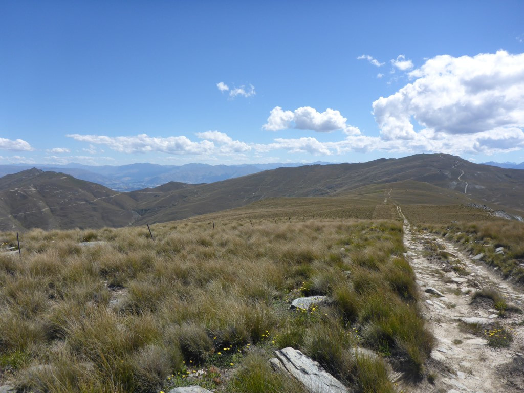 More of our farm track heading in to the distance toward Breast Hill. 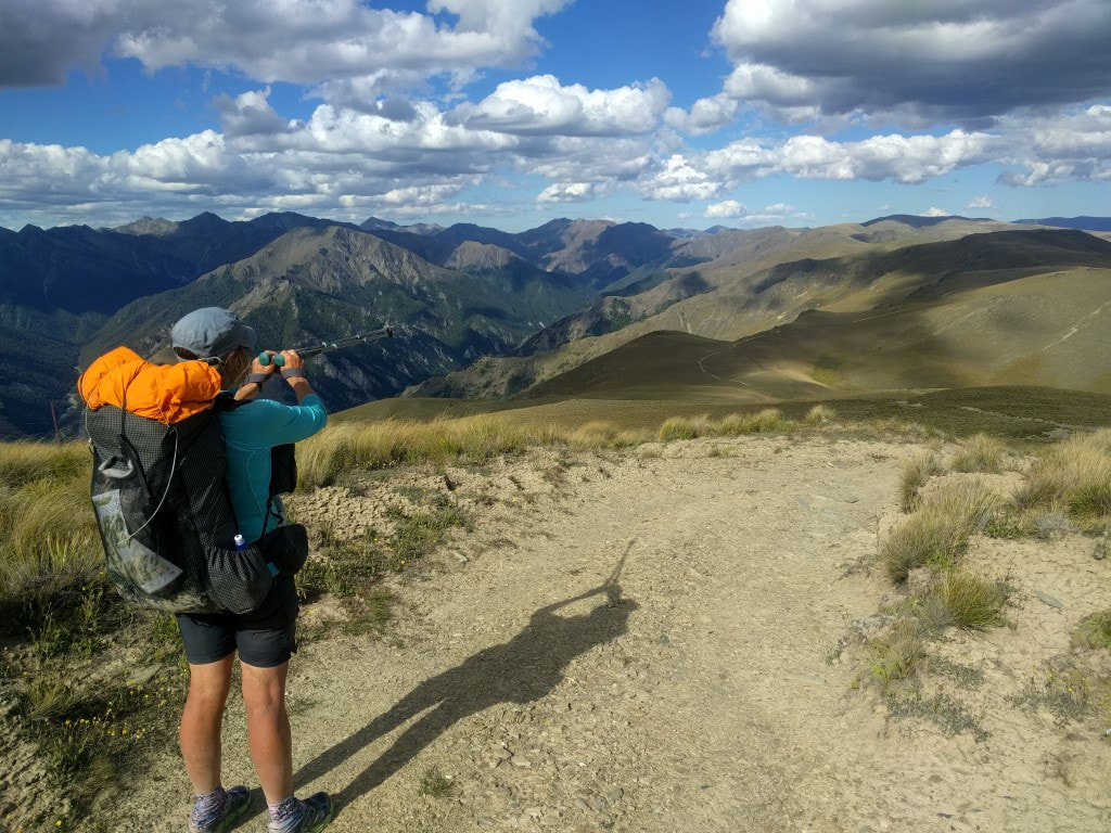 We've come from that direction!! 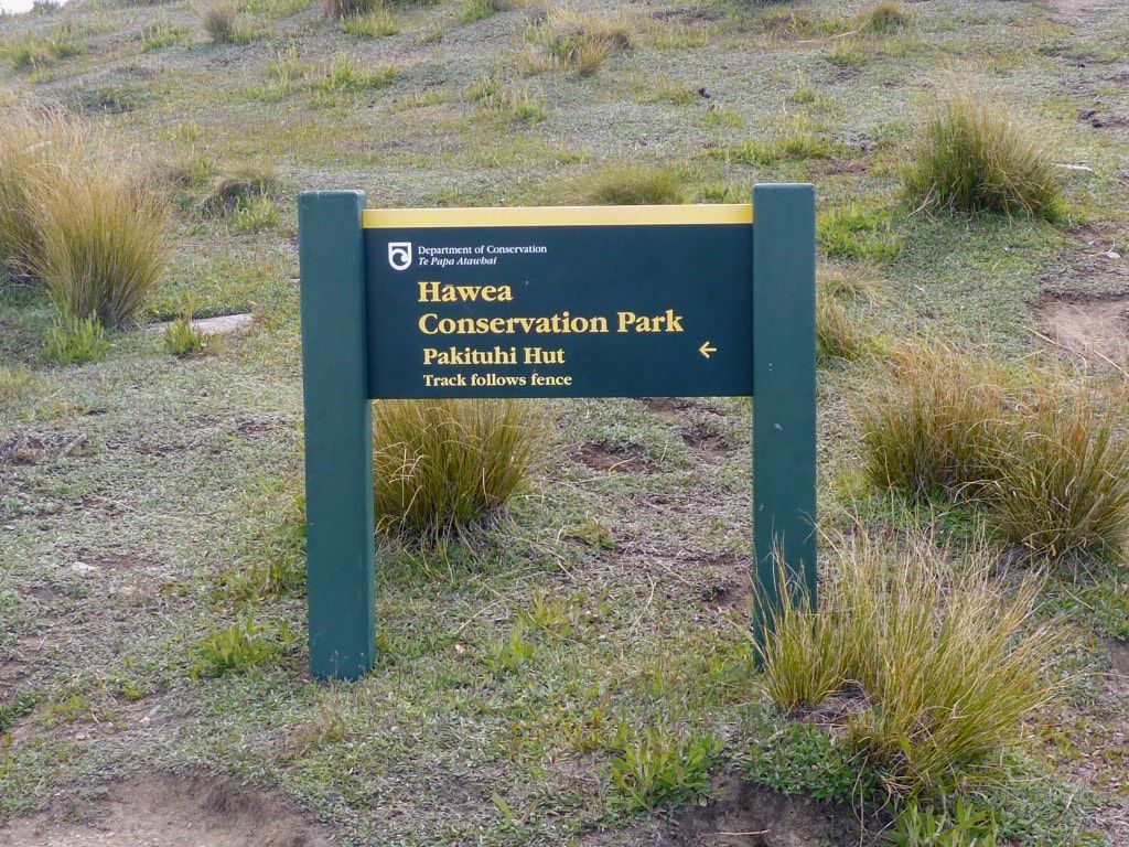 About 20m below Breast Hill peak you climb over a fence and back into conservation park. Following the fence down comes after you have climbed to the top for the view :-) The climb to Breast Hill was definitely worth it. It was 1800, and already 11.5 hours after we had left Top Timaru Hut this morning, with almost a hour still to get us to the next hut! A lovely evening with stunning views down to Lake Hawea and even further across to Wanaka and beyond. This vantage point is about 1200m above Lake Hawea (where we are going tomorrow morning) which makes for the stunning views. Obviously also looking across to the Alps and back where we had come from. Marie was there, as was an American girl working for a family in Wanaka who had come up for the day, as well as another young couple who were on an overnighter to Pakituhi Hut as well. We stayed after they had left and soaked up the views - also took the opportunity of cellphone reception to send a few “brag” photos and videos of our viewpoint! 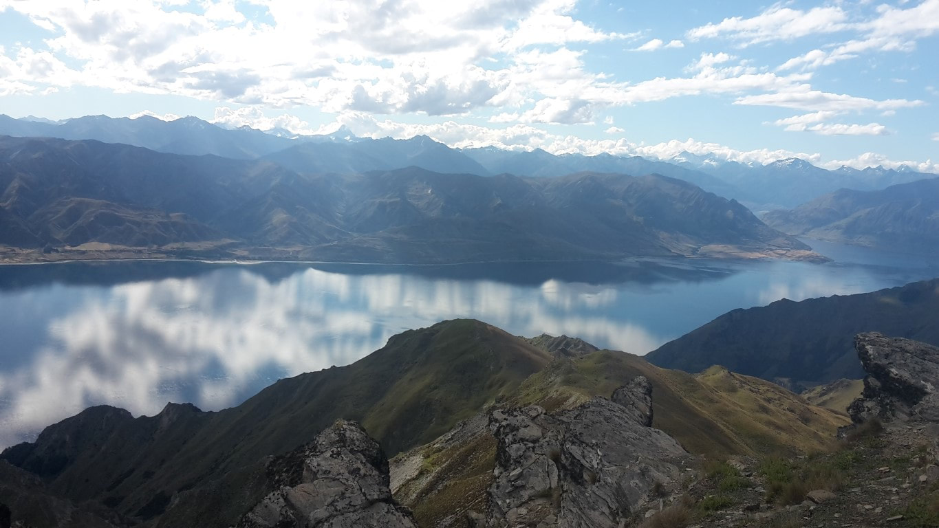 Looking up toward the head of the lake. 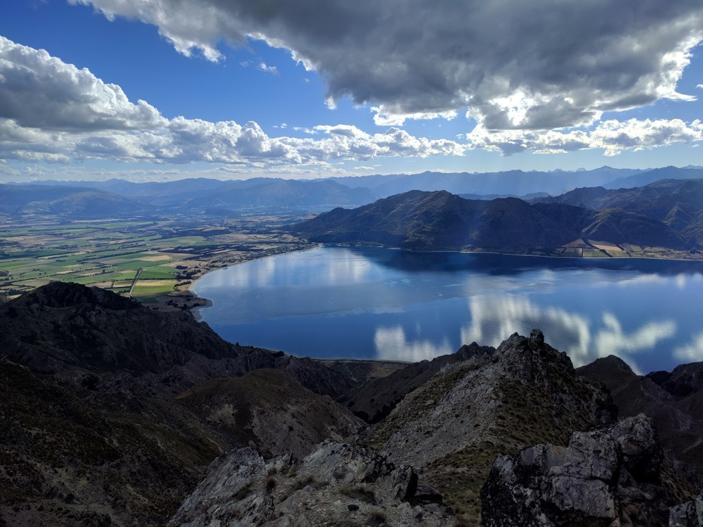 Lake Hawea village and the lake oulet. 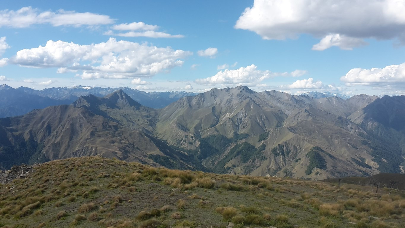 Great views in other directions as well! 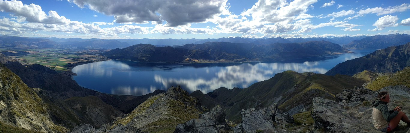 Thought I should include a pano of the whole lake. Also had to include a video showing the 360 degree views - can't seem to put captions under videos, hence this explanation!! Eventually we headed on down a (initially rocky) ridge by a fenceline towards Pakituhi Hut, which is a short diversion off trail. It took us almost an hour from the top - not my optimistic half hour stated in the video! Upon arrival we found a number of overnight trippers there. Marie was wanting to leave early, as were we, so we pitched our tent instead of using the hut. While there was room, with quite a few people in there and with the hut being new with double glazing and insulation, we decided a cooler tent would be better for an early start. As we hadn't got there until 1930 ( a 13 hour day since leaving the hut this morning), by the time we were ready for bed it was a bit later than normal - closer to 2200! :-) 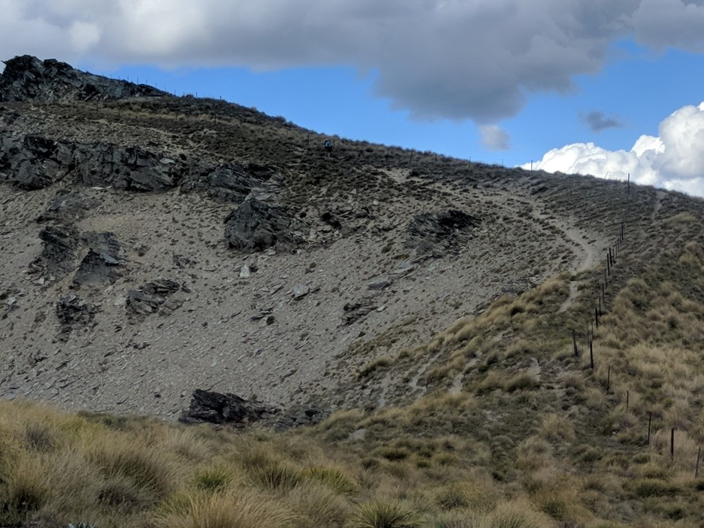 B (just below the skyline in the centre!) coming down the ridge from Breast Hill. 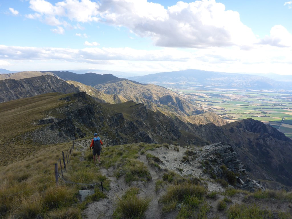 Following the fence and staying away from the cliffs! :-) 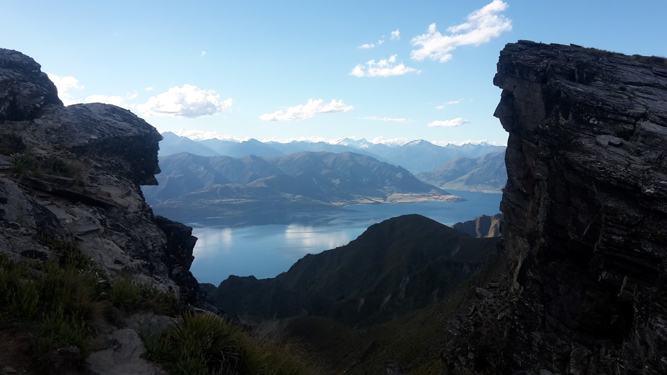 B's alternative view of the lake.  Farm land. 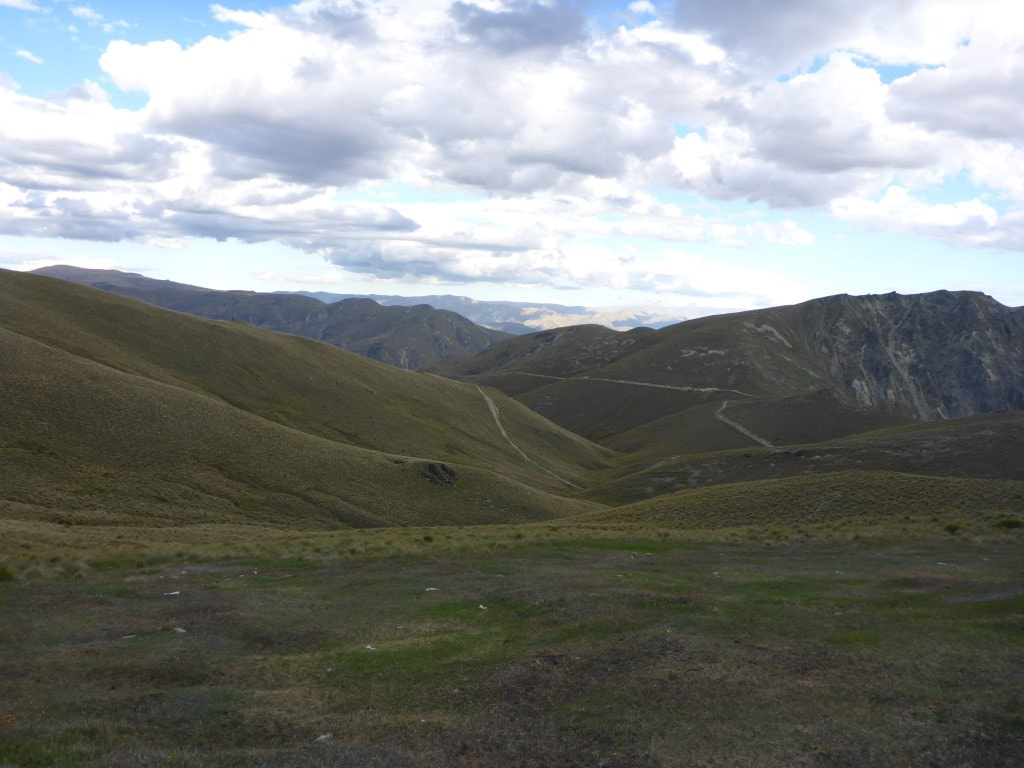 Pakituhi Hut is just over the second ridge at right of photo near where the farm track disappears behind the ridge.
0 Comments
Leave a Reply. |

AuthorBelinda and Anthony (aka Tony) Hadfield made a decision, in their late 50's, to do something a "bit different" and walk New Zealand's 3000km Te Araroa Trail over summer 2015/16 - although updates will now tell you that this plan will take longer now!!. As the old saying goes - "don't leave home 'til you've seen the country"!! Archives
January 2018
Categories |
 RSS Feed