|
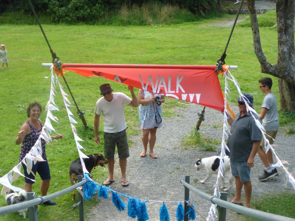
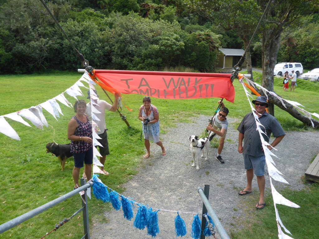
Today was the final day of our TA journey, right from top to bottom!! Belinda’s sister Julia, and husband Pete, had said they would come and pick us up and would be there from around 1600 in case we got in early (we expected to be closer to 1700 at Otaki Forks / Boielle Flat carpark/swingbridge). So we planned to get away early and arose at 0500. I then checked the Suunto which gaily informed me sunrise was at 0618 :-) Should check these things the night before!! Anyway, we had a leisurely breakfast with a couple of cups of tea and were ready to go by 0630 - while it was misty/cloudy, there was plenty of light to see by. TA notes said we had 18km and between 8 and 11 hours ahead of us! Suunto disagree with the distance, and we clocked up 20km finally. We arrived across the final swingbridge about 1615 after just under 8h30 of walking (9h40 in total as we kept our breaks short today so we wouldn’t be too late!!). The GPS tracking for the day is here. As noted, it was pretty misty and the tussock and scrub was wet, so rain skirts and jackets were the go for the start of the day. The jackets weren’t on long (it wasn’t cold or windy) but the rainskirts stayed for a bit longer. It was about 2.6km to Mt Crawford and another 1 km to Junction Knob - this is along some very exposed narrow ridges with sizeable drop-offs on either side. Hence the warning to trampers that they may need to be prepared to wait at Nichols Hut if weather conditions aren’t favourable (it can get REALLY windy up here!!). Luckily we only had a gentle breeze at worst and, at times, no wind at all. At 1462m, Mt Crawford is 300m higher than Nichols Hut so there was a fair bit of “up” and somewhat less “down”! Our views were hindered by the misty cloud but it was an amazing feeling climbing along these ridges in limited visibility nonetheless. We also got some great photos of our shadows in a circular rainbow projected onto cloud to the west, as the sun was behind us (see below). The climb to Crawford took us 1h20 and wasn’t too arduous - the bit that was concerning us most was the fact that the finish line was 1300m lower than Mt Crawford, i.e. lots of descending for the knees to cope with!! 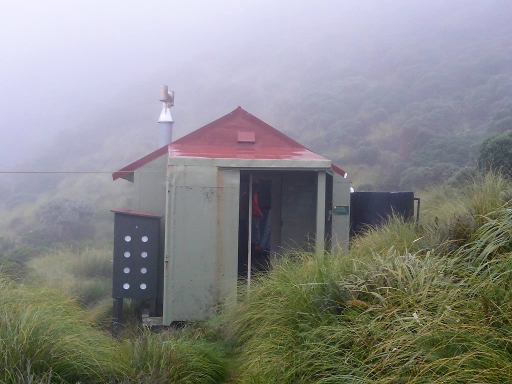 0622 and not far off departing Nichols Hut. 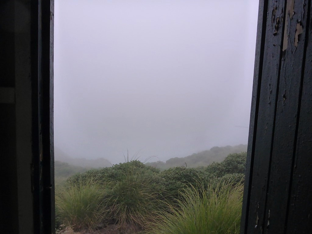 The view from the loo again - slightly more cloudy this morning! 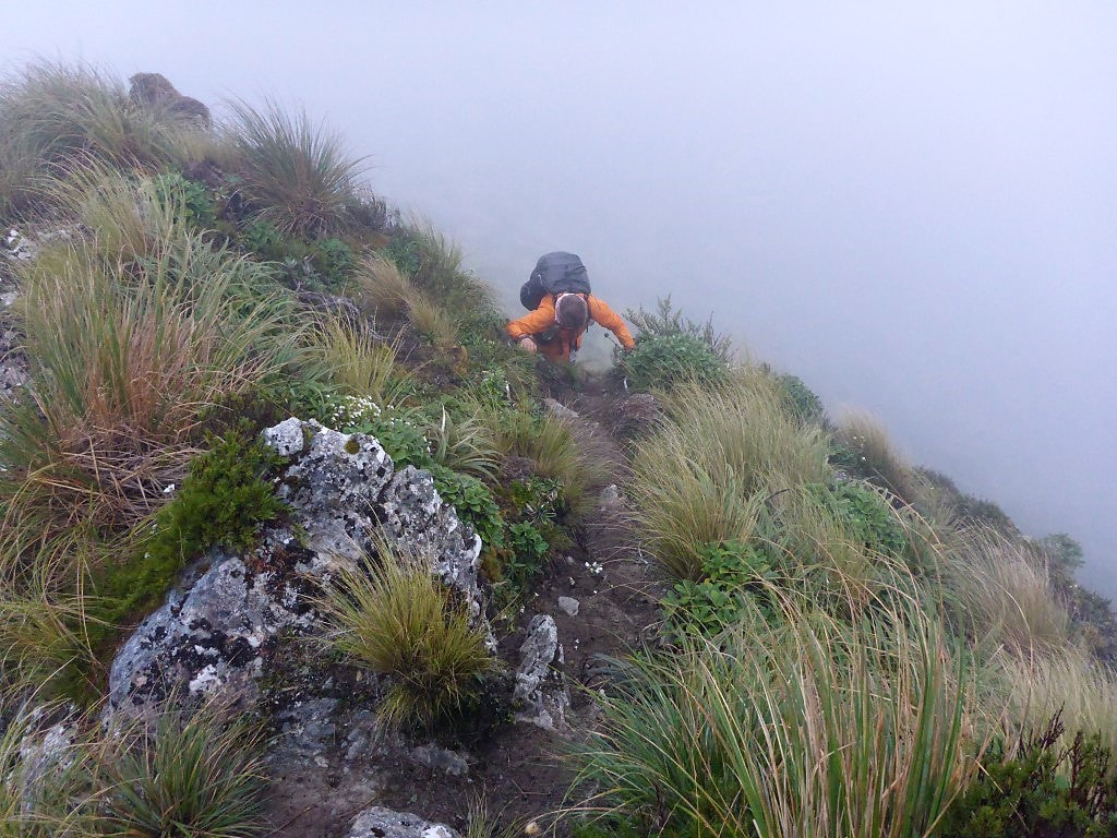 Rocky uphill clambering in the cloud. Video of us walking in early morning cloud is below. 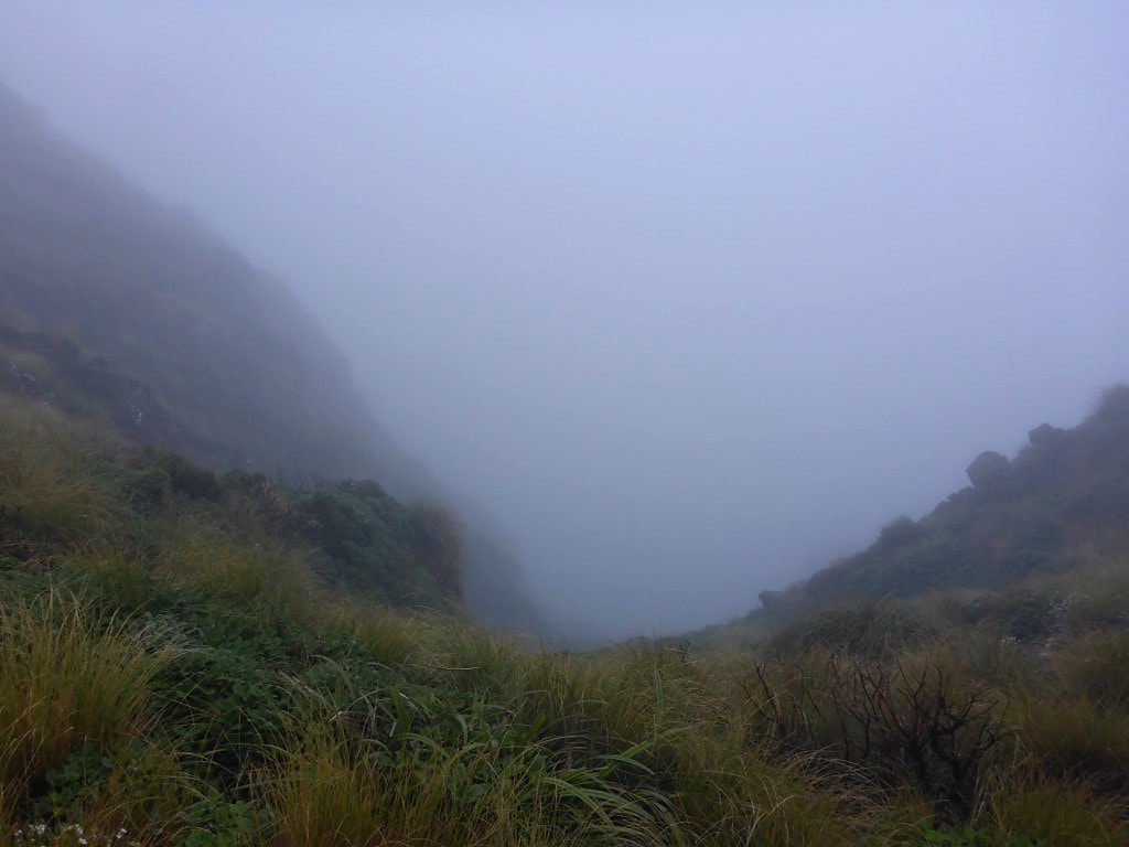 At least the cloud meant the drop-offs didn't look so big!! 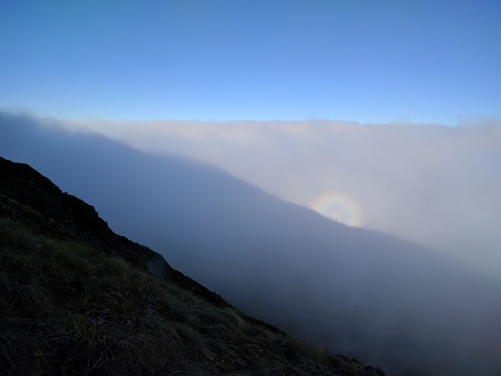 The sun casting a shadow of the ridge onto cloud in the distance. Our two little shadows atop the ridge in the middle of the rainbow! 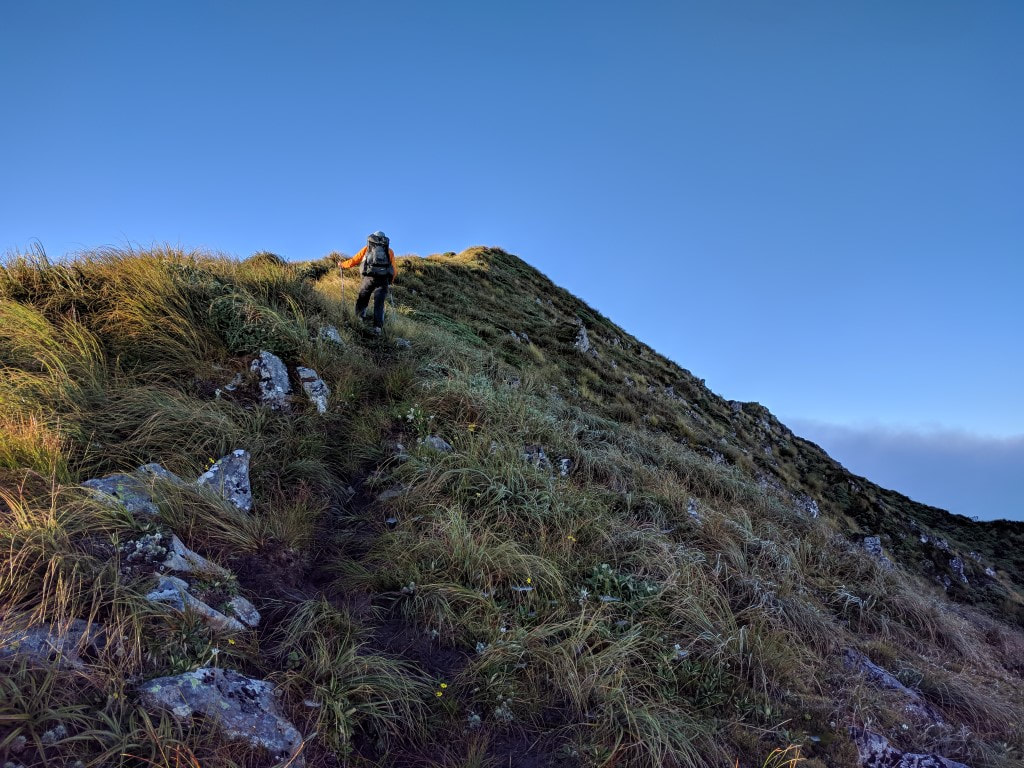 Above the cloud and looking up - there was blue sky :-) 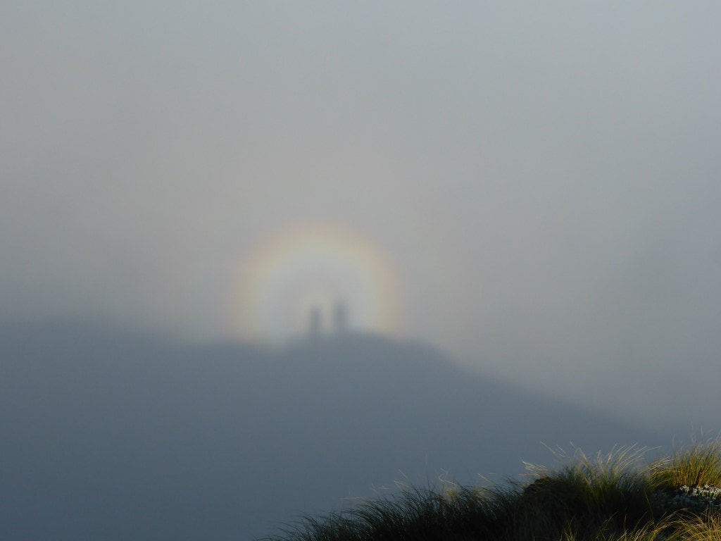 And further up another closer shot of our shadows projected onto cloud in the rainbow - we thought it was cool! 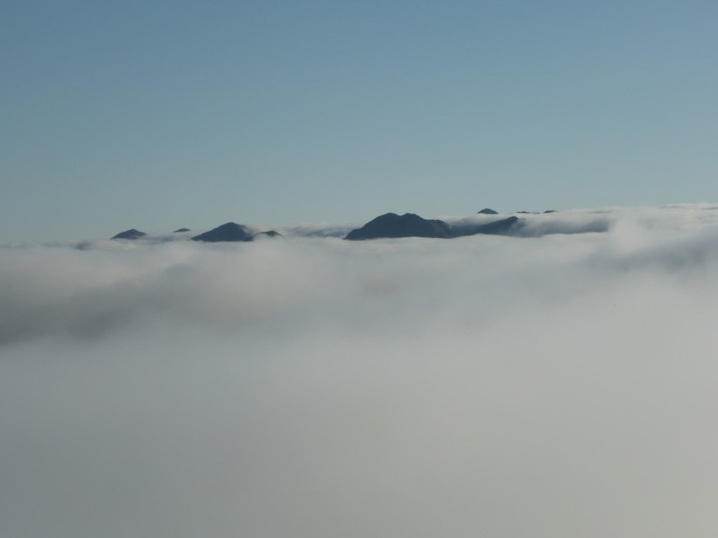 Looking back northward above the cloud to where we had come from yesterday. 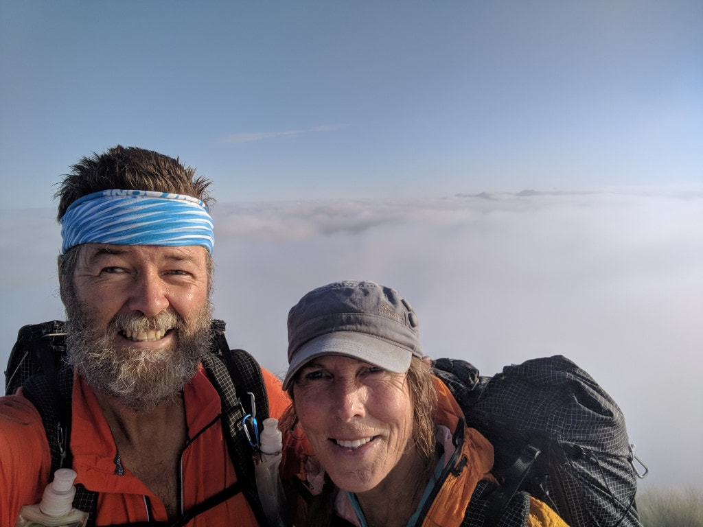 Atop Mt Crawford at 1432m - again looking back north. Video from Mt Crawford is below. Then it was on down to Junction Knob where we were surprised by a runner coming up behind us out of the mist, who only stopped long enough to tell us he was headed for Kaitoke near Upper Hutt, along the Main Range route south - I have no idea where he stayed last night! We turned west here and started down toward Shoulder Knob. The cloud was clearing a little as we headed down and went further west, so we saw some sun and some more views as time went by. At the 5km mark we got to Shoulder Knob (still at 1300m asl) where we stopped for 25 minutes for a break and to catch up on some phone things (cellphone reception has been pretty good on this trip, although none at Nichols Hut) and let the family know progress. 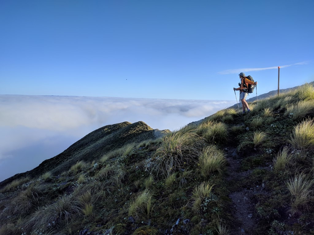 B admiring the view as we left Mt Crawford. 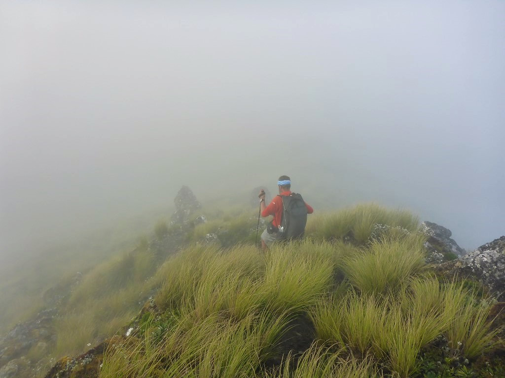 It wasn't long before we descended into cloud again - this was only 10 minutes after leaving Mt Crawford.. 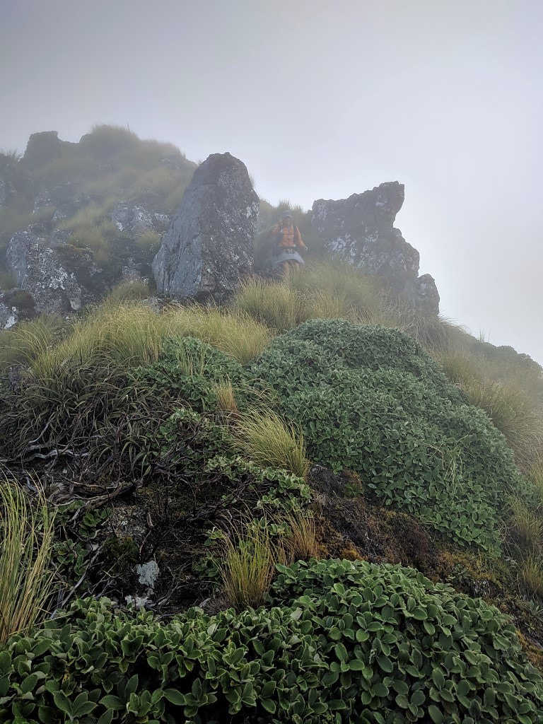 B coming down between a rock and a hard place! 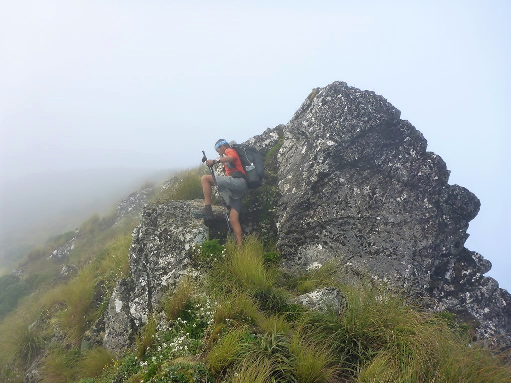 This little spot was slightly precarious - long legs come in handy in these spots. 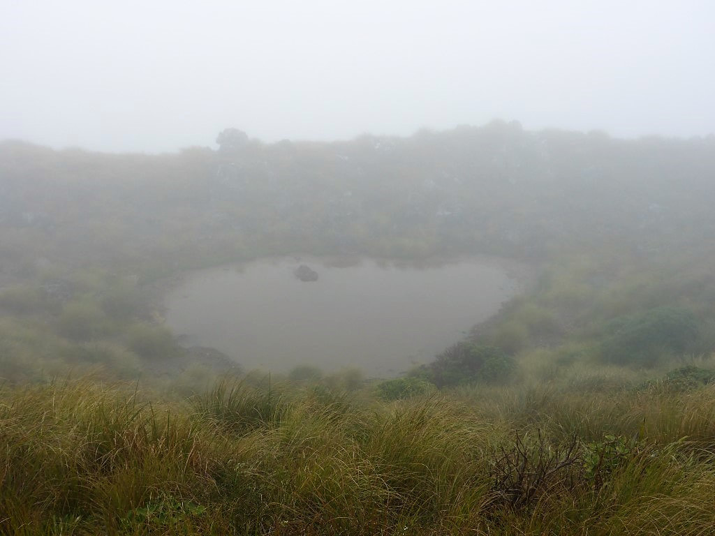 Most of the ridges dropped off fairly steeply but this popped up out of the blue on the eastern side!  A bit of colour on an often grey day :-) 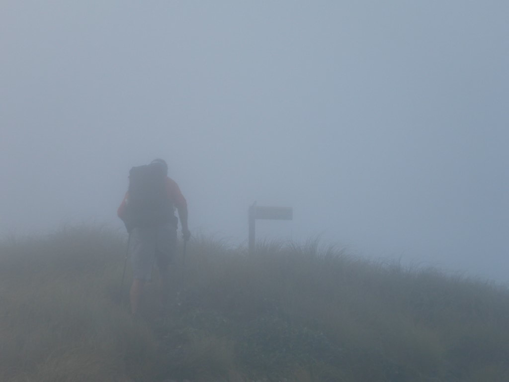 This was what it looked like approaching the sign atop Junction Knob. 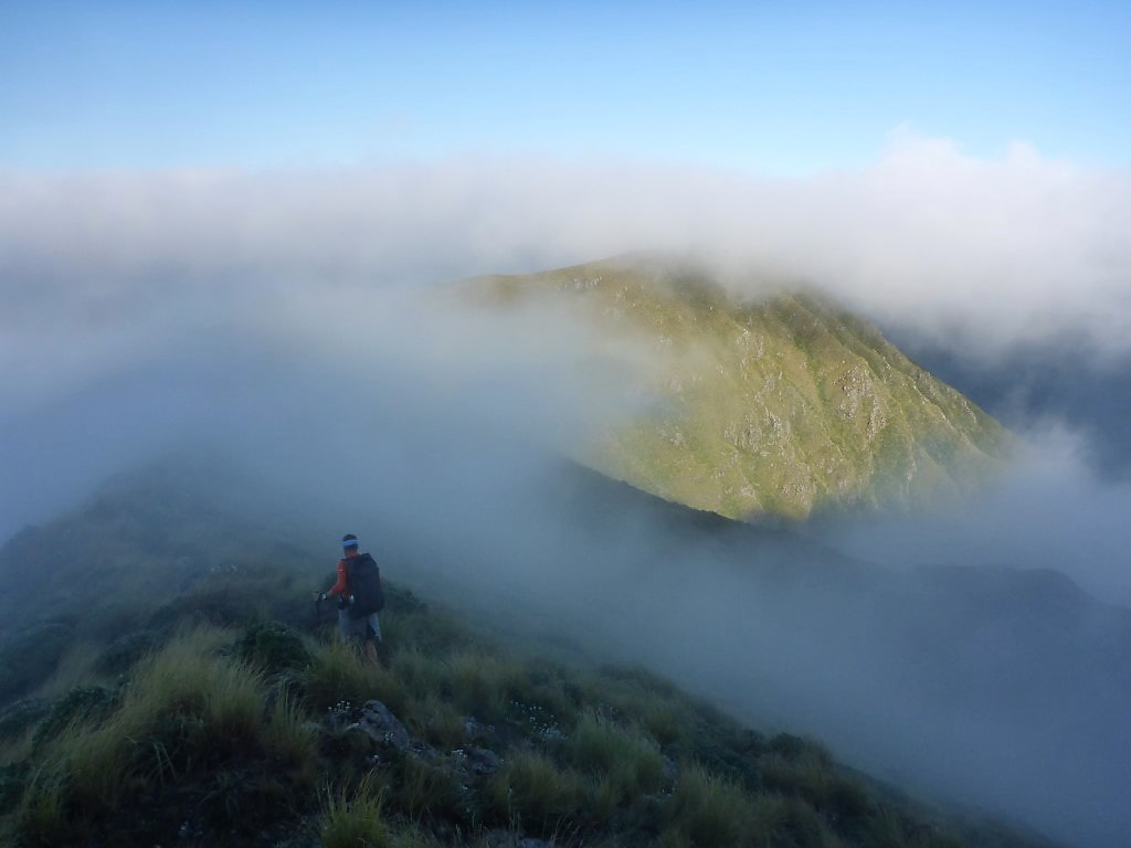 Now heading west down to Shoulder Knob (under cloud to the right). 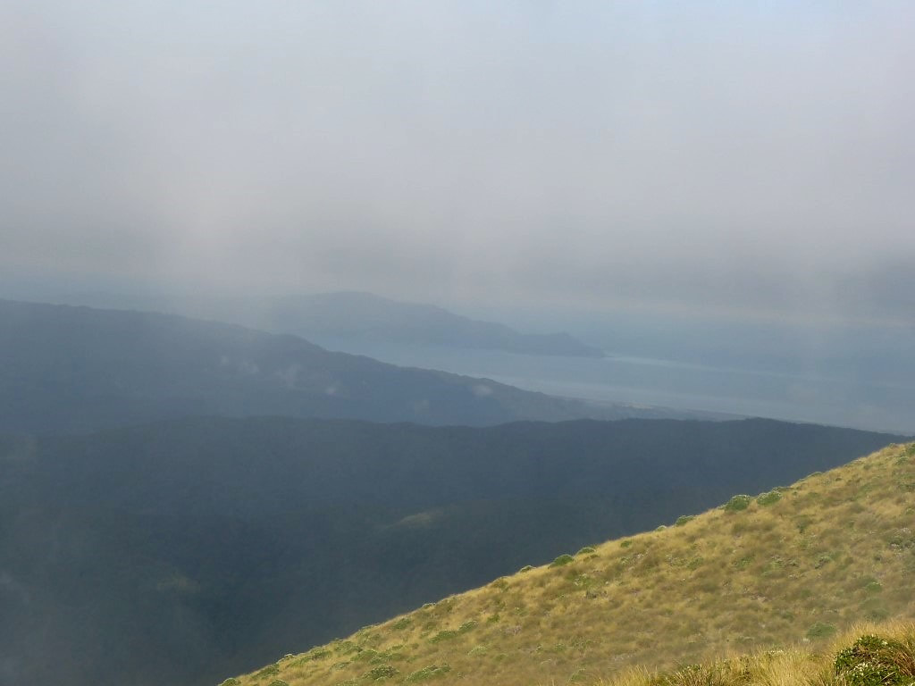 We did actually get a view of Kapiti Island!! A video below to show us about 30 minutes before Shoulder Knob. Below is a video from Shoulder Knob - note how the clouds come and go between the previous video and this one. 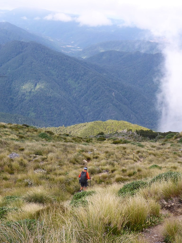 Heading down to the bushline The open areas around Otaki Forks are visible in the background.. From here we headed down into the bushline and a fairly steep descent down towards our first meeting with the Otaki River - 1000m down over 3.7km to the swingbridge across the river at the bottom. Luckily it was fairly dry underfoot so, although challenging terrain, we also realised that it could have been diabolical if it was wet and slippery - shades of the descent from Travers Saddle to Sabine River East Branch in the Nelson Lakes! We still took our time to try and minimise impact on the knees and reached the swingbridge 1h50 after leaving Shoulder Knob. B followed me across the bridge and, in the middle, noticed a rather large eel swimming happily underneath - which she managed to get a shot of. We then followed around above the true right of the river for 1.6km to Waitewaewae Hut (the Suunto had us at 9.5km for the day here against the TA suggested 8km - felt more than 8!!). 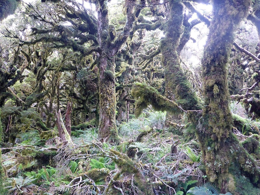 And back into more goblin forest. 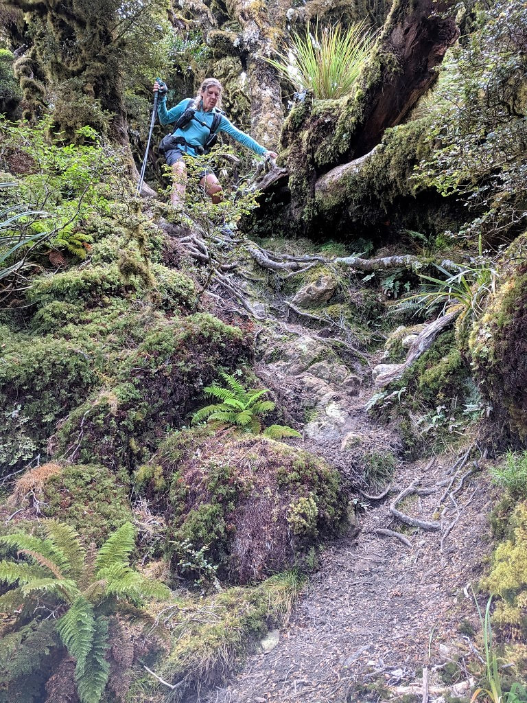 Steep and rooty in places but at least quite dry underfoot, for which we were thankful! 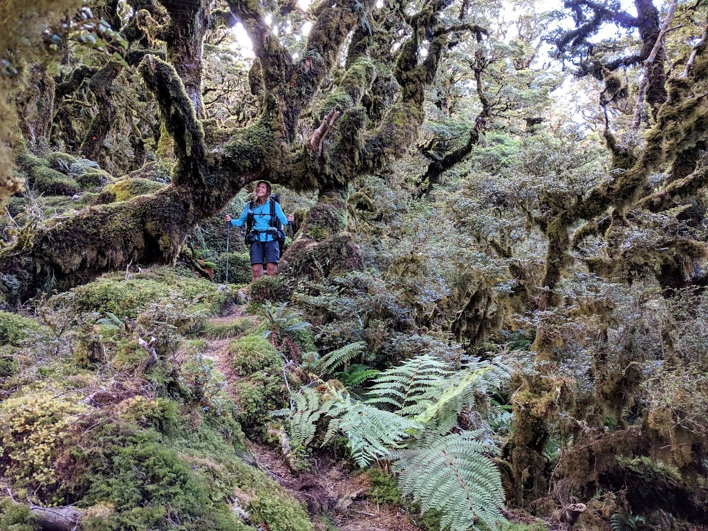 A goblin archway (I had to duck!). 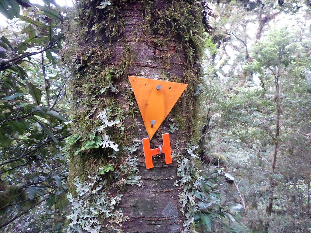 We followed the reflective H's for a while :-) Maybe someone put them there just for us? 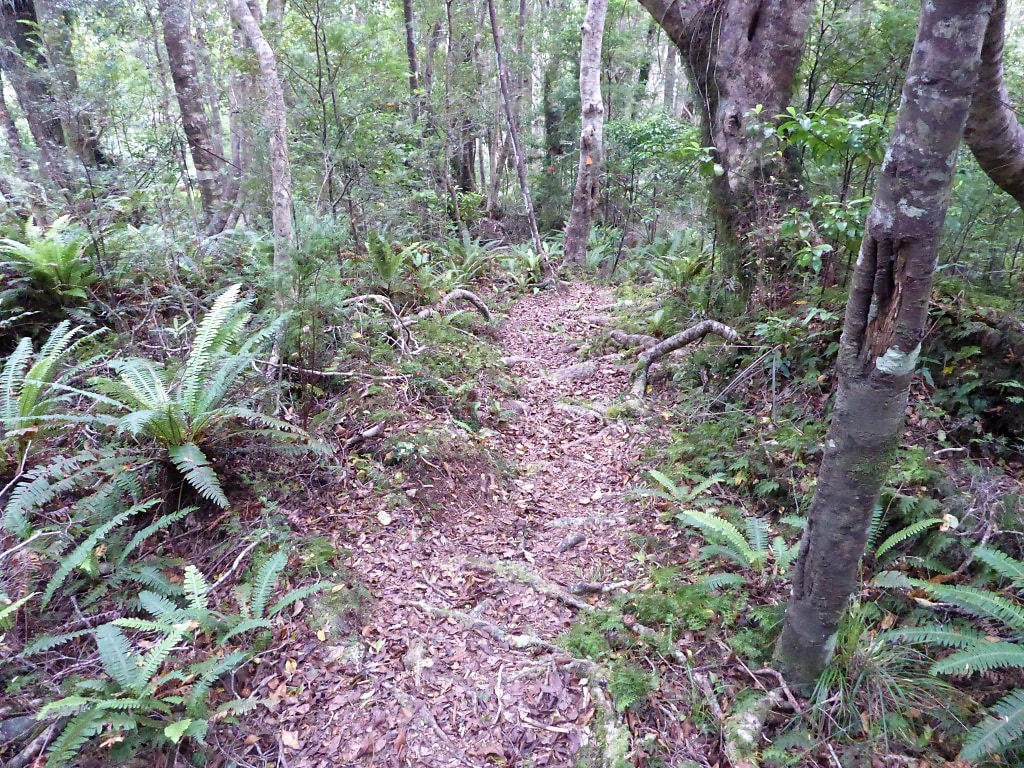 There was a nice short interlude of flatter walking before the last steep drop to the river. 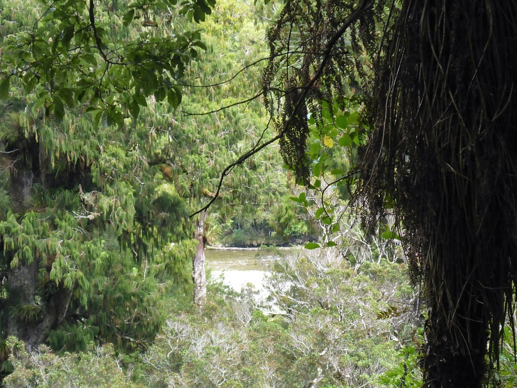 First view of the Otaki River near the bottom. 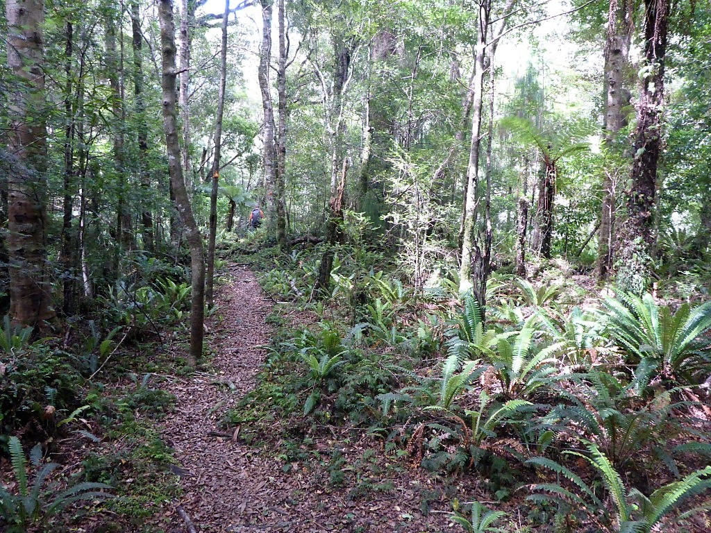 We turned south alongside the river at the bottom for a short walk to the bridge. 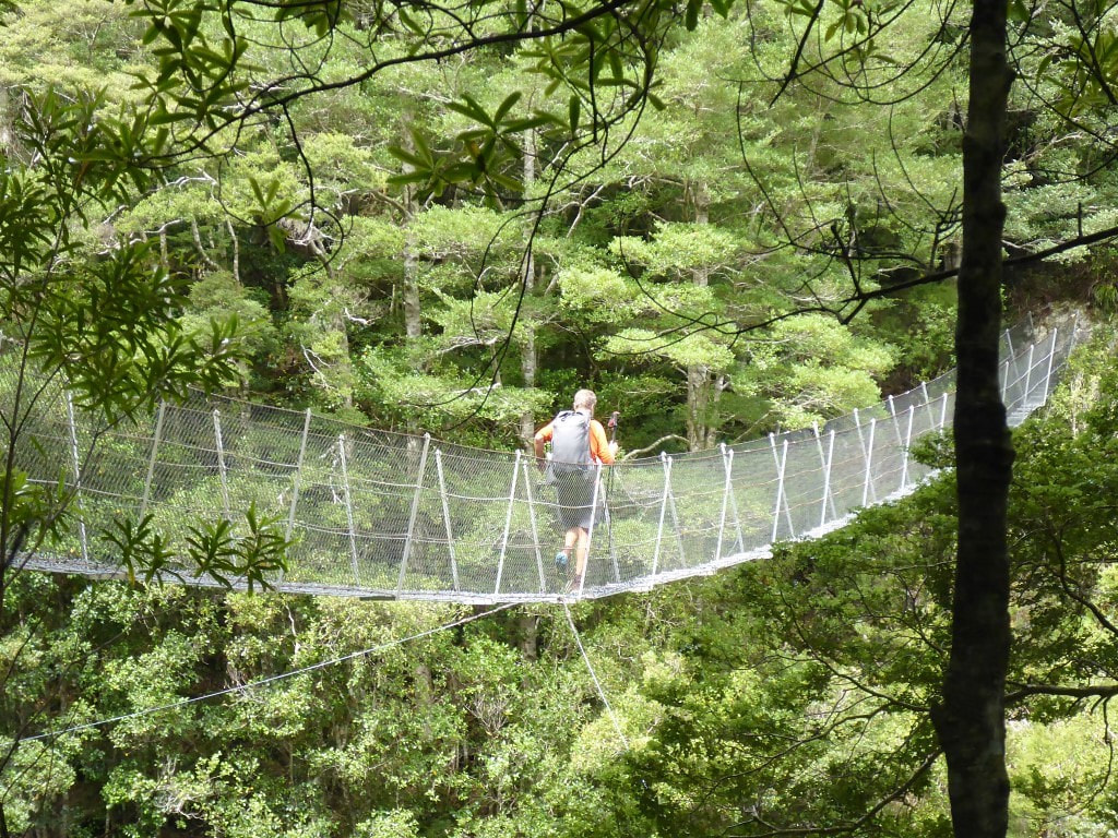 Third to last swingbridge for us on TA! 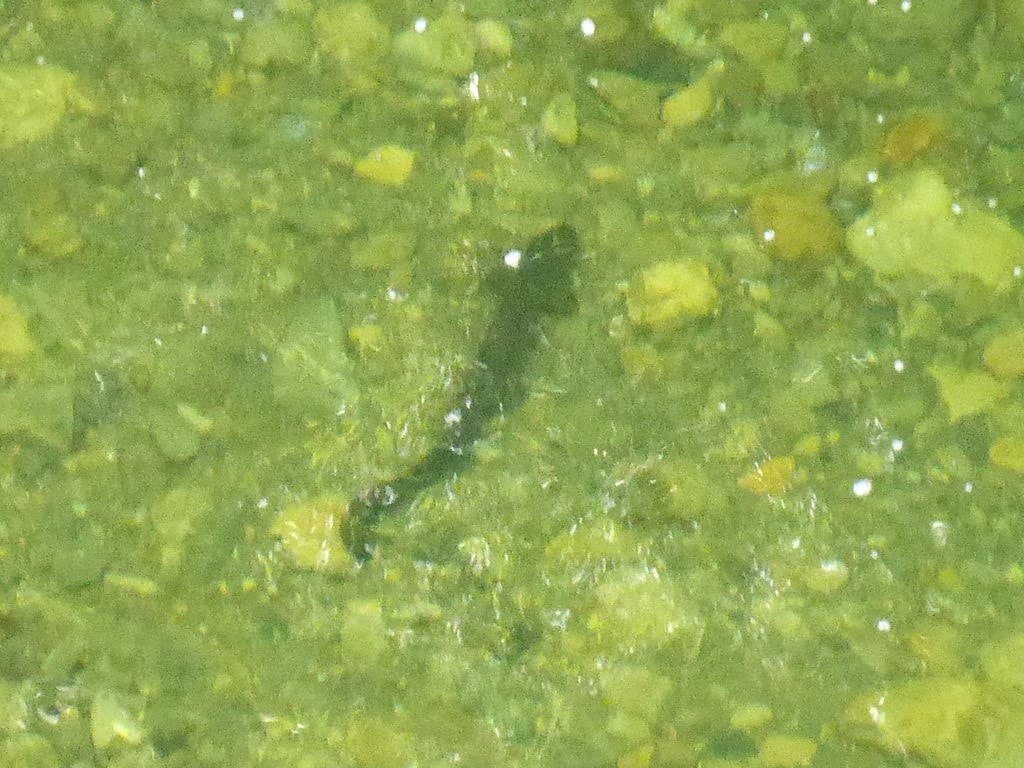 B got a clear photo of the large eel she spotted below her as she crossed the bridge!! 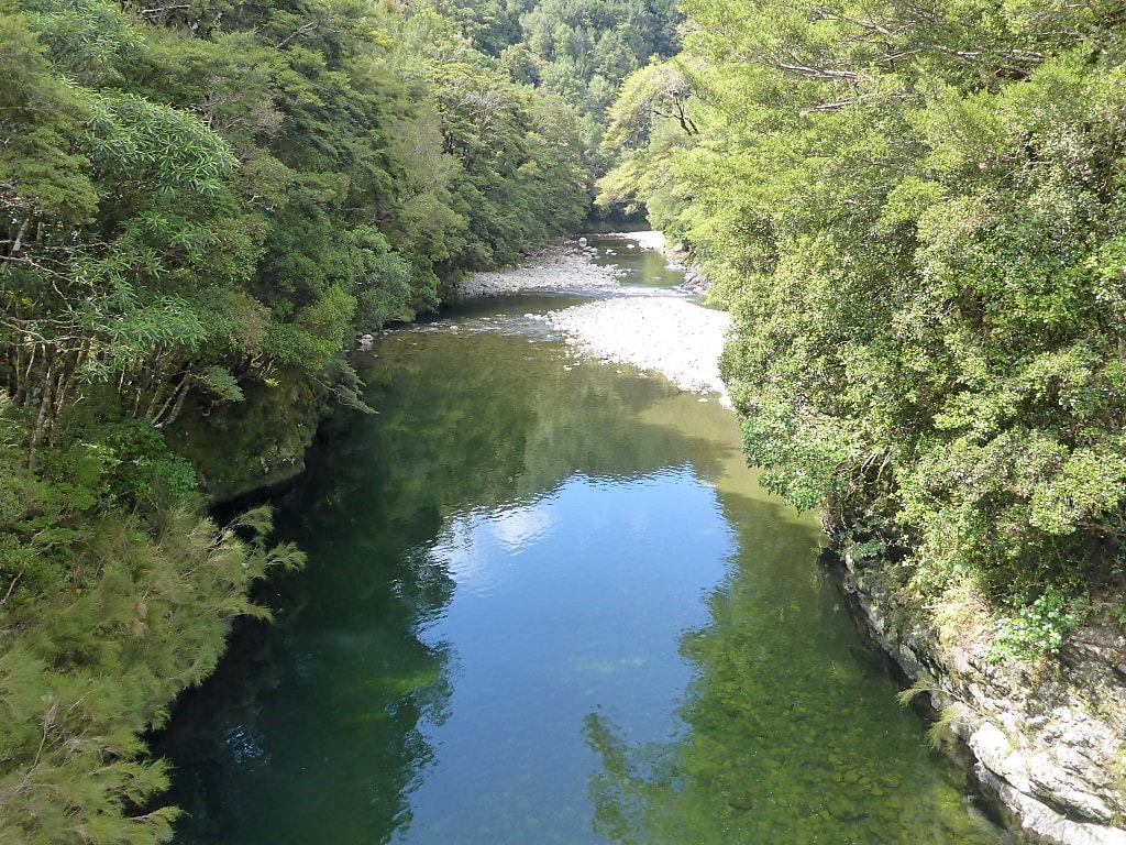 Looking downstream. 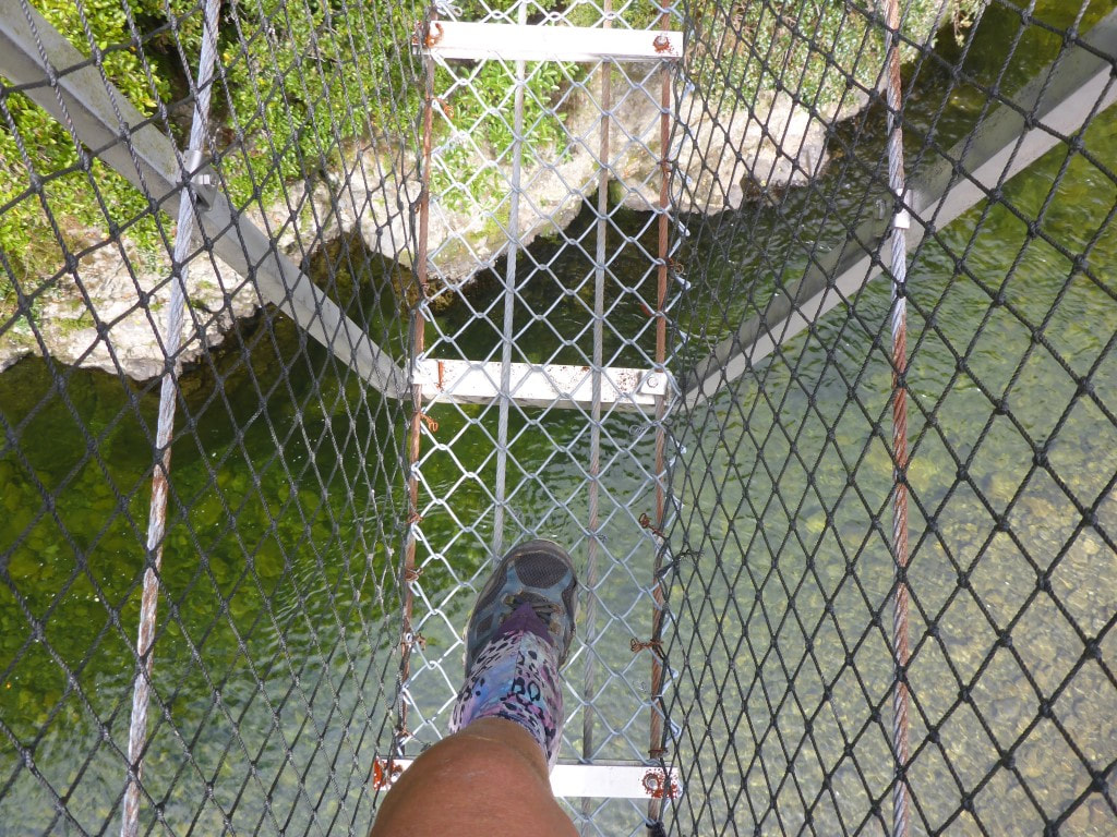 The view of a typical swingbridge from our perspective! 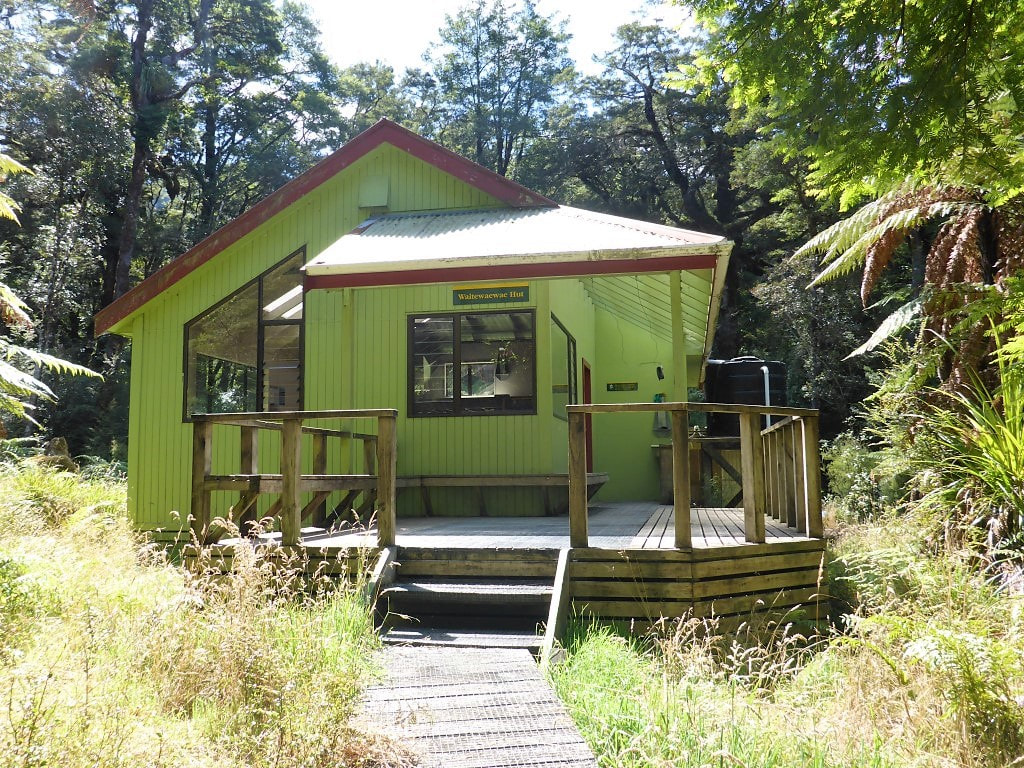 Waitewaewae Hut as we were leaving - we came in from the other side. We stopped here for less than 15 minutes to check the place out and to fill up our water before heading on. We planned to take the “dry weather” route as the river was low. This involves dropping down into the river about 100m after the hut and crossing to the true left, then following along the rocks on that side for about 400m, around a U-bend in the river, before crossing again back to the true left at the point where a nice orange triangle directed us up Arapito Stream. While it was only 600m up Arapito Stream before rejoining the main (wet weather) track, the orange markers and the track disappeared a couple of times, which made us take our time to figure out where exactly the track went - so not sure how much time it saved! 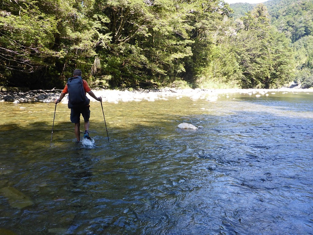 Crossing just after the hut - quite wide and shallow here. 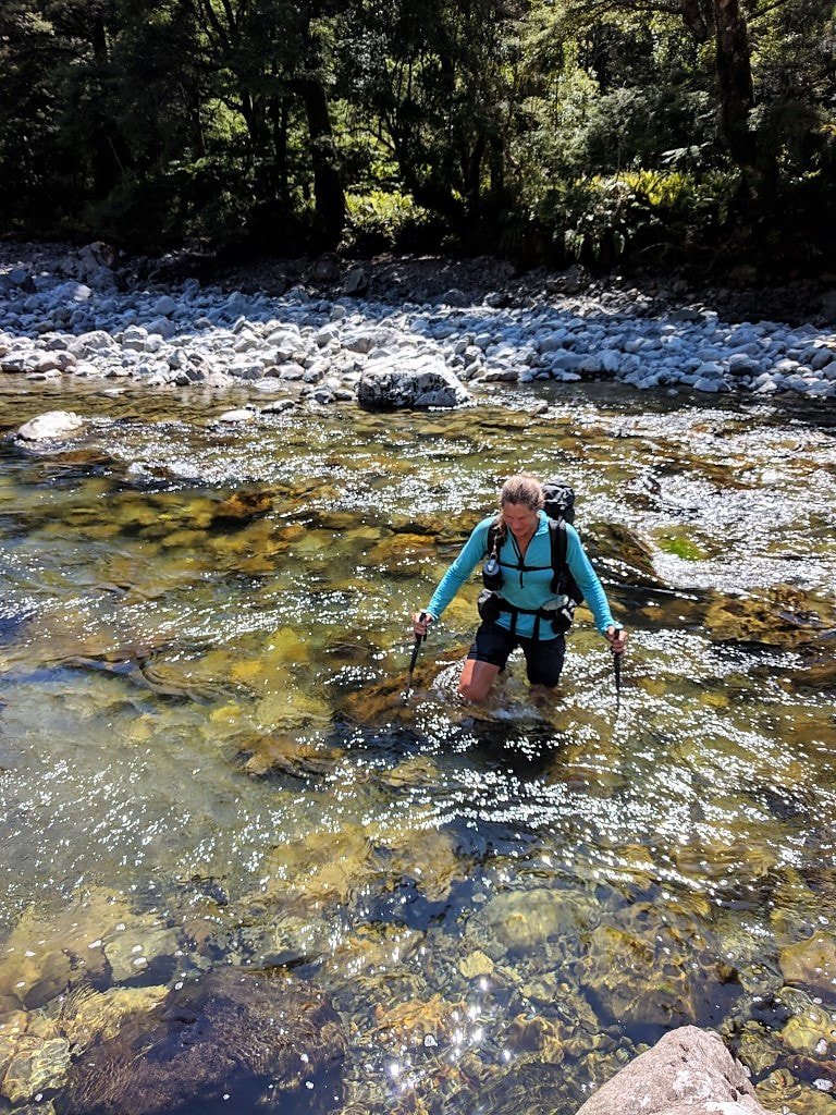 Crossing back again - a little bit narrower and deeper here. Wet trousers - just. 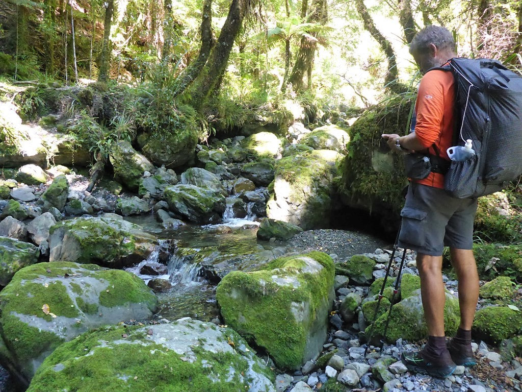 In 600m up Arapito Stream we checked the GPS twice! Mostly the "track" sits on the true right of the stream. From here we headed up onto the Plateau which we thought, from the TA GPS track that we have (using Viewranger app and Topo50 maps) on our phones, might be most of the climbing done for the day, with a benign downhill run. How wrong we were!!! The GPS file didn’t seem to have been updated to include the “new” (actually a few years old now) so-called Sidle Track that was put in to bypass a large slip on the old track. In short, this part of the track was bloody horrible (a nice version of the word I might otherwise use!). At the 13km mark (on my Suunto GPS track - follow the link at the top of the blog post) the Waitewaewae Track used to head down a valley (Saddle Creek) to the Waitatapia Stream. Now you head down around about 3km of gnarly roots, rocks and the occasional fallen tree on a sidle to rejoin the old track before a second slip (which you then climb up around to avoid). This bit was made worse for B by the fact that she had hurt her leg which was causing stabbing pains into her left knee on both ups and downs. Horrible doesn’t really do it justice. The funniest part of this was that, probably because we were feeling grumpy and sorry for ourselves, we didn’t take any useful photos of this bit of the track - so you’ll have to take our word for it!! If you want another view of this bit of track, read the eloquent Anthony Behrens who, with his partner Fiona, (otherwise known as Whin and Whiona!) walked this section northbound as part of an alternative TA journey in March last year. Follow this link to his blog for that day, entitled “Stairway to Hell”!! 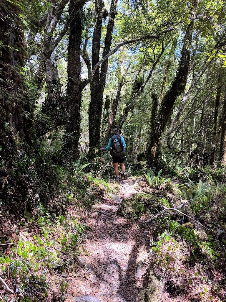 Climbing up to the Plateau (not bad going at this stage). 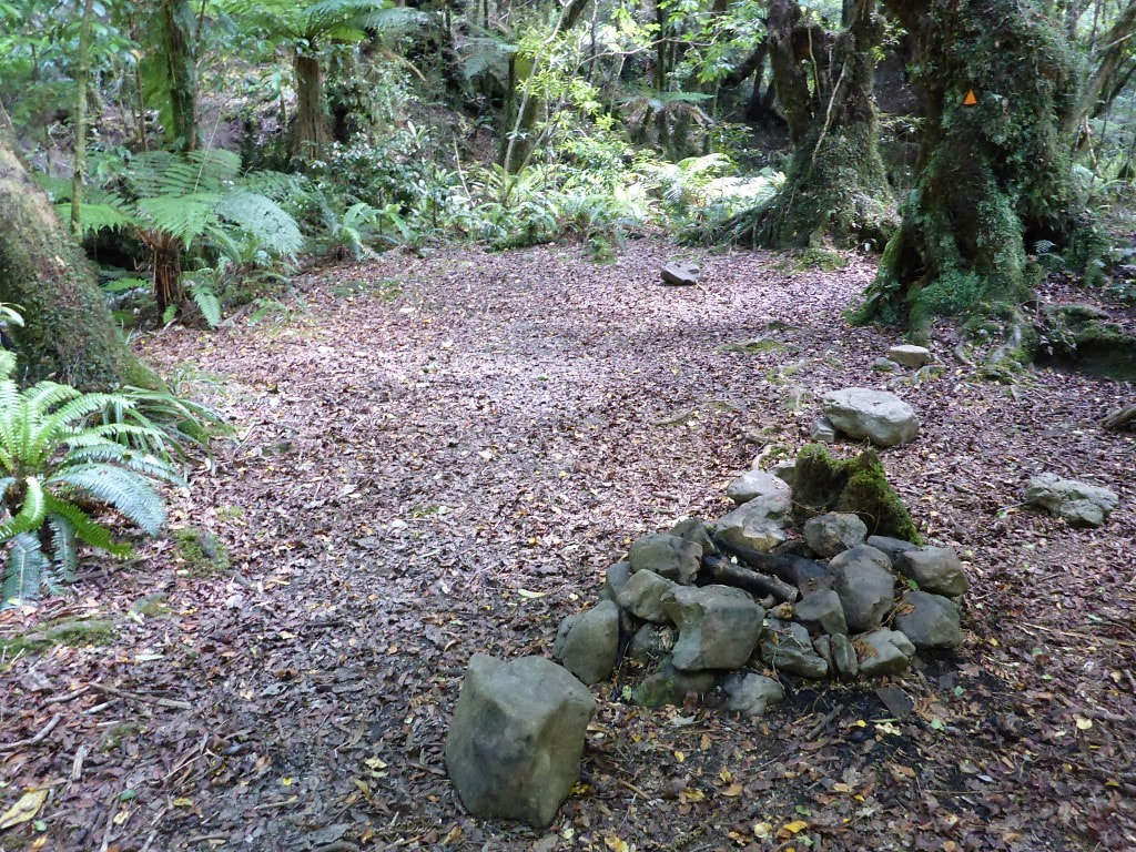 A camp fire spot along the Plateau before we started on the notorious sidle! 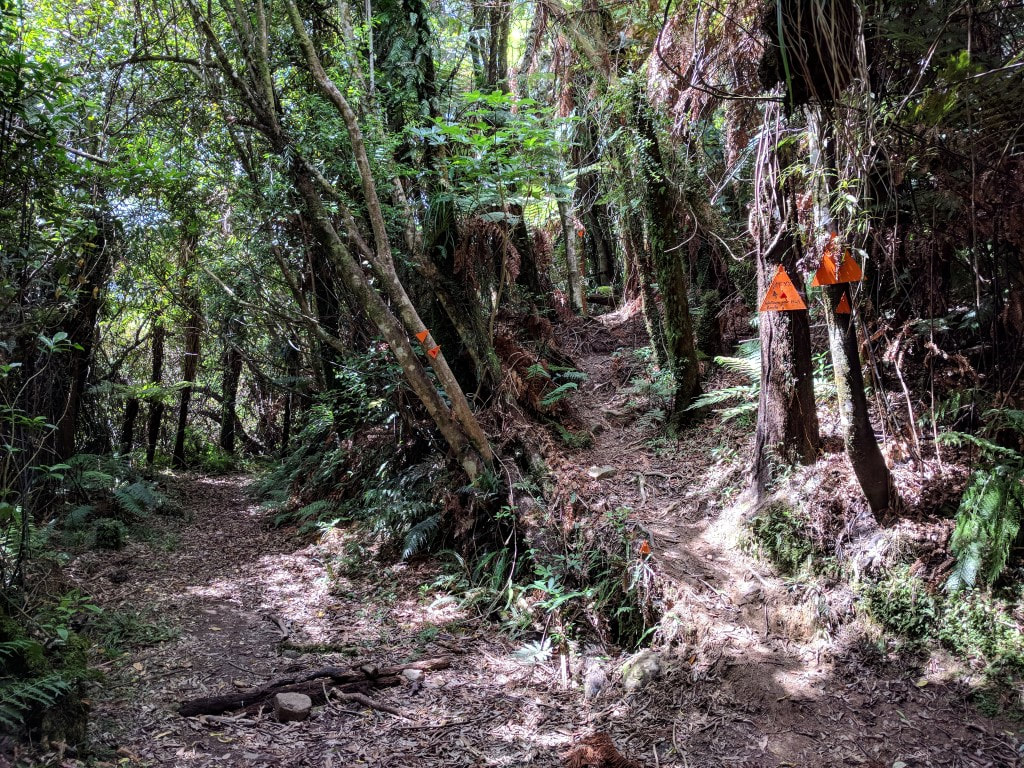 We are out!! That was quick!! Looking back, the old trail heads to the left, the new trail up to the right. "Abandon hope, all ye who enter here" might be appropriate for nobo trampers :-) Eventually we ended up back on the old trail which was part of the old logging tram track that used to run up the valley. This was absolute bliss by comparison and eased B’s leg pain a little :-) It was relatively flat, with only minor up/downs for the next 2 km, running above the Waitatapia Stream, until we dropped down to the penultimate swingbridge - this one across the Otaki River again. This is less than 1.5km from the Boielle Flat carpark at Otaki Forks so there were a number of people swimming in the river here. It has been a very hot summer in the district and I imagine the water is warmer than usual - it certainly felt pleasant to walk in!! 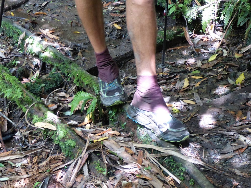 Some of the old bush tram tracks (and sleepers) are still there in places. 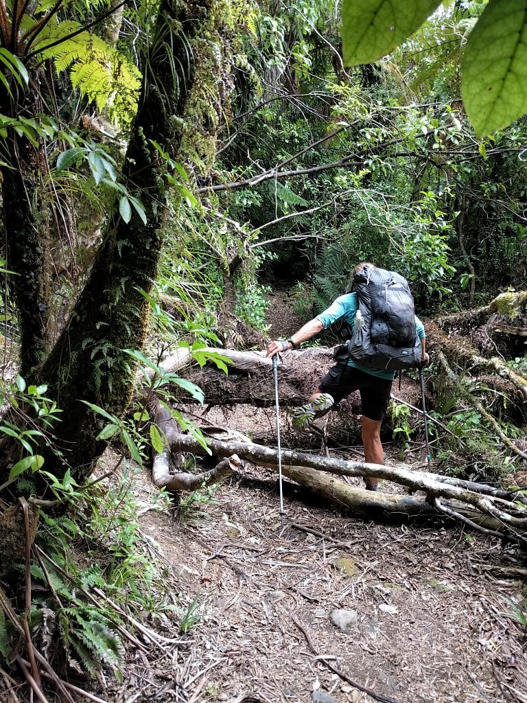 There's the odd obstacle ........ 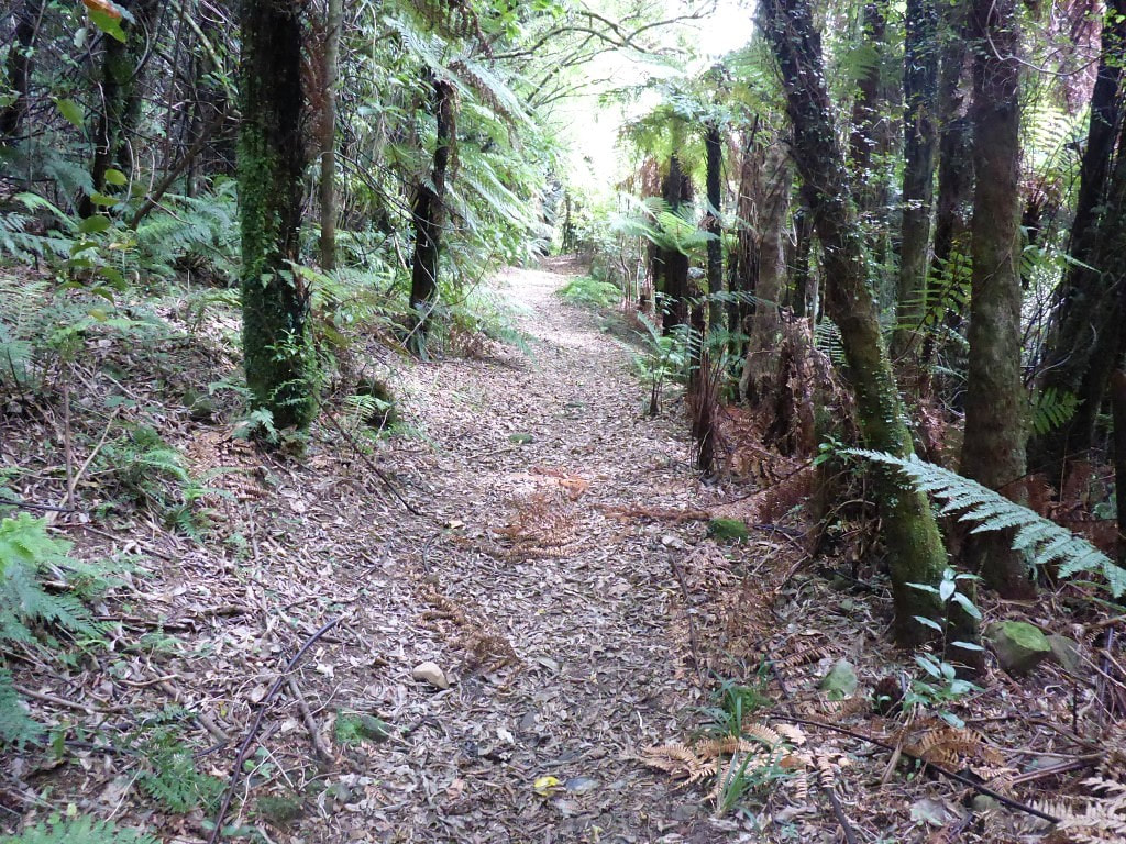 ..... but much of this 2km stretch is nice going. 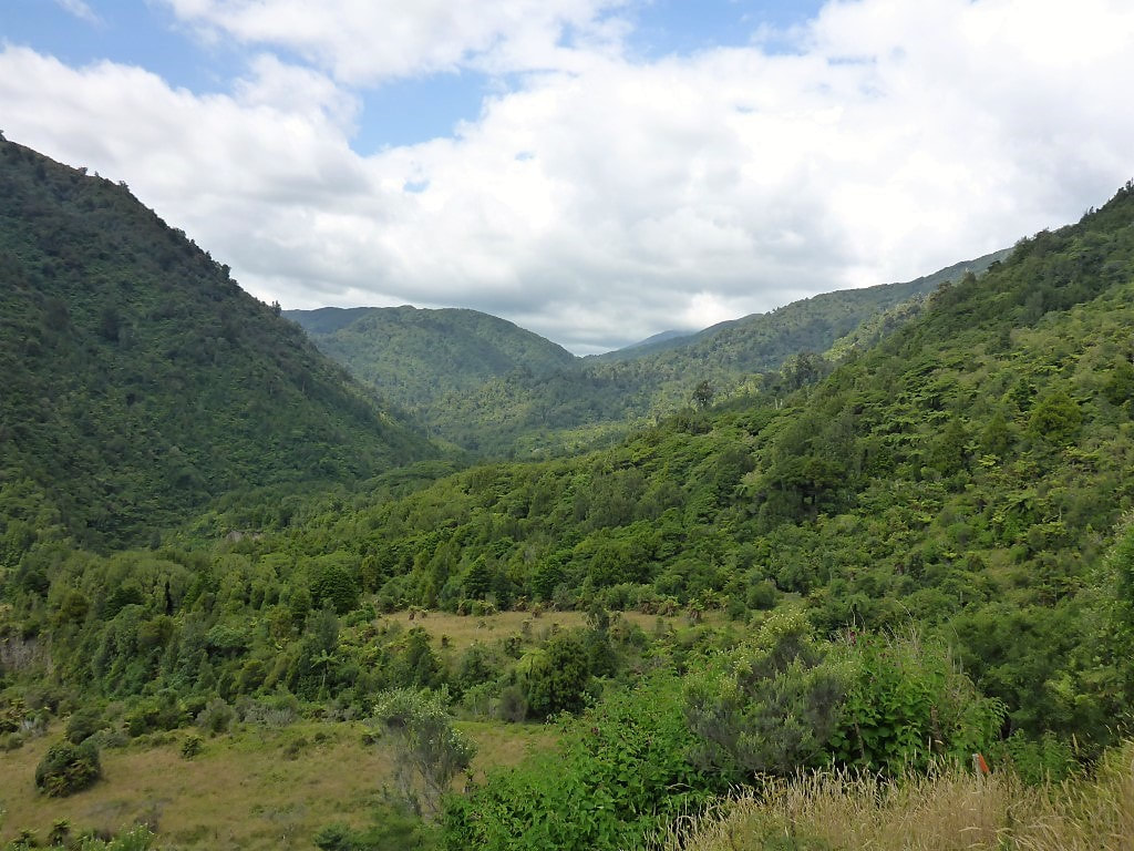 Then we were off the tram track and out of the bush. Looking back upstream. 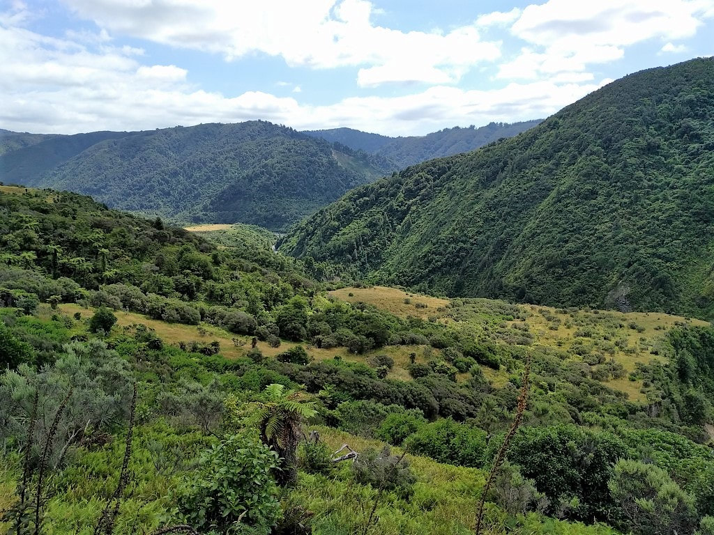 We're going that direction. The little clear plateau in the distance is where the Waitatapia Stream joins the Otaki River. Boielle Flat is just out of sight to the left. 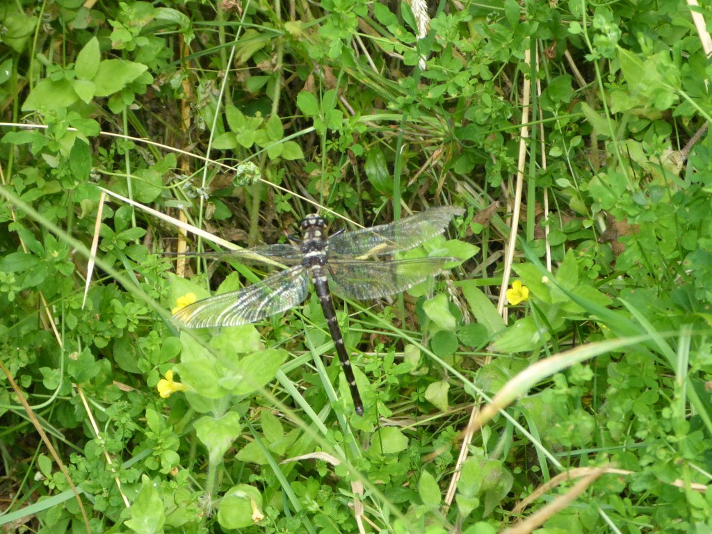 B found a large dragonfly along the way :-) 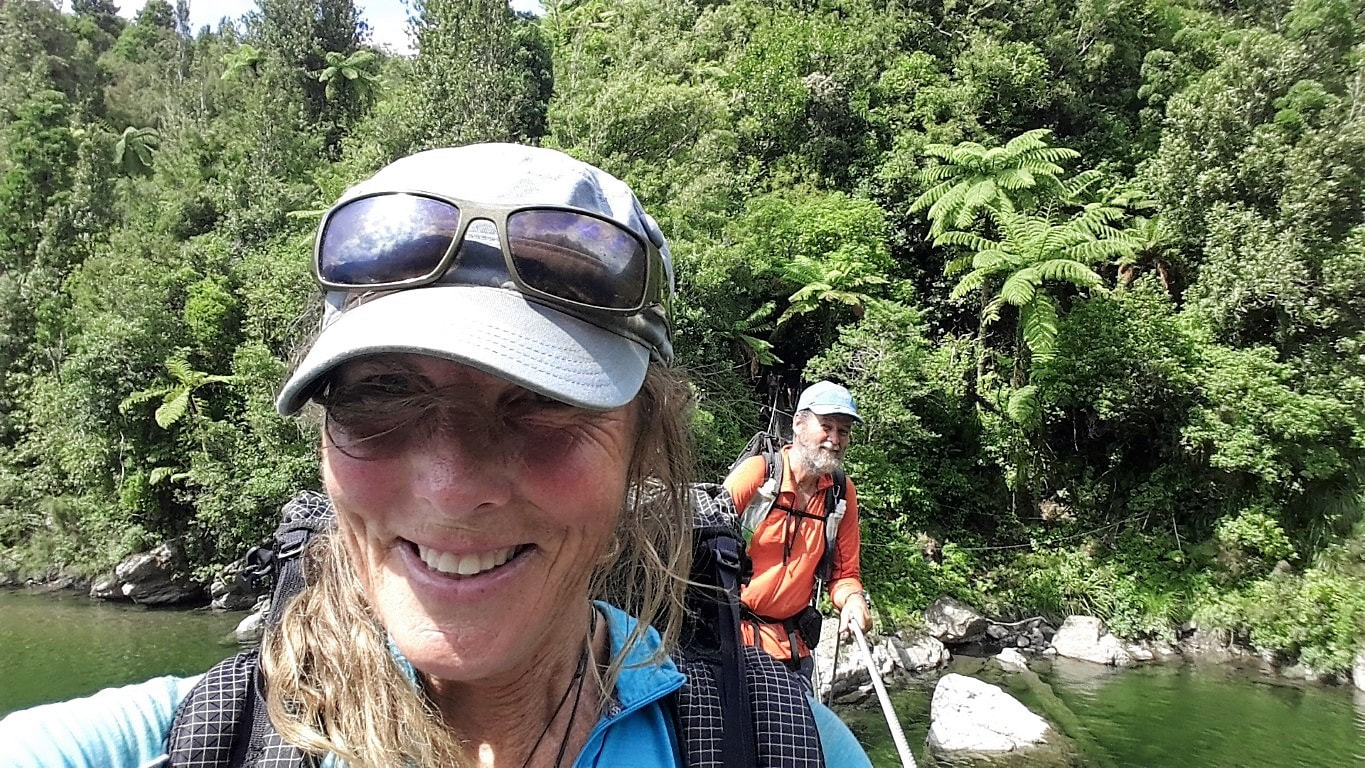 Thought we were allowed a few selfies on our final day! (not a "1" person limit on this bridge) Crossing the Otaki - people were swimming below us in the river. A short sharp climb up from the swingbridge on a well-formed track saw us on a plateau with only just over a km to go - we almost got lost here because of a plethora of tracks and even had to rely on the GPS to tell us which grassy path to take!! We finally dropped down to the Waiotauru River onto the Arcus Loop Track and headed for our last swingbridge of the TA - across to the carpark and picnic area. We got a rather large surprise when we saw a congratulatory banner hung on the eastern end of the bridge as we approached. We stopped for a photo under it and crossed the bridge to find another banner and a finishing tape strung across the bridge :-) Julia had excelled herself and had a small reception of family and friends to welcome us - a very nice surprise for us, especially as the surprise included bubbly, beer and a barbeque!! It was a lovely thought that capped off what has been a mammoth journey for us over 2 years and 4 months. So that was it DONE - I’m sure both Belinda and I will have some more thoughts to add “post the event”, when we have had some more time to reflect on what it all means. But, that’s the end of the walking part of the TA blog!! Bye to all, and a big thanks to those who have followed progress and provided moral and physical support:-) 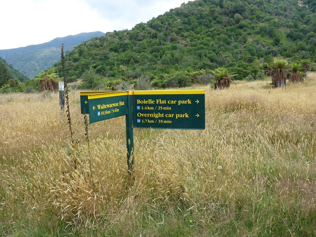 Lots of tracks here. 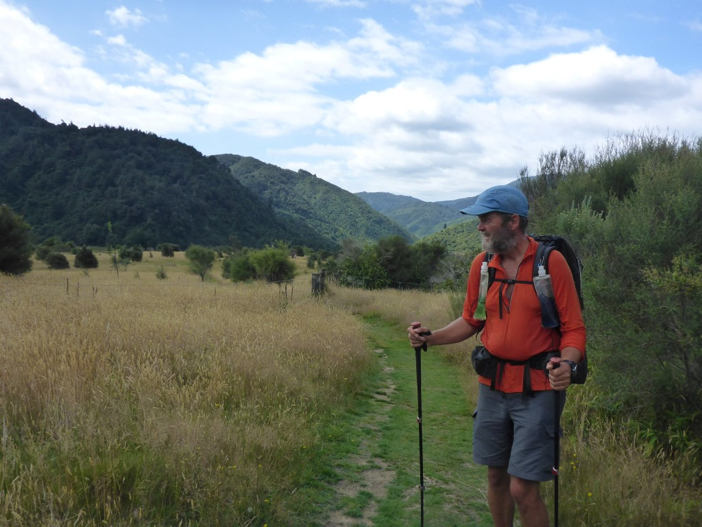 We set off on this nice track only to discover that we were supposed to be walking through the grass!!! 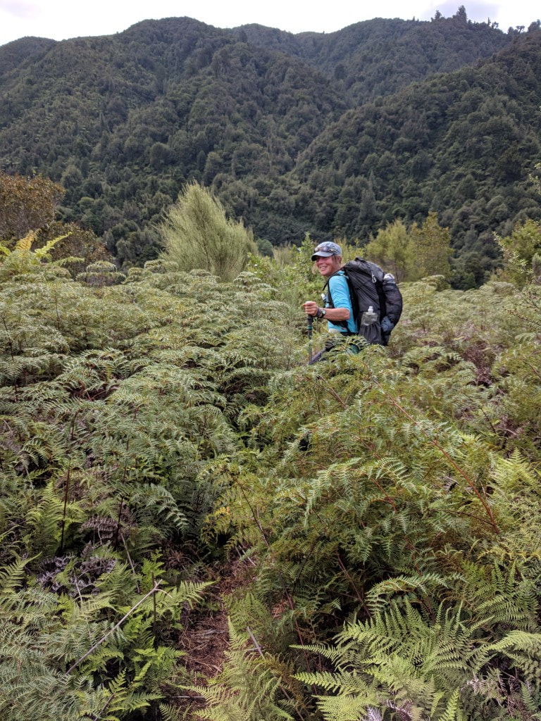 And then we walked through this - TA to the last!! :-) 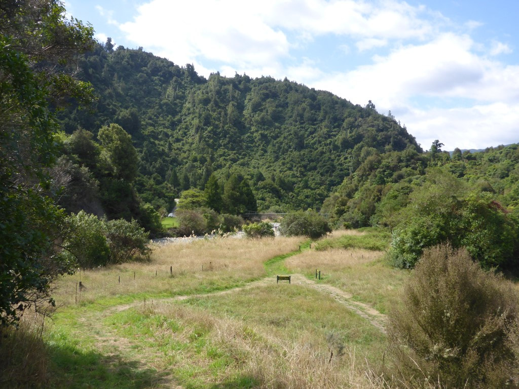 Our final swingbridge across to Boielle Flat is in sight. 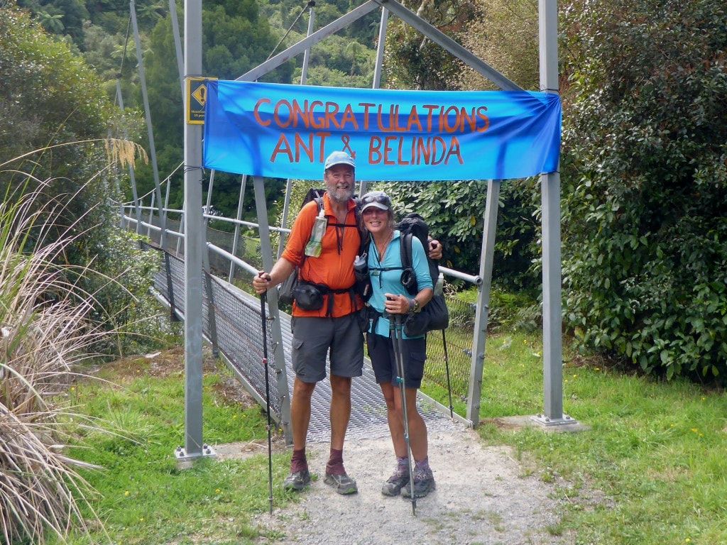 This was what met us at the start of the bridge!!! A nice lady who had been talking to Julia figured out it was us and offered to take a photo for us :-)
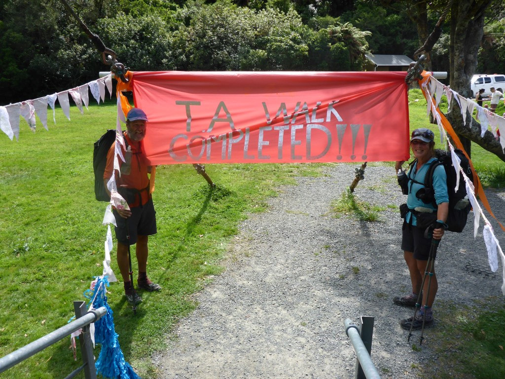 And more fanfare on the western side of the bridge as we crossed the "finish line"! What a treat for us - it made it feel much more special than just "getting there" :-) :-) 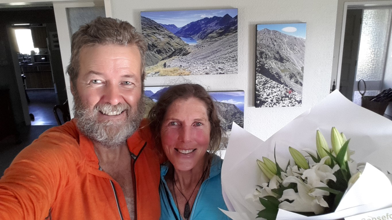 Arrived home to find our lovely daughter in London had arranged flowers for us :-) Thought it appropriate to take a pic in front of our "brag wall" showing Waiau Pass and Mt Rintoul!!
3 Comments
2/9/2021 14:15:45
My favorite part was the open grass field. Every corner of this journey is mesmerizing. 6/9/2021 14:10:45
Imagine if it was a week long campaign. Some would have probably went home after day 3, but true trekkers will experience the fulness of the event. 3/1/2022 20:00:42
Look at how well the place has been taken cared of. I wish to visit this place and see for myself the beauty of this sanctuary. Leave a Reply. |

AuthorBelinda and Anthony (aka Tony) Hadfield made a decision, in their late 50's, to do something a "bit different" and walk New Zealand's 3000km Te Araroa Trail over summer 2015/16 - although updates will now tell you that this plan will take longer now!!. As the old saying goes - "don't leave home 'til you've seen the country"!! Archives
January 2018
Categories |
 RSS Feed