|
Got up around 0630 and the four of us left at pretty much the same time just after 0800. Best guess is we did just over 14km in 5.5 hours walking time. Twice during the day I left the watch on pause (dummy!) so, while the track will look ok, albeit with a couple of straight lines on it, the time and distance is it. Anyway, the data, for what it's worth, is here. This was probably the most spectacular day, view-wise, of the TA so far. We set off at the same time as Phil and Viggo, turning west from the hut and heading up a narrow stream valley (still Bush Stream? Not sure), crossing back and forth across the stream. It was about a 5km hike rising about 600m to Stag Saddle, pretty steep in places, but easing off a little as we neared the saddle. Not as steep overall as yesterday's climb over Bullock Bow Saddle. The guys, as usual, pulled ahead of us as we took our time on the steady climb through tussock and swampy areas. There were a few little snow patches as we neared the saddle at 1925m, nominally the highest point on TA. The day was fine and clear for us so we had some great views. 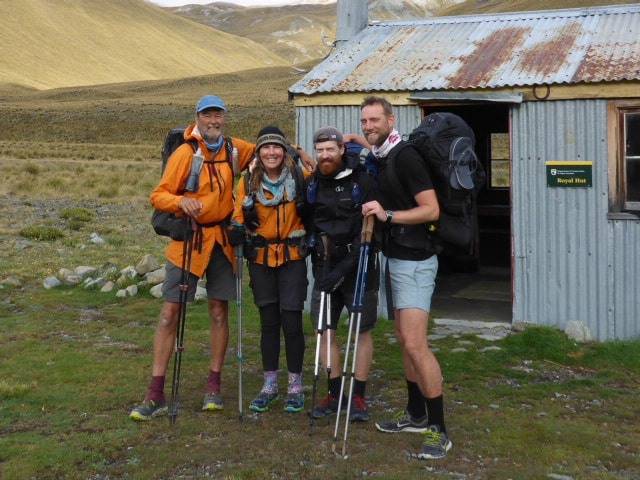 Viggo, Phil, B & me setting off from Royal Hut. 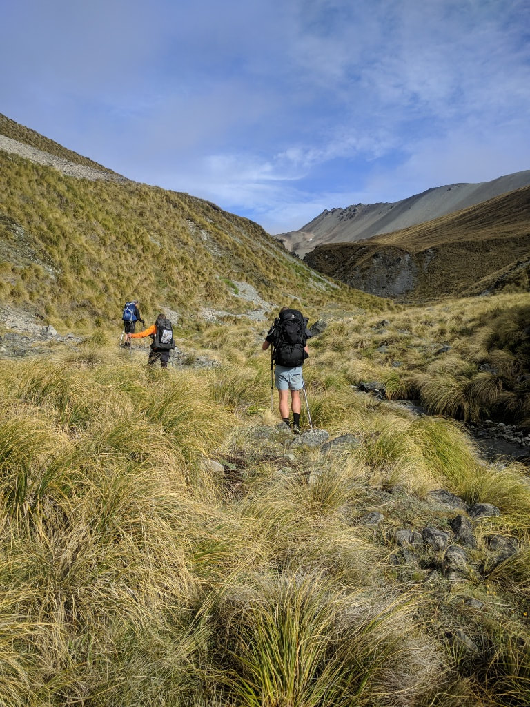 Heading up a slightly more open part of the stream. 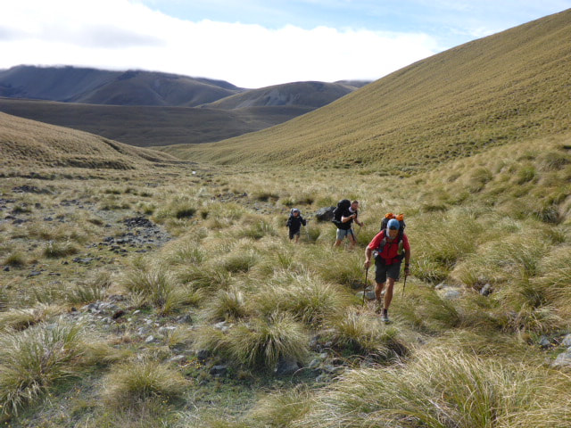 Looking back where we had come from. 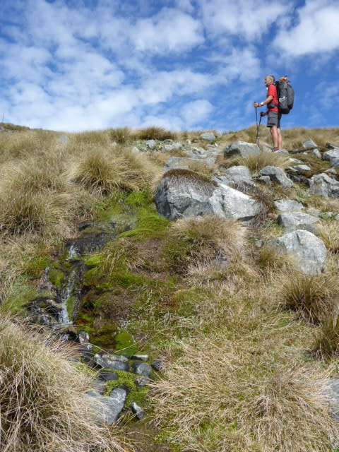 A few steeper, rockier bits on the way up. 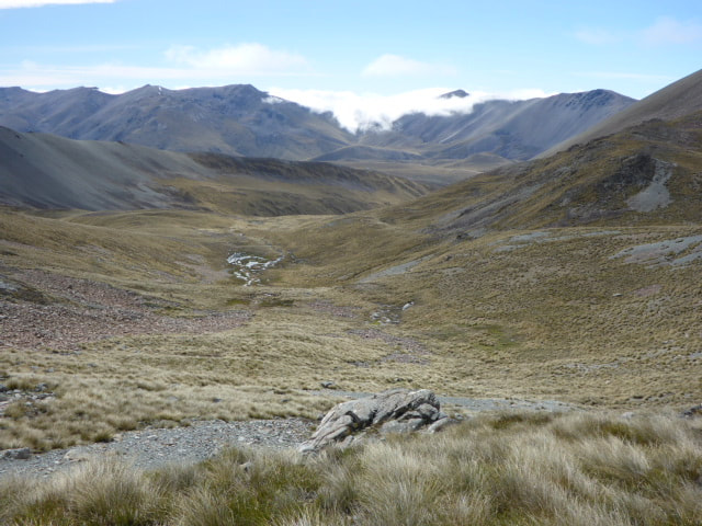 Another shot looking back. That is Bullock Bow Saddle under the cloud in the background - lucky we had a clear day there yesterday! 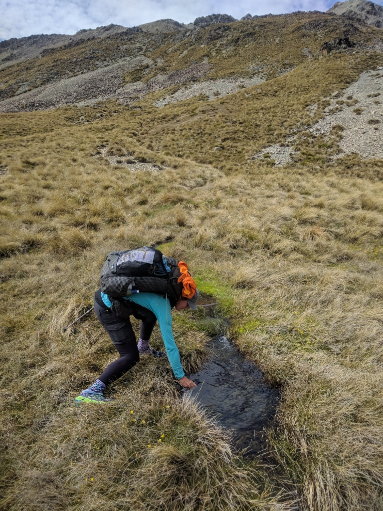 Lots of beautiful water to dip into up here. 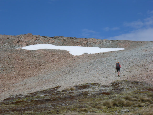 A little snow just below the saddle! 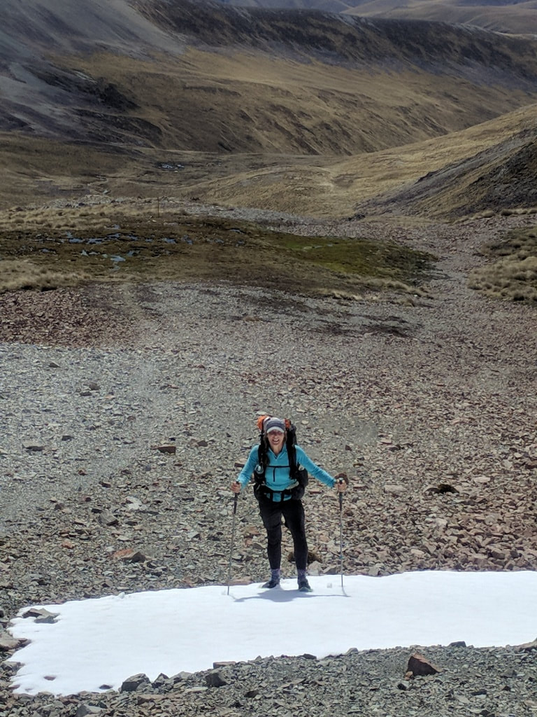 No crampons required! 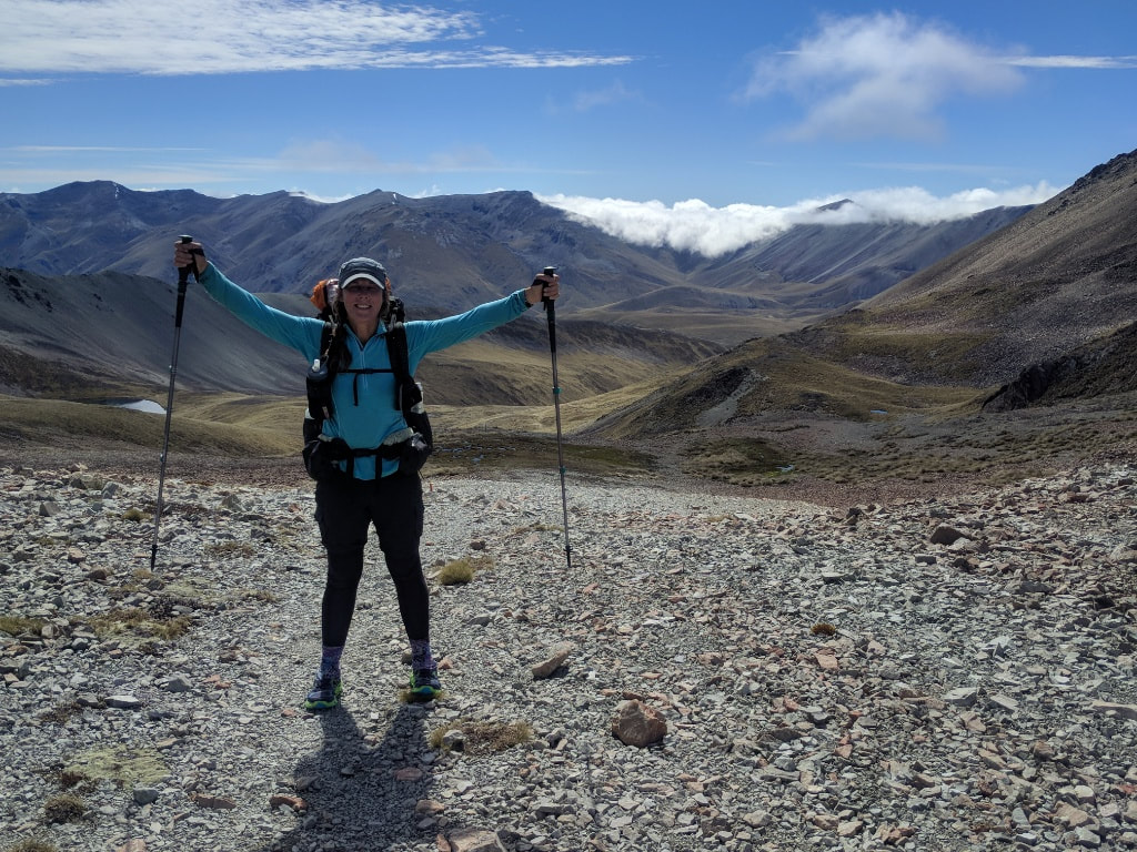 At the saddle having conquered that snow :-) 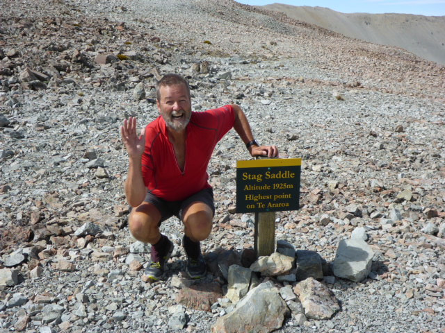 And just to prove that I was there as well! 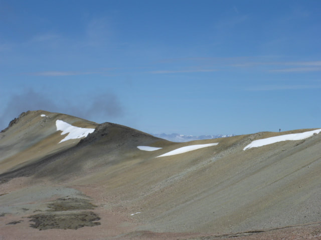 That's the ridge we were heading across to - you can just see Samuel on the skyline above the right hand patch of snow. Samuel had left after us but passed us at the saddle as we were on the phone sorting out some things (yes - there was cell reception!). Luckily this included sorting out some accommodation at Tekapo, which was pretty full! Samuel followed the guys in scrambling up onto the ridge to the west of the saddle and heading down that rather than the “main” route down the valley floor. We followed, initially across rocks and then onto a scree slope, eventually creeping under some slushy snow (quite steep and very slippery due to melting snow) to get onto the ridge. The views down and across the Macaulay River valley to the Southern Alps were just stunning. While Stag Saddle is nominally the highest point on TA, this ridge option actually takes you a little higher to around 1945m (according to the Suunto). We would recommend this option to everyone as long as the weather allows for it. We followed this ridge down for maybe 9km, enjoying views all the way, until we eventually dropped down to join another bulldozed track coming in from the upper part of Lake Tekapo. 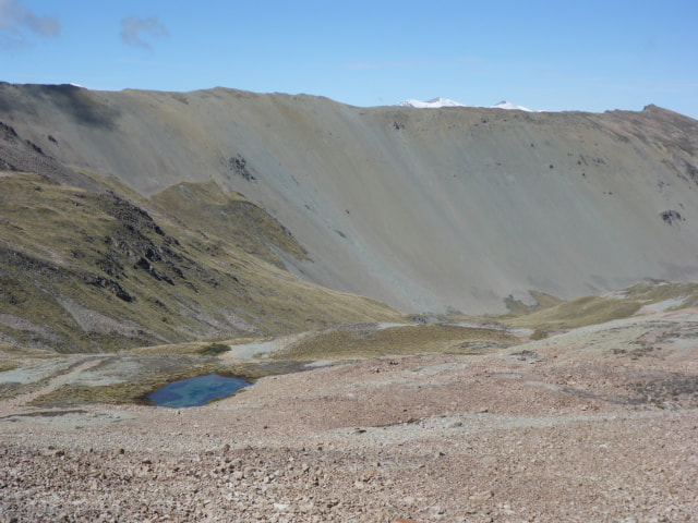 The alternative route goes down through that valley floor - no views so definitely only use in bad weather! 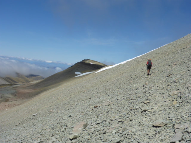 Across the last bit of scree slope towards the ridgeline. 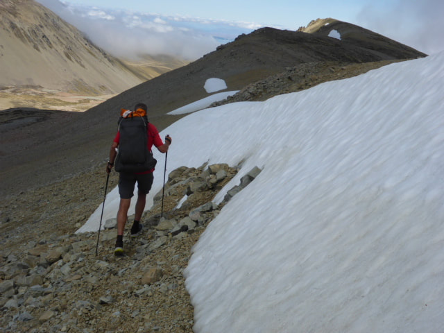 Negotiating our way around the snow onto the ridge - it was very slushy and slippery as the snow was obviously melting! 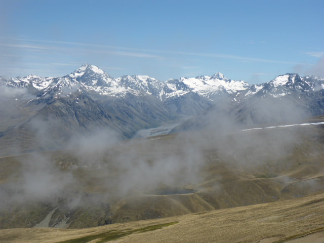 Looking west across the Macaulay valley towards the Alps - Aoraki / Mt Cook out there somewhere! 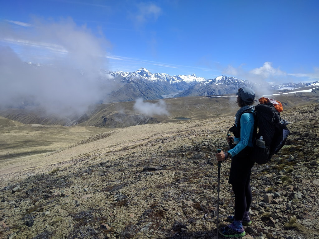 B looking across to the Southern Alps. 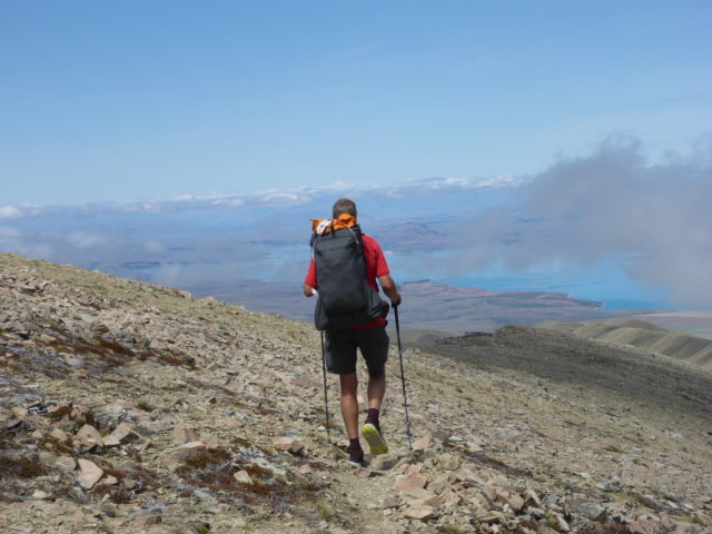 Starting down the ridge with Lake Tekapo in the background. 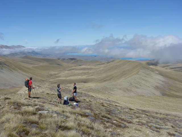 Phil and Viggo had stopped for lunch with a view so we caught up for a bit. Below is a video taken part way down the ridge from Stag Saddle. And just ignore where I make reference to "Lake Pukaki" - I meant Lake Tekapo !!! 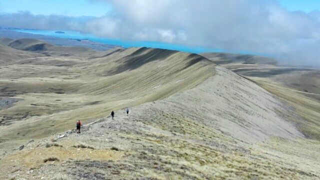 A procession of gentlemen ;-) heading down the ridge. 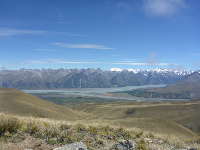 A different perspective across the Macaulay to the Southern Alps. 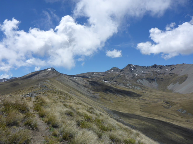 Looking back up the ridge towards Stag Saddle. 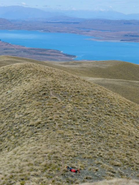 Me having a lie down while waiting for B who had been busy with the camera! Lake Tekapo looking lovely. 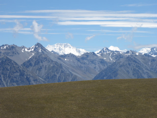 It was a bit embarrassing not being able to figure out where Aoraki /Mt Cook was! 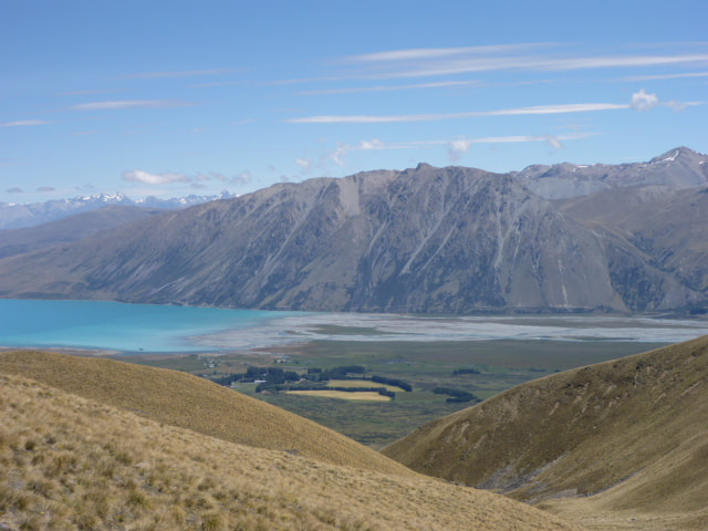 The head of Lake Tekapo with the Godley River - the Macaulay flows into the Godley just before it hits the lake. 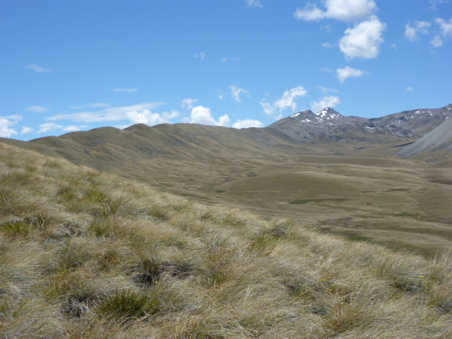 Another view back up towards Stag Saddle from lower down the ridge. 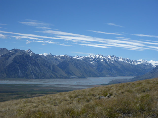 Looking back up the Godley with the Macaulay coming in just out of sight to the right. A couple of kms and one stream crossing saw us arrive at Camp Stream Hut after an amazing day’s walking. The guys were there ahead of us, as was Tomas, a nobo walker from the Czech Republic. This was a small 6-bunk hut with little room and shortish bunks - operated by the Mackenzie Alpine Trust. B had been keen to spend a night under the stars so she set up a mattress outside. Viggo decided he had better try it as well so he also spent the night outside. The rest of us bunked inside with the door open. B said she had a great night, waking around 0230 for an hour or so during which time she saw a whole bunch of shooting stars and a couple of satellites :-). The temp was not too cold and the wind also was not too bad, so a good night to test the outdoor sleeping! 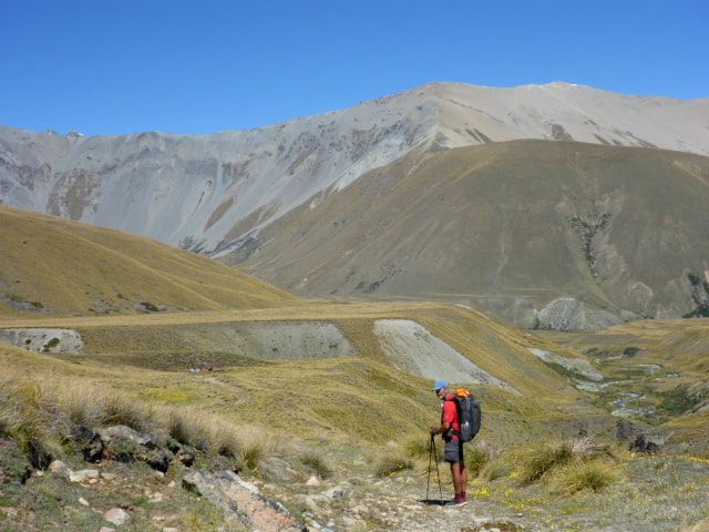 The last little bit towards Camp Stream Hut. 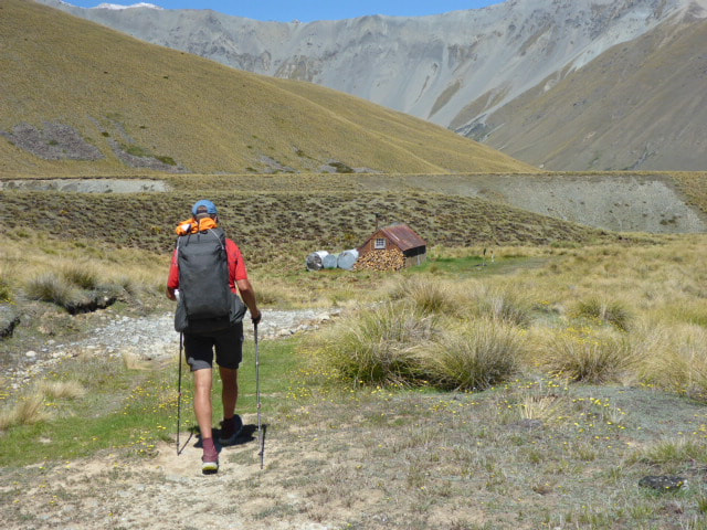 And there it is! 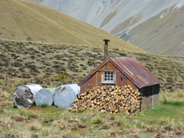 Closer up. 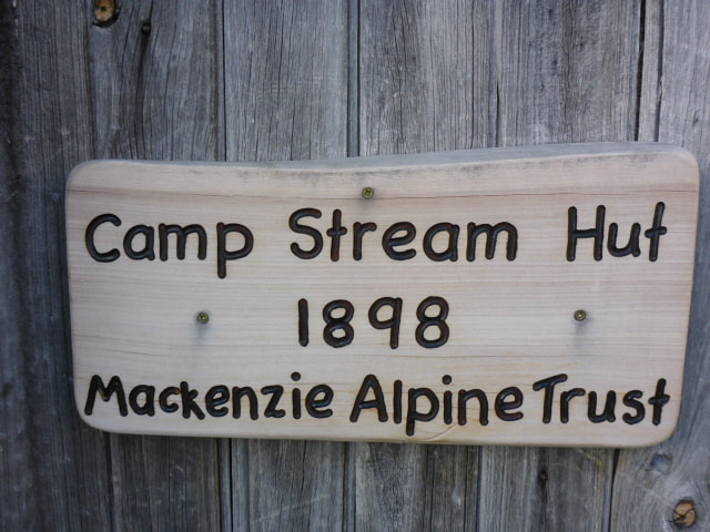 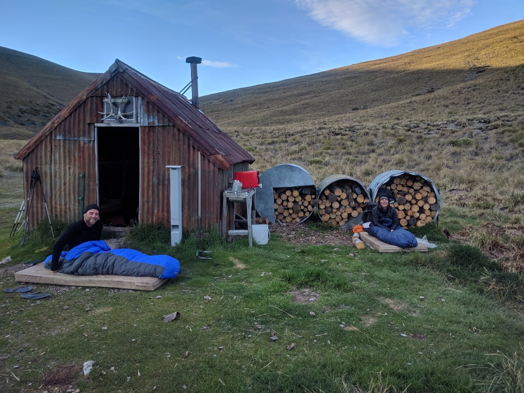 B behind the wood piles and Viggo in front of the hut for their night out :-)
2 Comments
Ju
30/12/2017 20:30:06
These photos are truly amazing.!! What an extraordinarily beautiful country we live in. Thank you so much for sharing them with us on your incredible journey. Good luck with your final leg of the South Island. What a great accomplishment. Xxx
Belinda
3/1/2018 15:44:18
Thanks Ju:) Leave a Reply. |

AuthorBelinda and Anthony (aka Tony) Hadfield made a decision, in their late 50's, to do something a "bit different" and walk New Zealand's 3000km Te Araroa Trail over summer 2015/16 - although updates will now tell you that this plan will take longer now!!. As the old saying goes - "don't leave home 'til you've seen the country"!! Archives
January 2018
Categories |
 RSS Feed