|
Our plan for today was a leisurely rise to do our resupply shopping at about 0800. But first we dropped in to Outside Sports to get a replacement pair of Icebreaker socks. I always felt weird about using Icebreaker’s lifetime warranty but the guy in the shop was great and said "no problem" - grabbed an identical pair of the shelf and took my old holey pair in exchange! He said they never had any issues with Icebreaker replacing them - a good PR ploy :-) So now I have a nice new pair of socks to finish off with. Then it was over the road to New World for our restock, which we took back to the hostel to organise for our next stretch. Having only a short 15km to Glendhu Bay today, we exited the hostel at 1000 and found a nice cafe for a hearty brunch to set us up for the day! Then it was a brief look at a local market before hitting the lakeside trail. Again it was a weekend warrior type cycle trail initially - flat, well packed and well used. We wandered past the famous ”Wanaka tree” and had to take a photo even though millions will have taken better ones!! The track for the day is here. About half way, I'm guessing just past Damper Bay, the track started to get a bit more hilly with lots of little ups and downs. As a consequence, mainly because of water effects on slopes, the track got a little rougher, but still fine for walking. This part of the track was noticeably less populated with traffic (foot and bike) - obviously people like the flat bits better!! 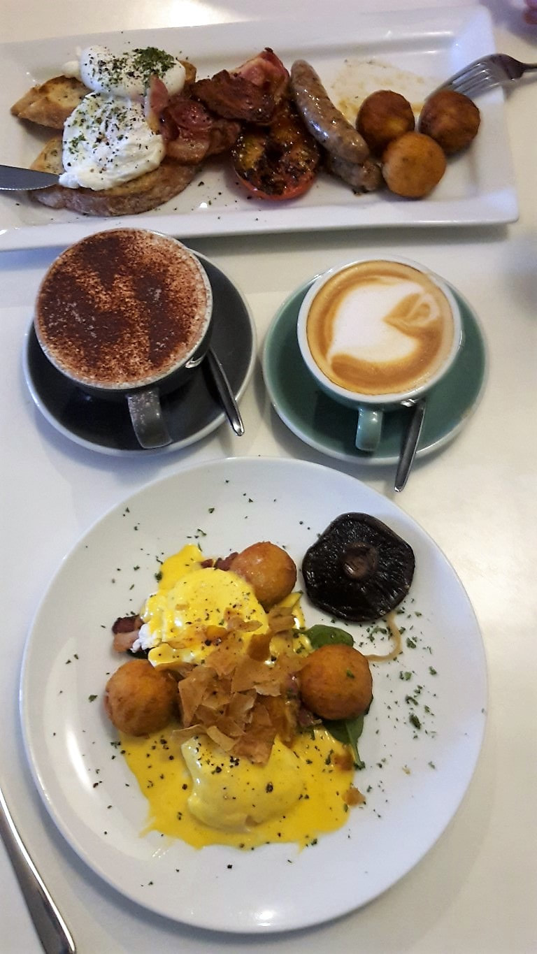 Trampers brunch! 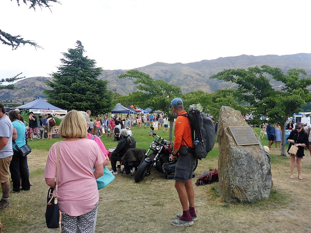 Market day. 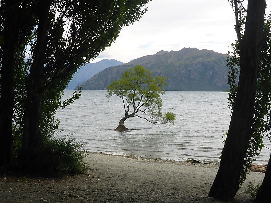 Off around the lakeside - and the obligatory shot of the Wanaka tree :-)  We could have stopped for a hobbit-like "second breakfast" but decided not to. 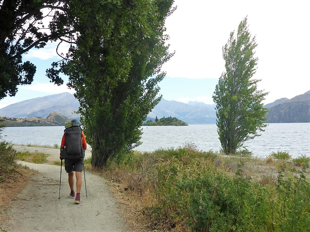 Meandering around the lake on a nice flat track. 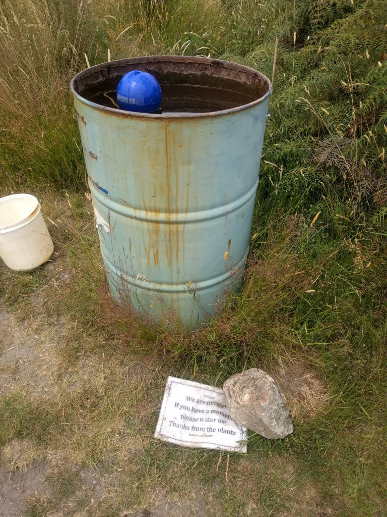 A nice way to help support the replanting programme by keeping plants moist. 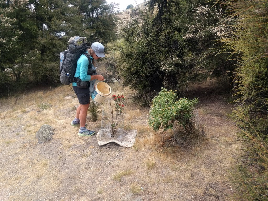 So B kindly obliged :-) 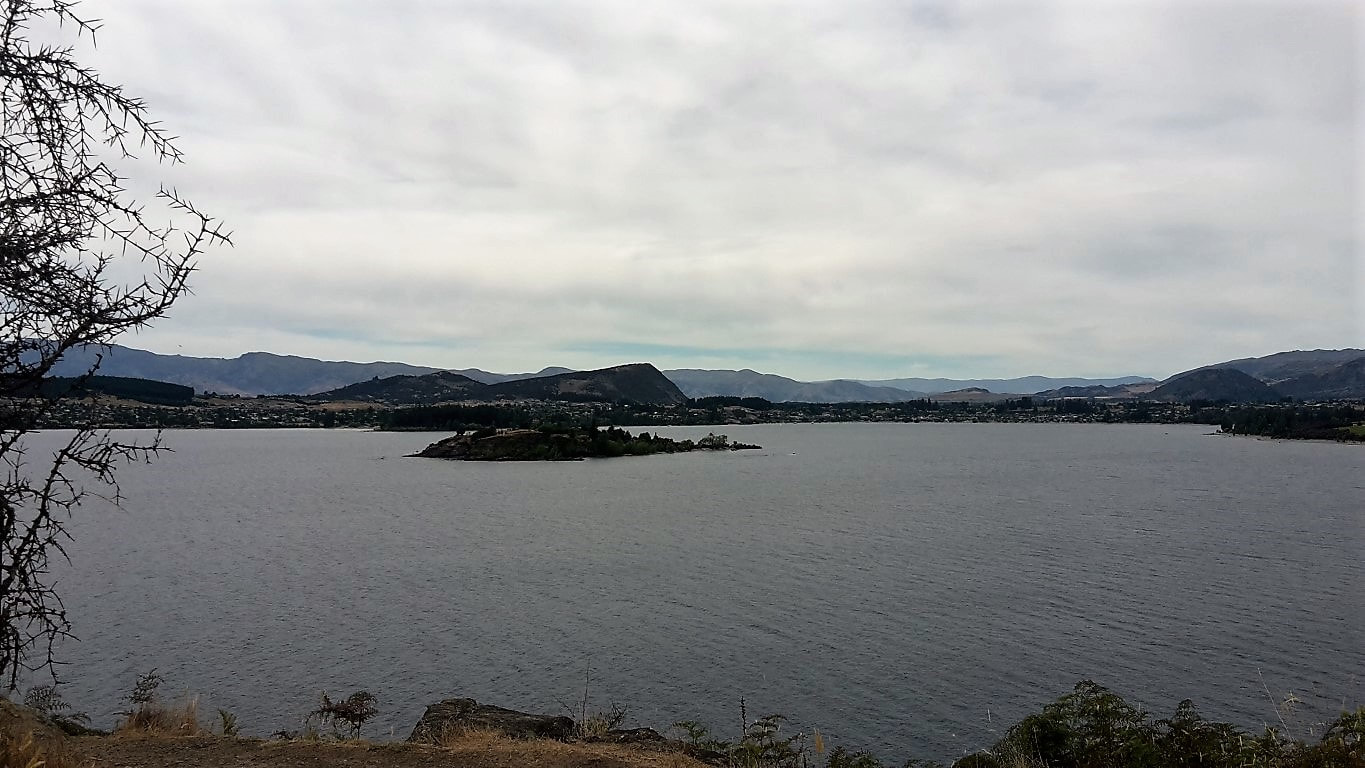 Looking back towards Wanaka. 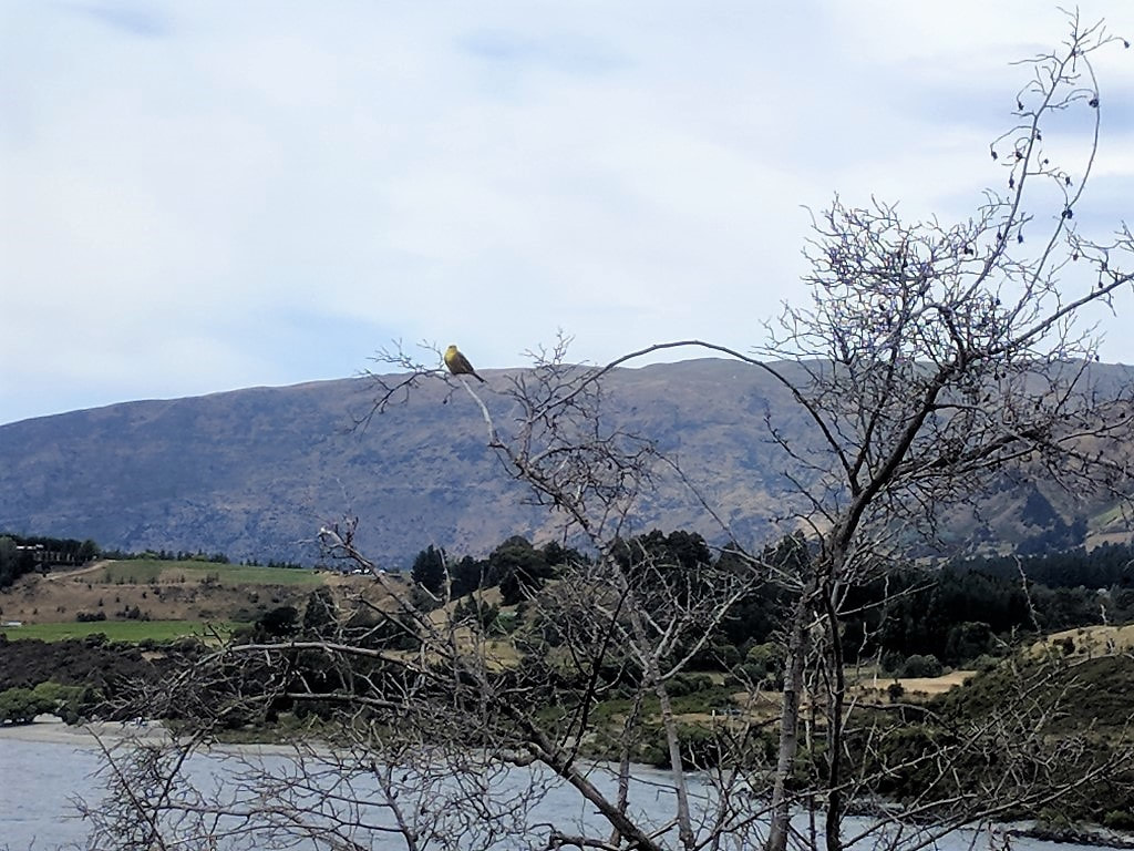 A bird along with the scenery for some variety! 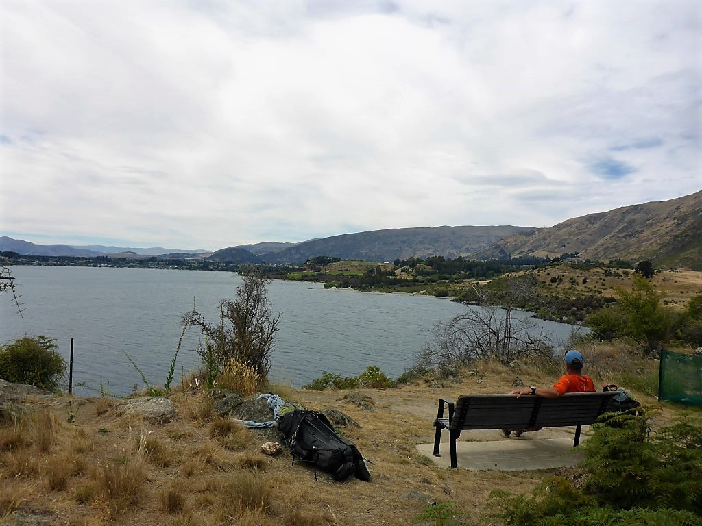 Nice rest spot for a stop - a bit overcast so not as hot for us today. We plodded on with our sore feet and eventually reached the campground. We settled into our quaint little cabin and stocked up on some cold drinks from the store - then first priority was a wash and a little lie down!! After our big brunch we had brought some fresh soup with us for a lighter dinner and were ready for bed around 2200, knowing there was no rush to get up on Xmas day. A lie-in - a luxury not often afforded us :-) 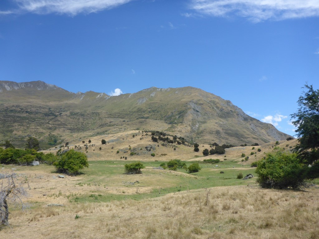 Farming country looking a little dry - although a tinge of green in the dips. 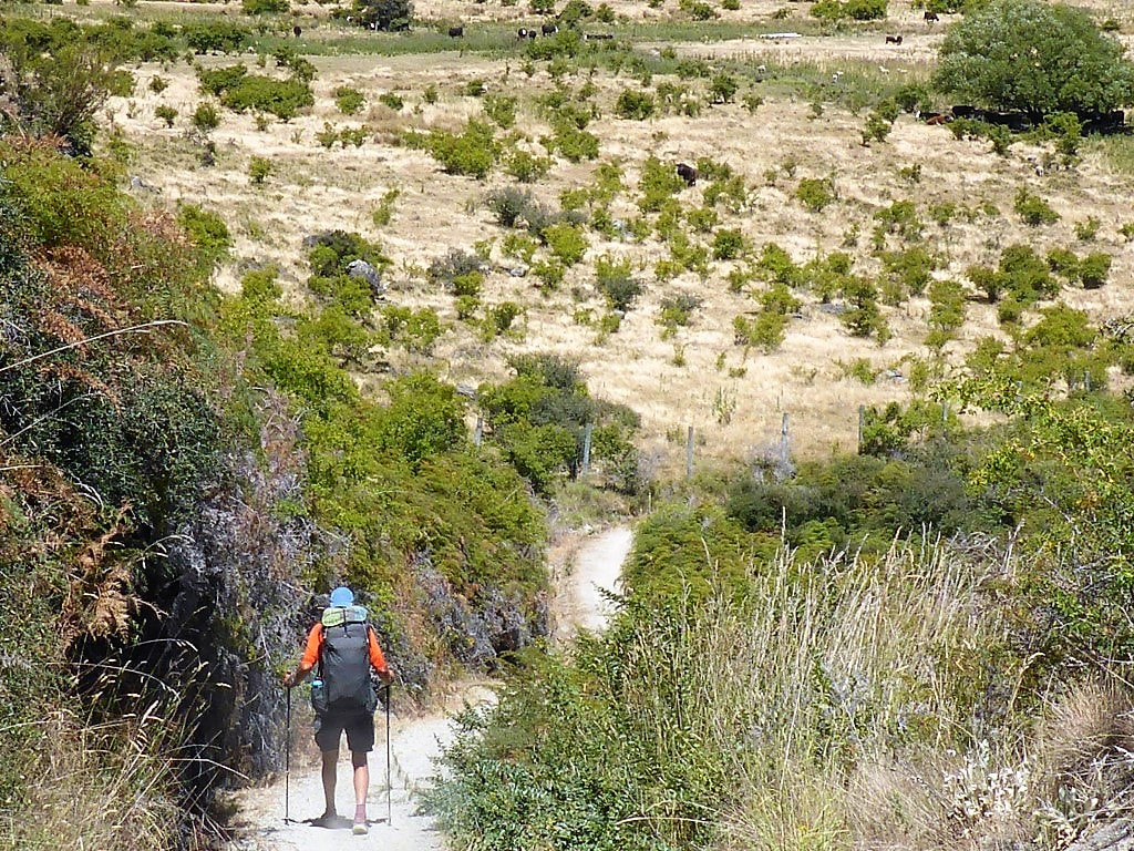 Heading down - cattle on the other side of the fence. 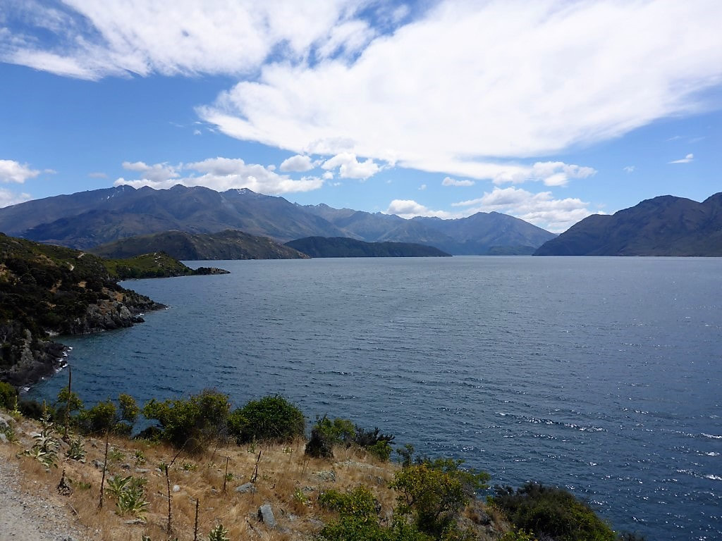 Pleasant views to the head of the lake. 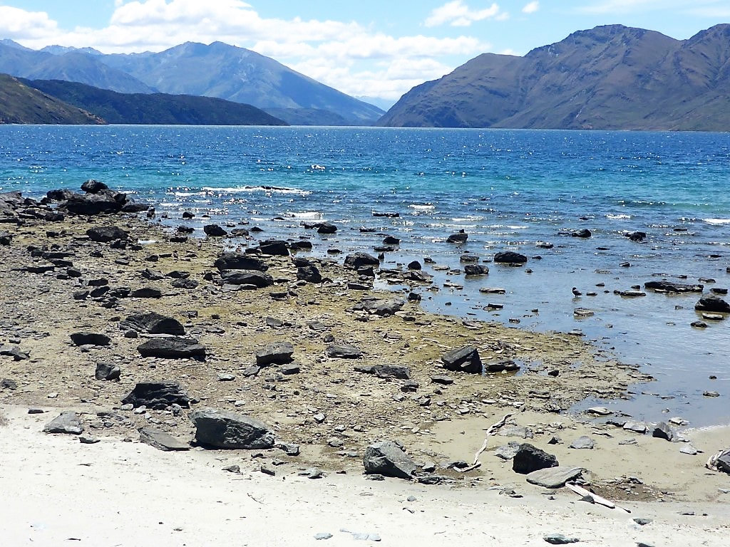 Getting close to the shore at times. 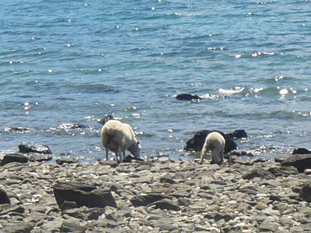 It is also a very big water trough for the stock in places :-) 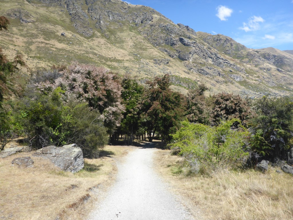 Getting a little warmer now so the approaching shade was welcome. 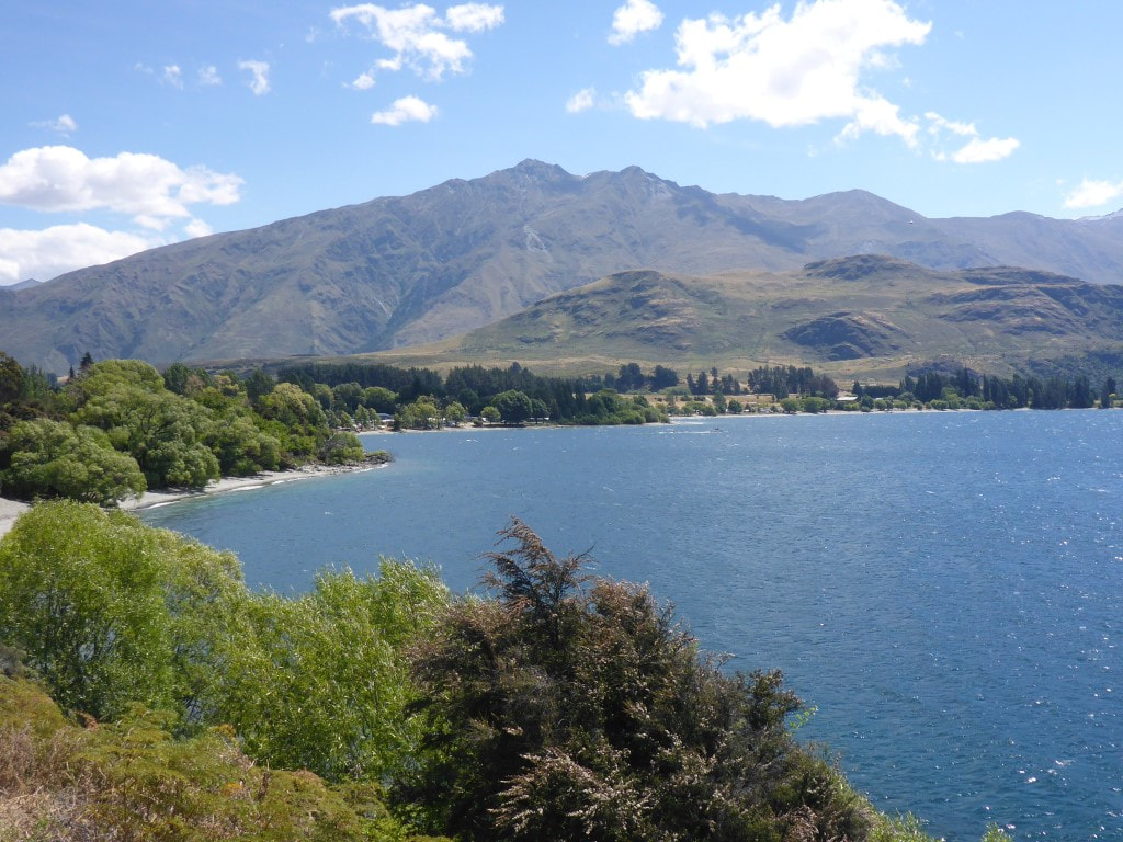 Getting closer - can actually see the campsite now! 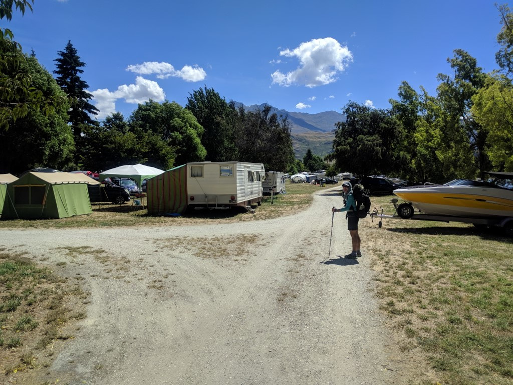 The start of the campsite. Looks like it covers almost 10 hectares (about 1.4km end to end) - apparently over 2000 people when it is full!! 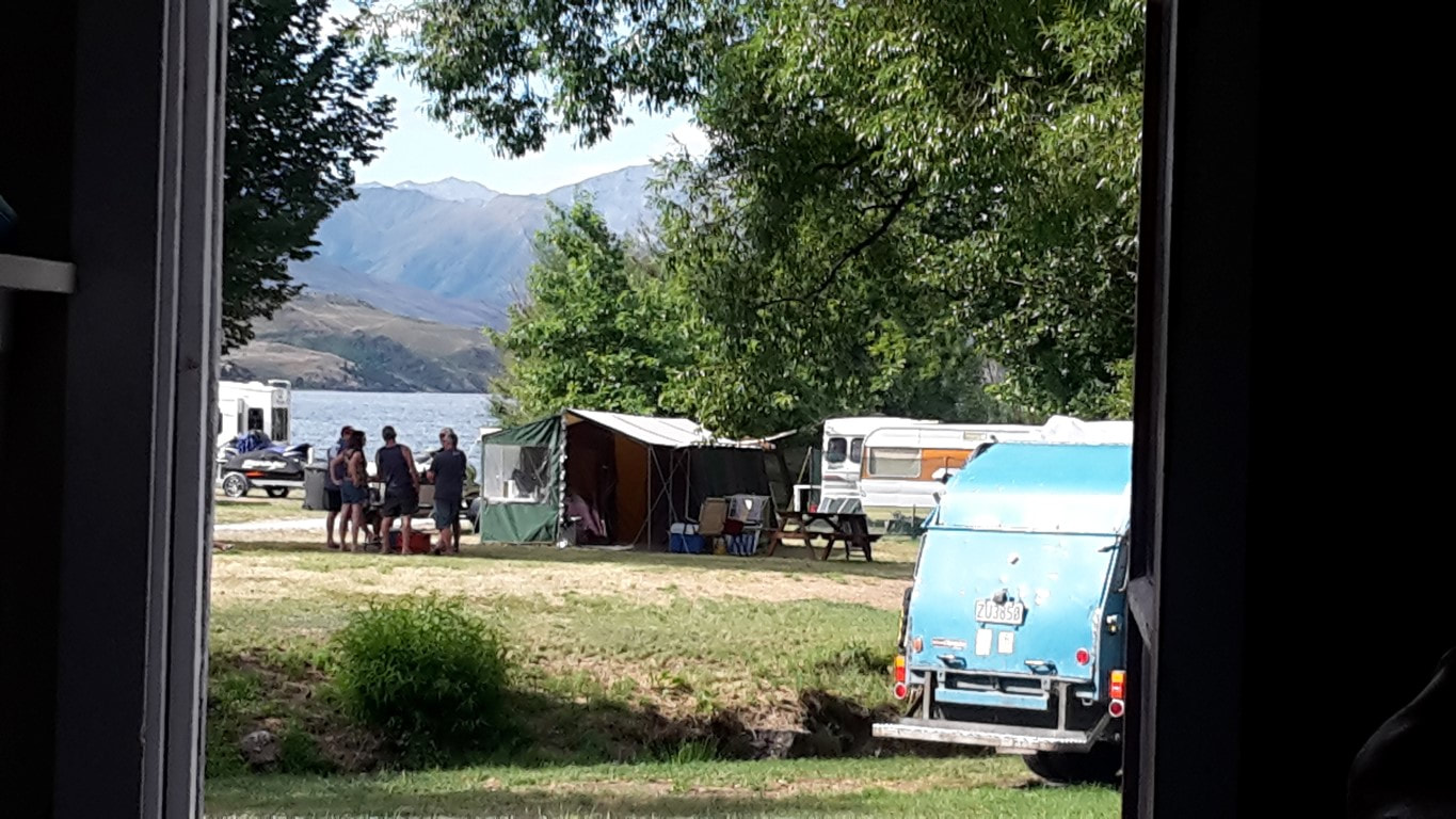 View out our cabin door toward the lake.
0 Comments
We were up early and packed up ready to go about 0620. Today ended up being over 37km in just over 9.5 hours of walking. It was a day of two sections: a very steep descent initially, followed by a long relatively flat run from Hawea to Wanaka. GPS data for the day is here. It was a short climb up to rejoin the trail before starting a 950m descent over 4km down to Timaru River Road on the shore of lake Hawea (we had already dropped around 300m from Breast Hill to the hut last night)! I have to say I found this the most nerve-wracking section so far. With no head for heights, the steep rocky decent on a fairly sharp ridge (at times), with big drop-offs in places, did nothing for my head! Still - it's only mind over matter! I thought I was being very slow and cautious, with B keeping a respectful distance behind! Eventually, after about 650m of descent and 1h40, it switched to a zigzag track on a steep face which I found a relative doddle! Surprisingly we hit the road in a whisker over 2 hours, which is faster than DoC suggest! Marie had left after us and not long before we hit the steep zigzag she caught up with us. Lucky she was behind us as B had stopped to rearrange her mesh pocket on the way down and my Icebreaker cap had fallen out! Marie had spotted it and kindly picked it up :-). We said goodbye to Marie at the road as she was heading down to the road to hitchhike straight to Chch for her flight out on Xmas day, rather than turn off onto the lakeside track that we would follow - it obviously went OK as we saw later on her Facebook page she made it back safely. 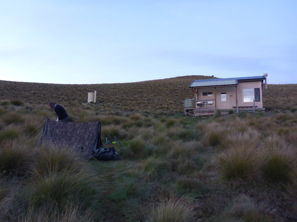 Tent and hut at 0530 - plenty of light around although I still had my headlamp on as we were up in the dark. 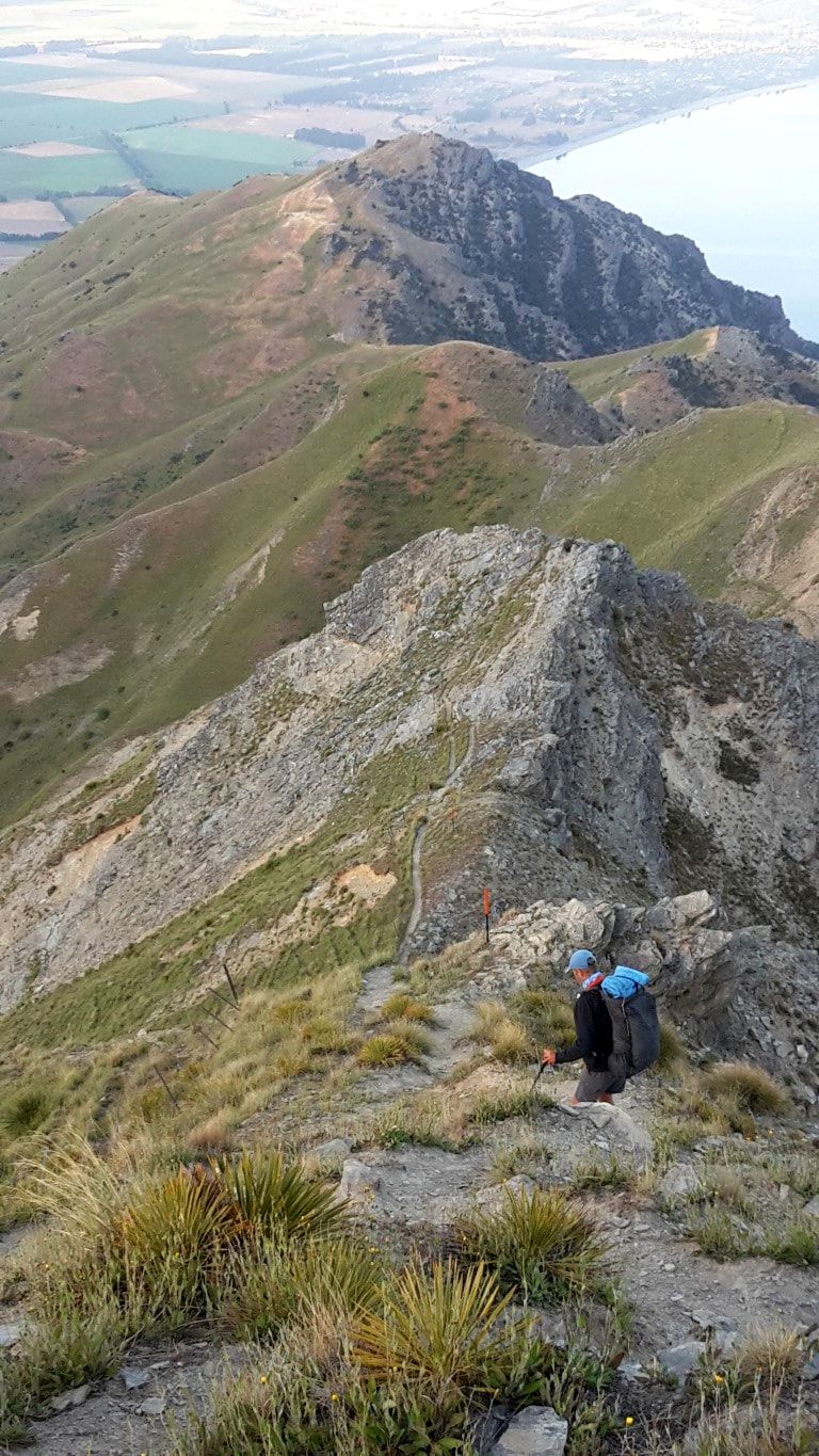 Starting down - around 900m still to go! 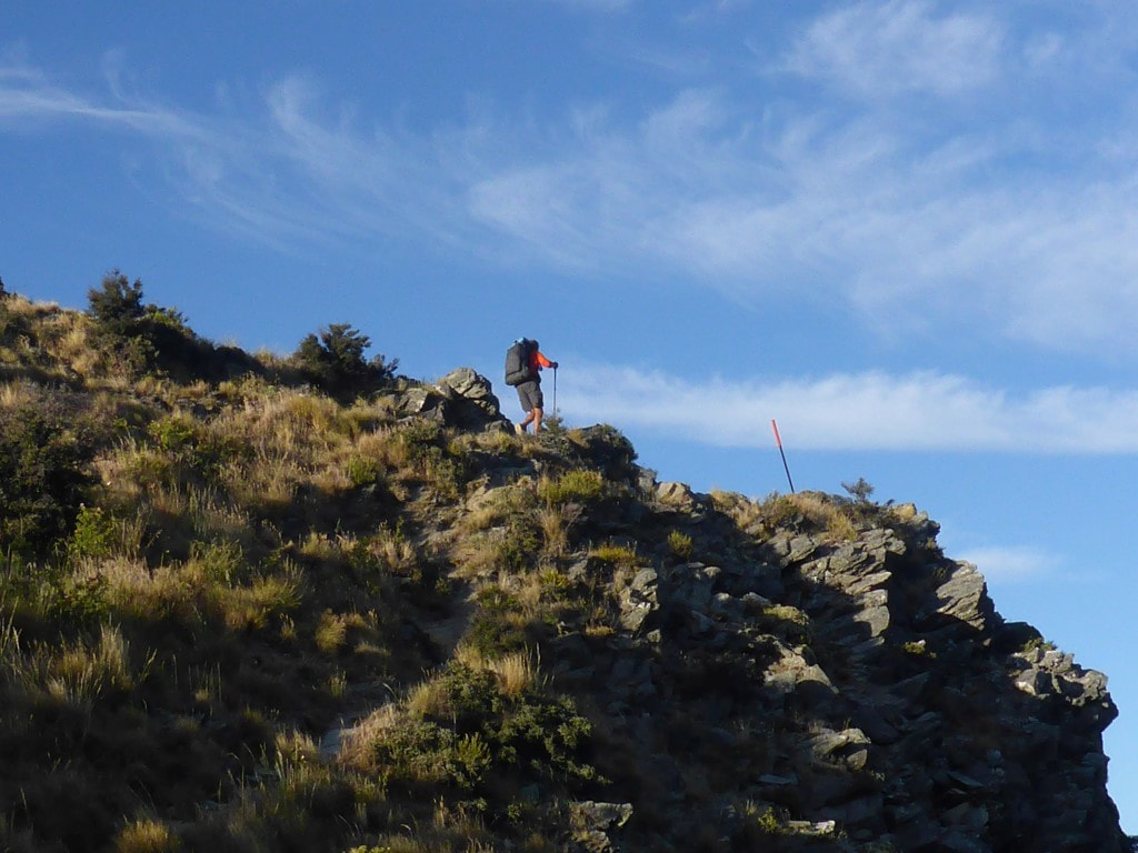 Little bits of "up" as well.  Sheep on the other side of the fence below - has no trouble with heights. 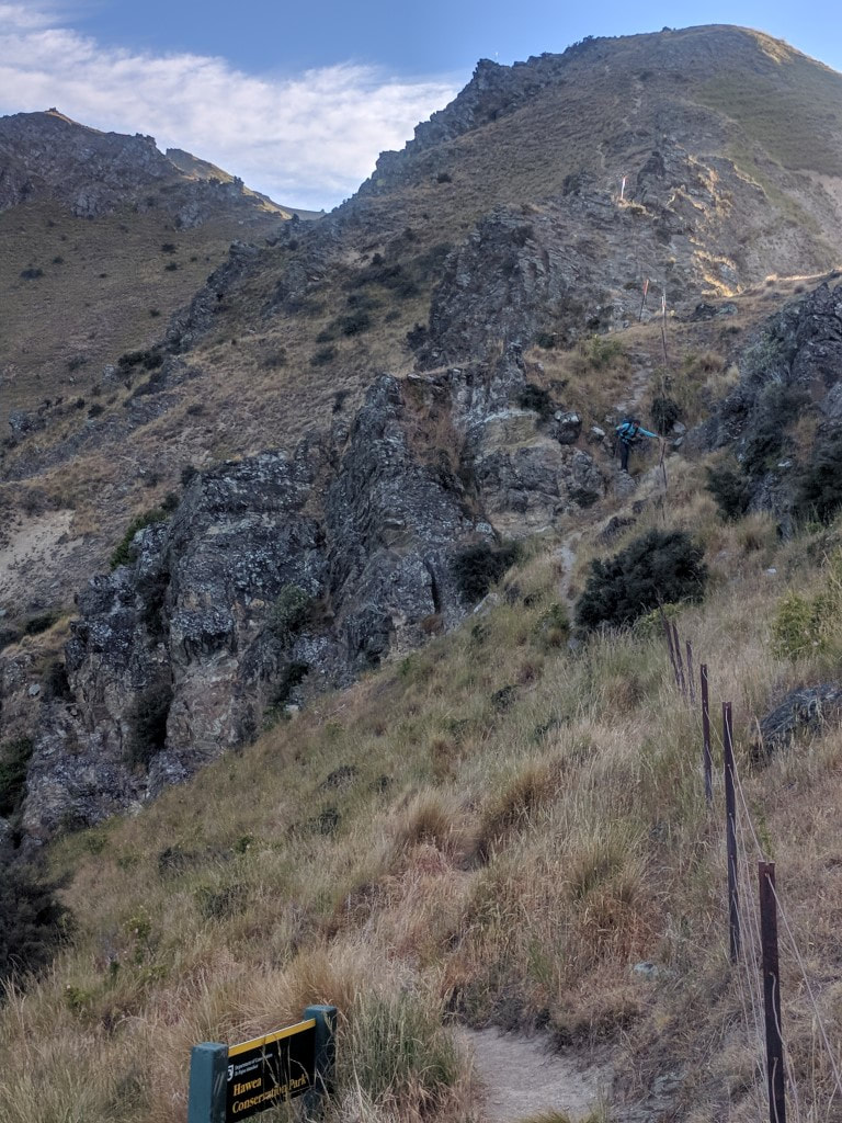 B a respectable distance behind, giving me some space :-) 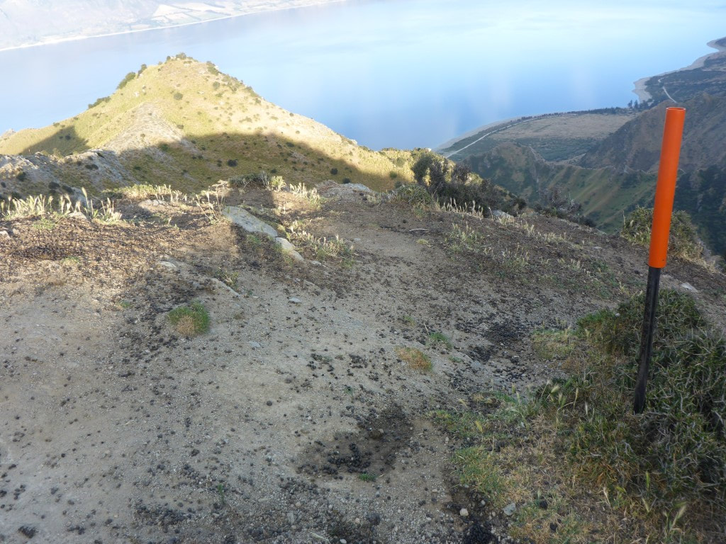 Slightly "flatter" bit on top of a ridge = sheep poo city. 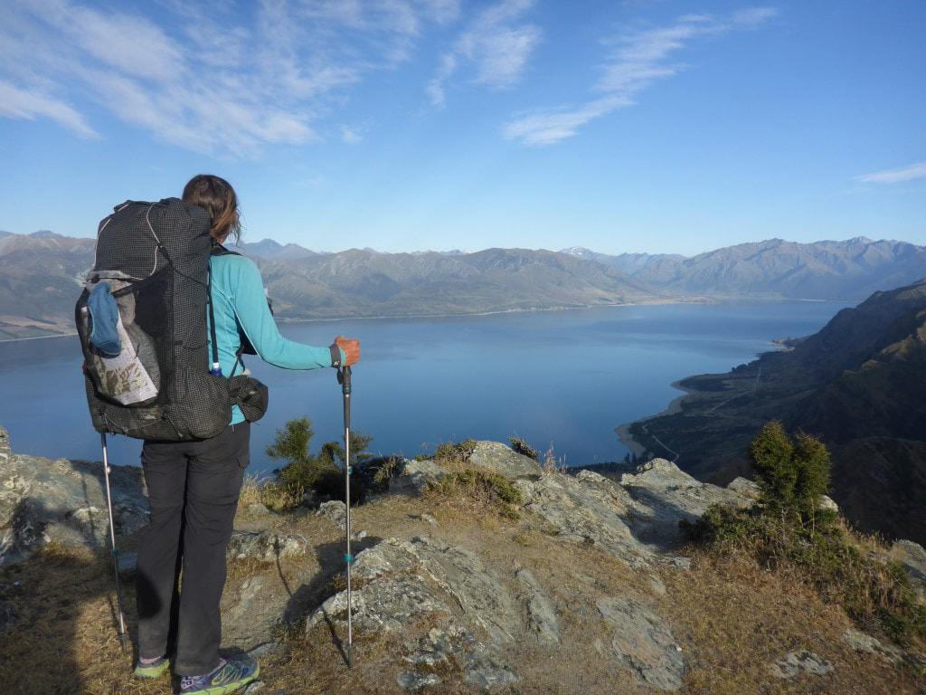 B taking in the still-stunning views on the way. 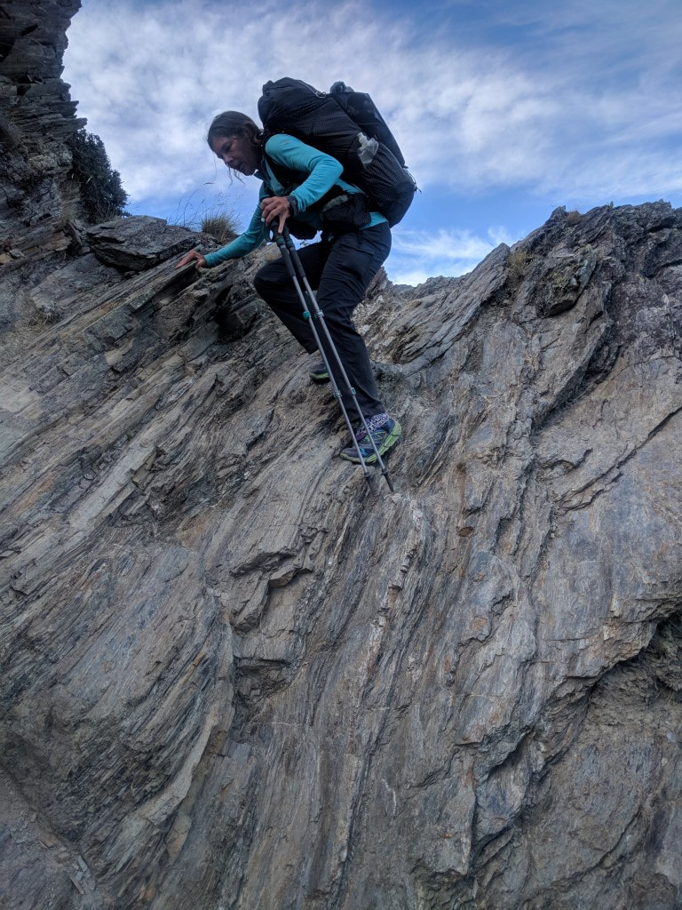 This bit was more climbing than walking - poles not much use! 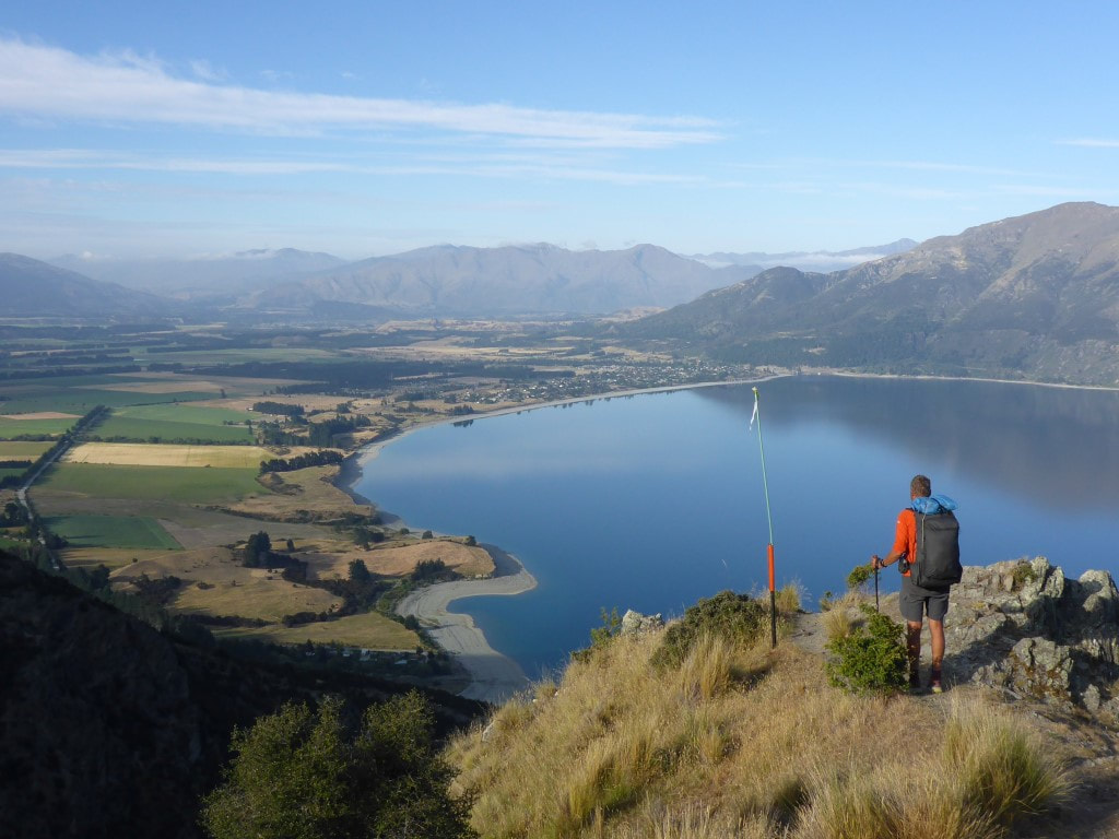 View of Hawea village at 0800 - almost at the zigzag track with 350m still to descend. 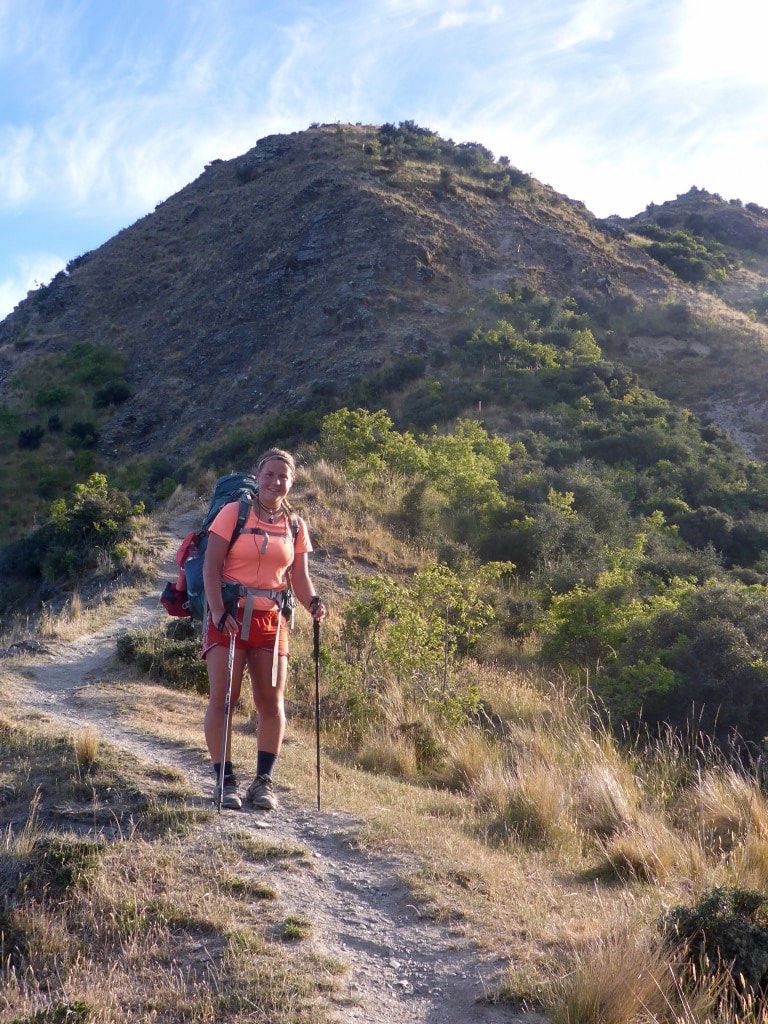 Marie catching us up - and kindly delivering my cap in the process :-) 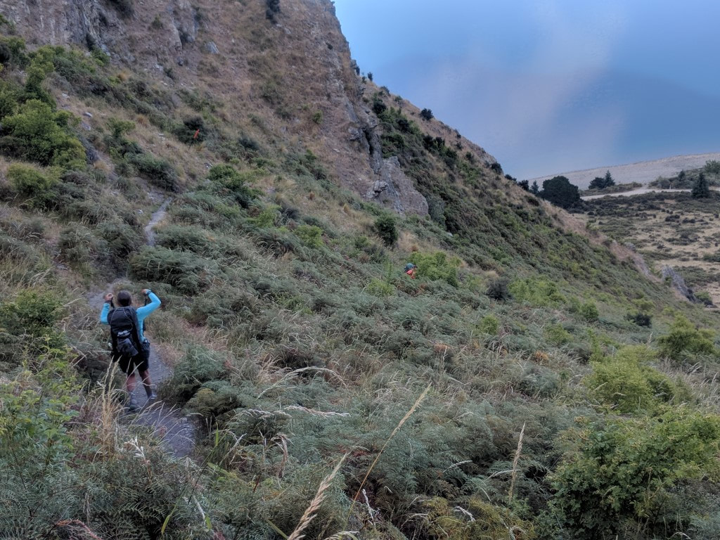 Marie (centre of shot), followed by Belinda on the zigzag track - me being "tail end charlie" now. 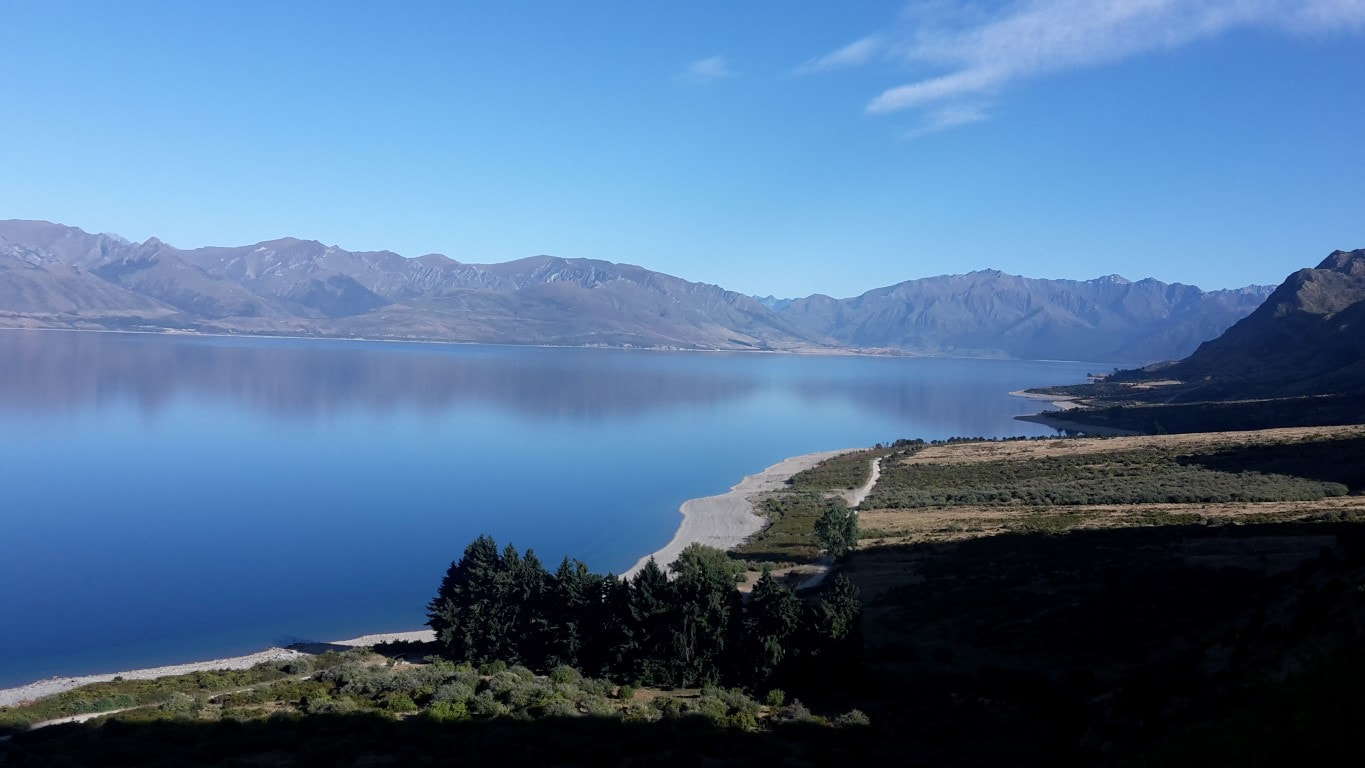 Another view toward the head of the lake from lower down. 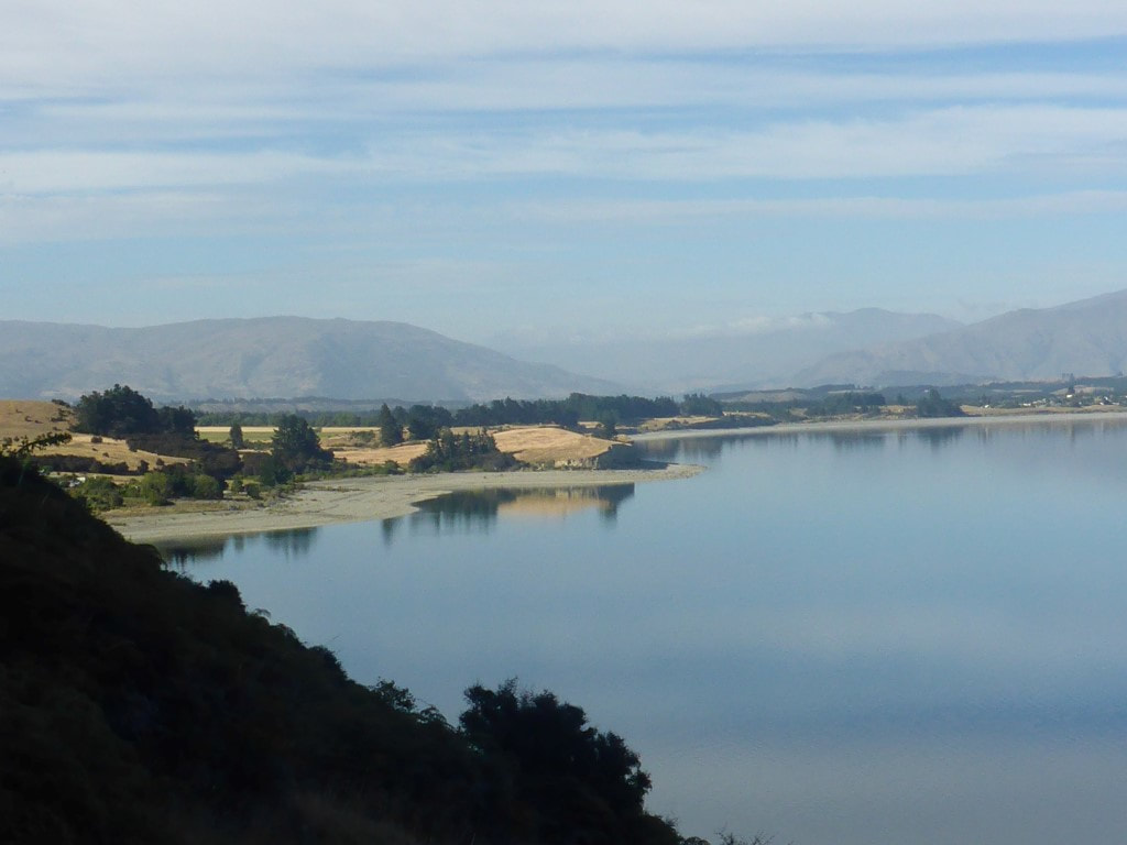 Getting closer to the lake. 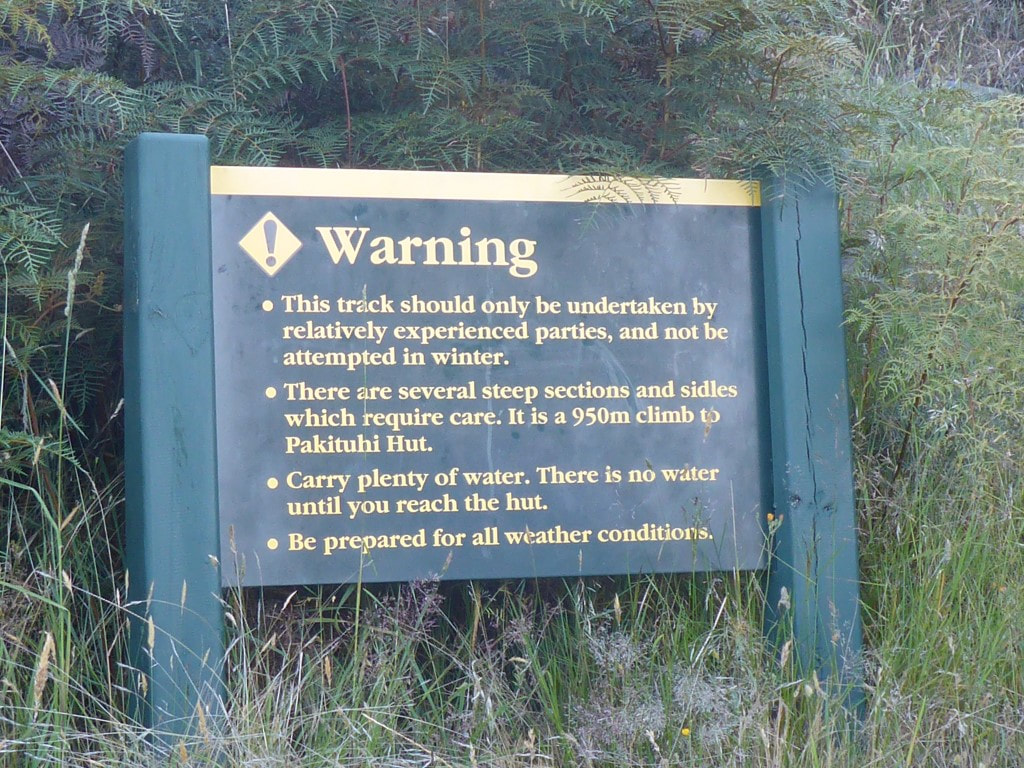 One of the signs at the road end of the track for those heading up!! Pretty much the rest of the day was spent on various cycle/walking tracks so was pretty easy going after what we had done over the last few days! Every now and then it's nice to be on flat terrain :-). From the Gladstone Reserve we walked around the lake edge to the village - getting near to the control gates we took a small detour from the trail and found a cafe/store on Capell Ave near the intersection with Parry Cres (its worth the small deviation off trail for this!!). We decided to stop here for half and hour for a coffee and some hot food (pie in my case and vegetables stack for B) which was very much appreciated :-) 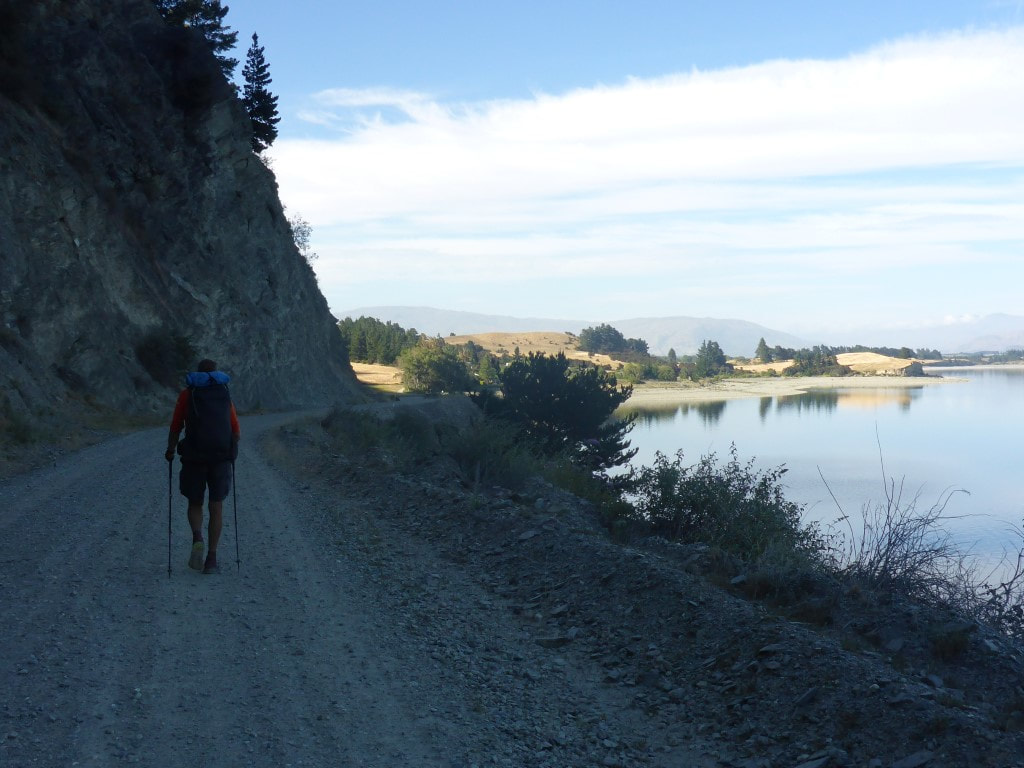 Finally onto Timaru Creek Road at the bottom of the big hill - 0845. 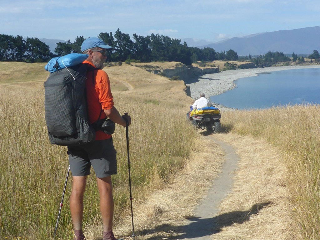 Nice track from Gladstone Reserve around lake edge. One of the local volunteers checking the track on quad bike.  B's artistic shot from the lake edge. 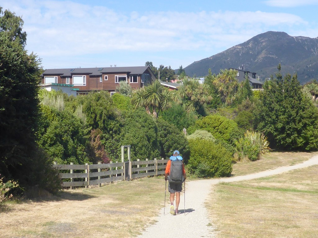 Entering Lake Hawea Village - cute little place, not quite yet got the growing touristy feel of Wanaka or Queenstown (or even Arrowtown). 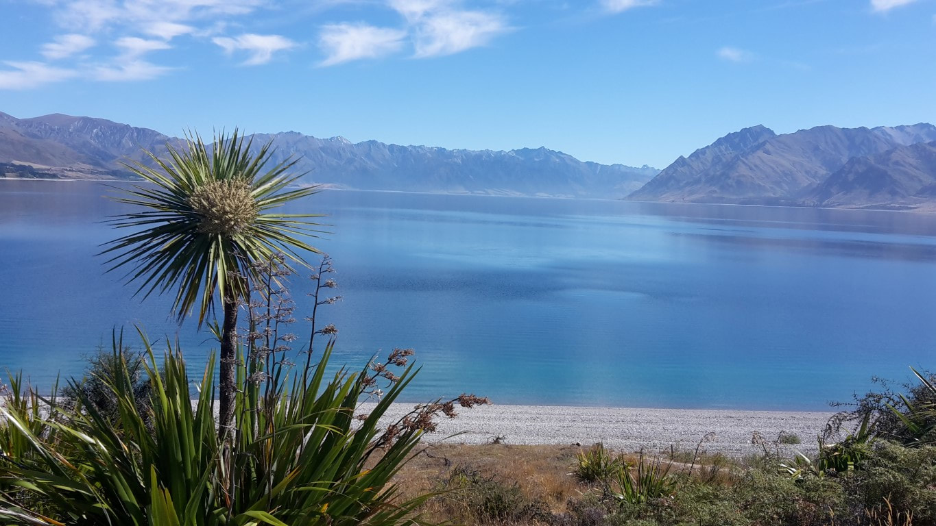 "Cabbage tree 1 with lake". 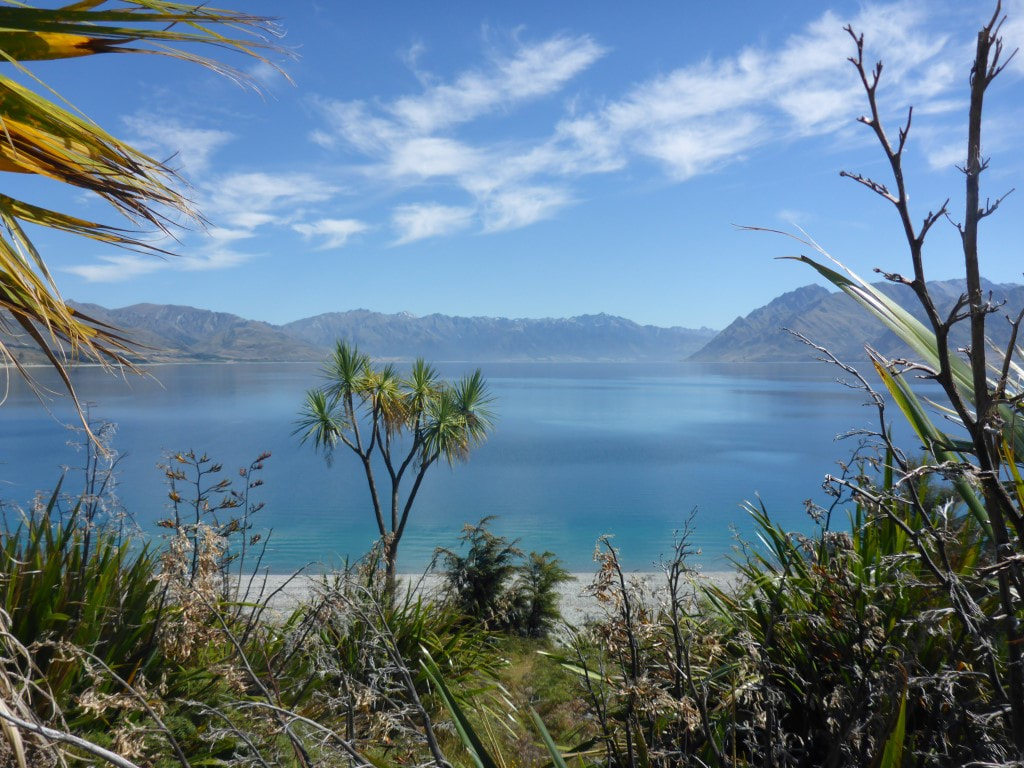 "Cabbage tree 2 with lake" :-) 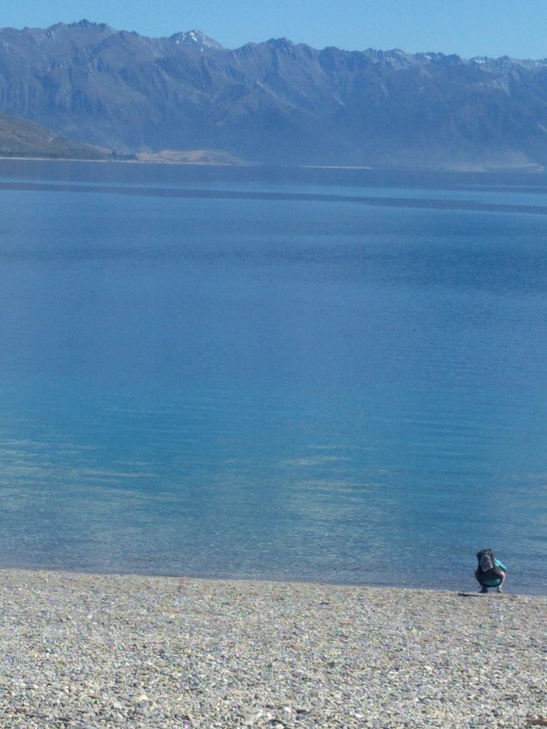 B dipping her fingers into Lake Hawea. 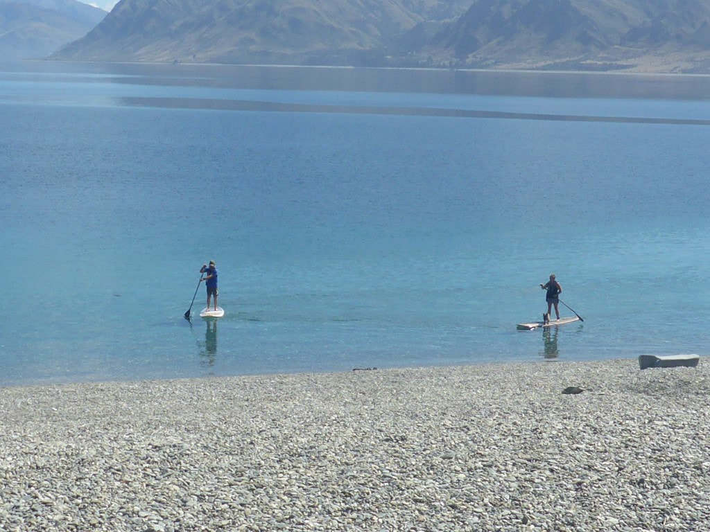 Paddle-boarders - note the dog catching a ride on the right hand board. Then it was another 12km mostly following the Hawea River towards Albert Town. We stopped here under a tree in a campground for half an hour or so as the day was hot and the track fairly exposed. We had stopped a few times to wet our headgear to help with cooling. A quick diversion into Albert Town to try and find the “store” for a cold drink proved a dismal failure so it was back onto the river track (this time now following the mighty Clutha River) towards Wanaka. 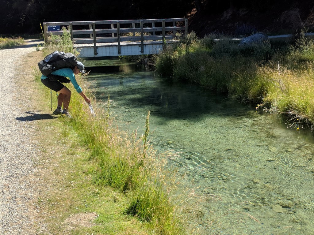 B wetting Joan (her scarf) in the water race. The water race was on our left and the river on our right for this part of the walk - easy access to coolant! 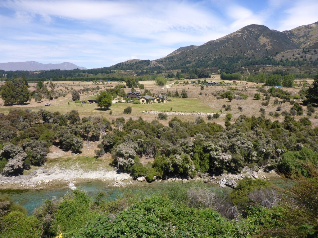 New area of development across the Hawea River. 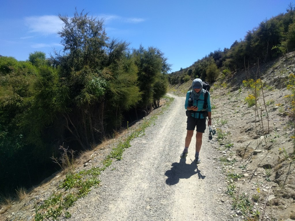 The technology fiend (not really)! :-) 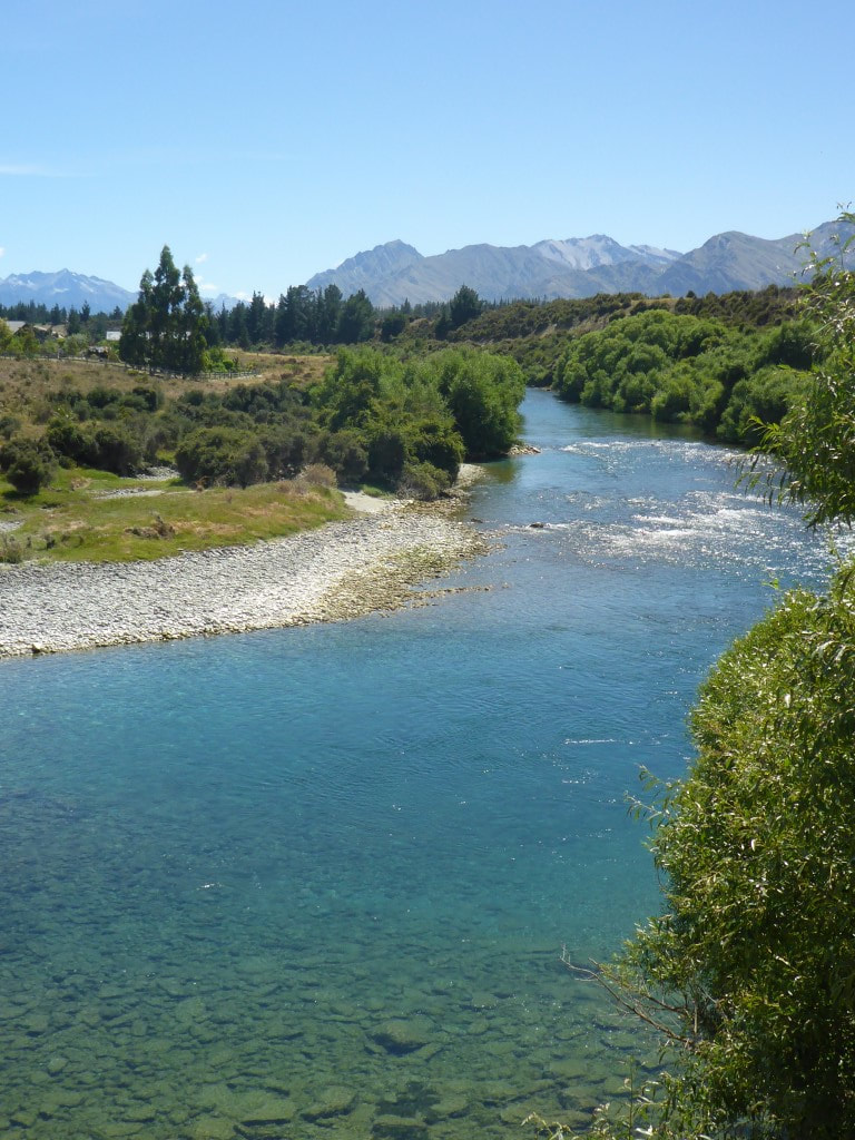 Nice clear river. 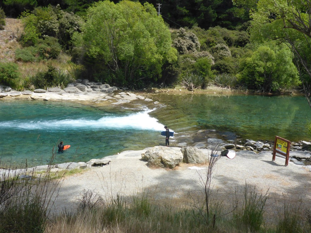 One of a couple of standing waves for use by surfers/body-boarders along the river.  Battle between rabbits and landowners continues! 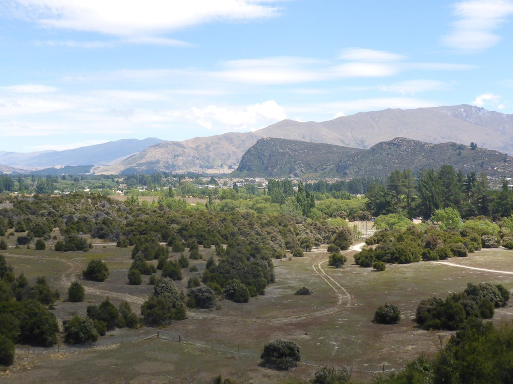 About to drop down toward a bridge across the Hawea before heading for Albert Town. 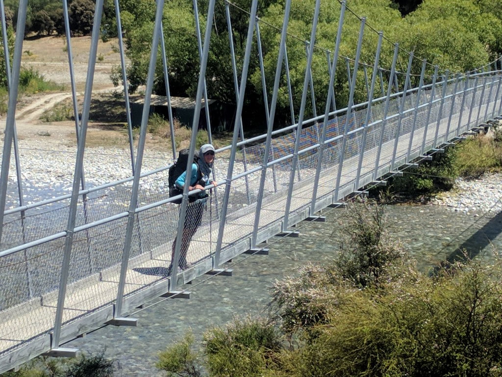 Across the footbridge - campsite on the other side. 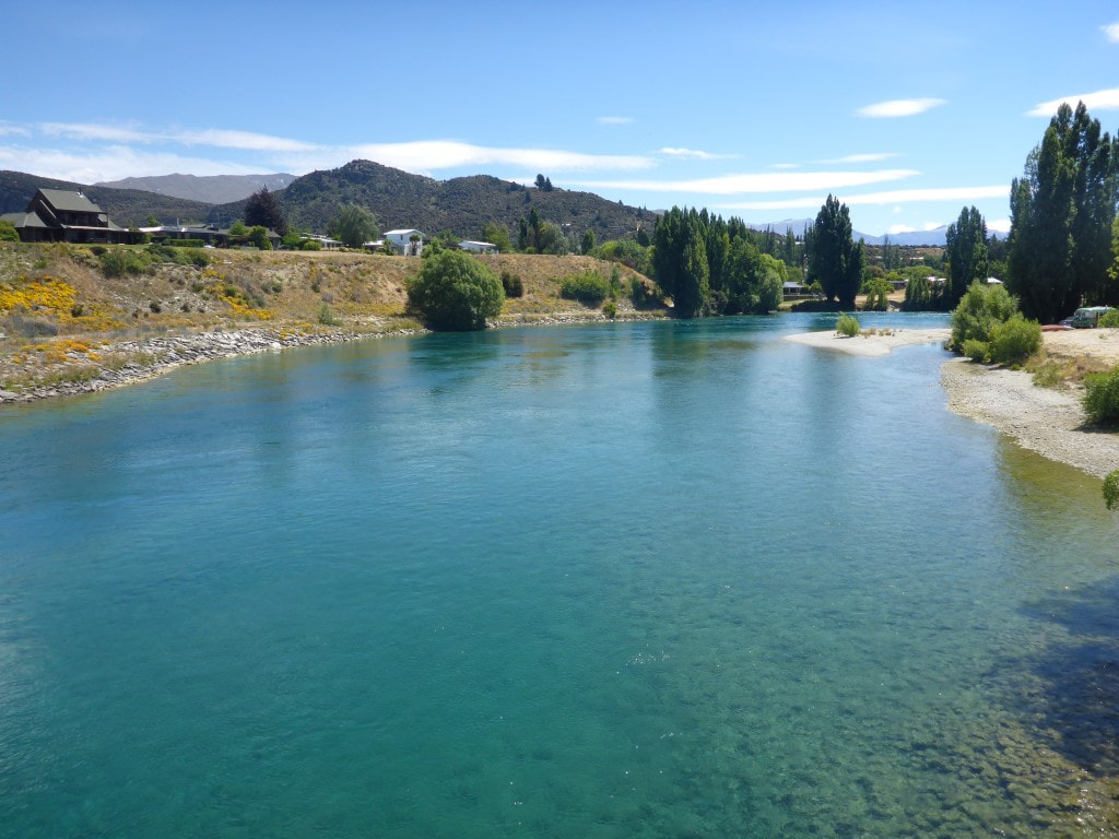 Photo looking up the Clutha from the single lane bridge on SH8 - Albert Town on the left of photo. Heading up the cycle trail alongside the Clutha, there were quite a few people on rafts and kayaks enjoying the trip down from the lake Wanaka outlet, which we arrived at after about 4km. These tracks are well used by locals and we passed numerous cyclists and walkers (it's all pretty easy going). From the outlet it was another 8km around the lake edge into Wanaka and to the YHA where we had a lovely ensuite room, arriving about 1800 from memory. On the way through town we couldn’t resist buying a bag of lovely fresh Central Otago cherries - a real treat! Julia had sent us a parcel with another pair of shoes each, so we picked that up as well. Then it was into town to check if we could find some gel insoles for the shoes (B needed some new ones and I was having trouble with pressure points under the ball of my right foot for the first time ever!). We also sat down to a lovely meal at a local eatery and I enjoyed several beers as we had a bit of a wait for the food (that's my excuse anyway). Given the state of our bodies we decided another rest day would be helpful and luckily managed to extend our cabin at Glendhu Bay campground for another night, so we would spend Xmas day there as well. Might also minimise the effects of a couple of days of possible showers! 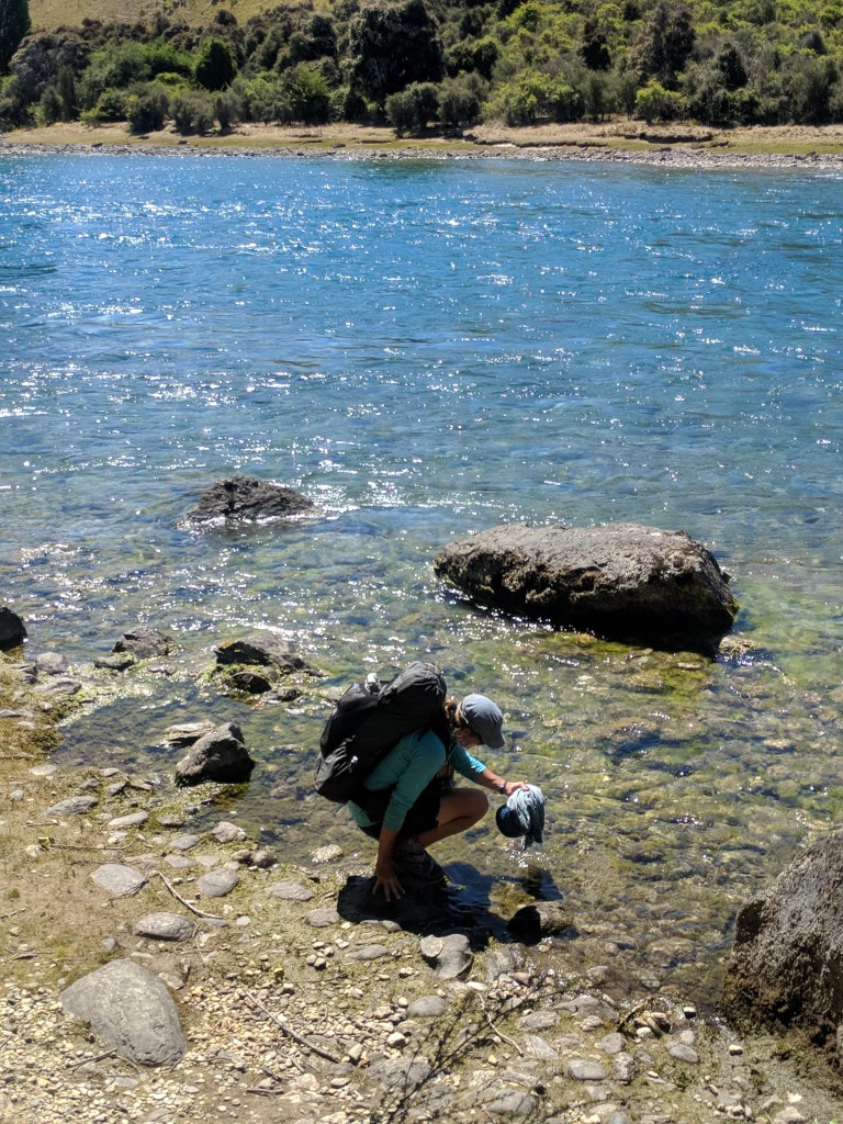 B wetting Joan in the Clutha, as well as my cap. 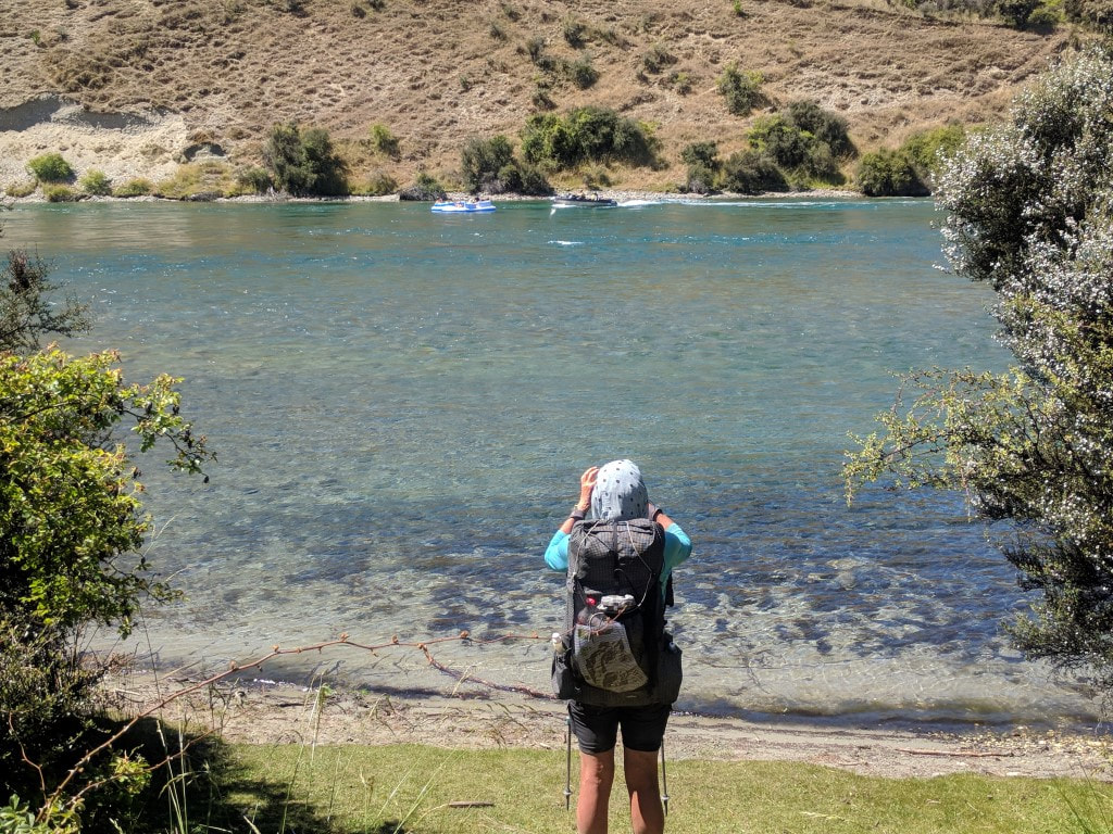 Jet boat occupants chatting with some kids on inflatable rafts. 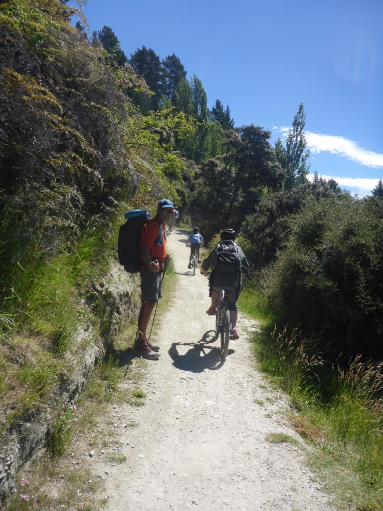 It is a cycle trail as well, after all. 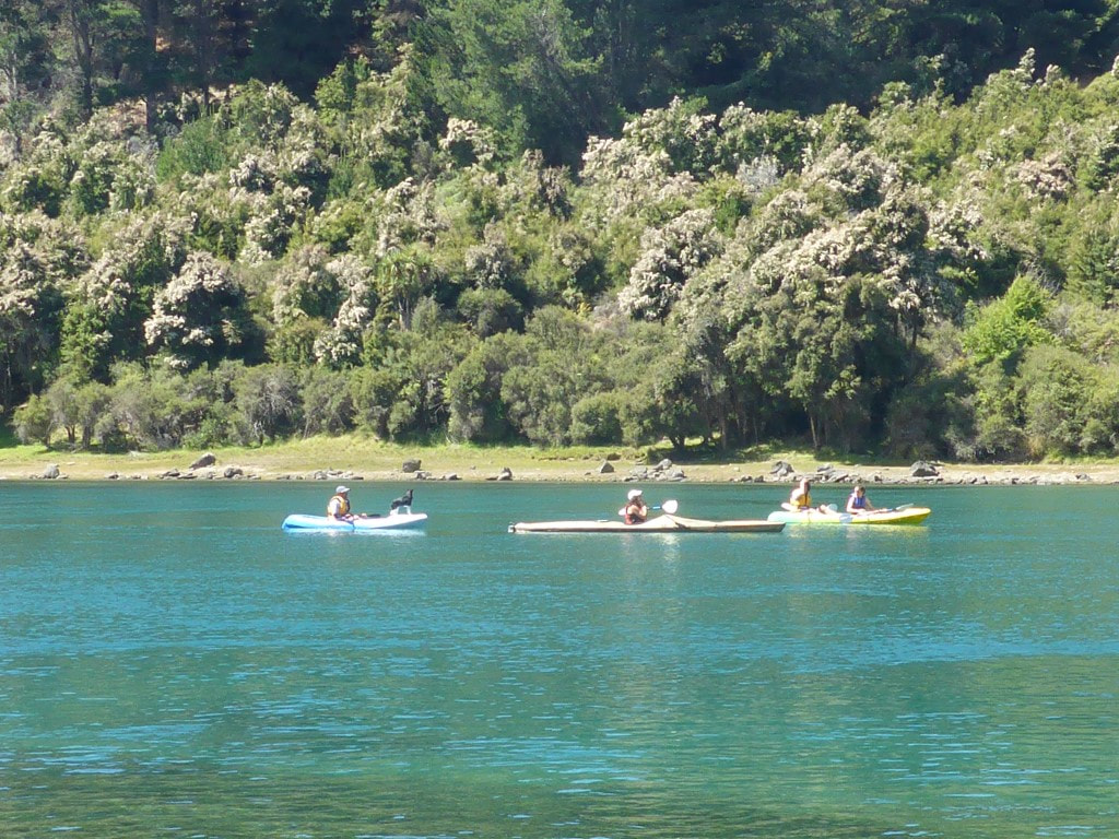 Kayaks - one with a dog onboard. 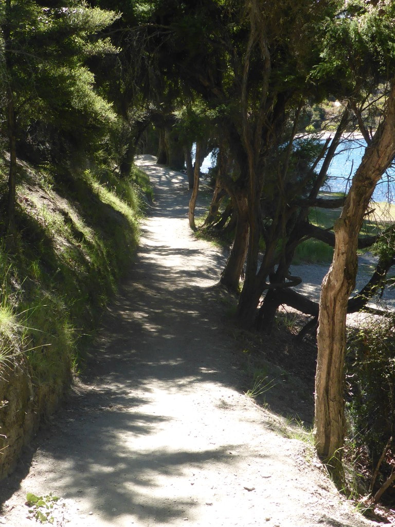 Nice track for walking - and even a bit of shade here. 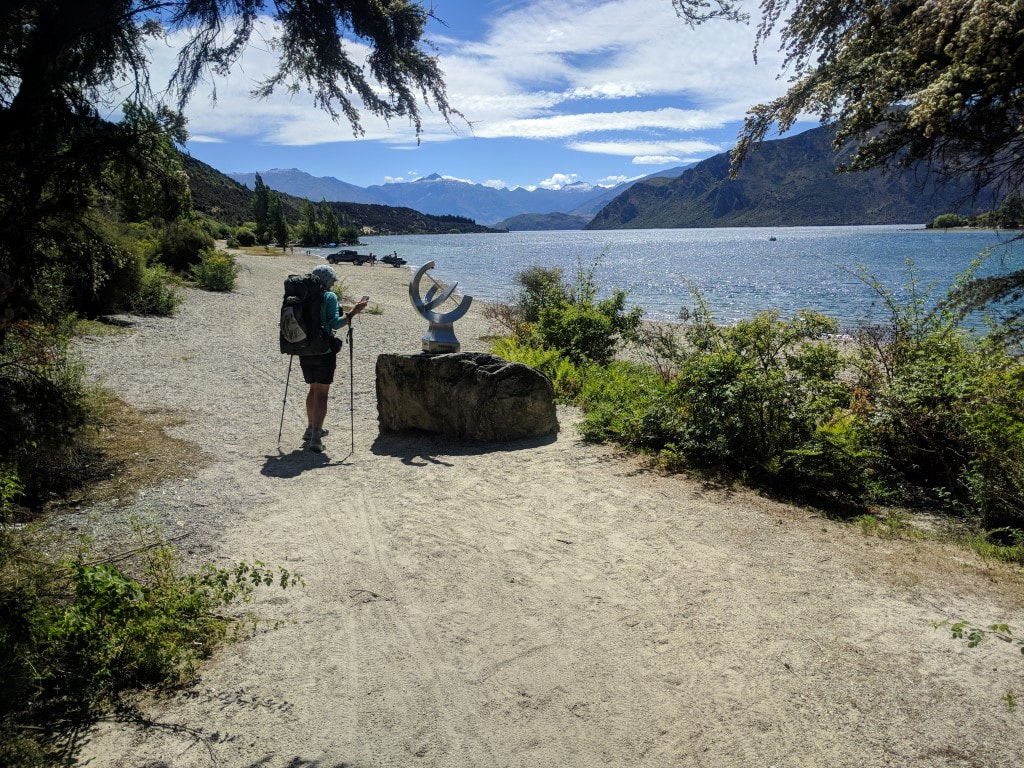 Sculpture at the lake outlet - this seems to be where most people launch for a trip down the Clutha. 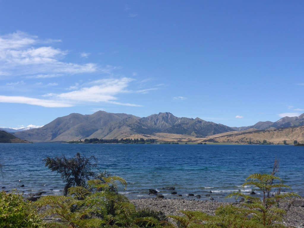 Looking across the lake to Dublin Bay. 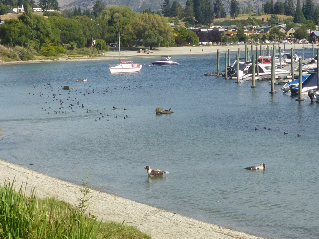 Water dogs obviously! Wanaka town centre in the background. 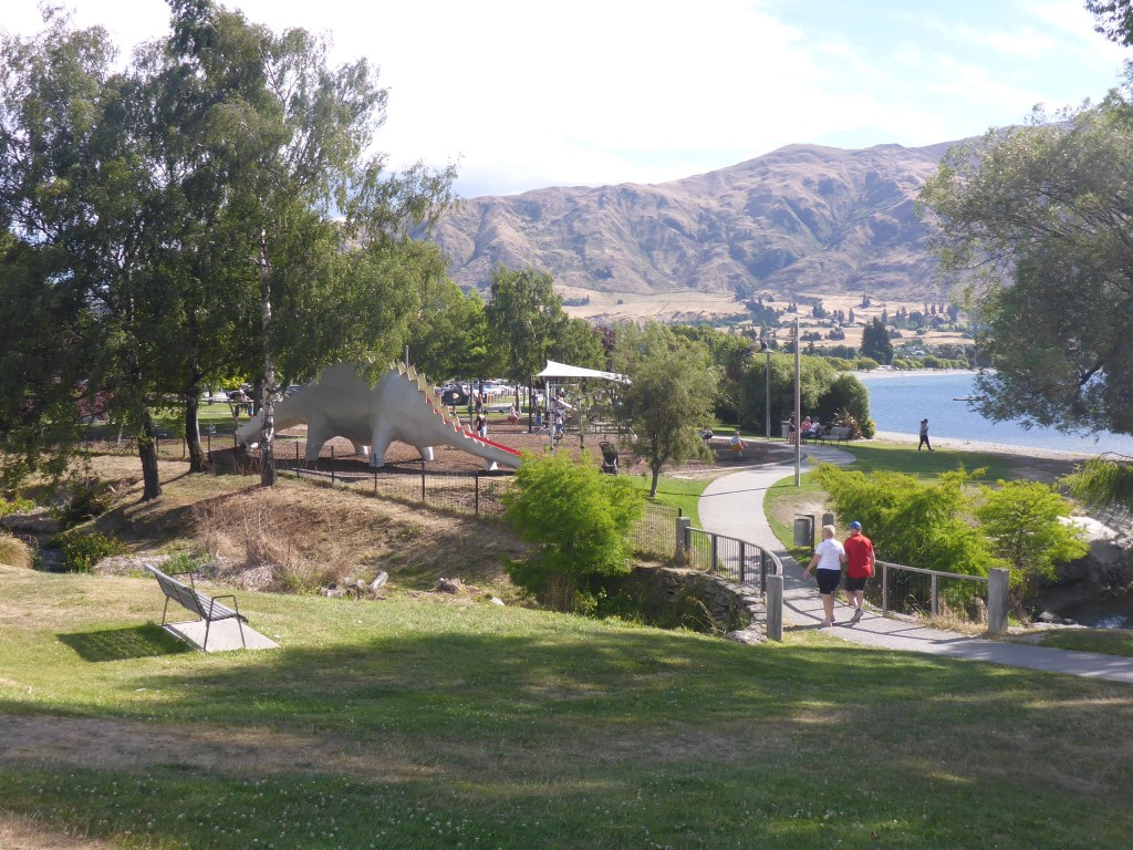 Waterfront walk into town centre. 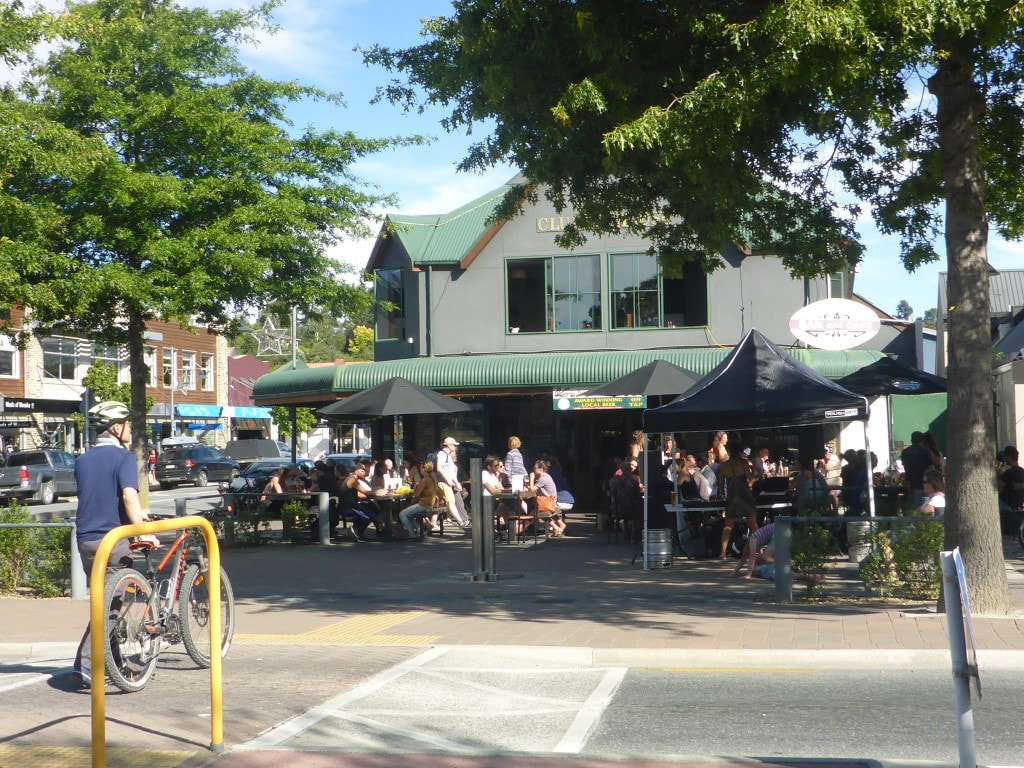 It was pretty busy in town - as one might expect a couple of days before Xmas! Made an 0630 start from the hut this morning as it looked like a fairly tough day ahead to get all the way to Pakituhi Hut, beyond Breast Hill. Ended up covering about 25.2km (left watch on pause for short while so did a little more than GPS data suggests) in just over 10 hours of walking - arriving at the hut at 1930. The 10 hours walking included literally dozens of micro-breaks because of the terrain! As the data shows, we did around 1700m of ascent and 1400m of descent during the day. It was an absolute gut-buster of a day for us! GPS track is here. It was a big photography day today - over 140 photos between us!! So apologies in advance for the trouble I had culling them for the blog page - it was an epic day in many ways! The TA notes actually explained the first bit very well! A short 20 minute continuation on an old farm track made up the start of the day, before dropping down on a sharp ridge into forest closer to the Timaru River. The TA notes state that the track then “climbs, descends and sidles through this steep sided river valley”! And this is what we did for almost 5 hours. We probably did more sidling on steep slopes than we have done in one TA section before, with lots of climbs up and down alongside the river included. There were also plenty of times we crossed the river, with occasional stretches walking downstream in or near the riverbed. We had about had enough of it by the time we arrived at the junction with the Timaru River track - after 4h50 of walking time covering 12km! Despite that, it was through nice beech forest and did include the odd little stretch of nice flatter walking at times - but not much of it unfortunately! 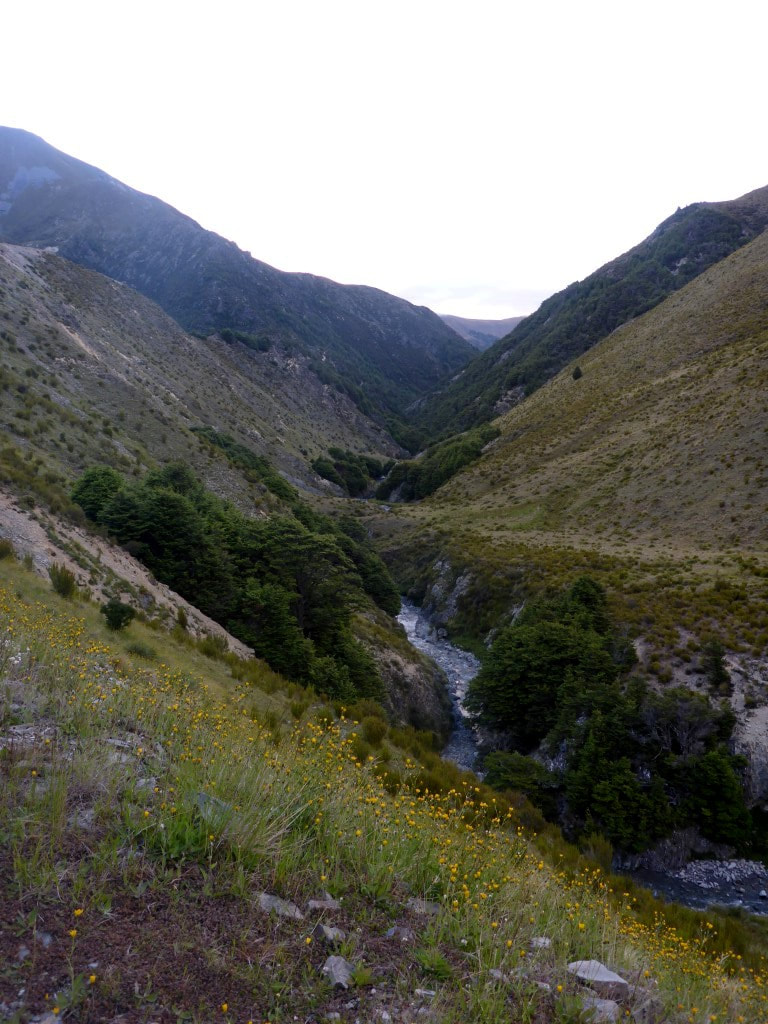 The start of the day - we soon dropped down into that narrow little river valley! 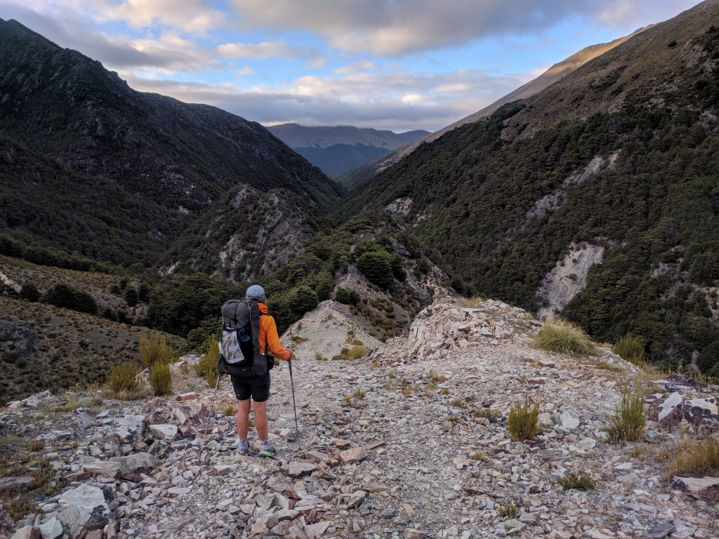 The farm track turns a sharp left here and you can see the track that we follow straight ahead on that narrow ridge, before dropping down toward the river. 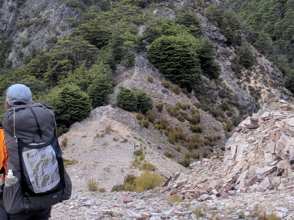 A closer shot of the same ridge track. 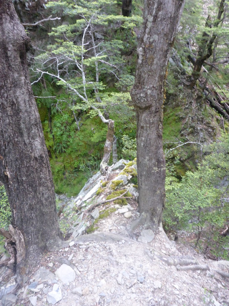 A squeeze between the two trees. 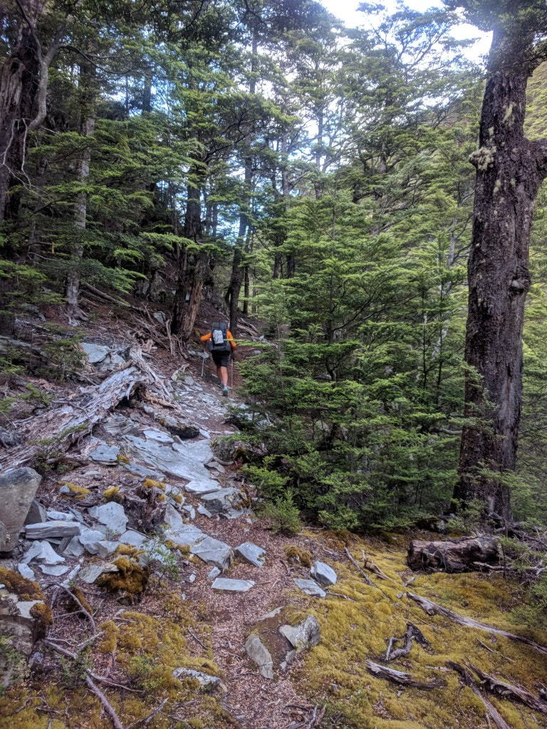 A typical rocky/rooty sidle - although not too steep in this case. 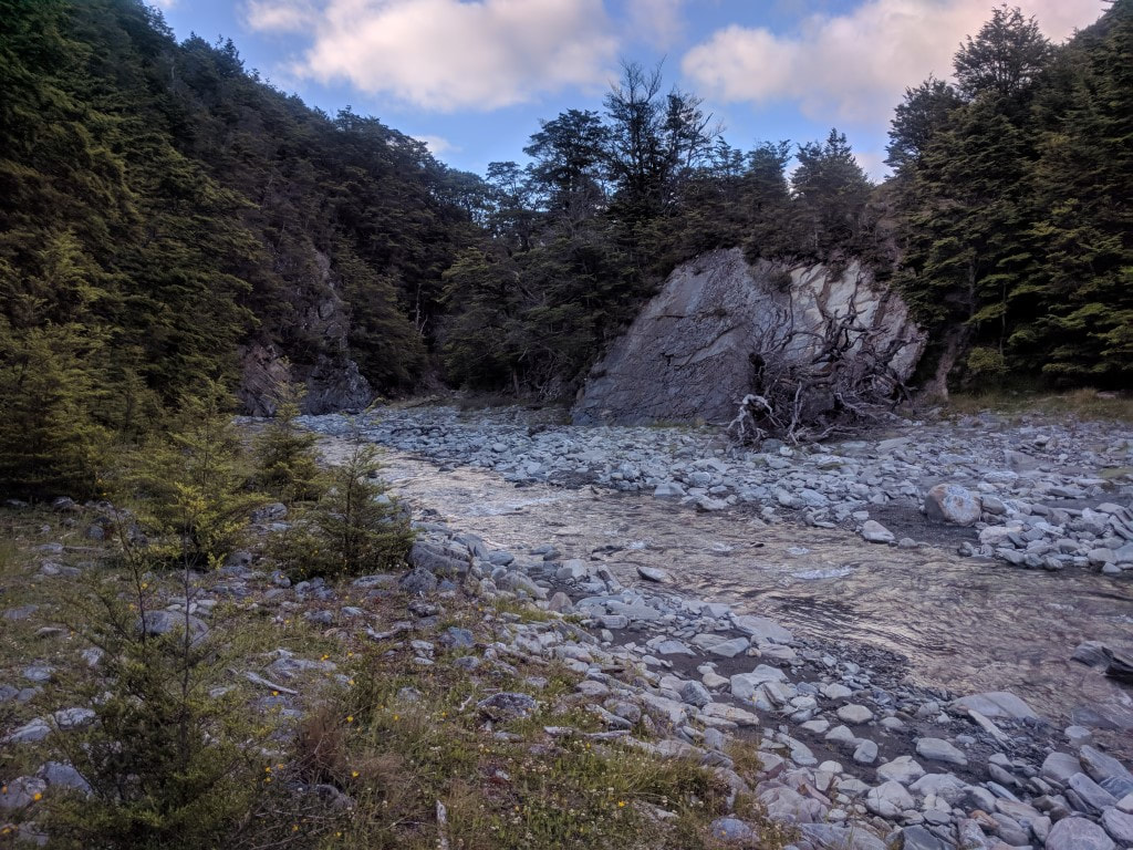 This was one of the wider parts! 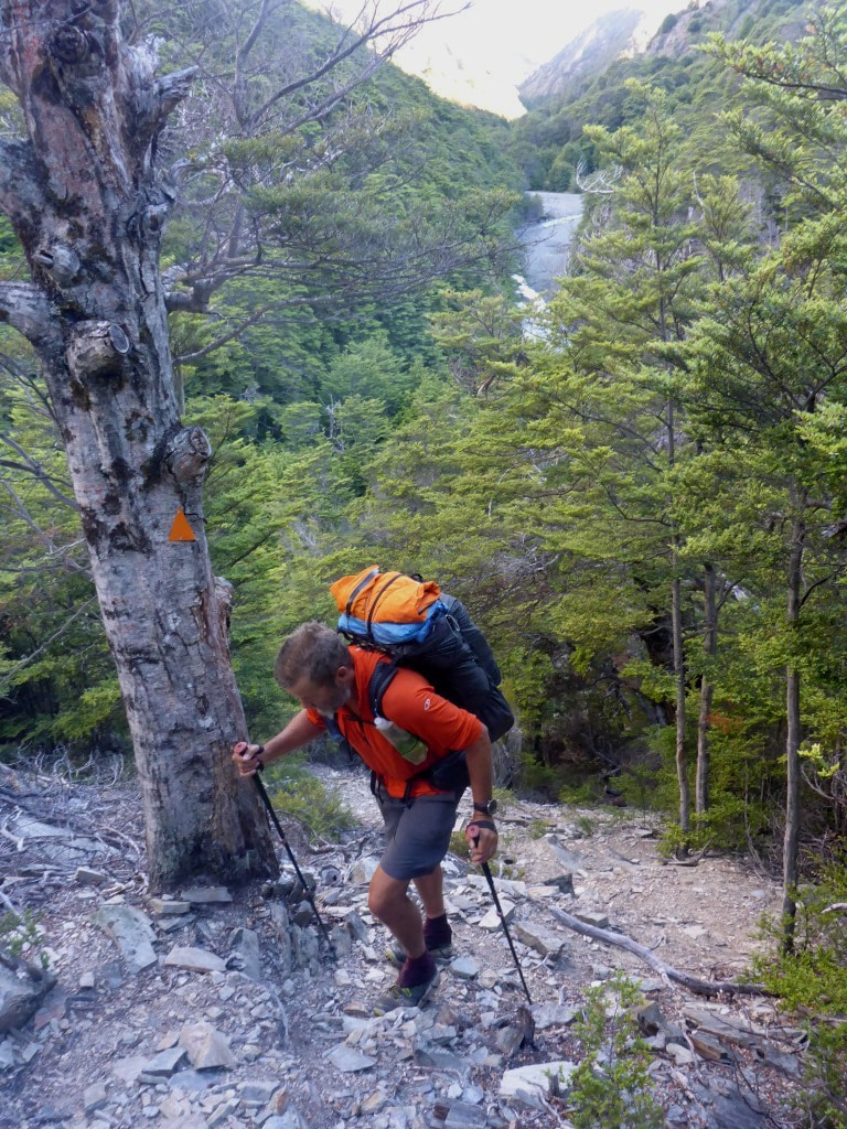 As I noted above, plenty of little uphill bits. 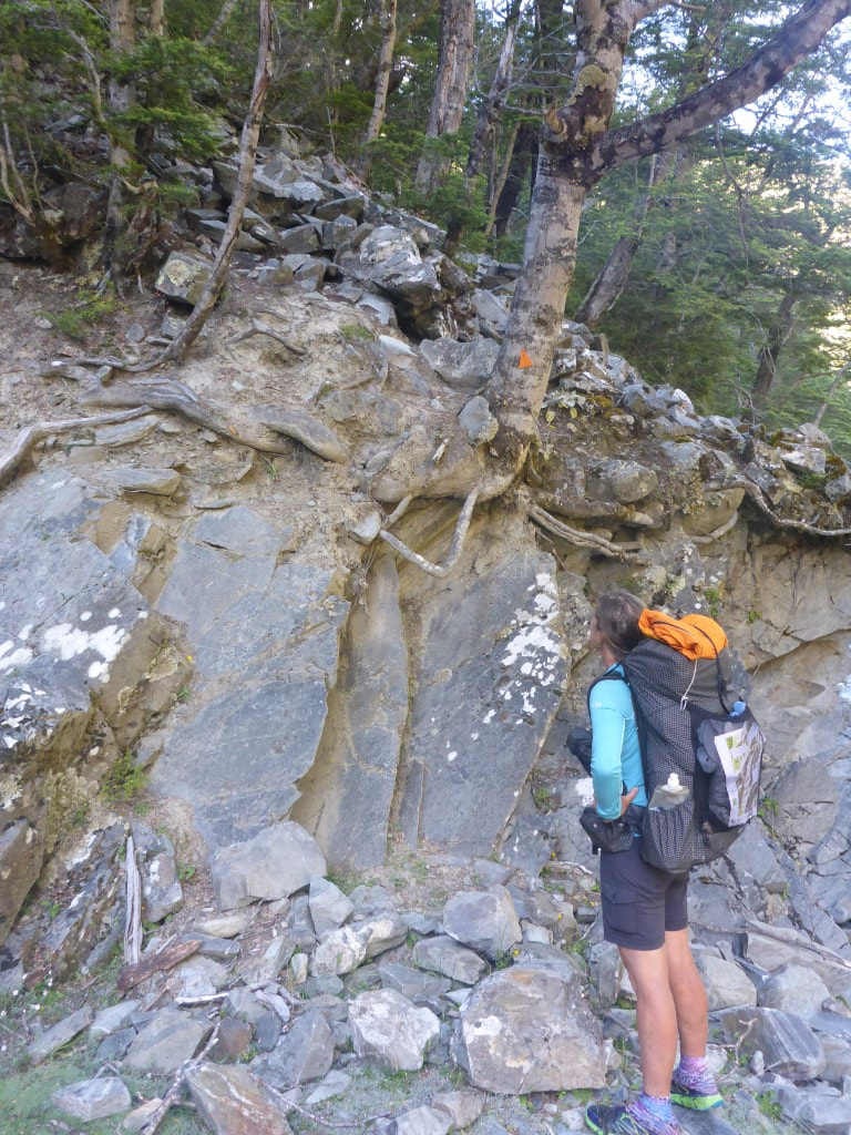 Climbing out of the riverbed - we pondered the best way to negotiate this bit!! 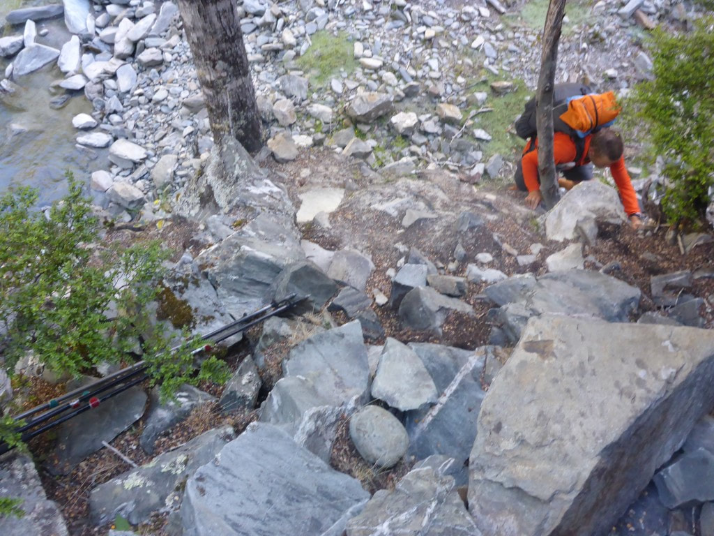 B climbed up without poles, I threw the poles up, and then clambered up myself (in ungainly fashion) :-) 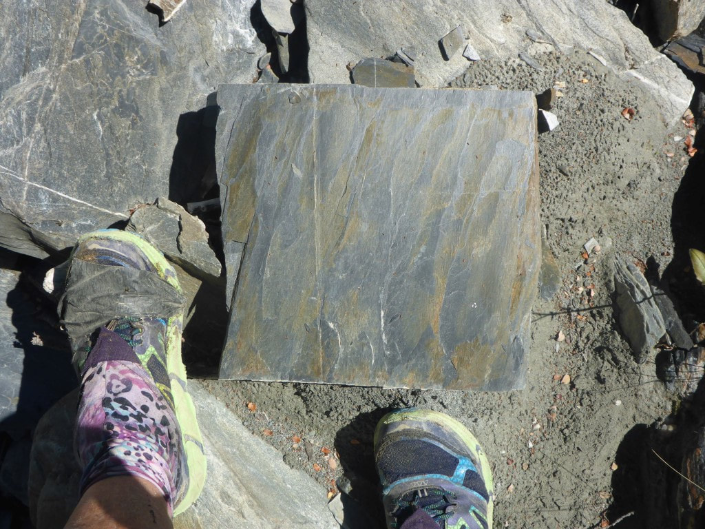 A bunch of these would make a fantastic patio - no cutting required! 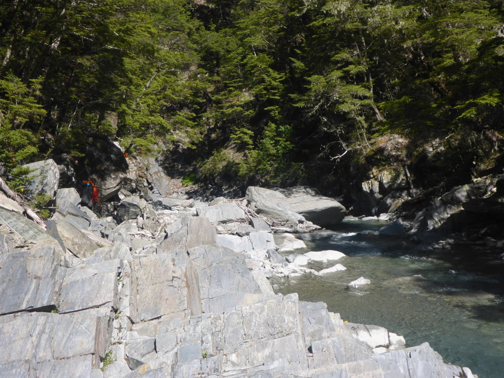 A rockier part of the riverbed to negotiate. 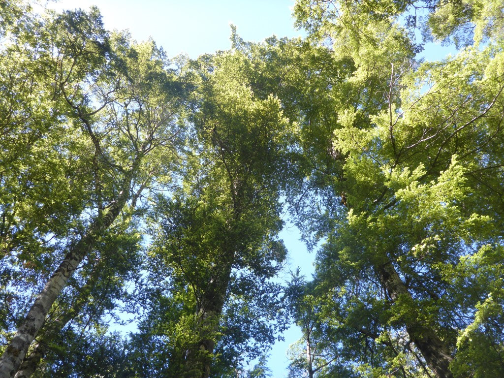 But there were some nice beech trees along the way :-) 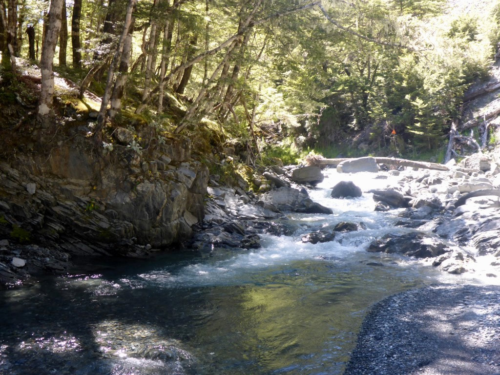 Orange marker straight ahead - find the best route! 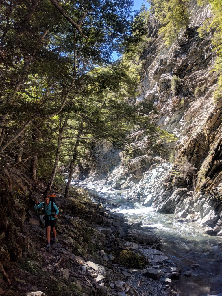 Another riverside stroll. 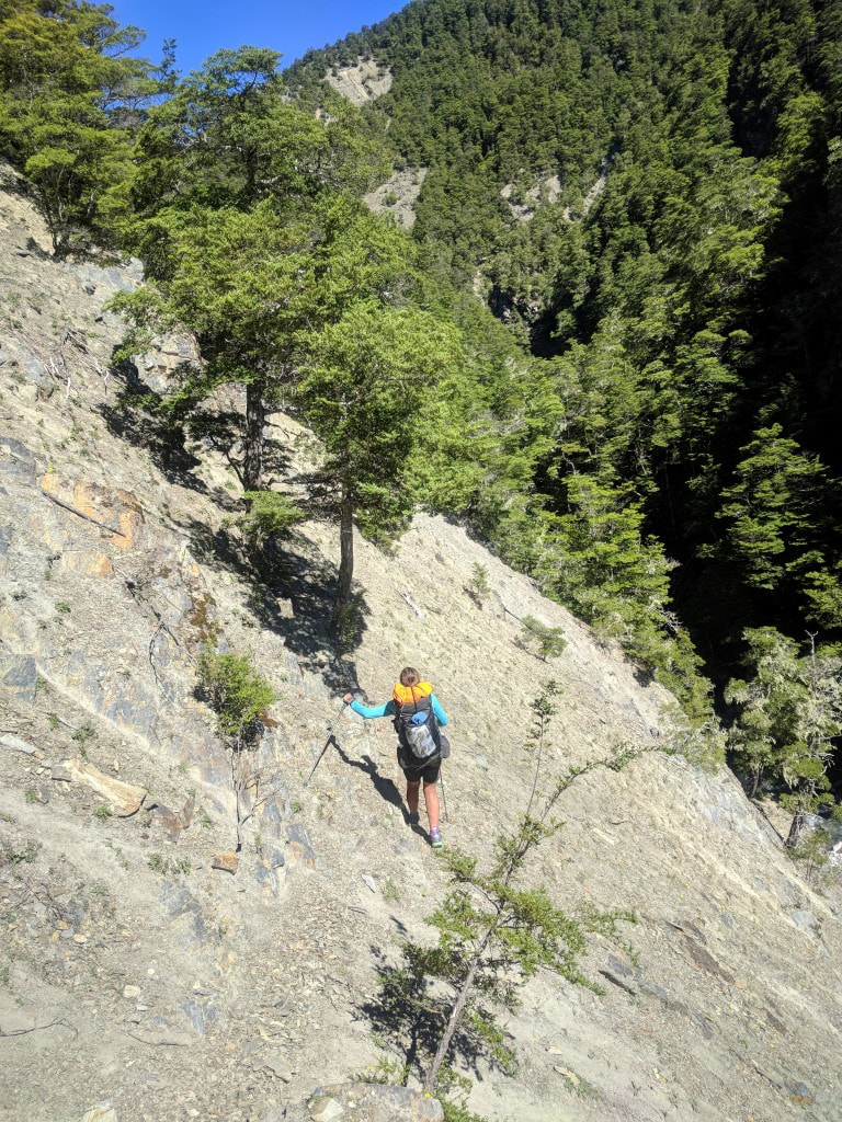 And another steep sidle - care required with foot placement. 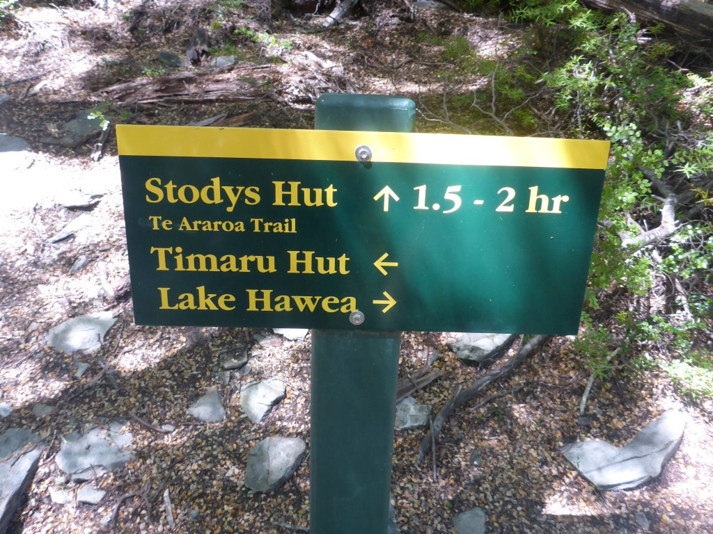 The Timaru River Track junction. A steep climb awaits - took us 1h50. Just to rub in the pain to our achy joints and muscles we were then faced with a 500m climb over 2km or so! This was up through scrubby forest for the most part but was very steep and lose underfoot, making it pretty slow going for us. At least we were in shade a lot as it was pretty warm and sunny. Then it was a steep sidle across an open face and a short section of gentle descent through bush before reaching Stody’s Hut, an old musterers hut with a dirt floor. It had taken us 1h50 to do 2.4km from the Timaru River Track junction - a hard slog indeed! At Stody’s Hut we met Marie, a young German - she had earlier completed the TA (except a few sections of the North island) and was just doing a 2 night trip up from Hawea, on one of her favourite TA bits, to fill in time before flying back to Germany on Xmas day! She had stayed at Pakituhi Hut and had just done a day walk over to Stodys and was about to head back to Pakituhi. This was late lunch time for us and we needed a good break so spent some time relaxing and filling water from a nearby stream. Marie headed off and we followed about 20 minutes later. 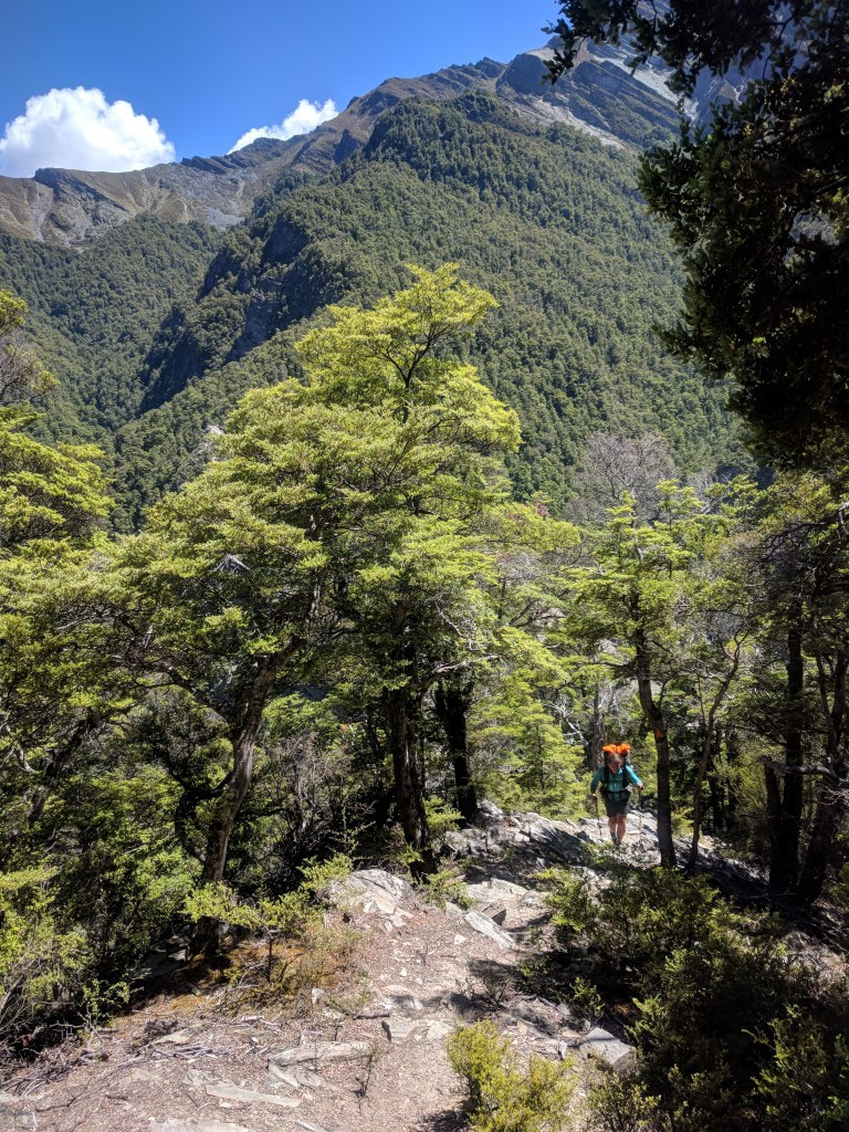 Part of our initial climb - as always, you never take photos on the hardest bits! 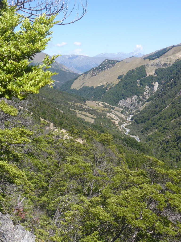 Part way up and looking at the Timaru River heading west toward Lake Hawea. 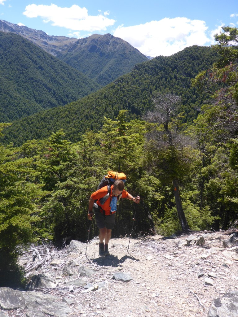 Just to confirm that this bit was all uphill!! 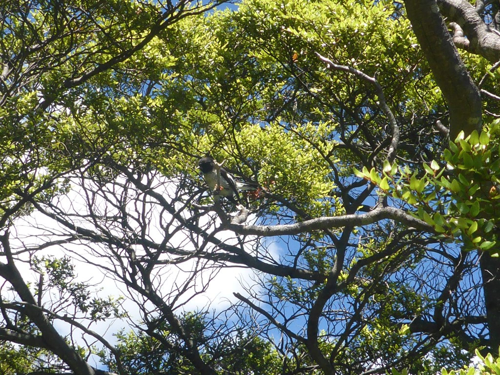 We did see a few robins during the day. B captured this one - always nice to see as they are pretty friendly usually.  A fine specimen of beech! 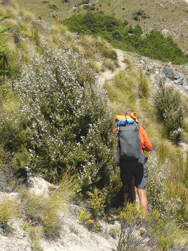 The last little bit to Stody's Hut was a steep sidle involving a slight drop in altitude. 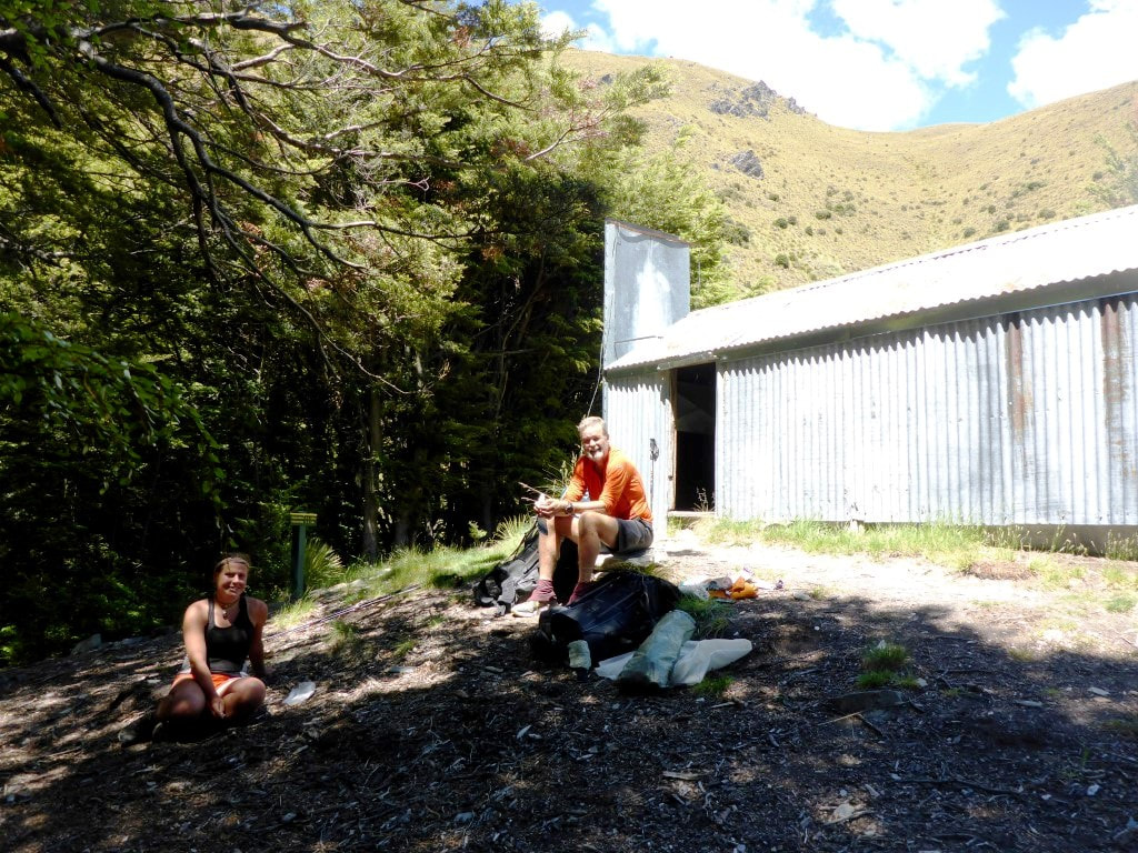 Marie and me outside the hut. 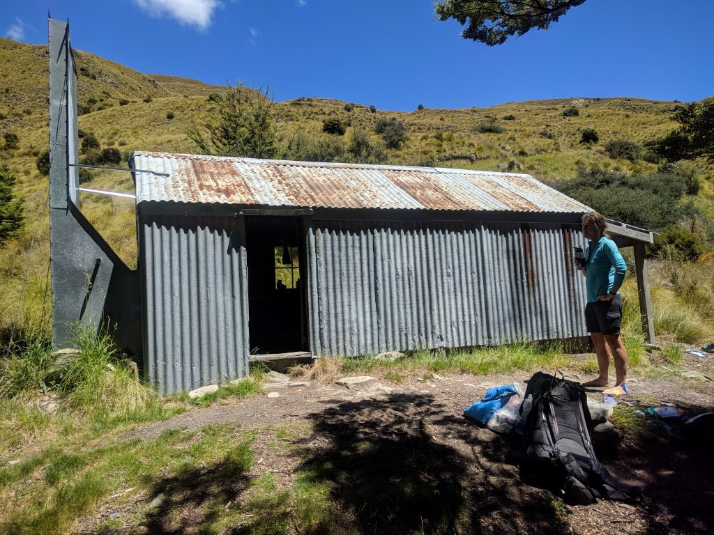 A quaint old hut. We were now back into open tussock country and on an old farm track so, while we still had to climb from 1080m asl (Stodys) to around 1578m (Breast Hill), at least the underfoot conditions were pretty reliable! It was a hot, sweaty climb given the exposed nature of the terrain. We stopped part way up where we had cellphone reception and organised some accommodation at Glendhu Bay, a 15km walk from Wanaka. This was after altering our plans slightly for how we would tackle the Motatapu Alpine Track - we had chatted with Marie about it and she had given us some good advice on time/distance/terrain that made us rethink. 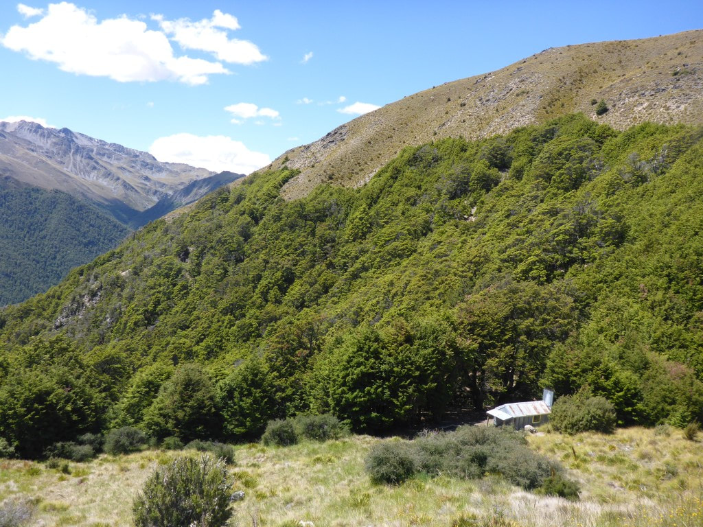 Heading up from Stody's Hut. 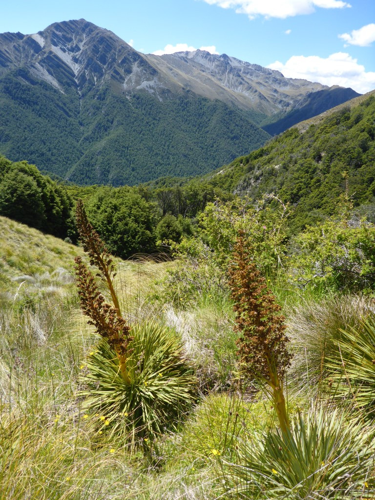 A reminder, if needed, that spaniard is still around in this environment! 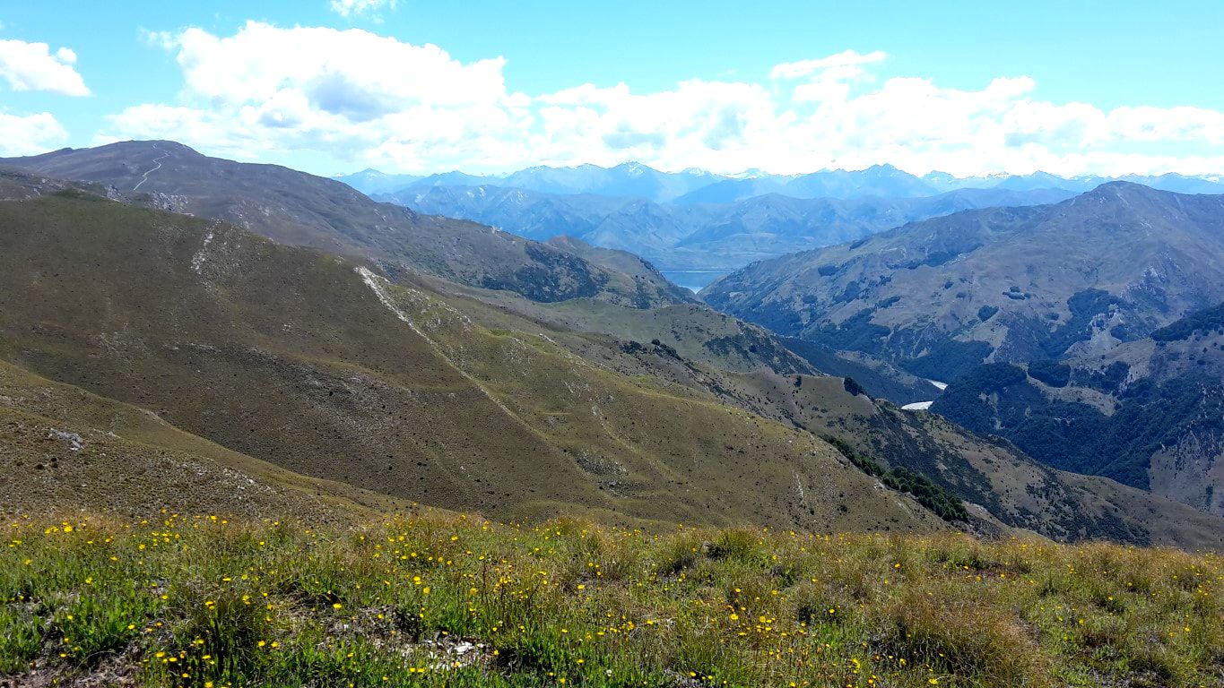 Looking at the Timaru River heading into Lake Hawea (the lake is just visible in the "V" at the end of the river valley). 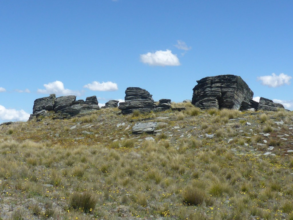 Rocks seem to grow out of the ground everywhere. 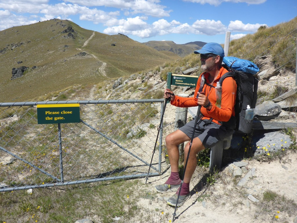 Stiles are not just for climbing over fences! 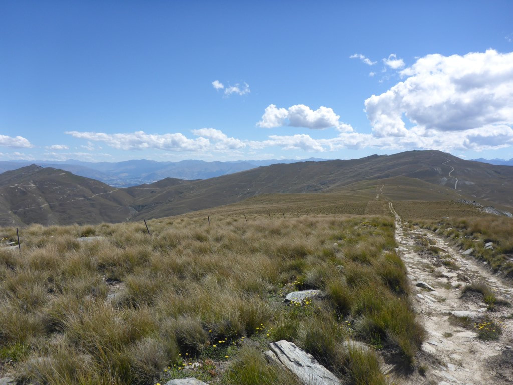 More of our farm track heading in to the distance toward Breast Hill. 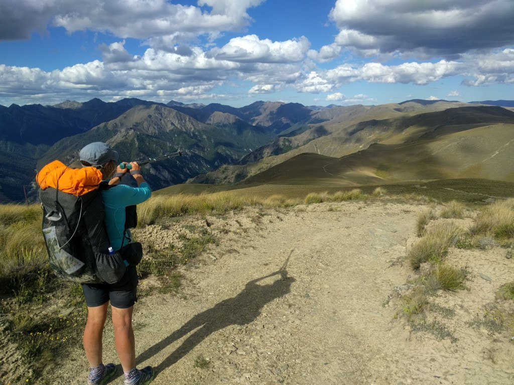 We've come from that direction!! 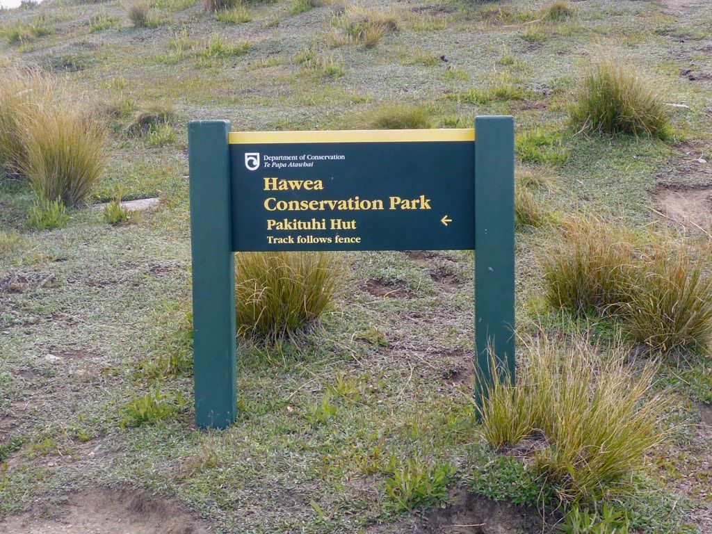 About 20m below Breast Hill peak you climb over a fence and back into conservation park. Following the fence down comes after you have climbed to the top for the view :-) The climb to Breast Hill was definitely worth it. It was 1800, and already 11.5 hours after we had left Top Timaru Hut this morning, with almost a hour still to get us to the next hut! A lovely evening with stunning views down to Lake Hawea and even further across to Wanaka and beyond. This vantage point is about 1200m above Lake Hawea (where we are going tomorrow morning) which makes for the stunning views. Obviously also looking across to the Alps and back where we had come from. Marie was there, as was an American girl working for a family in Wanaka who had come up for the day, as well as another young couple who were on an overnighter to Pakituhi Hut as well. We stayed after they had left and soaked up the views - also took the opportunity of cellphone reception to send a few “brag” photos and videos of our viewpoint! 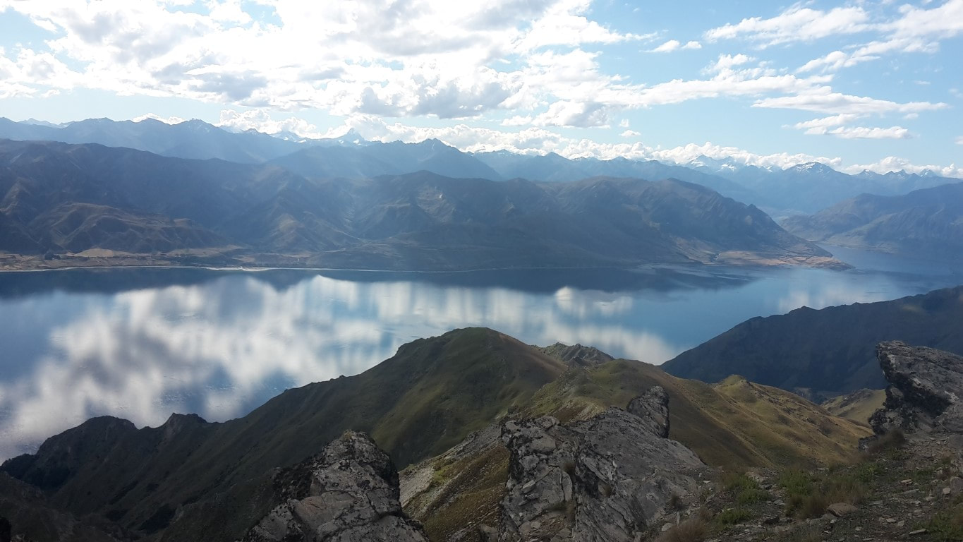 Looking up toward the head of the lake. 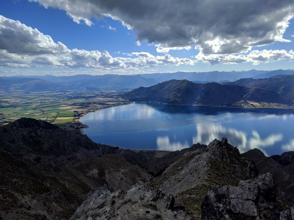 Lake Hawea village and the lake oulet. 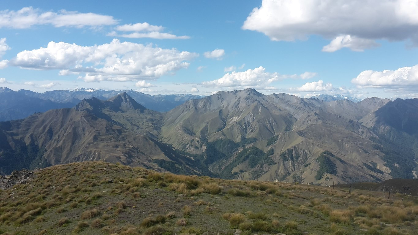 Great views in other directions as well! 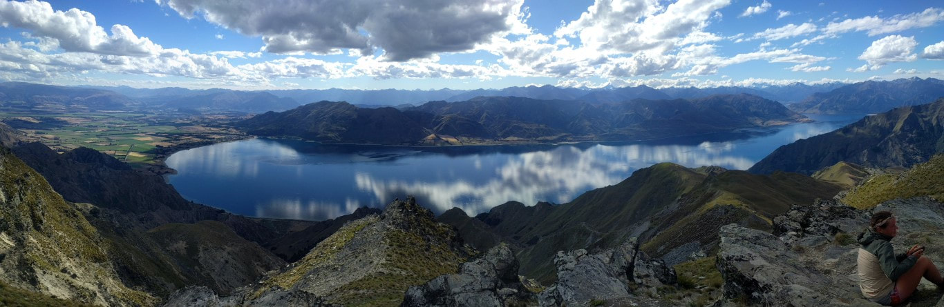 Thought I should include a pano of the whole lake. Also had to include a video showing the 360 degree views - can't seem to put captions under videos, hence this explanation!! Eventually we headed on down a (initially rocky) ridge by a fenceline towards Pakituhi Hut, which is a short diversion off trail. It took us almost an hour from the top - not my optimistic half hour stated in the video! Upon arrival we found a number of overnight trippers there. Marie was wanting to leave early, as were we, so we pitched our tent instead of using the hut. While there was room, with quite a few people in there and with the hut being new with double glazing and insulation, we decided a cooler tent would be better for an early start. As we hadn't got there until 1930 ( a 13 hour day since leaving the hut this morning), by the time we were ready for bed it was a bit later than normal - closer to 2200! :-) 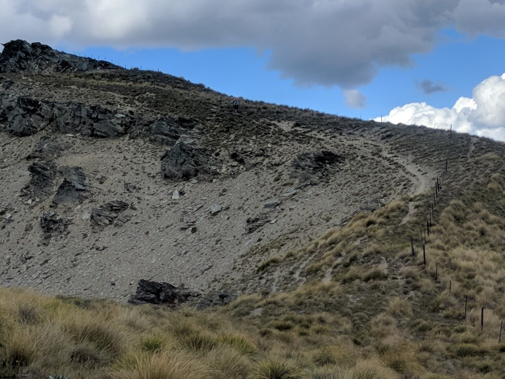 B (just below the skyline in the centre!) coming down the ridge from Breast Hill. 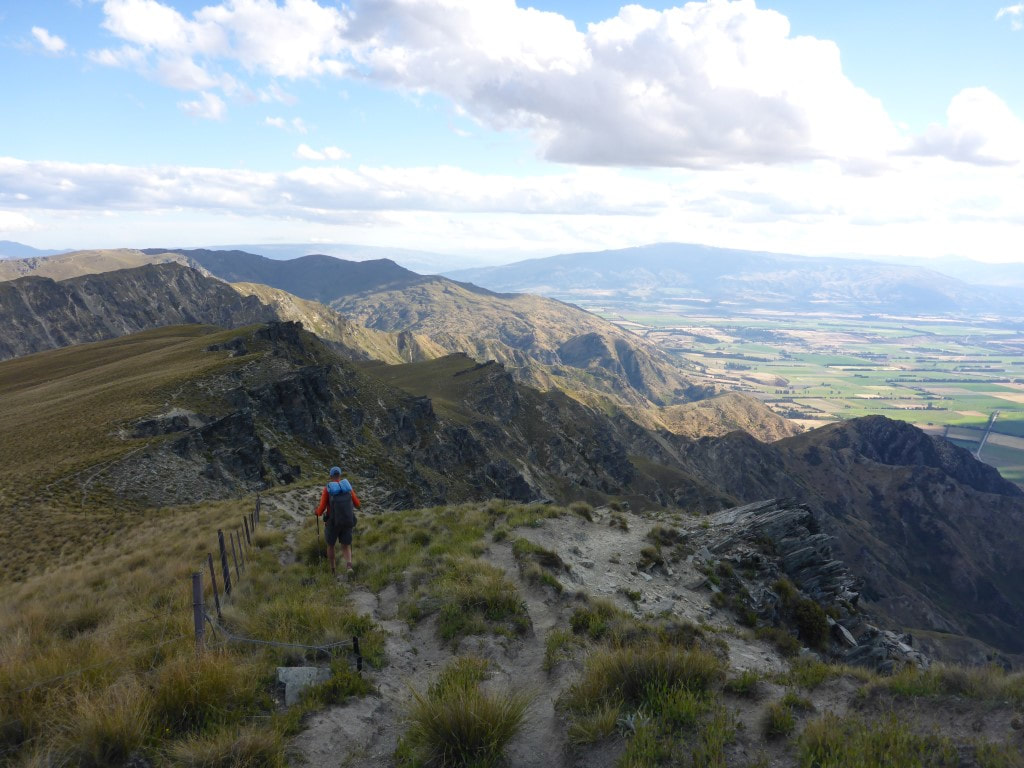 Following the fence and staying away from the cliffs! :-) 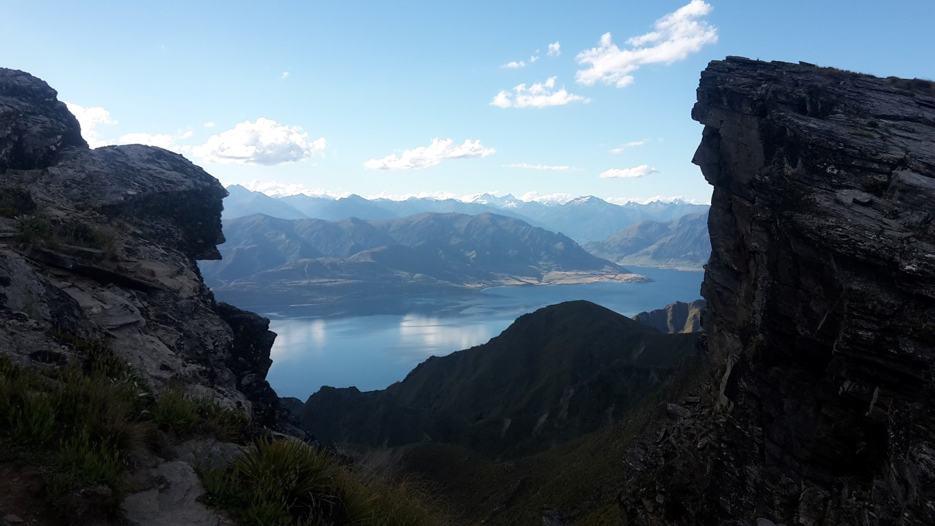 B's alternative view of the lake. 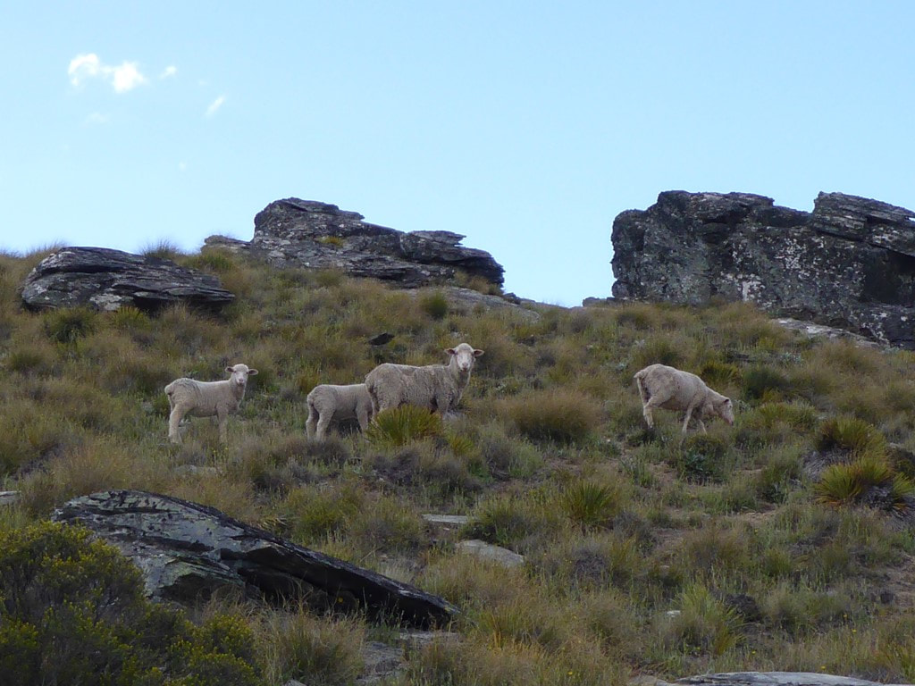 Farm land. 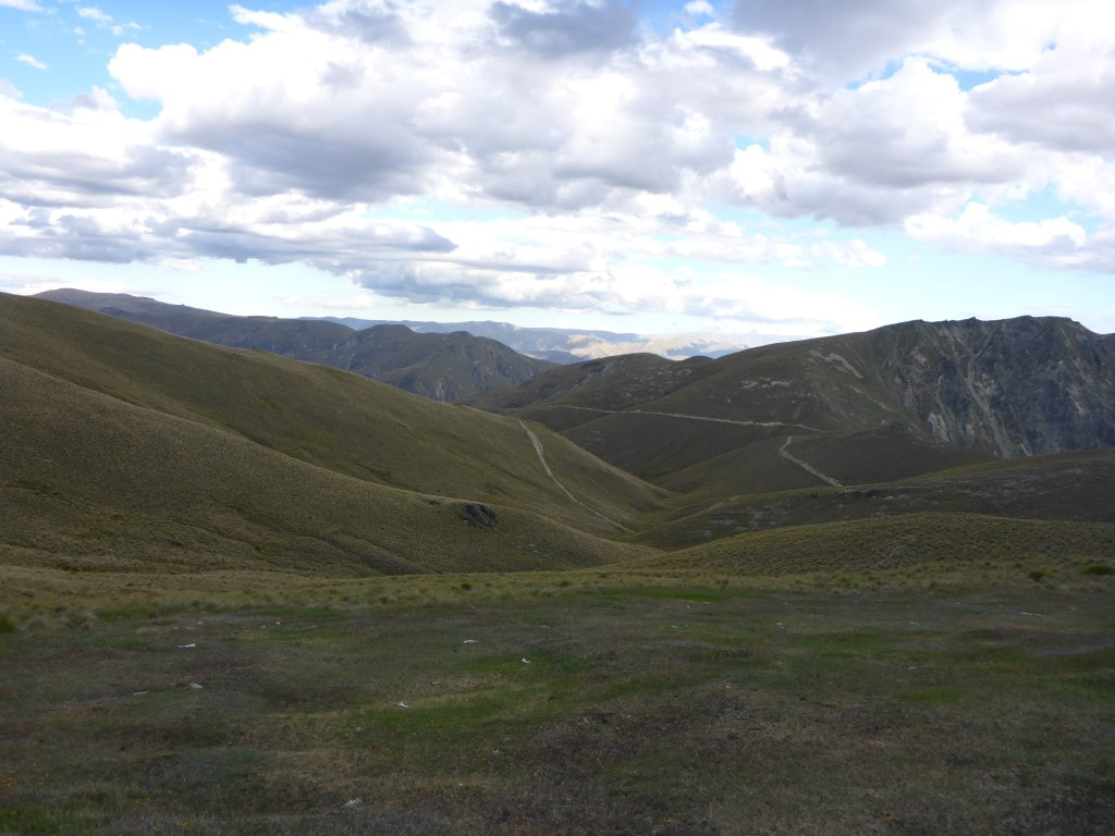 Pakituhi Hut is just over the second ridge at right of photo near where the farm track disappears behind the ridge. We managed to make an 0700 start. We achieved 21.6km today in 6.25 hours walking, arriving at Top Timaru Hut at 1430 - where we decided on balanced to stop for the night. There day included over 1100m of ascent and 900m descent - not so much flat!! The GPS track for the day is here. The camera seemed to have produced some pretty washed-out shots today (moisture?) - I have tried to manipulate them a little to improve the look, but I'm no expert. My phone camera was a little better behaved! It started raining lightly at around 0200 and was still raining lightly when we woke at 0530. We fluffed around in the tent packing stuff up as usual and, miracle of miracles, it stopped raining about 0600 so, while the tent was wet, we could pack up and have a cuppa in the relative dry. We had a short walk alongside our stream before climbing up onto a terrace and starting to follow a good farm track. We progressed steadily as the initial climbing was gentle, and reached the private hut (with toilet!) after 8km and 2 hours walking, so a pretty good pace to start. We had already climbed from 700m at our camp to about 900m so only another 780m to go up to the saddle below Mt Martha (1684m asl)! 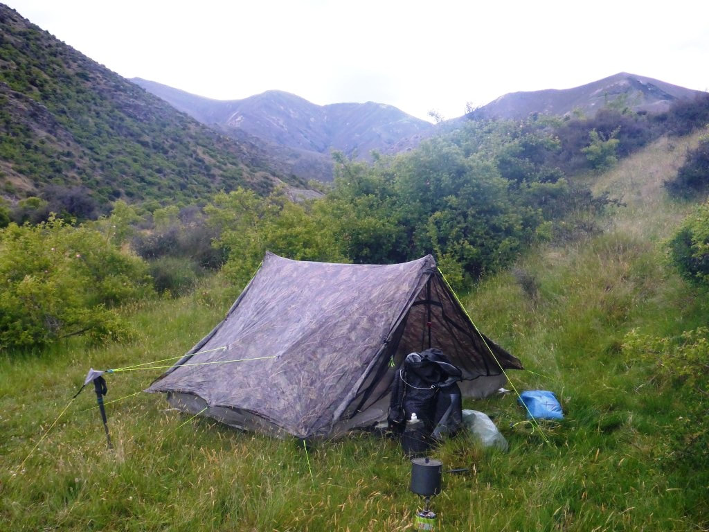 Morning at the tent site. 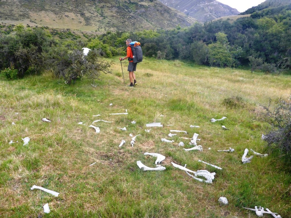 Just starting out - some wag had placed the cow skull on top of a bush. 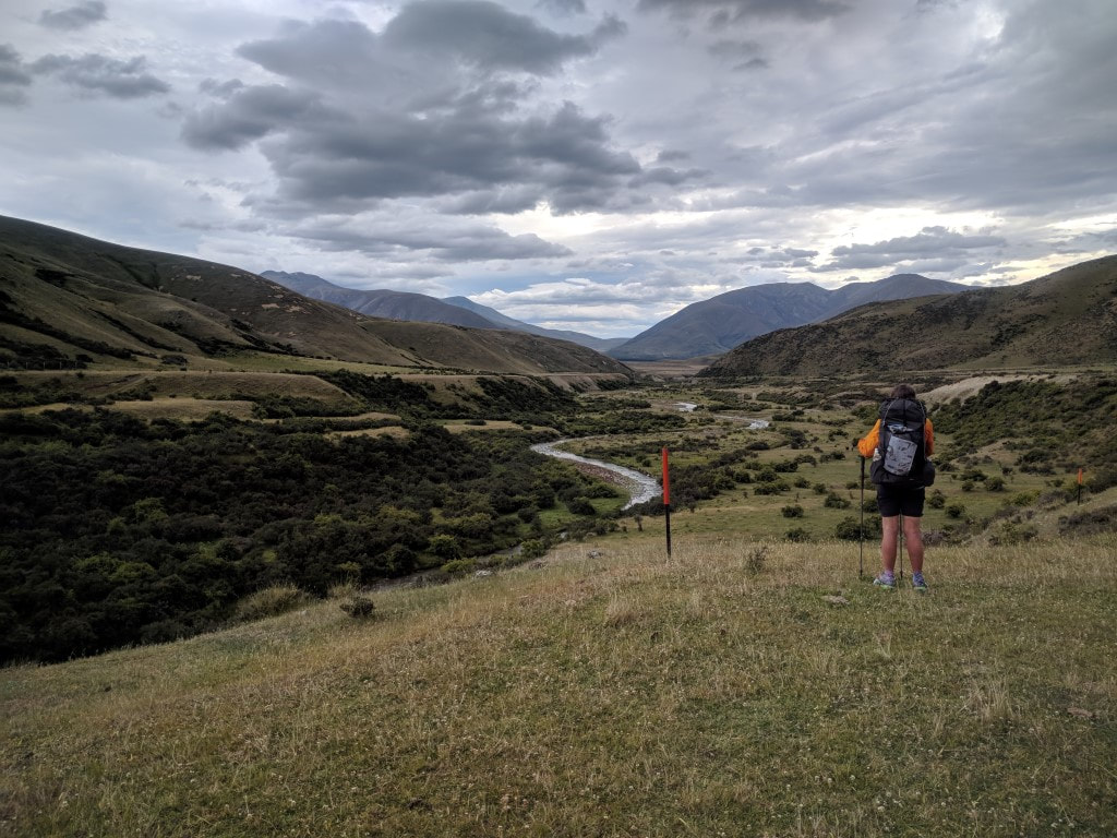 Heading up the valley alongside Avon Burn initially. 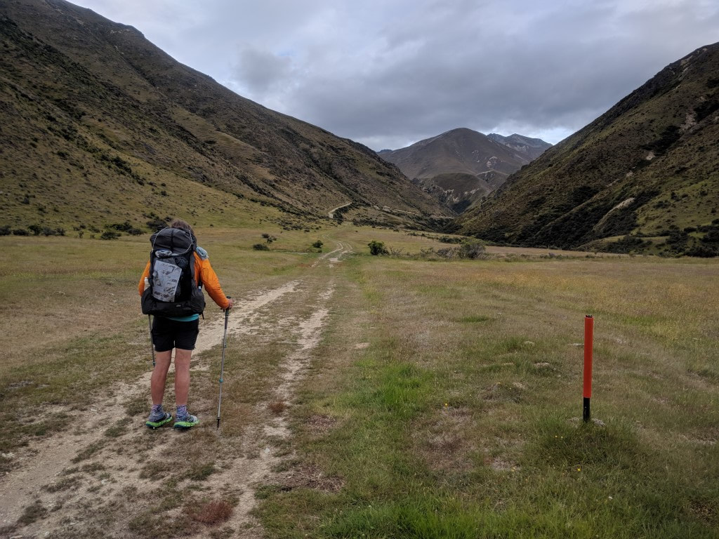 The farm track provided good underfoot conditions today. 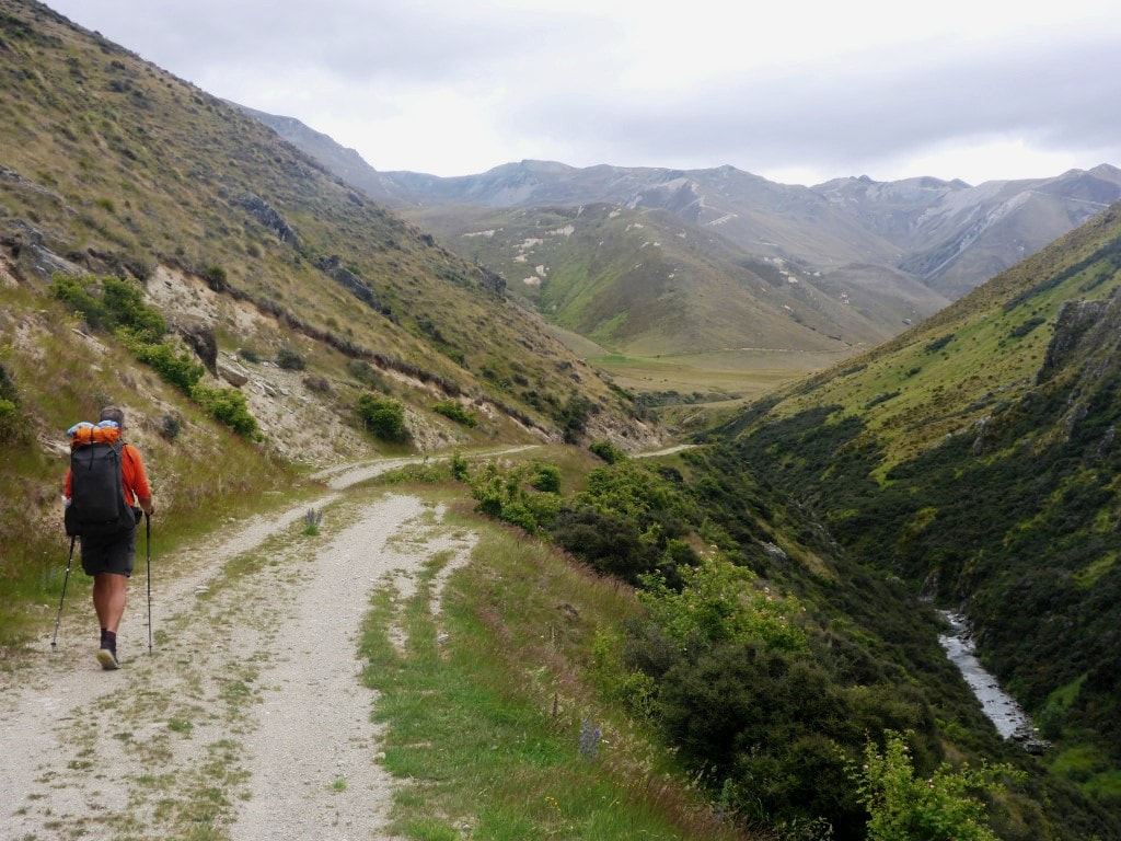 Getting a little hillier, but still a good track. 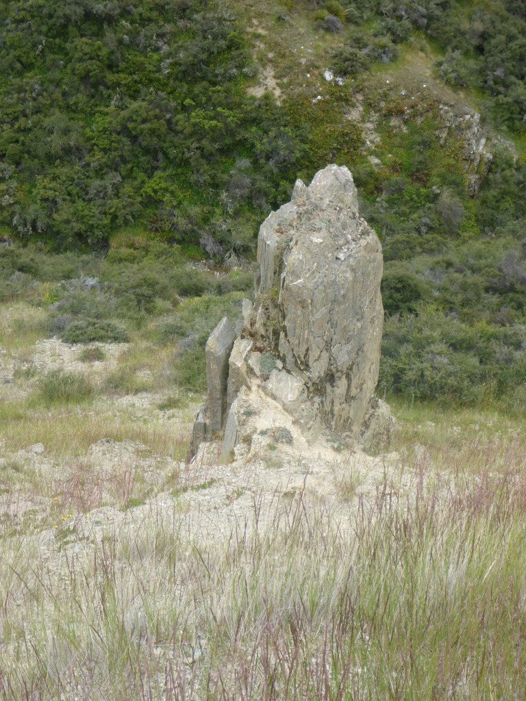 Sticking out like a sore thumb! 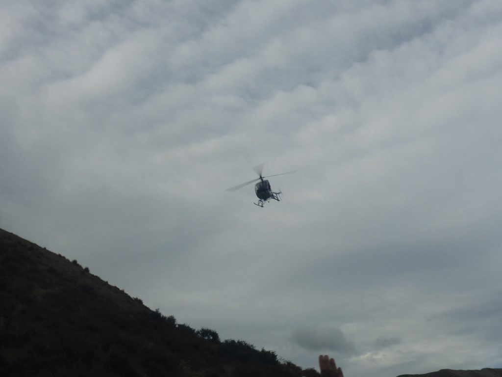 We had heard some helicopter activity - then it flew down the valley over us. B managed to get a shot of it. 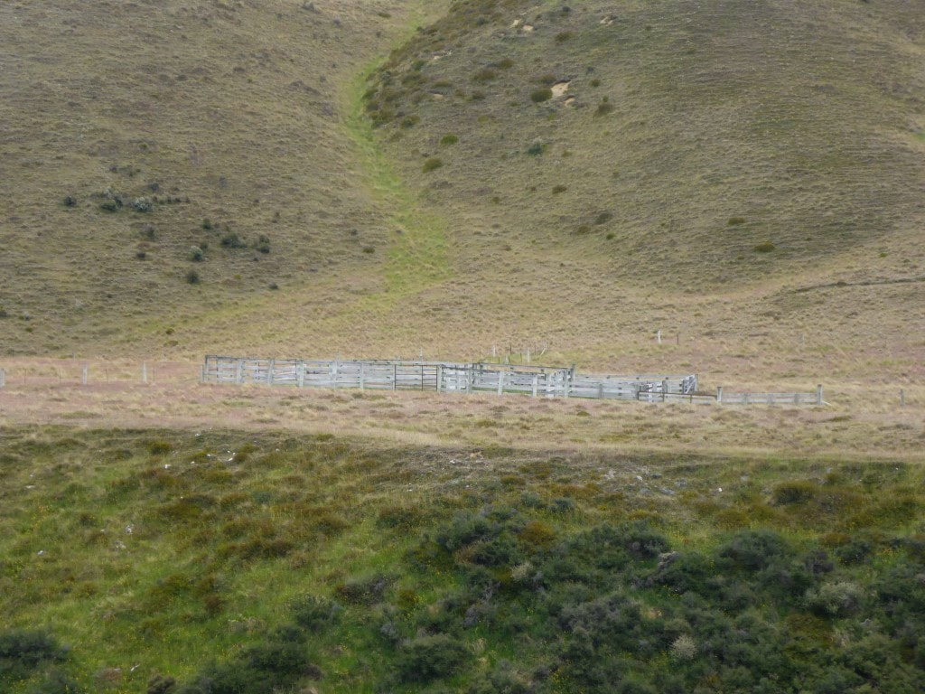 A set of yards in the middle of the farm (this bit is still farmed I think). 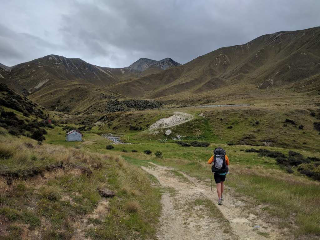 Approaching the little private hut. 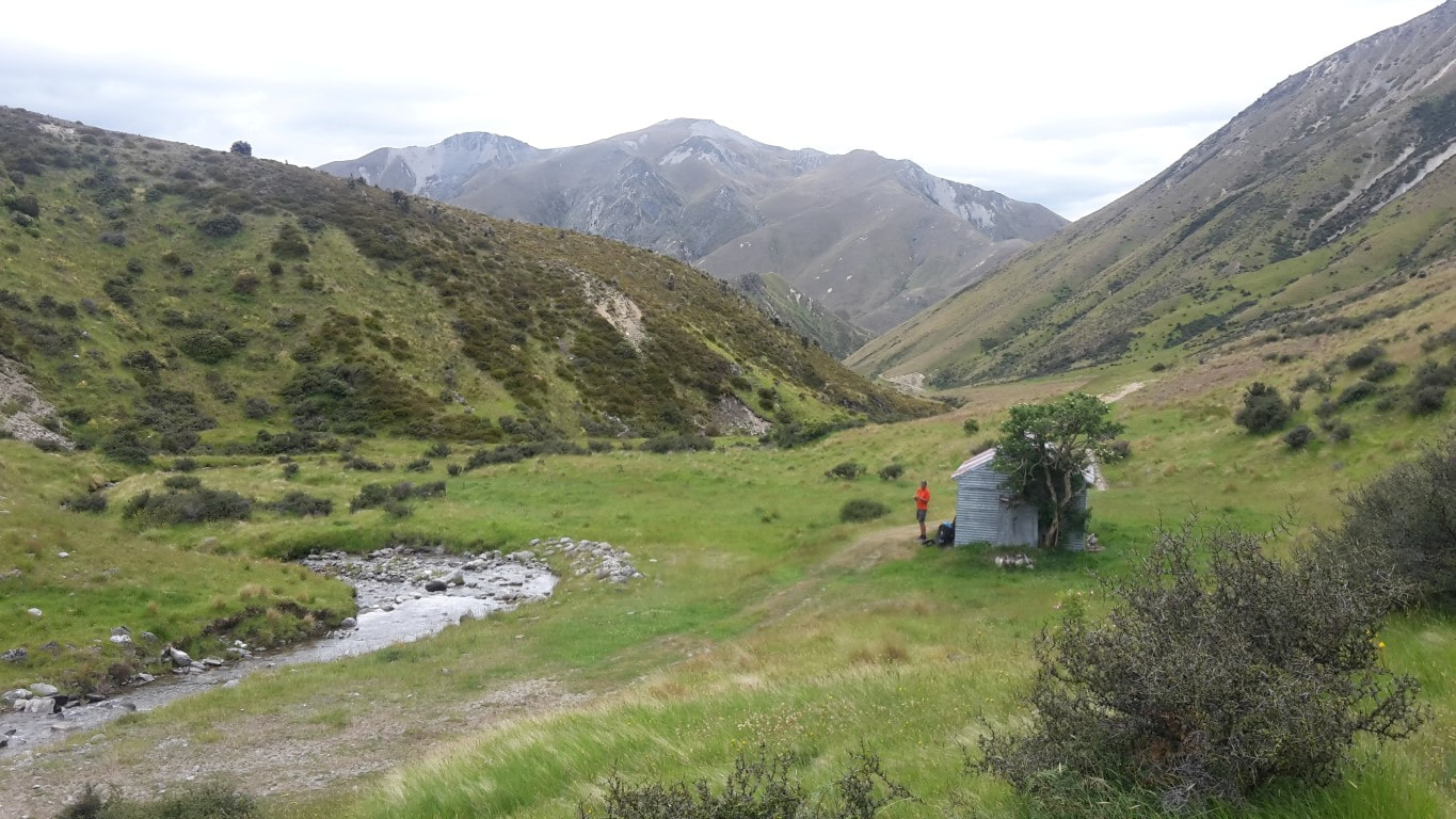 Me outside the hut - we stopped here for a break after about 2 hours. 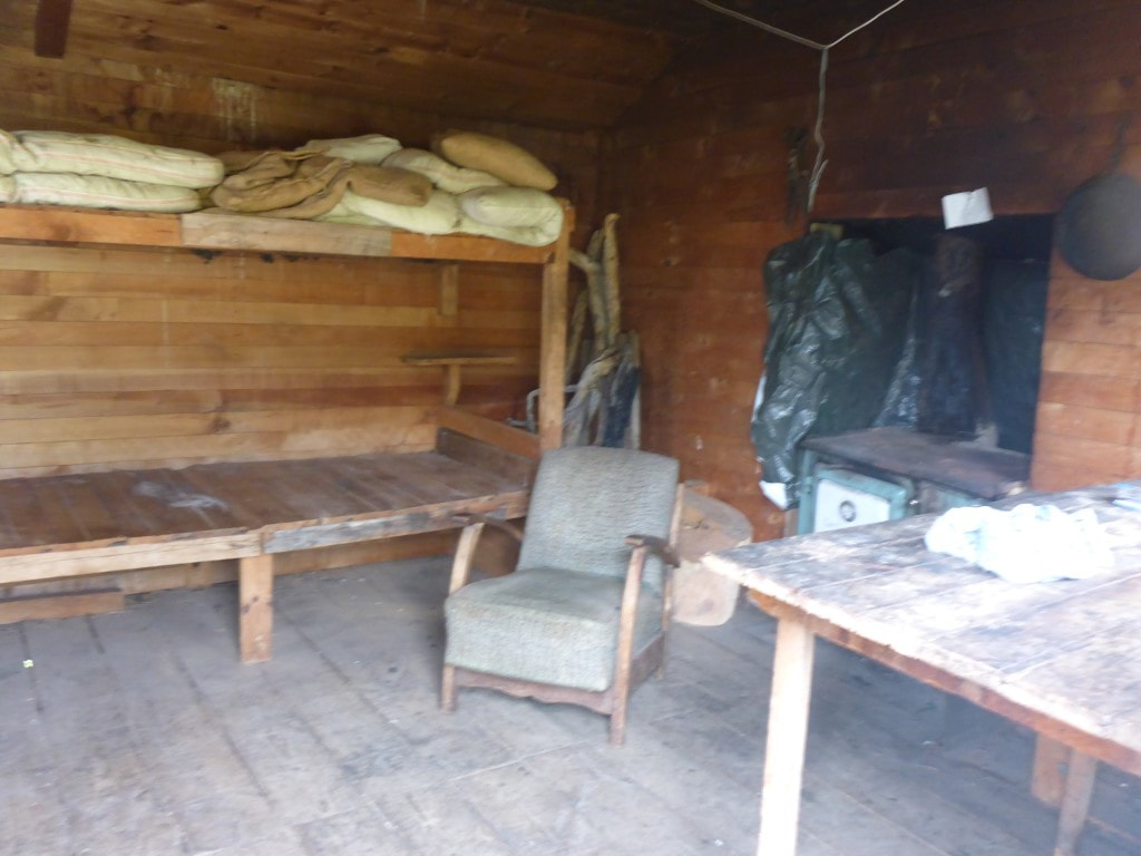 A (fuzzy) glimpse at the hut interior! We started climbing more steadily after the hut, but still on good farm tracks. Eventually we reached the Conservation Park boundary and the quality of the track deteriorated somewhat as it is not really maintained by DoC - certainly not for any vehicle access. However it is still easier than bashing through tussock and spaniard! From the hut we climbed for another 6km to achieve that next 780m vertical, arriving at the saddle after 14km, in 4h10 of walking time (around midday) - which also included a lot of “micro breaks” on the way to rest legs and catch the breath! Overall we were pretty chuffed with our efforts :-) Over the last km or so to the saddle the misty drizzle returned and, with a cool wind, required a stop to put on the rain jackets. We ended up keeping these on all the way down to Top Timaru Hut as, even though the drizzle came and went, the wind remained cool. 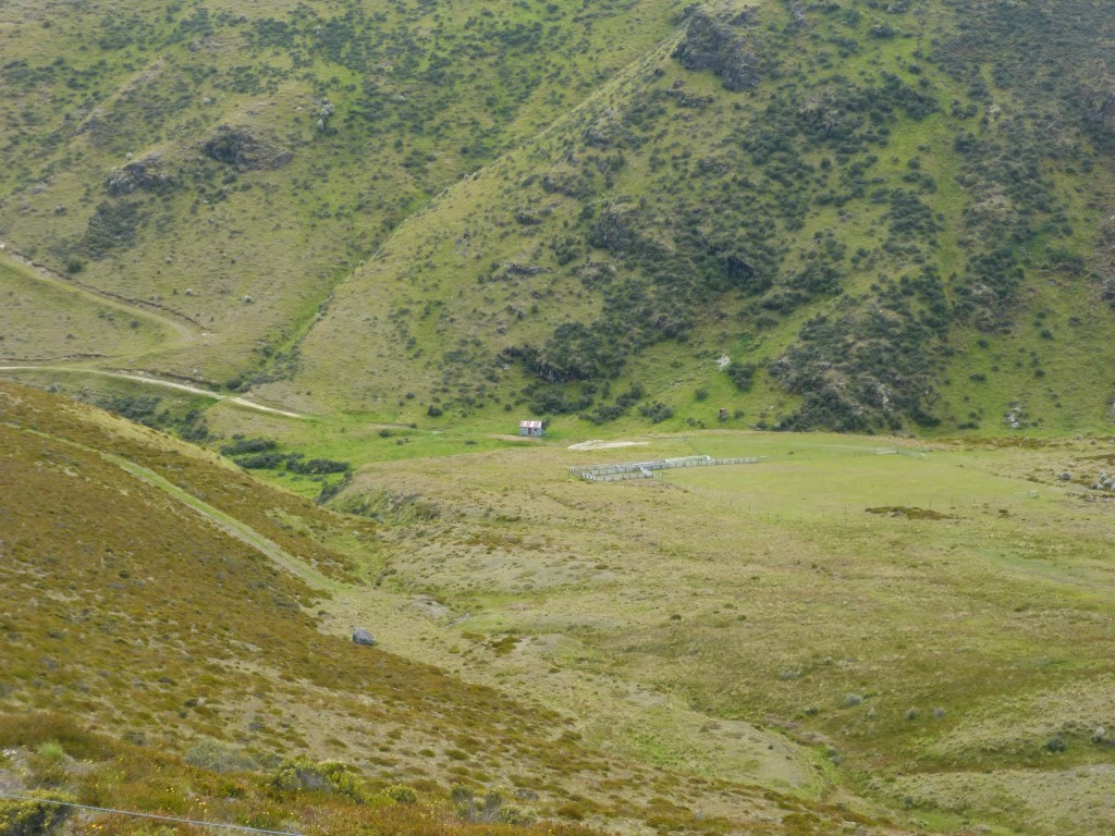 Starting the climb, looking back down to the hut. 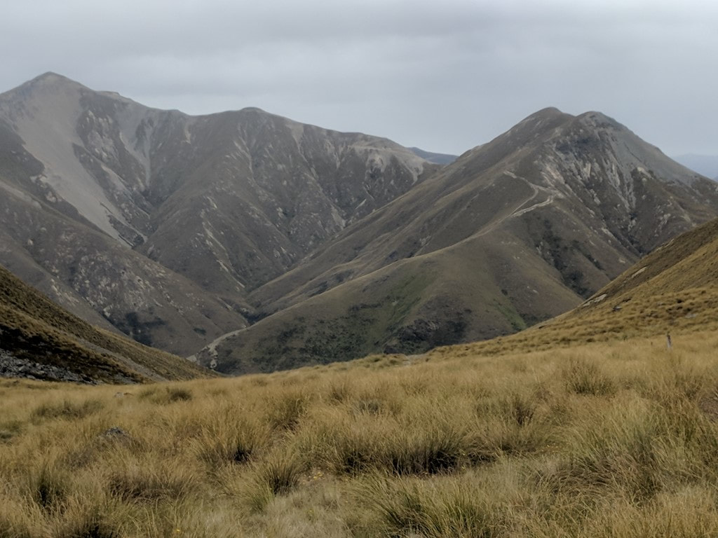 Back into tussock and rock! We were constantly fascinated by where they had bulldozed farm tracks in this mountainous country (see background)! 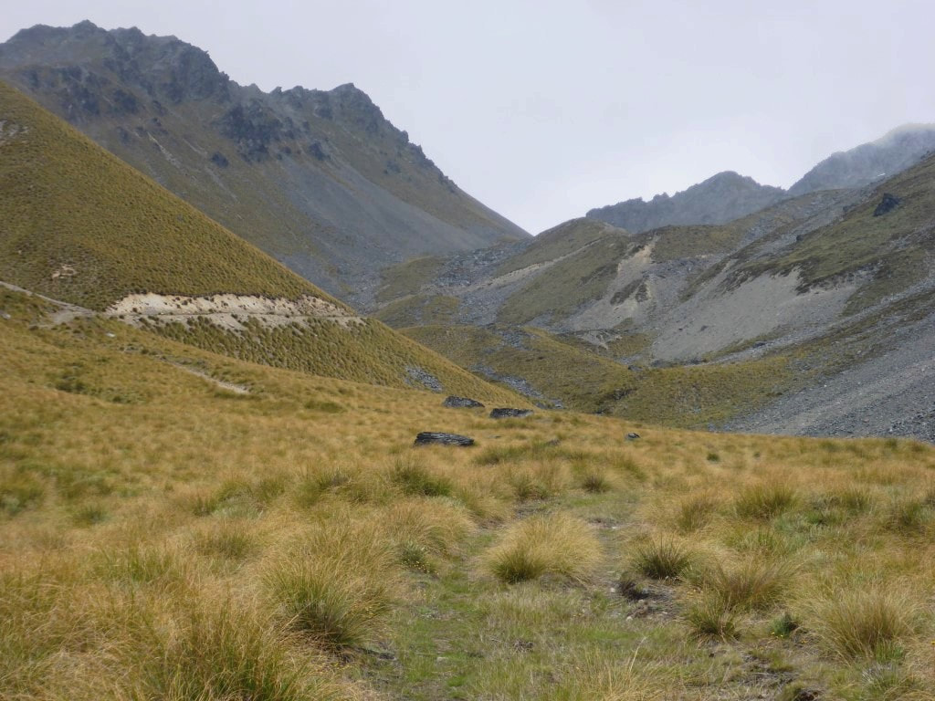 More rugged country, but an easy track to follow. 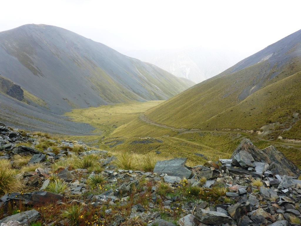 Looking back down to the valley we had come up. 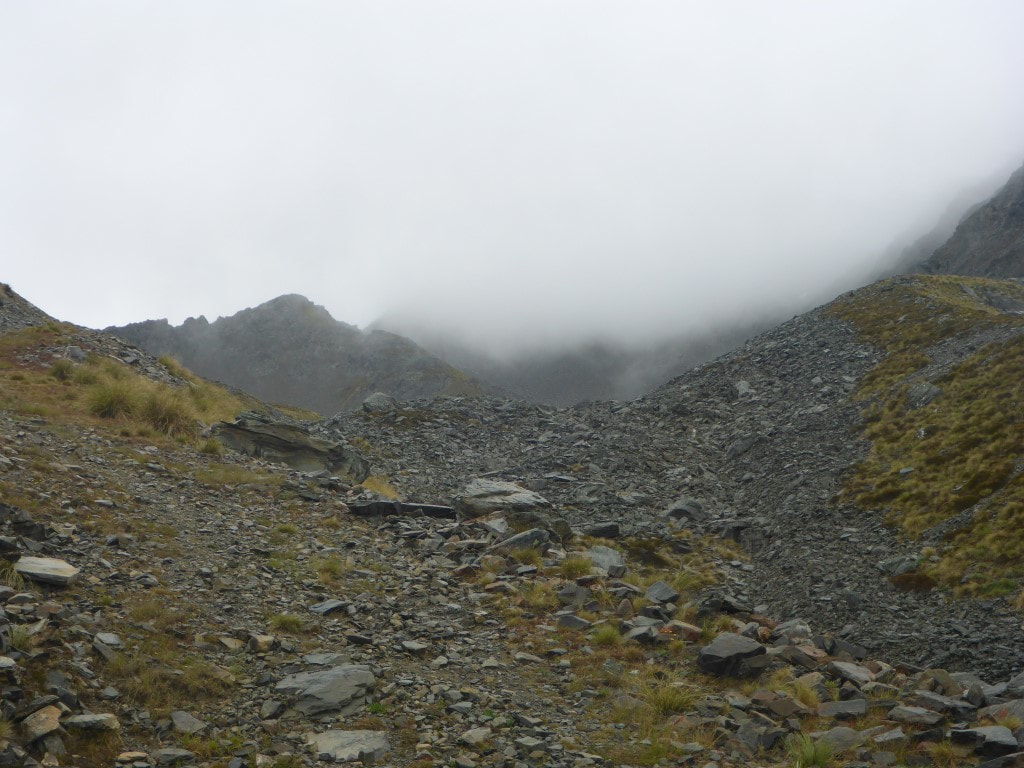 Wasn't looking promising for views at the top at this stage. 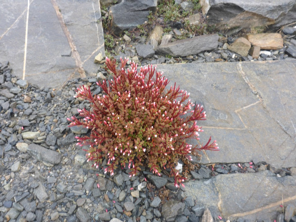 Almost looked like a plant amongst paving stones!! 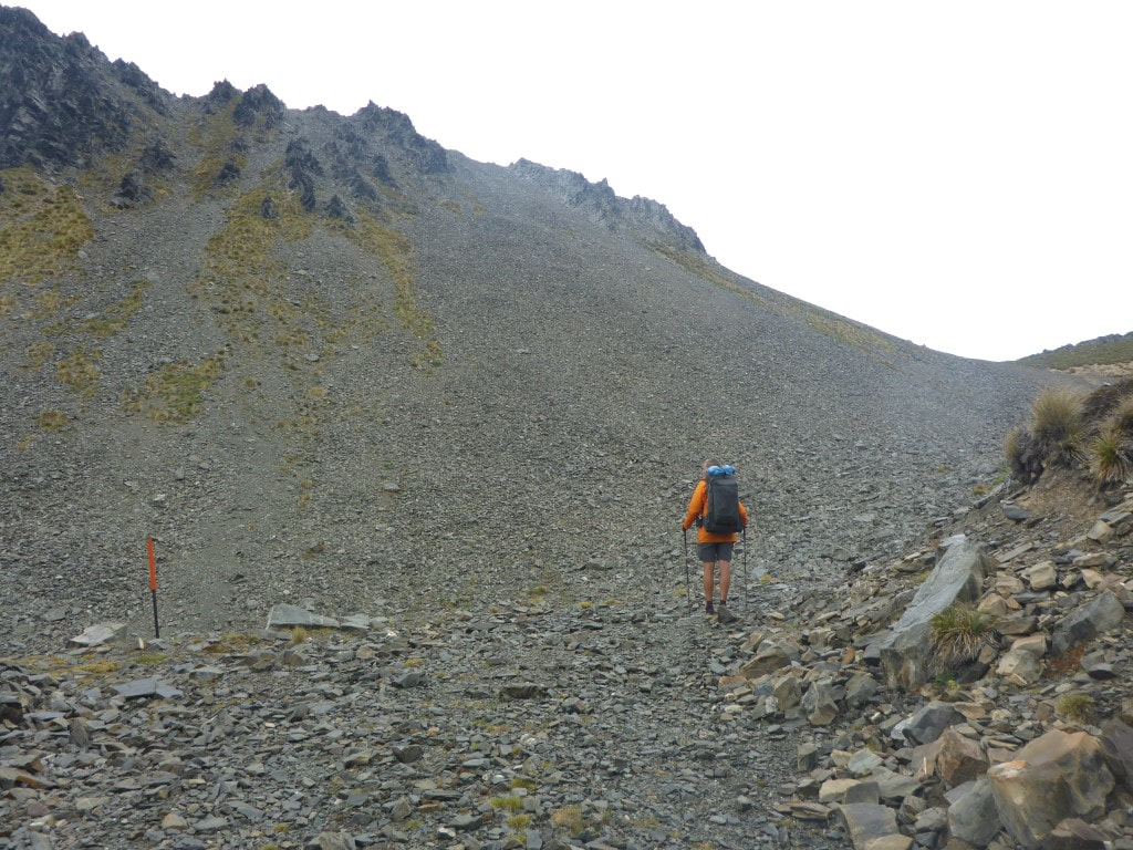 It cleared a little as we continued to climb toward the saddle. 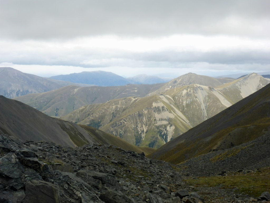 Near to the top - looking back down at the latter part of the climb through steep rocky terrain. 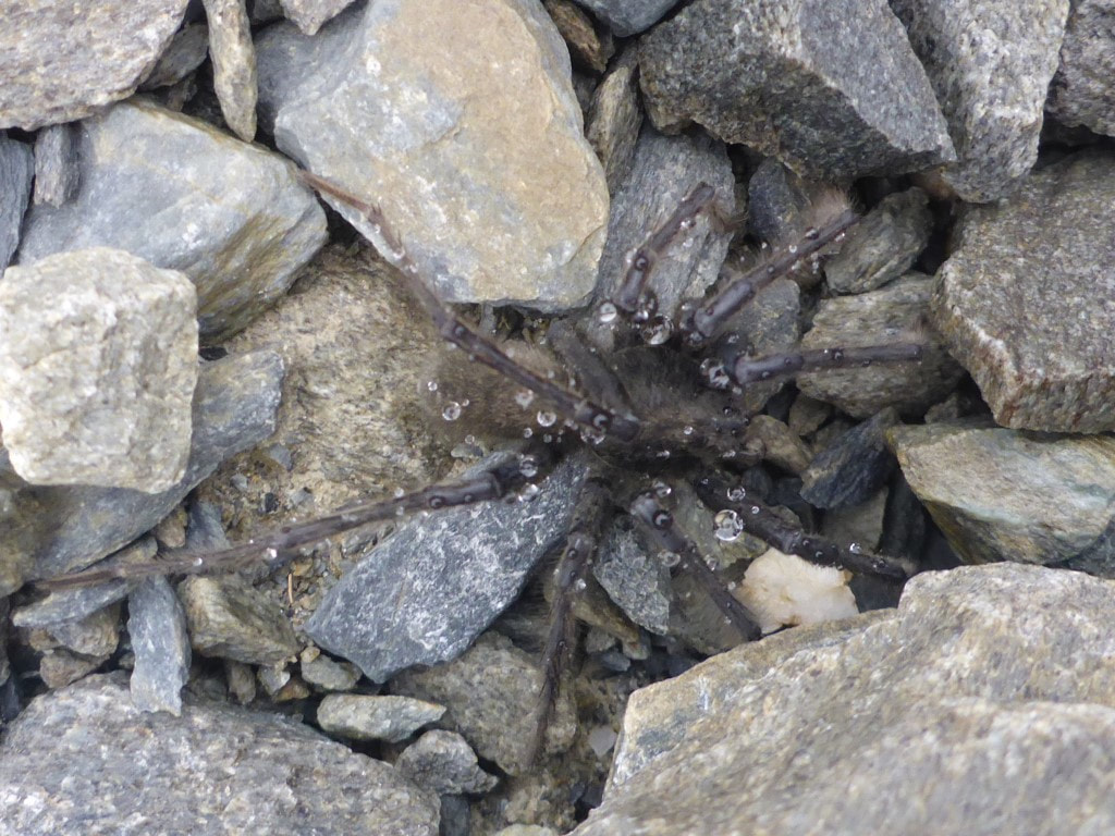 A few of these good-sized spiders around :-) 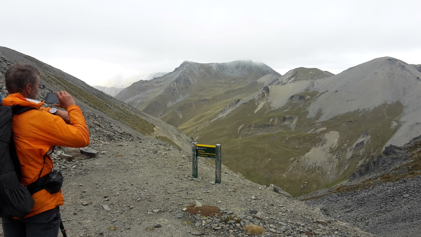 At last - Mt Martha Saddle at 1680m asl. And .... the weather had cleared a little! From the saddle it was a steep rocky descent on a bulldozed track to the valley floor. This was fairly tough for us as it is very hard on the knees - so not the fastest descent on record! Some younger legs had taken more direct routes down, cutting out some of the long zigzags, but the track was steep and rocky enough for us! DoC say 1.5-2 hours from the saddle to the hut - we took just over 2 hours. We stopped for a bit of lunch once into the tussock, then continued on alongside the Timaru River until reaching the hut. The toilet is the first thing you see from perhaps a km away, but the hut (below the toilet) doesn't appear until you are right on top of it. It had stopped raining but was alternating between sunny and cloudy. The hut is a quite new 6 bunk affair and is very comfortable inside - insulated, double-glazed and with bug screens on at least one window. Our biggest problem was trying to cool down - leaving the door open or staying outside inviting the invading airforce of sandflies to attack!! We had tossed up whether to carry on and camp further down as we have two rather long days ahead of us to get to Wanaka by the evening if the 23rd - however we decided to take the opportunity to rest instead and just accept the challenge of the longer days ahead! 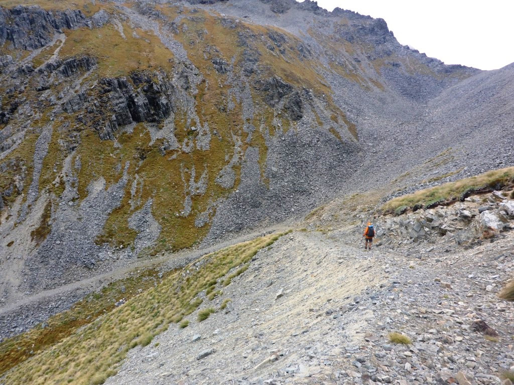 On one of the "zigs" (or maybe it's a "zag"?) not long after leaving the saddle! 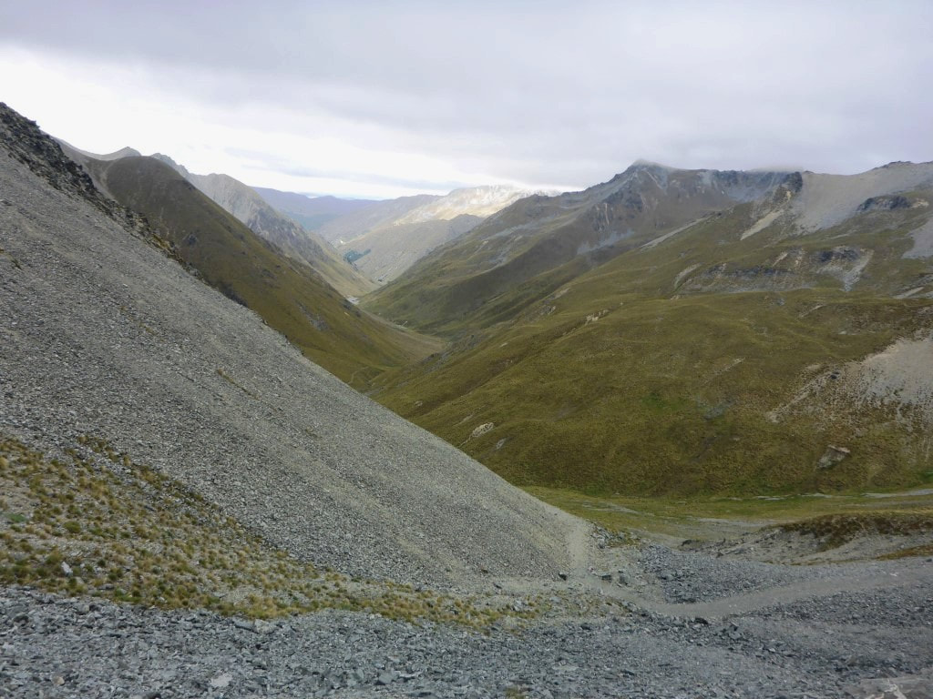 Wending our way down to the Timaru River valley. 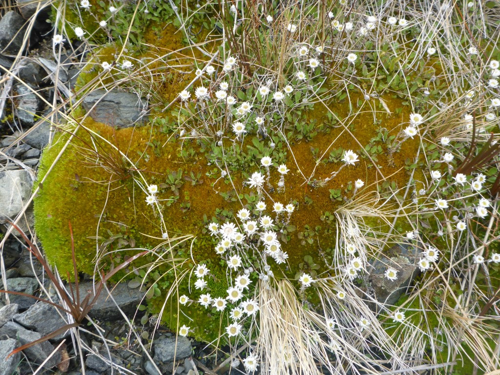 Moss and daisies :-)  More of the local flora.  Looking back at the last long traverse coming down - stopped for lunch after the track hit the tussock in centre of shot.  Water still shifts a lot of rocks down into the valley floor. 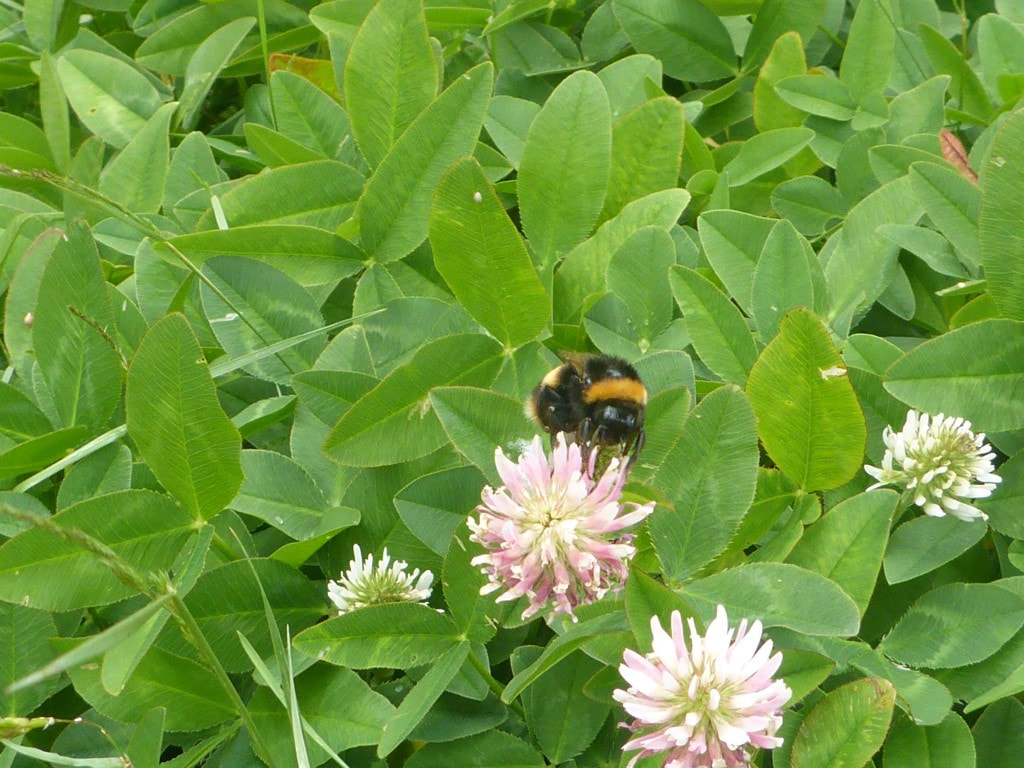 Walking through some boggy patches populated with strawberry clover - the bumblebees love it :-) We could see the tan-coloured toilet from a distance away (red arrow), but not the hut, which only appears down below at the last moment! 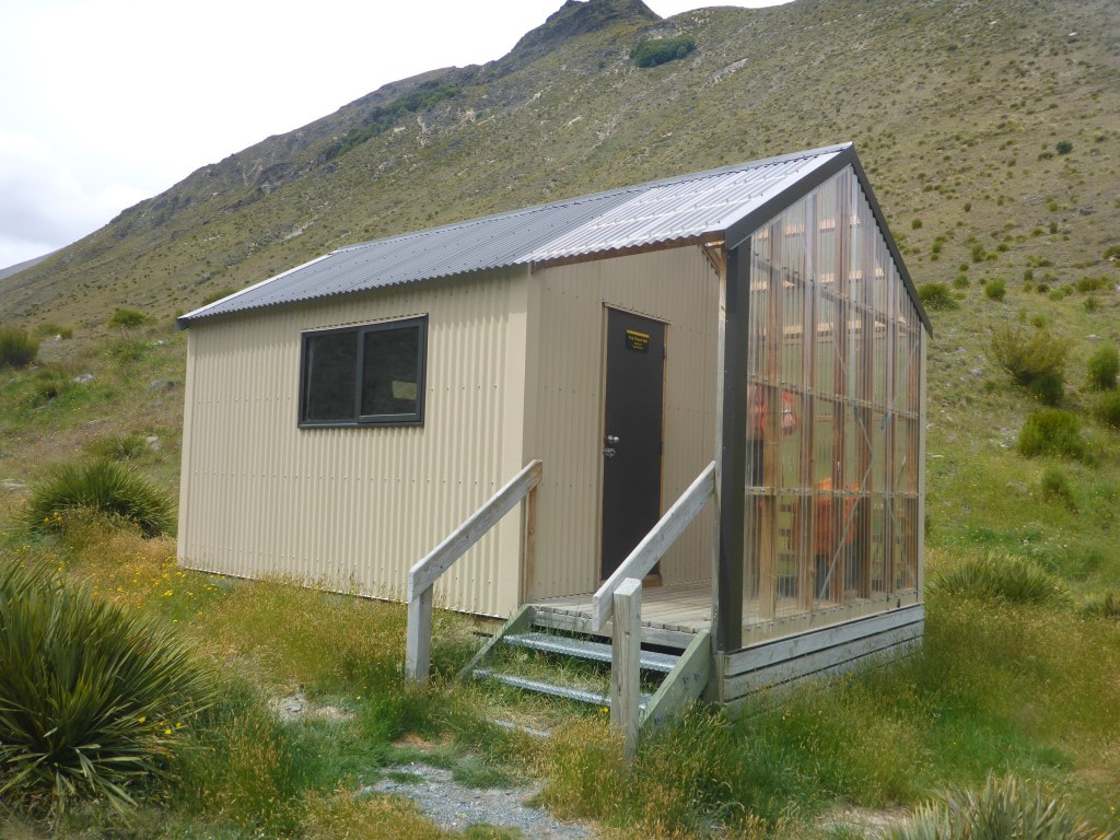 The hut from below - nice porch for drying stuff in - especially when you are the only ones there! 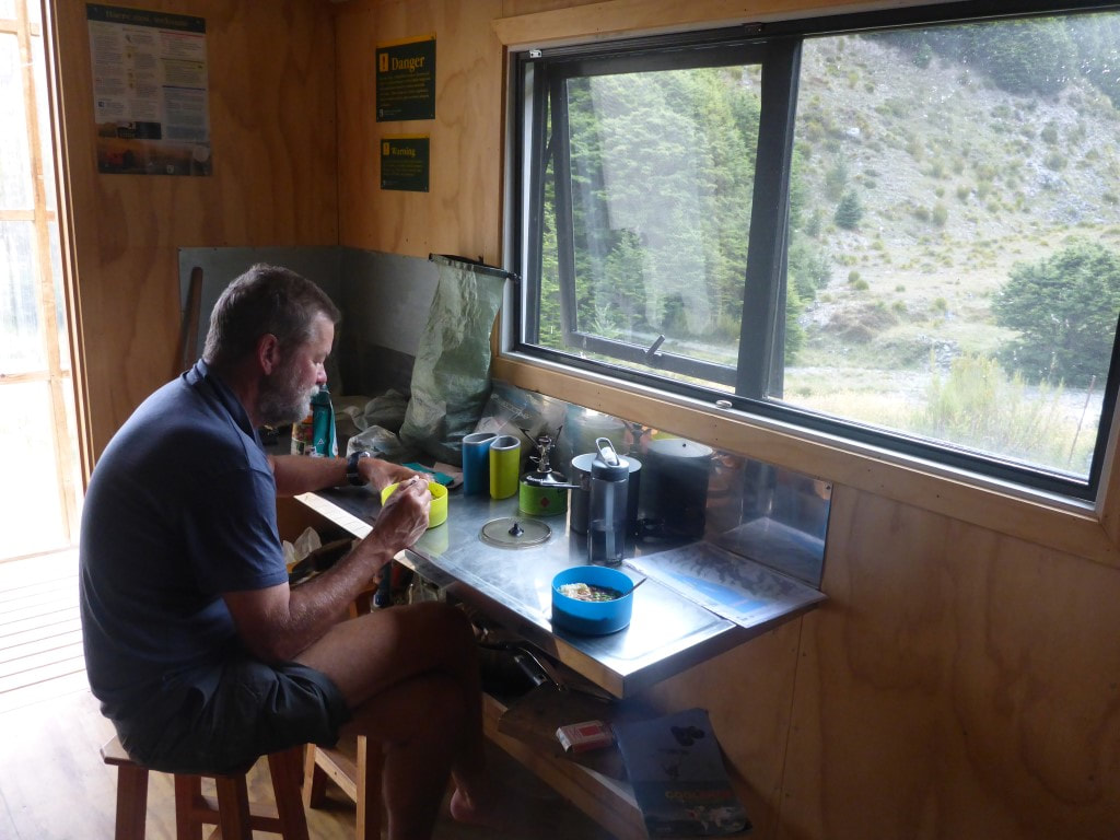 Dinner time - we had succumbed to leaving the door open to cool down at this stage. 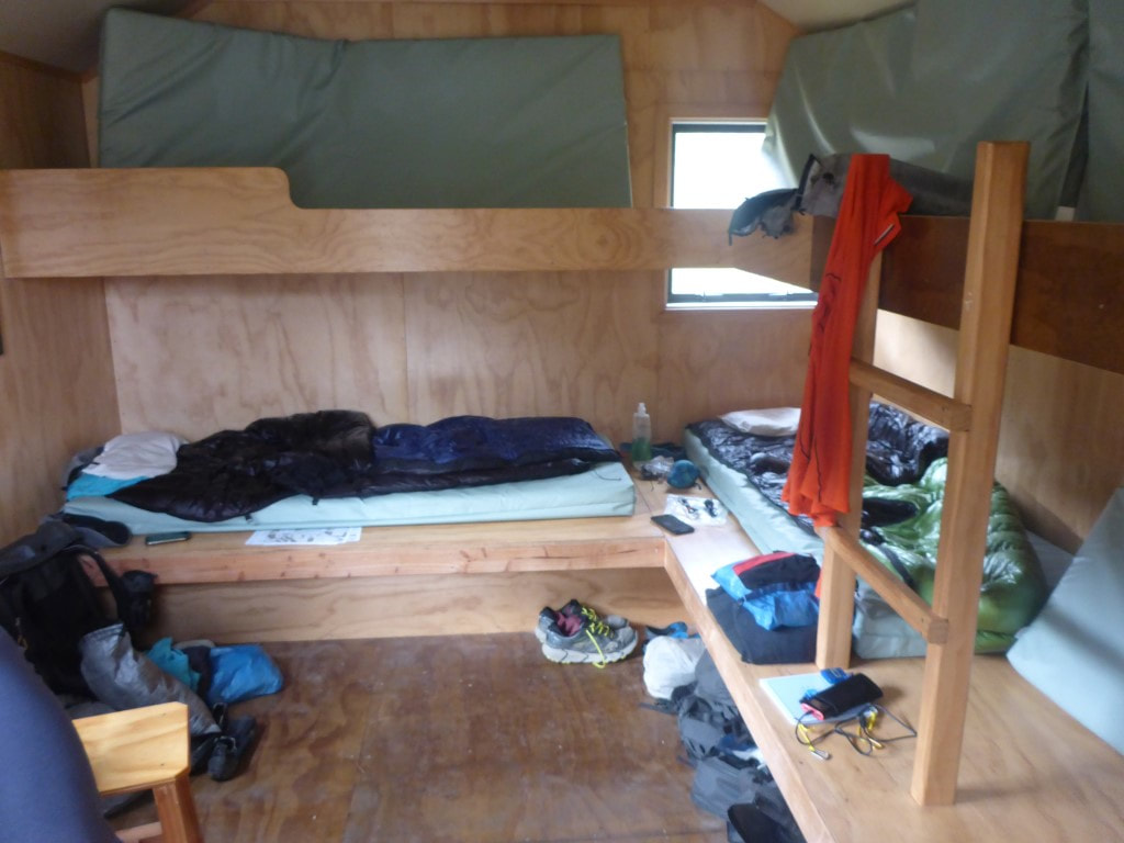 Shot from the door looking at the bunk area. Got up early to 3degC in the tent - very brisk - and had a hot drink with brekkie to ward off the cold! Ended up walking a whisker under 26km in 9 hours of walking. With stops included, it meant we stopped at our camp spot at about 1730. Still plenty of daylight left but the bodies suggested rest would be good! The GPS track for the day is here. We got underway at 0720, up through some lovely beech forest, including a couple of boulder fields to negotiate. Around 2.5km saw us at the treeline. The “informal campsite” mentioned in the notes was there but would have presented challenges for our tent. The best spot had a large dead beech suspended above it - a real “widow maker”! 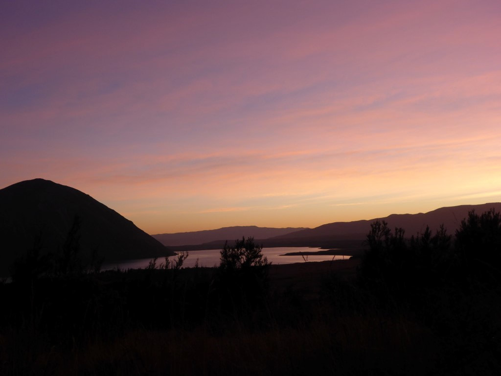 B capturing the sunrise at 0540. 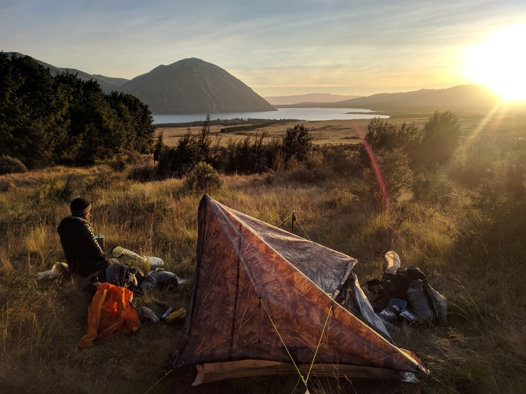 Breaking camp and having brekkie at the same time :-) 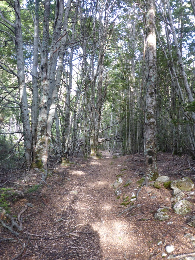 Up into the beech forest. 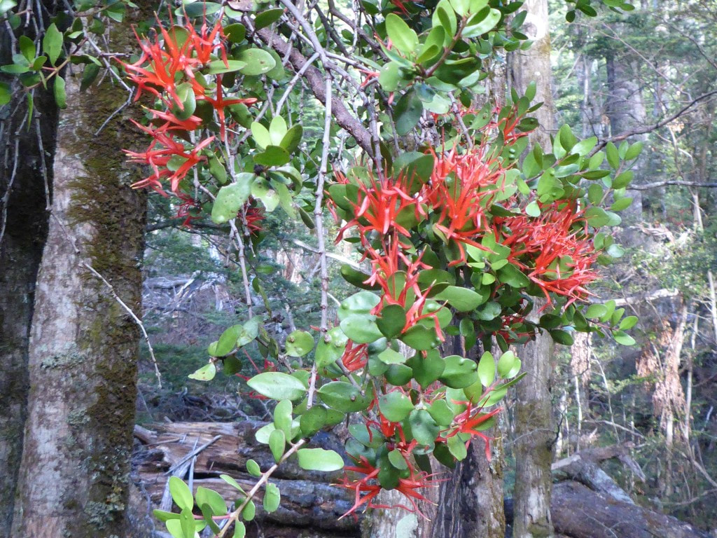 We couldn't always see into the tops, but this climbing rata was flowering closer to the ground. 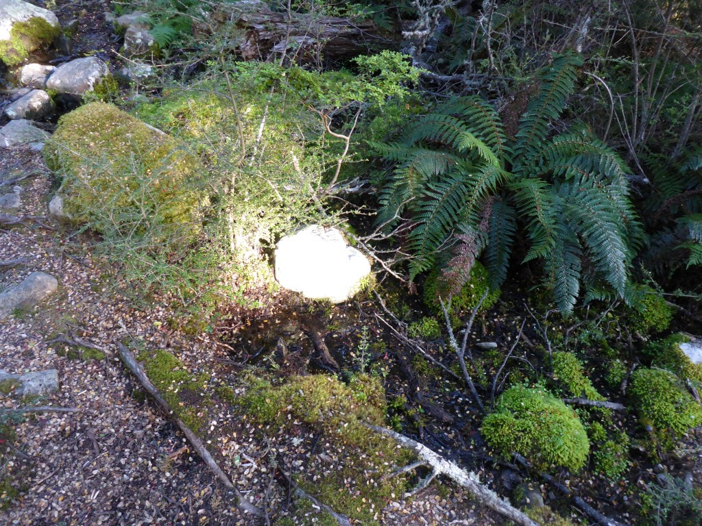 Lovely effect from the sun shining randomly on a white rock :-)  Then we got a view of a climbing rata higher in the canopy. 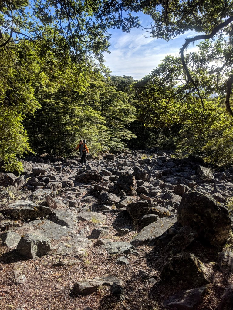 One of the rock fields we had to negotiate along the way. 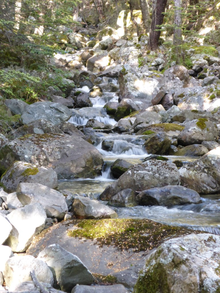 The epitome of a babbling brook tumbling down the rocky hillside.  This was the "informal campsite" on the left as we neared the treeline. Definitley preferred our spot at the bottom of the hill! 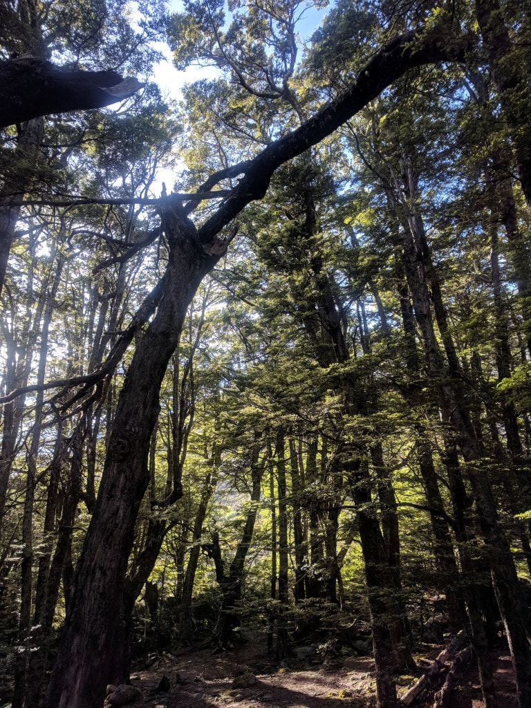 As noted in the text, this dead beech was hanging right above the best camp spot - wouldn't want to be under there. 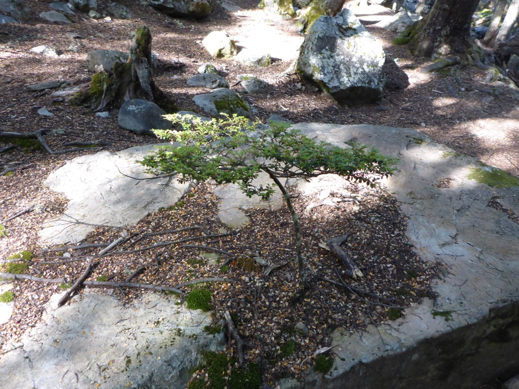 A bonsai beech right on the treeline!! Then it was out into tussock and ever upwards. After 2h15 we stopped for a break at 1420m asl, having climbed 720m in that time over 4.7km. We took it reasonably slowly today, having had a big day yesterday and having to care for our respective niggly joints (the sprained ankle is still strapped and bearing up OK on what had been reasonable going so far). It was only a little more climbing before beginning the descent into the East Ahuriri River. The descent was quite steep but manageable. Once we got down to the river the going was not the best for the first few km - rough tussock and spaniard interspersed with rocks and swamp. In many places the worn track was OK to follow, in other places it was easy to lose. This was quite slow going (and it involved river crossings as well). The going improved when the route diverted up above the river for a couple of kms - while it was mostly sidling, it was good going. Then we dropped back down to the river onto mostly flat ground, interspersed with the occasional boggy crossing! 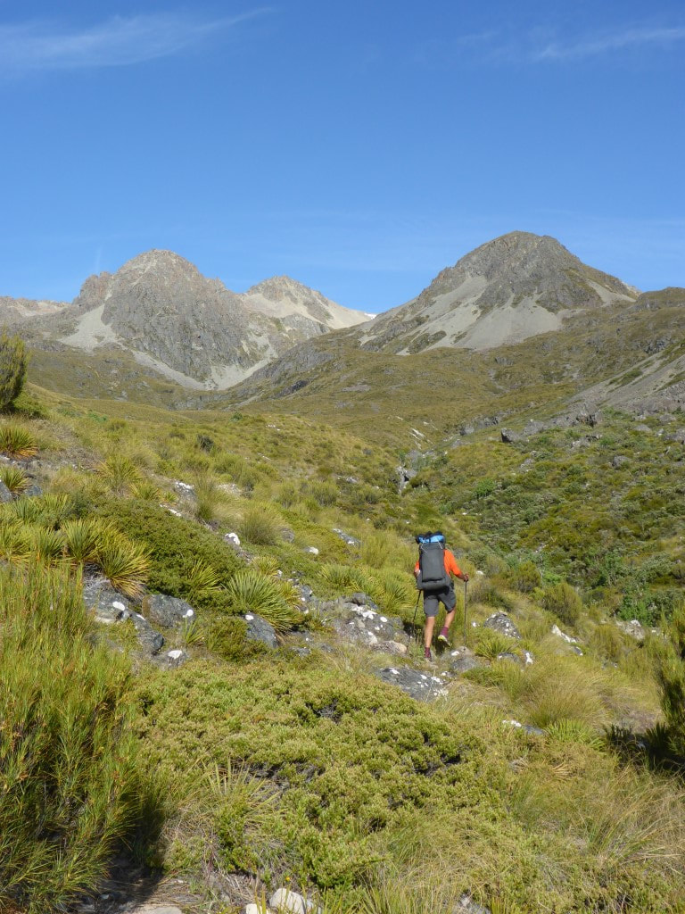 Now above the treeline.  Someone had gone to some trouble for this - but we have no idea why. Maybe advice to stop for a cuppa?  A spaniard "garden" - something to be avoided! 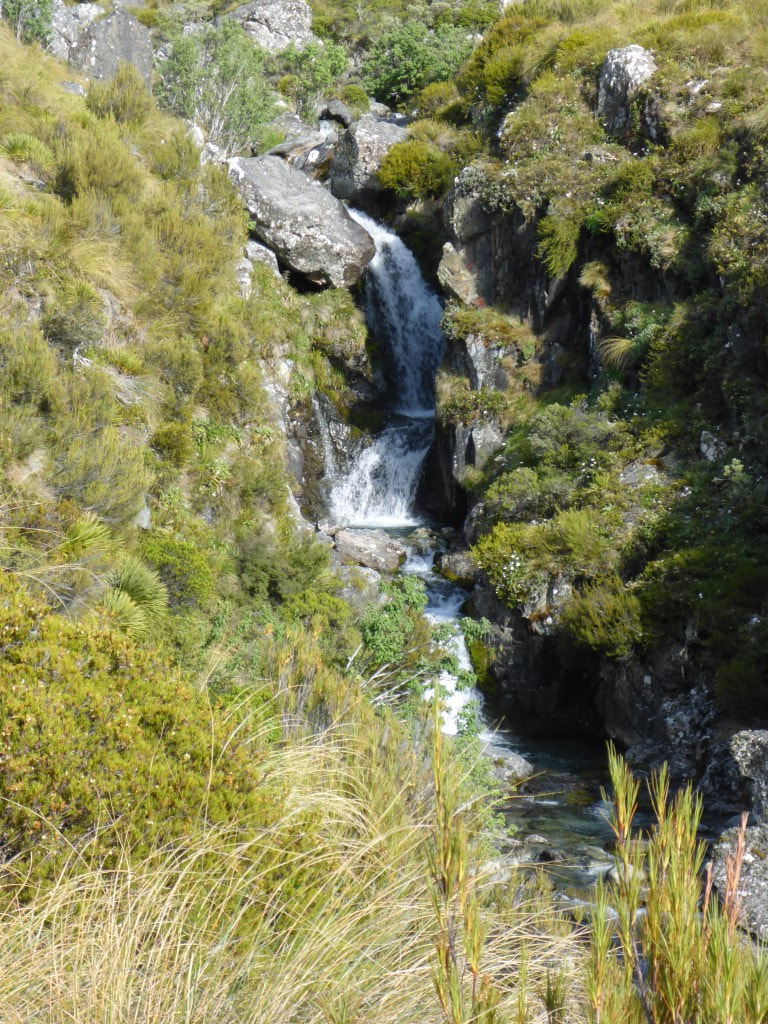 Pretty little waterfalls are abundant in this country. 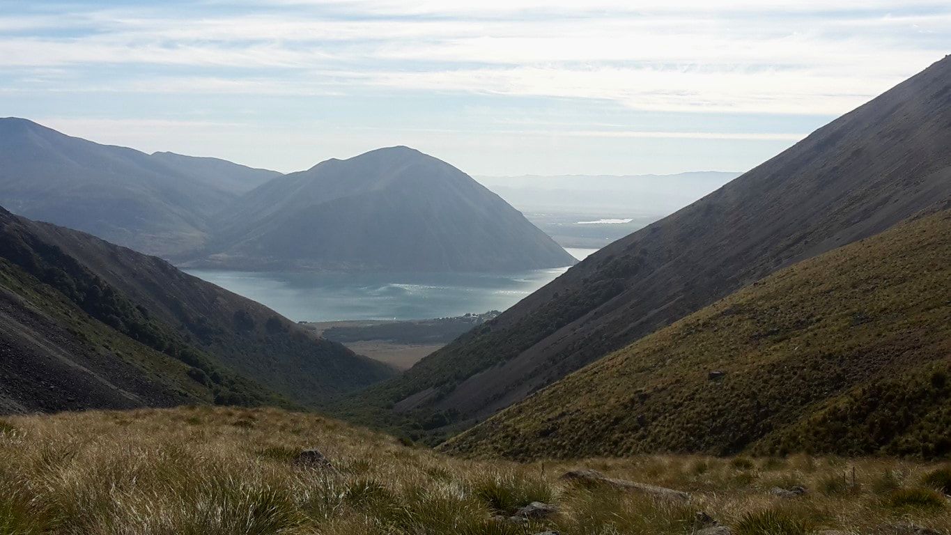 Looking back down to the treeline and to Lake Ohau - with the much smaller Lake Ruataniwha in the background. 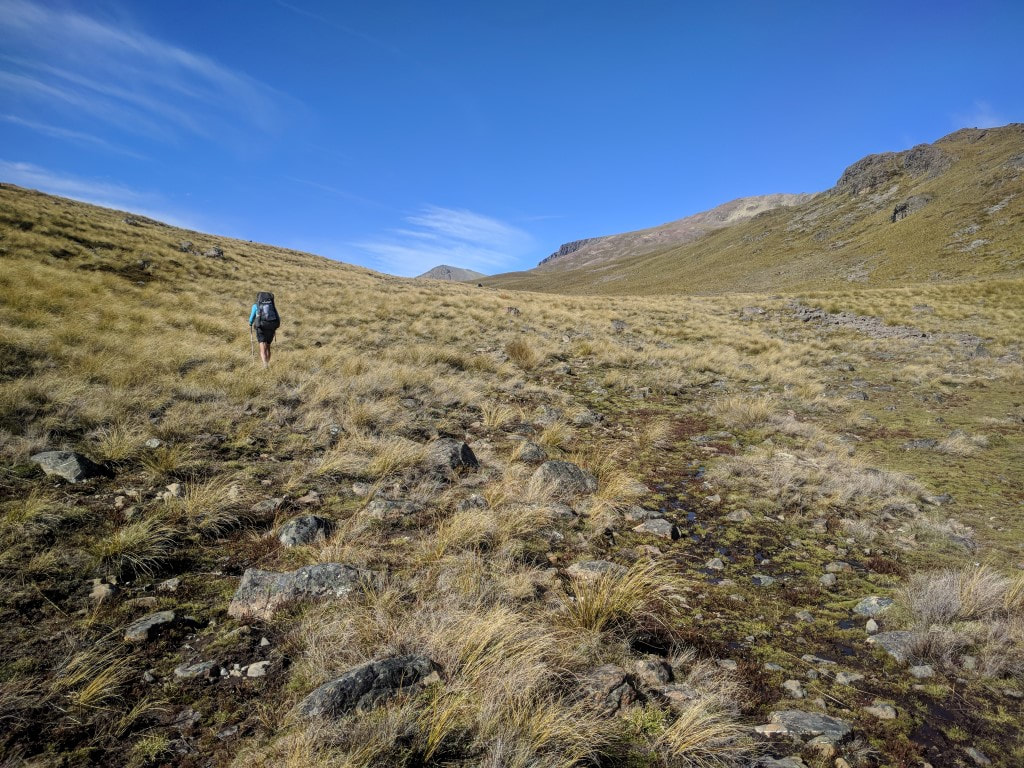 Climbing up towards the swampy tops. 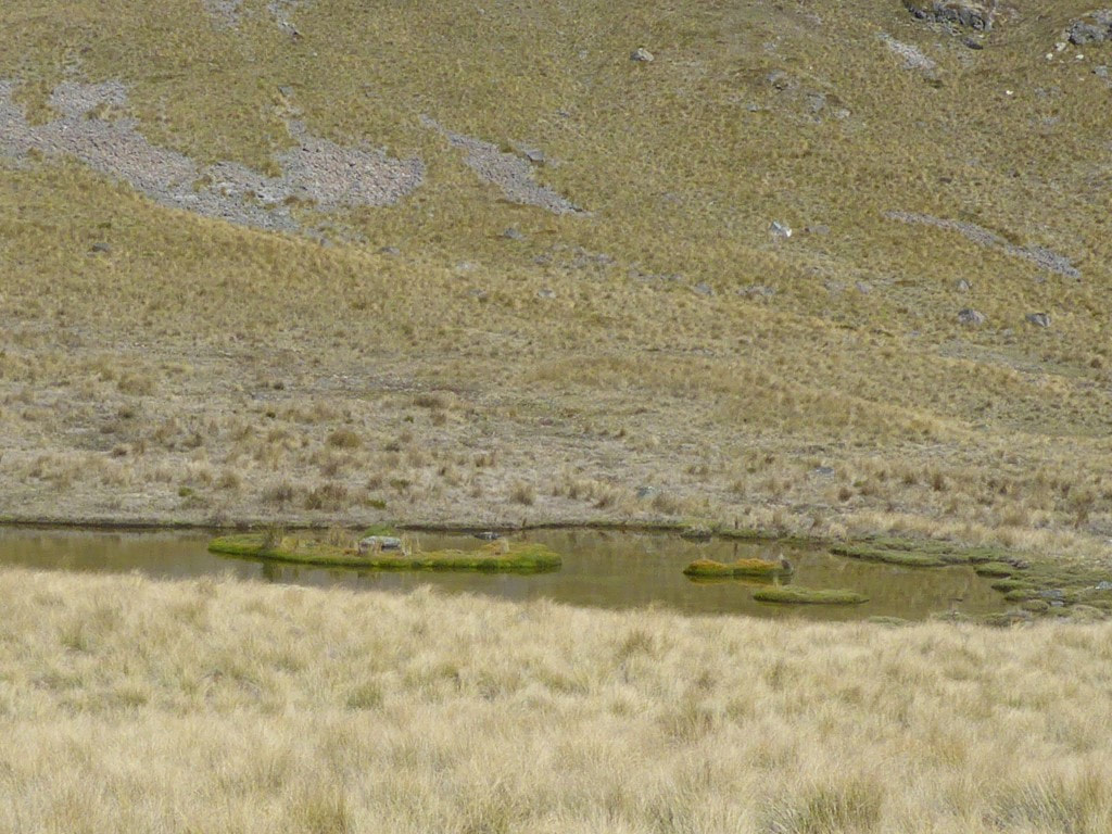 We tried to stay to the side of these swampy areas as we headed across to start our descent. 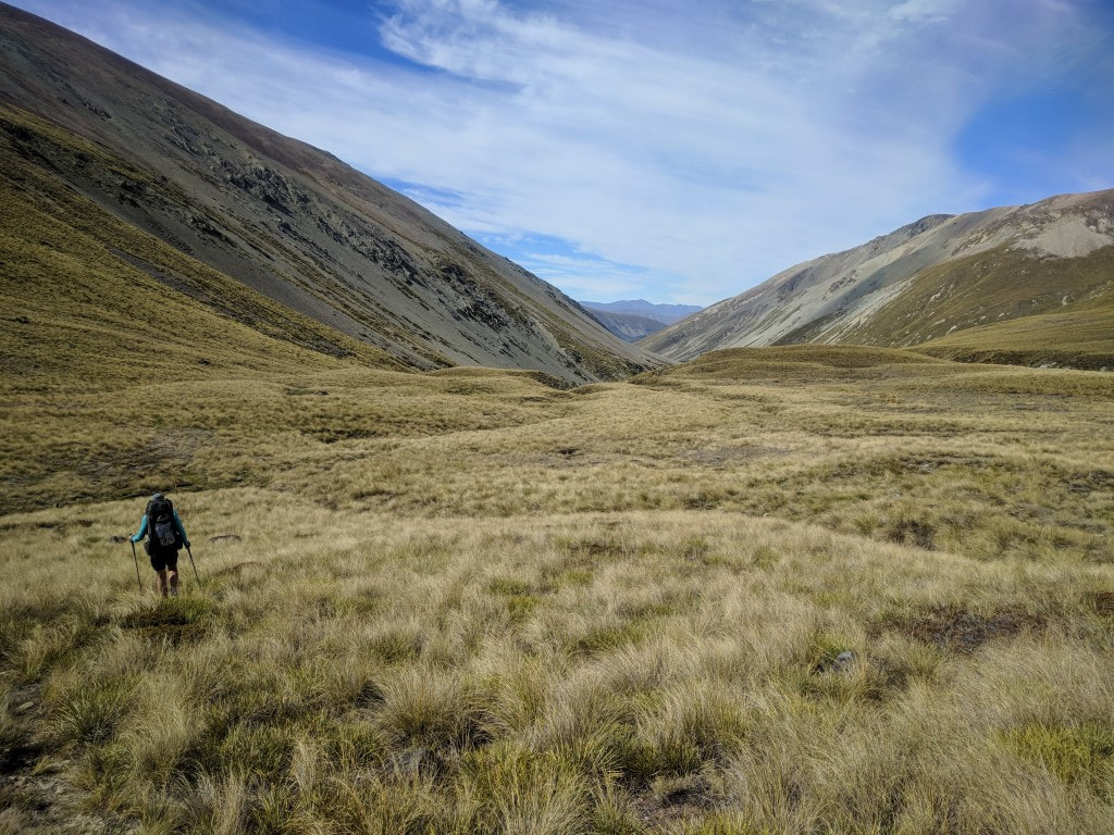 Heading in the direction of the East Ahuriri. 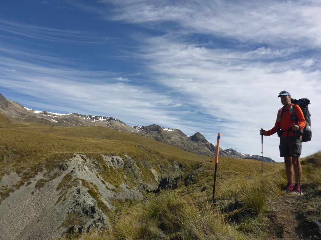 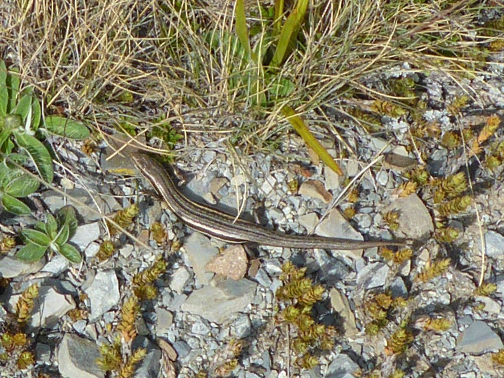 We saw literally hundreds of skinks in the tussock country through Canterbury and Otago - but not always easy to get a photo! 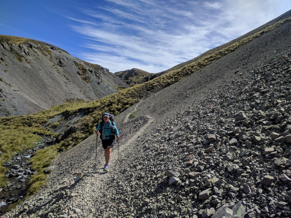 Seems like there is a scree slope every day :-) 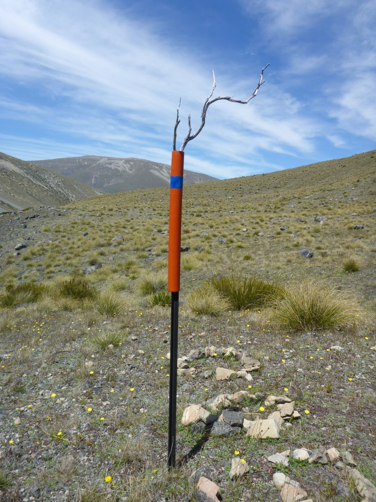 Someone couldn't resist livening up the marker pole :-) 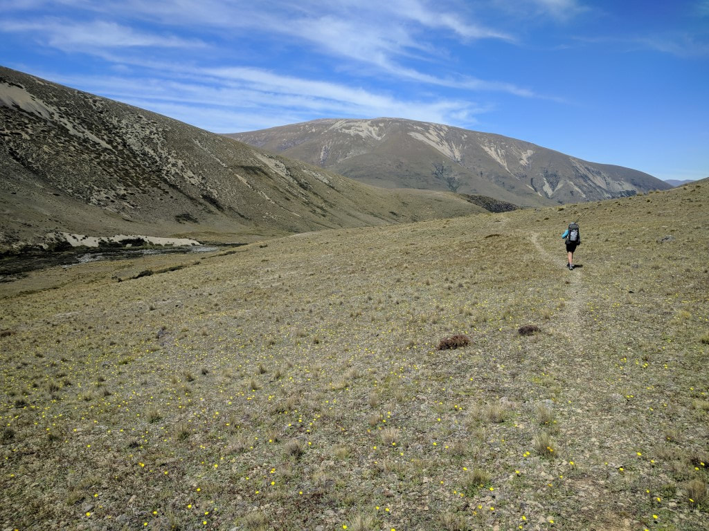 Heading down above the East Ahuriri. 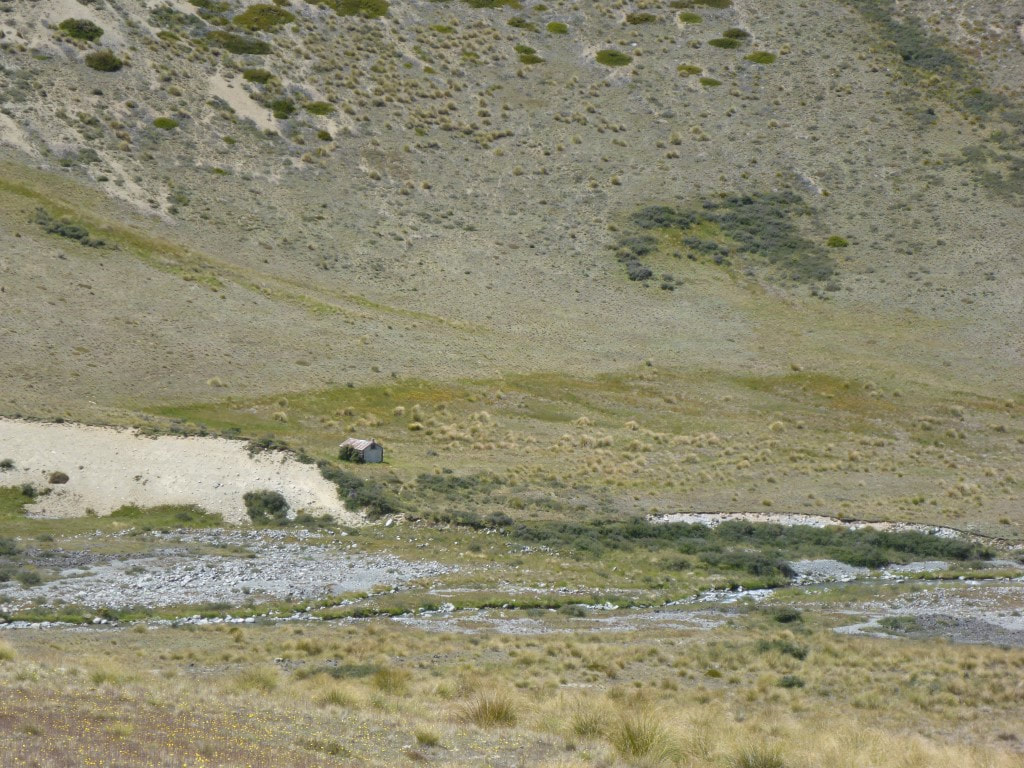 An old two-bunk hut mentioned in the TA notes. 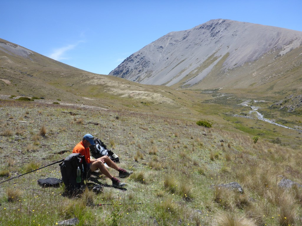 Nice setting for a break.  DoC appear to be spraying out exotic tree plantings since taking back this area. Finally it was a 3km straight run across rabbit-ravaged pasture past pine trees towards the Ahuriri River. From well above, we got a chance to survey the river and spot a likely crossing place - very near to where the large orange triangle is on the other side. We scrambled down to the river and got our phones etc into waterproof bags before setting off together into the river. The deepest part didn't quite reach my crotch so wasn’t too bad. Last I had looked at the river flow data for the Ahuriri at South Diadem - the closest monitor - the flow was about 14 cumecs and dropping. So this is very doable at that flow. Belinda, being somewhat shorter, did get a little wetter than me :-) 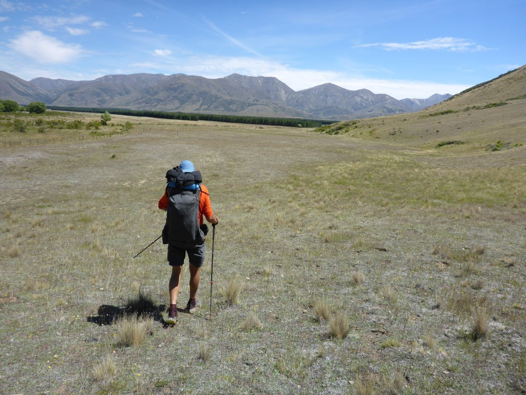 On the flat run down past the pine trees to the Ahuriri River.  Looking NNW across rabbit diggings up the Ahuriri Valley (to the left of the hill in the centre).  Heading down the side of the pines - evidence of the rabbit population is clear to see!! 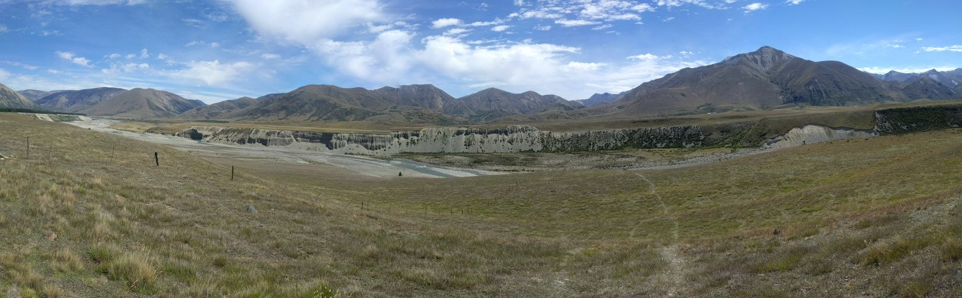 Panorama looking across the Ahuriri River. 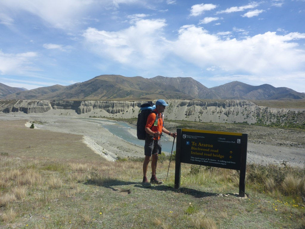 Ireland Rd bridge is an alternative if the Ahuriri is uncrossable - not an issue for us today. 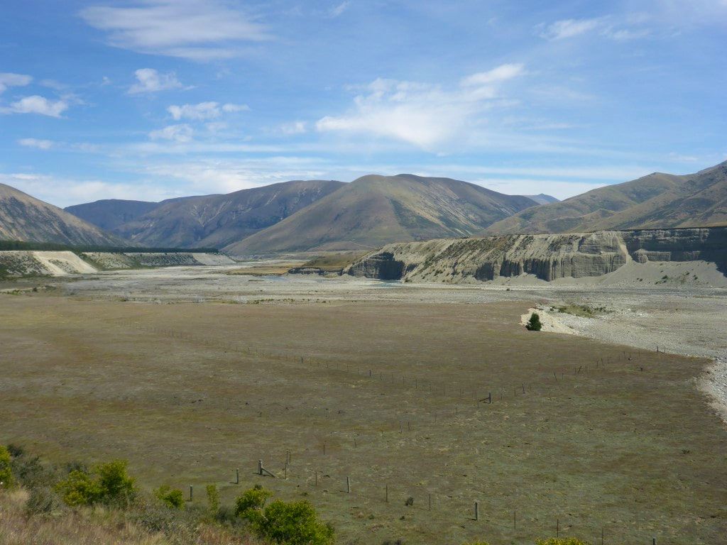 Looking south, downriver, in the general direction of the bridge. 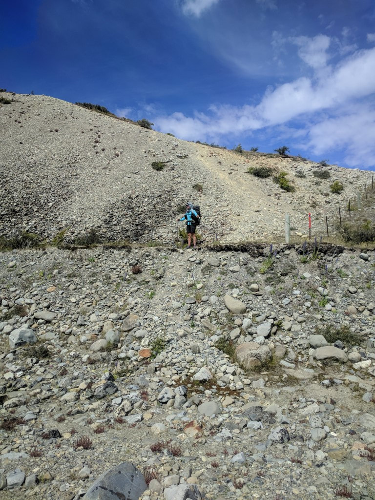 B coming down from the eastern side to the riverbed. 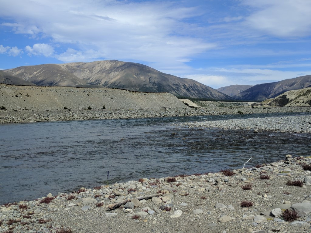 Safely across! We crossed in two stages. The deepest bit was the first part in the background. Then it was out and across to an incredibly steep scramble up a very loose shingle face to get up the other side. Just about the gnarliest little climb (although it was pretty short!) we have had to date, I think - hard top make forward progress at times because of the loose nature of the surface. Once up onto farmland (Longslip Station) we headed the 1.5km our so to Birchwood Rd. Just after we started on the track, just on the other side of a fence from a farm road, a young girl on a small quad bike came from a nearby house and wished us a Merry Xmas as she went past :-) We had decided to camp a little way up this next section of track and settled on a nice spot about 1.2km from the road, just after you drop down towards the river. This is farmed, so filtering water was the order of the day - there are cattle here and we had some wandering down the trail past the tent this evening! A wise decision to stop when we did as we have had a couple of longish days now and also have a 980m climb tomorrow as part of a 21km day to Top Timaru Hut (hopefully)! 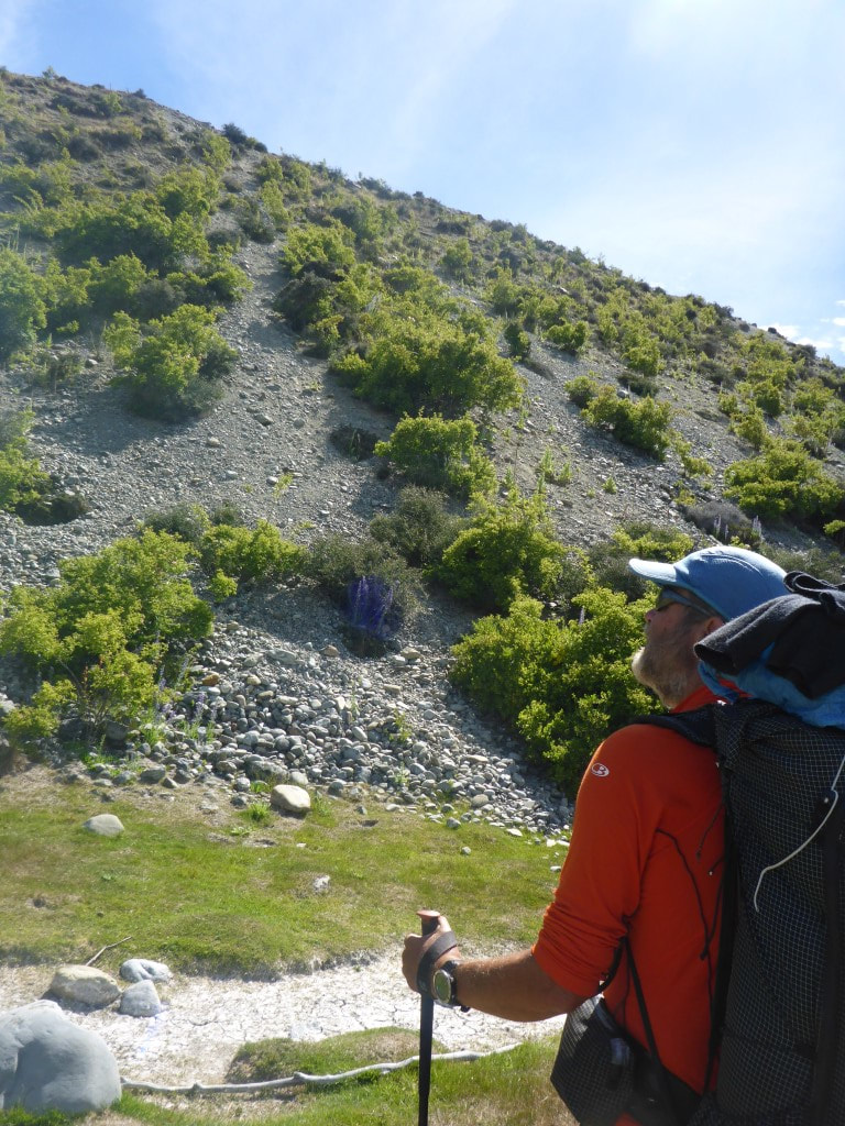 Yep - that's the sucker we have to go up!! 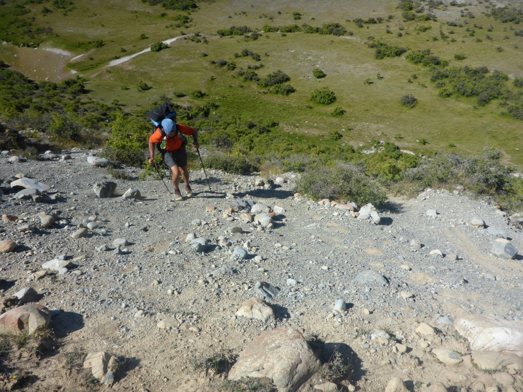 Me nearing the top after a valiant struggle :-) 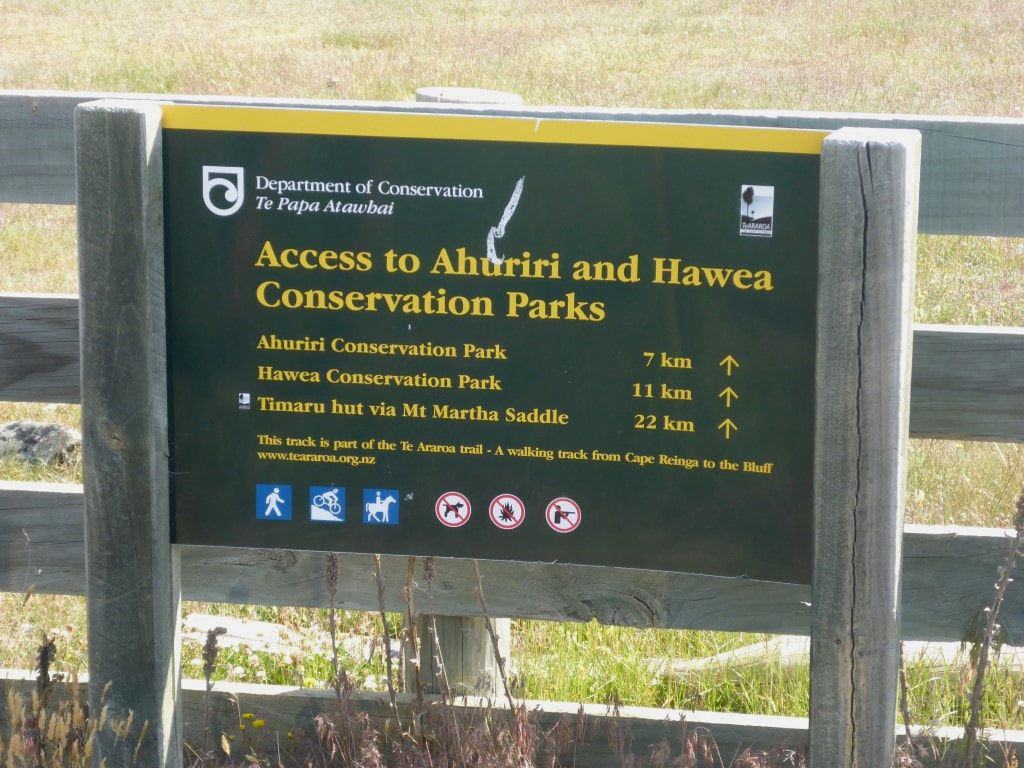 Sign at Birchwood Rd. 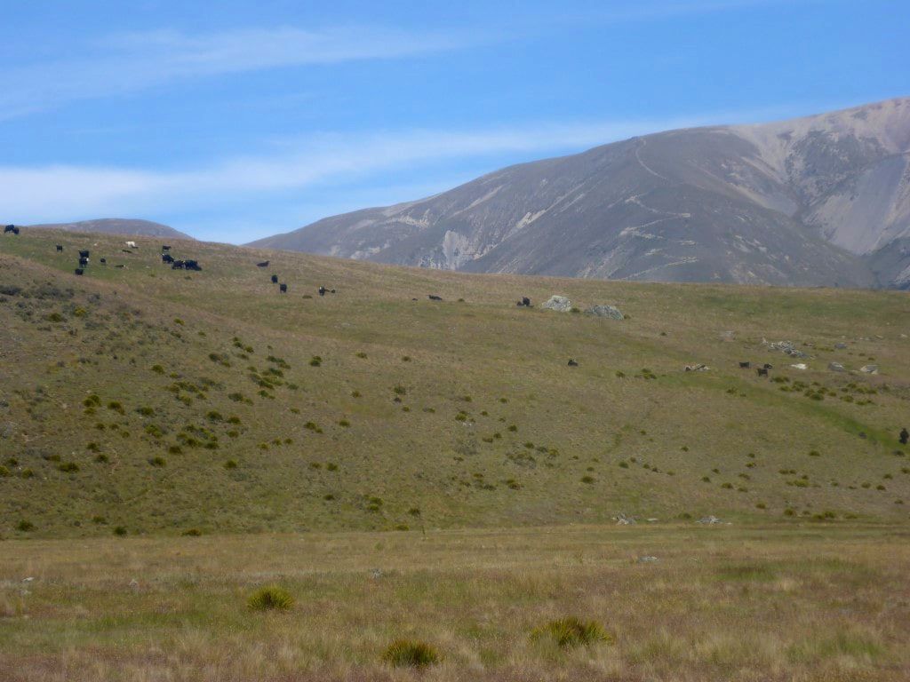 Cattle grazing to our left as we neared our campsite. Actually the same mob as the ones that wandered past our tent later in the evening. We left our accommodation just after 0715 - finally stopping at 1730 after almost 38km in 8.5 hours walking. We made it to Freehold Creek just where the trail turns and heads up the creek. We had thought we might go up another couple of kms to what the TA notes refer to as an informal campsite just below the treeline. However we bumped into 4 kiwis who had just come down and they said they couldn't really find it - so we decided to camp where they were, rather than starting uphill into the beech. GPS data for the day is here. We set off out of town alongside SH8 and headed over the canal outlet by High Country Salmon. Then it was a right turn heading up alongside Lake Ruataniwha (not that we saw even one taniwha!) towards the Ohau A power station. Then it was on up the Ohau River to the control gate at the base of Lake Ohau. All this time was basically on or alongside metalled 4wd tracks and the scenery can best be described by the photos (not the most exciting always). 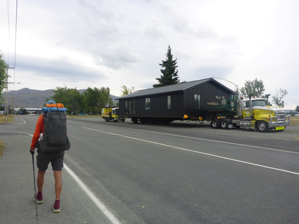 Walking through Twizel in the a.m. - house parked up for the day. 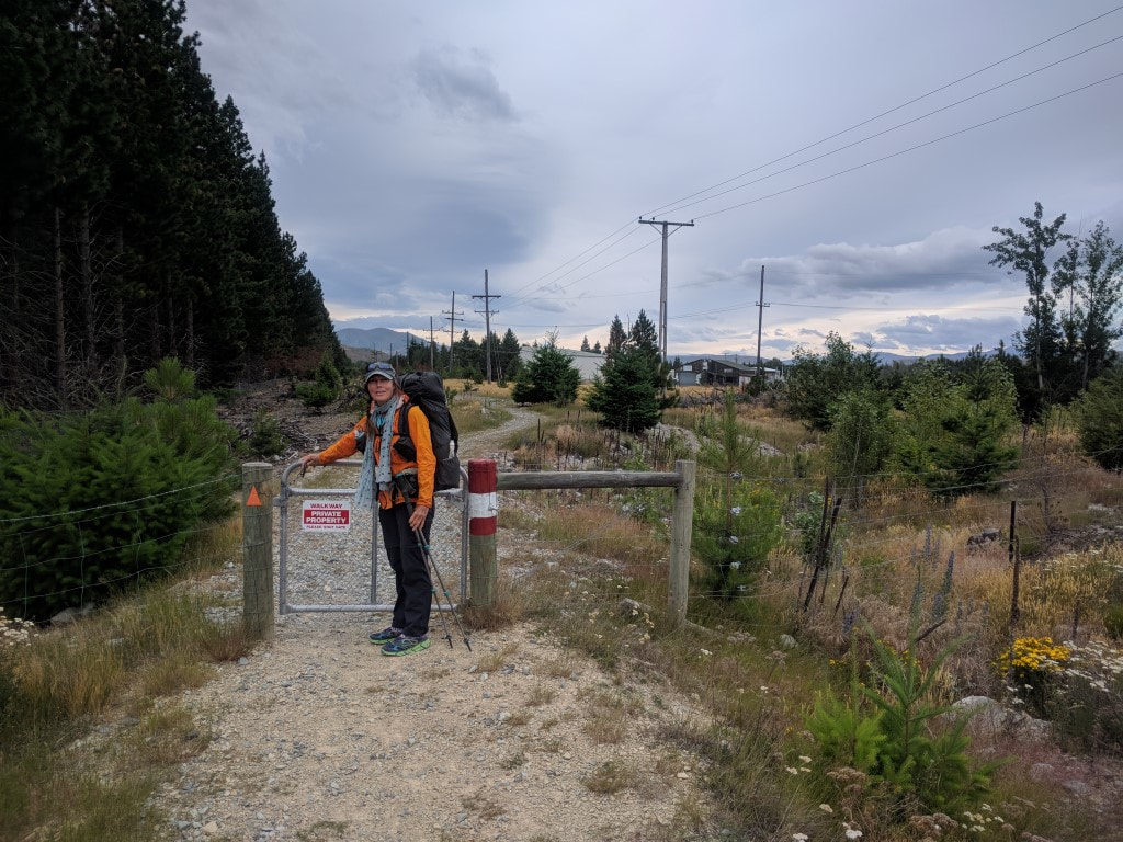 Leaving Twizel on a track through private land that gets you off SH8. 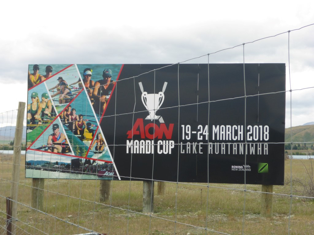 The local Lake Ruataniwha is known for rowing - especially the Maadi Cup (NZ high schools rowing championships). 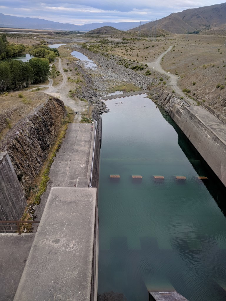 Crossing over the Ohau Canal on SH8. 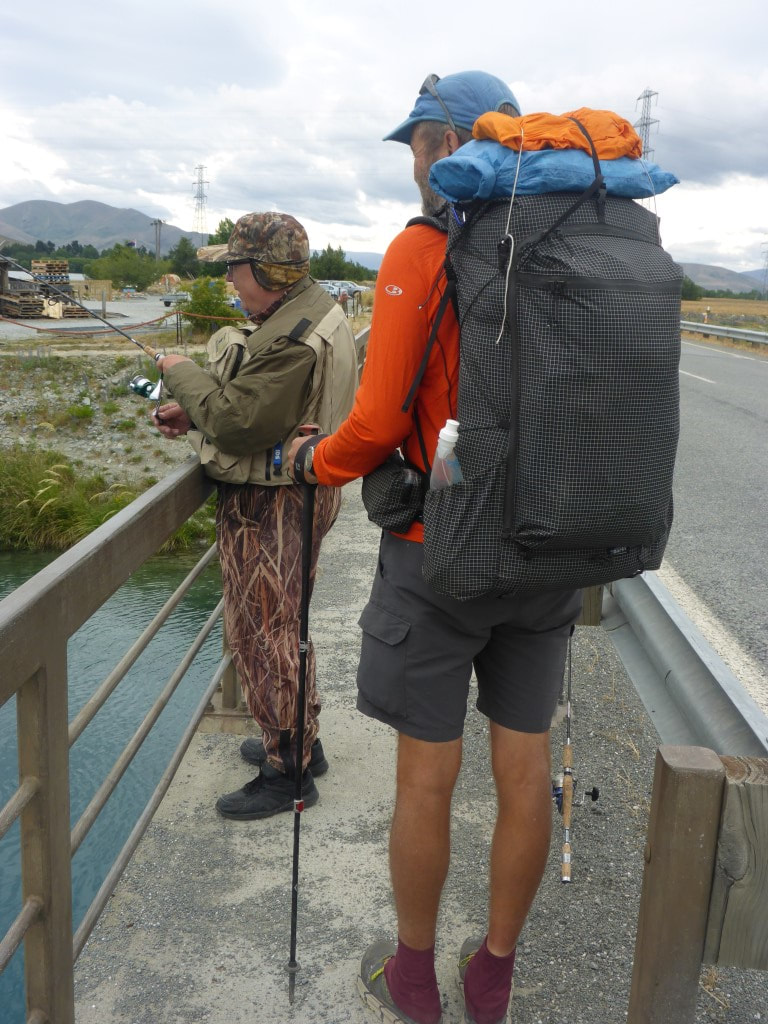 Chatting to a fisherman on the bridge. 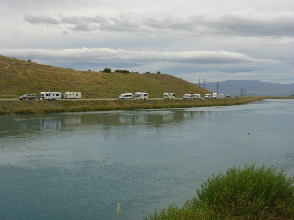 Plenty of fisher-people. 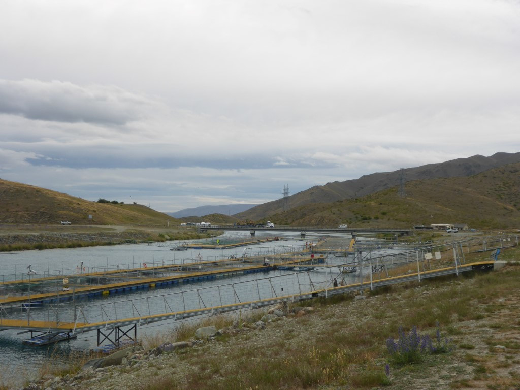 Looking back at the bridge and the fisher-people. This is the reason they are here - plenty of large fish downstream of the salmon farm cages!! 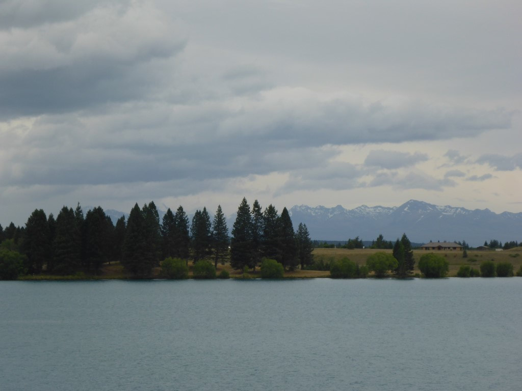 View across Lake Ruataniwha. 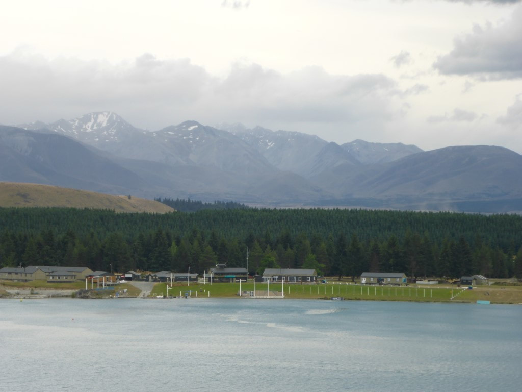 The rowing complex beside Lake Ruataniwha. 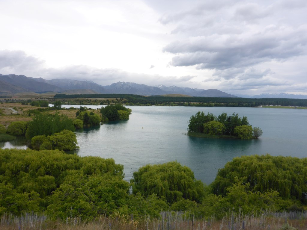 Some nice scenery along the way. 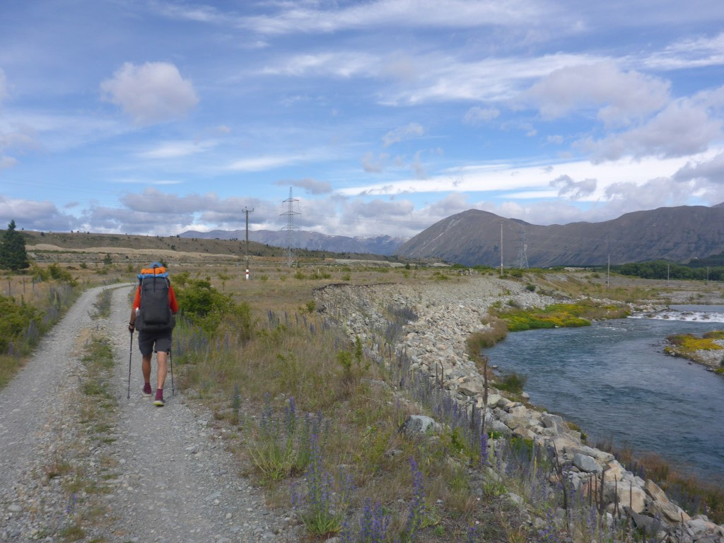 A lot of walking on this sort of track alongside the river. 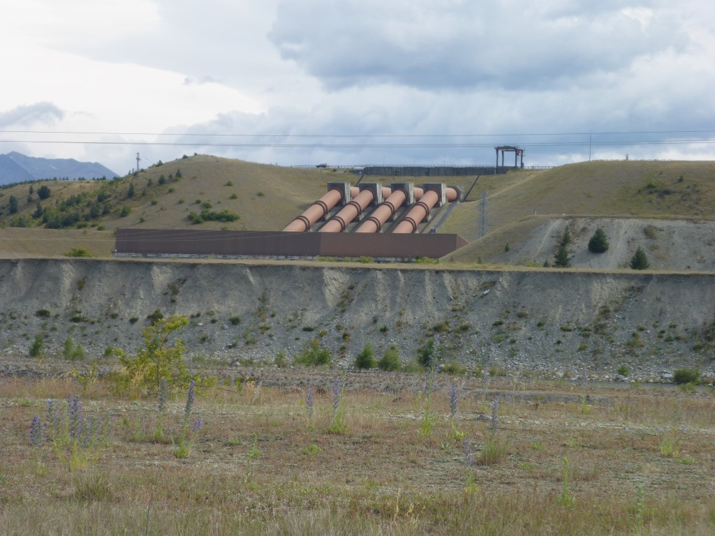 Penstocks for the Ohau A power station. 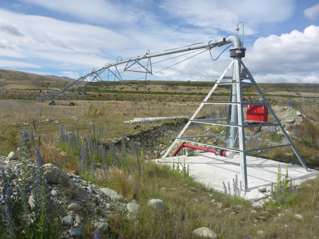 Irrigating rocks! Not sure why they hadn't done the land development before installing the irrigator? 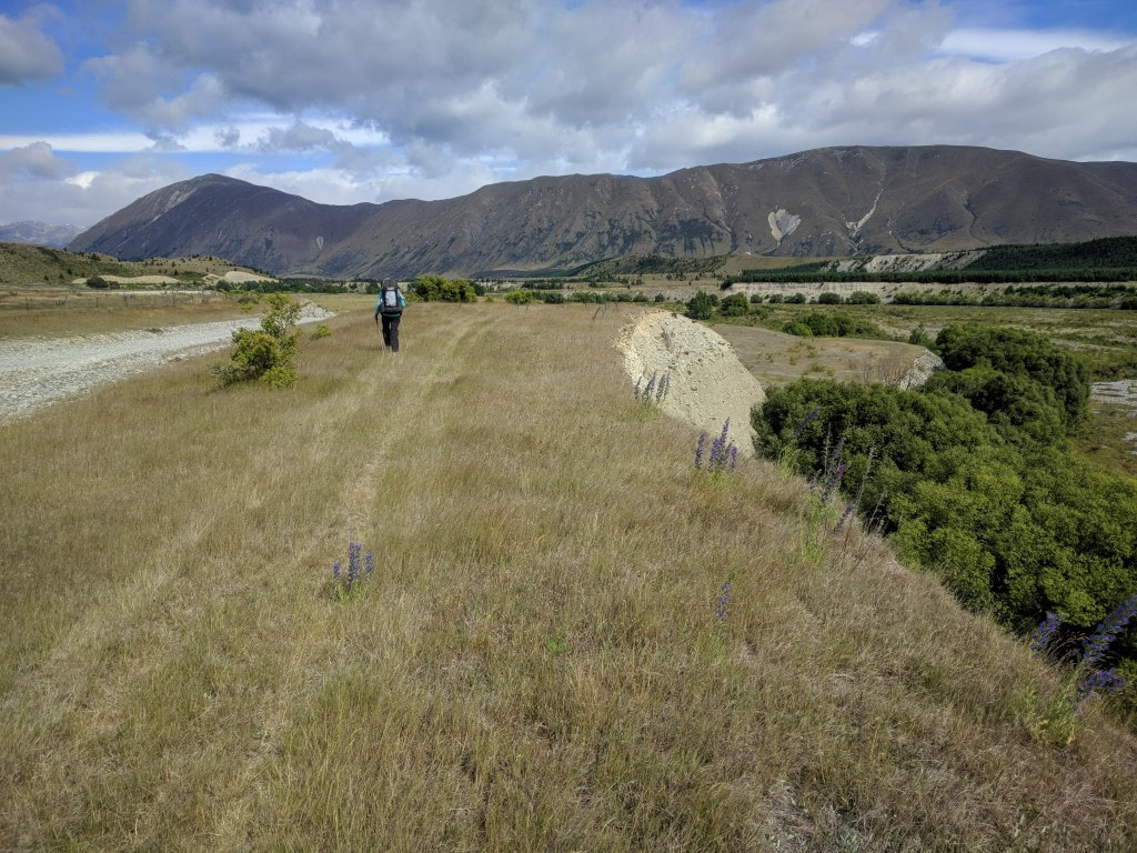 A steep drop down to the river bed here. 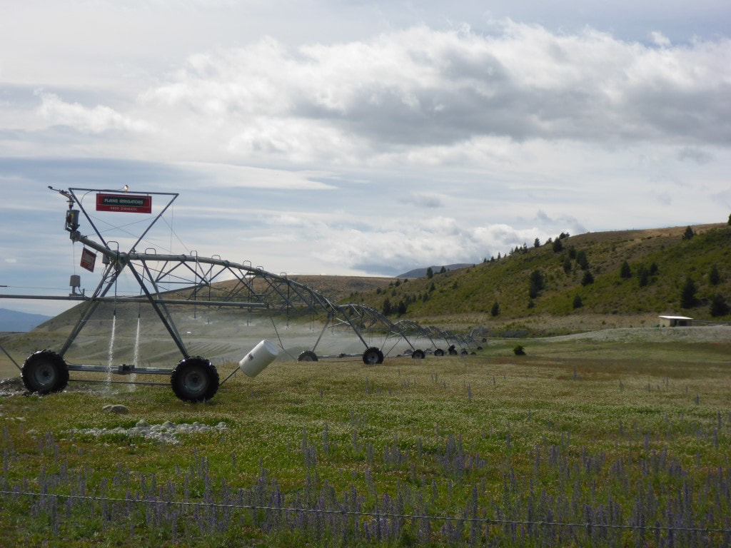 This irrigator was working - on a crop of clover. 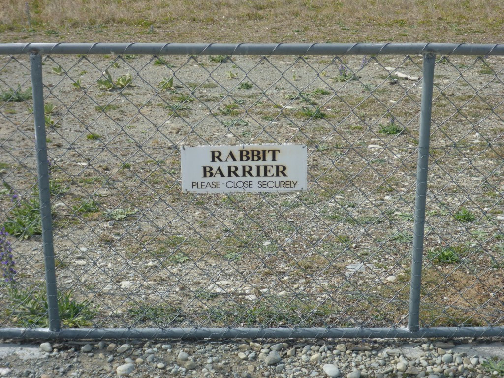 Always trying to keep rabbits out. 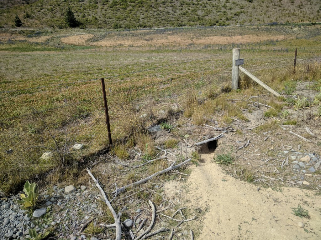 But man, can those rabbits dig deep!!  Rabbit poo was everywhere!  Very hard ground results in the post rammer causing considerable damage to the post.  Prettier views as we approached the hills.  Down through some pine trees.  And stopping for a break in the shade of the pines :-) 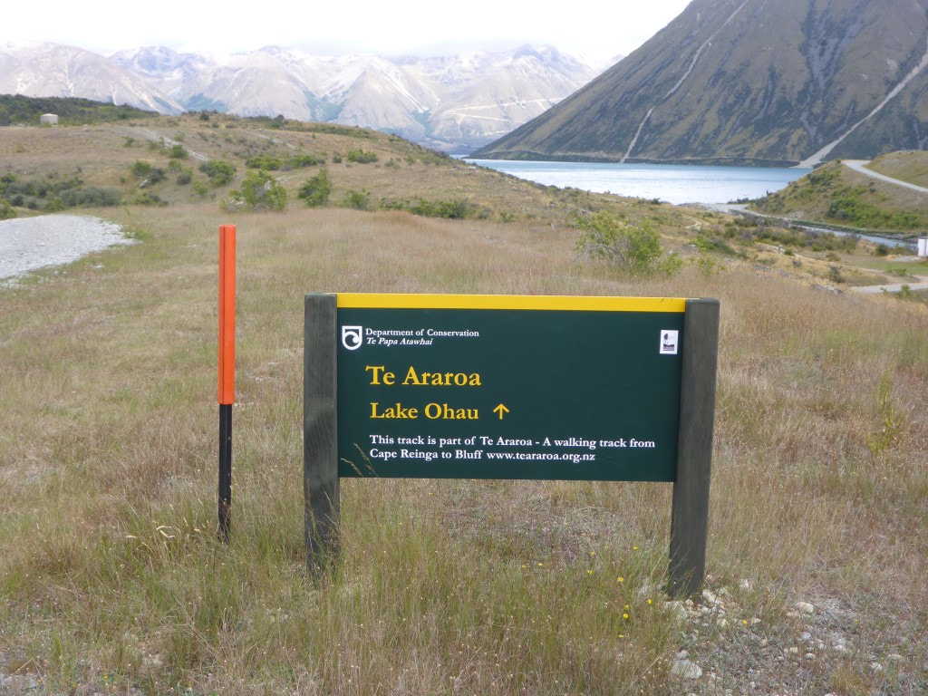 Approaching the weir at the outlet of Lake Ohau. 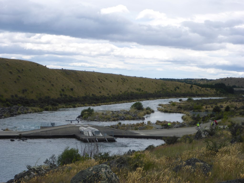 Looking back at the weir - this is where the cycle trail rejoins TA (note cyclists centre-right). At the weir we rejoined the Alps to Ocean (A2O) cycle trail, so the track became a nice smooth, lightly gravelled jaunt besides the lake for 9km! It was windy pretty much all day again today. In this part of the country it seems easiest to just refer to every wind as a headwind!! Had a couple of breaks earlier today, before stopping for lunch at 1300 just off the track beside the lake, after covering almost 22.5km. While we were sheltering out of the wind having lunch, about half a dozen cyclists went by - so the trail is used! 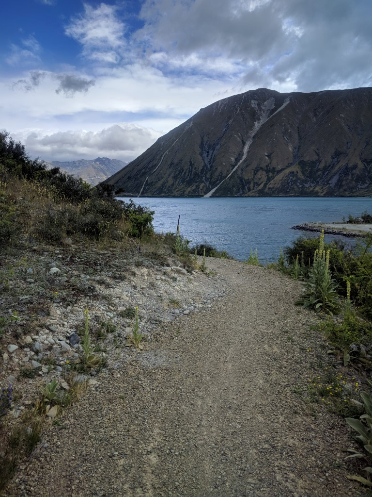 As always, the track is good underfoot when it is a cycle trail 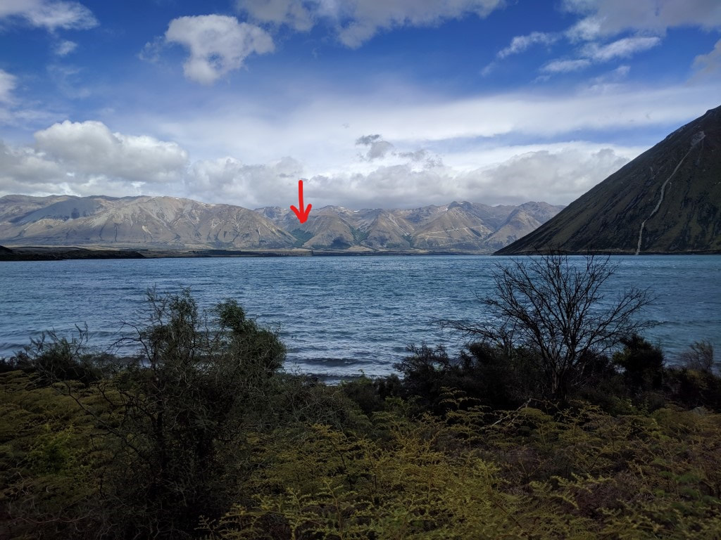 Walking around the base of Lake Ohau - looking up to where we are headed. The arrow points to the bit of bush we were to camp at the base of tonight. 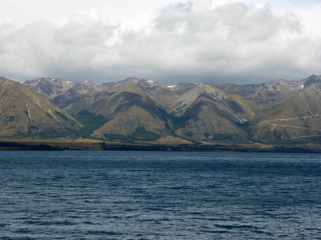 A close up of the target for tonight (bush in left-hand gully). The zigzag road to the right is actually the access road to the Ohau skifield! 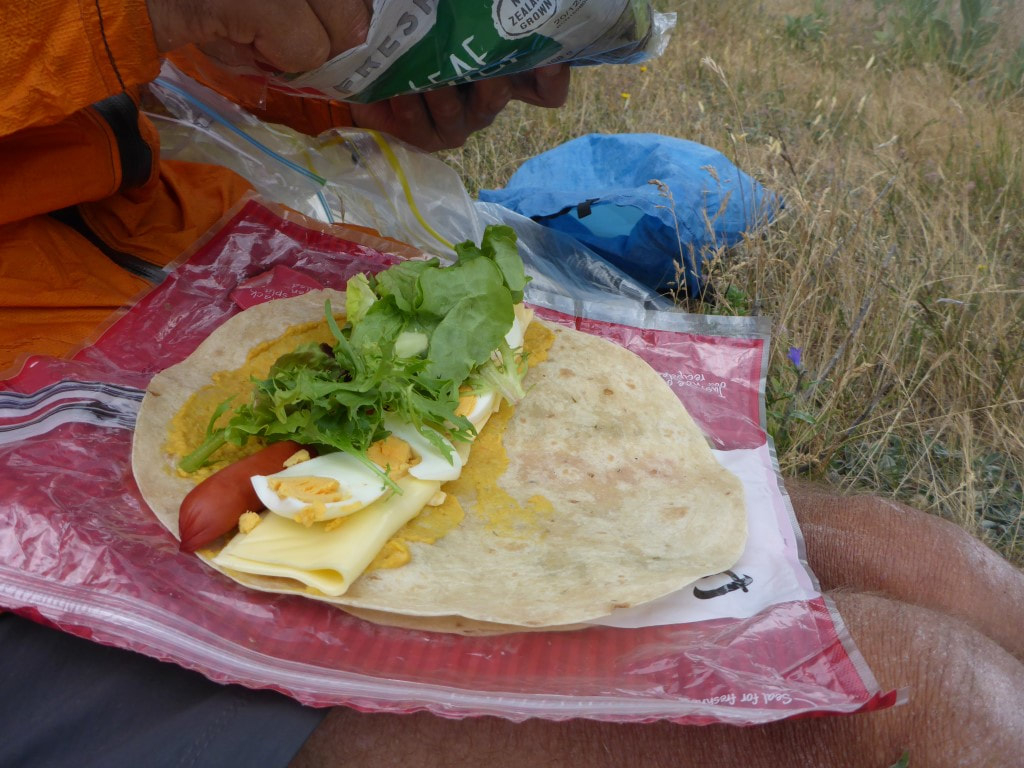 Lunch :-) Lettuce will normally keep for two days and hard-boiled eggs also. After that lunch becomes more austere!! We were back onto an asphalt road for a little while for the last bit into Lake Ohau village. Stopped at Lake Middleton campground, just next to the village, as they had toilets there, before walking about 50m to look at friends’, Cheryl and Malcolm, building site in Lake Ohau village. Great to see progress in the form of the concrete pad being poured recently. We could have stopped there but it was still only 1530 and we wanted to make more progress. We sent Cheryl and Malcolm a photo of us perched on their concrete slab - will have to come and visit when they are down here! 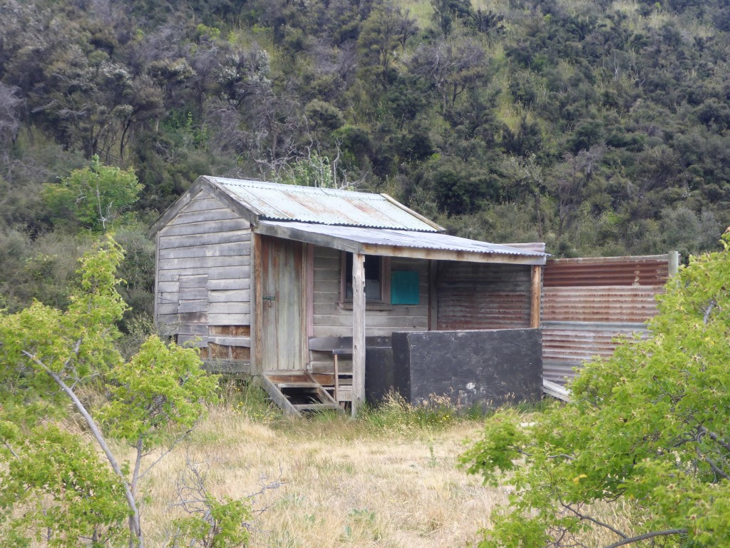 Old private hut on the shores of the lake. 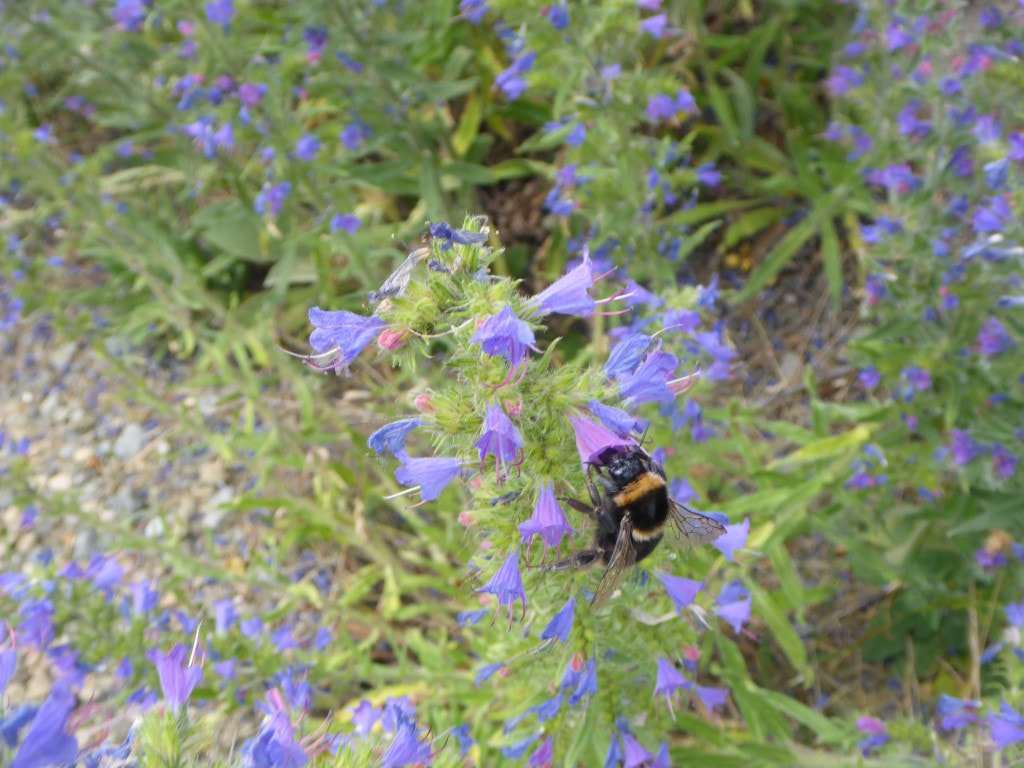 More blue borage and more bumblebees :-) 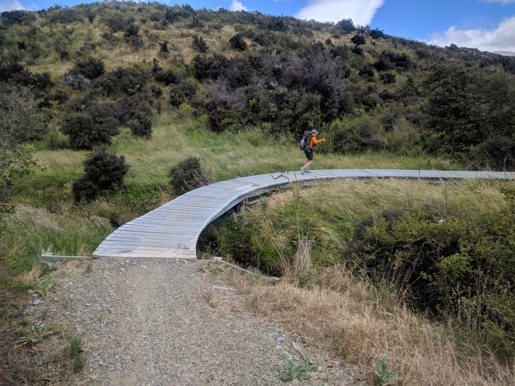 Again - the benefits of walking on a cycle trail! 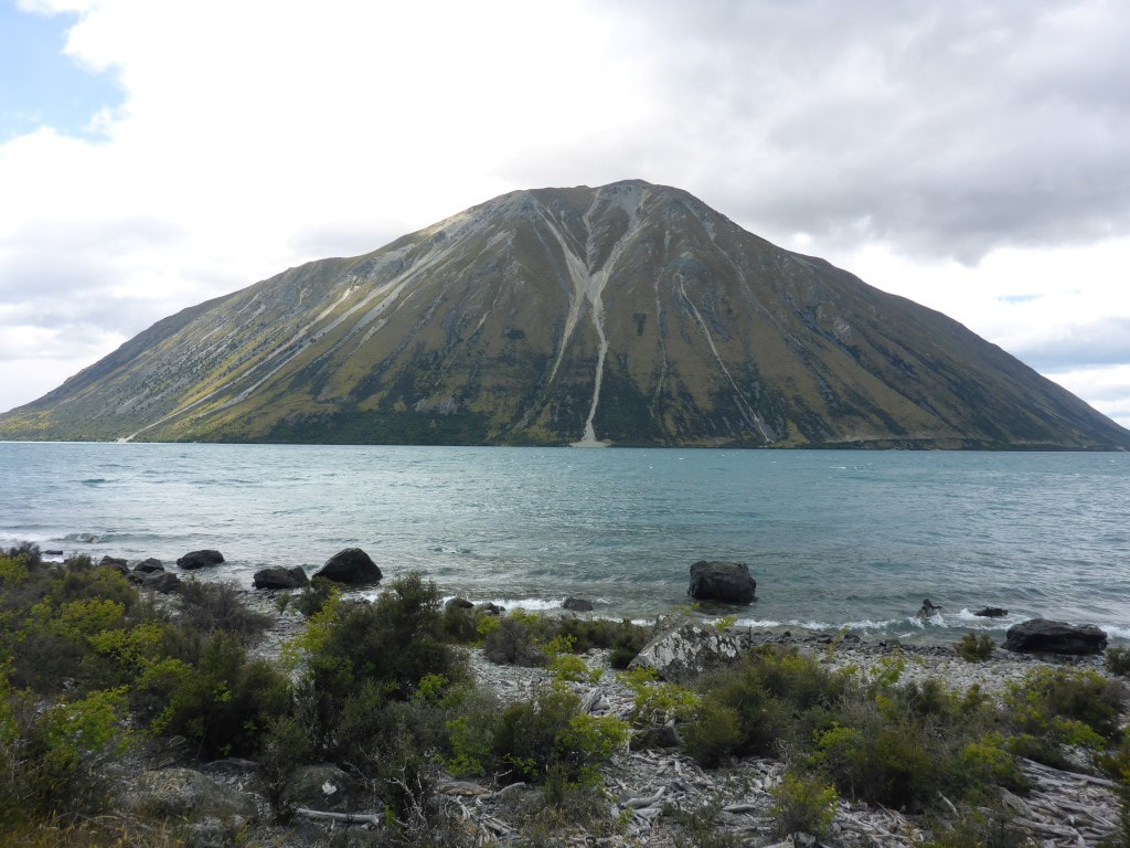 Looking northwest across the lake - some big scars on the hillside. 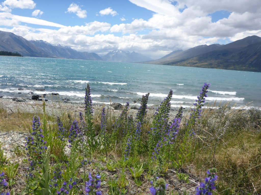 Looking up to the head of the lake and the Hopkins River/Valley. 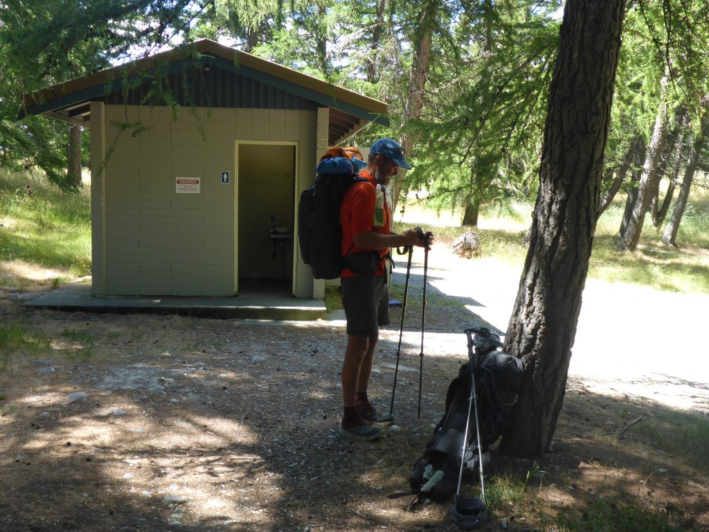 Flushing toilets at DoC's Middleton Reserve campsite next to Ohau Village. So we were back on the road after a brief stop, walking another 3km or so to where the track turned off the road near the Glen Mary Ski Club. We headed up a 4wd track which meandered back and forth but eventually took us up to join up with a cycle trail again which, of course, means really easy going for us!. From here it was only 1.5km to the bridge over Freehold Creek, and another 50m or so past this was the turnoff into the hills where we ended up camping. We saw two kiwi couples there setting up and, as noted above, they commented that they had looked out for the informal campsite on their way down and hadn't seen anything obviously suitable - on the basis of that, we found a flattish spot in this open area to set up camp for the night. 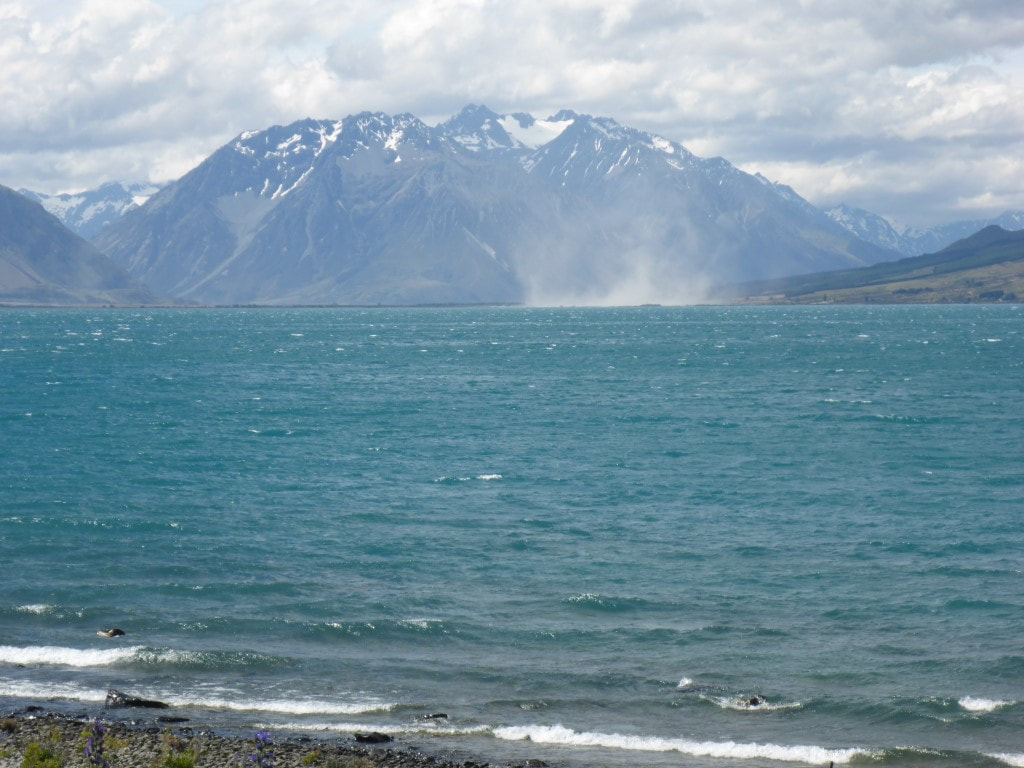 The wind was whipping up dust at the head of the lake (and, no, it wasn't a vehicle!). 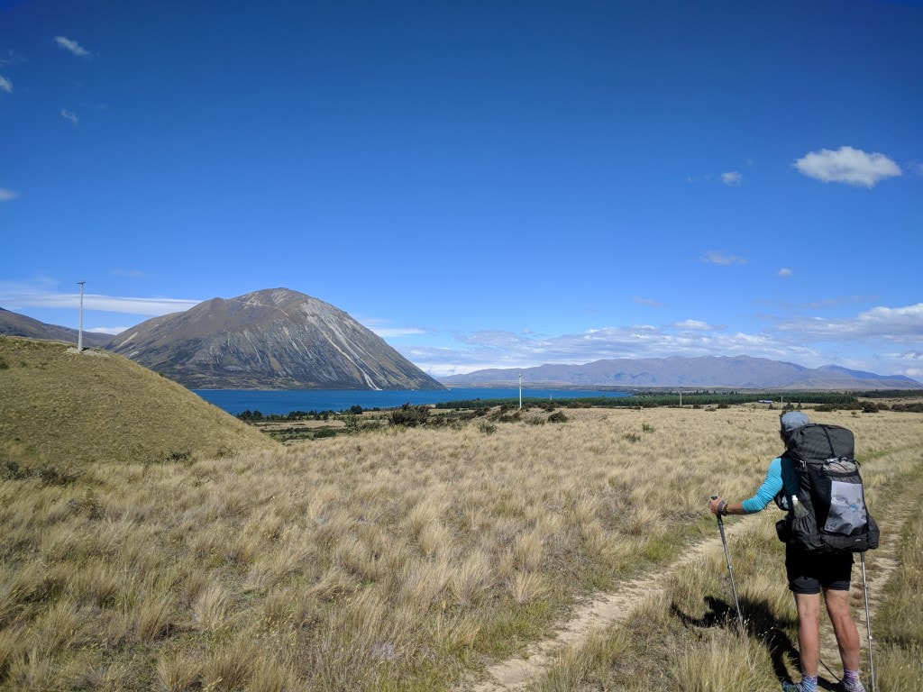 Left the road and now heading to the hills - looking back at the lake. 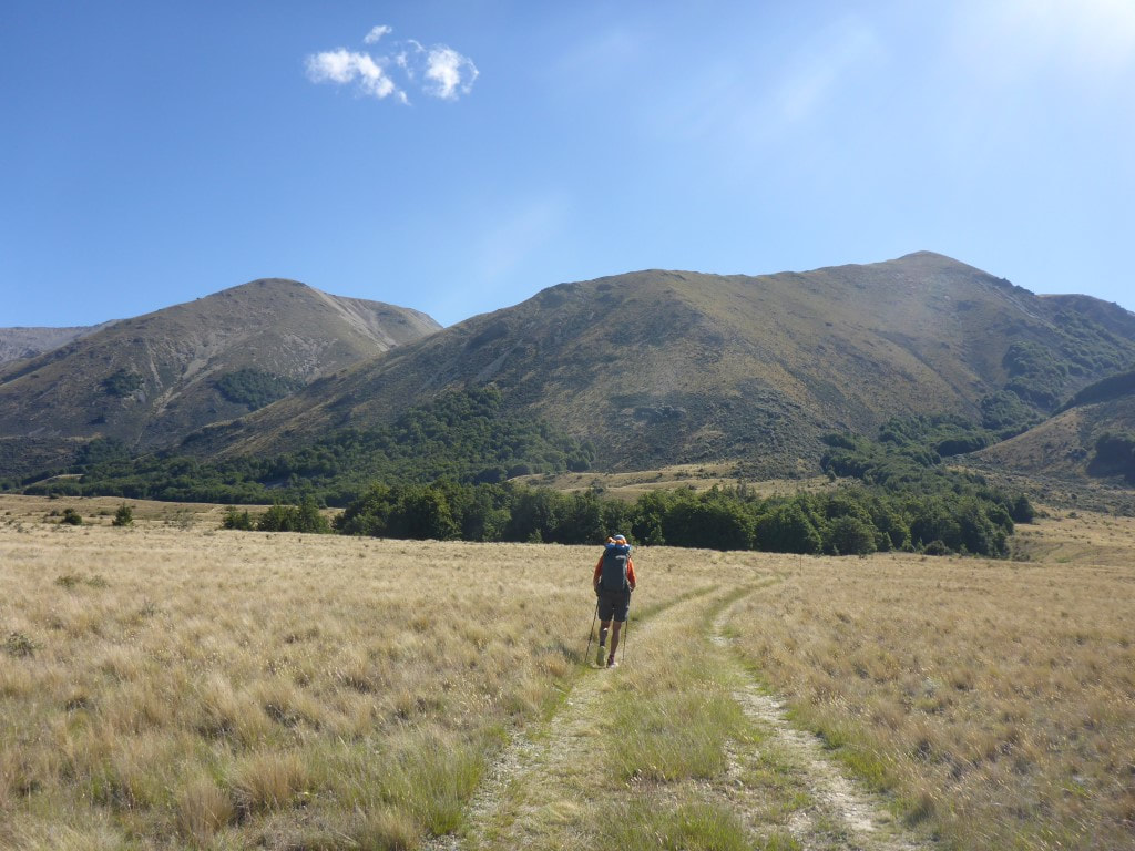 Pretty good underfoot on the 4wd track. 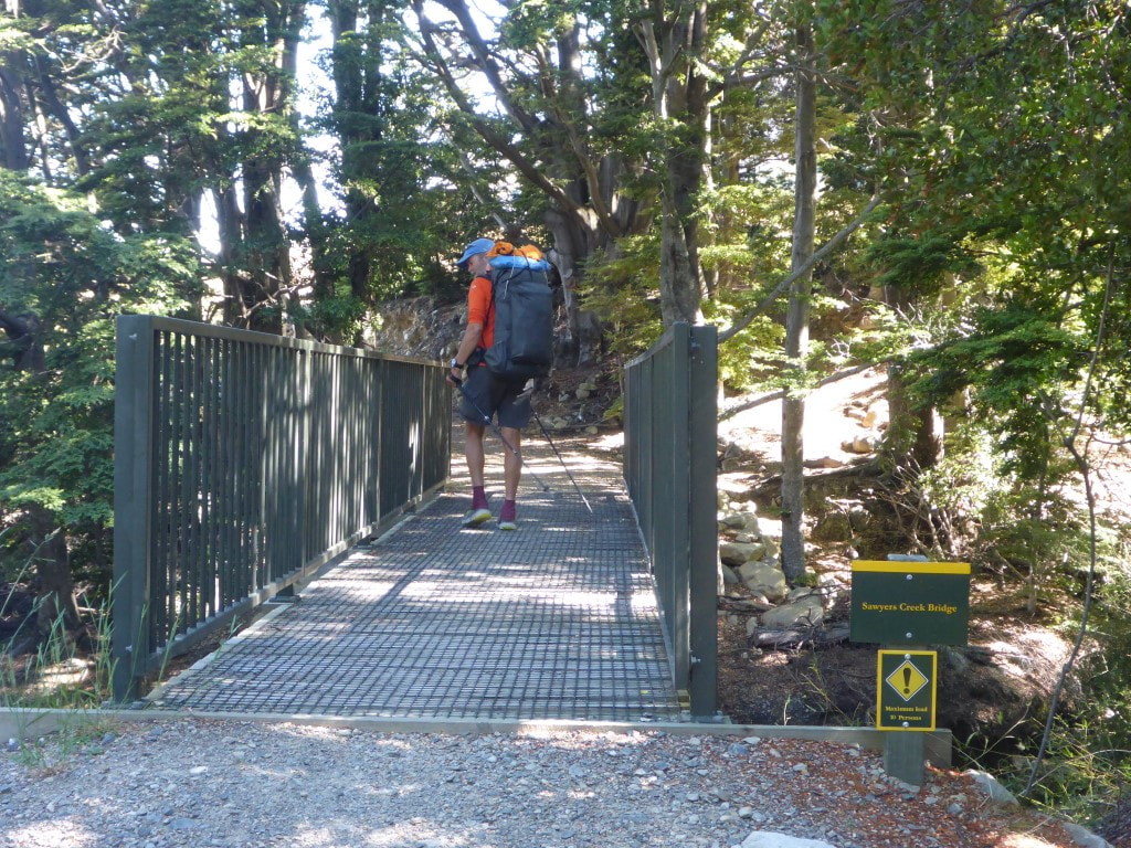 We had joined the cycle trail again by now. This is Sawyers Creek bridge, about 1.5km from Freehold Creek. 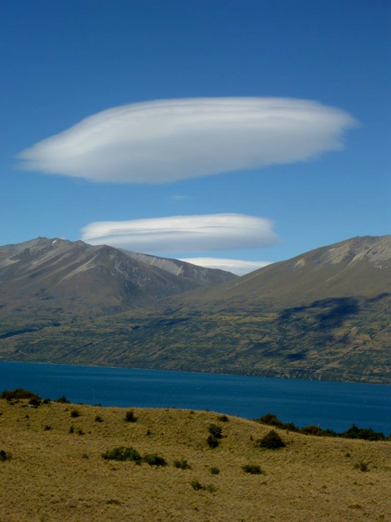 B got this lovely shot of lenticular cloud as we approached Freehold Creek. 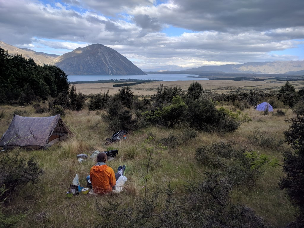 Looking back from our camp spot at 6.37 p.m. 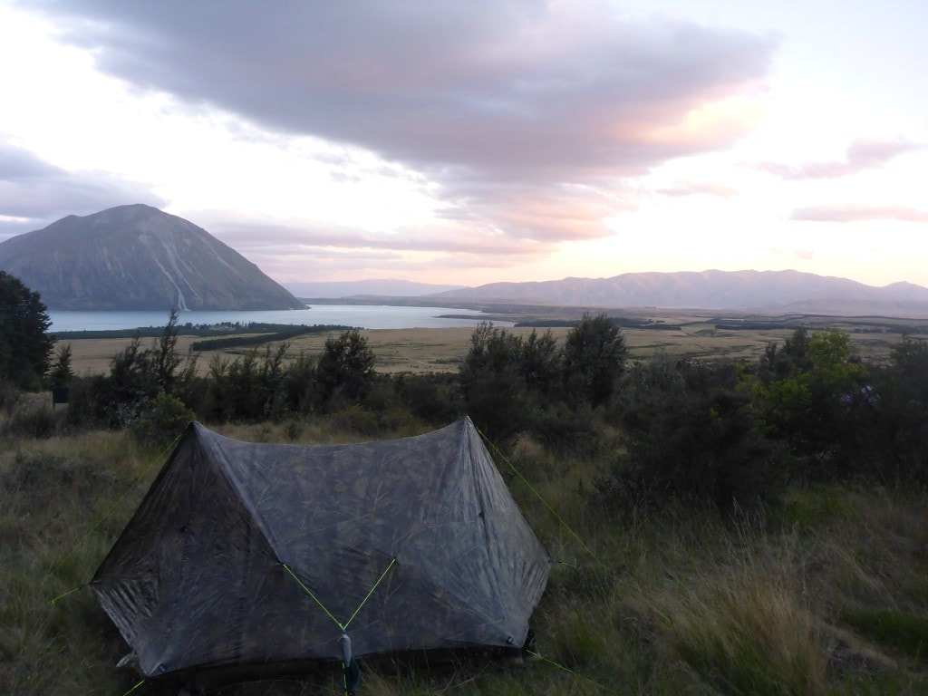 A bit more colour in the sky at 9.20 p.m. - unusual for us to be up that late!! Today was a rest day, at least in part because of my ankle, but also for resupply. I got a number of blog posts completed today (at last!). We went out for a little look around the shops and had a late breakfast (at least in my case!), while also buying a few odds and ends we needed. B had a further look around while I went back to the room to do some running repairs on my shoes with linen thread and 'Shoe Goo”! After lunch time we went to the supermarket and did a restock shop for the next 5 days to Wanaka. Managed to get accommodation in a double ensuite room at the YHA :-) for the 23rd so hopefully we make it there on time! Then it was time to rearrange the food into our packs - leaving time for reading and some more blogging. Belinda also arranged for her sister Julia to pick up our backup shoes and send them down to the hostel in Wanaka as we will definitely need them at some stage soon. The final order of the day was the plan for dinner tonight - we settled on pizza at a local bar! 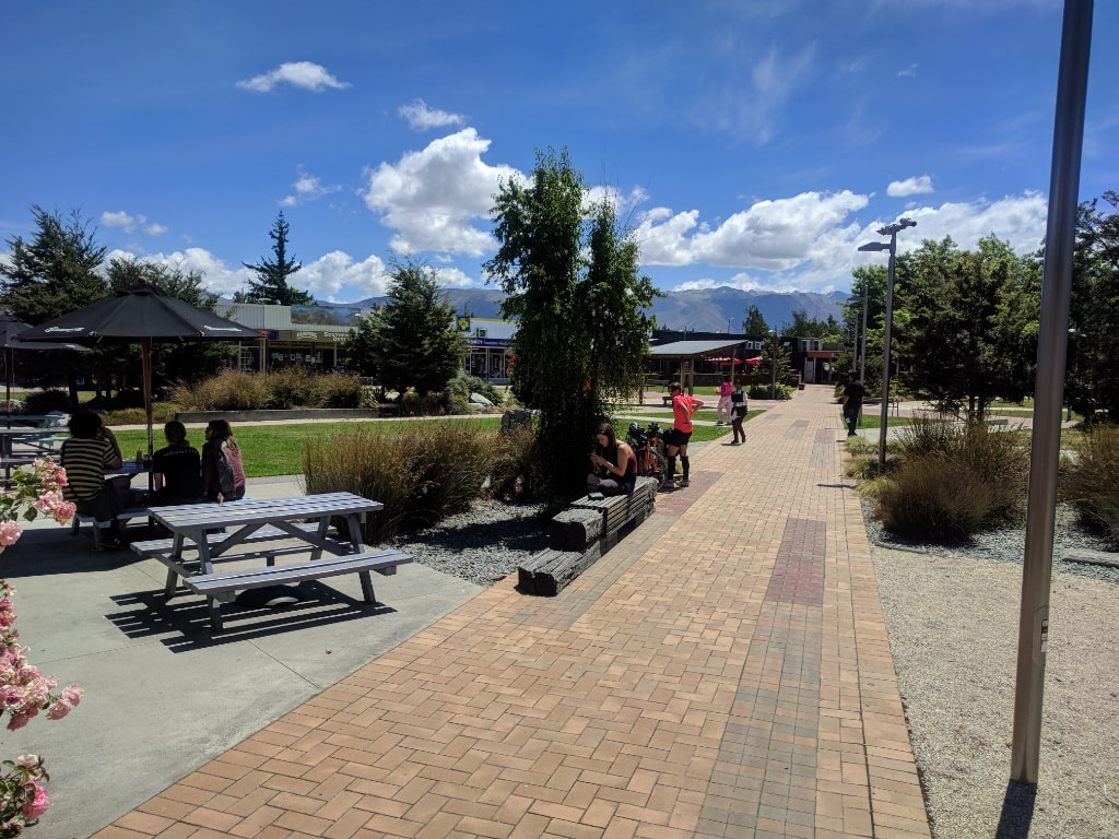 Lovely open area in the main little shopping center. 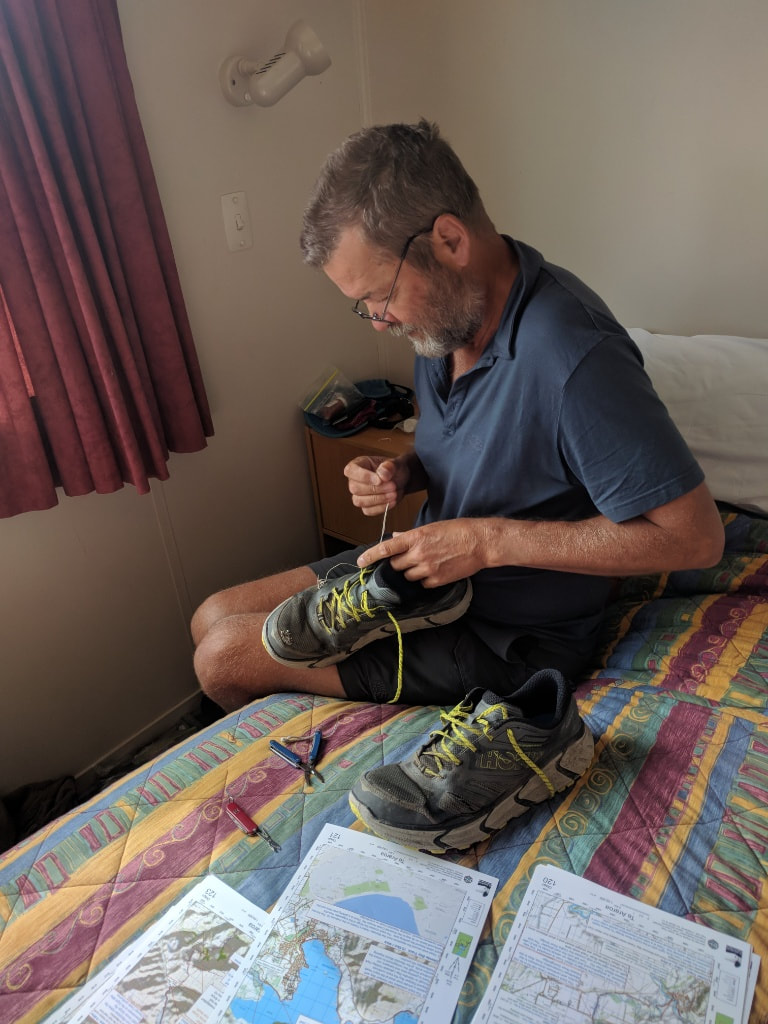 Seeing up the shoes with linen to provide some strength before applying "Shoe Goo". 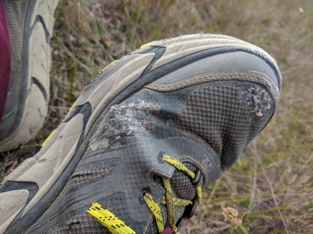 An example of the finished article - a few more kms of wear out of them now! 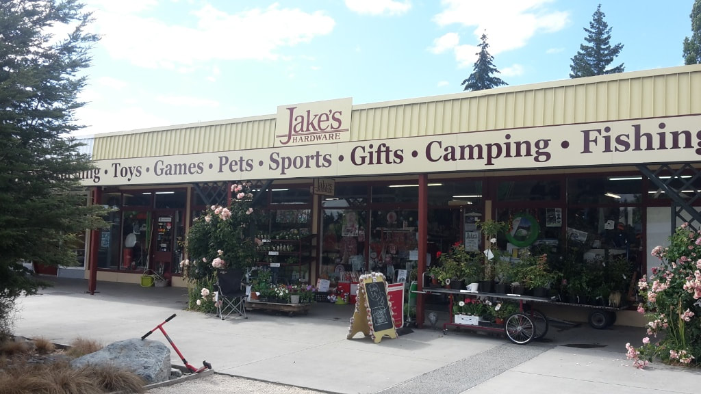 Fantastic example of an old style, small town "we have everything" store! Pricing was not unreasonable either. Recommend a visit! 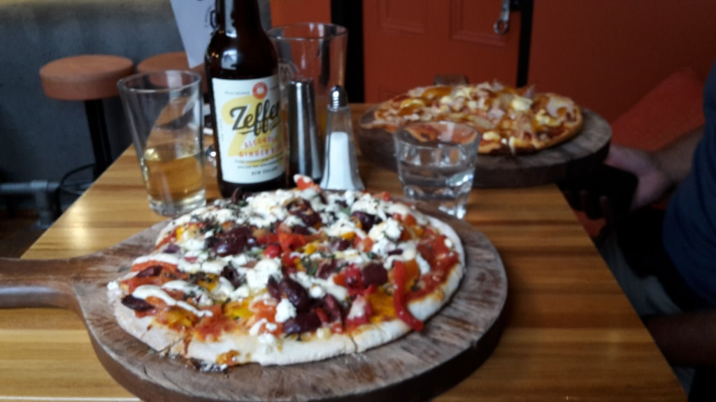 Pizza for dinner at local bar in town centre. Carbs, fat, alcohol - everything a famished walker needs. We got down to the nearby carpark at 0715 as requested and the shuttle arrived about 0745 with our tandem bike :-). They also took our packs to deliver to our accommodation at the High Country Lodge and Backpackers in Twizel - blissful! Despite the notes saying it was about 60km, the Suunto says we did 54km in 4hr10 cycling time. The data is here. We set off around 0800 and soon had the hang of it. We took plenty of stops as: a) it was hot and windy, and b) our bums were pretty sore given it is a long time since we have ridden a bike for any distance! Anyway, we made it safely to Twizel around 1430. The service from Cycle Journeys in Twizel was great and we would recommend them to anyone wanting to take the cycle option. 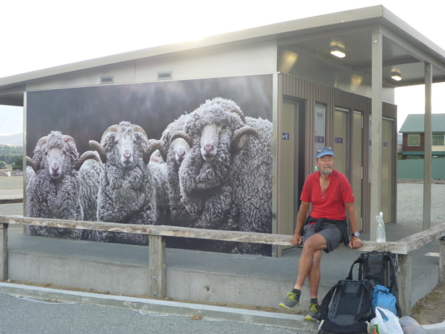 Me and the sheep on the toilet block - awaiting the shuttle! 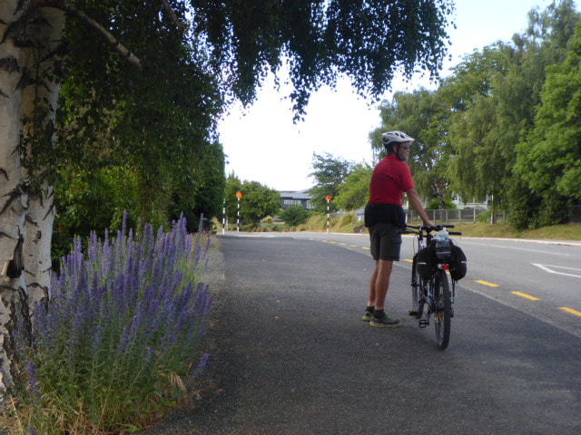 Headed across the highway and pushed up the first short hill :-) 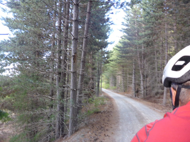 First bit heading out of Tekapo - photos on the go are possible with a tandem! 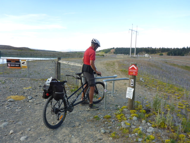 Our first cycle "stile"! The tandem is pretty long - bit like maneuvering a limousine compared to a car! 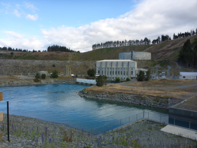 Crossing the outlet at Tekapo A power station. 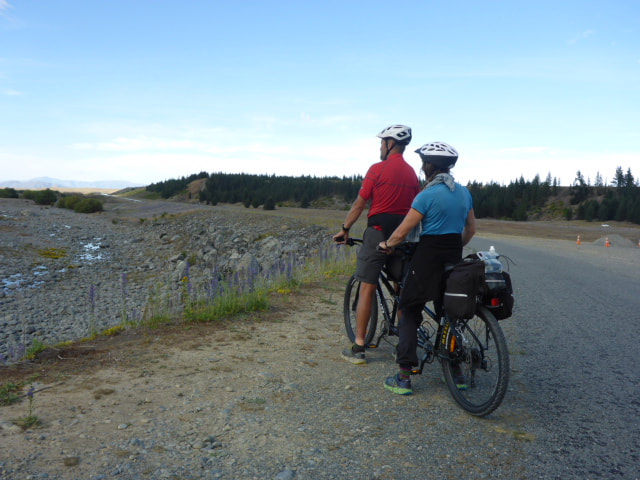 About to set off with river on right and canal on left. Most of the trip was along the Tekapo canal so was pretty flat. We passed Mt Cook Alpine Salmon on the way and later High Country Salmon farms as well. By about 1100 we had also caught up with Phil and Viggo who had stopped for a break in the side of the track. There was a little cycling around the side of Lake Pukaki, where we stopped at the High Country Salmon shop for a break. Met up with a lady (Faith) from Motueka who was cycling part of the A2O cycle trail with her husband. He had driven their car to Oamaru (the end of the trail) and was catching a shuttle back, so she and her son were awaiting his return before setting off. 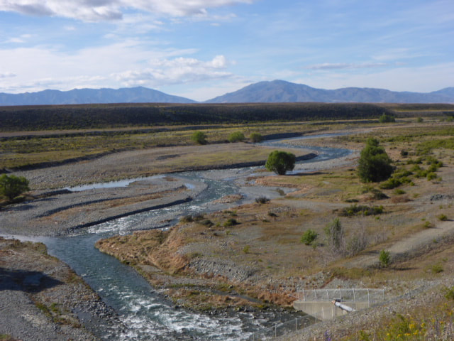 Outflow into the river. 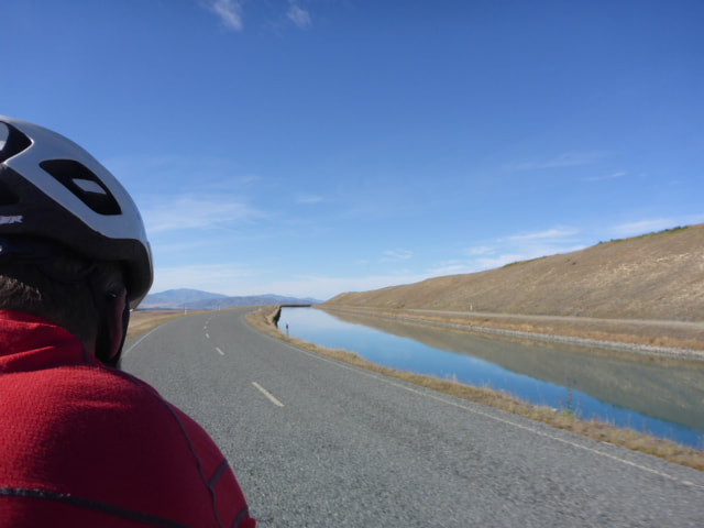 Canal now well and truly on our right. 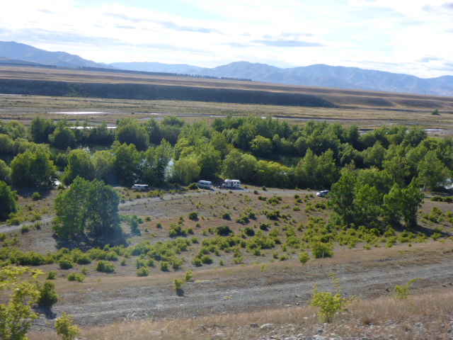 Campers down by the river. 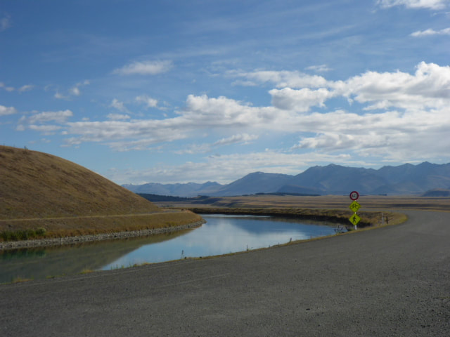 A view from whence we came!   Short rest by another gate - no vehicles on this section. 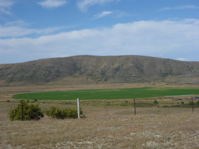 Irrigation makes all the difference here. 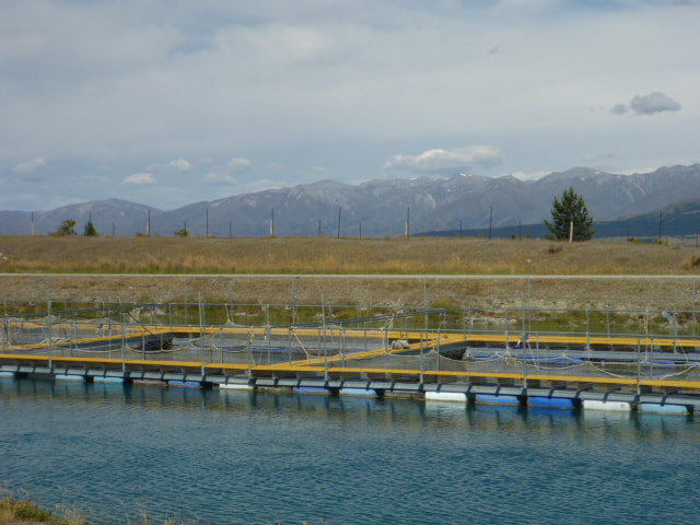 Salmon farm cages in the canal. 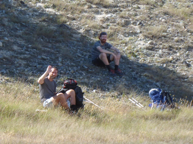 Viggo and Phil are walking this leg - hard yakka! 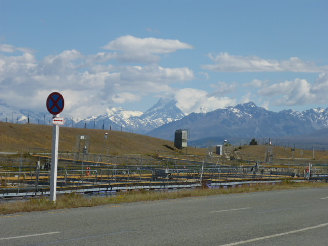 Looking out on Mt Cook (we think!) 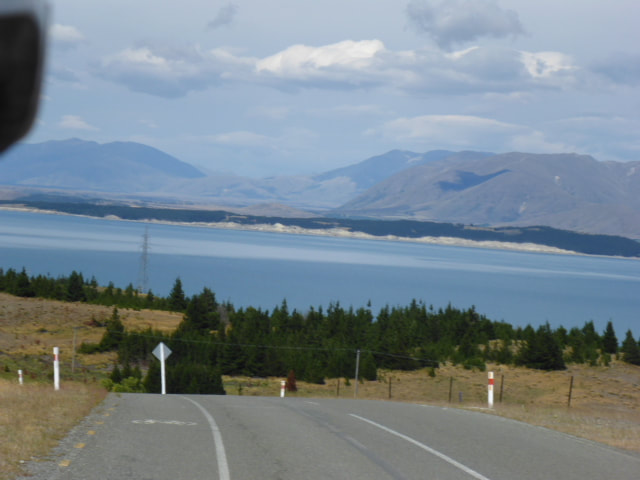 And, finally, down the big hill to Lake Pukaki ........ 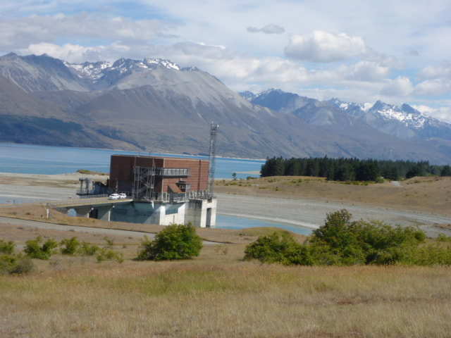 .... to another power station. 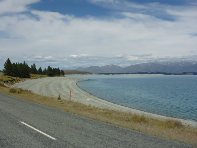 Around the lake. 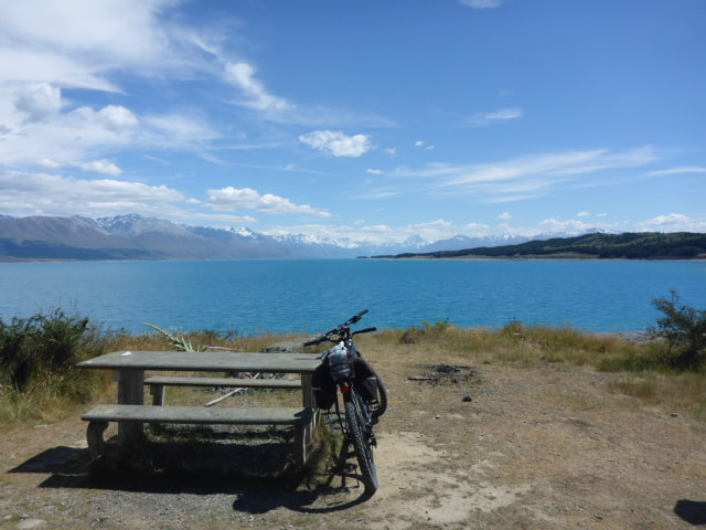 Got off road and onto a track again, so stopped for lunch.  We sat in the shade on "rabbit hole hill" for our rest!  Lovely views across the lake.  With Faith at the salmon shop on SH8.  A photo of us that is not a selfie for a change! Thanks to Faith :-) Then we had to cross SH8 before we headed across country for the final 10km or so to Twizel, battling increasing winds as we went! This last bit was real flat, barren Mackenzie country landscape! We survived this and arrived at the outskirts of Twizel before heading to the Cycle Journeys depot to drop off our bike. Then it was a short walk to the Lodge - we are in a small room that would have been one of the workers rooms when the power scheme was being constructed. Not flash, but perfectly comfortable. Then it was out for an early meal before heading back to our room and doing a few chores before bed! 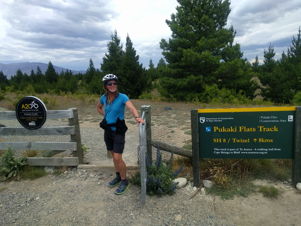 Chief gate opener. 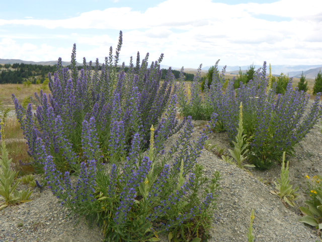  Flat. Barren. Windy! 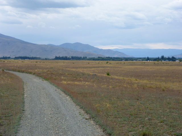 But the actual trail was a nice packed gravel still. 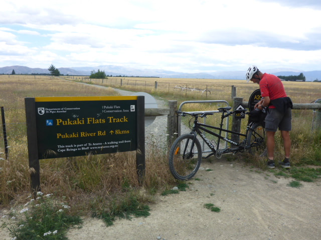 Looking back - very near Twizel now. 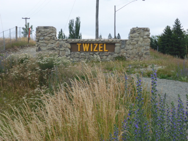 Even closer to Twizel! 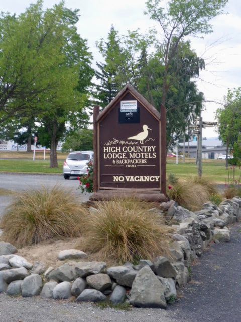 A short walk after dropping off our cycle got us to "home" for tonight (and the next night). The ankle was pretty swollen this morning so I wasn't intending to do much other than try and rest it - hence I didn't leave the room too many times during the day. B went for an early morning walk as the church was very busy with tourists when we arrived yesterday afternoon. I took the opportunity to finally get the technology working sufficiently to update some blogs! Discussing what the ankle might mean, we thought one way of making progress while giving it a bit of a rest was to cycle to Twizel instead of walking. It is a minimum of 34km to Pukaki that you have to do in one hit anyway, with a further 13km to Twizel. There was no way I could walk that far with the ankle so the bike seemed a great solution to the problem. The guys planned to leave early and try and do the 60km to Twizel walking. That was all sorted today so we are set for tomorrow hopefully. Have also booked another rest day in Twizel for recovery and a required resupply for the next stage to Wanaka. Today was also a momentous day as I decided to retire my red Icebreaker hiking shirt. It was so full of holes from the pressure of the pack that it was starting to rub and bruise above my hip - couldn't throw it away though so it is still in my bag as an emergency! Now into my orange long sleeved version!  B went for an early morning walk. Still couldn't avoid some tourists (and drones, despite it being a no-drone area!) 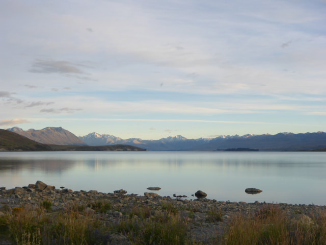 Looking up to the head of Lake Tekapo. 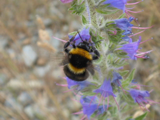 One of B's furry bee friends :-) 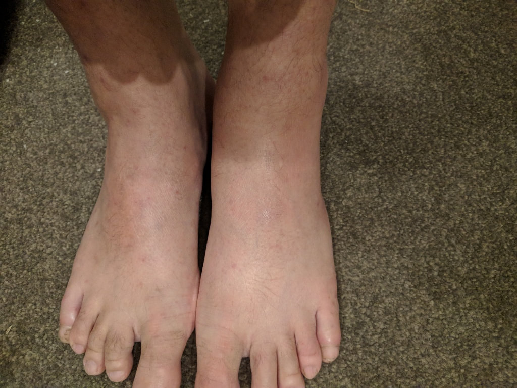 Somewhat puffy left ankle and foot. 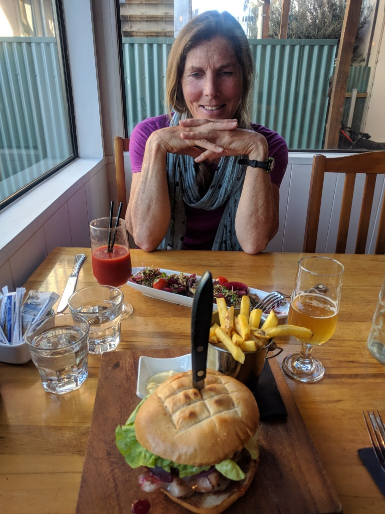 How good is this after days of trail food!? Same lovely place (Reflections Cafe) as last night but trying something different! Left just after 0700 and ended up doing 34km in 8 hours of walking. The GPS data is here. We headed off first as Viggo was still asleep outside! We shot down the steep hill past the hut to the creek (dry foot). We then walked along Camp Stream for about 2km to the junction with Coal River, which was inevitably a wet foot crossing! We headed off down the true left of Coal River but after only 900m or so came to an orange pole pointing us up a steep climb. The initial steeper bit was about 500m long (160m vertical) but further climbing ensued until we started across more rolling tops. The notes say that you climb up to meet the road, but the road is actually quite some distance away! We carried on across rolling tussock until we reached the skifield road after 1h45 and 5.2km. We stopped here for a break and for B to rearrange her innersoles which were bunching up - not comfortable! 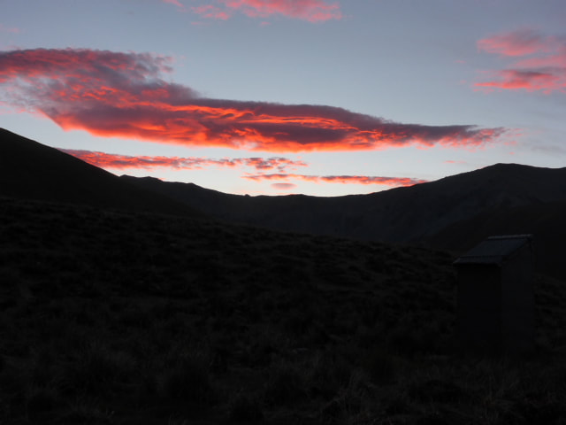 Sunrise from B's bed. 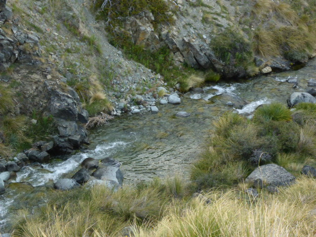 Nice spot for a dip - below the hut. 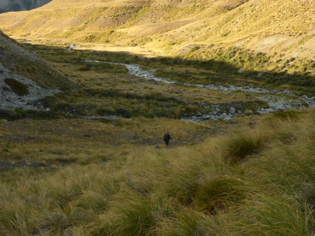 First creek at bottom of hill by hut. 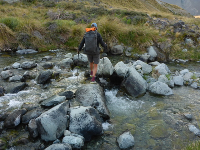 This one was dry foot. 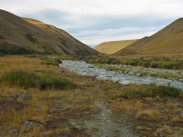 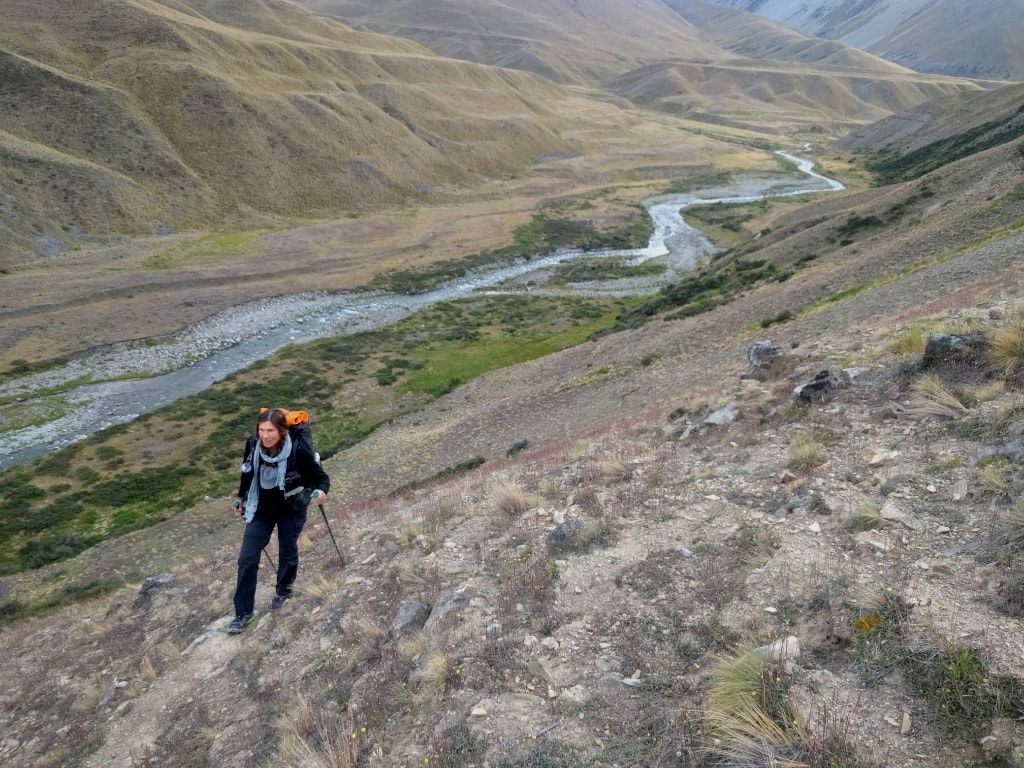 Heading up the steep climb not long after crossing Coal River. 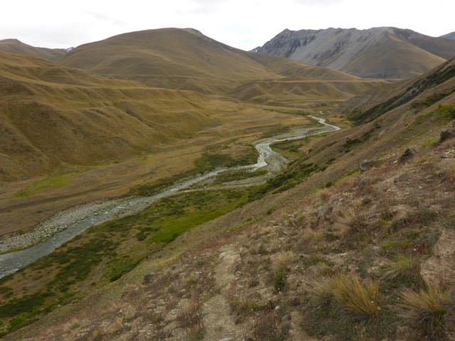 Looking back after the steepest bit of the climb. 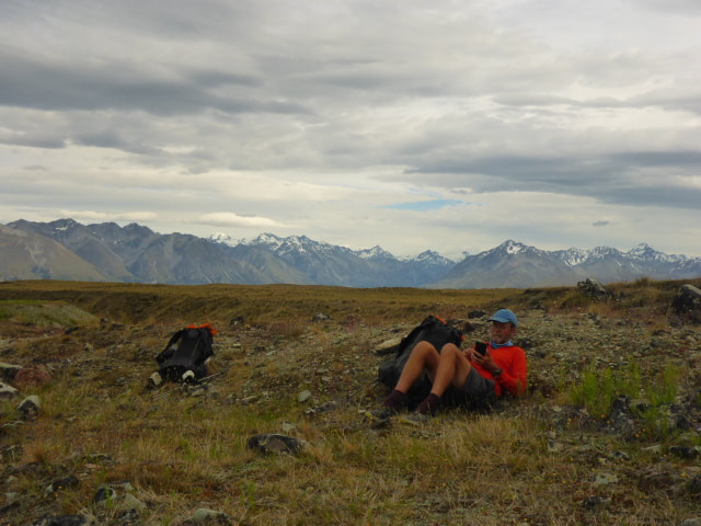 Stopped for break near the skifield access road. We then headed off following what appeared to be a bike trail with a narrow little track that was near impossible to walk in. This was not the most exciting part of the day as we slowly descended towards Boundary Creek and then, parallel to this, down to the carpark at the road. Unfortunately as we were about a km away from the carpark I had a random stumble and twisted my ankle resulting in a bit of a sprain. We stopped at the carpark and I put some Voltaren cream on it and took some ibuprofen to try and ease it. 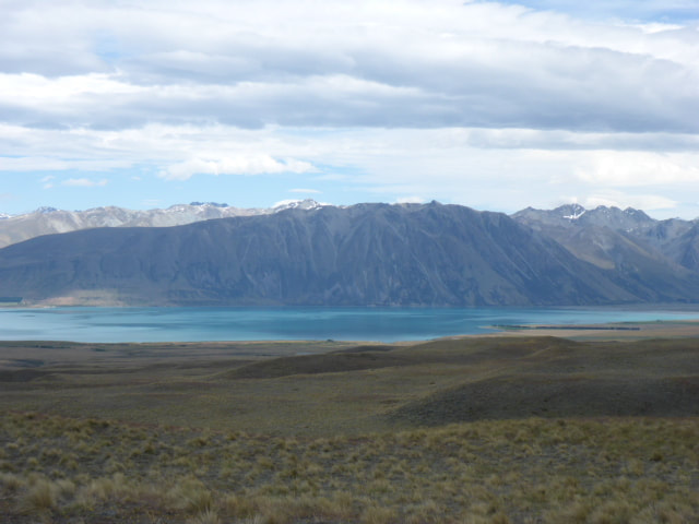 More views of Lake Tekapo as we cruised along rolling terrain. 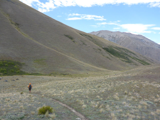 This was typical of the narrow little ground path we followed - later we discovered it was because of regular use by mountain bikes. 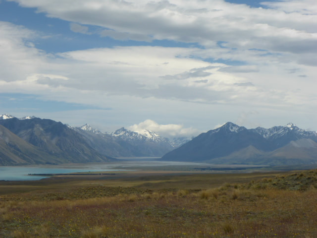 Looking back up the Godley River valley. 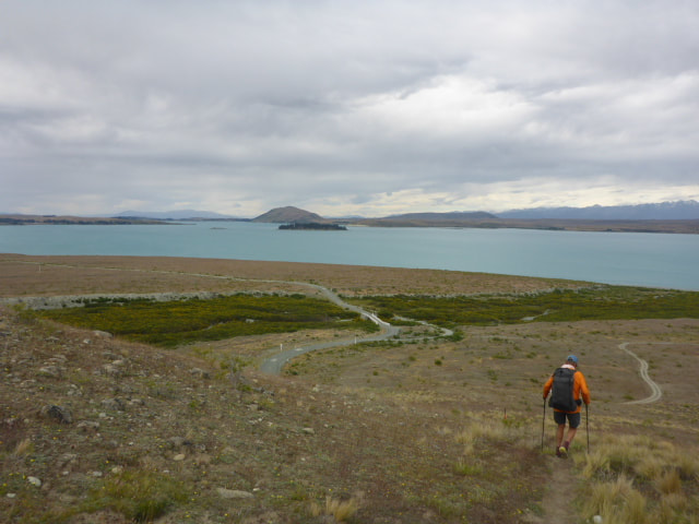 Dropping down towards the road. 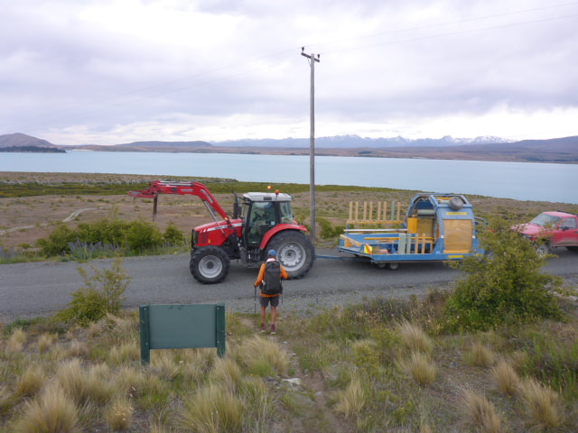 Local contractor was the first traffic we saw. Reinforced with anti-inflammatories, we carried on and walked the remaining 17km into Tekapo, although it wasn't the most comfortable walk for me! This was pretty much all gravel road walking apart from the last bit into the township. The guys caught up with us while we were having lunch, sheltering from the wind behind a large rock. We arrived in Tekapo and noted the large number of tourists at the Church of the Good Shepherd - the photo below was actually taken by B on an early morning walk the next day, when tourist numbers were significantly less!! We walked to our lodgings and settled in to a 6-bed bunk room all to ourselves, with a rest day already planned for. This was handy as the ankle was quite swollen by now! Went out and had a lovely meal to top up our reserves! Caught up with the guys on our way out of the restaurant and joined them to chat and have a nightcap before heading back to the hostel and bed. 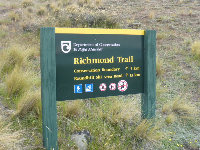 That shows part of what we had just completed. 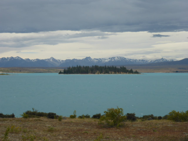 Now walking alongside the lake.  This was our lunch rock - provided a little shelter against the wind. 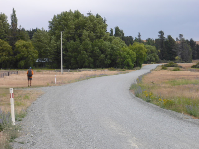 Plenty of gravel road to walk into Tekapo! 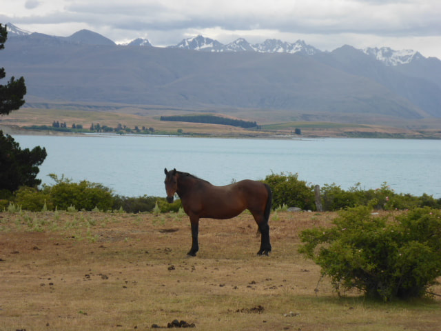 B found another horse :-) 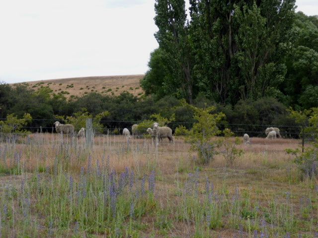 Perhaps surprisingly, we hadn't actually seen many sheep recently. 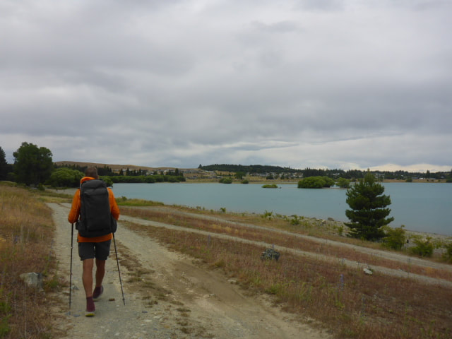 We got a bit of lakeside walking closer to town. 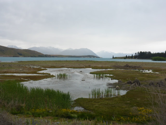 Wetland area beside the lake. 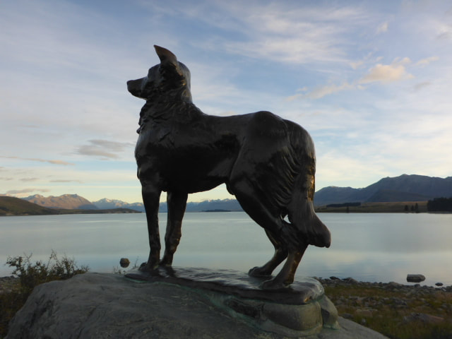 The dog ............. 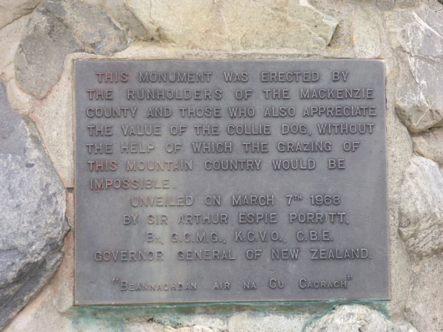 ............ and it's plaque. 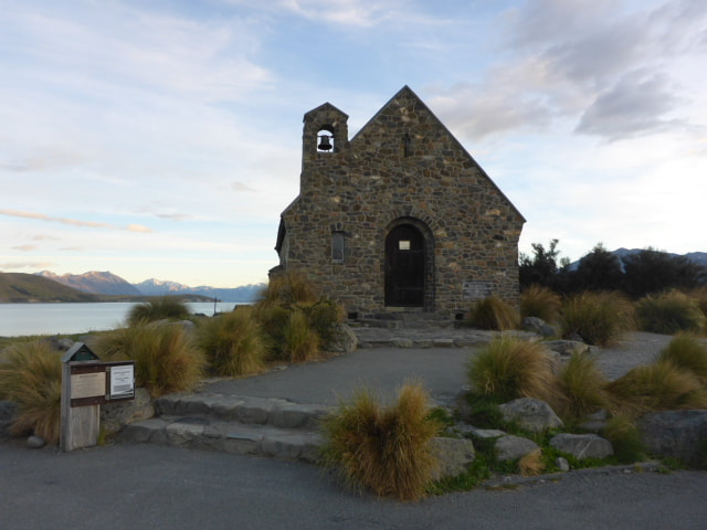 The famous Church of the Good Shepherd. |

AuthorBelinda and Anthony (aka Tony) Hadfield made a decision, in their late 50's, to do something a "bit different" and walk New Zealand's 3000km Te Araroa Trail over summer 2015/16 - although updates will now tell you that this plan will take longer now!!. As the old saying goes - "don't leave home 'til you've seen the country"!! Archives
January 2018
Categories |
 RSS Feed